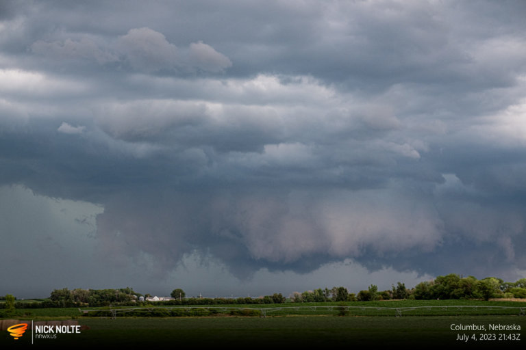
Blog

30 Aug

August 30, 2020 – Ainsworth, Nebraska

A surface low in western North Dakota was forecast to drift southeast into northern Nebraska by 0z with a frontal boundary extending southeast from there. With moderate instability and dew into the low 60s there seemed to be a decent chance for severe weather along the front. Given that my target for the day was the US 83 corridor between Thedford and Valentine and points east.

Read more
19 Jul

July 19, 2020 – Southwest Nebraska

With zonal flow present across the upper third of the United States and a lee surface low forming in Colorado presented a decent opportunity for severe weather as well as along the warm front extending to the east. An area of favorable deep layer shear around the point where Wyoming, South Dakota and Nebraska meet offered the chance of supercells and with backed surface flow near the warm front meant a tornado could not be ruled out.

Read more
12 Jul

July 12, 2020 – Colorado / Nebraska

July 12th featured a chance for supercells along the Front Range and with the strong low level lapse rates it was expected that storms would be capable of large hail and eventually evolve into clusters with a strong wind component later in the evening. SPC had outlined a 2% tornado risk in Eastern Colorado and forecasts were showing low 60°F dewpoints which is pretty good for the High Plains.

Read more
30 Jun

June 30, 2020 – Central Nebraska

June 30th presented a marginal opportunity for severe weather across the Eastern Dakotas and stretching down into Central Nebraska, while tornado risk was low it looked like a decent opportunity for some supercells. While a negative tilted trough was moving out of the intermountain west a cold front was forecast to move across the target area triggering storms with supercells initially possible then transitioning to a linear event quickly.

Read more