Month: June 2022

11 Jun

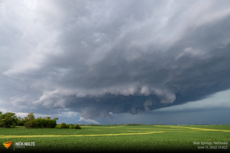
June 11, 2022 – Nebraska / Kansas

A sagging frontal boundary with very high instability in southeastern Nebraska and northeastern Kansas was expected to be the primary target zone for severe weather with a chance for tornadoes and large hail. SPC had specifically outlined Northwest Missouri with higher probabilities but I was more interested in the western edge of the risk area for a better chance at isolated cells and to avoid the Missouri terrain.

Read more
07 Jun

June 7, 2022 – Central Nebraska

Another day of local chasing as a shortwave was moving out of the Rockies and upslope flow was forecast to initiate storms along the higher terrain that would roll off later in the afternoon and progress across Nebraska. Moisture was limited, however, and I debated even chasing this day so I would end up waiting until late afternoon before heading out.

Read more
06 Jun

June 6, 2022 – Southern Nebraska

June 6th was a bit of a marginal day, a weak surface low beneath a modest shortwave trough along with looped hodographs would create an atmosphere favorable for south-east moving supercells across Western and Central Nebraska. We had a nice introduction to June for severe weather across Nebraska with plenty of local opportunities for chases.

Read more
05 Jun

June 5, 2022 – Holdredge, Nebraska

An overnight MCS across Oklahoma and it’s associated outflow combined with a frontal zone setup a potent environment across Western Nebraska and storms were expected to fire along the front later in the afternoon. It looked like a MCS type event again so I hadn’t planned on chasing, but initiation held off until later in the day so I was able to just head out late to check it out.

Read more