Month: February 2012

14 Feb

Exporting images from Lightroom stamped with Geotag information

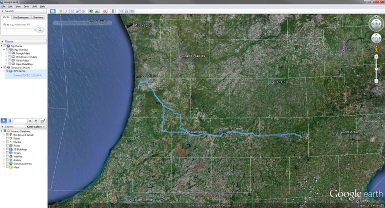
Welcome to part three in my series on GPS logging and photo geotagging. In the previous two entries, I explained how I use GpsGate to log my travels and how I use those logs to geotag my chase photographs. The end result is, not only a great collection of photos, but also a story that tells me where they’re from. In this entry, I’ll take it a step further and show you how to export images from Adobe Lightroom and stamp the time, date and location information right on the photo. You can even incorporate this with your copyright watermark, all in one swoop. Ah, the power of Lightroom with a couple of plugins 😉

Read more
09 Feb

Logging your GPS stream from the chase

Almost every storm chaser has a GPS device in their vehicle. Whether it be a personal nav device, a phone with GPS or a separate GPS puck they use with street atlas software. Being a data junkie, one of the things I like to do is log my GPS stream everytime I hook it up. This way, no matter what, I’ll always have a GPS log of wherever I went on any given day. Well, as long as I bring the laptop, anyway. Aside from having a historical record of my trip, keeping a GPS log enables you to do all kinds of cool stuff after the fact. I use my GPS data to create travel maps and compile chase statistics. I also use it to geotag the photos I take so I can always say exactly where I shot a particular photo. Not only that, but with some special software I can even create watermarks with the location and timestamp of the photo! This is part 1 of a series of blog entries that will show you what I do with my GPS data and how you can do it, too!

Read more