19
Jul
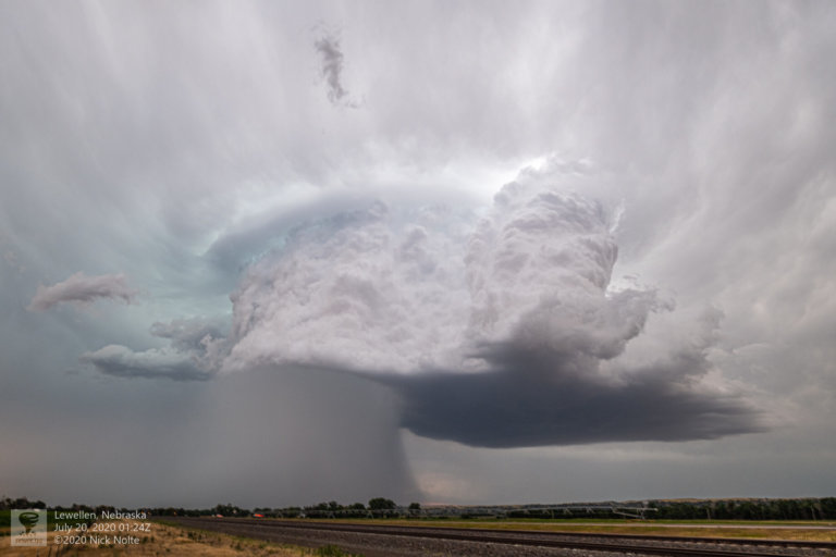
July 19, 2020 – Southwest Nebraska
With zonal flow present across the upper third of the United States and a lee surface low forming in Colorado presented a decent opportunity for severe weather as well as along the warm front extending to the east. An area of favorable deep layer shear around the point where Wyoming, South Dakota and Nebraska meet offered the chance of supercells and with backed surface flow near the warm front meant a tornado could not be ruled out.
Read more