Month: June 2017

17 Jun

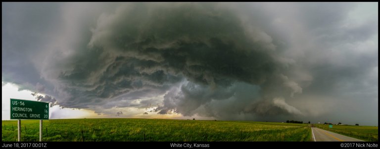
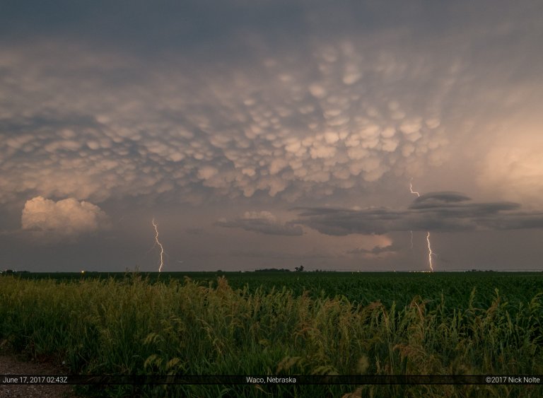
June 17, 2017 – Northeast Kansas

June 17th was the last decent shot at severe weather during my week off. A large MCS from the prior day storms traveled overnight across southeastern Nebraska and Missouri. This complex left an outflow boundary which arced from Beatrice, NE to Kearney then southwest into Kansas and Oklahoma. Meanwhile a weak frontal zone was present from New Mexico through Kansas into Iowa.  Either of these features would serve as the focus for storms later in the day, unfortunately that meant a zone stretching from western Kansas into the lower Great Lakes.

Read more
16 Jun

June 16, 2017 – Meadow Grove, Nebraska

June 16th featured a surface low expected to drift across Northern Nebraska into Western Iowa while a belt of strong westerlies clipped the area at 500mb. A weak cold front stretched from Minnesota through Nebraska into Colorado. Mid 60°F dewpoints existing in the warm sector across southeastern Nebraska into Iowa but low level wind fields looked to be rather weak. To me, this made the play obvious: play the surface low.

Read more
15 Jun

June 15, 2017 – Kansas

June 15th featured a surface low in western Kansas with a composite outflow and moisture gradient draped across the state that was forecast to drift northward throughout the day. With a dryline extended south into the Texas Panhandle, extreme buoyancy in the warm sector and south created a recipe for very large hail and strong downdrafts. A smaller tornado risk presented itself in Kansas along the composite boundary and near the surface low.

Read more
13 Jun

June 13, 2017 – South Dakota Tornado

After a moderately successful chase in the high plains on the 12th, another potential significant day followed. As a closed mid-level low rotated across Montana and Wyoming into the Northern Plains, a trough lagged behind that was forecast to move into the Dakotas during the evening on the 13th. At the surface, a low along the SD/NE border would drift east throughout the day while low 70 dewpoints advected into the warm sector in eastern South Dakota.

Read more
12 Jun

June 12, 2017 – Roads? Who needs Roads?

June 12th was shaping up to be the most significant severe weather outbreak in the high plains in 30 years. The setup favored supercells throughout eastern Wyoming into Western Nebraska. A trough was progged to amplify and eject across the high plains while strong mid level south-westerly winds overspread the area atop rich low-level moisture advecting into the area via an upslope regime.

Read more