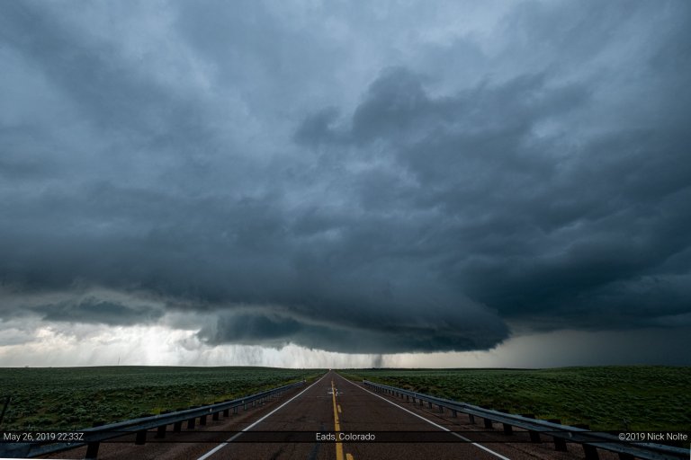
Month: May 2019

25 May

May 25, 2019 – Southwest Kansas

May 25th featured rather brisk southwesterly flow across the southwest United States permeating into Texas, Oklahoma and Kansas. While at the surface mid 60°F dewpoints stretched into eastern New Mexico. The dryline was rather broad, however we expected that to be the focal point for severe initiation later in the afternoon. The question was where?

Read more
24 May

May 24, 2019 – Northern Texas

May 24th featured a convectively modified boundary stretching from near Wichita down into the southern Texas Panhandle where it intersected a dryline that extended further south into the Trans-Pecos region of southwest Texas. It was looking like the same area as the day before would have the best chance for severe weather.

Read more
23 May

May 23, 2019 – Slapout – Laverne, OK Tornadoes

May 23rd featured an expansive enhanced risk of severe weather stretching from Emporia, KS southwest into the southern Texas Panhandle. A stationary front was positioned across Northern Oklahoma into the Texas Panhandle. South of this feature dewpoints into the upper 60s to low 70s was advecting into the area setting the stage for severe weather as MLCAPE values were forecast to reach 3,000 J/Kg.

Read more