| 0 | 1.00" | 80 | 430 |
|---|---|---|---|
| TORNADOES | HAIL | WIND | MILES |
July 11th was another local chase. By local, I mean in Nebraska. A low pressure in northwest Nebraska with a front draped across the state would lift north a bit as a warm front. Temperatures into the 80°Fs and dewpoints into the lower 60°Fs would prime the air along the frontal boundary for initiation in the evening. Isolated supercells were expected eventually growing upscale into a wind threat further east towards Iowa.
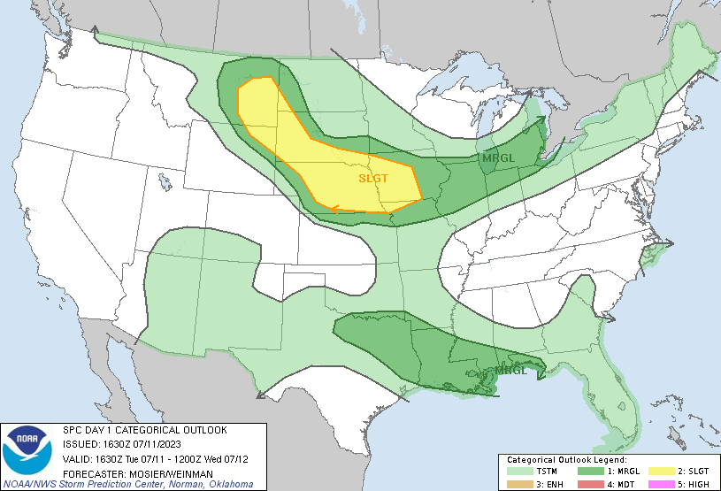
SPC had a large slight risk area outlined from Eastern Montana into Iowa. The western half of this was for isolated supercells capable of hail and the eastern half for the MCS wind event that was expected after dark. I left work early with the plan to drive straight to Valentine, figuring I could reposition on the way if needed. Turns out the cap would hold a bit and I would have a lot of waiting around to do.
I took off from Grand Island at 1930z and began the drive up highway 2. Wind was out of the “northish” at Valentine and southeasterly at Thedford and there was some indication on visible satellite that a boundary was somewhere between there.
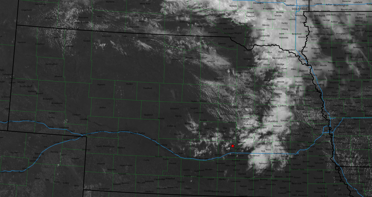
I figured it took a couple hours to get to Thedford so maybe by the time I got up there something would be going on. Turns out that would be rather optimistic, but the delay would be worth it. As I approached Broken Bow there was some development in a cumulus field near Ainsworth, so I hedged and went north on US 183.
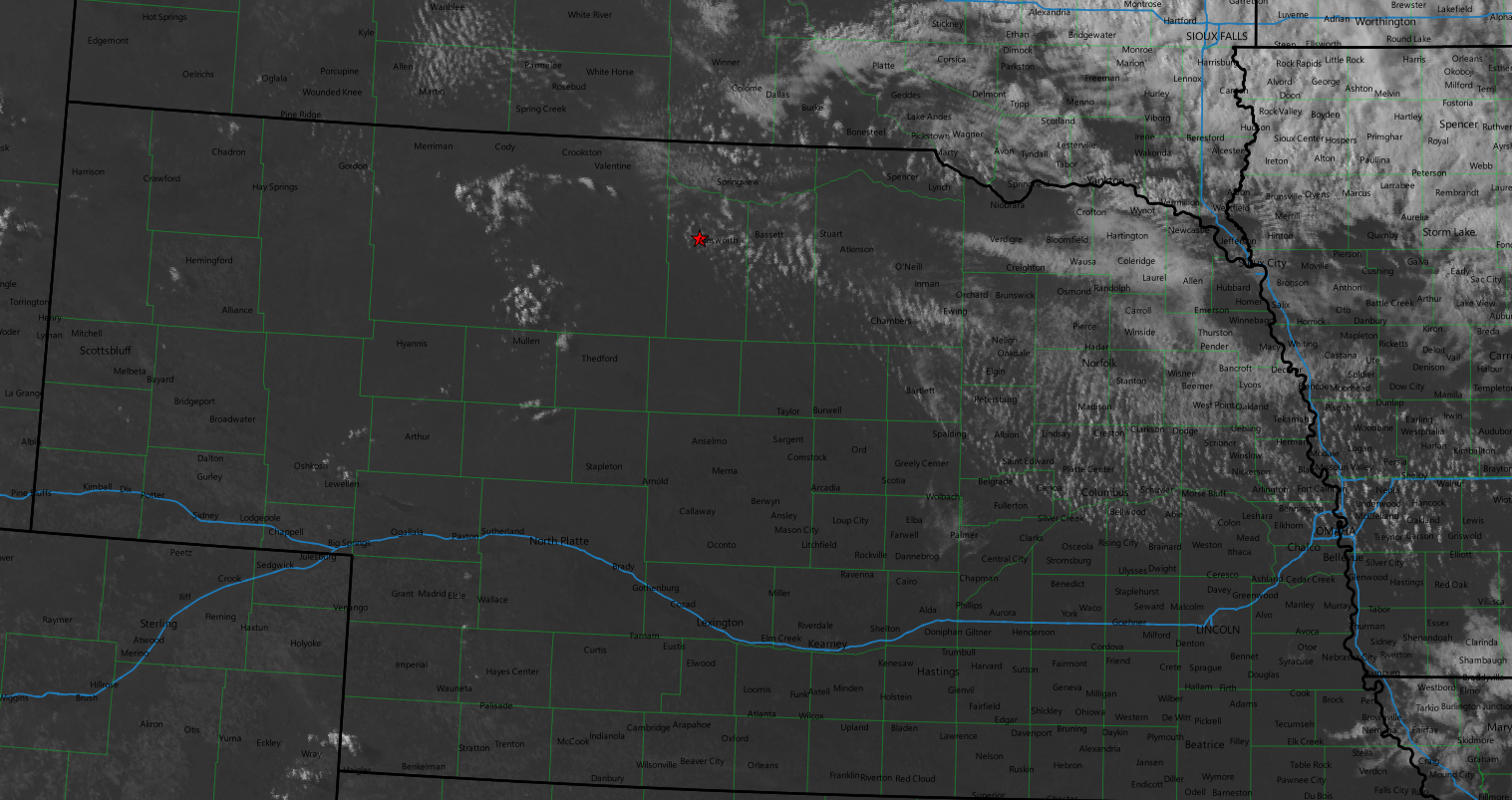
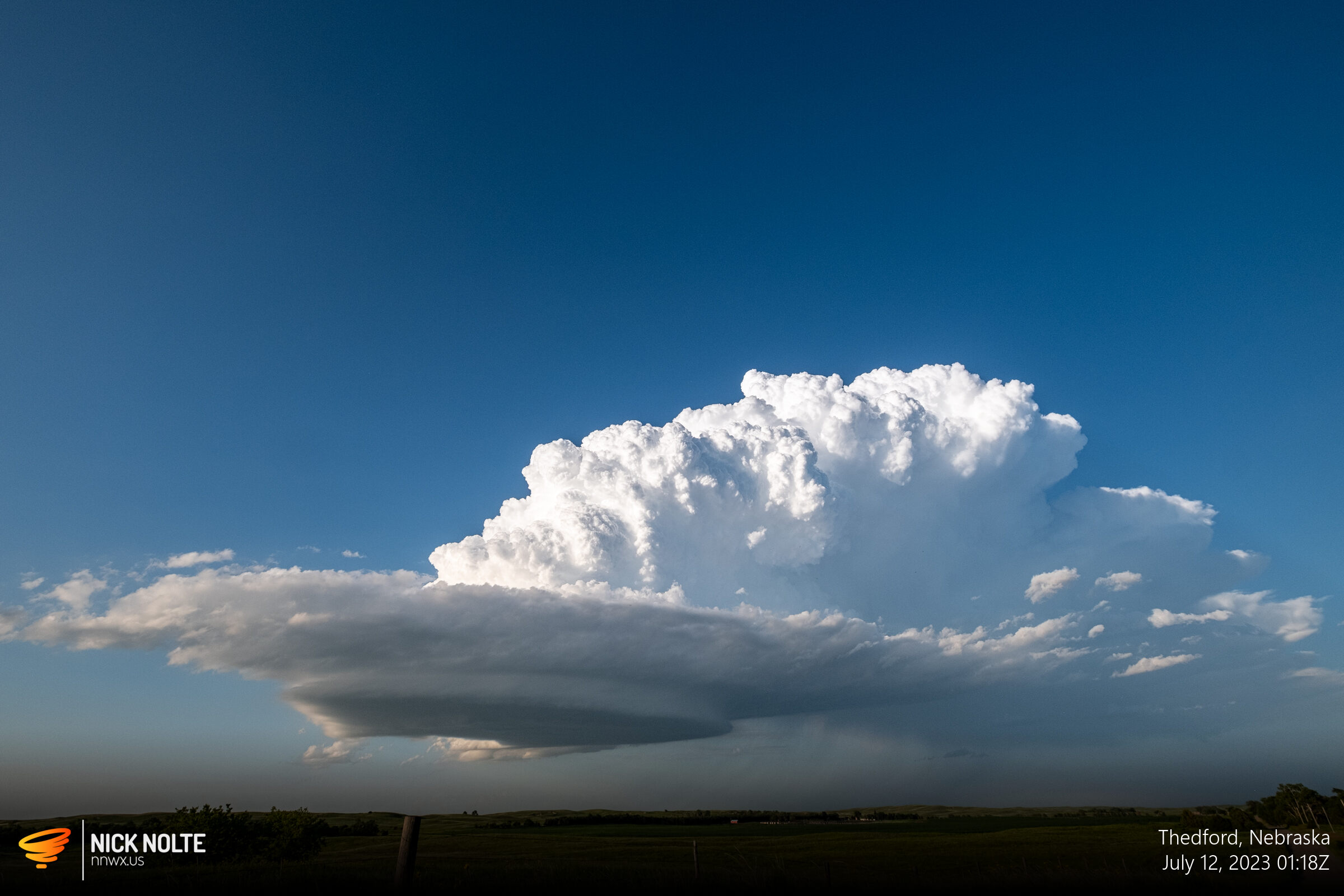
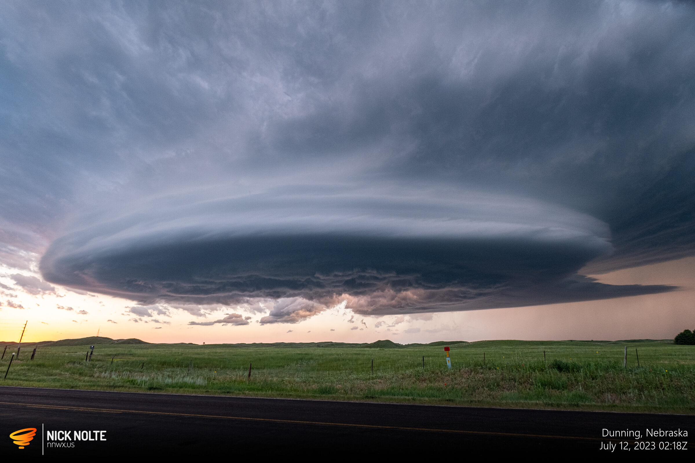
It appeared the cap was still holding, especially east so I decided to go west towards the taller cumulus fields in central Cherry County. I got to a recreation area south of Valentine around 23z and sat there for a while and watched two areas of development. The first one to go up came out of the group of clouds southwest of Valentine. Shortly after a new storm started to develop out of the southern group of cumulus. I was parked along US 83 between the two keeping an eye on both. They were both struggling.
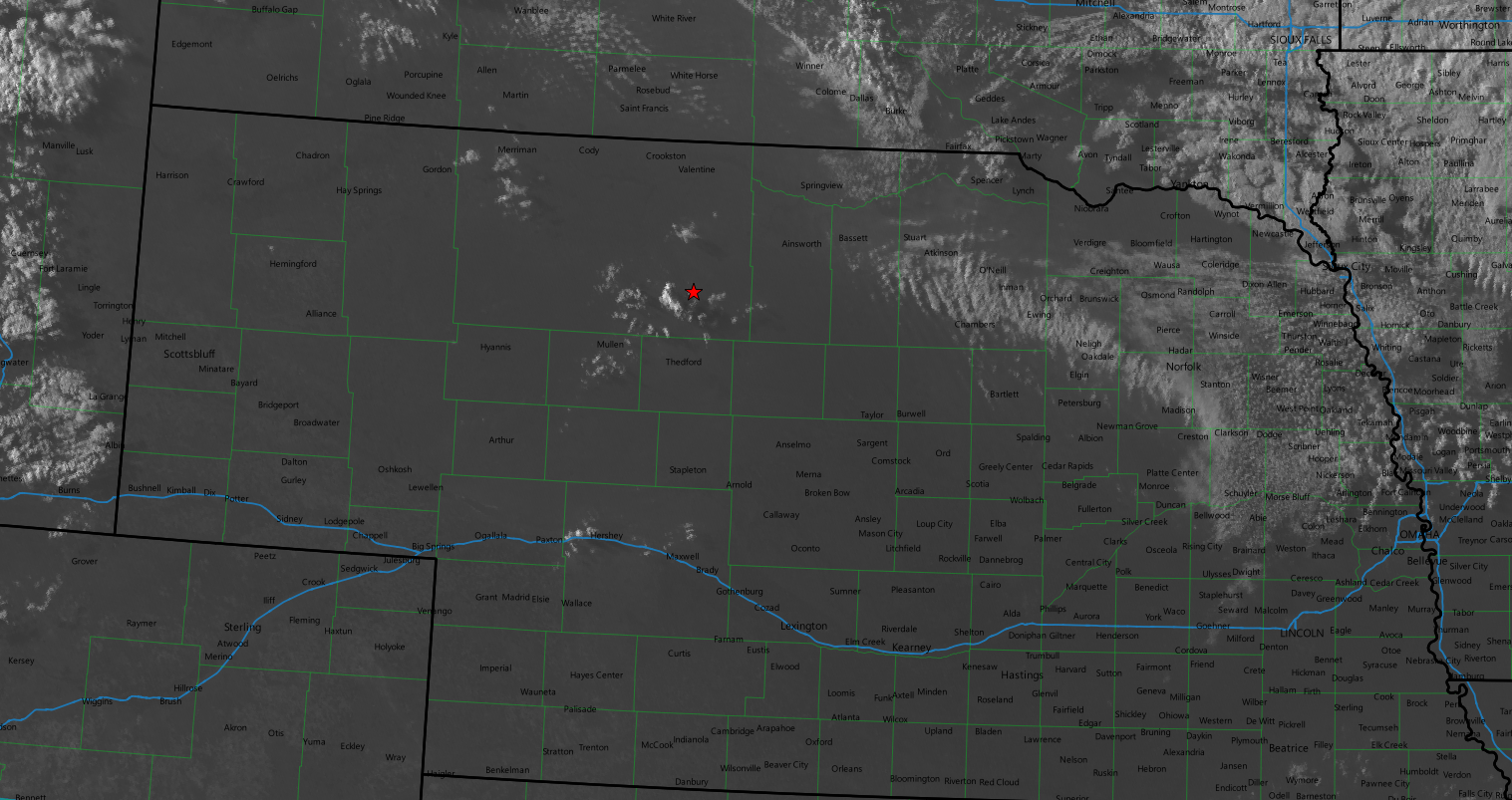
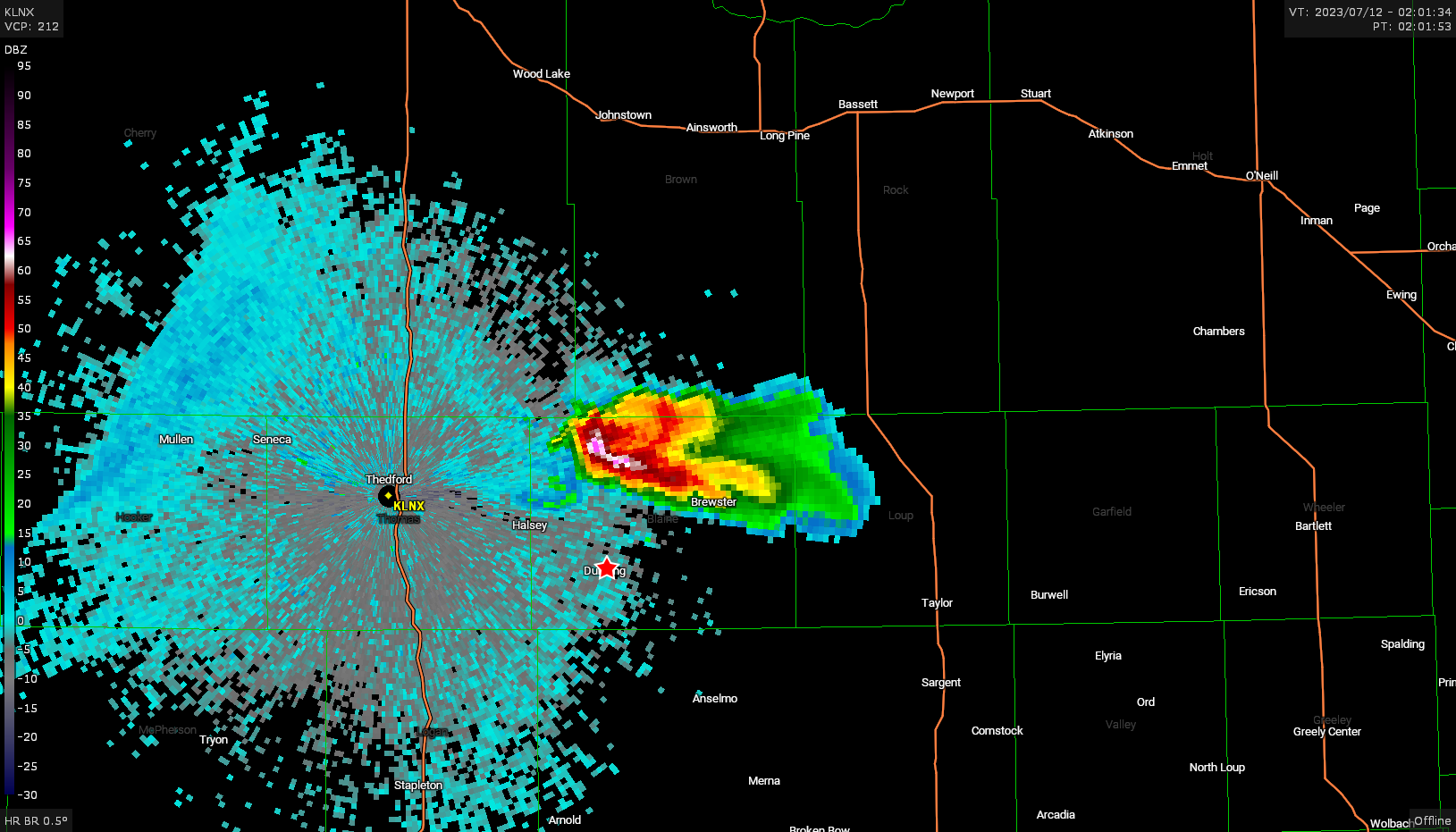
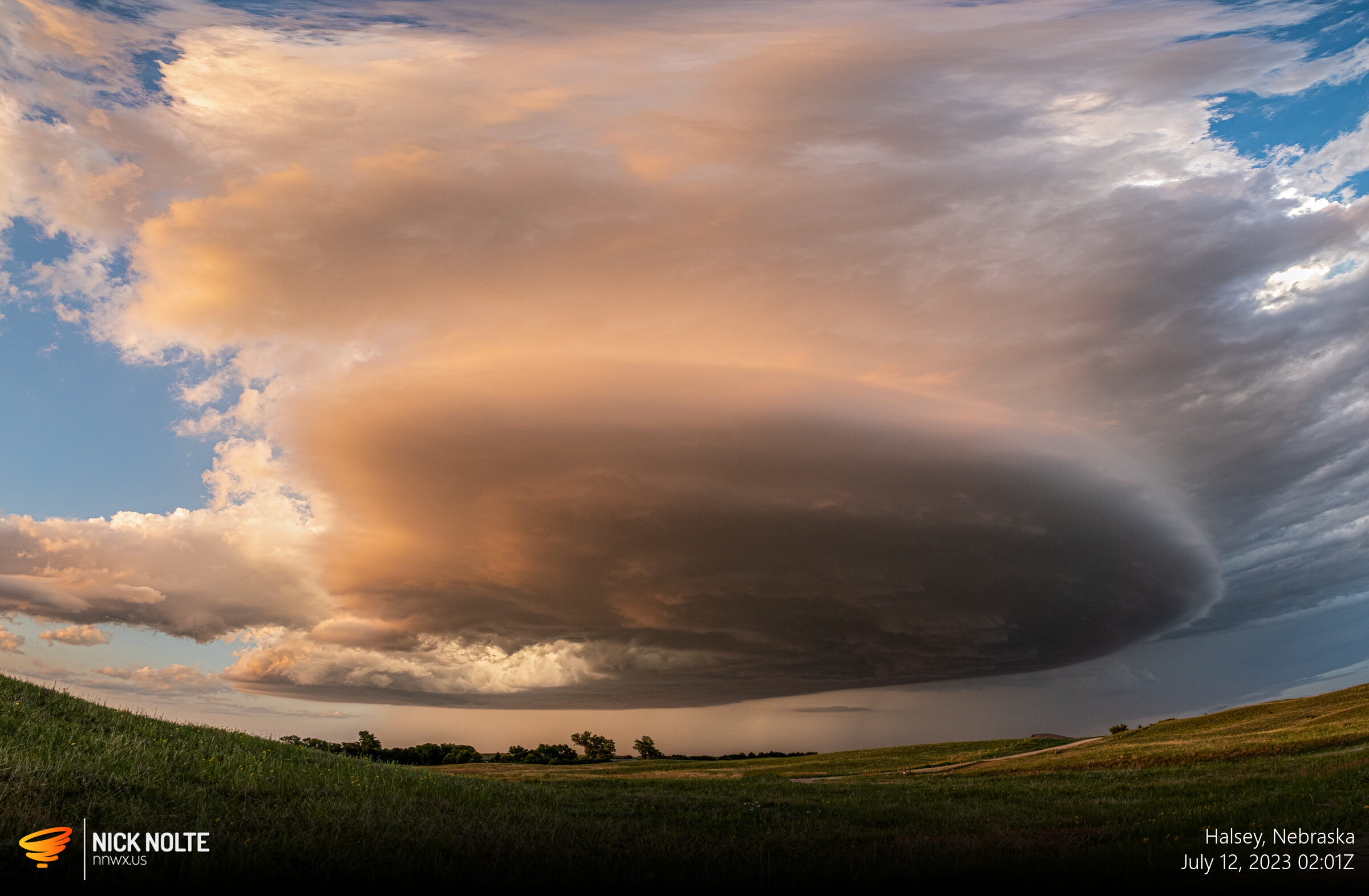
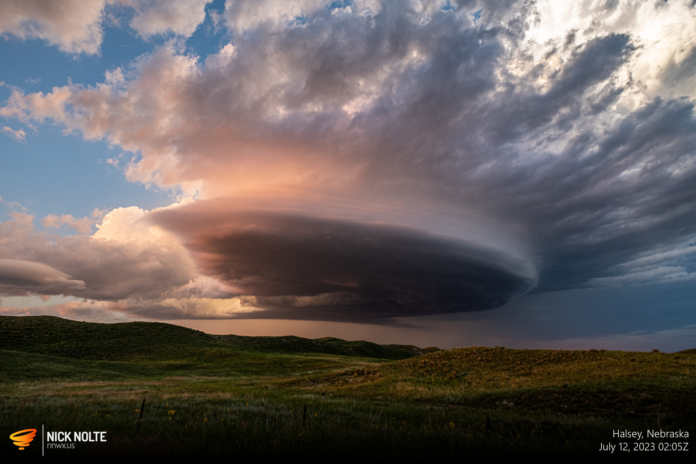
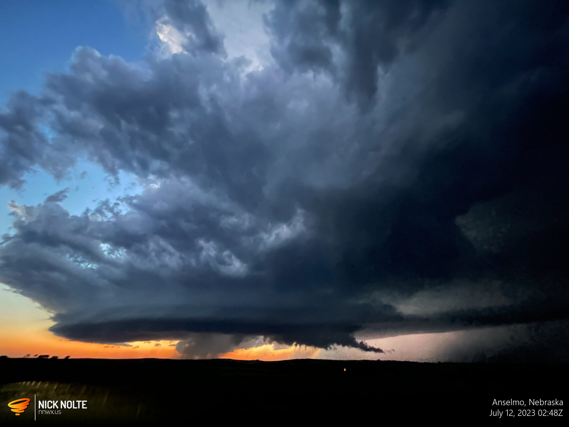
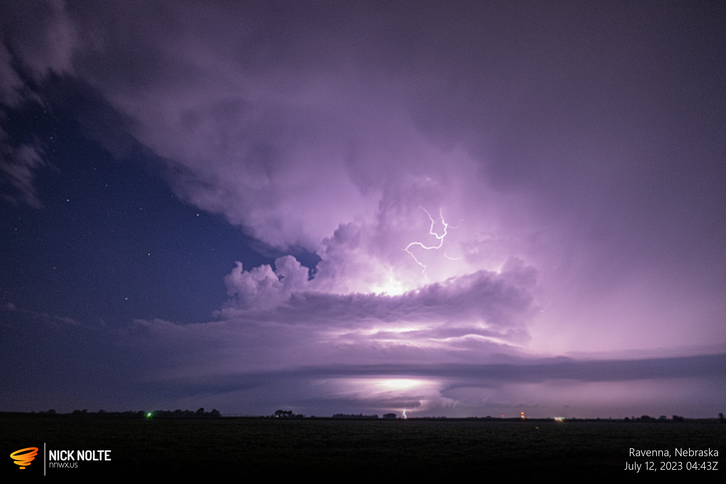
Eventually the northern cell completely dissipated and now just had to hope the southern cell got going. Lucky for me, it did, and the rest of the chase was following this single storm as it tracked from Thedford to Ravenna and provided one of the better structure shows of the year.
Here we go!
Here’s a video of some time lapses I shot during this storm. This was the first time I took shots with my camera to make a time lapse instead of just speeding up video. I learned that my interval was too long lol, but still cool.
Tracked the storm all the way back home basically as it rolled into Hall County around midnight. Ended up being a pretty good chase.
Chase Recap
| START | END | DURATION |
|---|---|---|
| Grand Island, NE @ 11/1925Z | Grand Island, NE @ 12/0515Z | 09 hours, 50 minutes |
| INTERCEPTS | CHASER ENCOUNTERS |
|---|---|
| None | None |