01
Jun
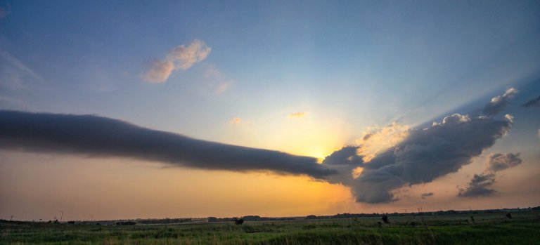
June 1, 2011 – Stockton, Kansas
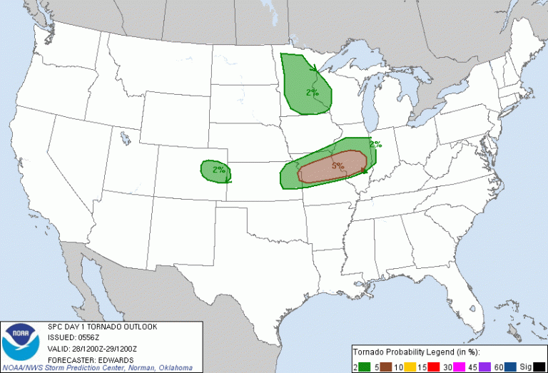
Convergence along a lee trough was expected to trigger scattered thunderstorms from New Mexico to Nebraska. Southwesterly flow from 500mb up juxtaposed over southerly flow in the low levels would create an environment supportive of supercells while the large CAPE would promote large hail while large low level shear and high helicity would promote possible tornadic activity. I awoke in Sioux Falls, SD and wished I had at least driven a little south the day before, but I spent the 31st resting and relaxing. Anyway, I left Sioux Falls at 1340z and made my way down to my target area of Norton, KS.
Read more