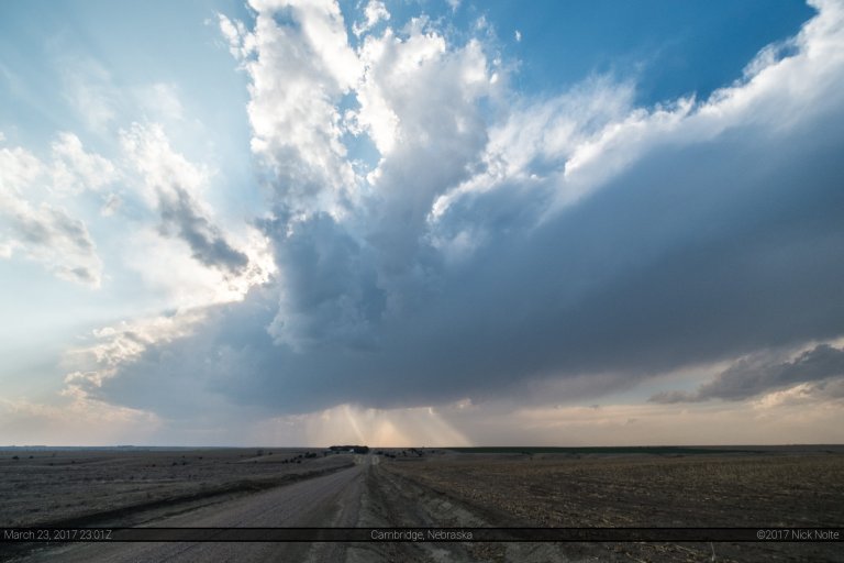
Blog

11 Nov

November 11, 2015 – Southern Iowa

November 11th presented an opportunity for the first chase in a while. A powerful system with a 120kt 500mb jet was moving into the Central Plains atop a deepening surface low that was going to pull 60 degree dewpoints into the target area. Coupled with a strong low level jet in the 60-70kt area provided more than adequate shear atop marginal to modest instability through southern Iowa and Northern Missouri.

Read more
13 Jul

July 13, 2015 – Northern Illinois

July 13th presented a decent opportunity for severe weather across Northern Illinois and being within driving distance of home, it was pretty easy to pull the trigger and head out. An overnight MCS diving southeast through Illinois and Indiana into Kentucky as it followed the frontal boundary would probably lay down some nice outflow boundaries in the clear air behind in Northern Illinois and Eastern Iowa.

Read more
24 Jun

June 24, 2015 – Southwest Iowa

Still recovering from the long drive back home on the 22nd, another chance for severe weather in Iowa presented itself for the 24th and only being home for 24 hours before heading back there made me question my sanity. Nevertheless, the storms are a callin’ and the forecast looked decent enough for me to pull the trigger.

Read more
22 Jun

June 22, 2015 – Southeast Iowa Redux

I hadn’t planned on chasing in southeast Iowa on this day. I had actually taken the day before off and took a leisurely drive along the Mississippi River to Prairie du Chien, Wisconsin where I stayed the night. Little did I know, I’d end up driving past the hotel I stayed at in Ottumwa the night before while tracking storms in Southeast Iowa again.

Read more