| 1 | 1.00" | 70 | 1,080 |
|---|---|---|---|
| TORNADOES | HAIL | WIND | MILES |
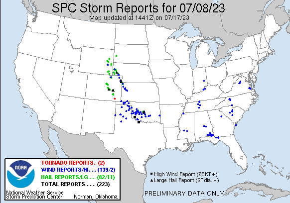
Another day of modest easterly flow into the foothills coupled with westerly flow aloft was setting the stage for another round of severe weather across Colorado. The forecast looked like initiation north of Denver with those storms moving southeast onto the Plains then another group of initiating storms south of Colorado Springs later in the afternoon.
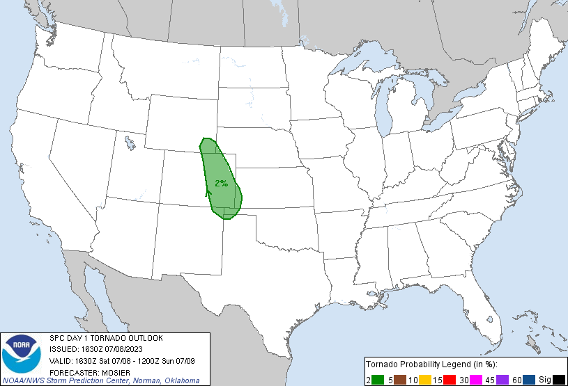
SPC had outlined a 2% tornado risk from Cheyenne into the Oklahoma Panhandle and things were setting up for another day of 3,000 J/Kg CAPE across Eastern Colorado as dewpoints moved into the mid-60°Fs. My plan for the day was to head to Fort Morgan and reassess from there, so I left home around 14z and began blasting down I-80.
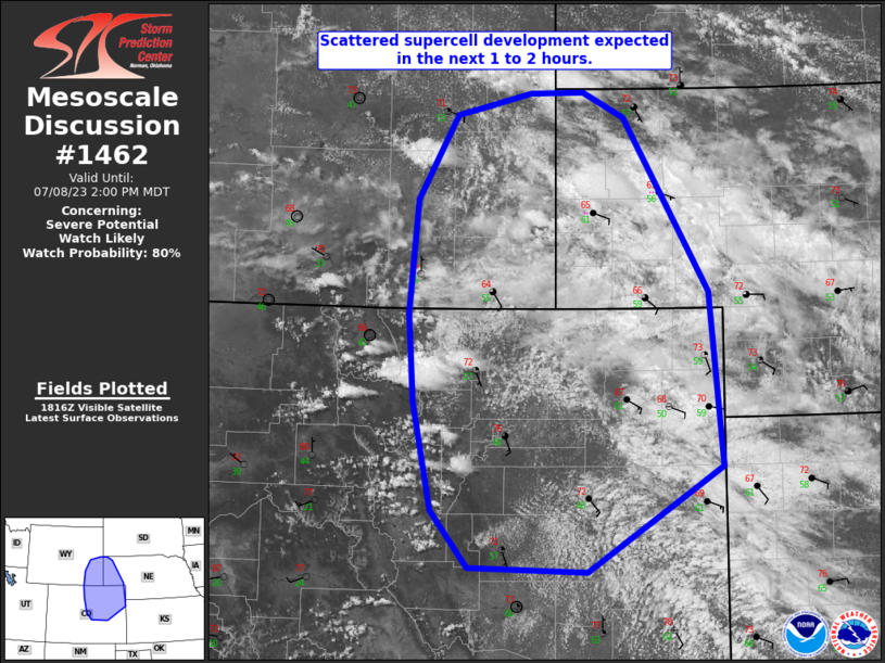
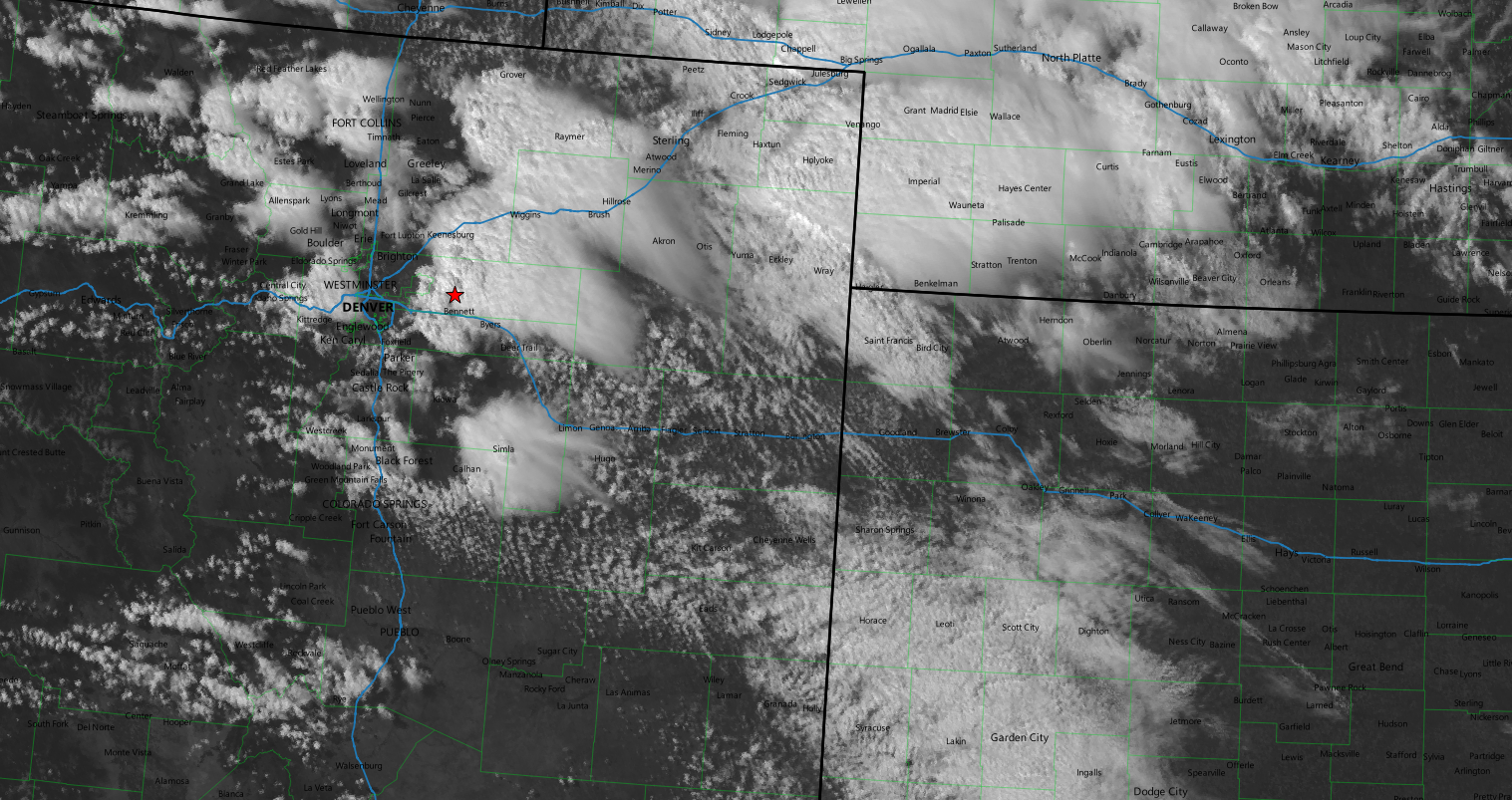
As I arrived in Sterling, the SPC issued the first mesoscale discussion of the day indicating that scattered supercell development was likely in the next couple of hours.
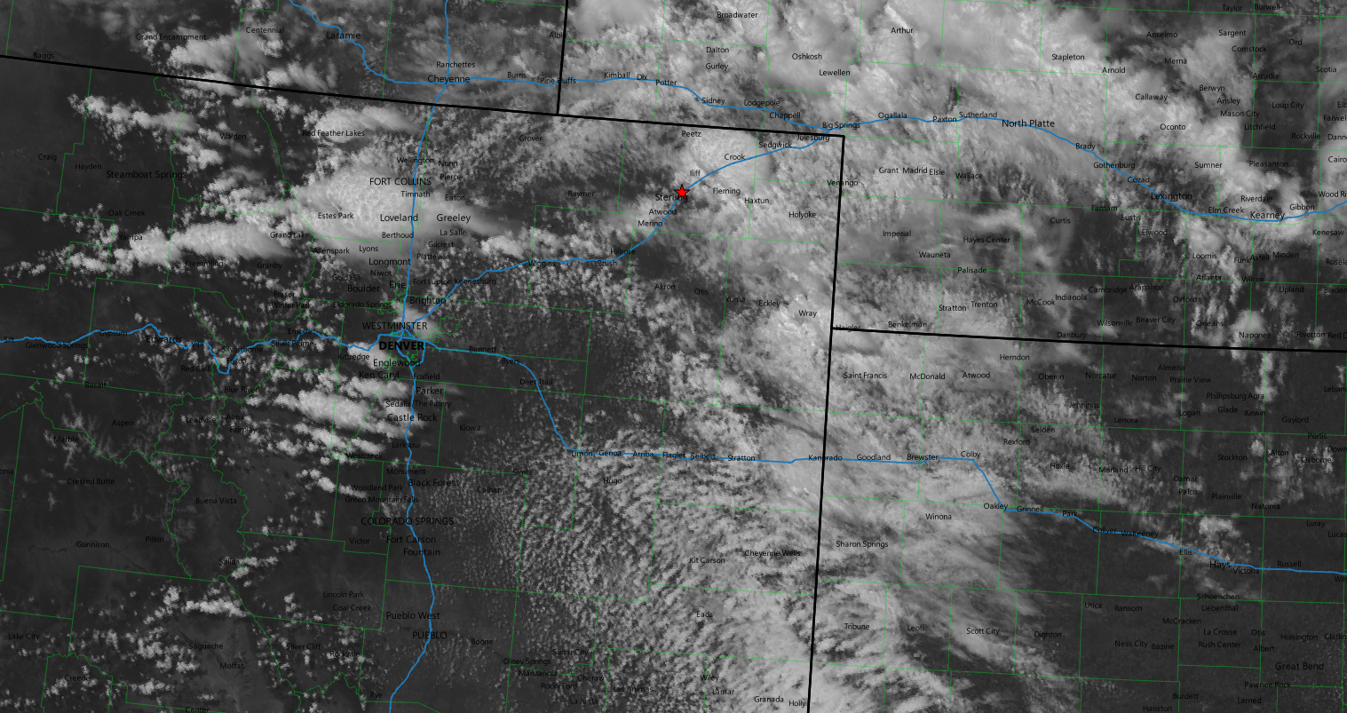
Visible satellite also was showing storms developing all along the front range from Fort Collins down to Castle Rock.
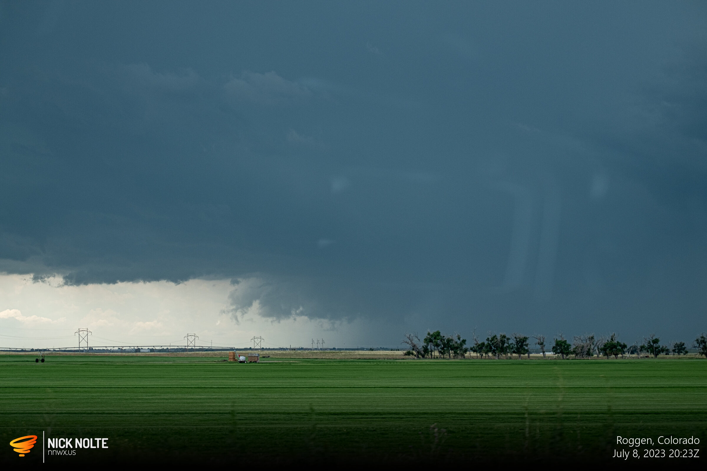
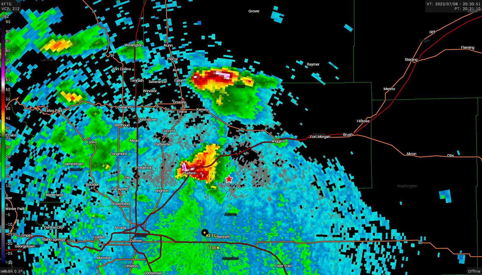
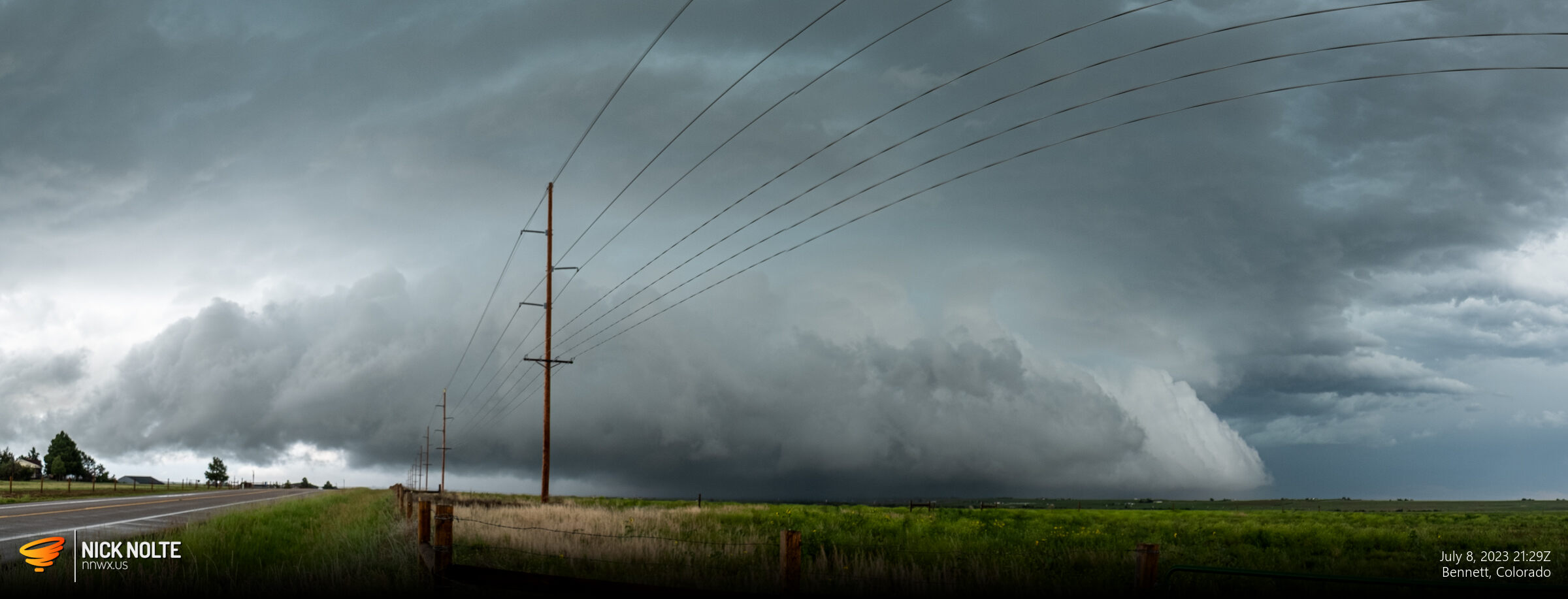
I decided to go for the newly developing storm just west of Wiggins and as I got visual beneath the base around 20z there was a small wall cloud already in place.
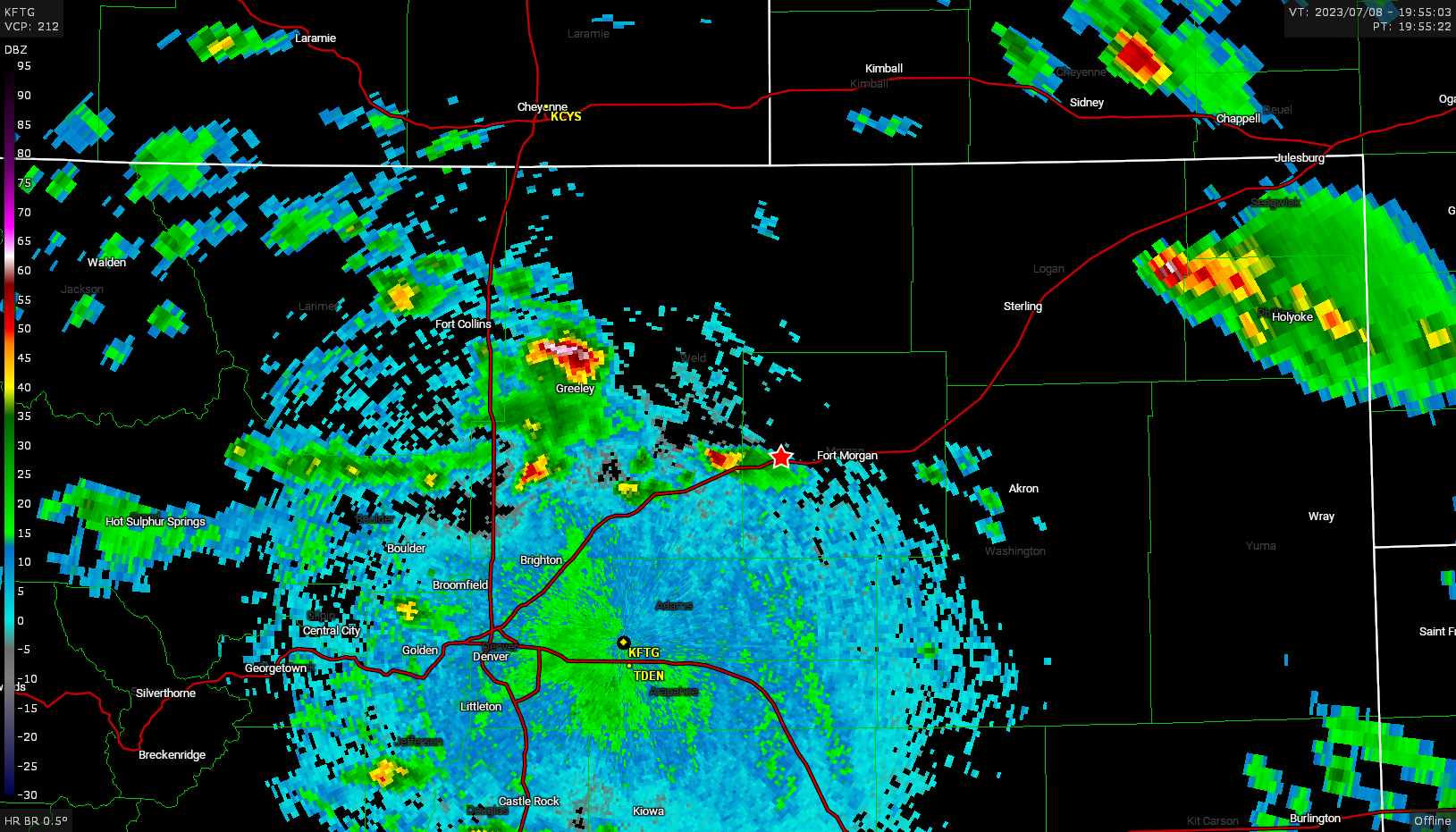
The storm began to weaken so I moved to drop south and intercept the next storm in line which ramped up pretty quickly on radar.
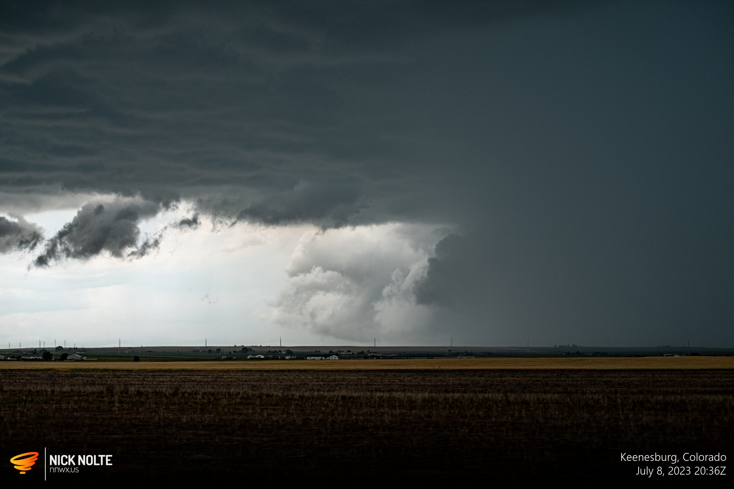
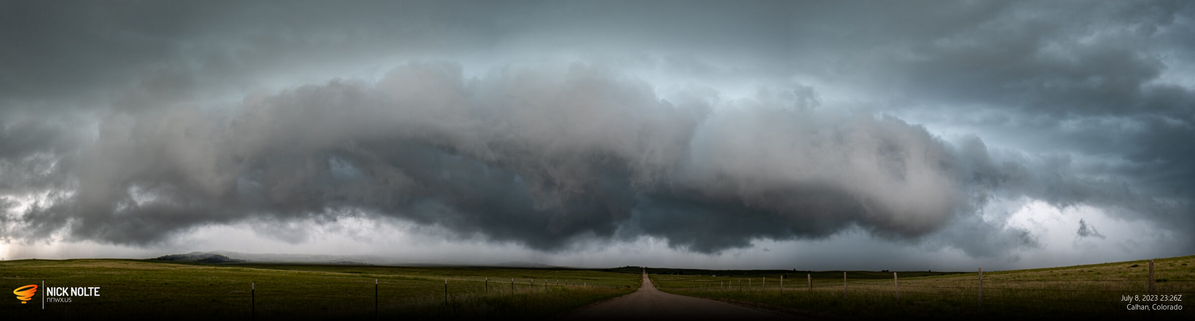
This storm looked pretty good with a nice clear slot around the meso and a really low base.
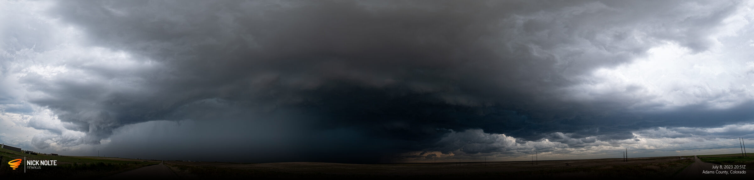
I continued to track along with this storm even as it grew upscale trying to position myself with a view of the westernmost flank
I drove down to Kiowa and went east on highway 86 with a plan to head east a bit then south to US 24 to stay in front of the storm.
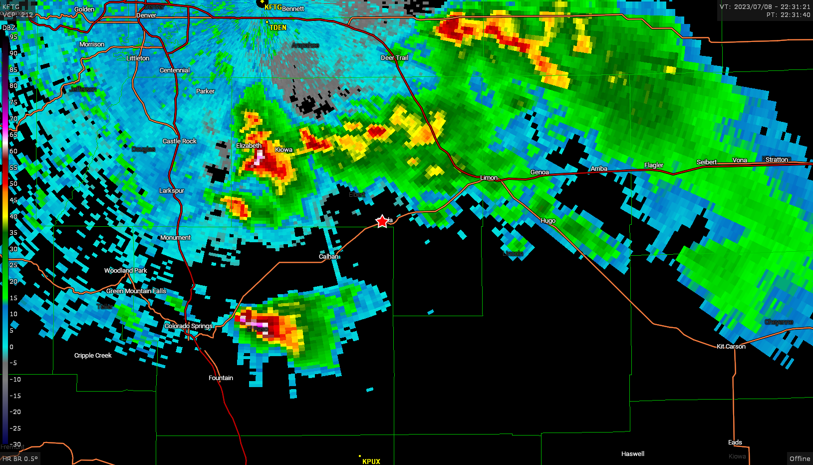
Ragged wall cloud with a nice clear slot wrapping around it, but there wasn’t a whole lot of motion going on and I started to be more interested in the stronger looking cell to my south that was east of Colorado Springs. I started to head west on US 24 with a plan to peek once more into this storm before bailing to the south storm.
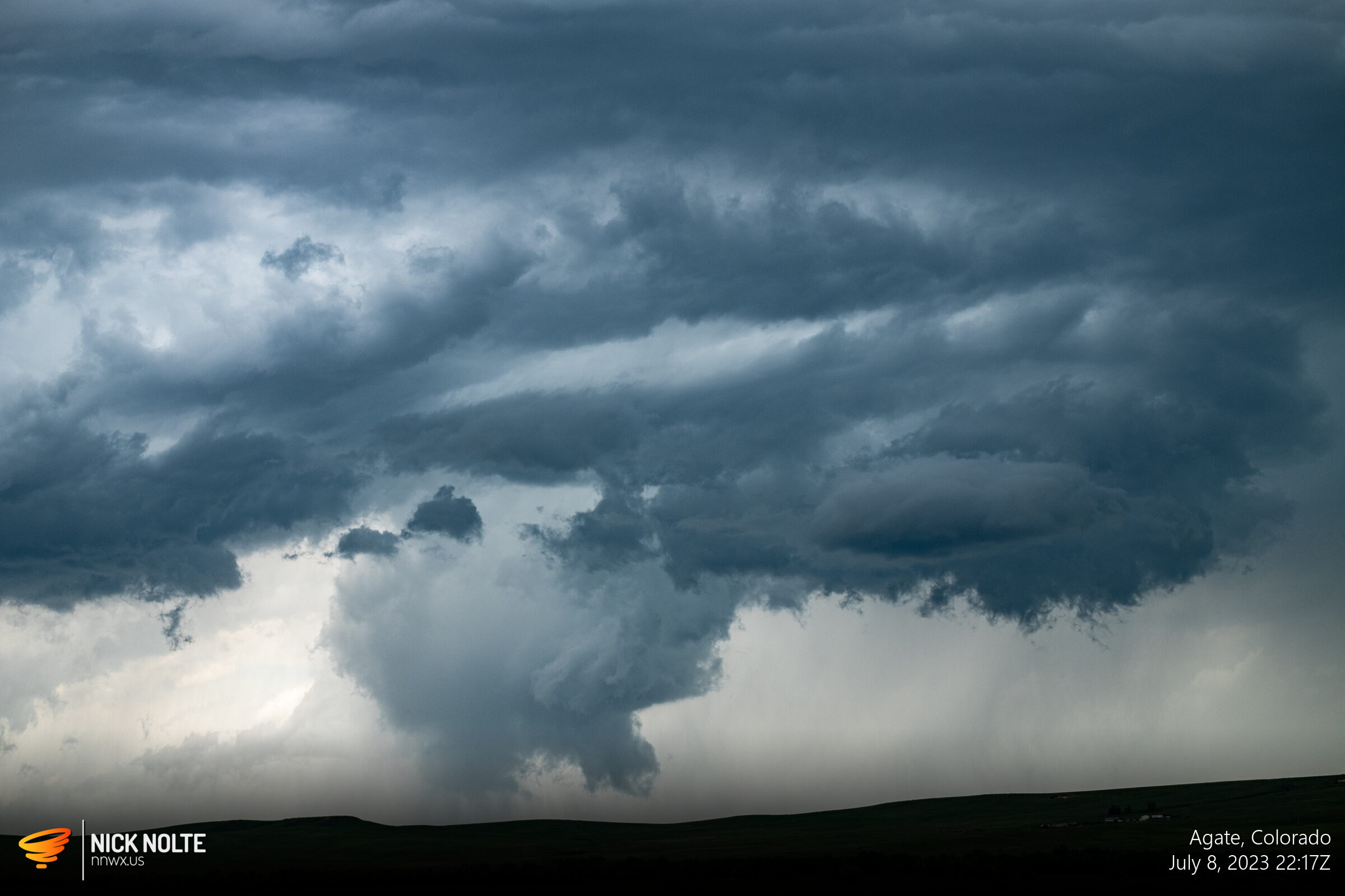
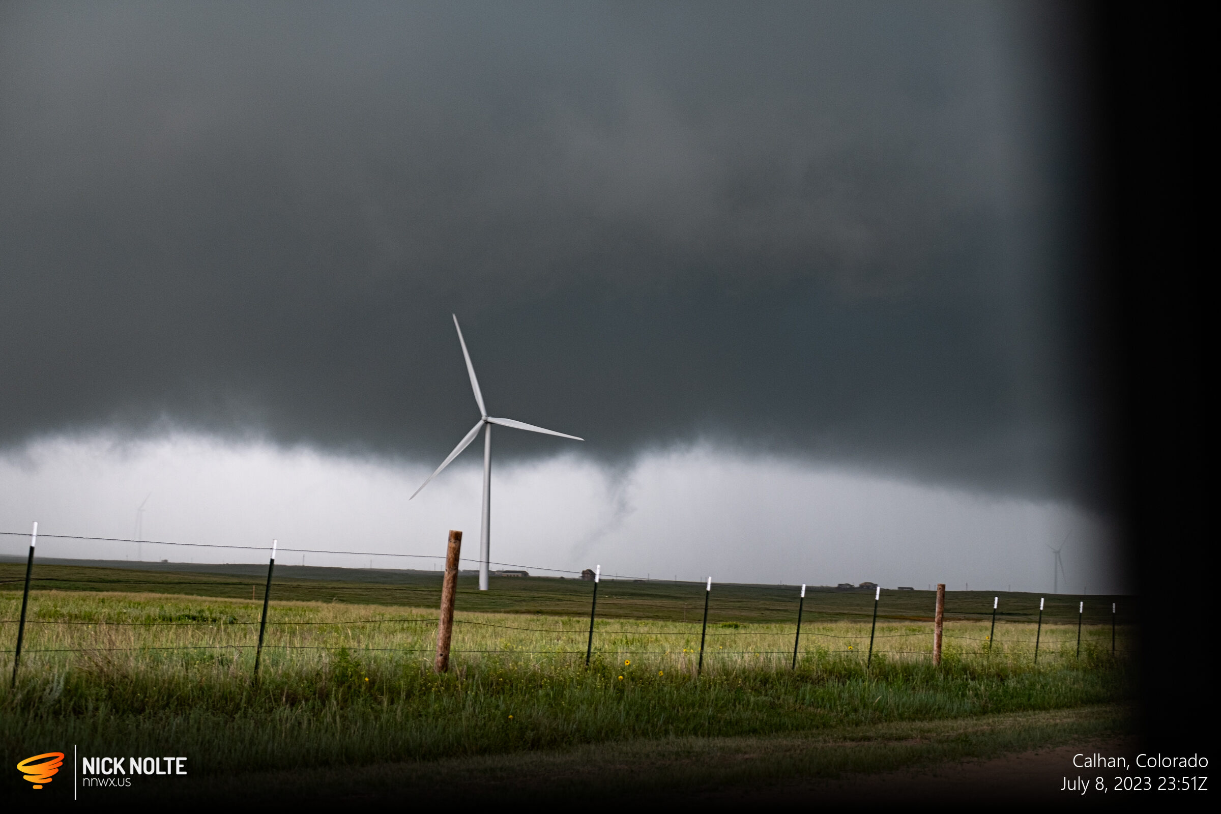
Near Calhan I drove up into the Bear’s Cage to check it out and here I managed to find a very brief tornado.
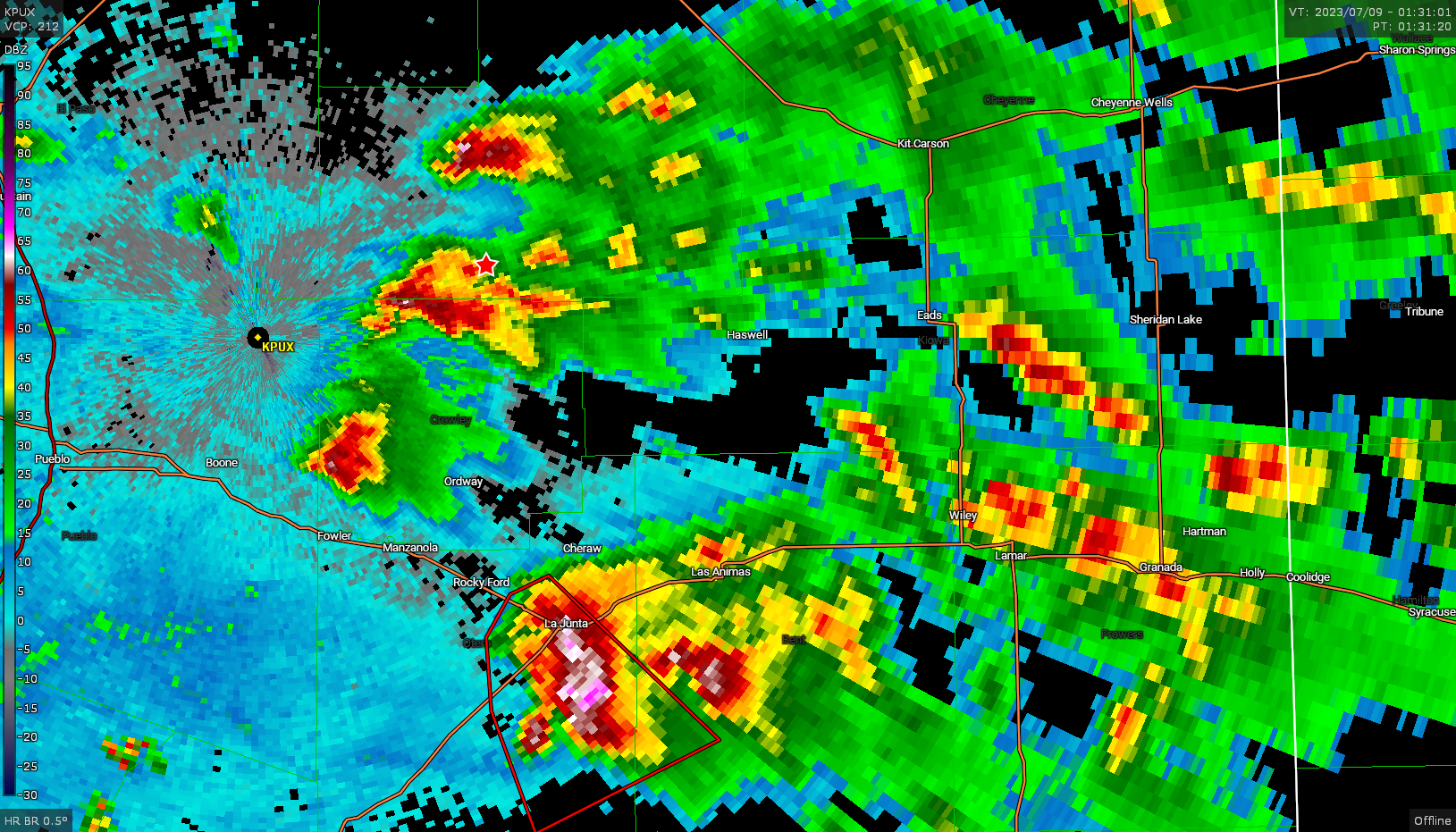
After tracking this storm for a little bit longer I eventually bailed towards the southern cell but lack of cell service between Punkin Center and Ordway along highway 71 meant dodging the supercells was a tricky endeavor.
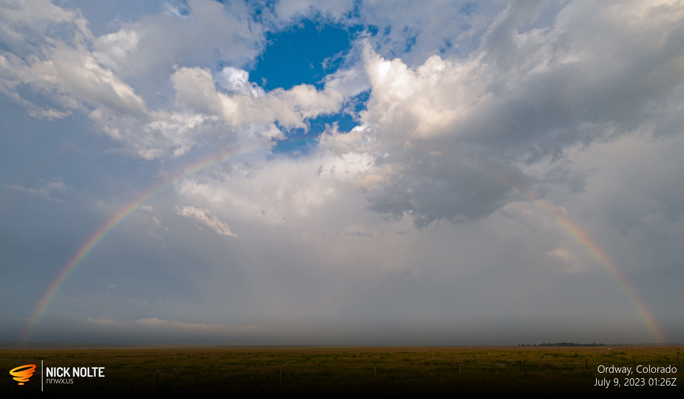
Luckily I was able to navigate through this mess and get back up to US 24 as the sunset in time to catch a glorious ending to a chase day.
Chase Recap
| START | END | DURATION |
|---|---|---|
| Grand Island, NE @ 08/1407Z | Grand Island, NE @ 09/0826Z | 18 hours, 19 minutes |
| INTERCEPTS | CHASER ENCOUNTERS |
|---|---|
| 08/2351Z @ 4 SE Calhan, CO | Adam Lucio (14) |