Blog

08 Apr

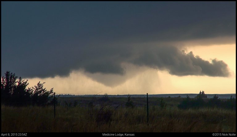
April 8, 2015 – Southwest Kansas

April 8th and 9th had been shaping up to be decent severe weather days and the chatter amongst chasers had grown to a fever pitch as the first big system of the spring seemed poised to kick the season off. A trough centered over the southwest was beginning to eject into the Plains and bringing with it the dynamics we would need to kick off severe weather. At the surface, a surface low was forecast to strengthen in southwest Kansas before it moved off to the northeast and eventually into Wisconsin by the following day. A couple target areas presented itself for Wednesday: the triple point and east along the warm front along the Kansas/Oklahoma border and further south along the dryline into the Texas Panhandle.

Read more
12 Jul

July 12, 2014 – Eastern Iowa

A quasi-stationary boundary draped across the United States from a low in Colorado through Nebraska, Iowa and Minnesota to Lake Superior co-located with mostly 40kt zonal flow in the mid-levels was the focus for storm development as a weak low was expected to drift into western Iowa throughout the day. Target for the day was eastern Iowa around the Iowa City area as upper 60-low 70s dew were pooled south of the boundary across Iowa into Illinois bringing surface based CAPE into the 4,000 J/Kg regime.

Read more
16 Jun

June 16, 2014 – The Pilger Day

This blog entry will be a little different than usual because the Pilger, Nebraska day was quite the failure for me and I’ve wrote about it in a couple of different places. While I caught the tail end of a very rain-wrapped tornado near Wakefield, a series of missteps and general apathy led to a disastrous chase day for me, probably my worst. I have no photos or videos from this chase, so it will mostly be a description of how I pictured the day to unfold and how I executed those plans.

Read more
07 Jun

June 7, 2014 – Texas Supercell

Saturday was my final day of chasing after almost a full week out in the Southern Plains and I wasn’t looking forward to the long drive back to Michigan. The prospects for storms looked pretty decent, as it was the day before. The Storm Prediction Center had a nebulous region of slight risk issued spanning from the foothills of Colorado and New Mexico across Oklahoma and into the Mid-Mississippi Valley. The focus for storms was easterly upslope across the foothills of eastern NM and CO and latching on to any of those as it rolled east.

Read more
06 Jun

June 6, 2014 – Clovis, New Mexico Tornado

A series of embedded shortwave troughs were expected to migrate across the High Plains in otherwise zonal flow of 40 to 50 knots. Southeasterly surface flow was expected throughout the front range in Colorado and New Mexico while low 60s dewpoints were drawn into the area. With several hours of insolation, this would provide substantial instability for storms to initiate in this area.

Read more