| 1 | 0.50" | 50 | 624 |
|---|---|---|---|
| TORNADOES | HAIL | WIND | MILES |
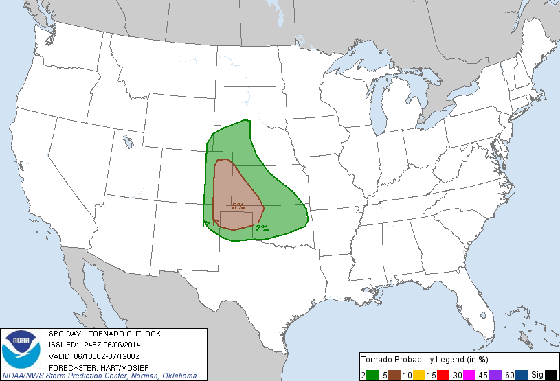
A series of embedded shortwave troughs were expected to migrate across the High Plains in otherwise zonal flow of 40 to 50 knots. Southeasterly surface flow was expected throughout the front range in Colorado and New Mexico while low 60s dewpoints were drawn into the area. With several hours of insolation, this would provide substantial instability for storms to initiate in this area.
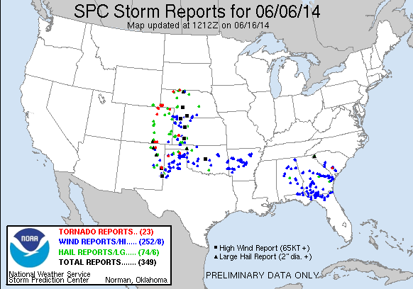
Jonathan and I had met up with Sean Casey the night before as Williamson was recruited for navigational duty in the TIV. We figured that we would have quite a drive to the target area and expected an early morning. Originally our target was the western Texas Panhandle into New Mexico so we left Oklahoma City at about 15z and began the trek westward on I-40. The Storm Prediction Center had a very large slight risk area encompassing most of the High Plains and east through the southern states to the Atlantic Coast. A 5% tornado probability was indicated throughout the High Plains areas of Colorado, Kanasa, New Mexico as well as the panhandles.
After lunch in Shamrock we initially headed north on US 83. The plan was to head northeast and try to target the storms that were starting to fire in the Raton area of New Mexico. I wasn’t 100% convinced this was the correct decision to make and we pulled off the side of the road near Twitty to discuss. I was concerned that the storms to the north were behind an outflow boundary we had noted earlier in the day and that I was more intrigued by the cumulus field that was developing further south in New Mexico. I decided to part ways with Jon and the TIV and went back to Shamrock and started west on I-40.
As I continued west storms started to fire south of I-40 in New Mexico near Fort Sumner, the SPC had issued a tornado watch for areas north of I-40 which made me second guess my decision to leave Jon and the TIV for a target further southwest, but decided I was committed to my new target in eastern New Mexico and continued on.
As I crossed into New Mexico, new storms started to fire downstream from the previous ones, just northwest of the KFDX radar. This cell actually split and the left turner moved northeast through Tucumcari and across I-40 while the right split moved almost due east over the KFDX radar. As I traveled down state highway 489 I was able to get a visual on both storms and for a while the left split looked pretty good. Eventually I moved on to the right split which looked pretty ragged when I got a visual. By this time, the storm had begun to turn right a little bit and look much more organized, especially on radar.
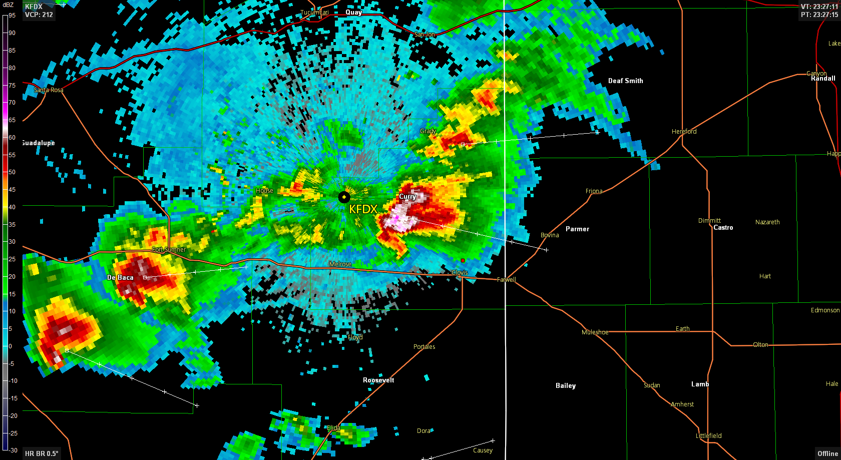
The Albuquerque NWS office issued a tornado warning for the storm I was attempting to intercept and it started to show organization and some lowerings that made things interesting.

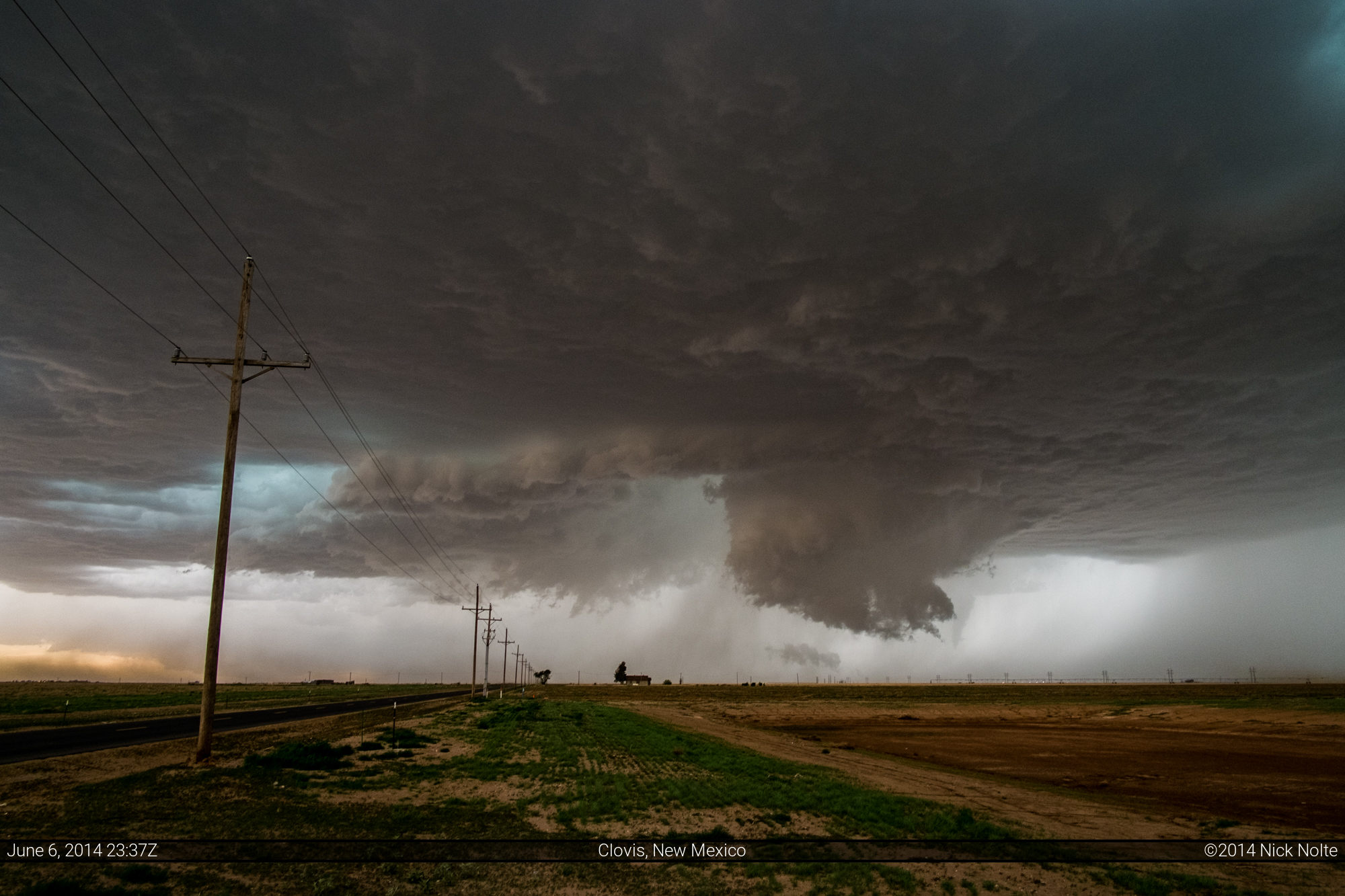
I stopped on the north side of Clovis at a school parking lot to sit and watch the storm come my way. It was essentially heading straight for town and I had a wide open view to the west of it from this location. The NWS issued another tornado warning which included the northern part of Clovis and eventually I got a visual of a tornado which must have been occluding as it was behind a newly forming wall cloud.

After watching the storm for a few minutes, I could no longer see the funnel and the storm became very rain wrapped and began to stir up quite a bit of dust.
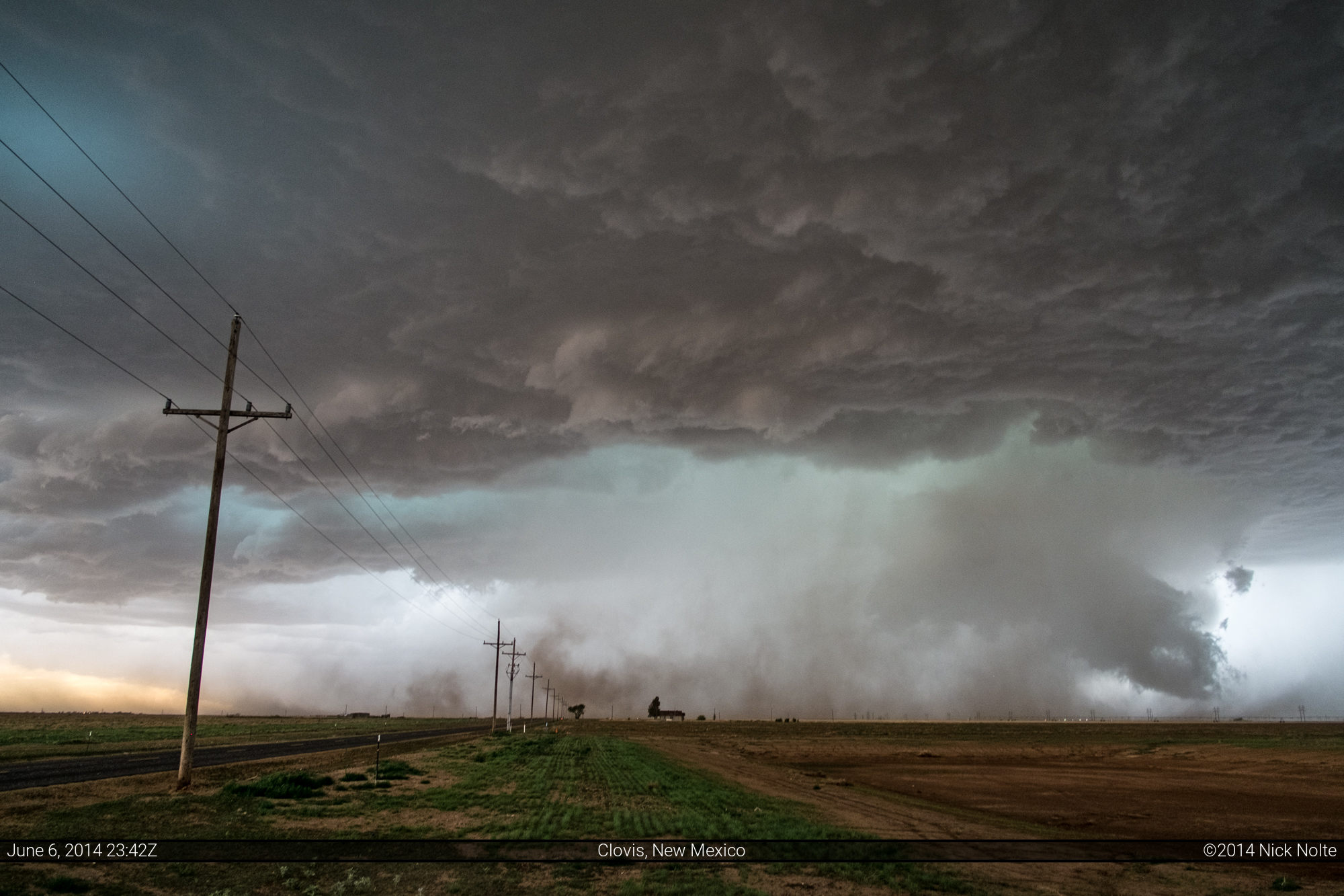
As the storm grew closer, I decided it was time to bail and attempted to make my way through Clovis, which just so happened to be having some kind of apocalypse as every car in the southwest was on the roads. It looked like some kind of local event was just ending or being canceled due to the tornado warning and everyone was trying to get somewhere, I’m not sure exactly what was going on. At this time the rain and wind started to pick up and then I realized that KFDX had gone down and radar updates were not coming in any longer. I was able to switch to the Lubbock radar and noted the hail core was almost on top of me.
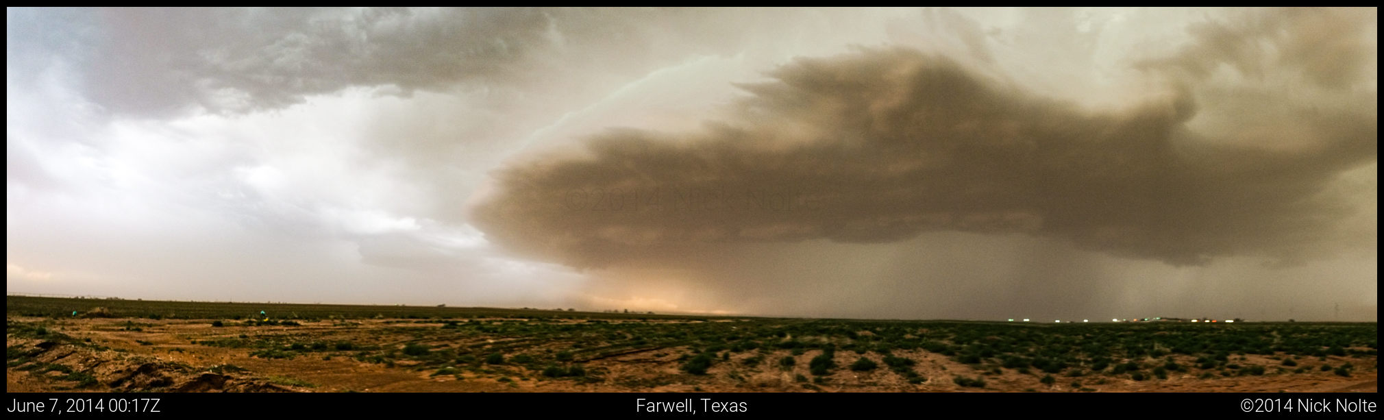
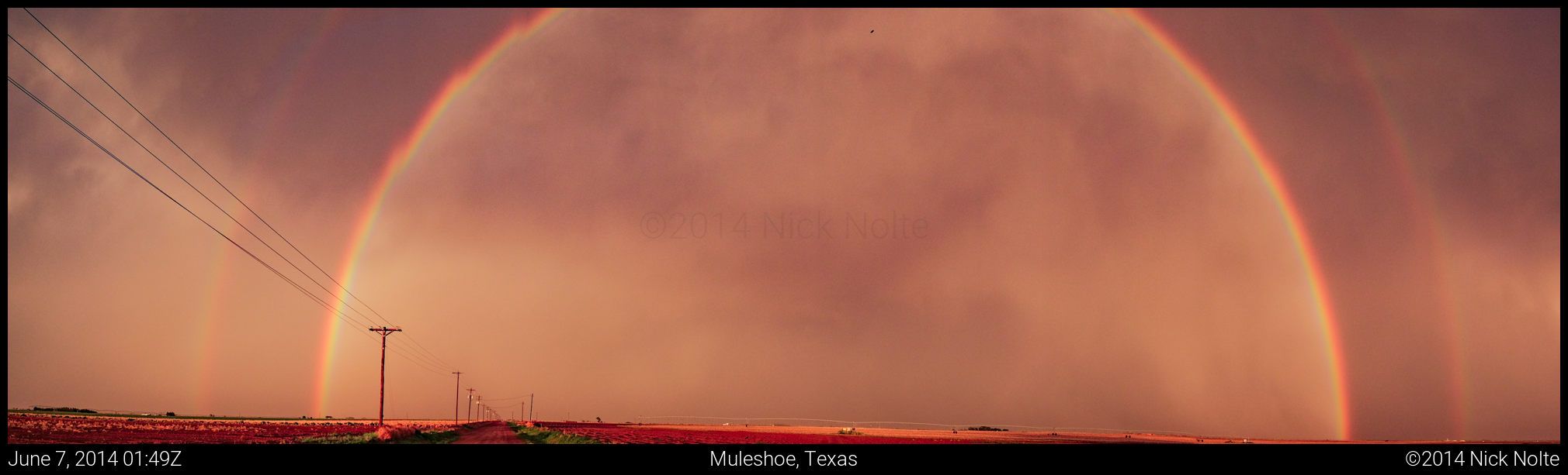
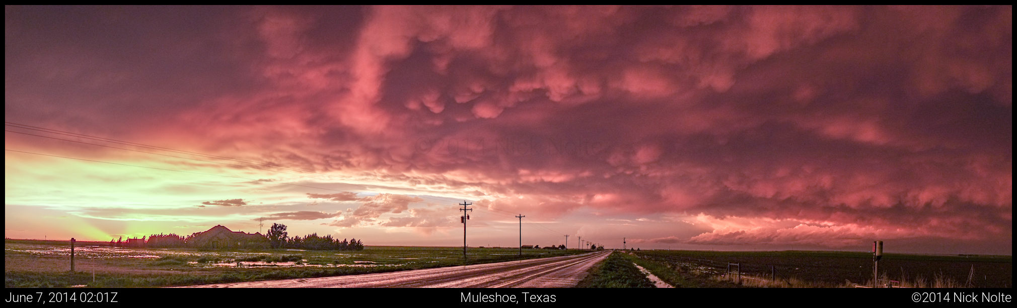
I finally got back to US 84 and blasted east to get back in front of the storm. I crossed back into Texas where I was able to watch the storm from a distance. It had nice supercellular structure for most of the time before the storms from the west eventually caught up with it, and everything congealed into a messy line. I tried to play peek-a-boo with an embedded cell 20 miles south of Farwell, TX, but over time as it became darker, the visibility dropping very low, I made the decision to blast east and call the chase. The storms I was running from started to weaken and breakup and as I approached Muleshoe was presented with a beautiful sky for a parting gift.
Chase Recap
| START | END | DURATION |
|---|---|---|
| Oklahoma City, OK @ 06/1459Z | Amarillo, TX @ 07/0330Z | 12 hours, 30 minutes |
| INTERCEPTS | CHASER ENCOUNTERS |
|---|---|
| 06/2349Z @ Clovis, NM | Brad Goddard (38) Jonathan Williamson (57) Sean Casey (11) |