| 1 | 1.50" | 70 | 656 |
|---|---|---|---|
| TORNADOES | HAIL | WIND | MILES |
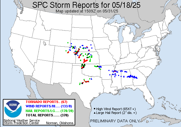
May 18th featured a potent setup along a surface low in Northeast Colorado into the tri-state area and southward along a dryline into Oklahoma. A strong mid-level jet was forecast to eject into southwestern Kansas in the afternoon as the trough tilt turned negative. The SPC had outlined a couple of enhanced targets. One in NE Colorado and Western Nebraska and a second along the dryline from Kansas to Oklahoma.
While strong southerly flow would boost dewpoints into the low 70s into Oklahoma and maybe into Southern Kansas, I was more intrigued by the wrap around area on the low which looked like it would setup around the Hays to Ogallala corridor. Dewpoints would climb into the 60s here and I figured with the enhanced helicity this would be a decent play. The 13z SPC update actually extended the 10% tornado outline northwest into my target area so that made me feel better about my forecast.
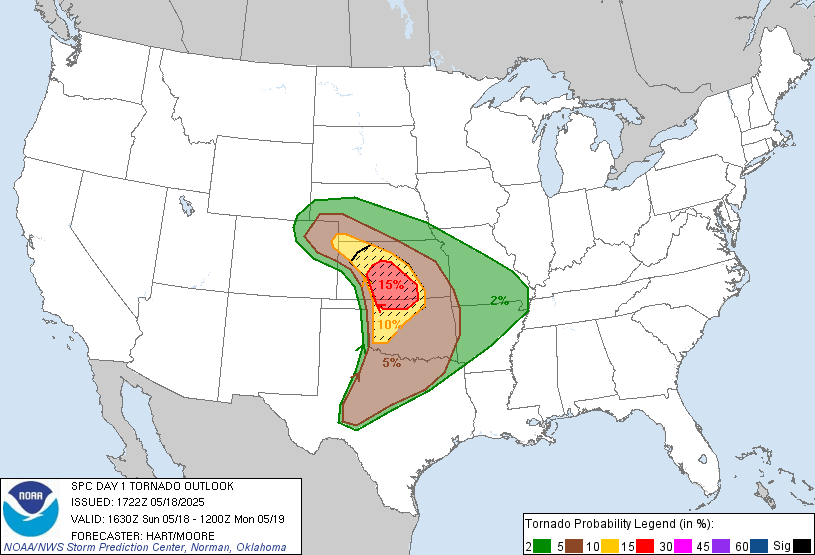
They also upped the probabilities in Kansas and Oklahoma to 15%, but I was not going to be swayed and stuck to my forecast. I took off from Grand Island a little after 14z and my initial target was WaKeeney where I’d reassess. As I approached WaKeeney, a cumulus field was getting organized in Northeastern Colorado.
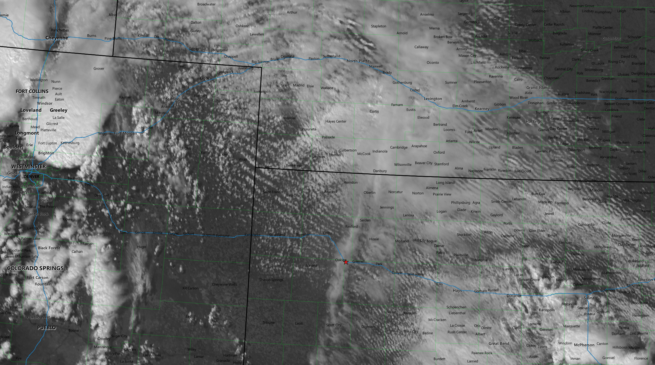
It looked like that area from Sterling down to Cheyenne Wells would initiate within the next hour or so so I decided to just head west on I-70 towards the Colorado border and intercept whatever developed. The SPC issued a mesoscale discussion just after 19z highlighting the moisture axis from Dodge City into Northeast Colorado and the Nebraska Panhandle. The tornado watch was issued at 20z and an hour after storms started to pop between Cheyenne Wells and Burlington. I continued west on 70 to intercept this storm.
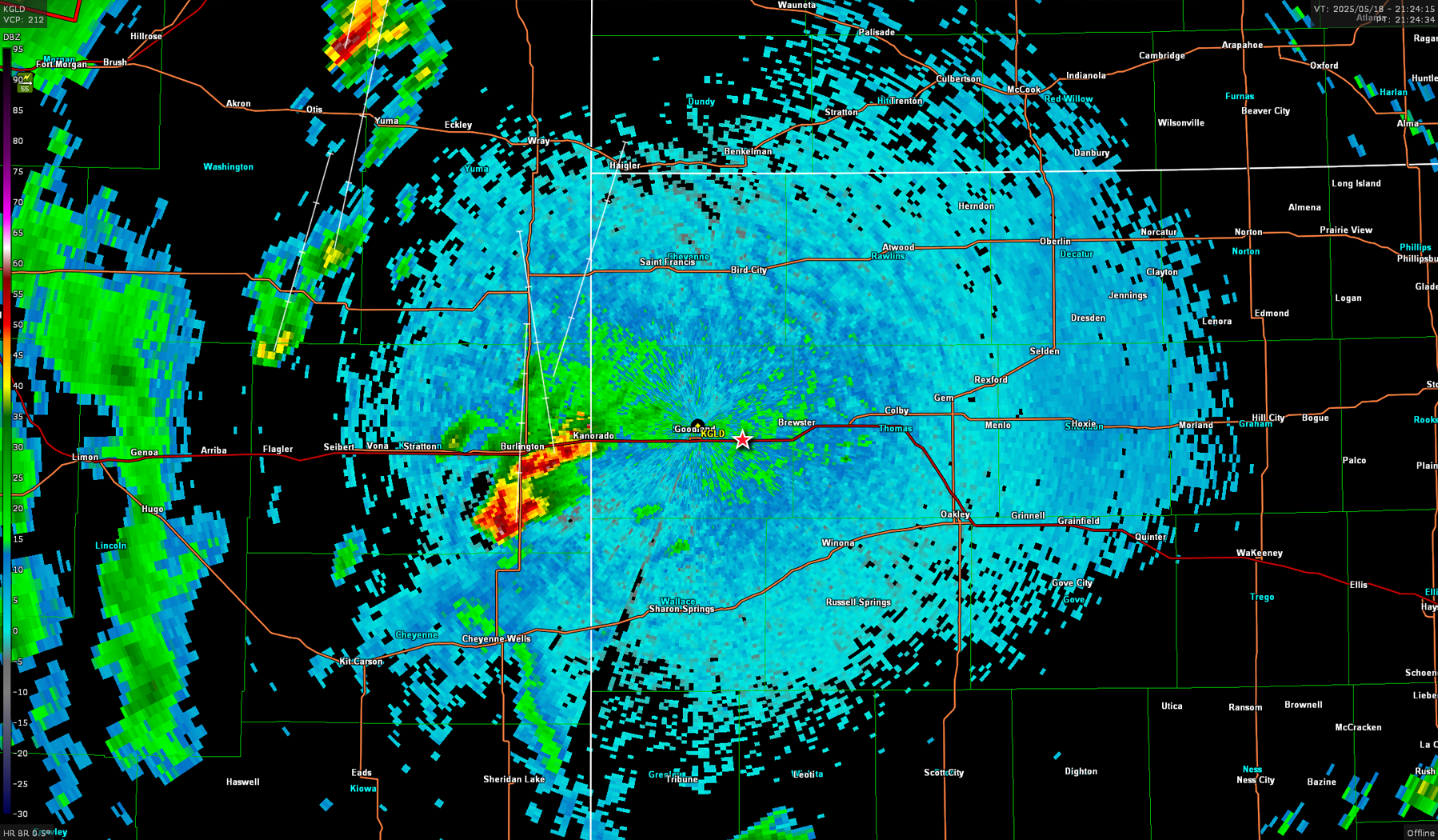
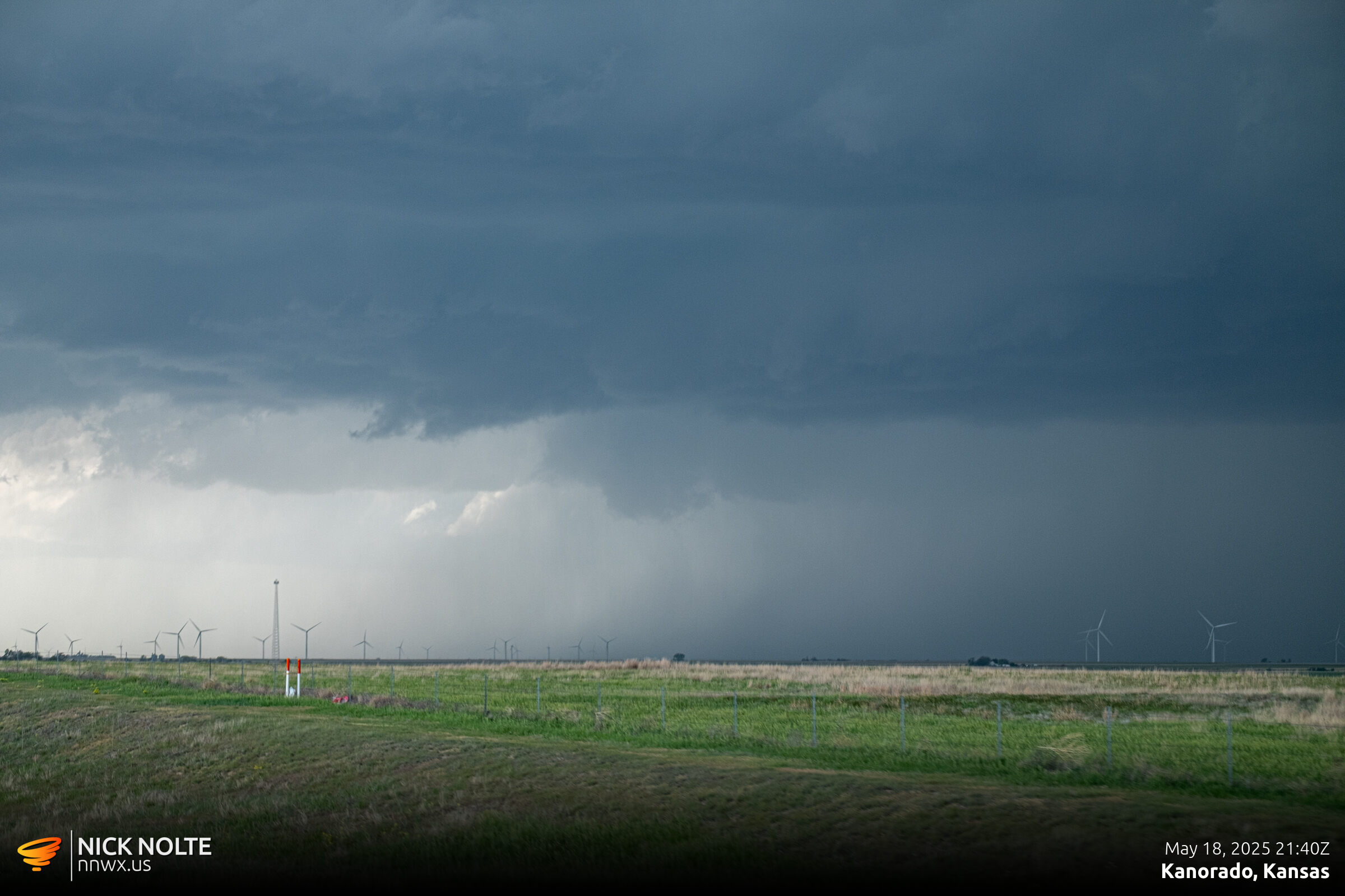
The storm continued to develop and started dropping golf balls just a few minutes later. I finally got on the storm just before 22z
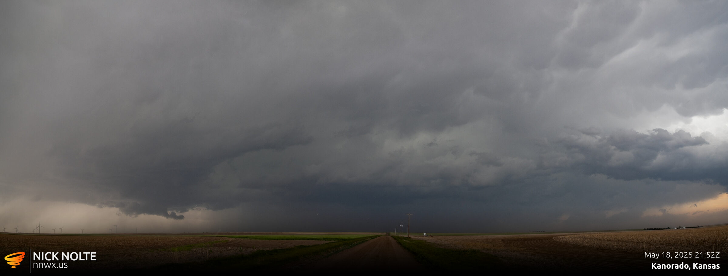
While this was going on, a couple cells developed down near Leoti and a tornado report came in shortly after it developed. This made me wonder if I shoulda went further south but I decided to stick with the storm I was already on as it seemed like it was still getting going. As I was heading north from Goodland towards St. Francis, a tornado report came in on the cell to the north. I eventually caught up to the storm around 2230z.
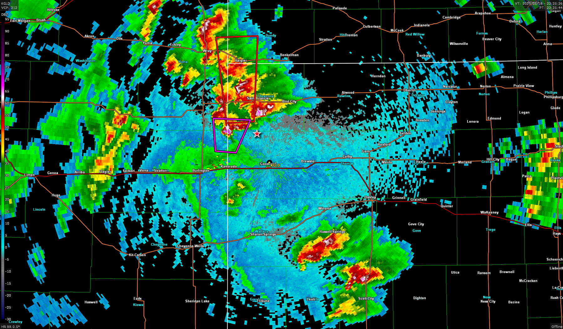
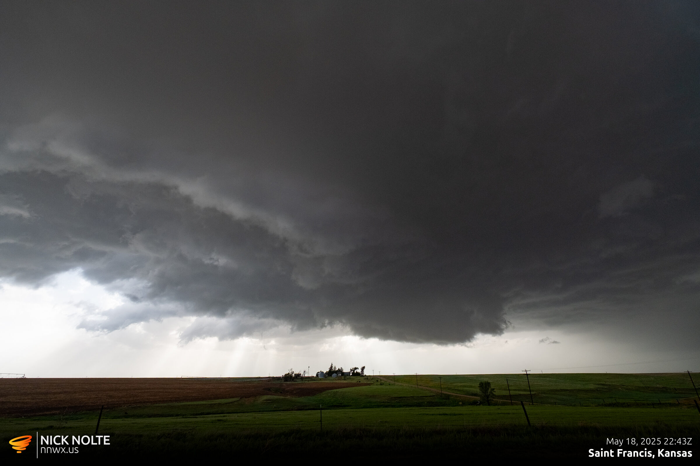
A few tornado and funnel reports came in during this time, but from my vantage point I never saw anything. Either I wasn’t in position to see them or they were fleeting. I continued tracking the storm north
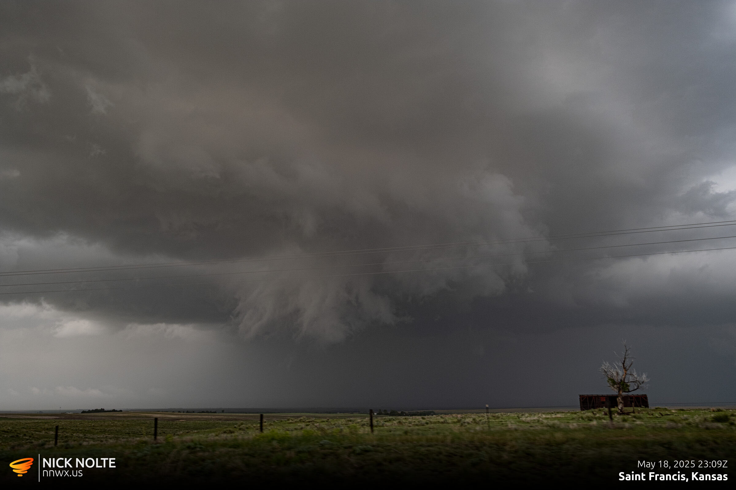
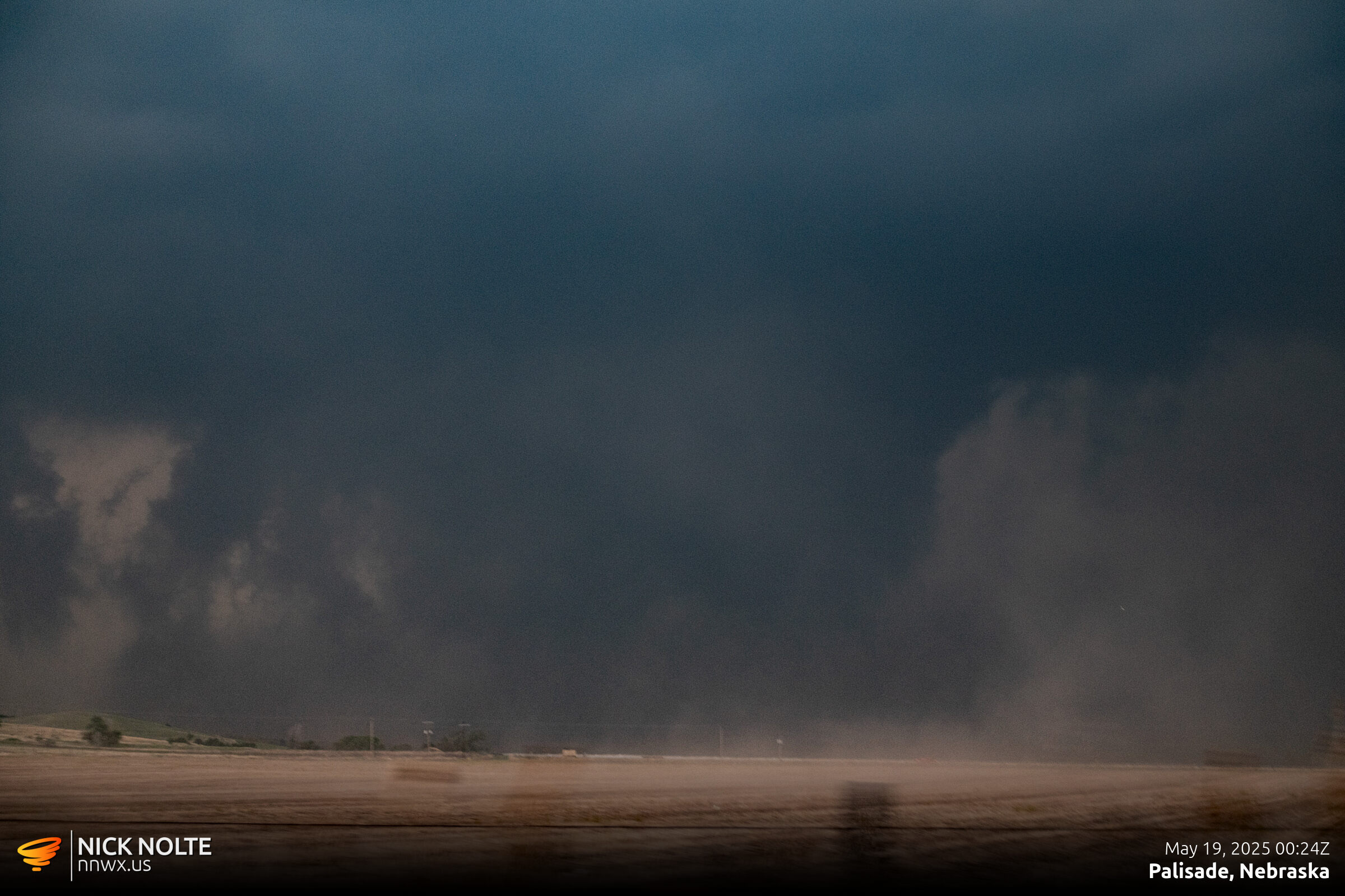
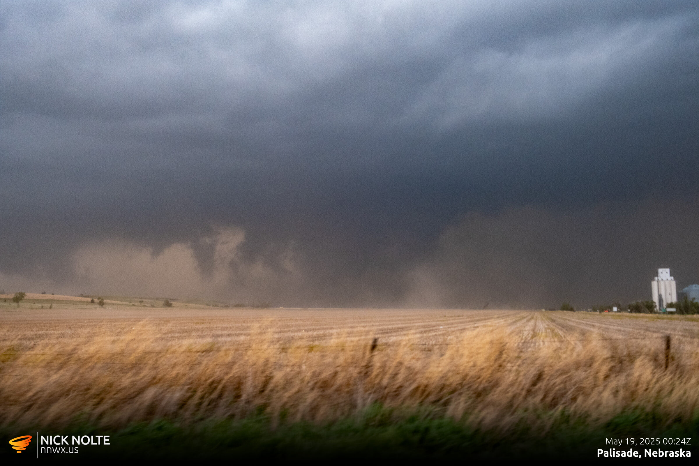
As I reached US 36 east of Saint Francis, I decided to get up to Benkelman as quick as possible to keep up with the storm. East of Benkelman I made the decision to punch through the hook to try and get a visual and as I did a broad area of rotation formed to the south side of the road and crossed the highway in front of me west of Stratton.
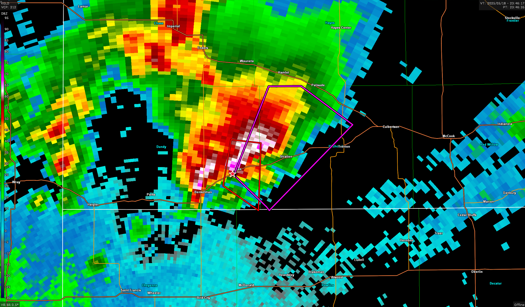
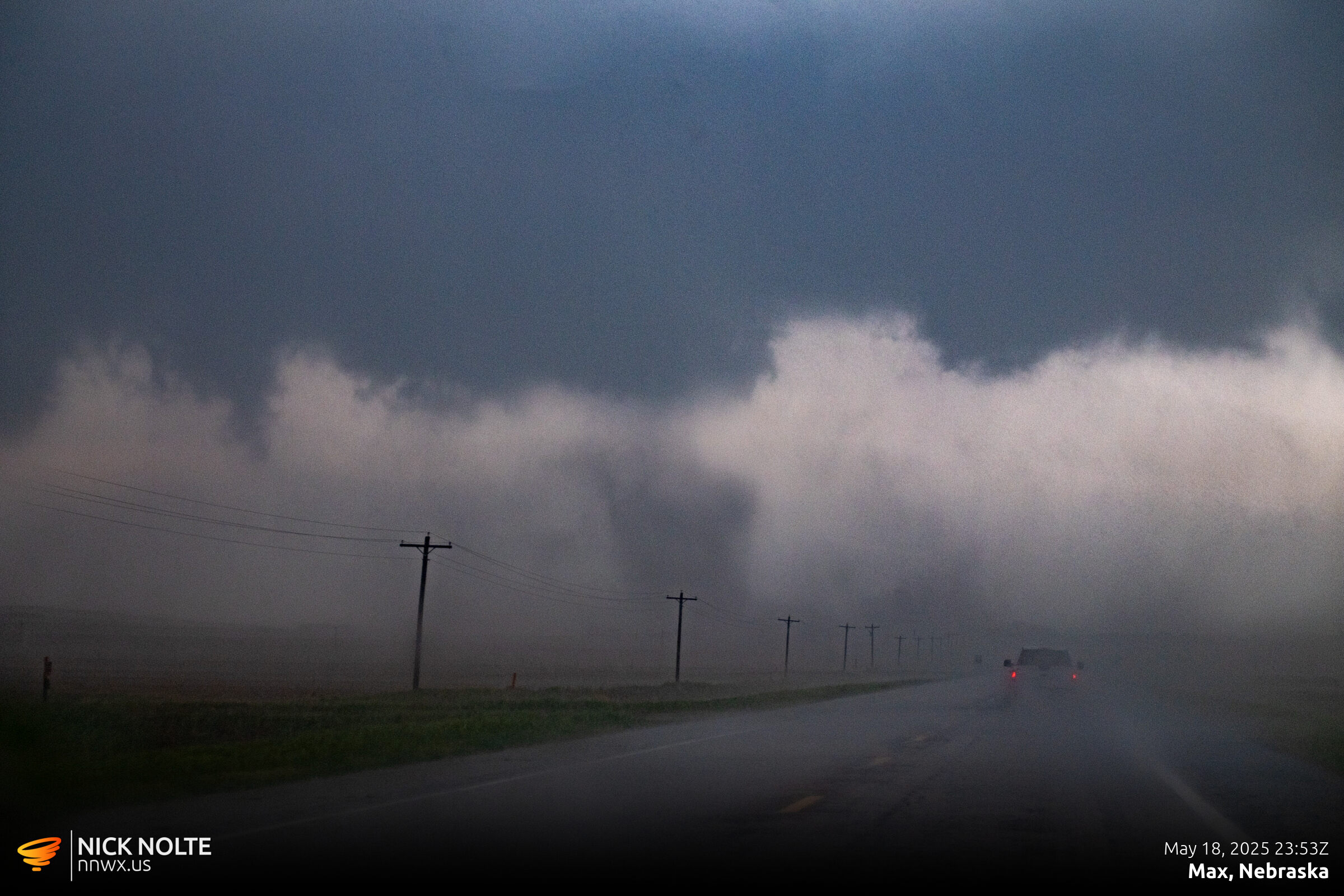
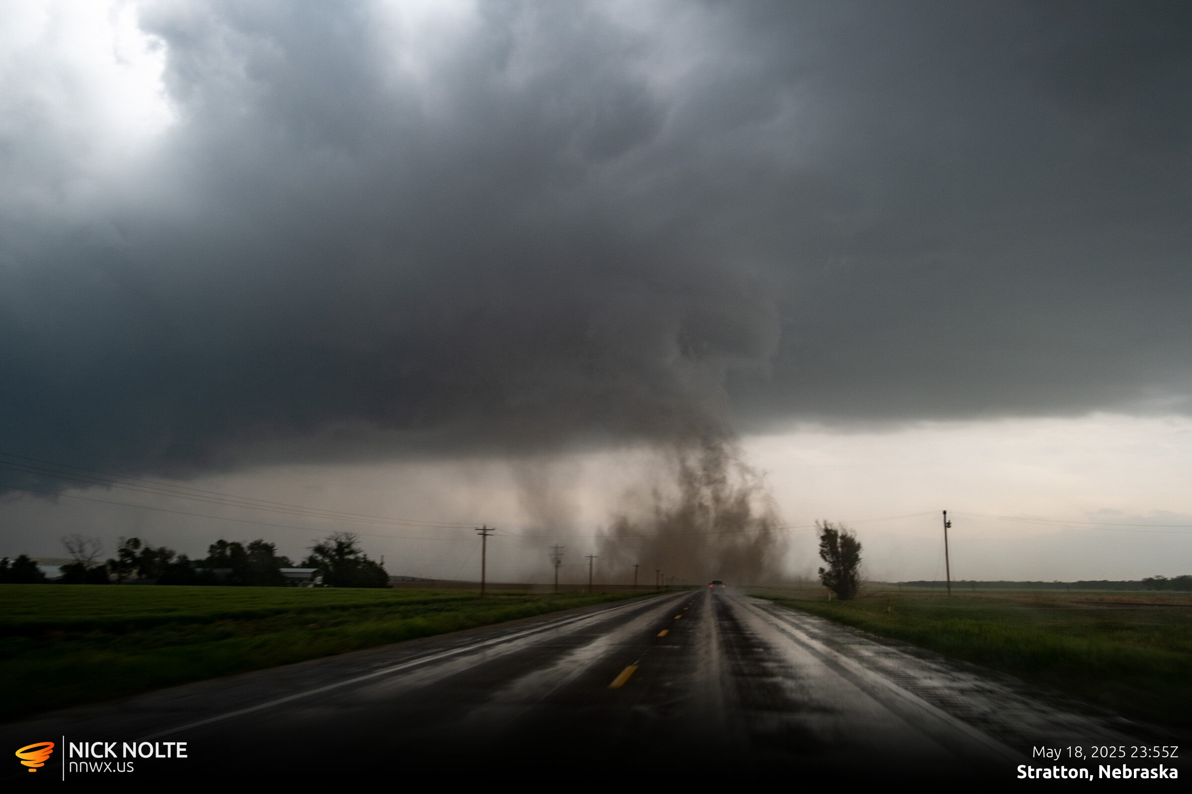
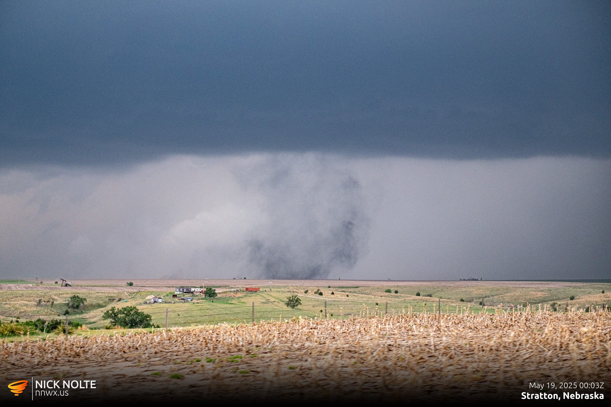
NWS Survey the following day identified this as an EF-3 tornado that tracked for eleven miles from near Stratton north towards Hamlet.
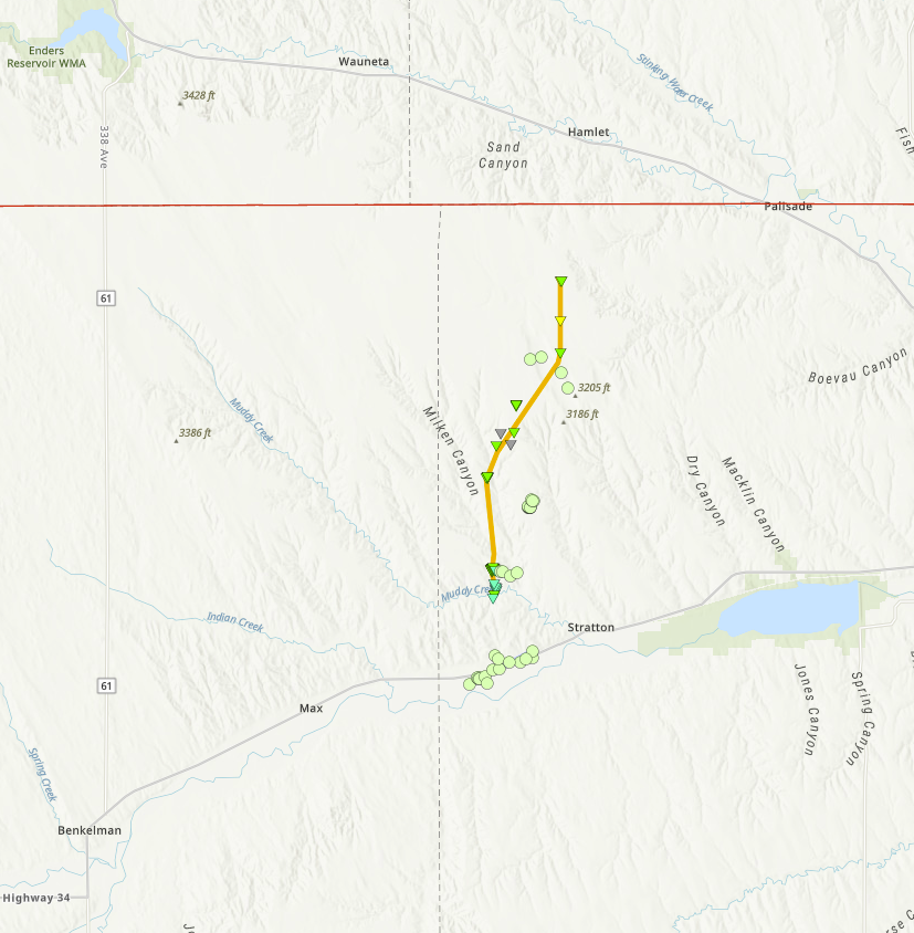
I continued tracking the storm to Palisade and it had a very chunky wall cloud that at times looked like it was scraping the ground. There was another surveyed tornado in this area but it was apparently ten minutes after my photos below so I’m not sure if this is when it was occurring or not.
As I continued tracking the storm to the north, the storm started to weaken and pretty much fell apart by the time it got to Alma. I called the chase at this time and began the trek home.
Chase Recap
| START | END | DURATION |
|---|---|---|
| Grand Island, NE @ 18/1421Z | Grand Island, NE @ 19/0420Z | 13 hours, 59 minutes |
| INTERCEPTS | CHASER ENCOUNTERS |
|---|---|
| 18/2355Z @ Stratton, NE | None |