| 0 | 1.25" | 75 | 845 |
|---|---|---|---|
| TORNADOES | HAIL | WIND | MILES |
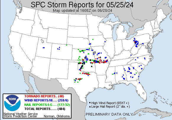
May 25th was one of the first real potent looking days I chase in 2024. A cold front stretching from Michigan into Arkansas with a stationary front from there to West Texas was forecast to move north as a warm front as a strong low developed across Western Kansas. A dryline was forecast to surge eastward across Kansas and Oklahoma as the warm sector was primed for a possible severe outbreak.
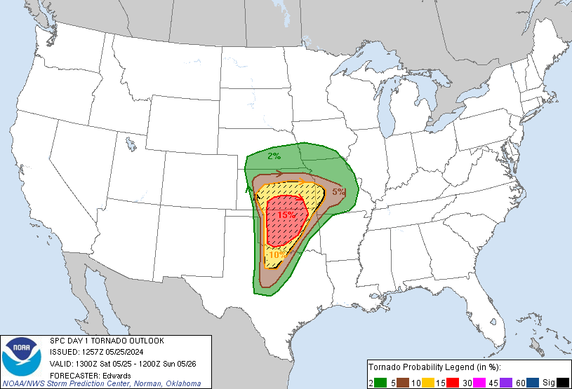
SPC had a 15% tornado moderate risk in the area stretching from the triple point along the warm front and south along the dryline. There was potential for tornadoes further north closer to home, but moisture wasn’t as good the further north you went so I opted to make the trek to southern Kansas for the play.
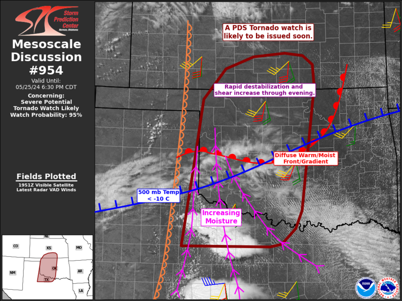
I took off from Grand Island around 14z and began my trek to the Great Bend / Dodge City area. I arrived in Greensburg around 1930z and a little bit after, at 20z, SPC issued a mesoscale discussion for Southern Kansas and Western Oklahoma for a possible PDS Tornado Watch.
The watch was issued about thirty minutes later and another thirty minutes after the first cells started to develop in the eastern Oklahoma Panhandle near Beaver. I migrated down towards Coldwater to get in position to intercept the cells coming up from the panhandle.
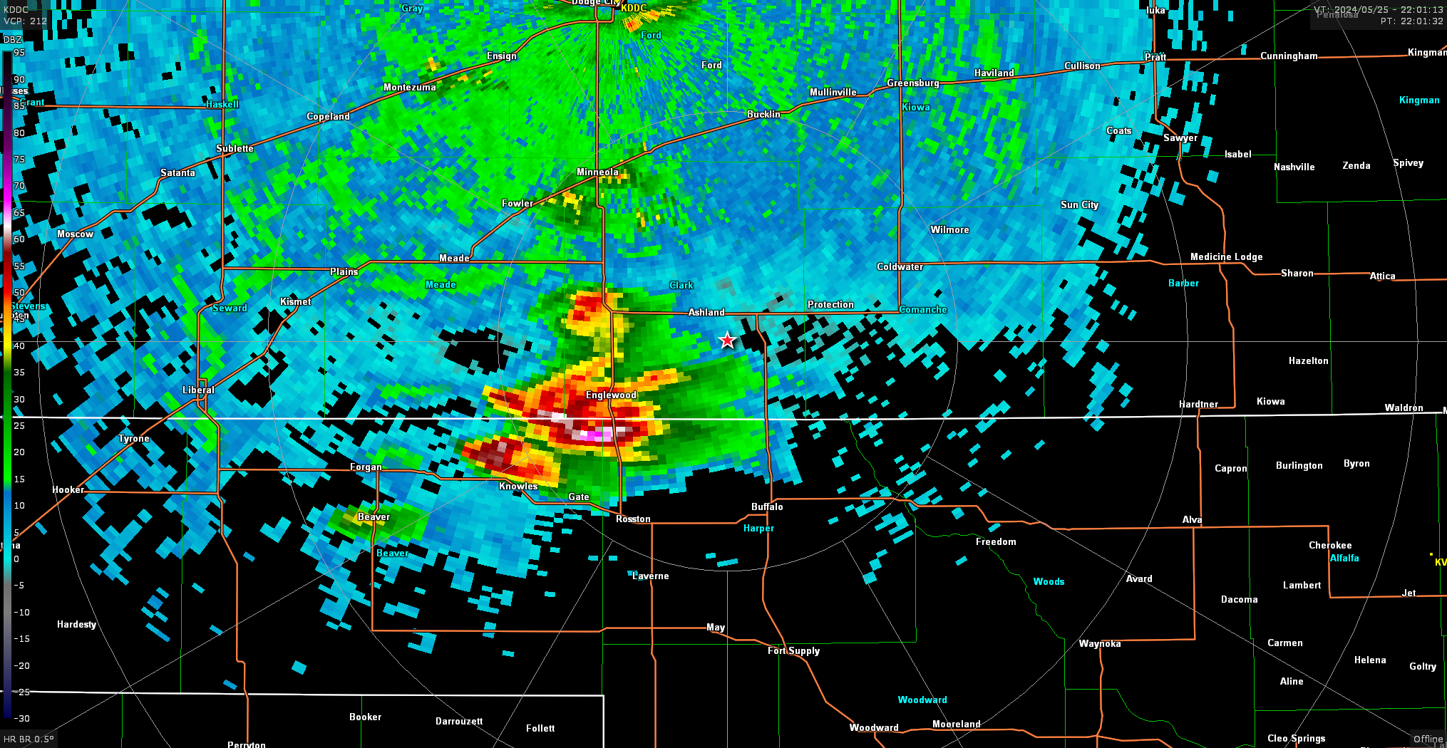
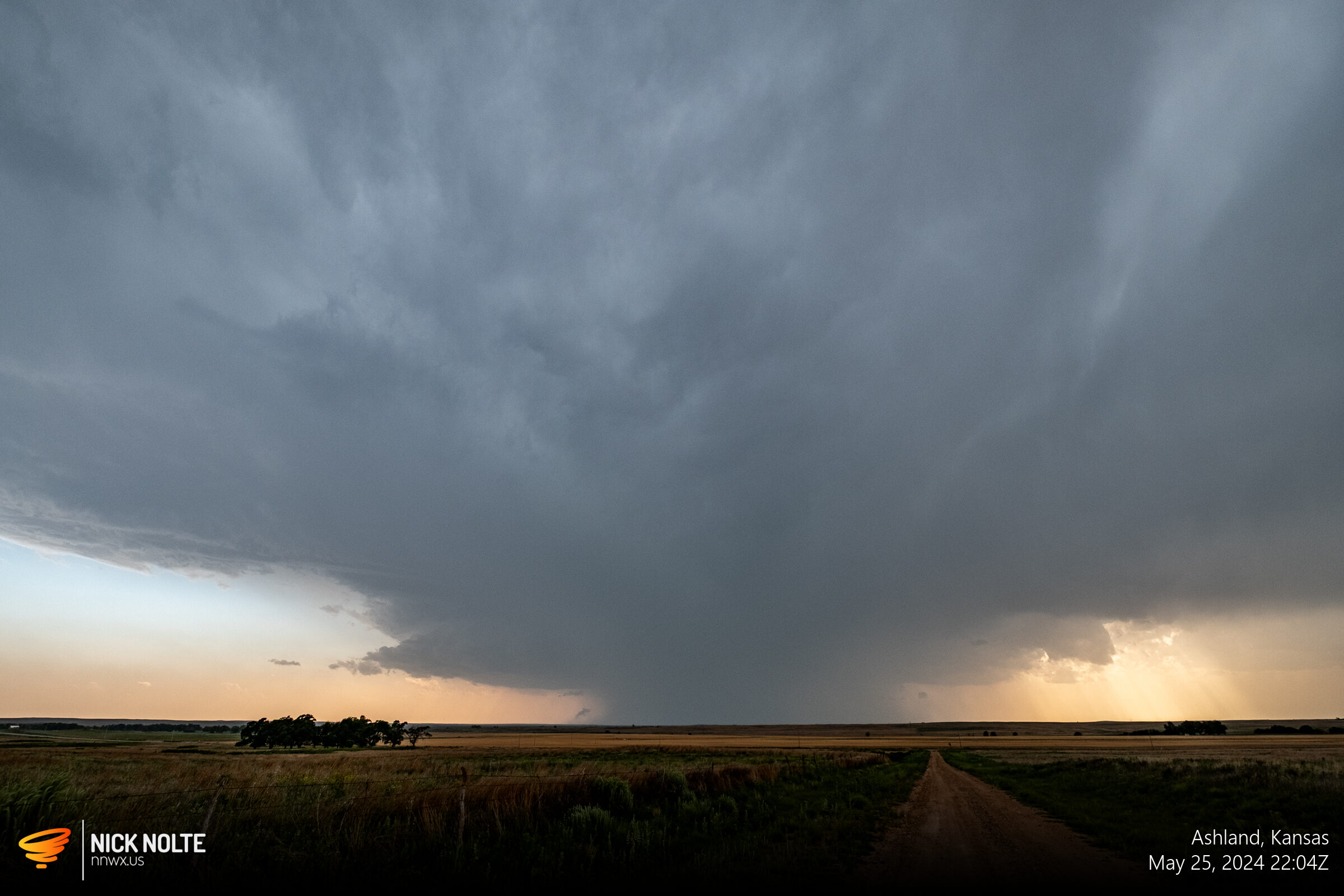
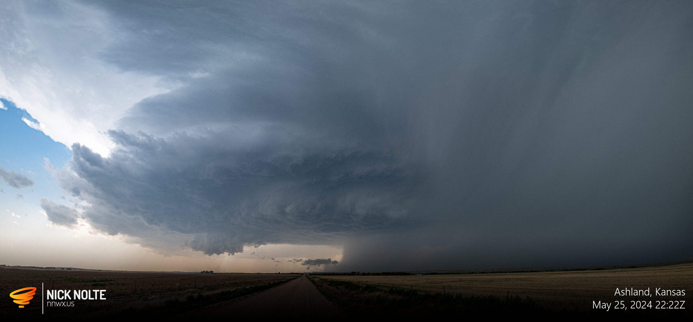
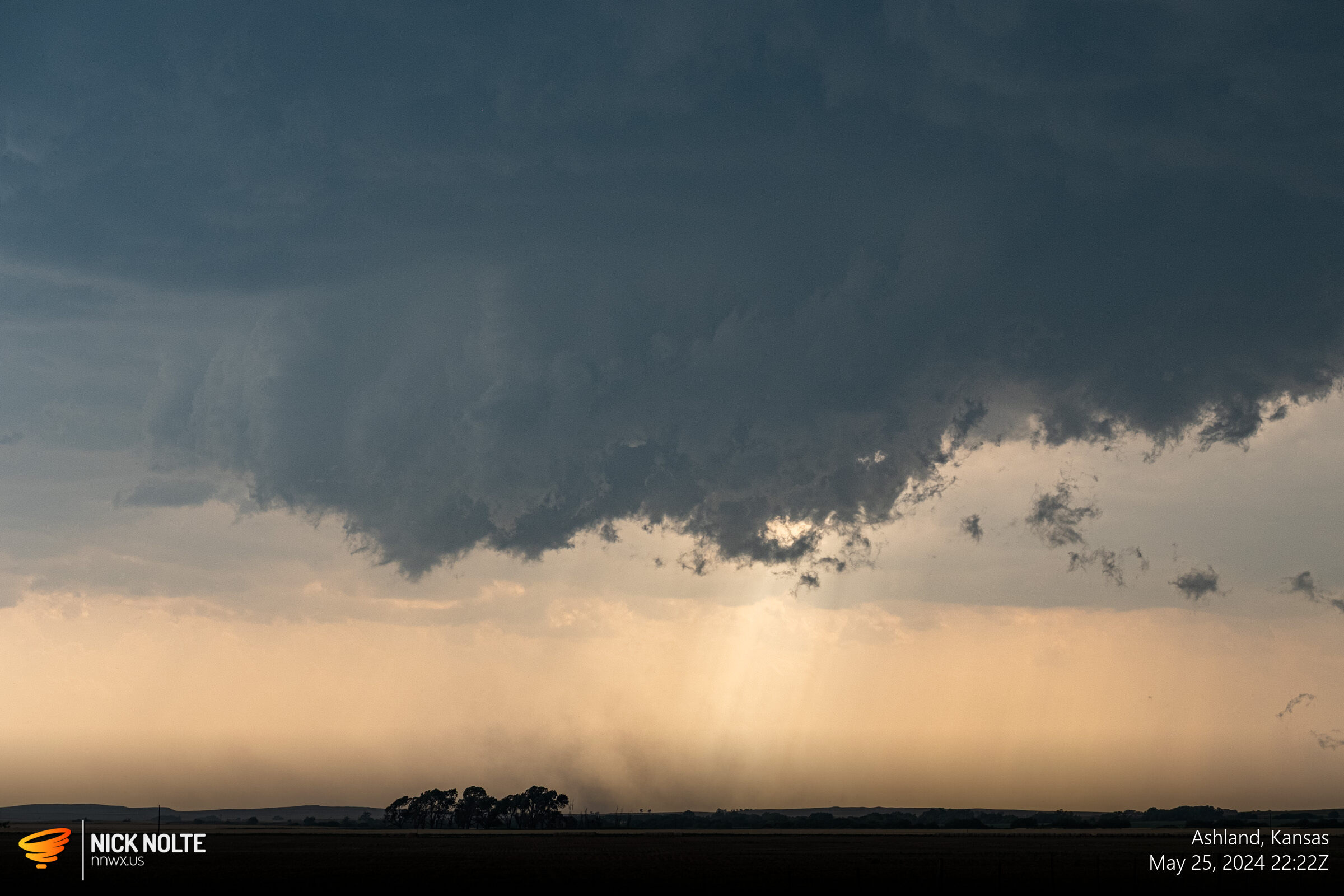
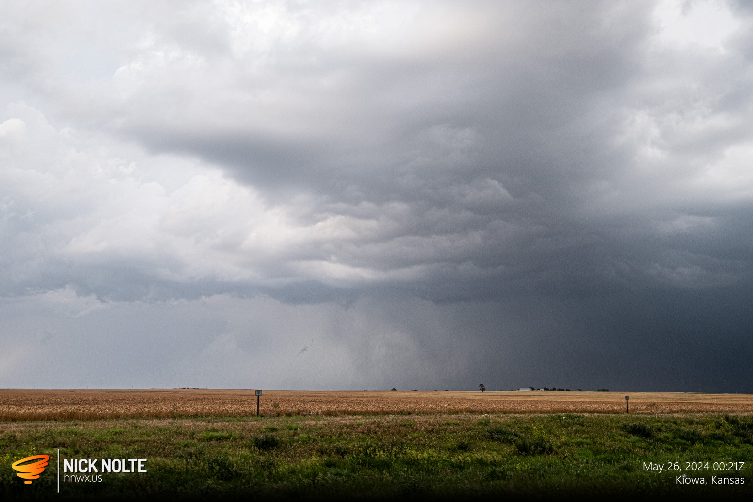
At this point during the storm there was dust being kicked up beneath the wall cloud, but I’m pretty sure this was all RFD stirring up the dirt. I continued to track the storm as it paralleled the state line.
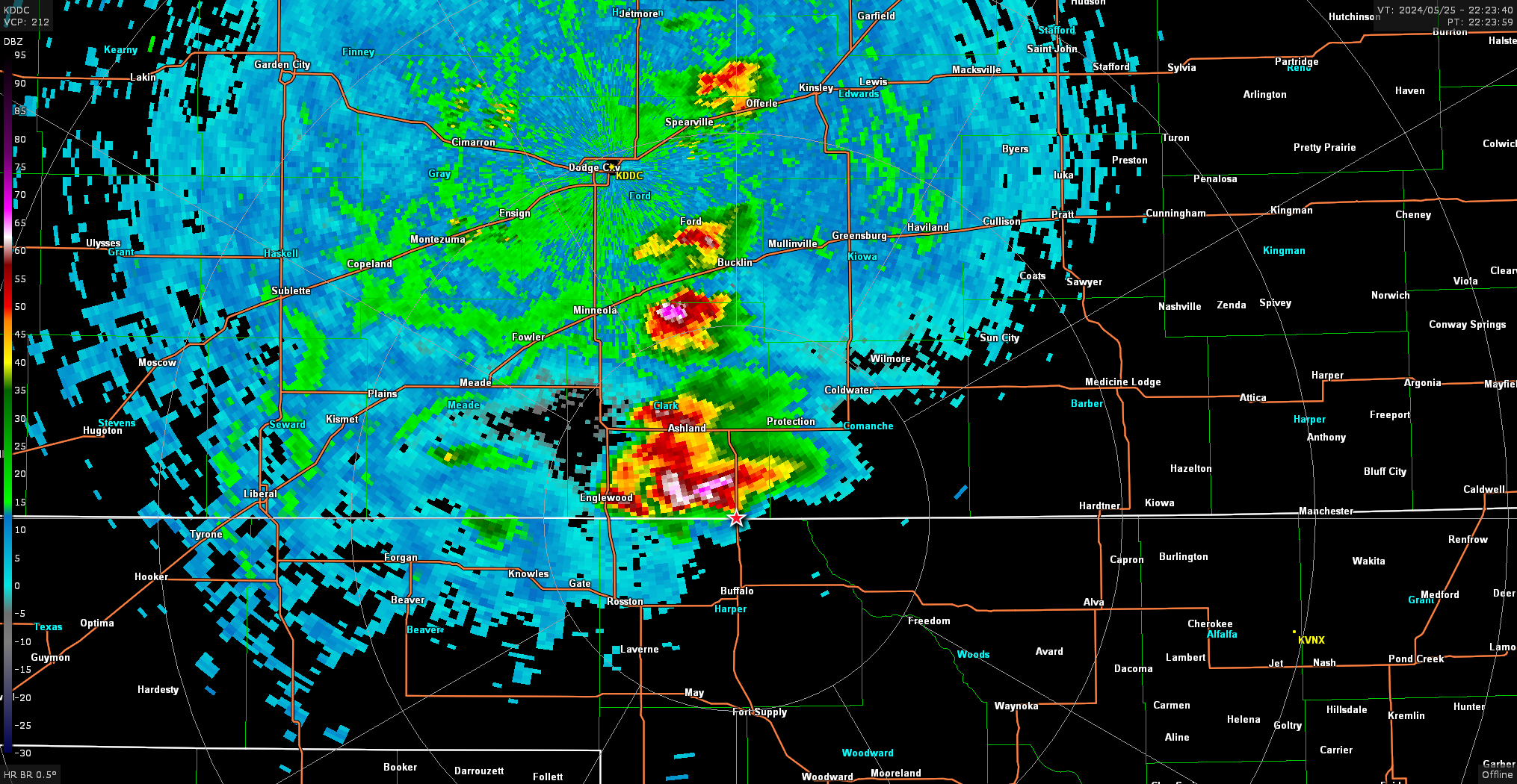
As the storm passed Coldwater, I had to decide whether or not to go north to US-160 or south to US-64 to progress east. I decided to go north and while I did the storm started to weaken on radar while as storm further south near Alva went tornado warned.
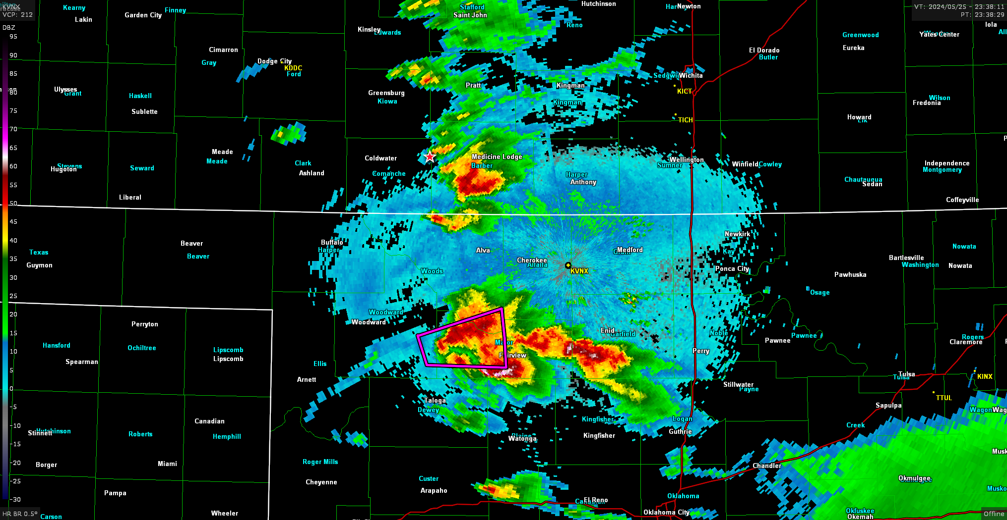
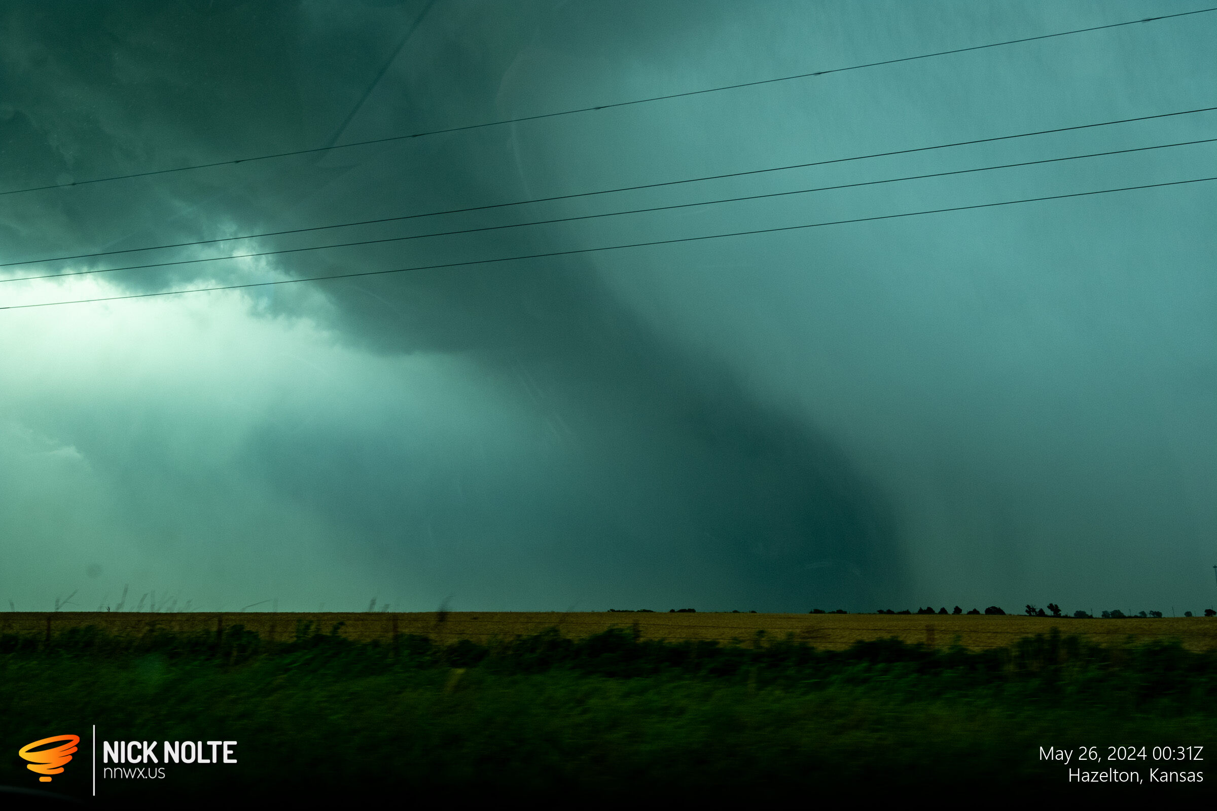
I stuck with it because there were cells to the south that were coming up and one of them might run into the storm I was tracking and get things stirred up a bit. I got back on the storm near Kiowa at 0015z and then it went tornado warned as a cell came up and interacted with it on the flank.
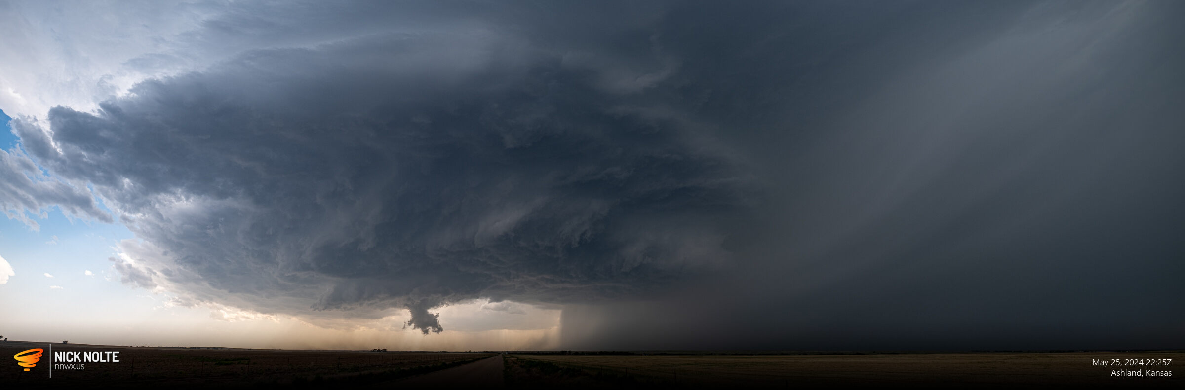
There was apparently a confirmed tornado on the ground at this time, but I was unable to get a visual from my vantage point. The storm did exhibit some funky looking structure, but I think these were just leading edge features either along the RFD or FFD.
At this point, the storm was pulling away and catching up would have probably happened after sunset so I decided to call the chase at this point and begin the trek home.
Chase Recap
| START | END | DURATION |
|---|---|---|
| Grand Island, NE @ 25/1400Z | Grand Island, NE @ 26/0630Z | 16 hours, 30 minutes |
| INTERCEPTS | CHASER ENCOUNTERS |
|---|---|
| None | None |