| 1 | 1.75" | 60 | 48 |
|---|---|---|---|
| TORNADOES | HAIL | WIND | MILES |
May 20th wasn’t a big chase day and I hadn’t planned on chasing at all. The main focus for the day was storms firing in the high plains, especially near Denver and those storms would track east into Nebraska where they’d encounter better moisture.
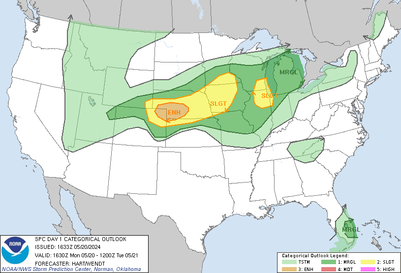
SPC had outlined an enhanced risk in southwestern Nebraska into northeast Colorado which included a 5% risk for tornadoes. This area was for storms firing along the DCVZ and then migrating east northeast. I didn’t plan on chasing this event so I just worked as normal.
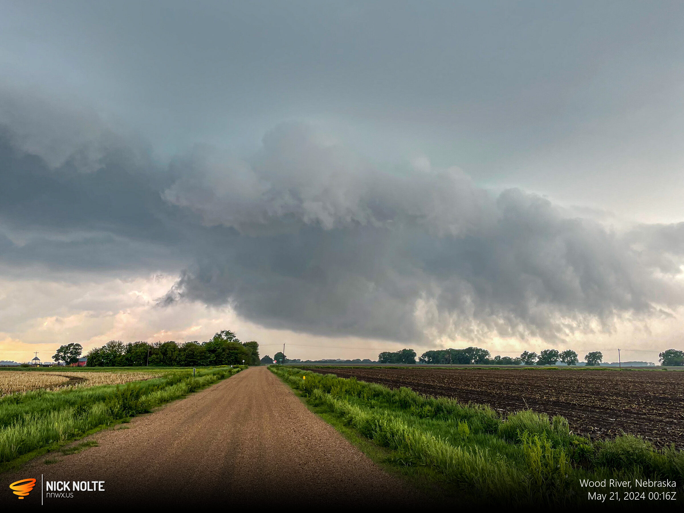
Around 23z cells started to fire east of Kearney so I trekked out towards Wood River to intercept as they came into Hall County. To my surprise the storm had a wall cloud on it.
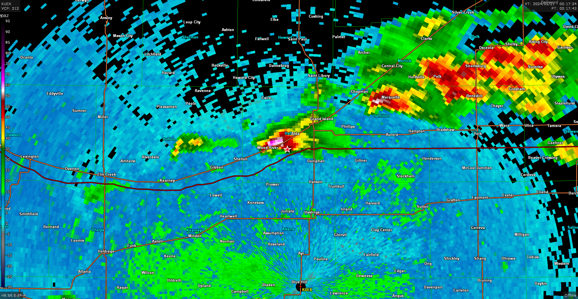
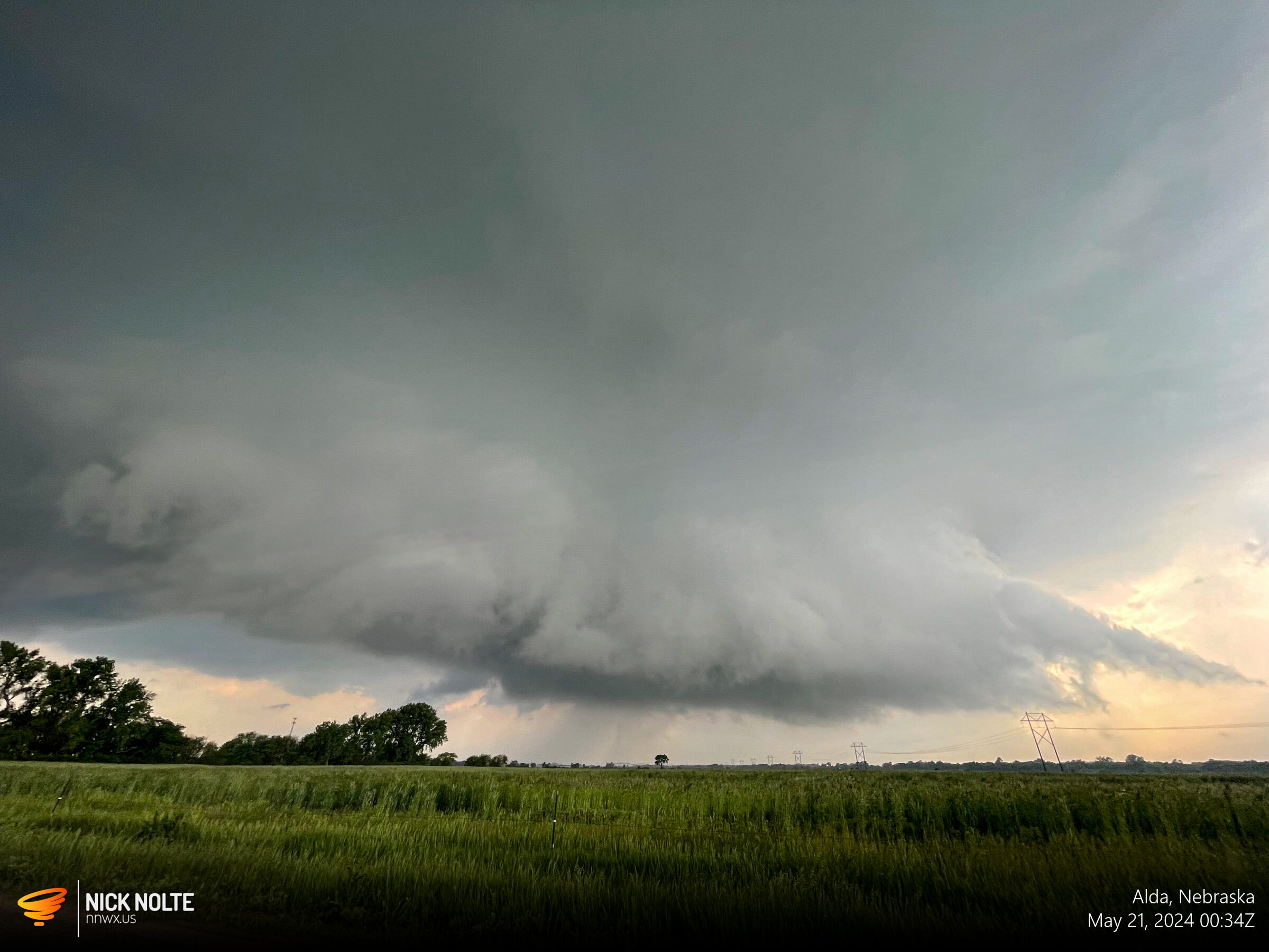
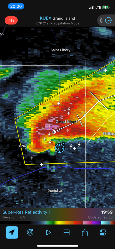
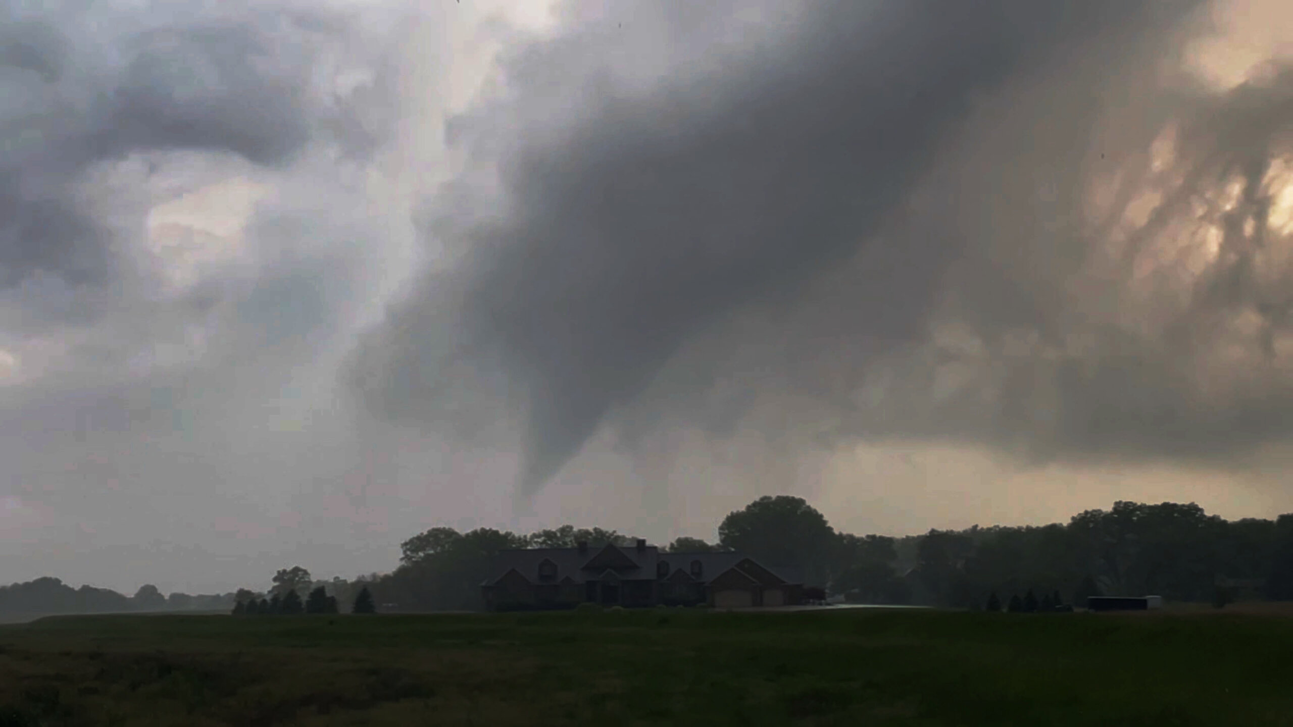
Eventually this storm tracked towards Grand Island and I positioned myself south of town. The storm continued to look very organized in the low levels and as it approached town a nice RFD cut formed and a brief tornado actually developed and touched down for a few seconds.
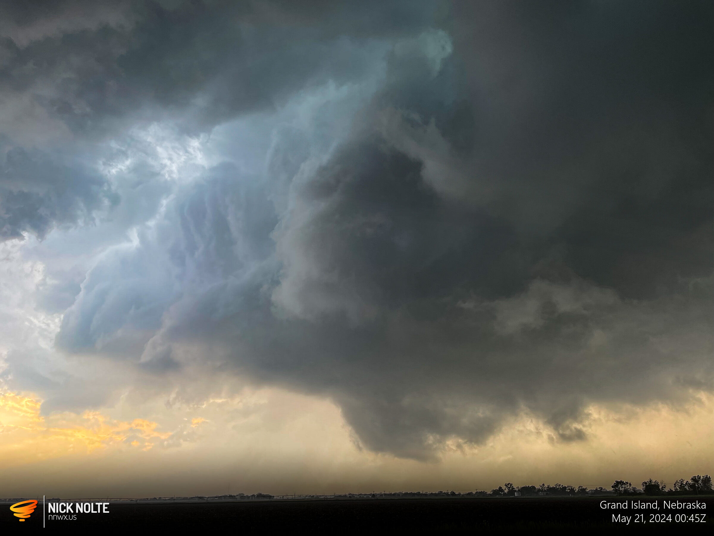
I continued to track the storm for a bit as it traveled northeast but began to dissipate shortly after and completely evaporated after it passed Chapman. I had called the chase and went back home. All in all, a nice little surprise local chase.
Chase Recap
| START | END | DURATION |
|---|---|---|
| Grand Island, NE @ 20/2300Z | Grand Island, NE @ 21/0200Z | 03 hours, 0 minutes |
| INTERCEPTS | CHASER ENCOUNTERS |
|---|---|
| 21/0102Z @ Grand Island, NE | None |