| 0 | 1.25" | 70 | 202 |
|---|---|---|---|
| TORNADOES | HAIL | WIND | MILES |
August 10th wasn’t really on my radar as a chase day, portions of Eastern South Dakota and Nebraska were in a slight risk as a weak surface low was expected to develop in North Dakota with an attendant surface trough arcing into Nebraska. Shear wasn’t that great but values were high enough to support supercells if they could develop.
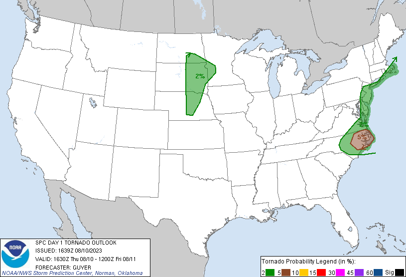
SPC had stretched the 2% tornado risk south right around my home so I knew to keep an eye on the visible satellite in case anything could fire west of here. I was working for the day and didn’t plan to take off to chase. Around 4pm I took a look at the satellite image and noticed an agitated field of cumulus over by Lexington and figured that might spawn a storm later after work was over.
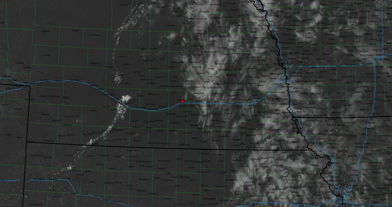
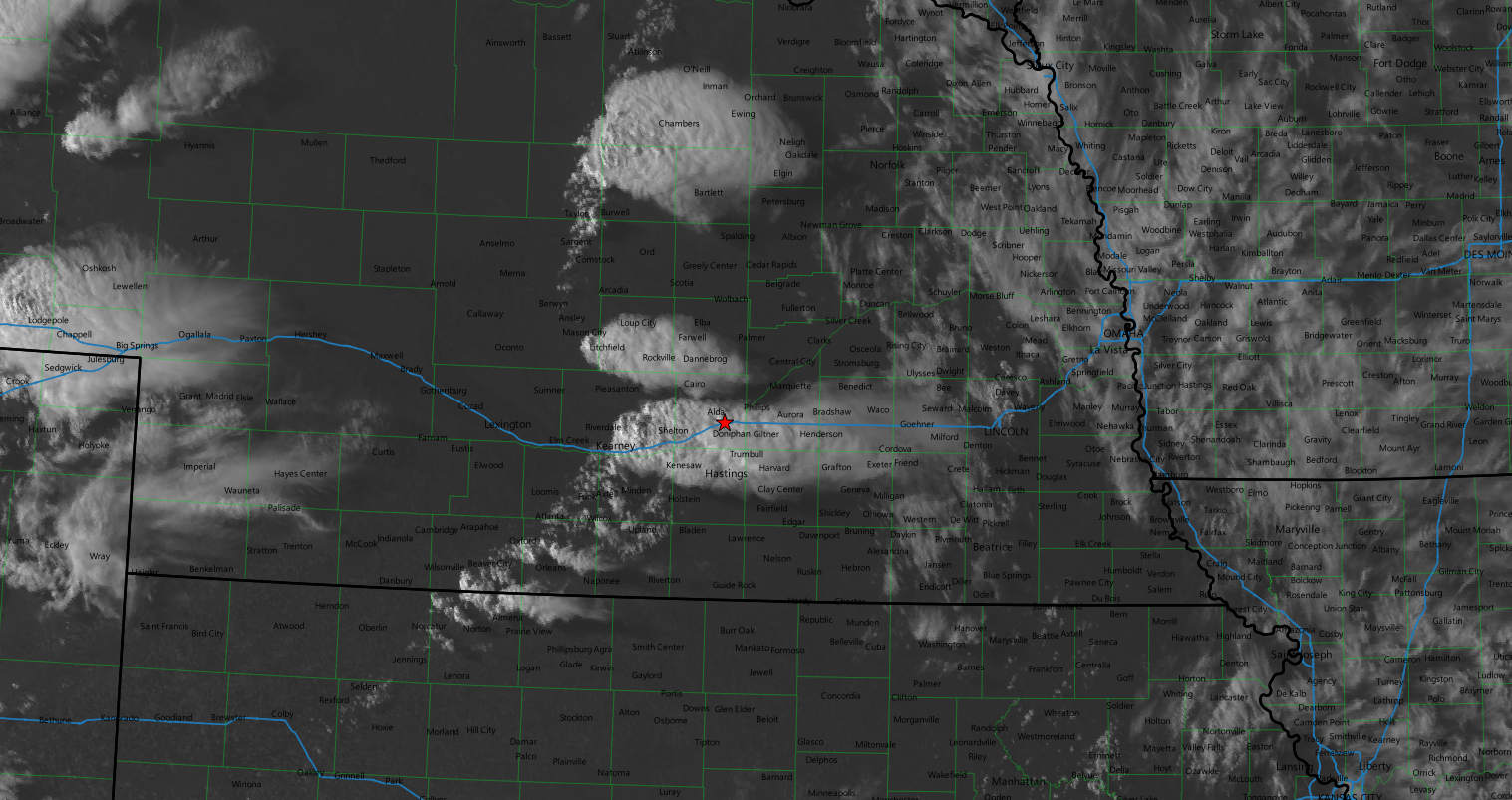
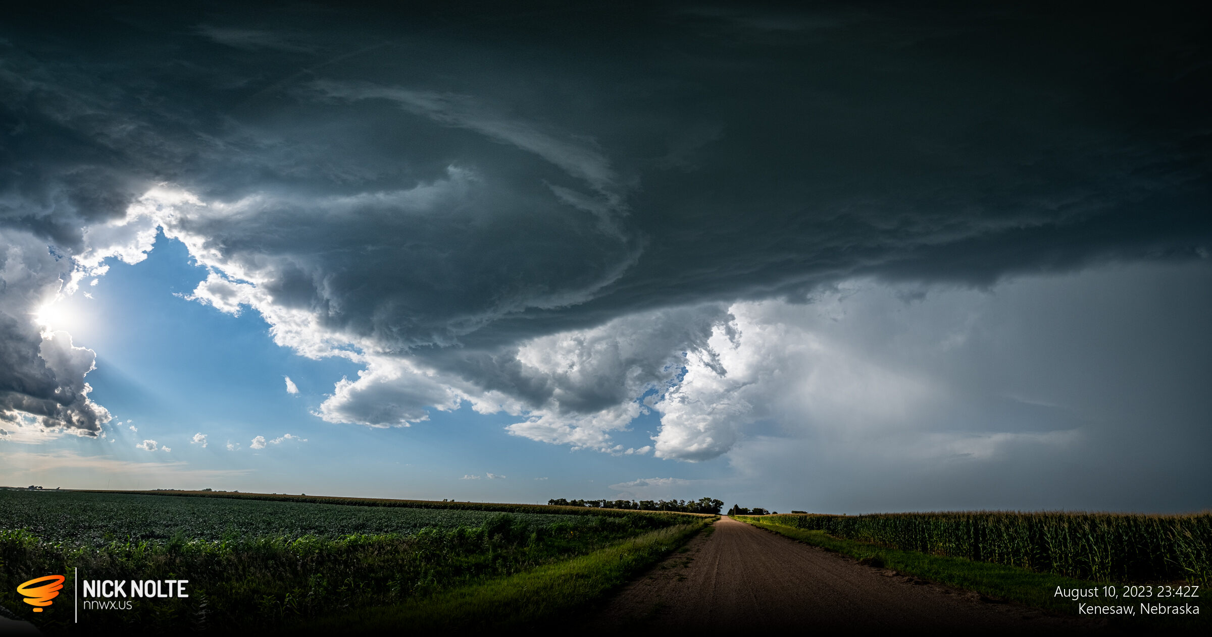
Sure enough a storm started to take off by Lexington. I watched it as the work day wore on and it struggled to get going as it drifted towards Kearney. Eventually I got out of work and by then the cell finally started to get it’s act together so I grabbed the gear and went after it.
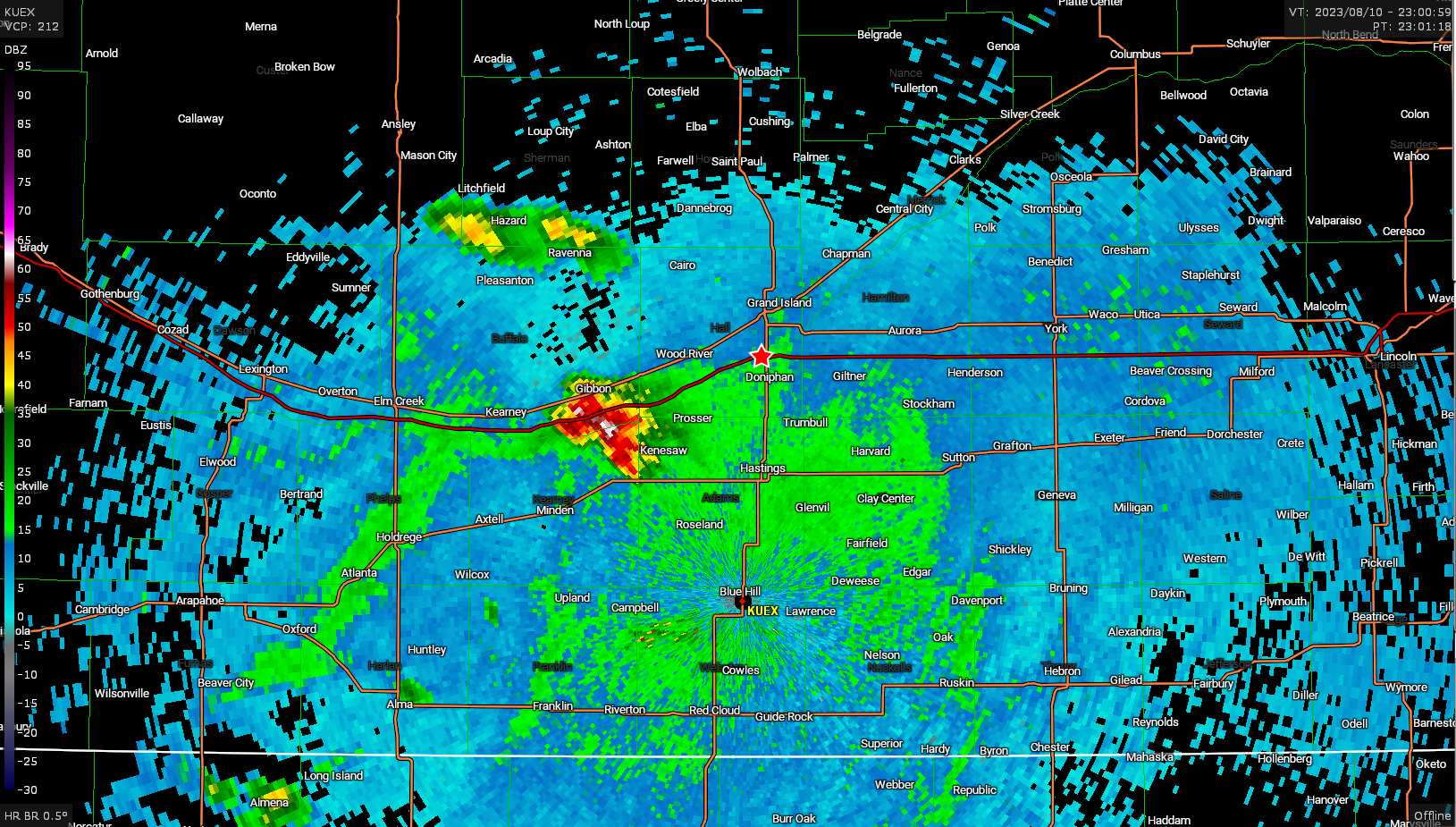
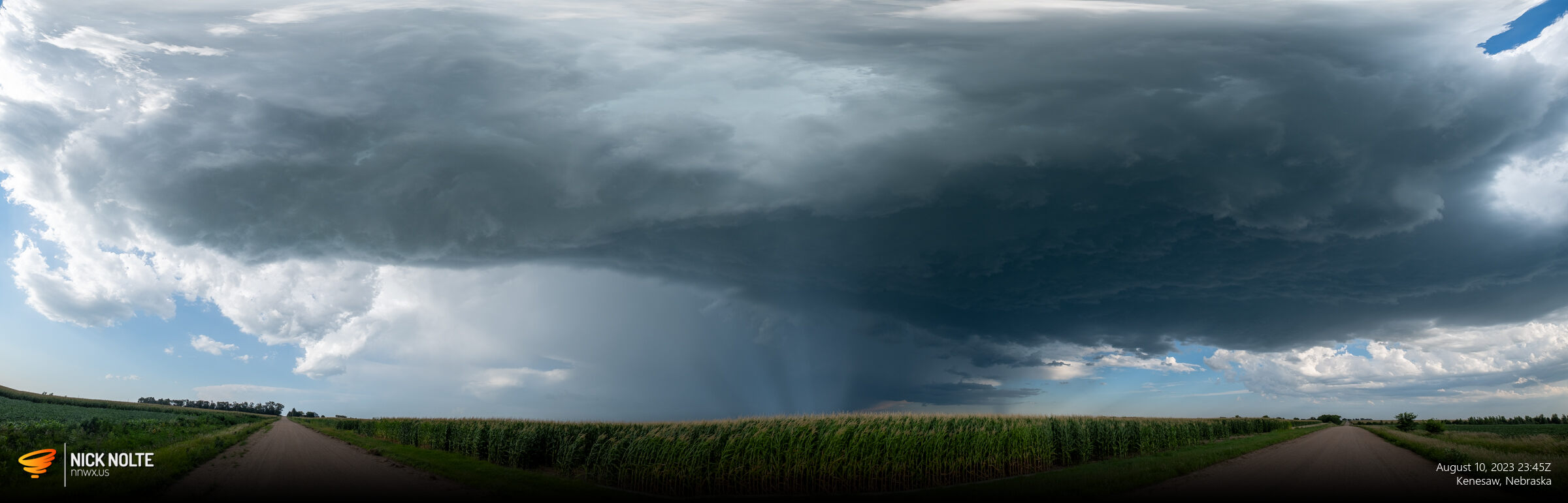
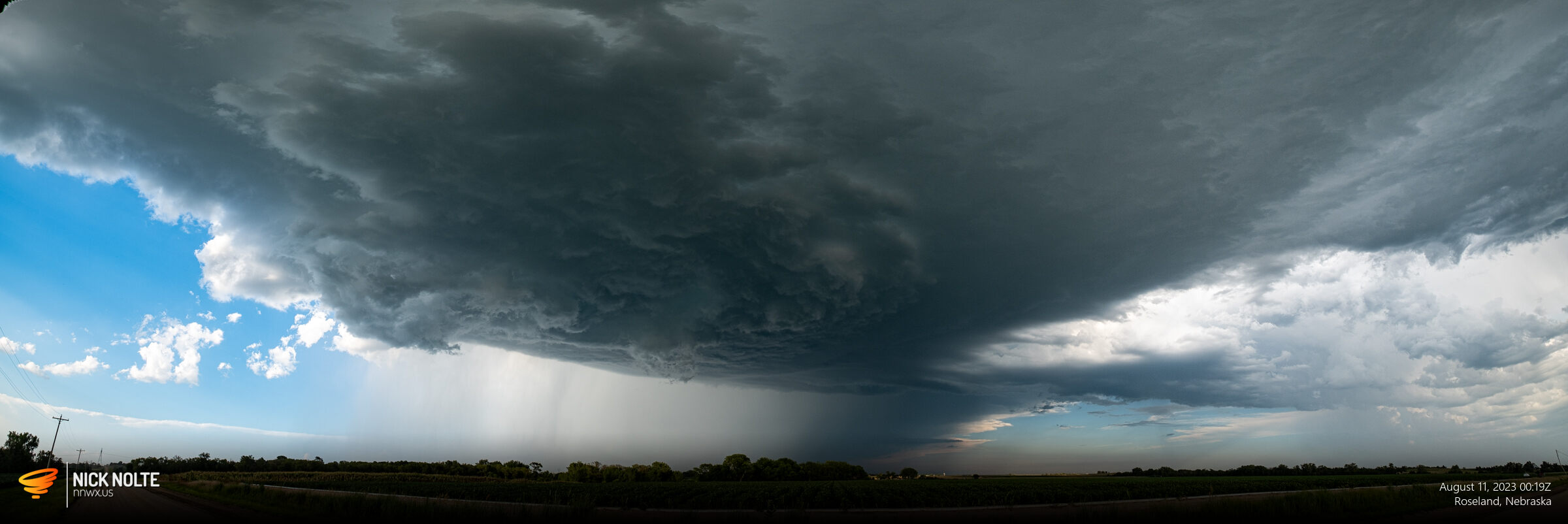
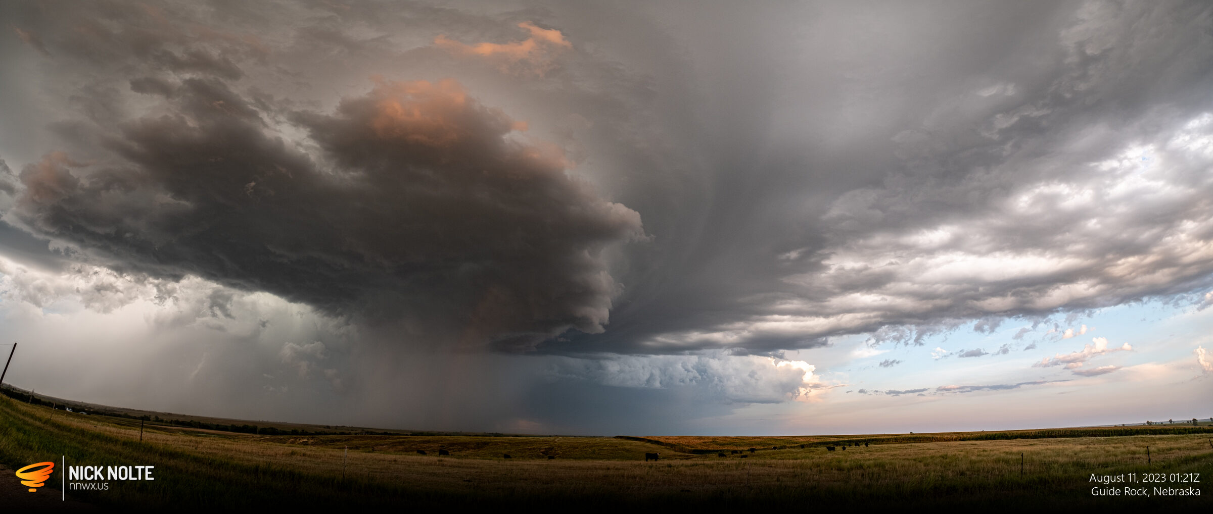
I got on the storm by Kenesaw and had a really cool experience. The radar wasn’t showing the hook well because the RFD was pretty clear but there was a clear cinnamon bun on the southwest edge of the storm where a hook would typically be. I was standing outside observing the storm with weak surface flow from the south and as the hook approached the southerly winds ramped up to near 40mph, gusting to 60mph as it went overhead, then 60mph from the west as the RFD wrapped around.
There was clear rotation in this feature and it was quite fun to watch as it passed nearly overhead.
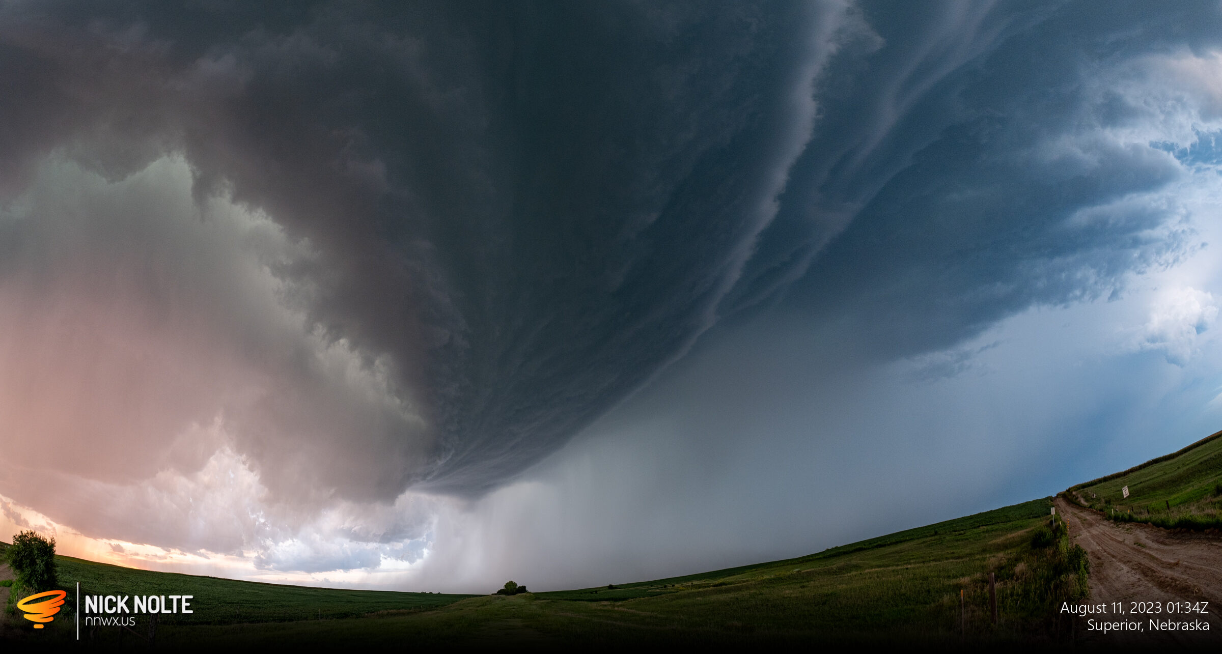
I dropped south a bit past Roseland to reposition and watched as a clear RFD cut became visible around the rotation and a funnel developed.
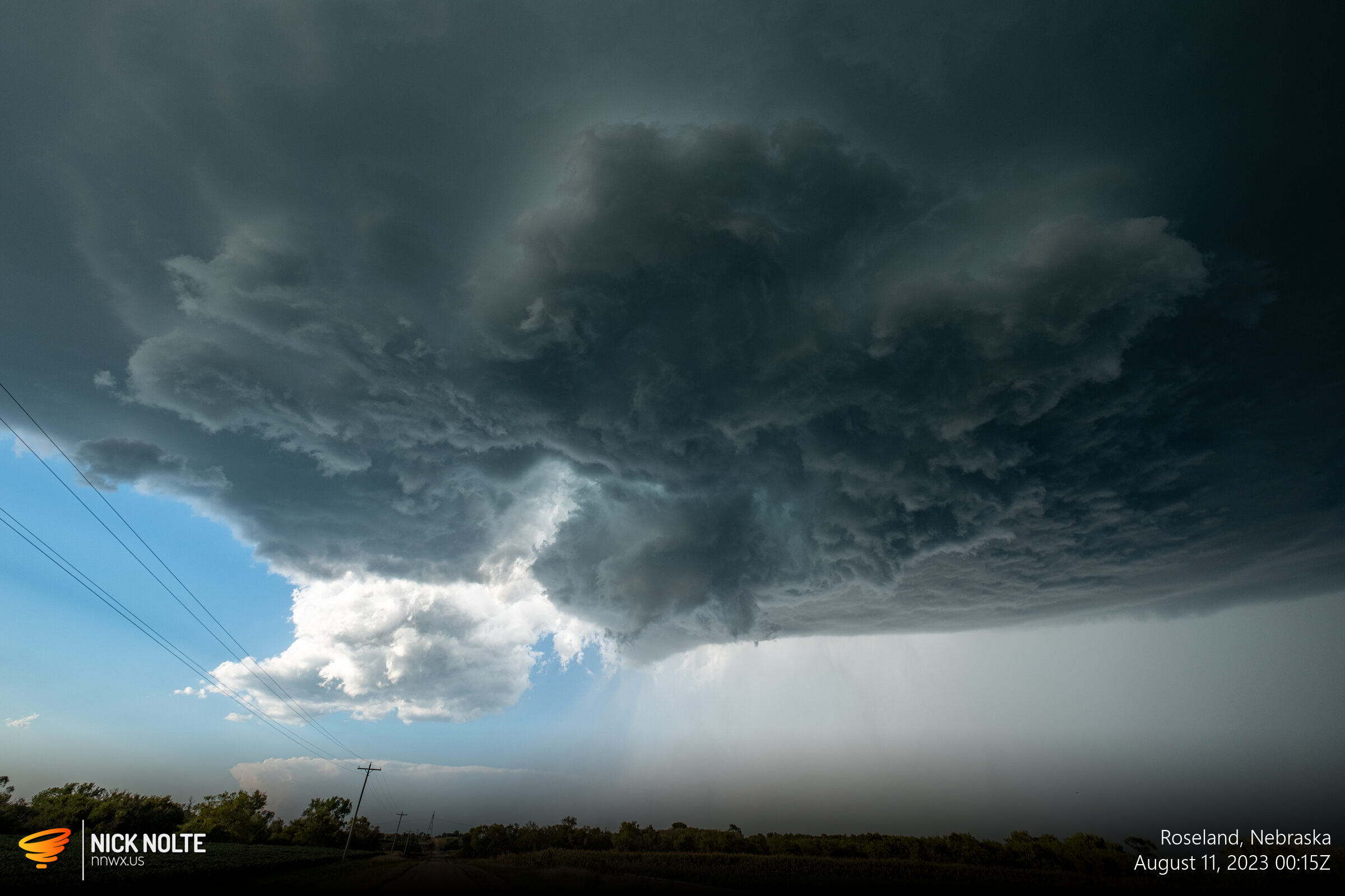
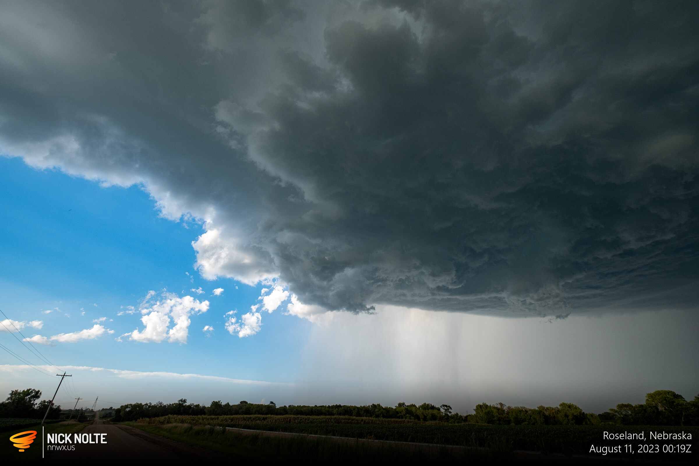
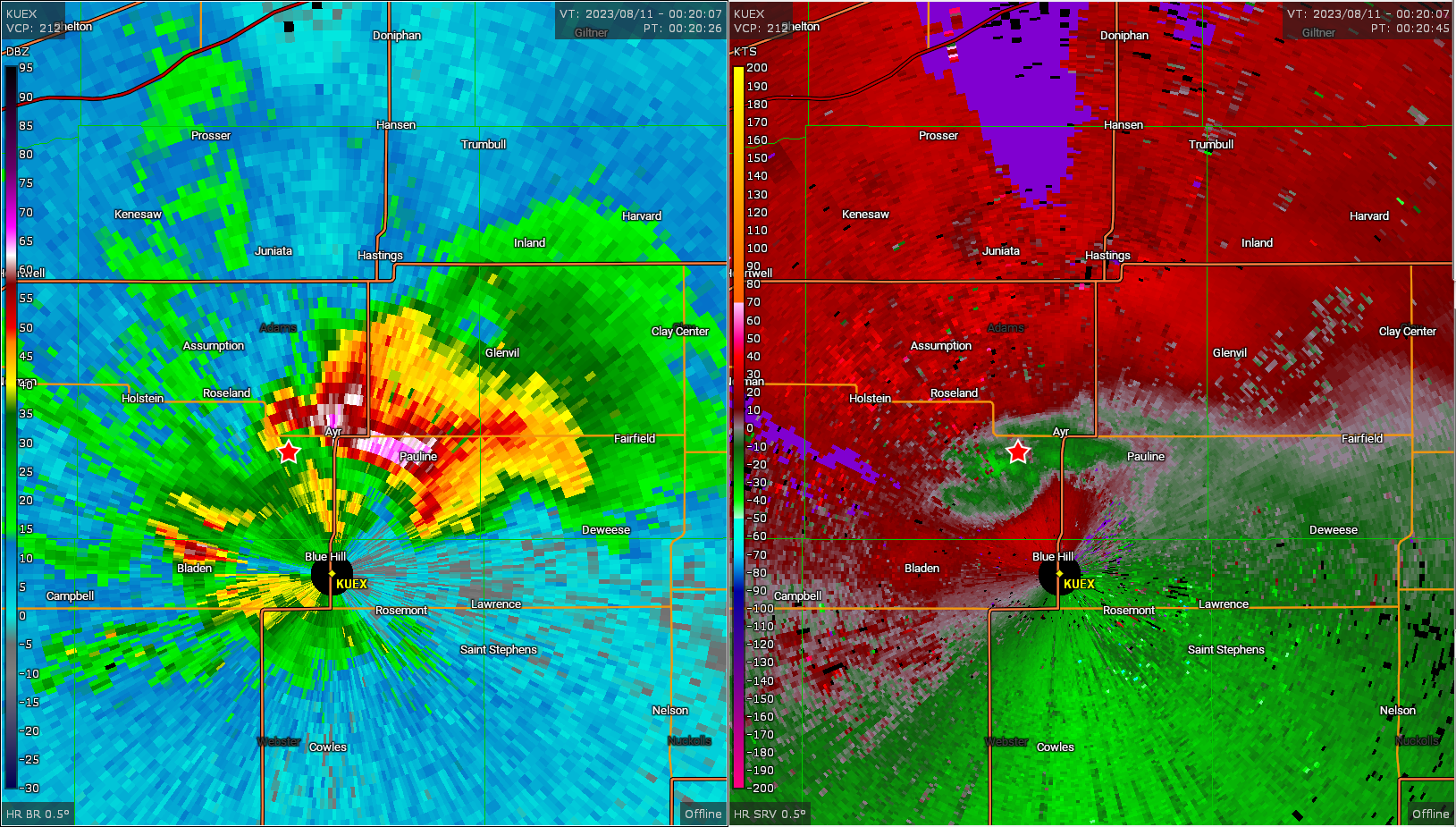
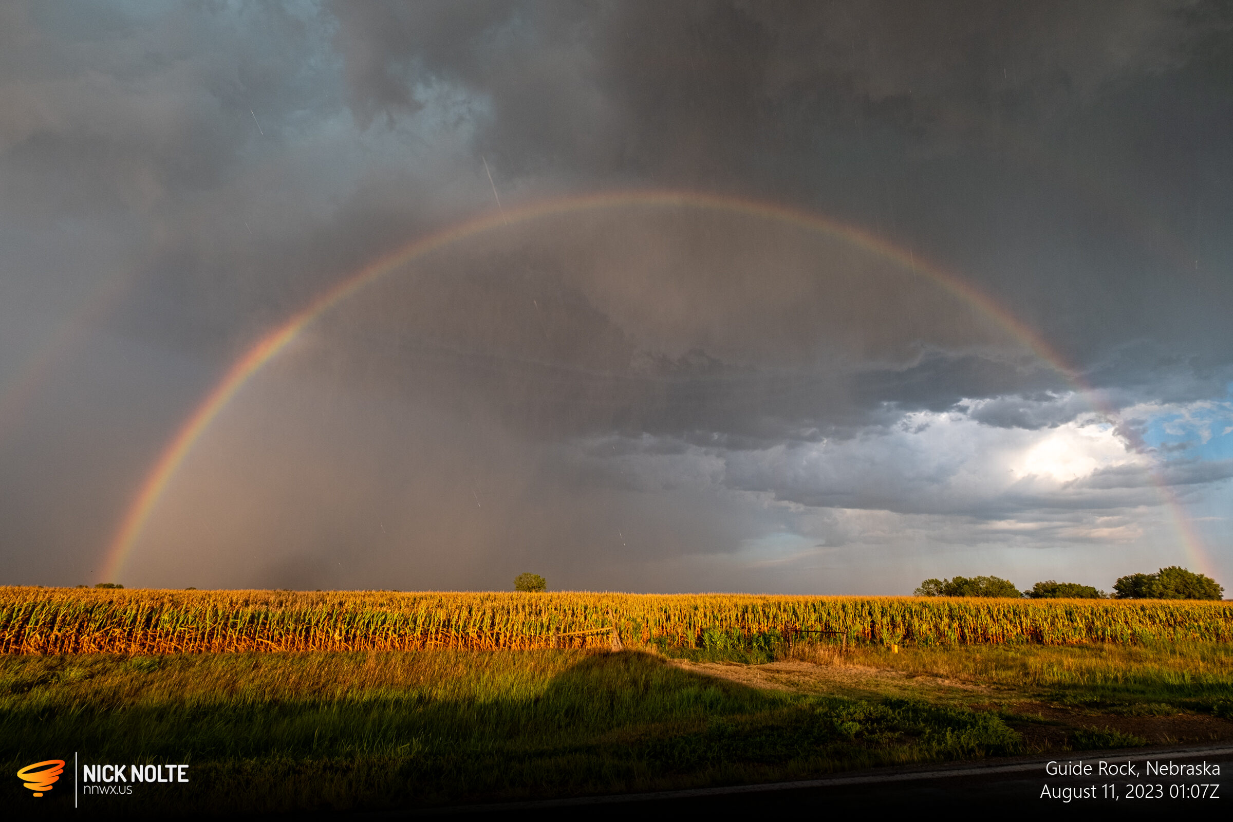
The Hastings office issued a tornado warning shortly this for the funnel cloud sighting. I continued to track the storm as it drifted southeast and occasionally ran into quarter sized hail as a new cell began to develop on it’s flank. I figured this would become the primary updraft so bolted south to get in front of it and on my way got treated to some cool rainbow action.
I continued in front of the storm, staying within the inflow region, and while the radar presentation of the storm was pretty good, there wasn’t as good of a wall cloud or motion since earlier, but as the sunset approached it did put on quite a photogenic show.
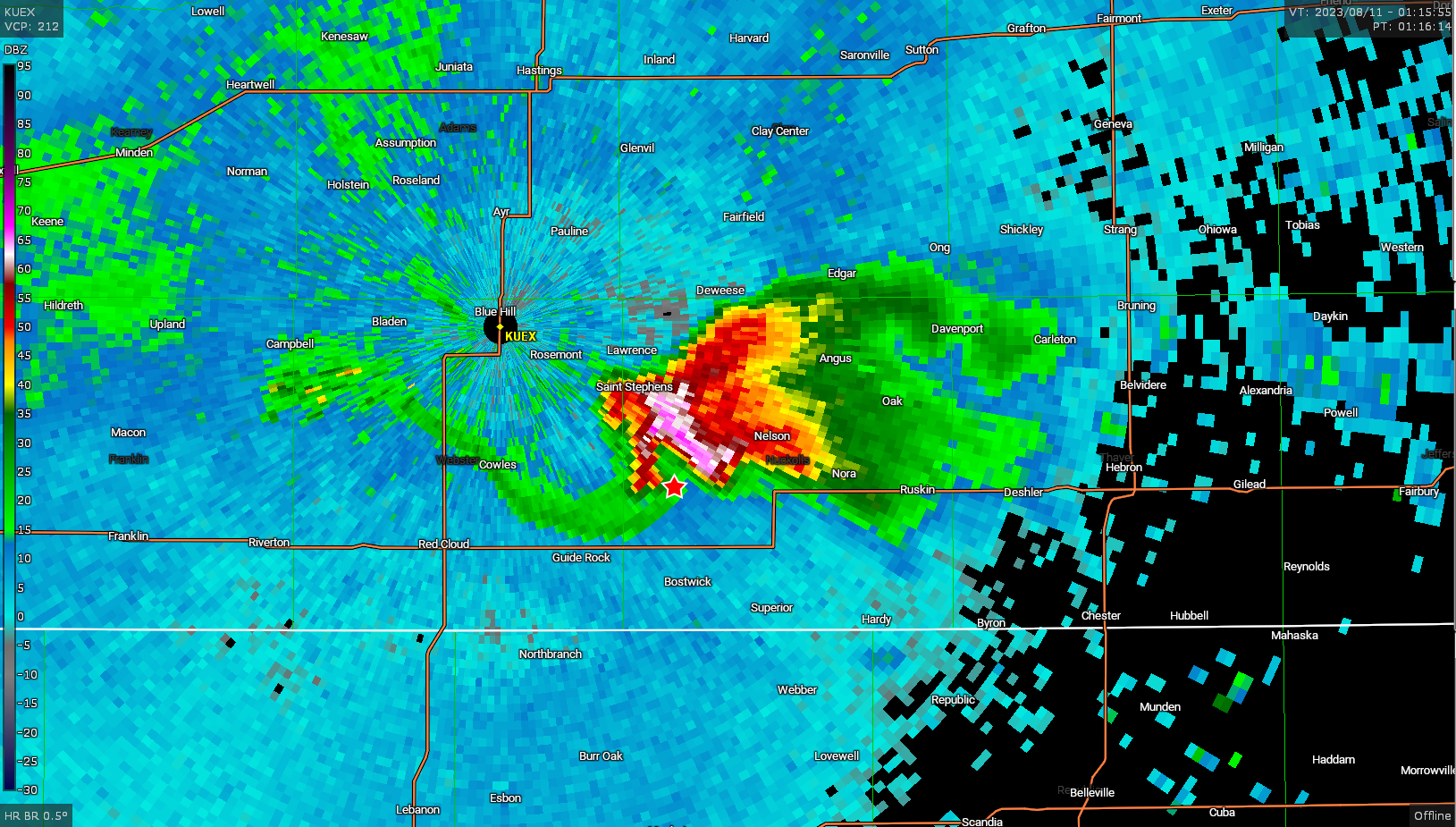
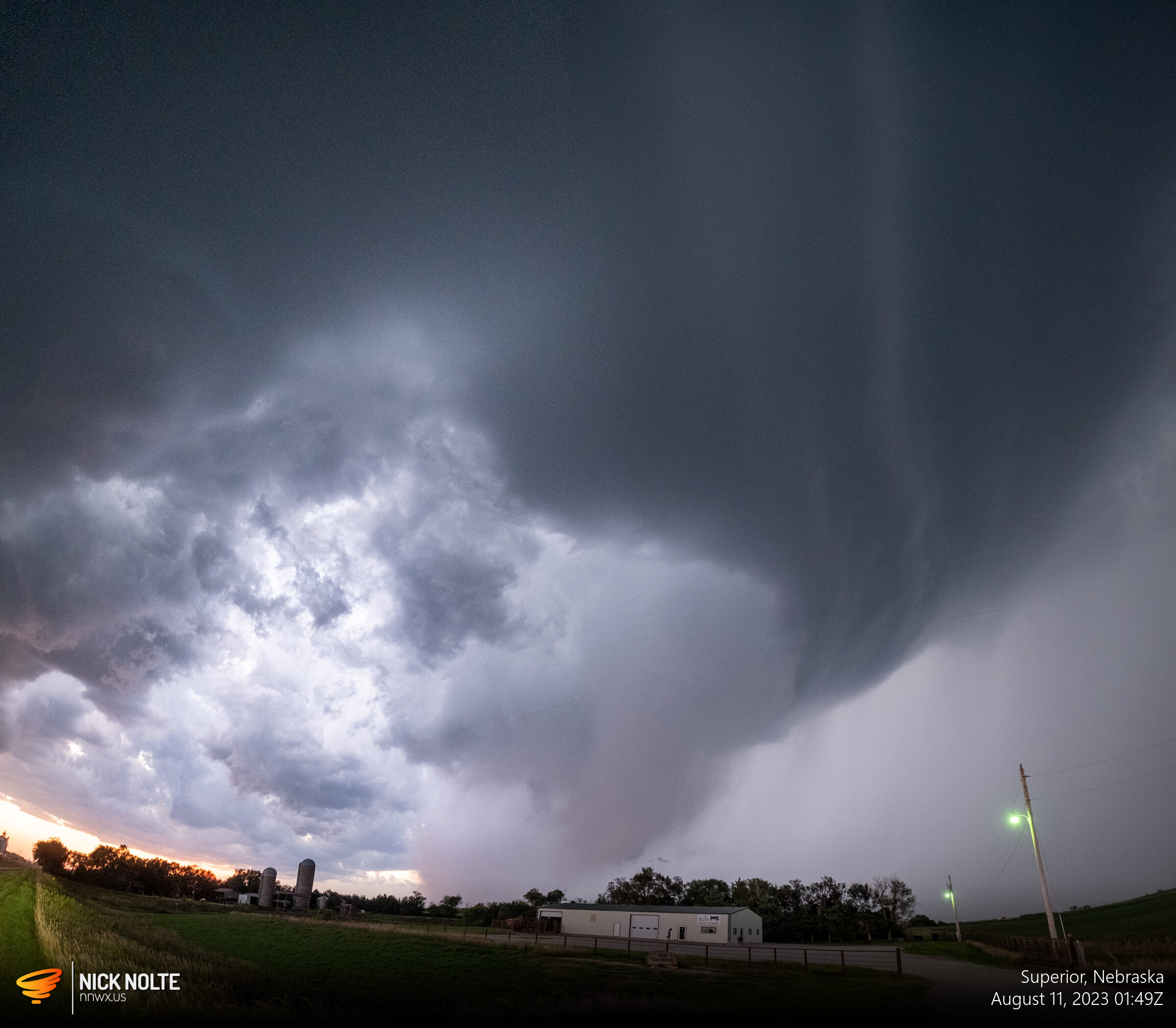
Here in Superior, the hail core made for a very suspicious looking feature, but I think this was just a very narrow wall cloud mixed in the hail core. Shortly after this I called the chase as the sun was setting and the road network near the border left little options to stay in front.
Chase Recap
| START | END | DURATION |
|---|---|---|
| Grand Island, NE @ 10/2242Z | Grand Island, NE @ 11/0309Z | 04 hours, 27 minutes |
| INTERCEPTS | CHASER ENCOUNTERS |
|---|---|
| None | None |