| 0 | 1.25" | 60 | 702 |
|---|---|---|---|
| TORNADOES | HAIL | WIND | MILES |
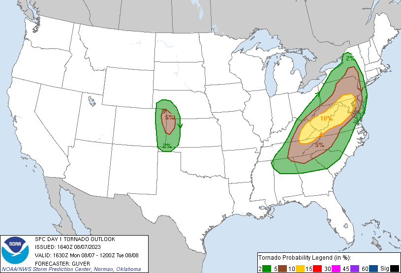
While a big severe weather outbreak was expected along the Eastern Seaboard, back around my parts moderate westerlies overlaid atop an expected lee trough near the Nebraska Panhandle and Eastern Colorado would set the stage for scattered supercell development with all hazards possible.
My original plan for the day was to head into Northeast Colorado around the Sterling area to sit and wait. I expected storms to initiate in the higher terrain and eventually move east into the favorable atmosphere closer to the tri-state area. I took off from work early and left Grand Island right around 16z and headed west on 80.
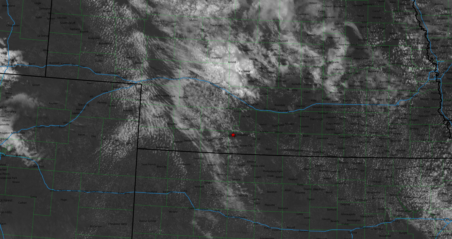
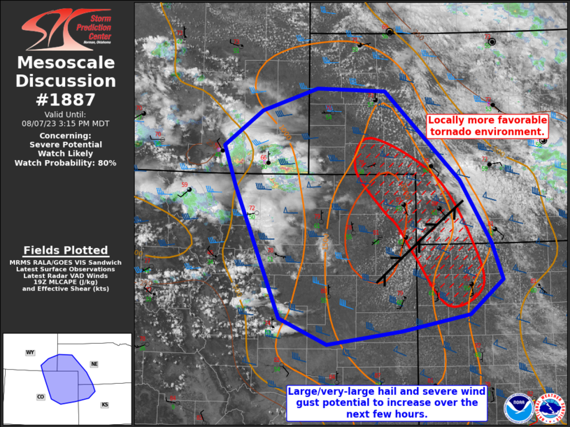
I was between Arapahoe and McCook around 18z and it looked like there were going to be two places on satellite where initiation was imminent: around Wray and up by Big Springs. After I left McCook I was going to need to decide whether to take US 6 towards Sterling or US 34 towards Wray. Initially I decided to take US 6 but not long after it became clear the south area was going to initiate first along a convergence boundary from Wray to Imperial. SPC issued a mesoscale discussion for the area just after 19z and pointed out that convergence zone.
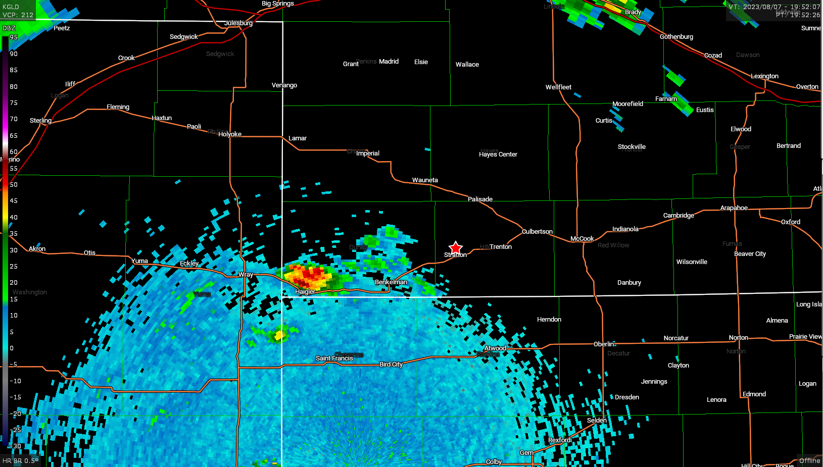
When I got to Hamlet, I diverted south to get back down to US 34 near Stratton with a plan to head to Benkelman as the first storm started to explode near Haigler in the extreme southwest corner of Nebraska.
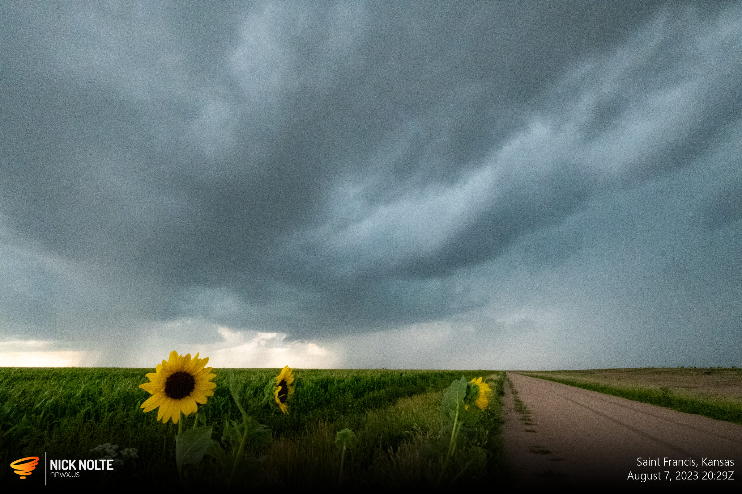
The storm eventually split and the right mover started to intensify displaying a wall cloud on several occasions and having pretty good motion within.
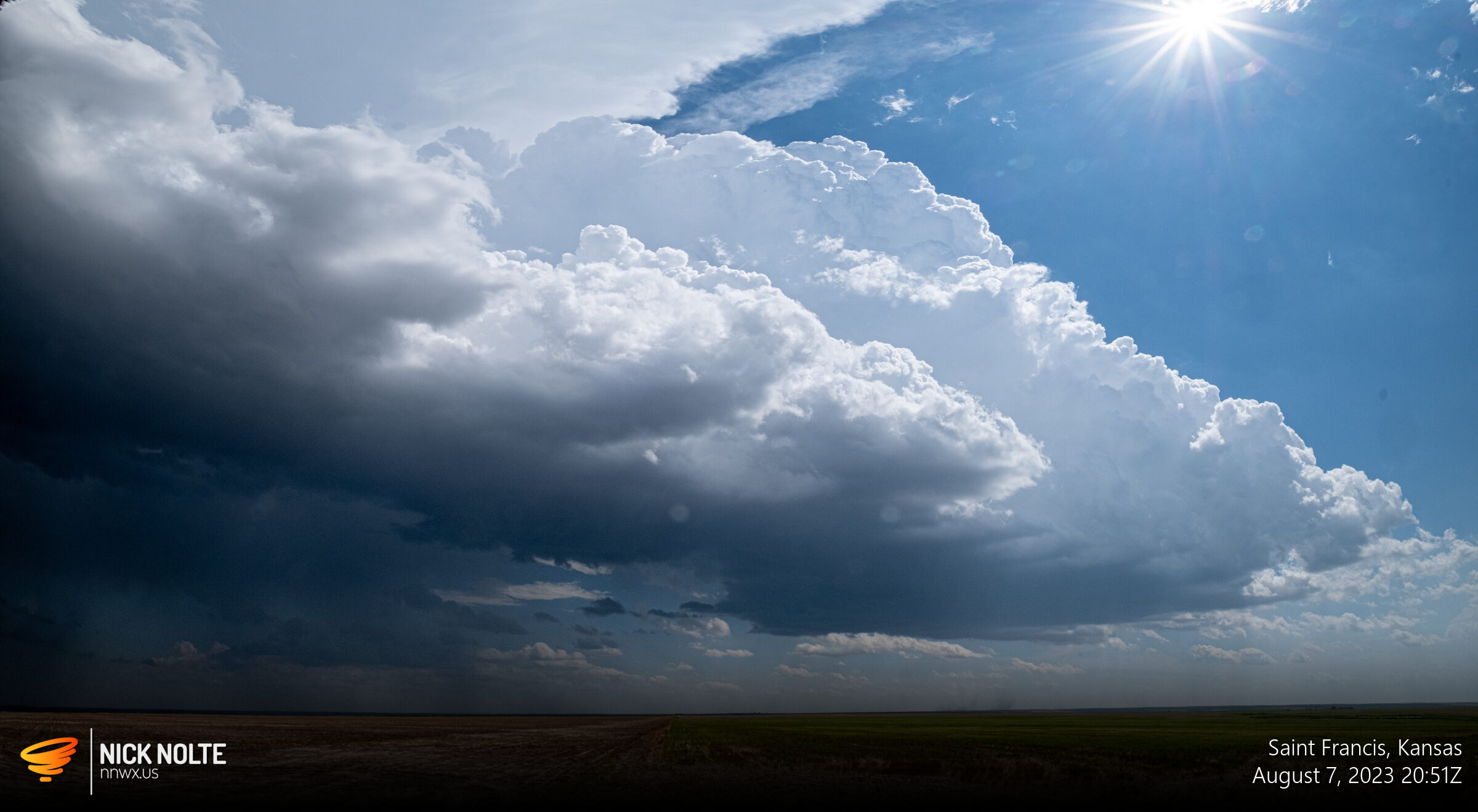
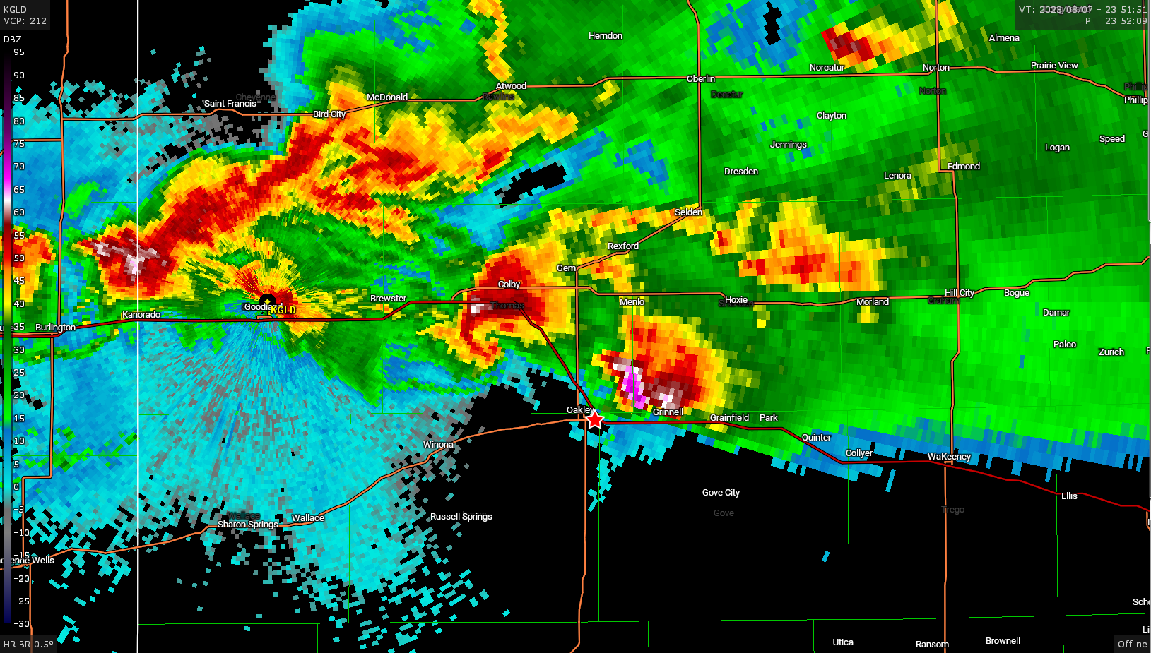
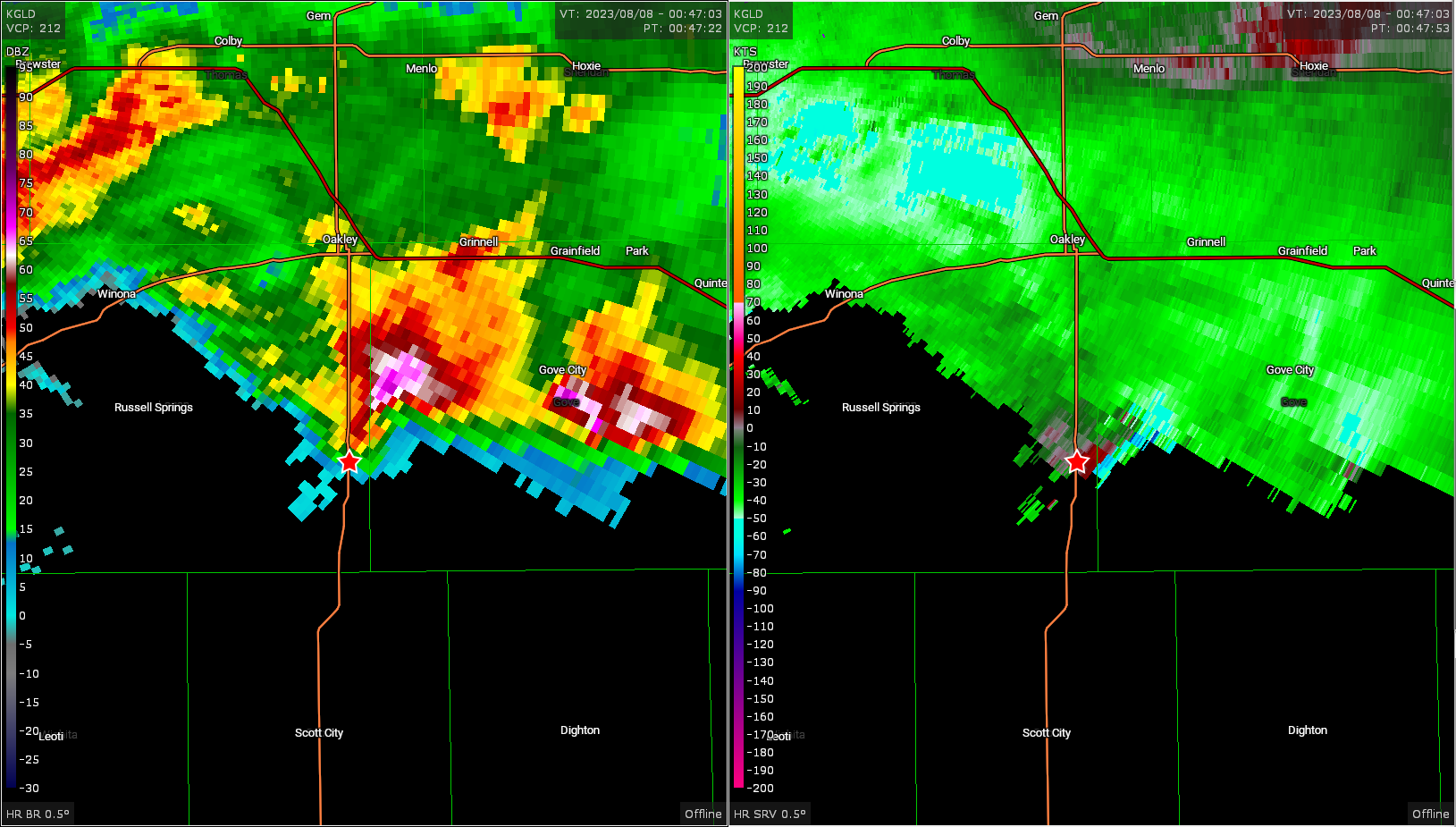
A new cell began to go up on to the south so that became the new chase target and would be the one I followed for the next few hours as it traveled towards Colby. The core really ramped up near Bird City and southeast of there would be a 4.25″ hail report. The storm continued to organize and developed a very convincing hook echo north of Colby.
It was at this time a really stout inflow band started feeding into the wall cloud of the storm
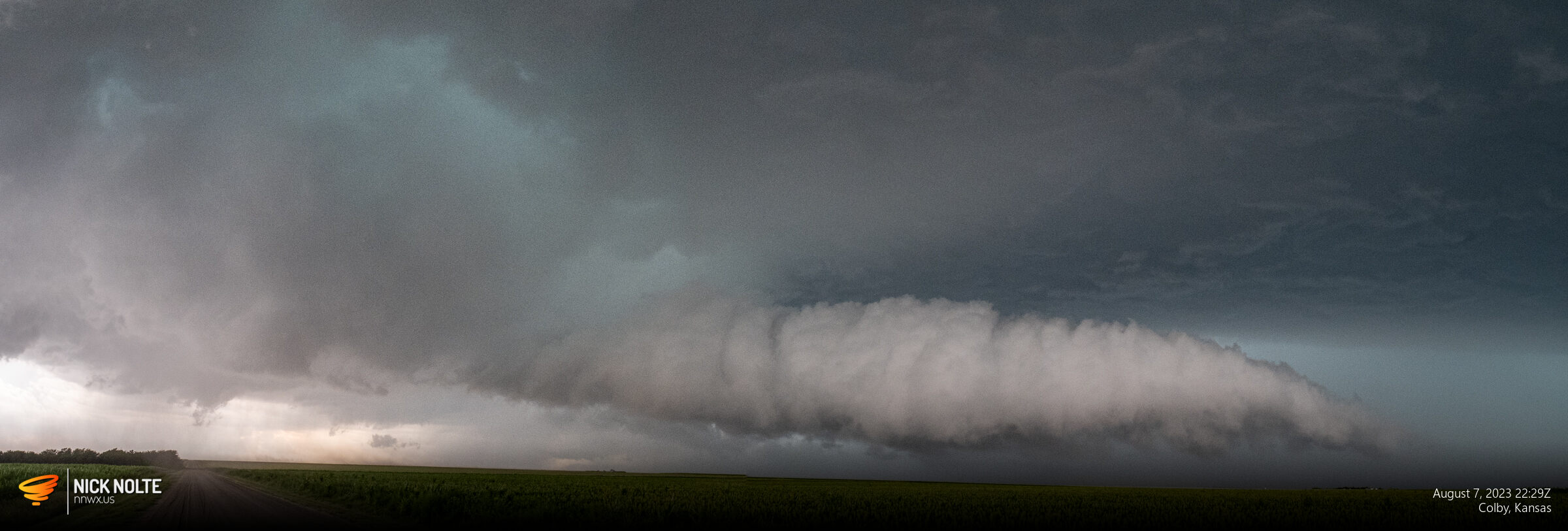
This feature did not last very long and as the storm approached Colby proper it appeared to split a second time but it more looked like the RFD wrapped around, occluded, then that portion kind of trailed the forward flank as a separate storm as it tracked southeast towards Oakley. I continued to track it but started to keep an eye on the cell to it’s northwest that was starting to look pretty good on radar.
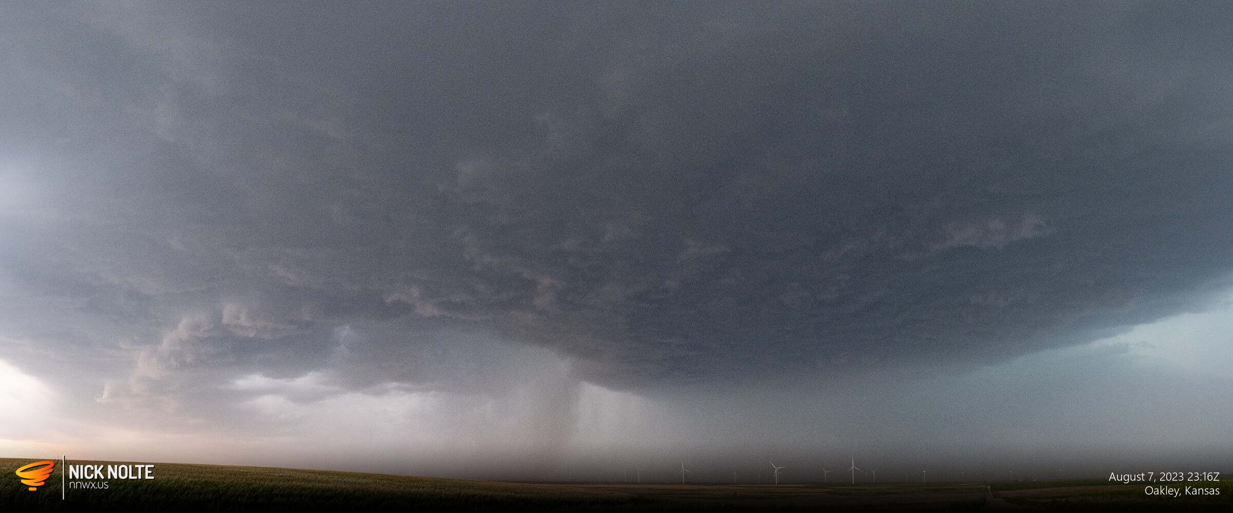
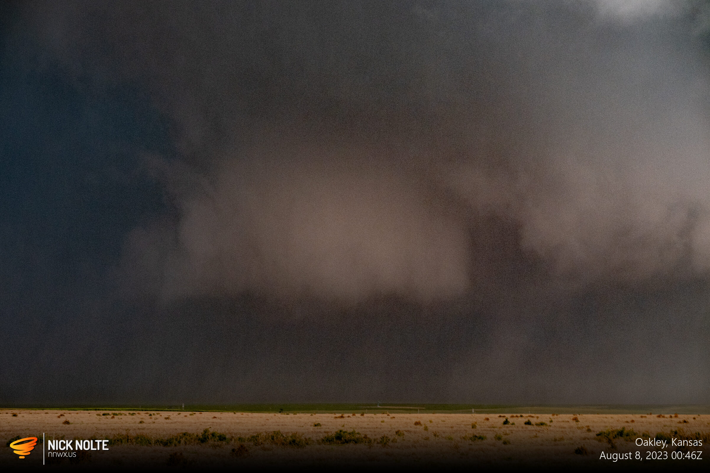
I gave this storm one last look as I turned my attention to the storm behind it with the wicked looking hook and stout wall cloud!
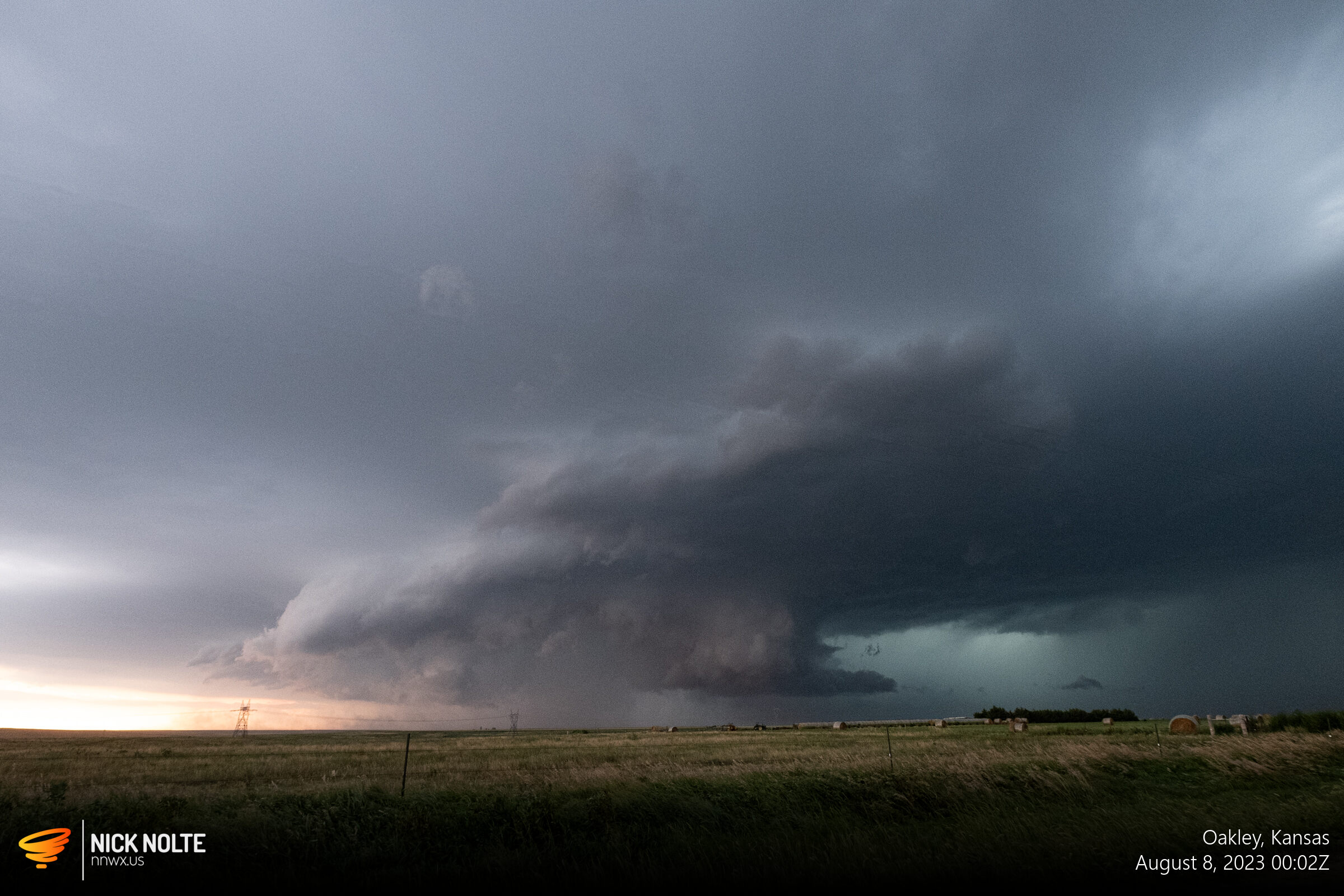
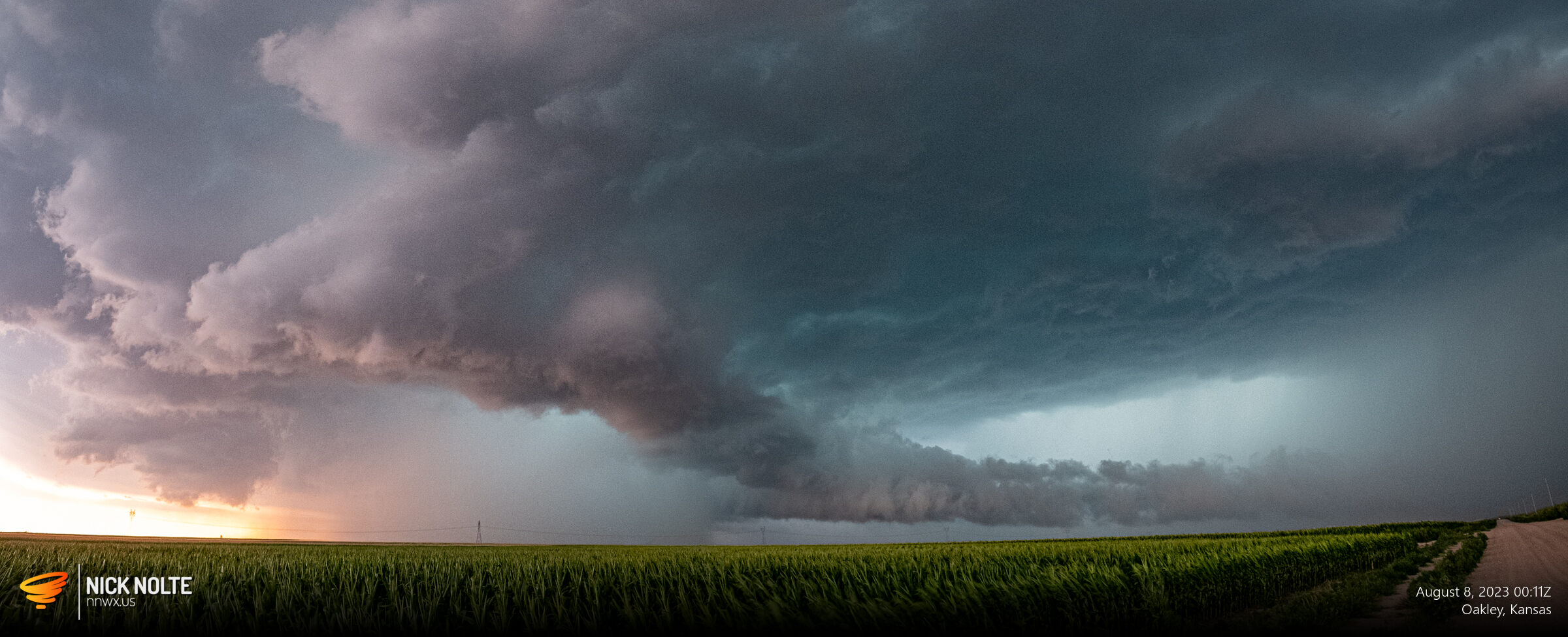
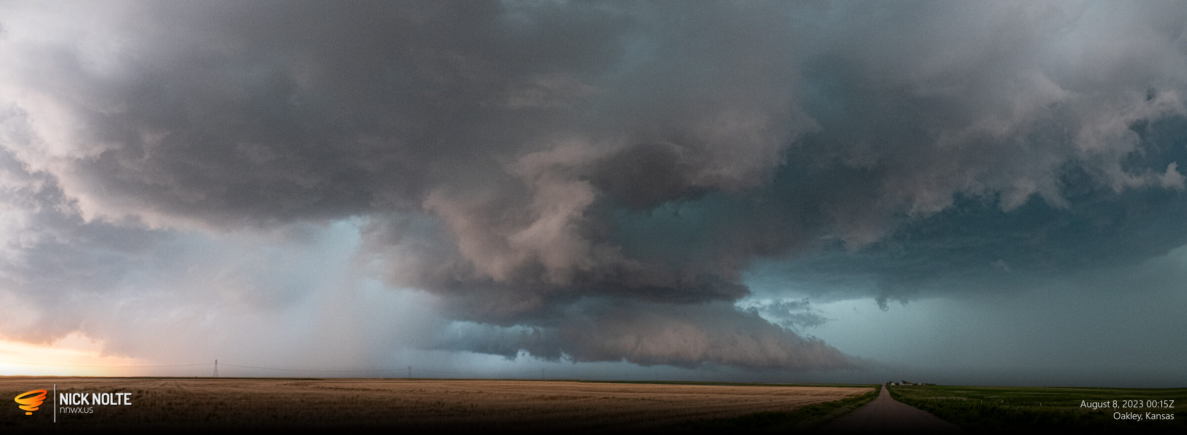
As the storm tracked south it continued to look pretty gnarly and at one point had a rather strong, blocky wall cloud, but never saw a tornado from my vantage point and there weren’t any reported. Eventually the sun went down and it started to get dark so that’s when I called the chase.
Chase Recap
| START | END | DURATION |
|---|---|---|
| Grand Island, NE @ 07/1607Z | Grand Island, NE @ 08/0615Z | 14 hours, 8 minutes |
| INTERCEPTS | CHASER ENCOUNTERS |
|---|---|
| None | Freddy McKinney (3) |