| 0 | 1.25" | 60 | 811 |
|---|---|---|---|
| TORNADOES | HAIL | WIND | MILES |
In a post-frontal upslope regime, easterly surface flow was forecast to transport a moist boundary layer towards the foothills, especially into the Raton Mesa and Southeast Colorado. While CAPE was expected to be meager, it would be sufficient enough for supercells to form which would then move southeast into the Plains. While tornadoes were unlikely, they could not be ruled out.
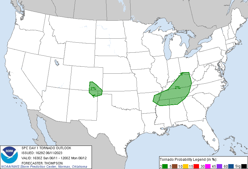
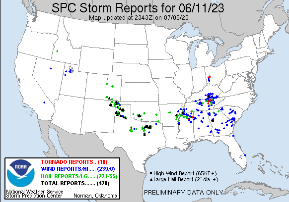
SPC had placed a small 2% tornado risk in Southeast Colorado within the slight risk for the area. My morning forecast was to head to La Junta as a staging location with the expectation for storms to fire along the I-25 corridor between Colorado City and Trinidad which would then move east as isolated cells then a shift towards the southeast as the day wore on and storms possibly grew upscale.
I left Grand Island just before 6am getting an early start to the day as I began the long trek towards La Junta. I was running a little early, which I prefer, and ended up in La Junta around 18z. I was expecting storms to begin firing in the mountains soon and was looking for SPC to issue mesoscale discussion soon, which eventually came just before 19z.
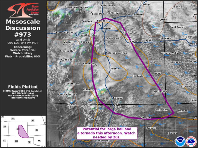
Didn’t look like we were going to get a red box, but that’s ok. A storm had already started to develop west of Aguilar as the MD was issued and it was already looking pretty good on satellite and radar.
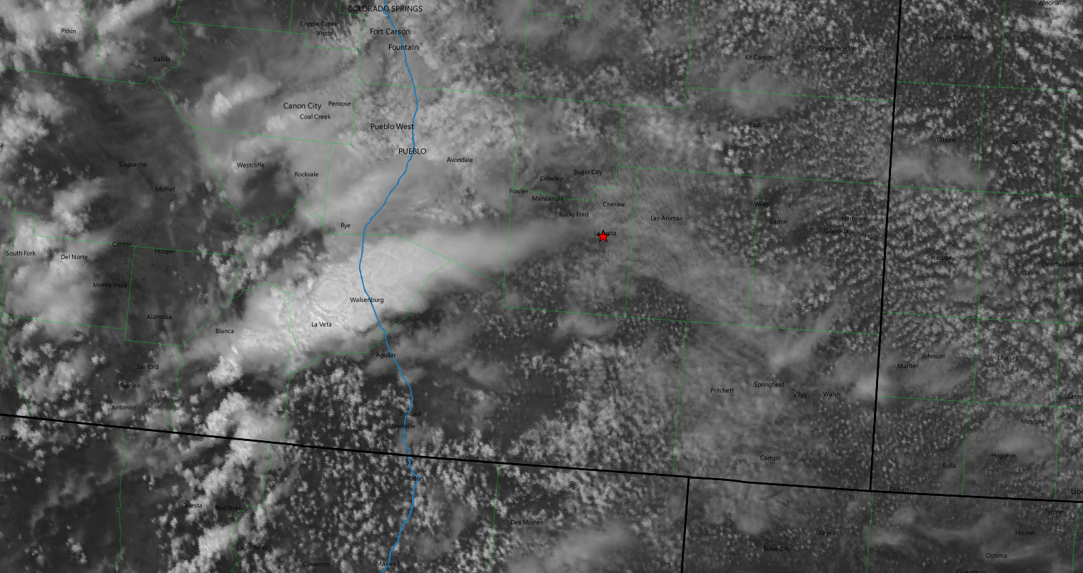
I began the trek down US 350 towards Aguilar to get closer to the storm and see what it was doing.
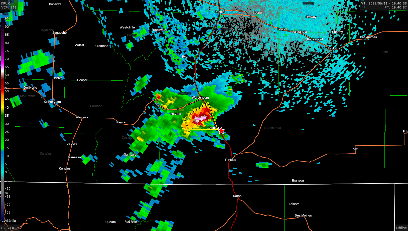
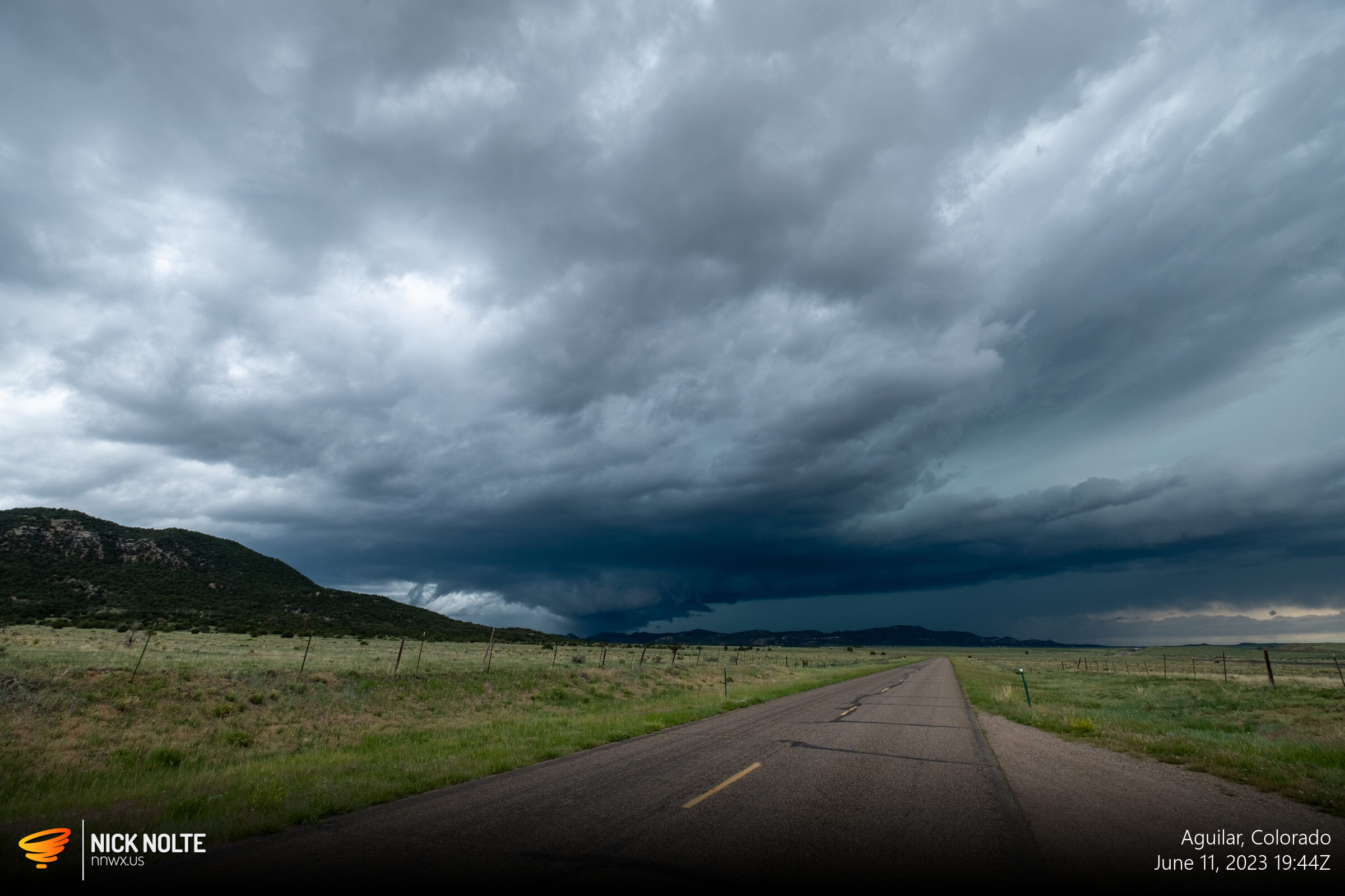
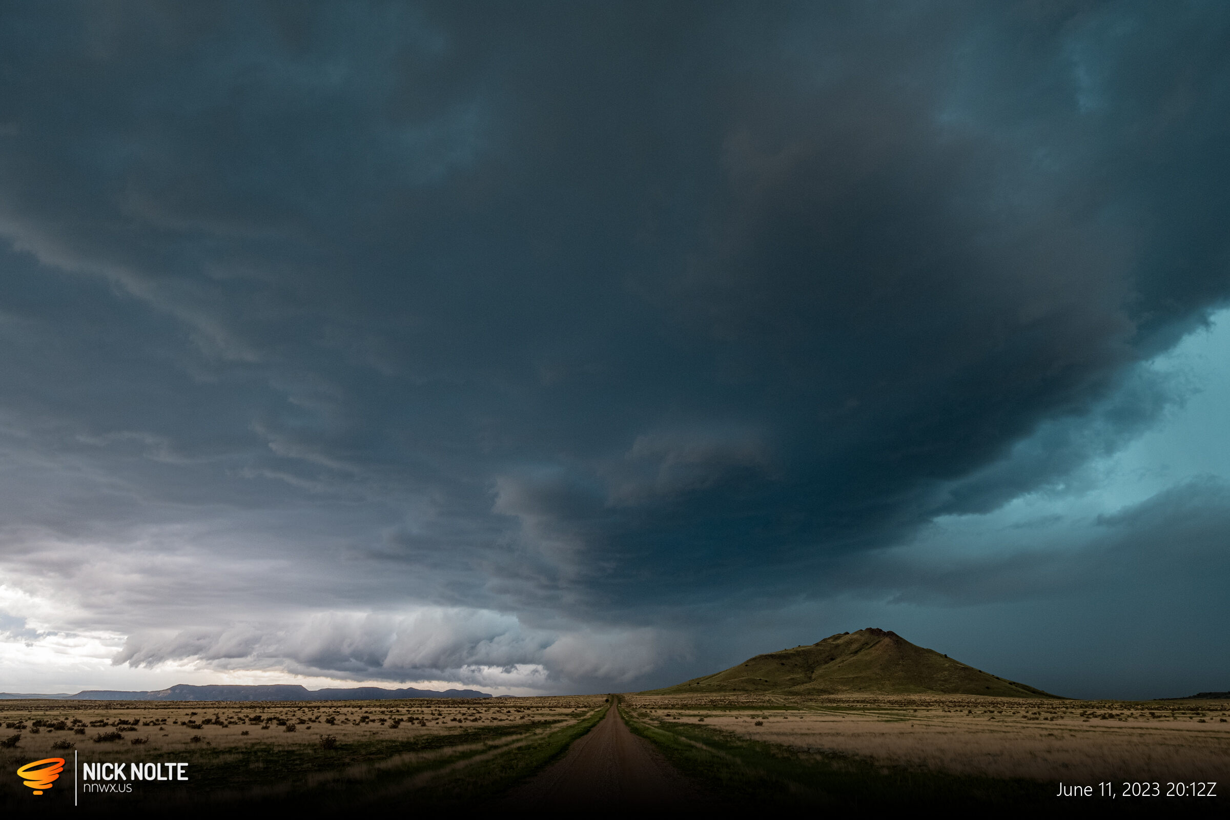
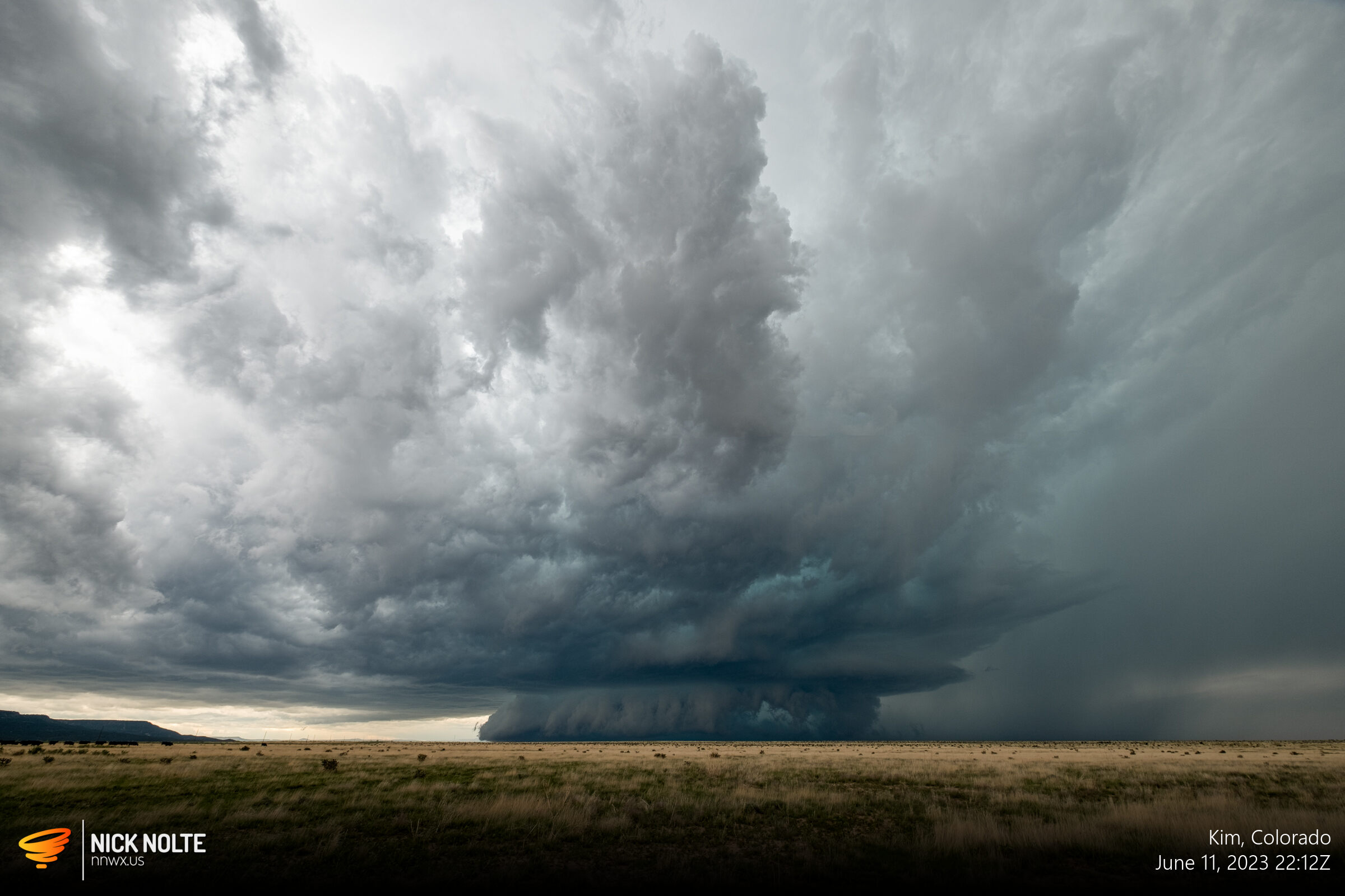
Pretty cool landscape for the storm to roll over. As it finally began to roll of the mountains it’s general east-southeasterly drift meant we got to try and follow along with it along US 160 between Trinidad and Kim which crosses some of the most remote areas of Colorado…roads few and far between. If the storm dropped south of 160 it would be difficult to follow it given it would cross Carrizo Canyon which is typically impassible during storms.
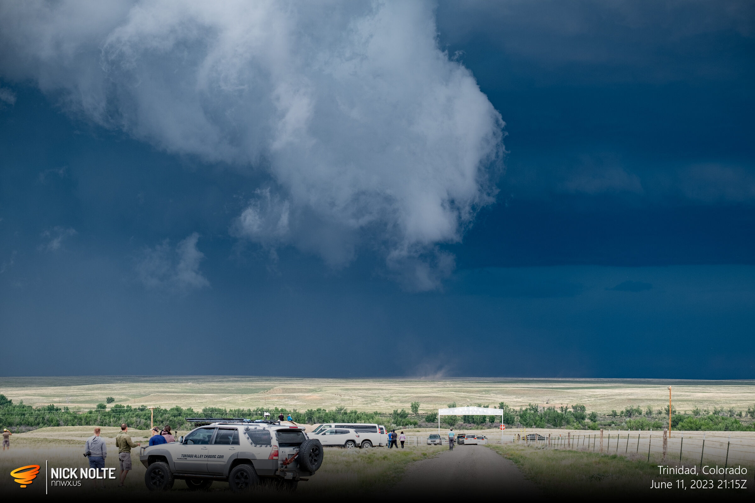
The storm wrapped up and looked like it might do something a bit east of Trinidad, and a brief gustnado or area of wind-blown dust kicked up that gathered the attention of the chasers around.
Shortly after this the storm began to surge southeast and in retrospect I probably shoulda taken highway 389 into New Mexico to highway 456 to continue following east, but I stayed on US 160 as the storm tracked southeast of the highway.

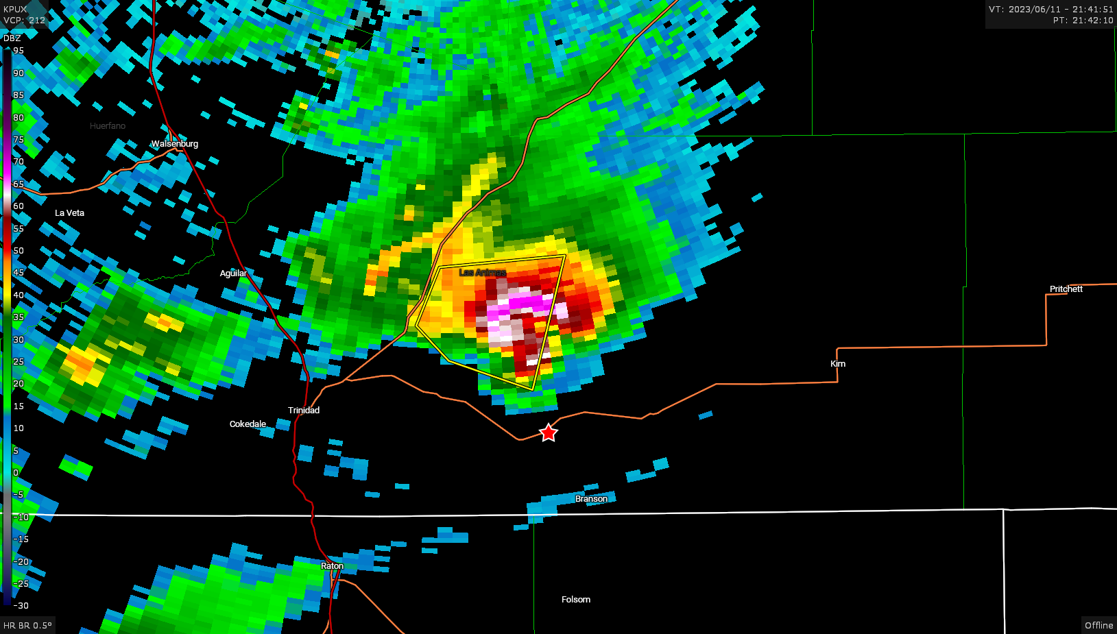
As the storm crossed the highway 20 miles west of Kim the wall cloud got real big and real low
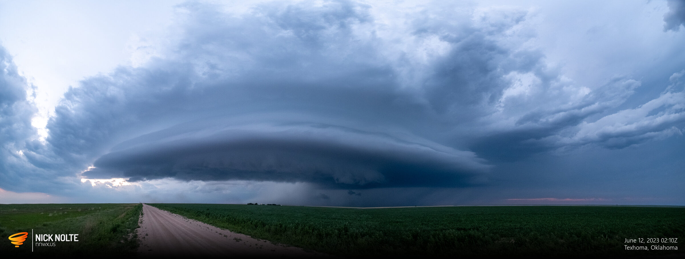
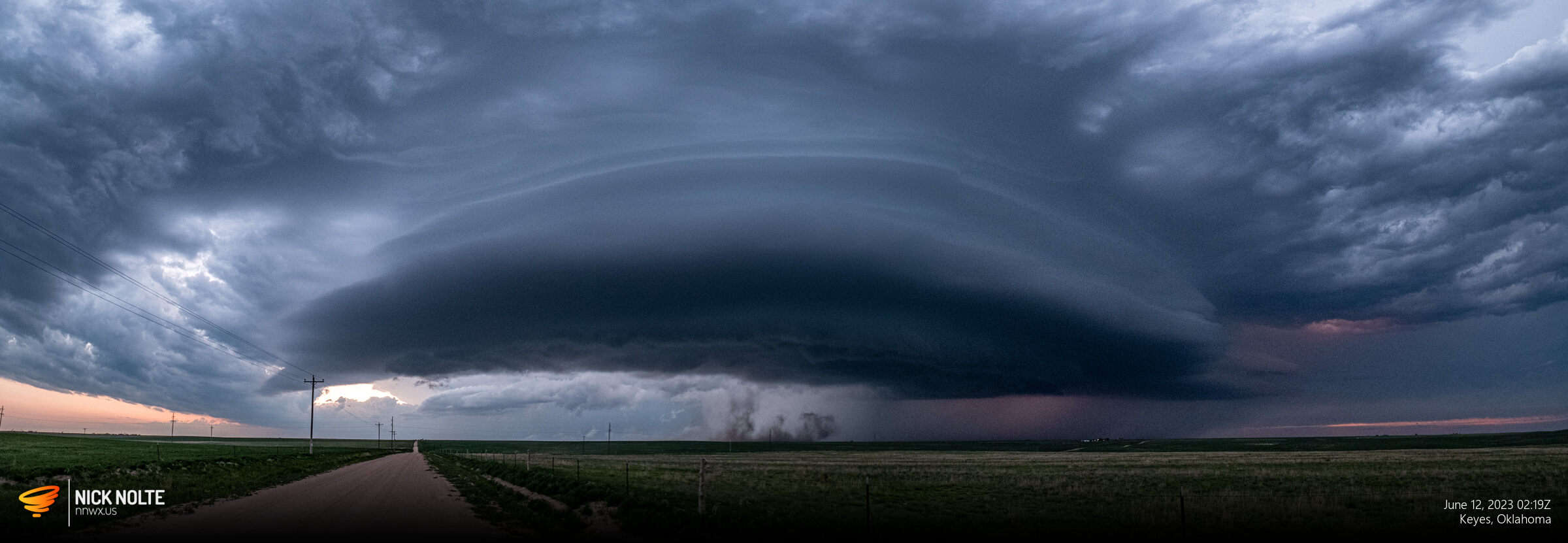
After getting gas in Kim, it was now time to play catch up. The storm had drifted into the canyon, so the only option was to head east to US 287 and try to beat it to Boise City. Luckily I did manage to setup west of Boise City to watch as the storm put on a decent structure show outside town.
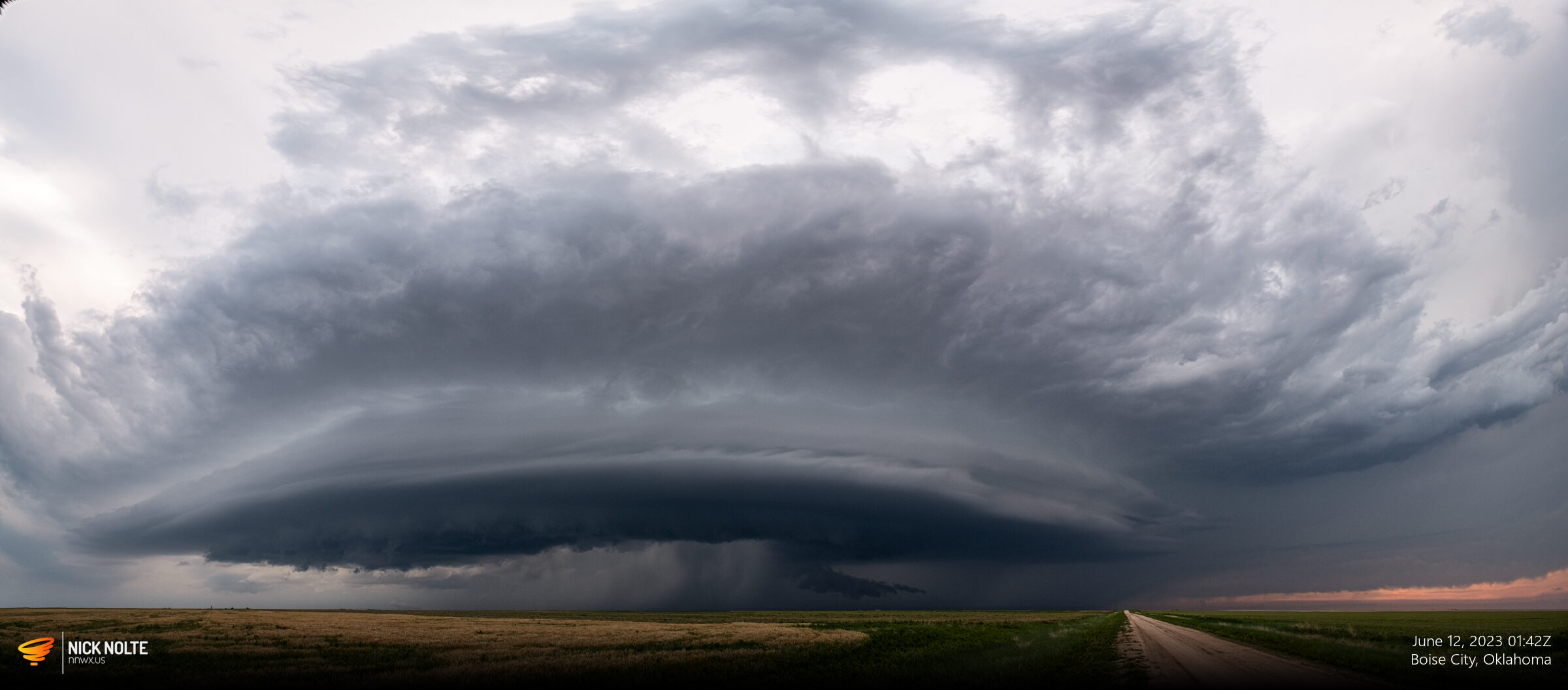
A pretty good chase in an area with not a great road network. I spent the night in Guymon to chase the next day.
Chase Recap
| START | END | DURATION |
|---|---|---|
| Grand Island, NE @ 11/1041Z | Guymon, OK @ 12/0313Z | 16 hours, 32 minutes |
| INTERCEPTS | CHASER ENCOUNTERS |
|---|---|
| None | Daniel Shaw (1) |