| 3 | 1.50" | 80 | 450 |
|---|---|---|---|
| TORNADOES | HAIL | WIND | MILES |
May 12th was the third day in a four day severe weather event. This day featured an enhanced risk across Northeast Nebraska and I decided to apply the lessons learned from the previous two days and play the north side of the surface low which was in the process of occluding as it drifted north.
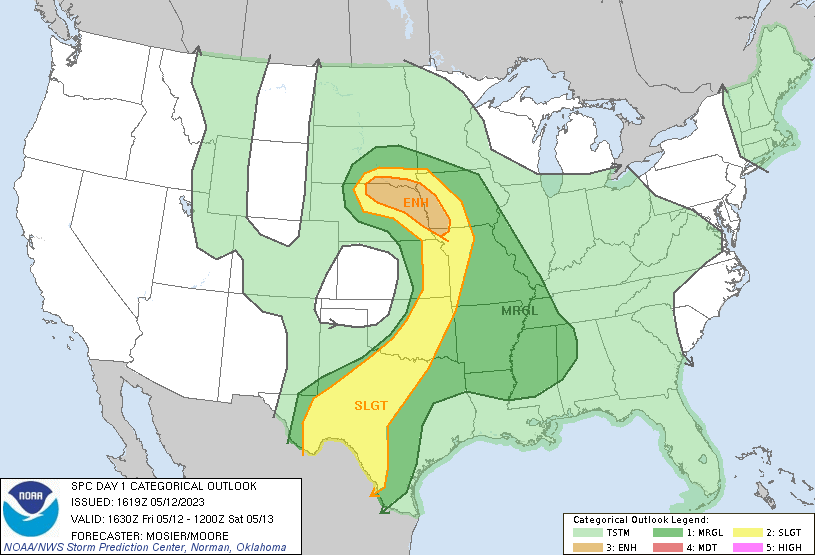
I was actually back at work in the morning after driving home from Kansas the previous day. As the morning progressed it started to become clear that I needed to leave work early and get north to chase. Mid 60°F dewpoints were well entrenched along the front that stretched from near Valentine to Nebraska City.
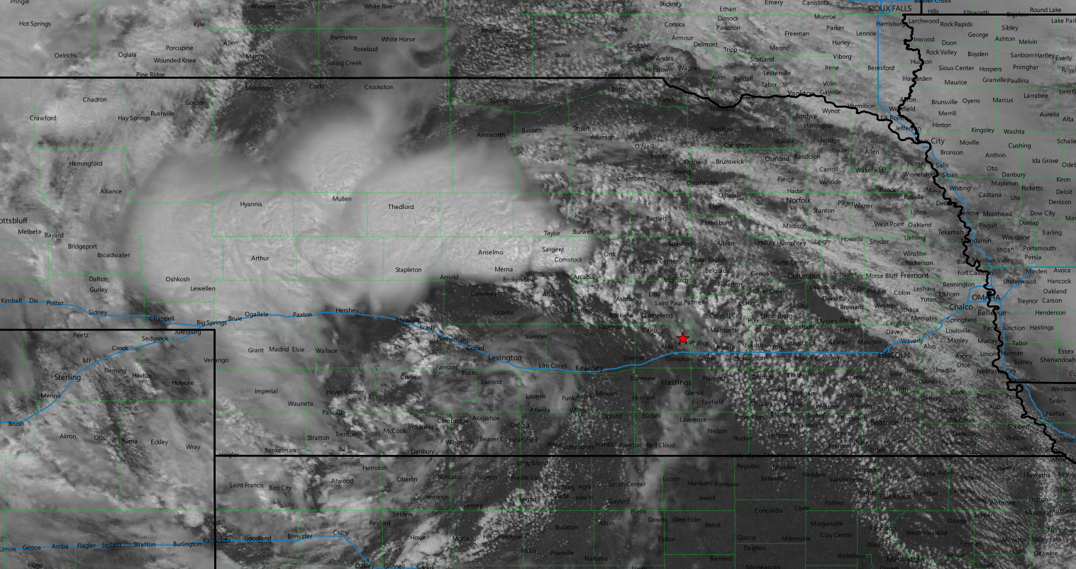
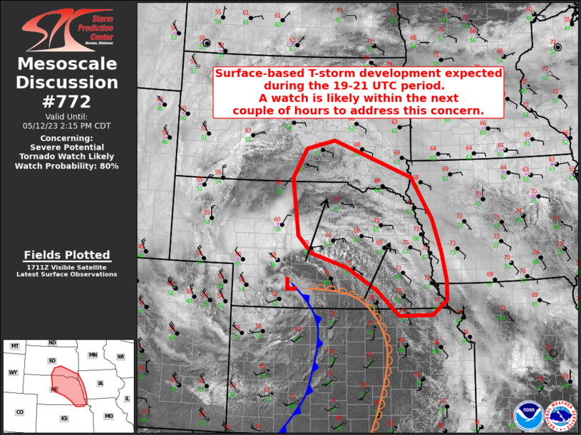
The visible satellite was quite a sight to look at. The occluding low centered over the Lexington area with bands of convection spiraling outward across the northern half of the state. A vast cumulus field with ongoing convection at the western edge sprawled from the Panhandle to Ord. I took off from Grand Island with the plan to head straight north on US 281 and start intercept on the easternmost storm. Just as I left town the SPC issued the mesoscale discussion for the impending tornado warning.
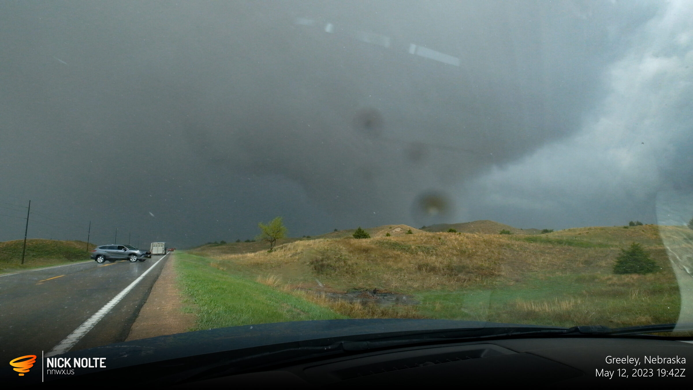
As I started north on 281, tornado warnings were already coming in west of Broken Bow. I figured this was a good sign, if we were getting tornado sightings in the ongoing storms, surely once they developed further eastward we’d get the same result, right? I was going to head west on highway 92 to get over towards Loup City where storms were strongest, but right as I turned onto the highway new development to my north and east drew my attention.

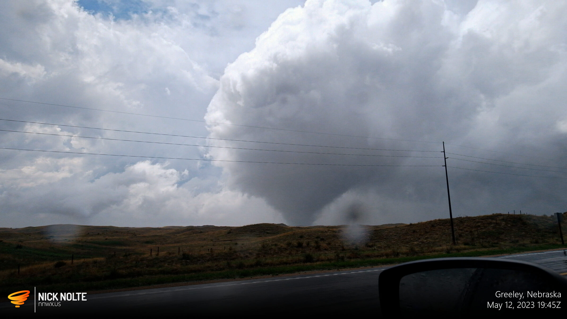
I turned around and continued back north on US 281 to intercept the two new cells just southeast of Greeley.
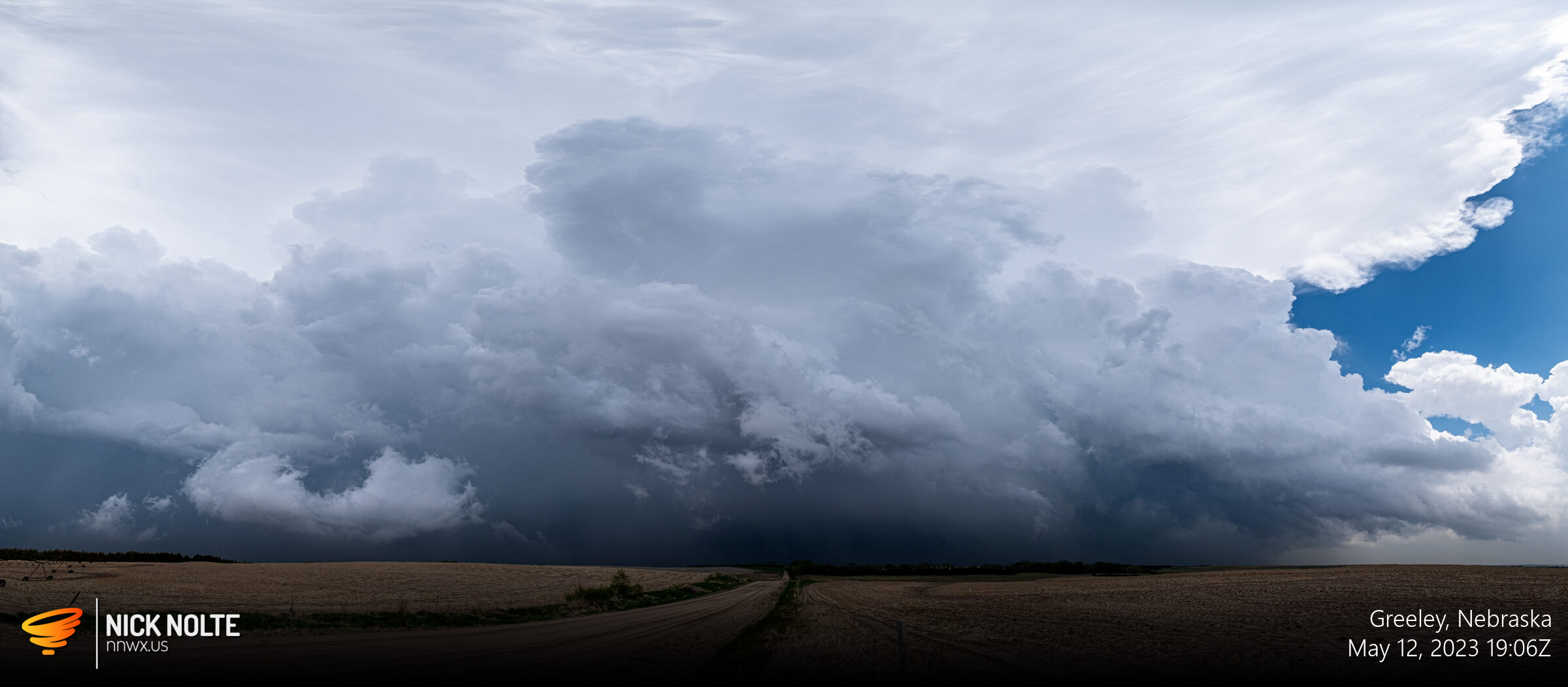
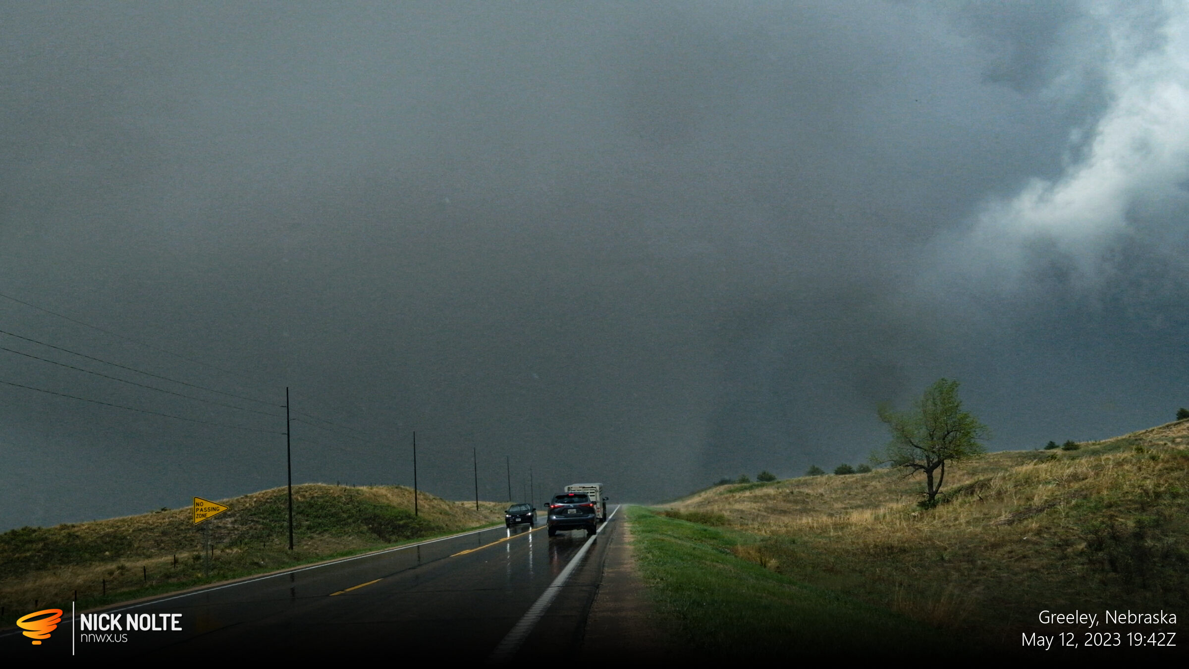
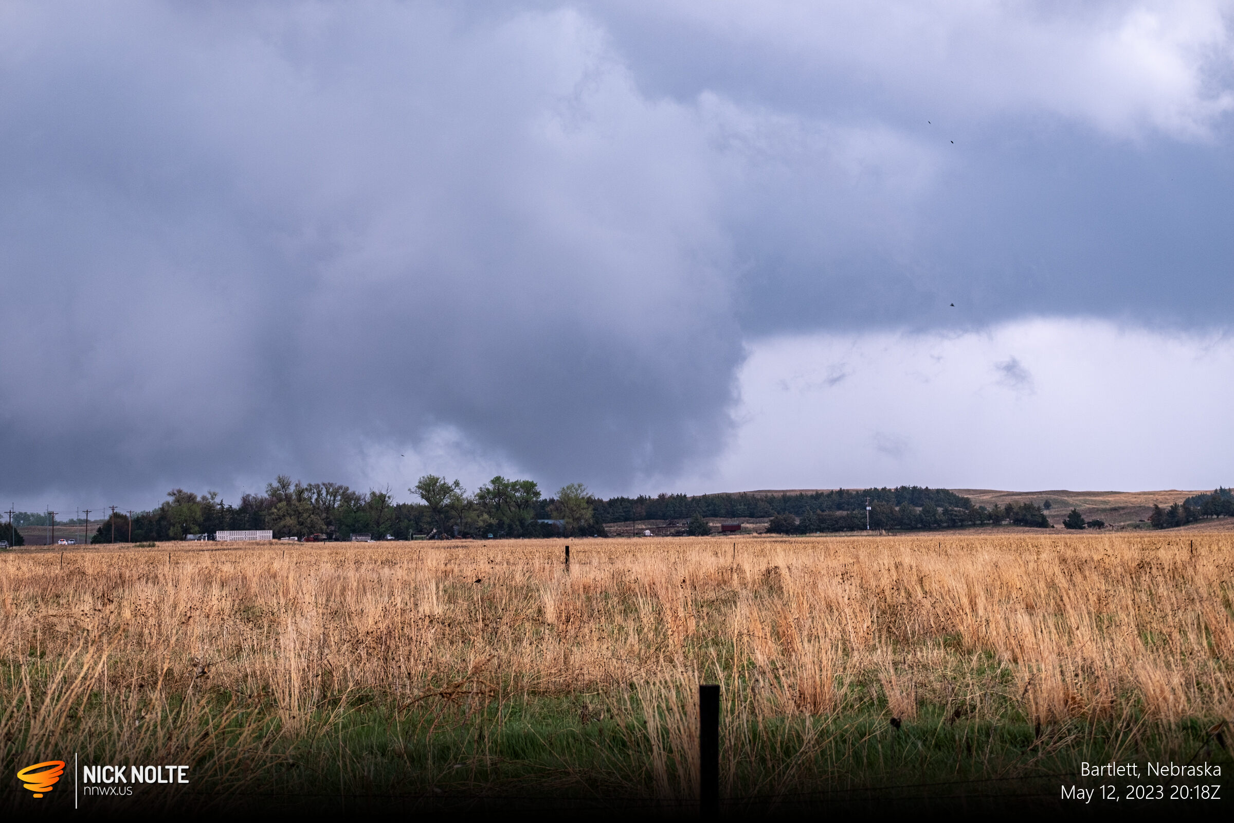
This cell had a couple of sub-severe hail reports on it, but more cells were developing to the southeast. The base of this storm looked pretty good to me so I decided to stick with it until one of the eastern storms started looking better. Right around 1920z or so I was debating heading to one of the other cells when a tornado report came in.
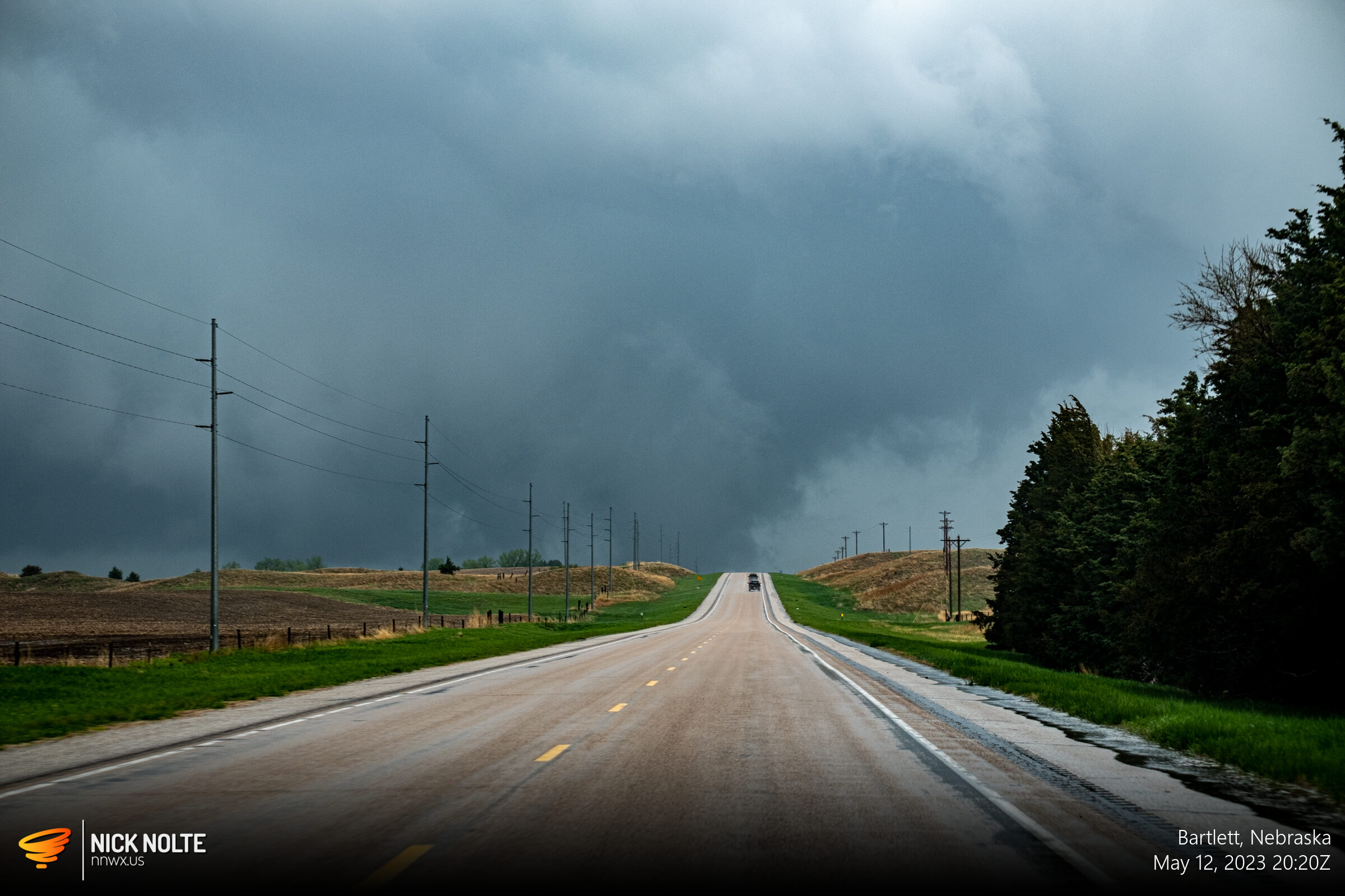
I couldn’t see it from where I was so I drove north on 281 hoping to catch something as it crossed the road. As I approached the edge of the storm I could see some crazy motion in the clouds, so I stopped to observe and the large tornado emerged from the murky shadows just before it crossed the highway.
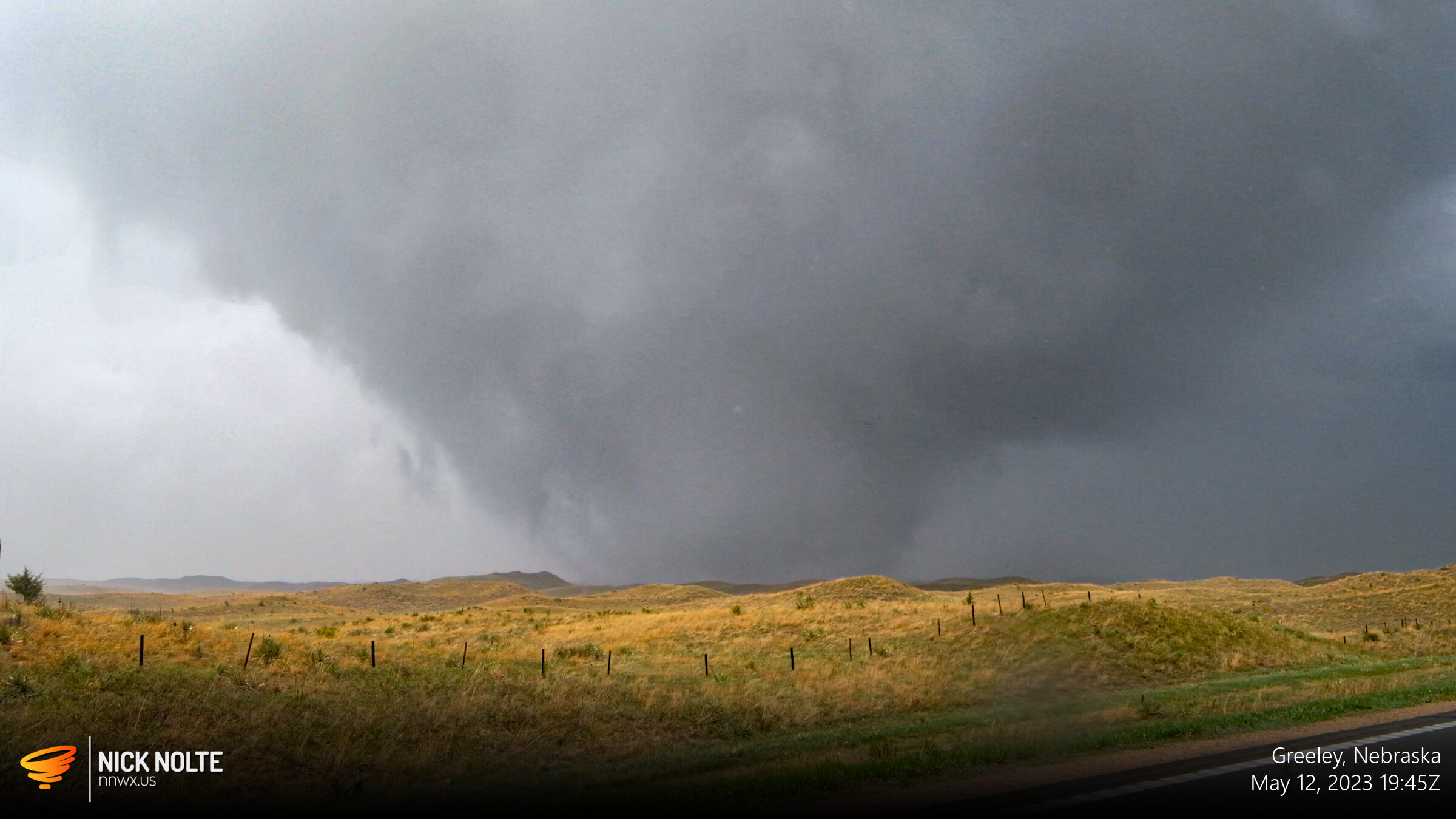
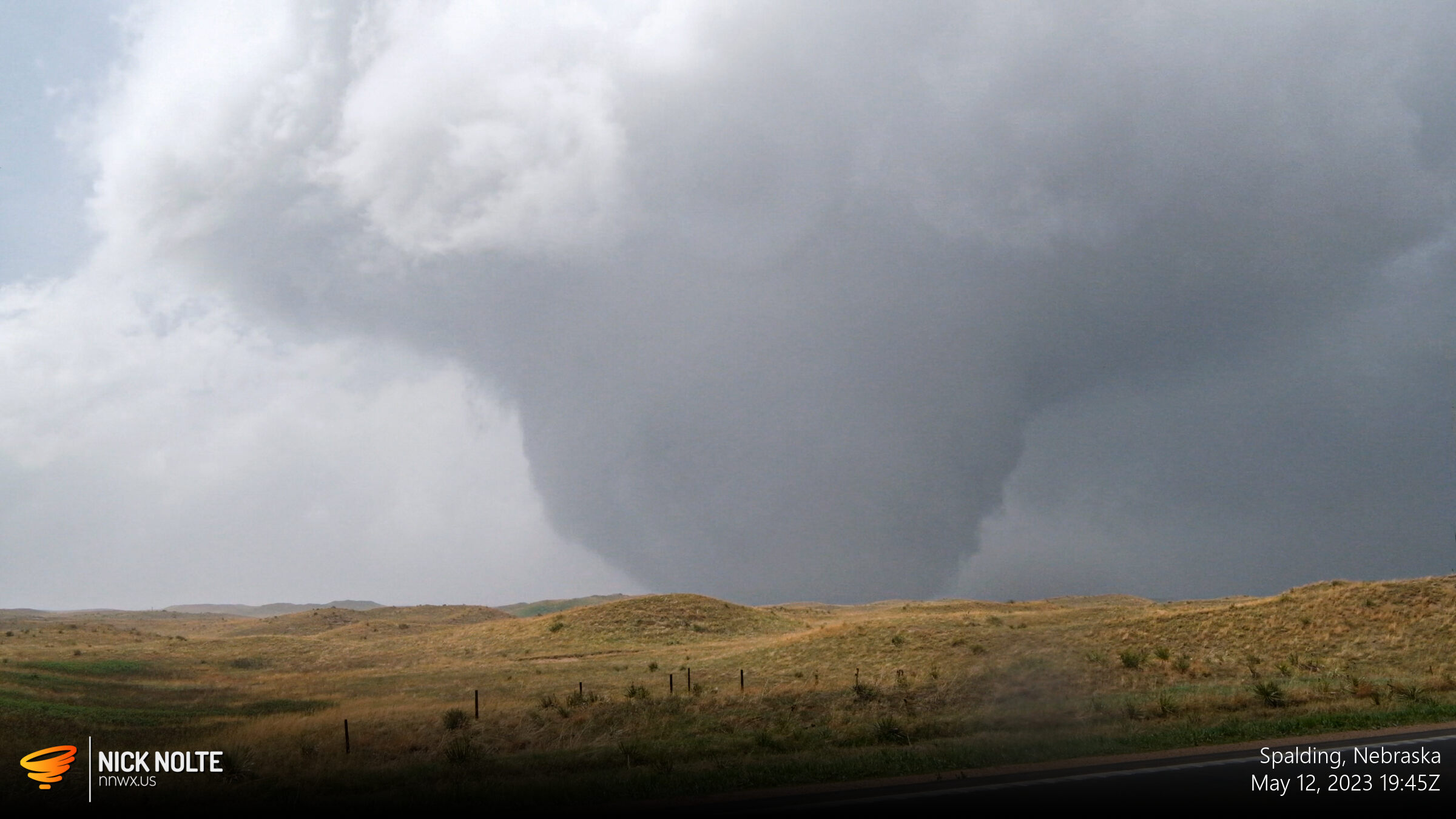
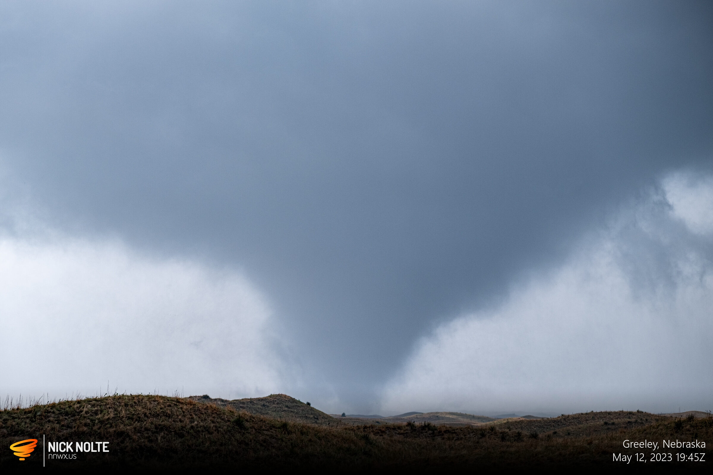
Eventually, this large wedge roped out several minutes later and I decided to head north to see if any of these other cells were going to do anything. Just a bit up the road I pulled over because it looked like another tornado in the rain was about to cross the road. This was never verified by anyone else, so may have just been a really low wall cloud.
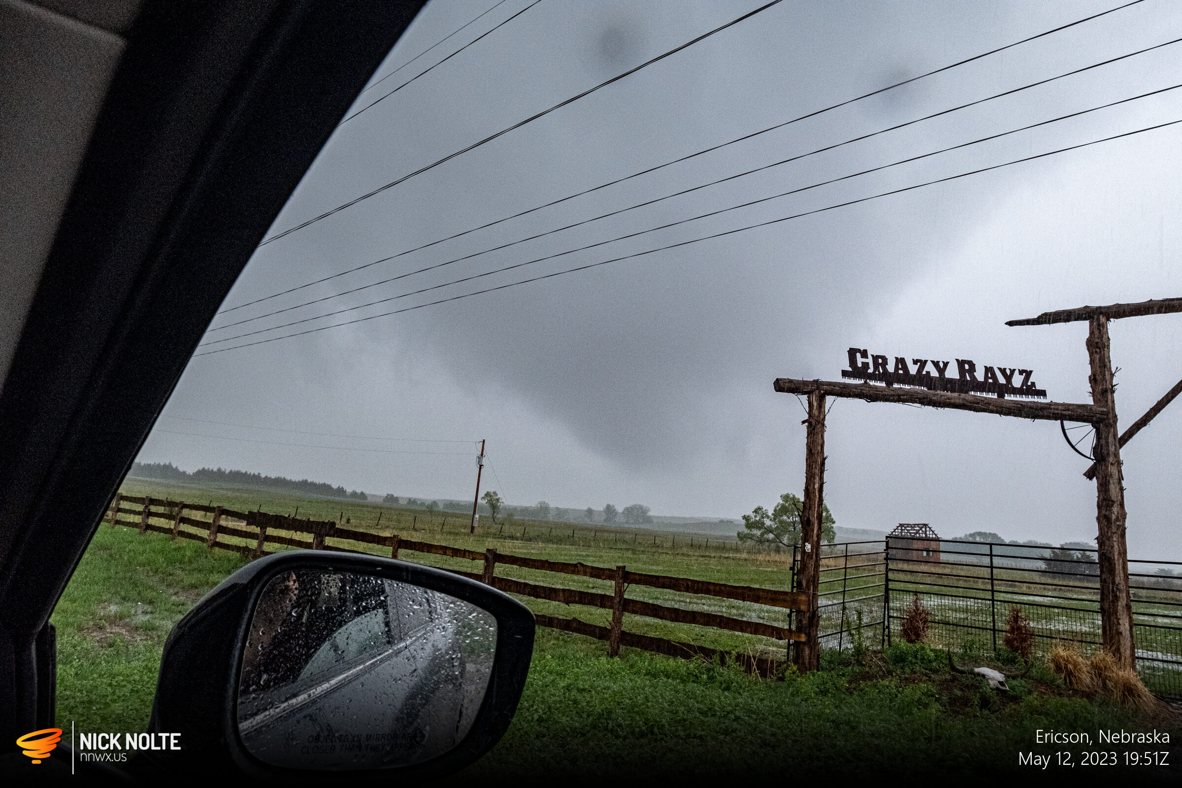
But not to fret, yet again, shortly up the road another tornado began to develop east of Ericson.
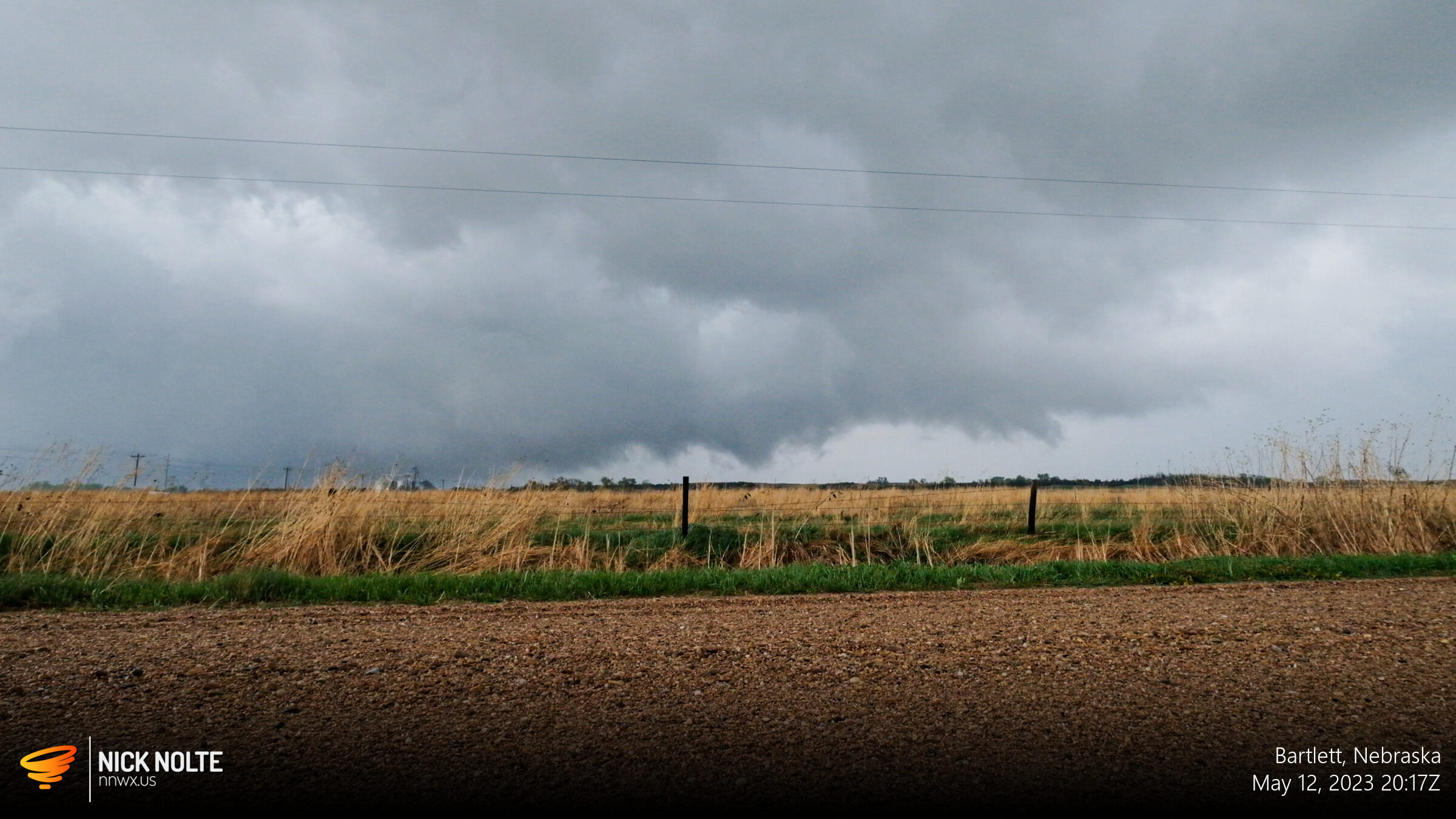
After following these north for a bit I made the decision to bail east and hopscotch down the line to see if I could find any new tornadoes. While heading east on highway 32 I made the decision to punch through the line to get to the other side because it was impossible to see anything from the west.
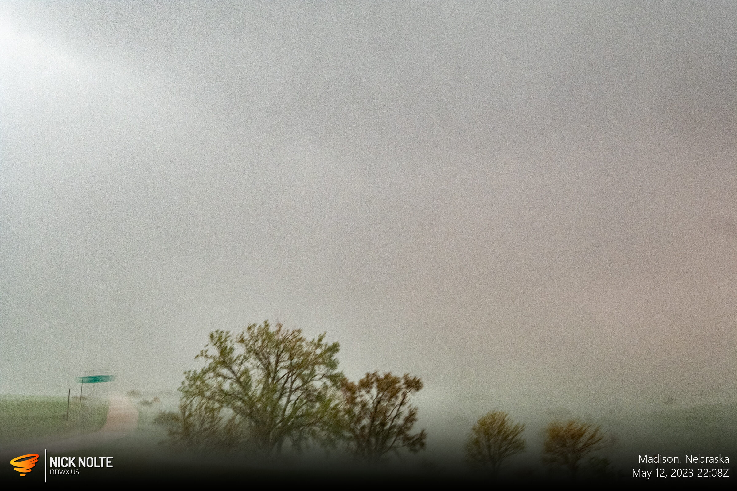
As I was approaching the tail end of one of the storms crossing highway 32 west of Madison, I stopped as once again it looked like a circulation was ahead about to cross the road. There had been a tornado report on this storm prior to it crossing highway 32 twenty minutes earlier. Better to be safe so I held back while “the hook” crossed the road.

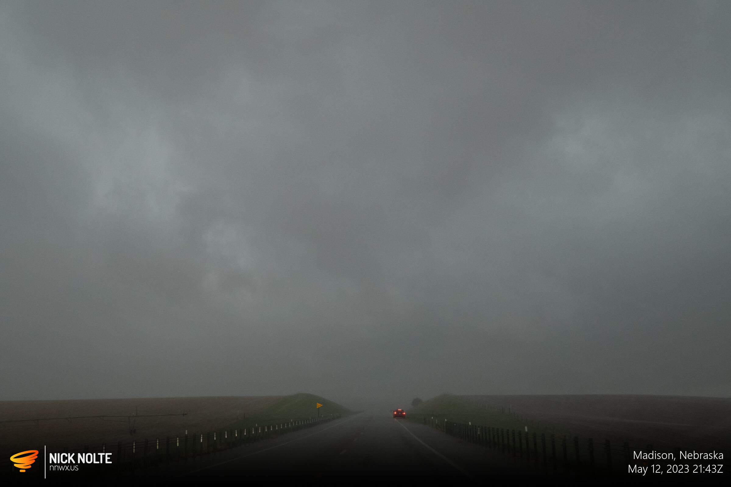
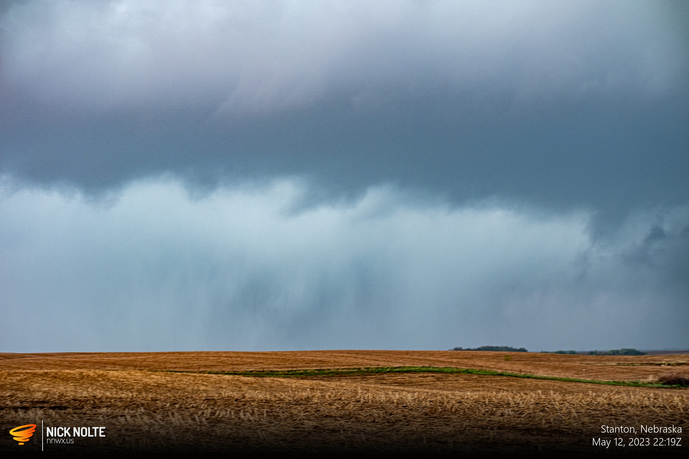
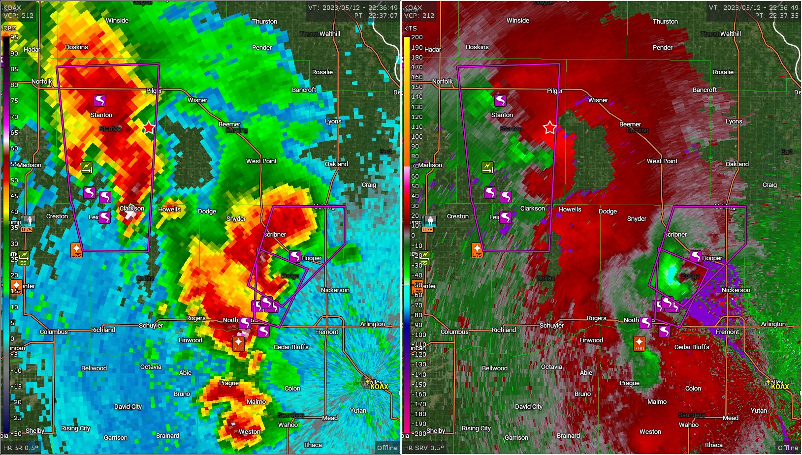
As you can see, another car had the same concern as me. After this crossed the road, I continued east and carried on with my plan to punch through the line. About 20 minutes down the road I had the same situation to consider, except this time there appeared to be a couplet on the radar. I decided to proceed forward with caution. No tornado reports were coming in with this storm despite the velocity images so I paid special attention to the rain. It was consistently blowing south-to-north during the travels until a few miles west of highway 57. I had my driver’s side window down to watch in the field to my north and the rain suddenly whipped around and started blowing directly in my window. I stopped and watched as the rain continued to blow north-to-south, a couple small branches blew over the car then the rain changed back to south-to-north.
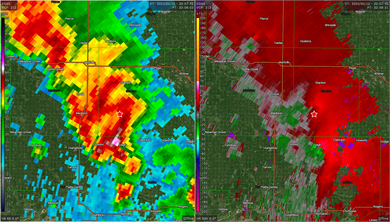
I was pretty sure a tornado crossed the road a couple hundred yards ahead of me, I never visually saw it, but an Omaha survey the following day verified an EF-1 crossed the road and damaged a house and some outbuildings just south of me. I continued east a few miles and finally was in front of the storms. I stopped to look back as the couplet on the storm I drove through was ramping up, but from my vantage point there wasn’t much to see.

At this point the storms were looking grungy and the storm above had a confirmed tornado report, but there was no way to see much unless you were in the bear’s cage. There was another storm to my southeast by North Bend that had just gone tornado warned that had one hell of a hook on it. I decided to try and get to that one to close out the chase and the tornado reports started rolling in.
I did get down to the storm while there were still tornado reports going on as it was near Oakland, but even getting within a mile or two I wasn’t able to see anything, while earlier there were some pretty cool shots coming out from under the meso.
I called the chase shortly after this, I had an internal debate about whether or not to get a hotel in Omaha and chase the weakening system into Iowa the following day. I decided to head home, but as you’ll see there’s a blog entry for tomorrow 😮

Chase Recap
| START | END | DURATION |
|---|---|---|
| Grand Island, NE @ 12/1731Z | Grand Island, NE @ 13/0317Z | 09 hours, 46 minutes |
| INTERCEPTS | CHASER ENCOUNTERS |
|---|---|
| 12/1938Z @ 10 N Greeley, NE 12/2018Z @ 3 S Bartlett, NE 12/2208Z @ 8 SW Stanton, NE | None |