Month: May 2015

10 May

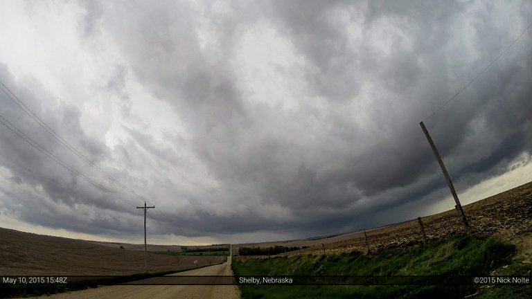
May 10, 2015 – Northern Iowa

May 10th was the last day of my 5 day mini chasecation and although there was an enhanced risk of severe weather along the Missouri River into Iowa, having to work the following day limited how long I could hang out in the target area. Nevertheless, it was on the way home and I may as well give it a shot. SPC had outlined two areas of enhanced risk, along the Missouri River from Sioux Falls through Iowa  and the southern target in Texas near the Dallas-Fort Worth Metroplex.

Read more
09 May

May 9, 2015 – Colorado & Kansas Tornadoes

Day three of a multi-day chase trip featured a mid-level trough that was rotating through the four corners region into the High Plains with a 70-80kt upper jet rounding the base as well. Morning convection made the situation messy for the day and it appeared that two target areas would develop later in the day. The first was in an upslope regime from the OK Panhandle into Colorado; the second along and south of the Red River. I had a bias towards the northern target because I was planning on returning home the following day and I didn’t really want to drive back to Texas after driving to Clinton, OK for the night.

Read more
08 May

May 8, 2015 – Texas

Day two of a multi-day chase trip began in Wichita Falls where I stayed the night before after a successful tornado intercept on the previous day near Sanger. Target for the day was southwest of Wichita Falls, so no one was in a rush to leave the hotel. Skip Talbot, Jennifer Brindley and Phil Bates were caravanning with Sean Casey and the TIV in Doghouse and we discussed the day’s prospects before going our separate ways. A cutoff low was still over California and expected to move a little east during the day while the southern branch of diffluent flow at 250mb was expected to move over the southern areas of the target area. A cold front extended from Iowa through Oklahoma and into the Texas Panhandle and into New Mexico where it was stationary.  A dryline intersected the front in New Mexico and was expected to mix eastward into Texas throughout the day. Outflow from the overnight MCS was expected to lift north through the day, possibly stalling out south of the Red River. That was the focus for severe weather as the air mass south of it was expected to become strongly unstable.

Read more
07 May

May 7, 2015 – Sanger, Texas Tornado

Thursday, May 7th was the start of a four day chase event starting in the Southern Plains and moving north each day into the Northern Plains on the 10th as a pretty deep 500mb trough was making it’s way onshore from the Pacific through the four corners region and into the Dakotas. Each day would present itself with a severe weather opportunity. The first day being focused along the Red River area along the Oklahoma/Texas border as well as further upslope in the SW KS/OK Panhandle areas where dryline intersected a cold front. Overnight convection was still ongoing across southern and eastern Oklahoma at daybreak and while upper level energy was still quite a ways west, I felt that the outflow from the overnight MCS might be the focus area for the day and set my target for Wichita Falls.

Read more