| 0 | 1.00" | 70 | 647 |
|---|---|---|---|
| TORNADOES | HAIL | WIND | MILES |
This will be a short entry as I was hoping to parlay the previous day’s success into back to back days, but this would end up just being a frustrating grunge chase a lot further south than I ever intended to travel. As far as the forecast, a low in Southeast Colorado was expected to develop into the Texas Panhandle through the day while a dryline extended south and an outflow boundary was supposed to settle somewhere in Southern Kansas.
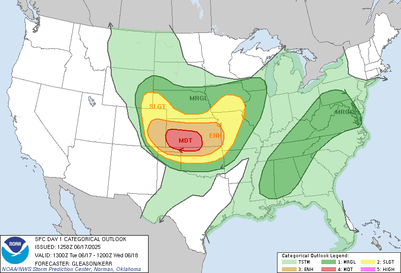
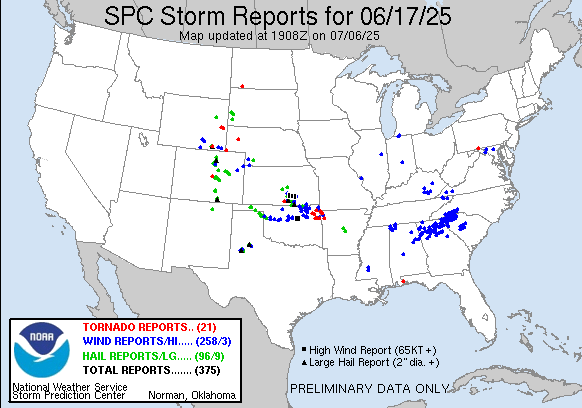
SPC had a moderate risk in place across Southwestern Kansas. I was hoping the boundary would hang out further north near Scott City or so, but as the day wore on I ended up further and further south. I took off from Colby a bit after 16z and actually messed around with some of the early day convection that was going on west of there.
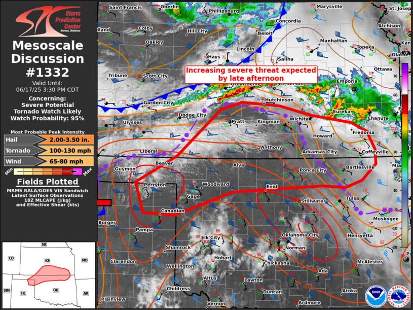
Eventually, I began the trek south and as I passed through Garden City, the SPC issued a mesoscale discussion for severe weather later in the afternoon from the northeast Texas Panhandle towards the tail end of the ongoing storms near Great Bend. With the front continuing to sag southward I knew I was going to have to keep going. Eventually I ended up in the friggen Oklahoma Panhandle just a few miles northwest of Booker, TX when I got on the first storm.
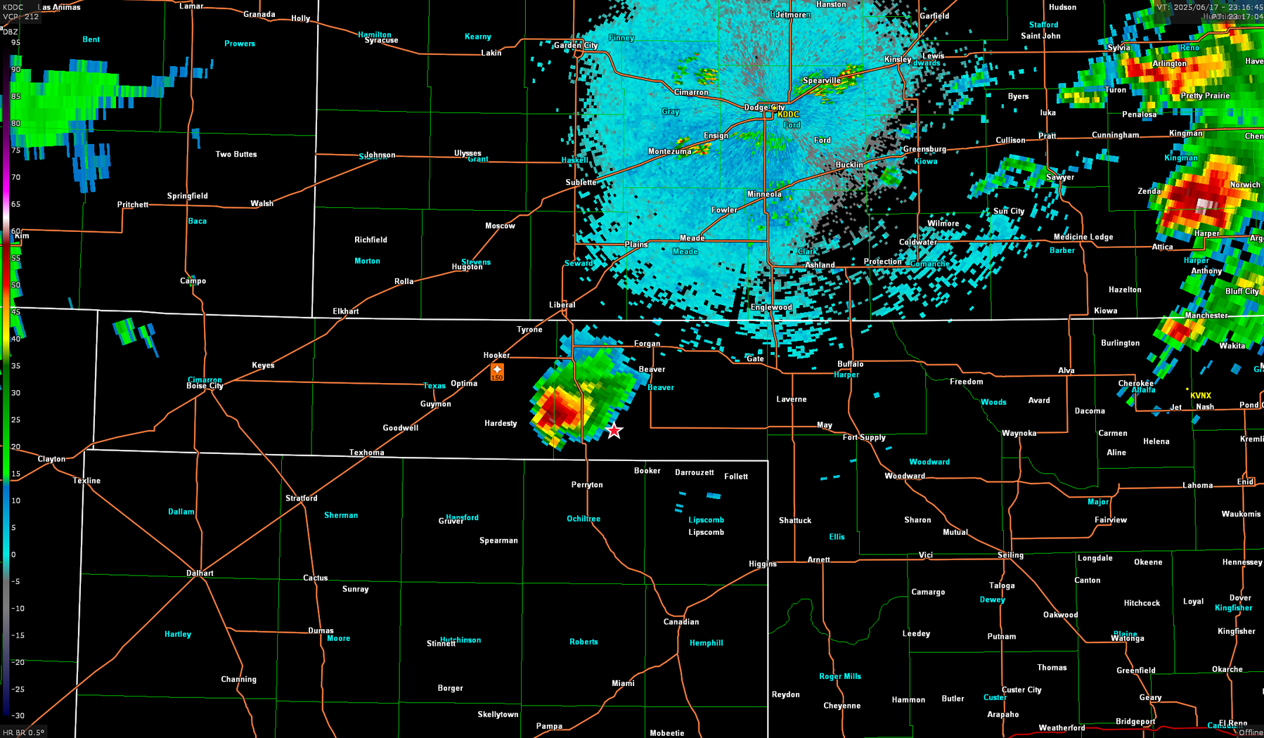
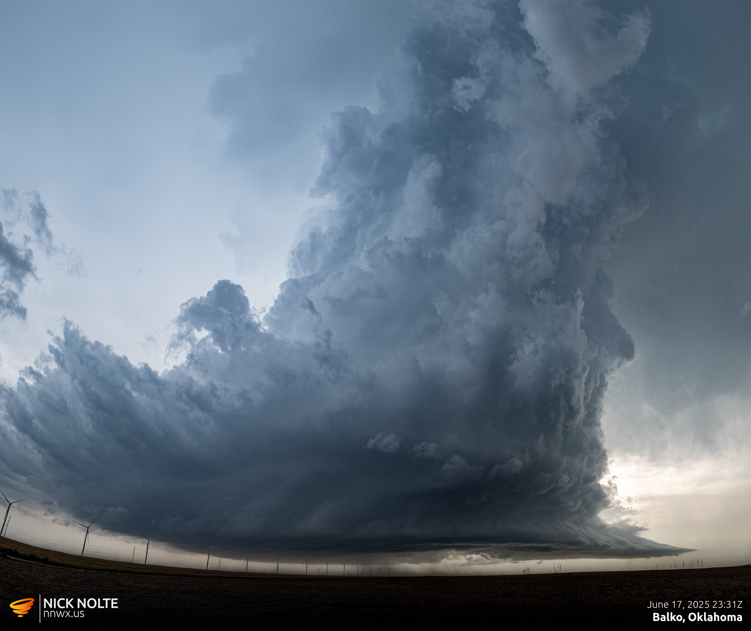
There were periods where the storm exhibited some crazy inflow and at one point even though it was buried in grunge there was a beefy inflow tail streaming into the storm.
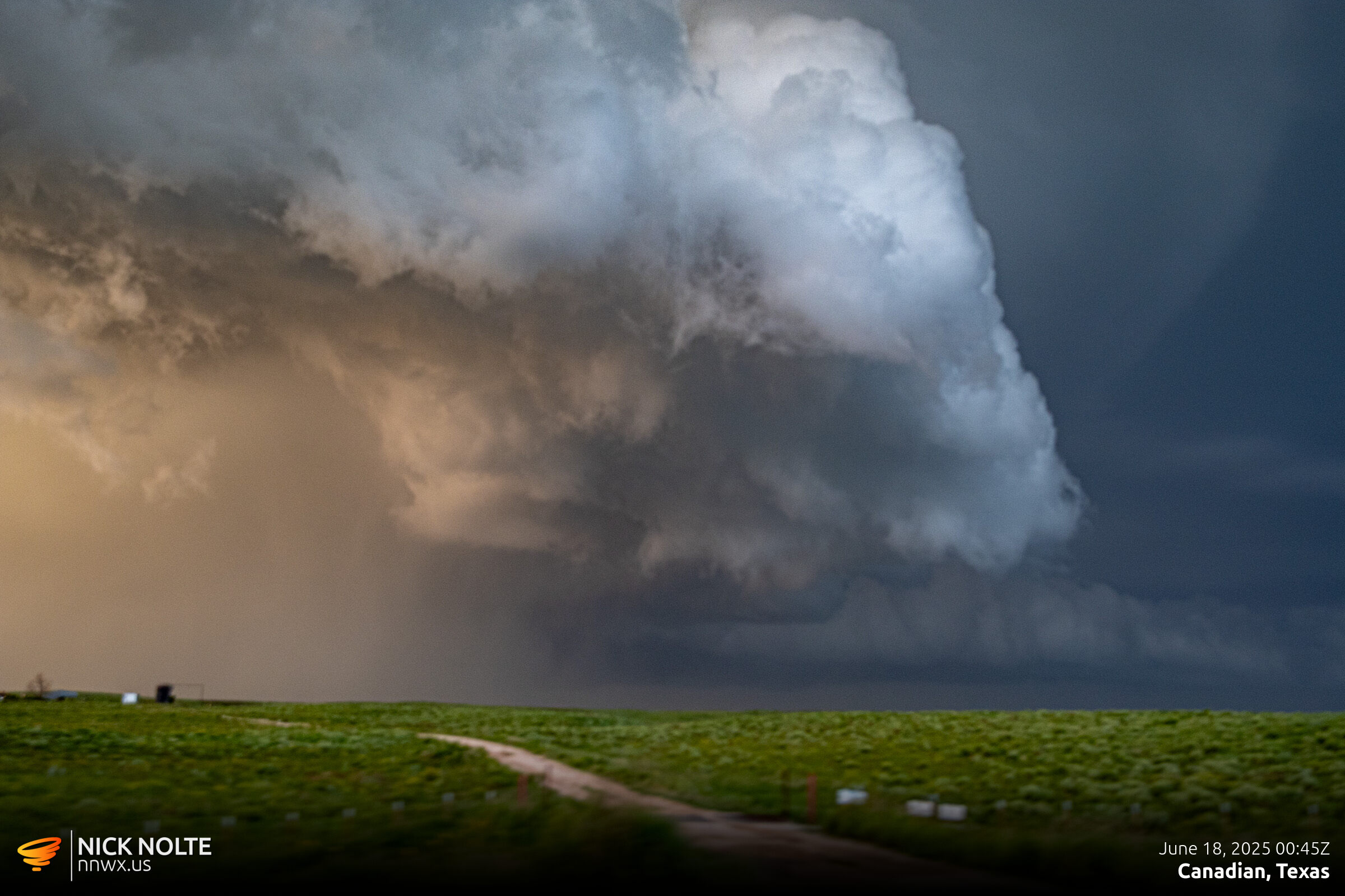
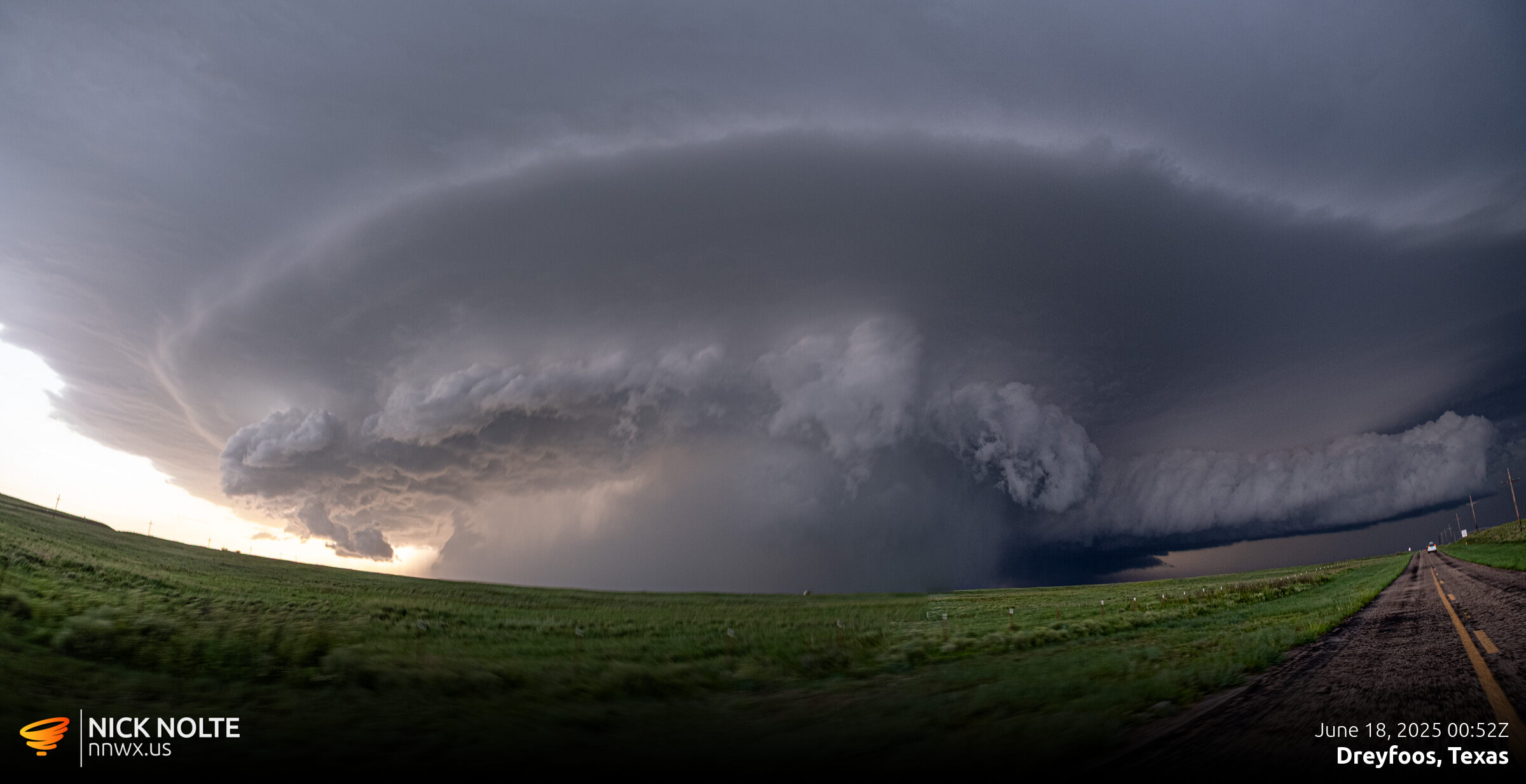
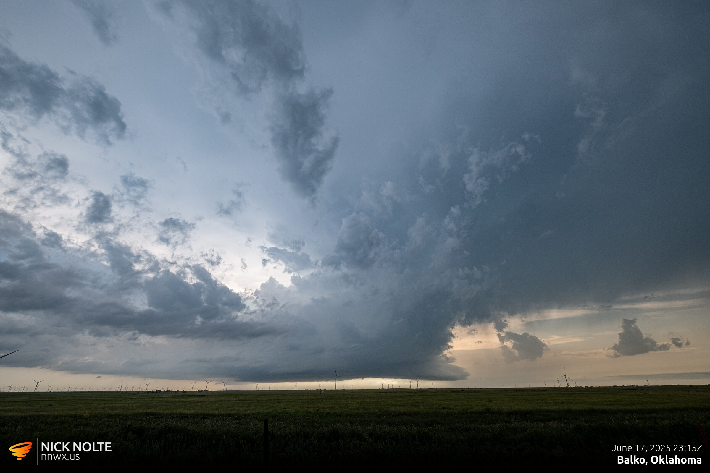
This was as good as it got for me. I tried to get in front of this storm but ended up in the rain and with no visibility as the sunset, as soon as I was clear of the FFD I called the chase and headed to Dodge City for the night.
Chase Recap
| START | END | DURATION |
|---|---|---|
| Colby, KS @ 17/1528Z | Dodge City, KS @ 18/0438Z | 13 hours, 10 minutes |
| INTERCEPTS | CHASER ENCOUNTERS |
|---|---|
| None | None |