| 0 | 1.75" | 70 | 822 |
|---|---|---|---|
| TORNADOES | HAIL | WIND | MILES |
June 15th was the second day of a 4-day trip that ended up stretching from Central Montana to the Texas Panhandle. The previous day was a chase along the I-25 corridor between Wheatland and Sheridan as I watched a couple storms develop off the foothills, but ultimately not doing much. I spent the night in Sheridan and planned to chase somewhere in Central Montana this day.
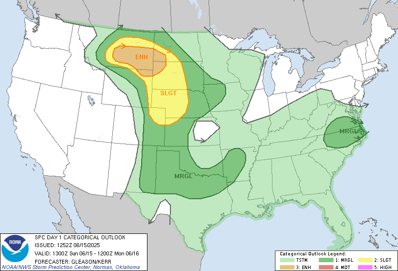
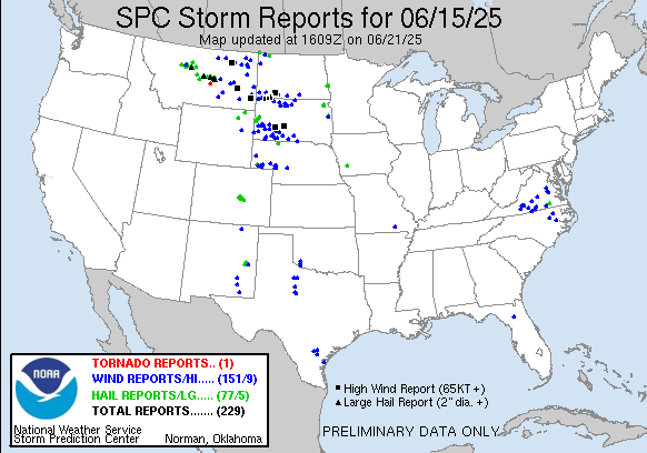
SPC had outlined a large enhanced risk area across Central and Eastern Montana for wind and hail, while a 2% tornado risk also existed in the enhanced and down along the dryline into Colorado. A shortwave was forecast to translate across the Northern Rockies that would kick off storms on the higher terrain which would migrate east into rather buoyant atmosphere featuring MLCAPE values over 2,000 in Montana. My forecast for the day looked like Lewistown or maybe west of there. This would be the farthest I’ve ever chased into Montana. Previously the furthest I’d been on a chase in Montana was along the Glendive to Broadus corridor.
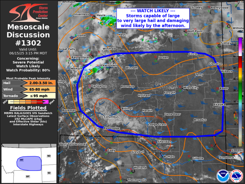
Anyway, I took off from Sheridan a little after 14z and began the long trek north towards Lewiston. I took a little sightseeing tour while in Billings, exploring the road along the cliffs north of town near the airport. Pretty cool scenery. As I rolled into Lewistown around 19z a mesoscale discussion was issued for most of Central Montana as storms had initiated west of Lewistown near Stanford.
Felt good to be on my first chase deep in Montana and get initiation where I was. I meandered west out of Lewistown to get on the storm and see what was happenin.
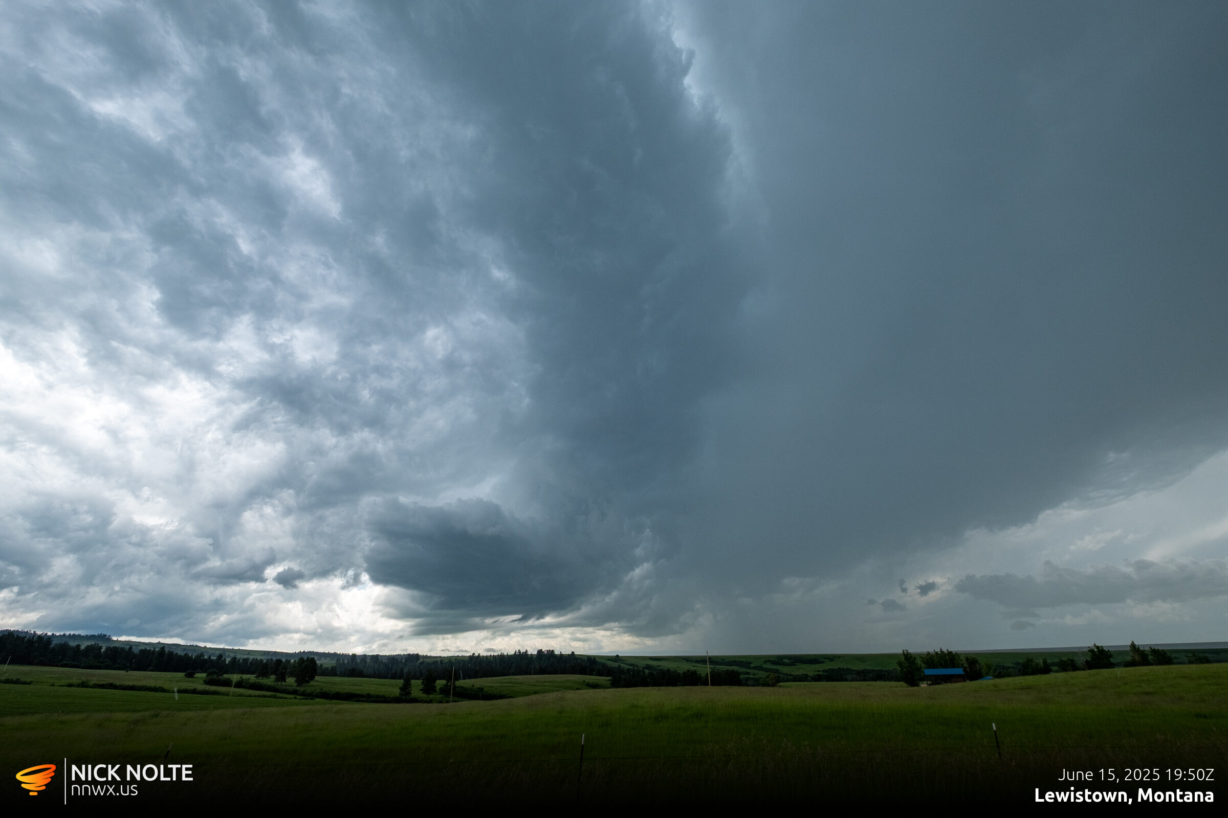
As the storms mostly stayed rooted in place, I ventured deep into the wilderness north of Moccasin to keep up with the strongest cells.
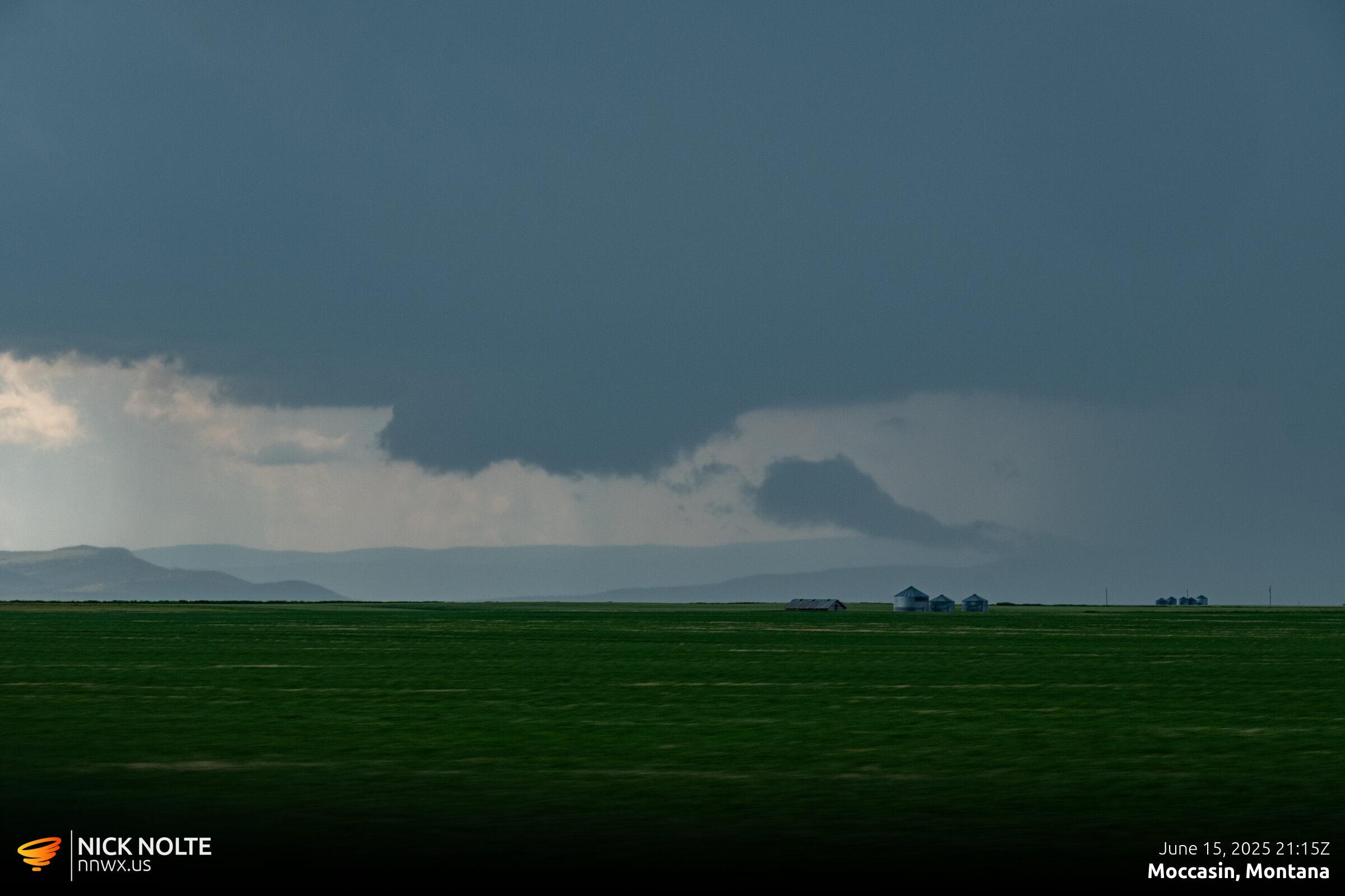
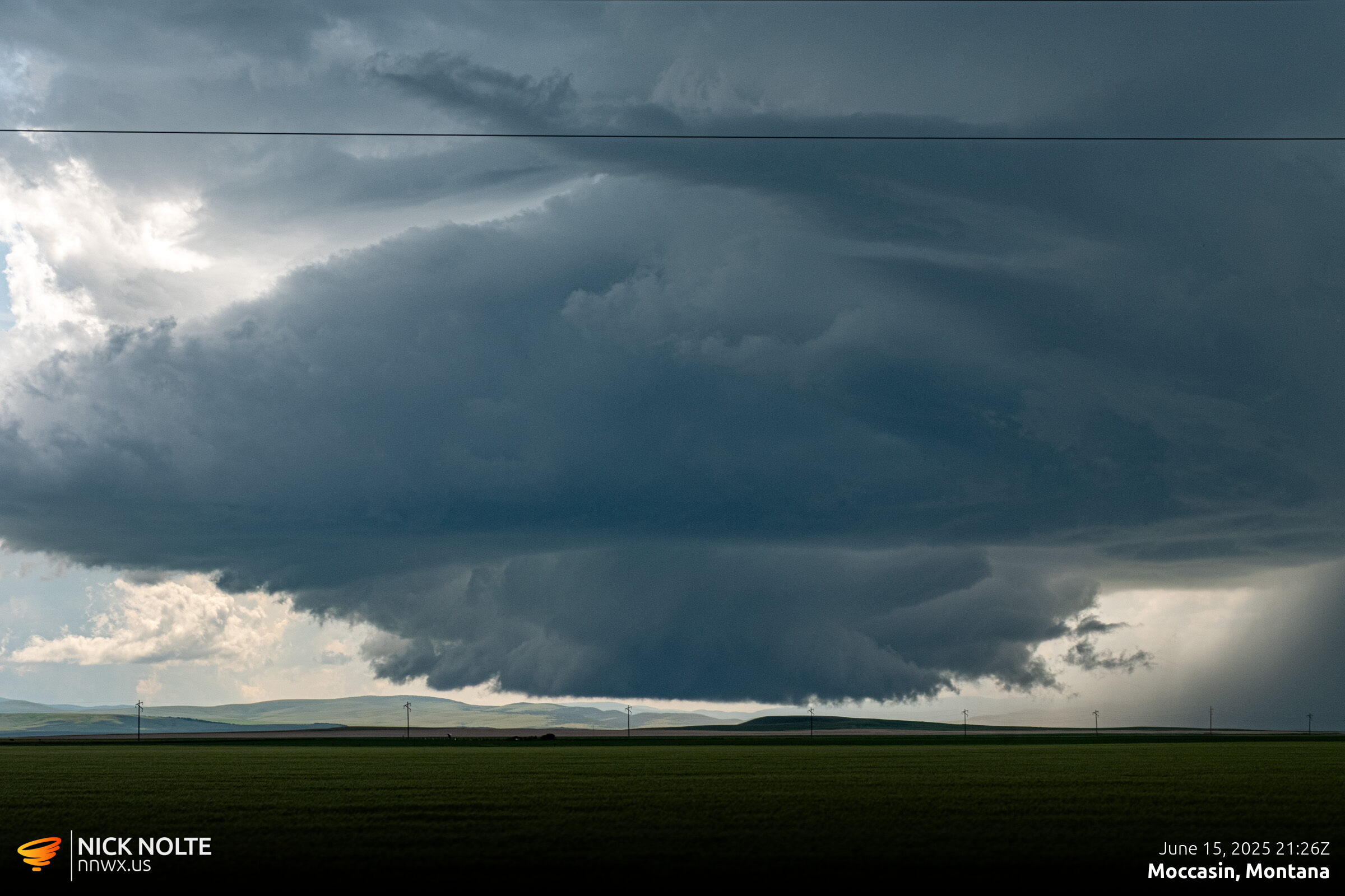
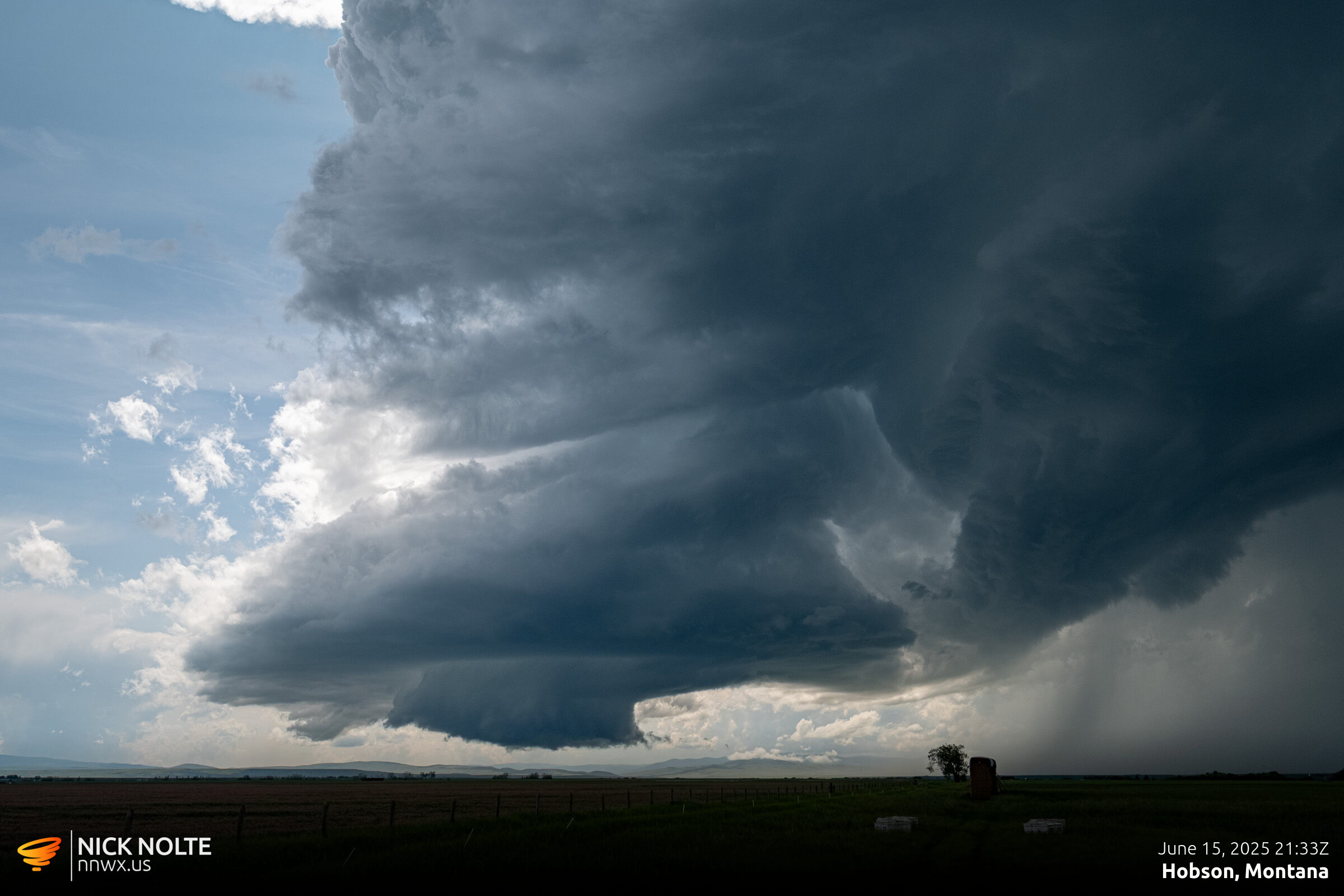
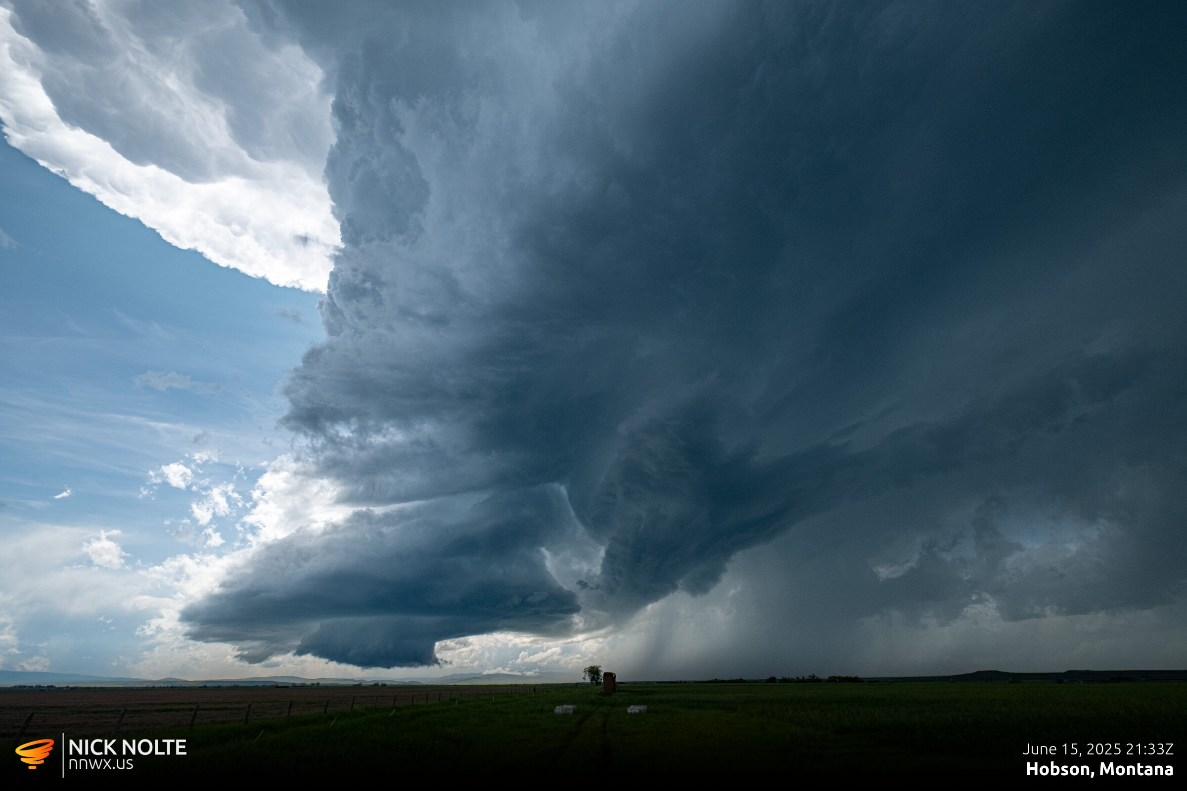
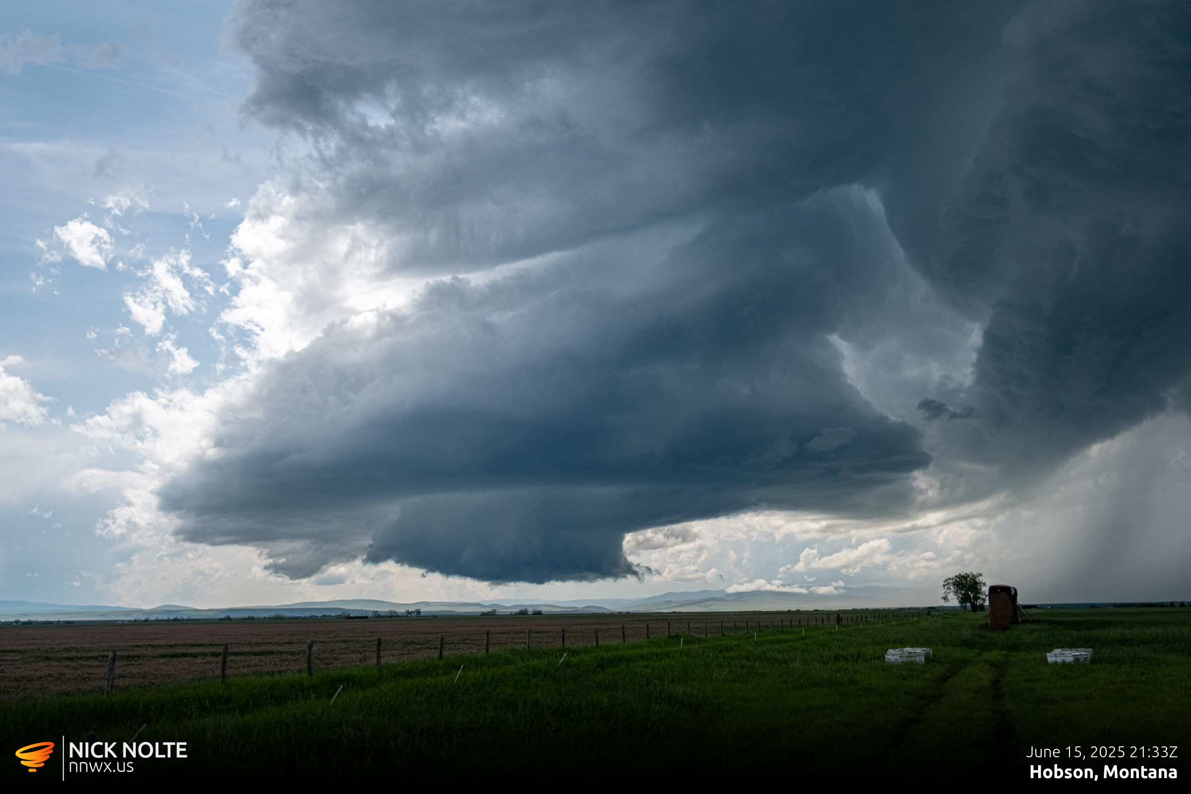
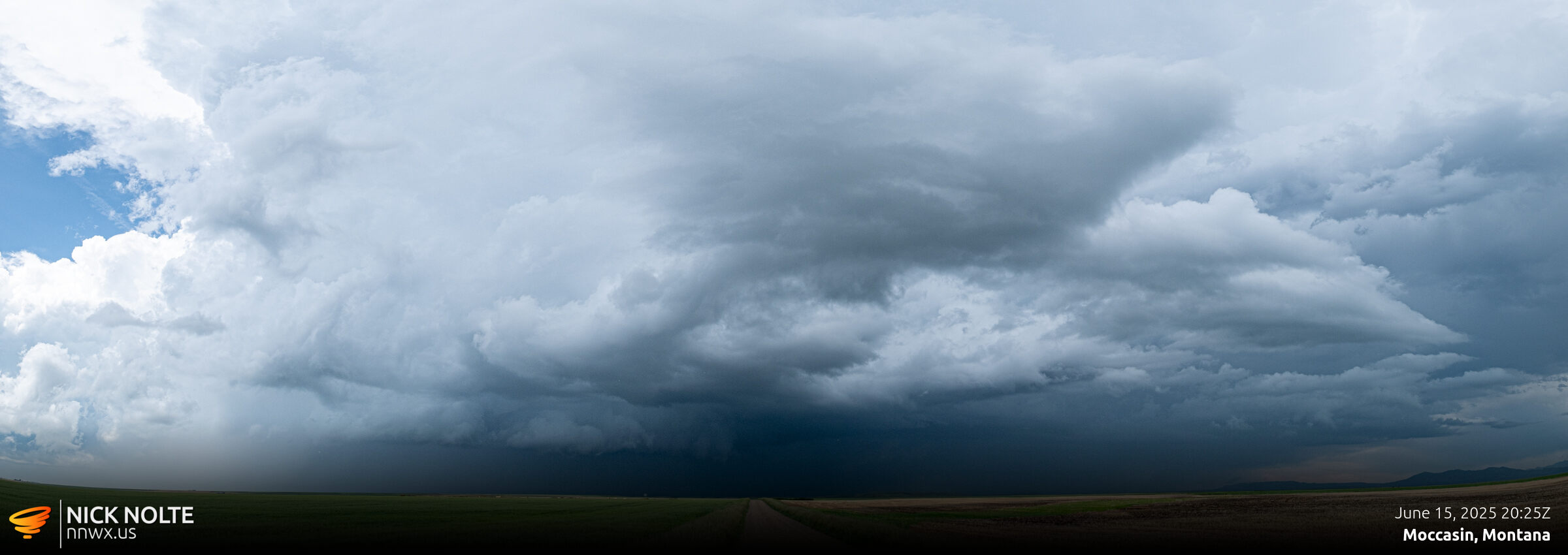
As the storms continued east beyond Lewiston they continued to develop as they moved into juicier air. Visibility was amazing, as it tends to be in the high plains. The storm continued to exhibit some great storm structure, complete with a wall cloud.
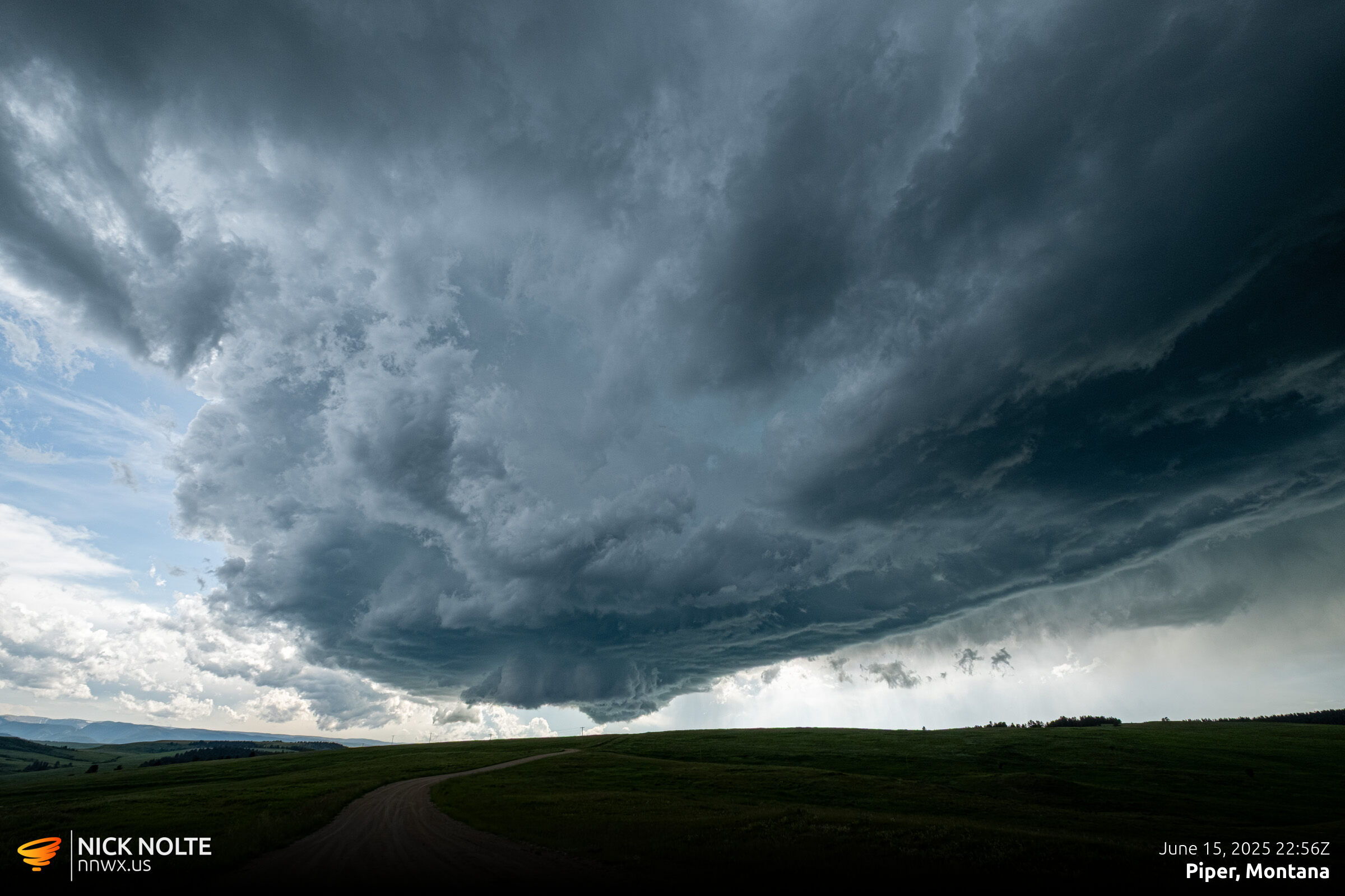
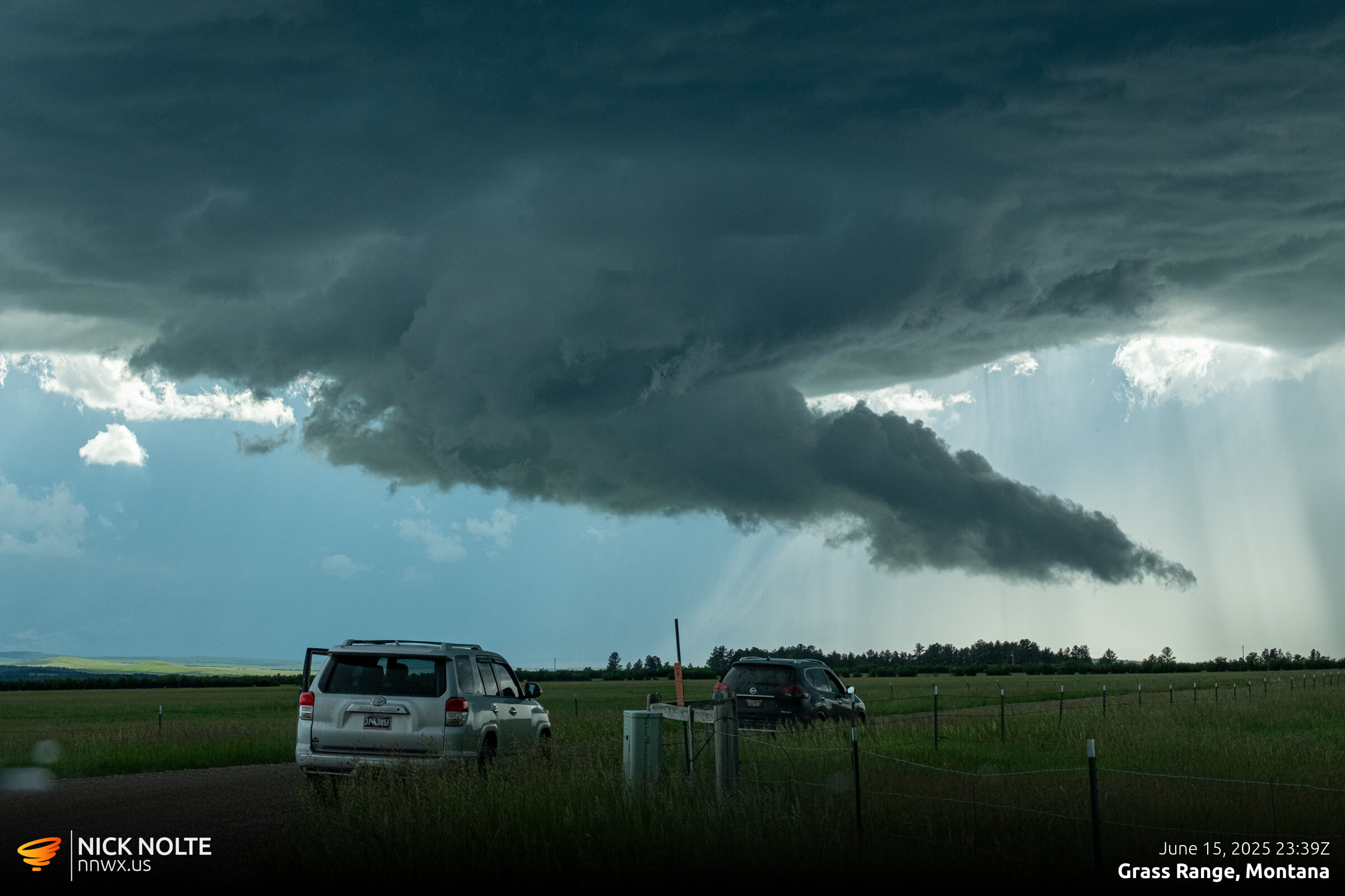
Roads started to get a little tricky as the only roads were mainly the highways, but I did manage to track along a road that paralleled US 87 as I approached Grass Range.
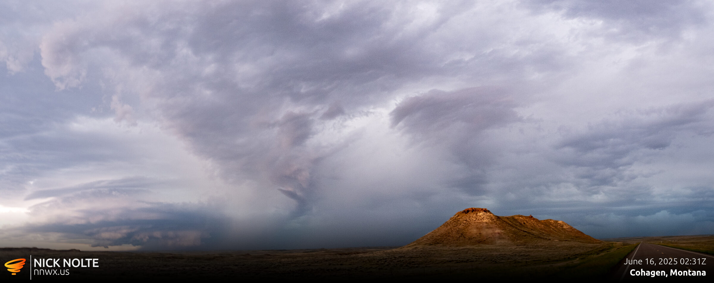
As this storm progressed east, the structure started to disappear and the storm began to weaken. I started to call the chase and head somewhere east and south knowing I’d need to be in South Dakota or Nebraska the following day. The timing of my driving worked out that I would actually intercept a nice cell after sunset southeast of Jordan as I traveled down highway 59 towards Miles City.
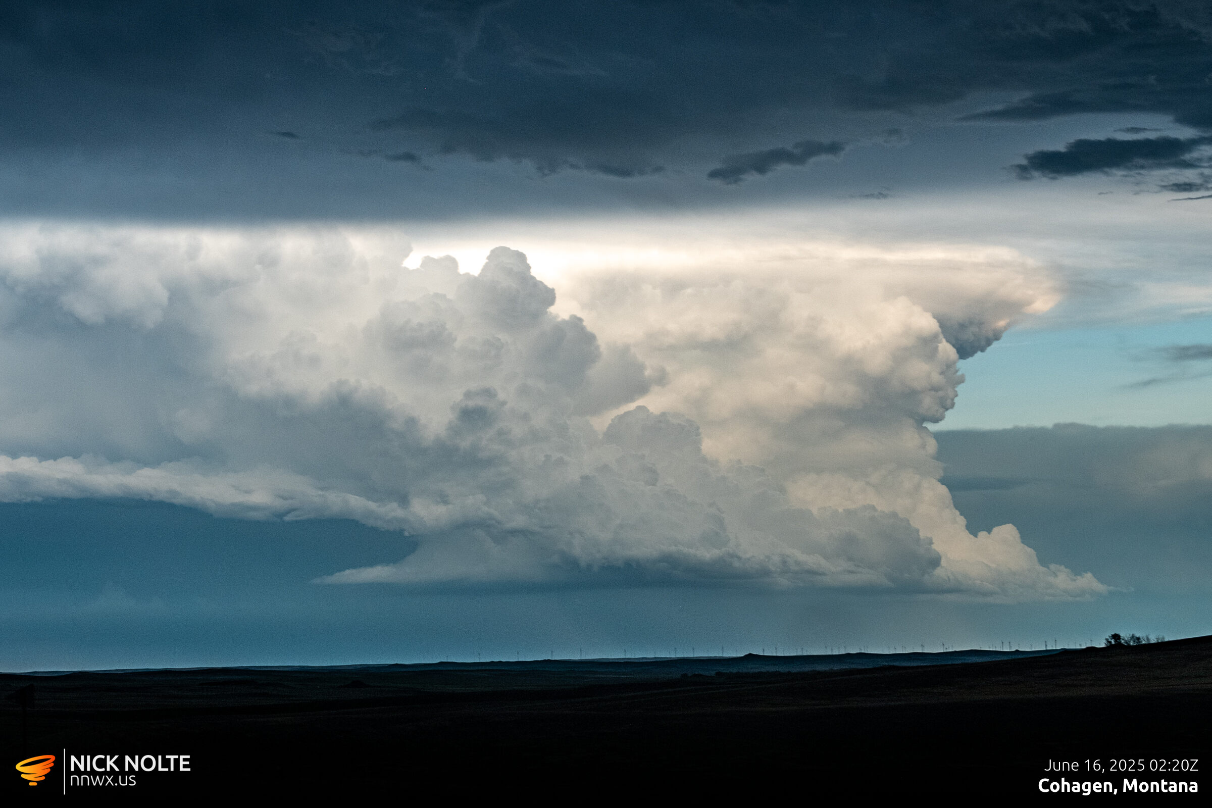
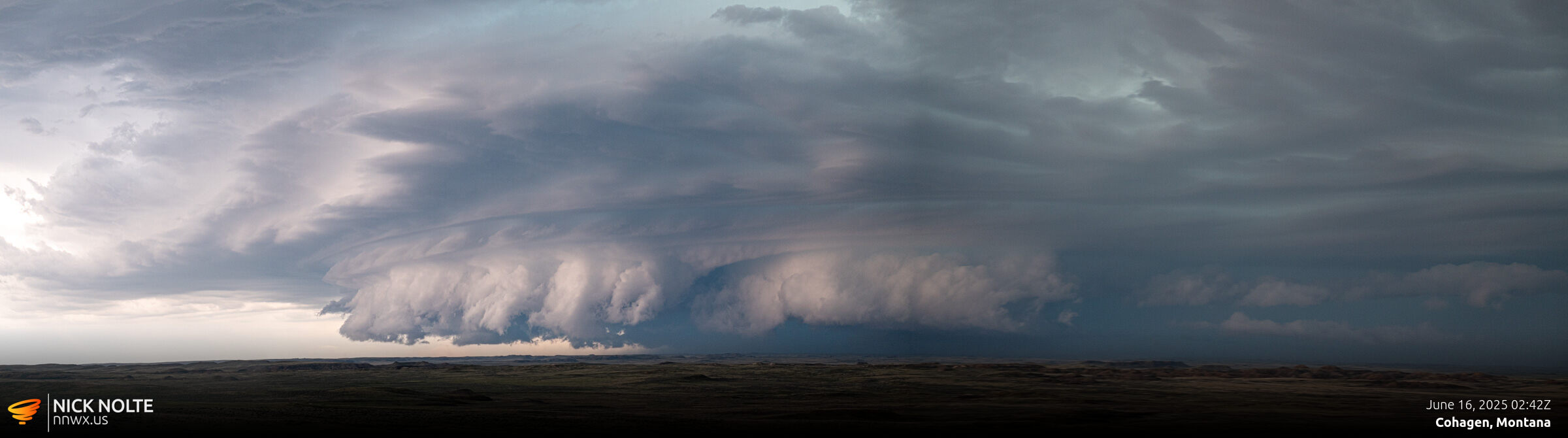
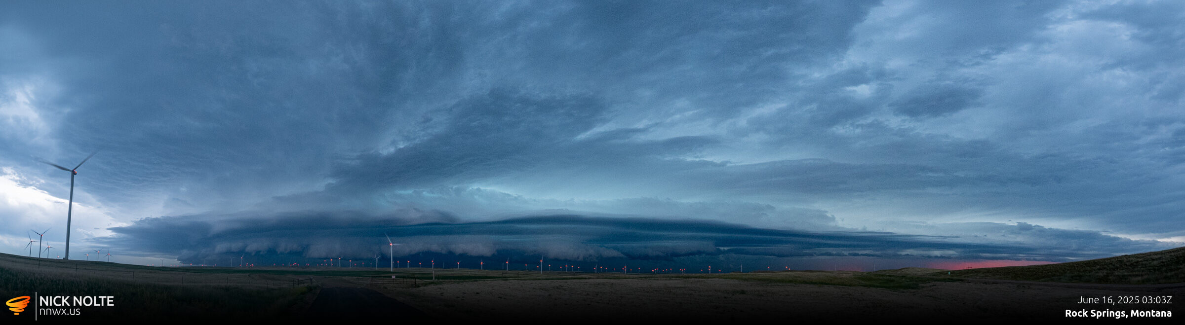
I was able to watch this storm for quite a while as I sauntered down highway 58, in no particular rush.
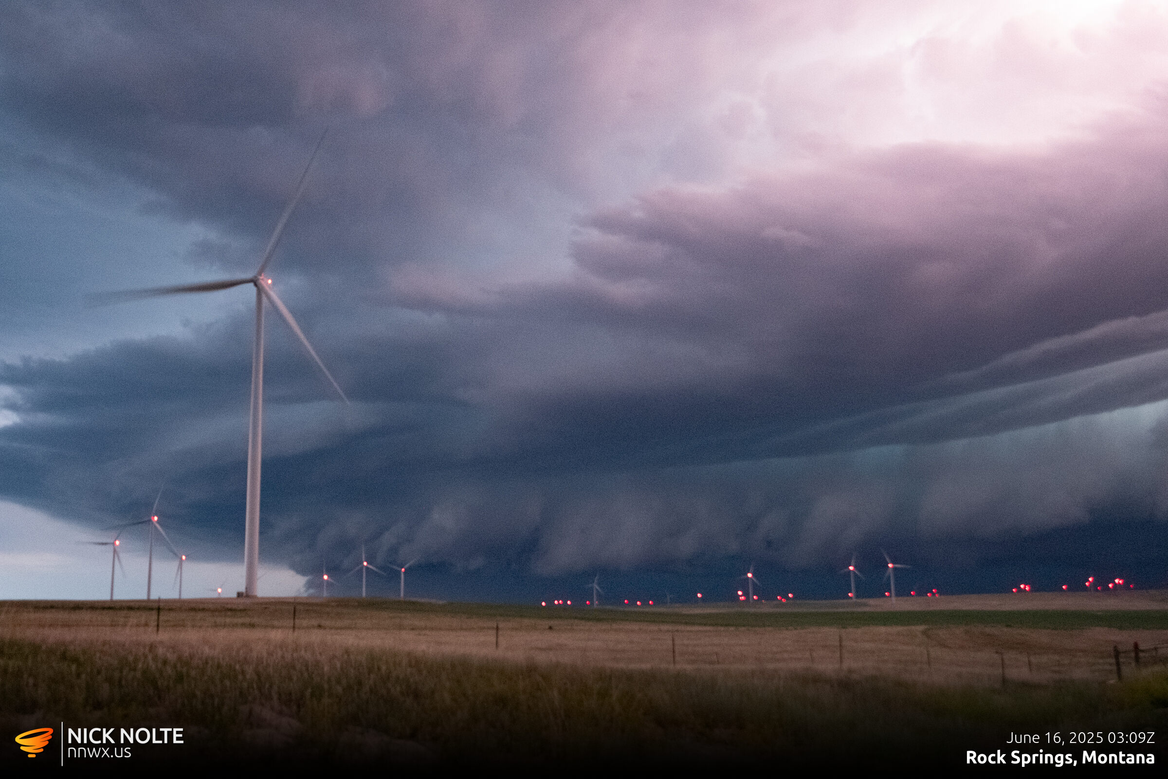
Eventually I called the chase a bit after 3z and began the trek to Spearfish where I would stay the night in preparation for the following day.
Chase Recap
| START | END | DURATION |
|---|---|---|
| Sheridan, WY @ 15/1420Z | Spearfish, SD @ 16/0653Z | 16 hours, 33 minutes |
| INTERCEPTS | CHASER ENCOUNTERS |
|---|---|
| None | None |