| 2 | 1.75" | 70 | 618 |
|---|---|---|---|
| TORNADOES | HAIL | WIND | MILES |
April 27th was a day before the day scenario. A surface low was located in southeastern Wyoming in the morning with a dryline extending south through Nebraska, Kansas, Oklahoma, and Texas. That surface low was supposed to deepen as it translated east northeast through the day. It looked like playing the area of the dryline that bent back into the low could be a good target, models were not having it with a plethora of solutions not even showing convection.
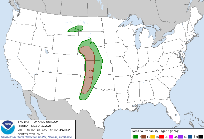
That scenario seemed unlikely and I felt we’d at least get a storm or two on the northern target from Northwest Kansas into the Nebraska Panhandle. SPC was even more optimistic with a 5% tornado risk stretching from the triple point all the way through the Texas Panhandle, but the further south you went, the more conditional the threat.
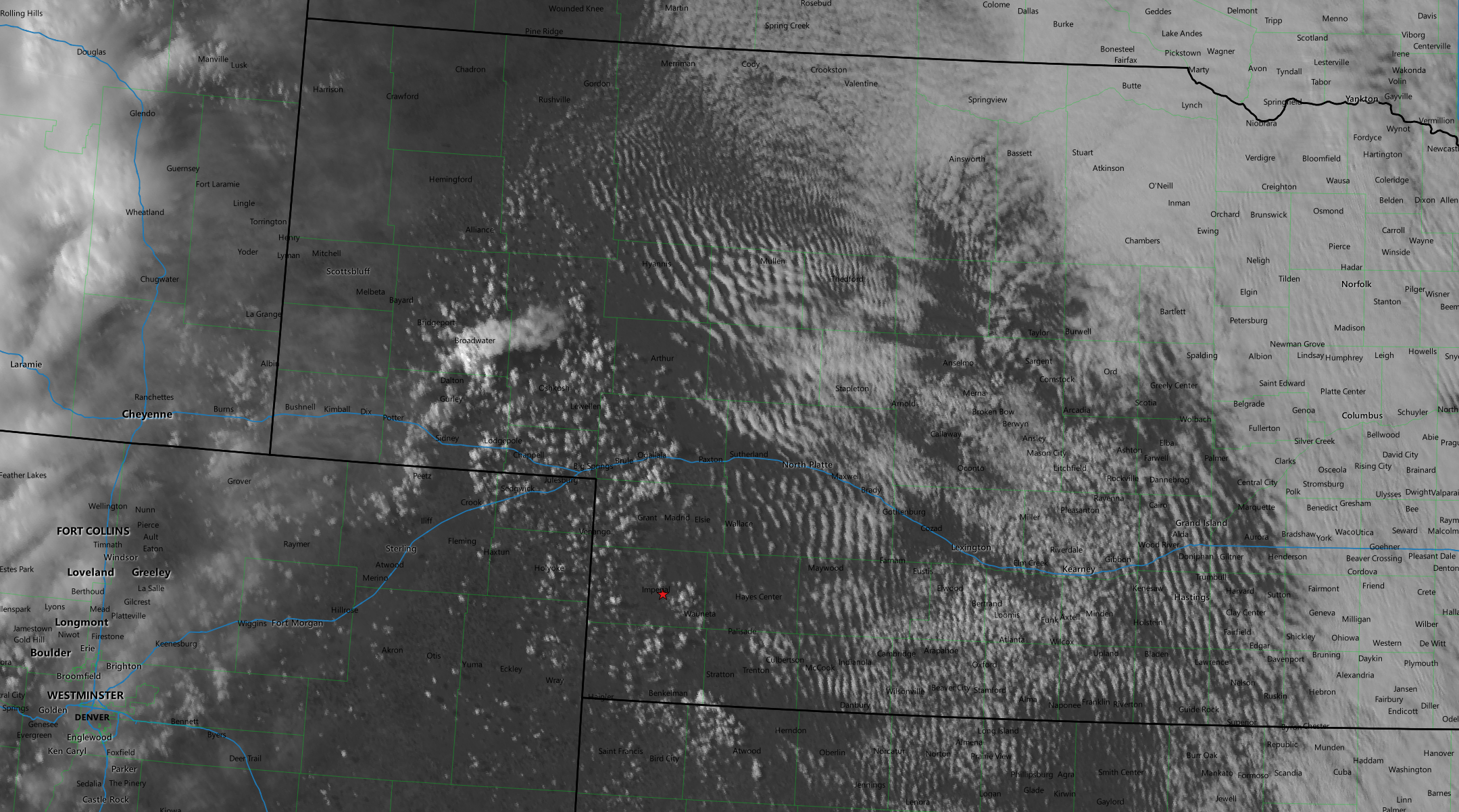
My original plan was to head to North Platte and re-evaluate as I was expecting the area along the highway 61 corridor between Ogallala and Imperial to be the area with the best dryline convergence. I took off from Grand Island at 17z and as I approached Lexington, based on satellite I opted to begin drifting south and adjusted my target to McCook at which point I could make the decision to migrate northwest towards Imperial or southwest into NW Kansas.
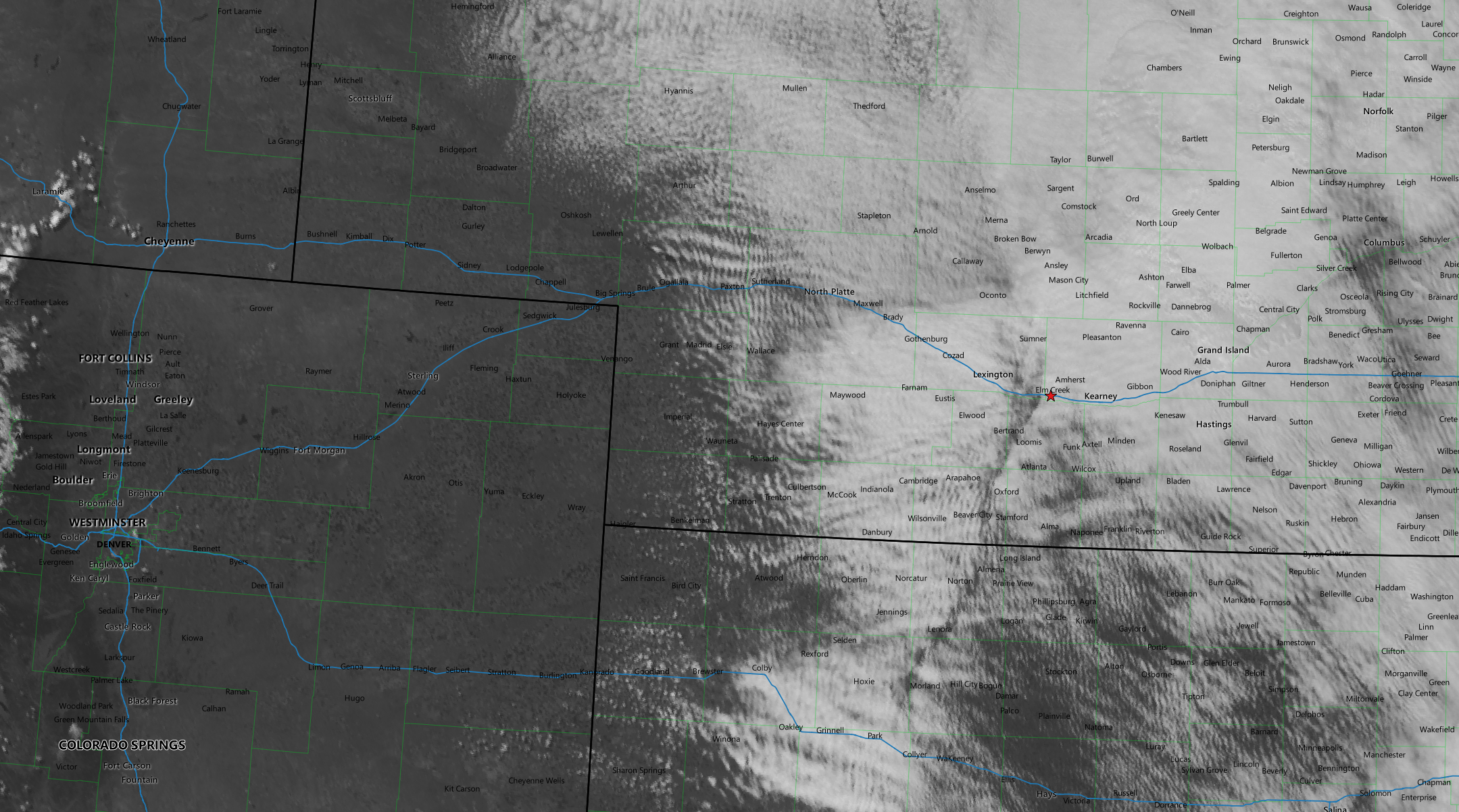
I was interested in the cumulus fields starting to form around Wauneta and Goodland. I arrived in McCook just before 20z and noticed a larger area of deeper cumulus forming south of Sidney. It looked like that was going to be a prime area soon, but I decided to hold out just a little longer to see if the southern target would pop.
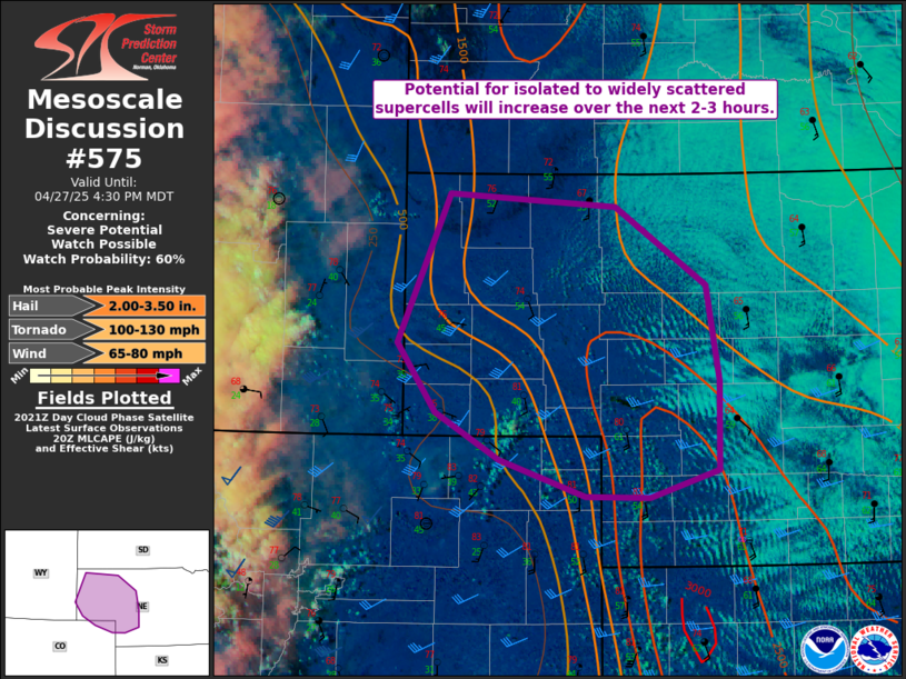
SPC issued a mesoscale discussion shortly after highlighting the area surrounding the building cumulus field I noted earlier. I decided if the cumulus fields in southern Nebraska and NW Kansas didn’t go within the next 30 minutes I was start heading north.
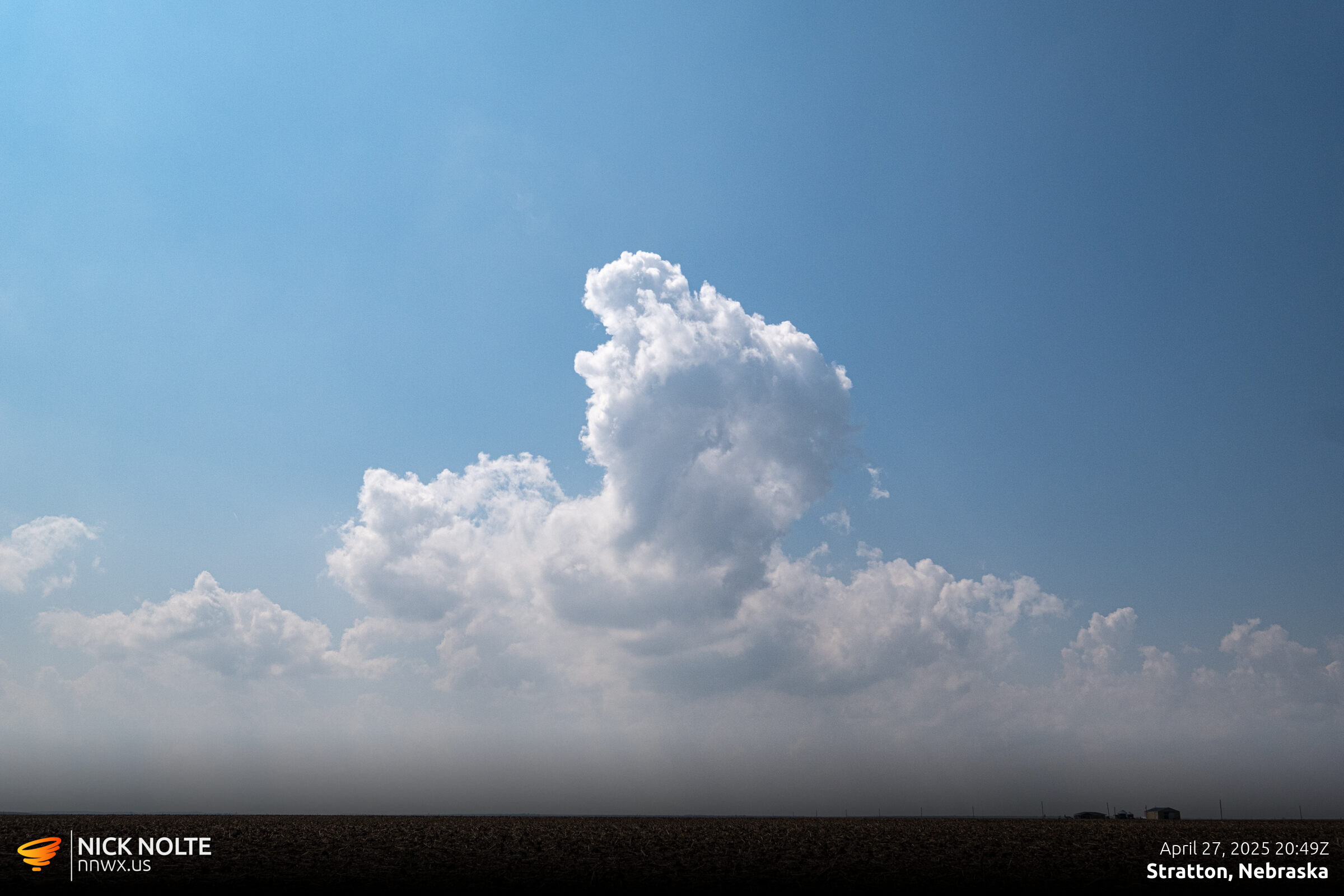
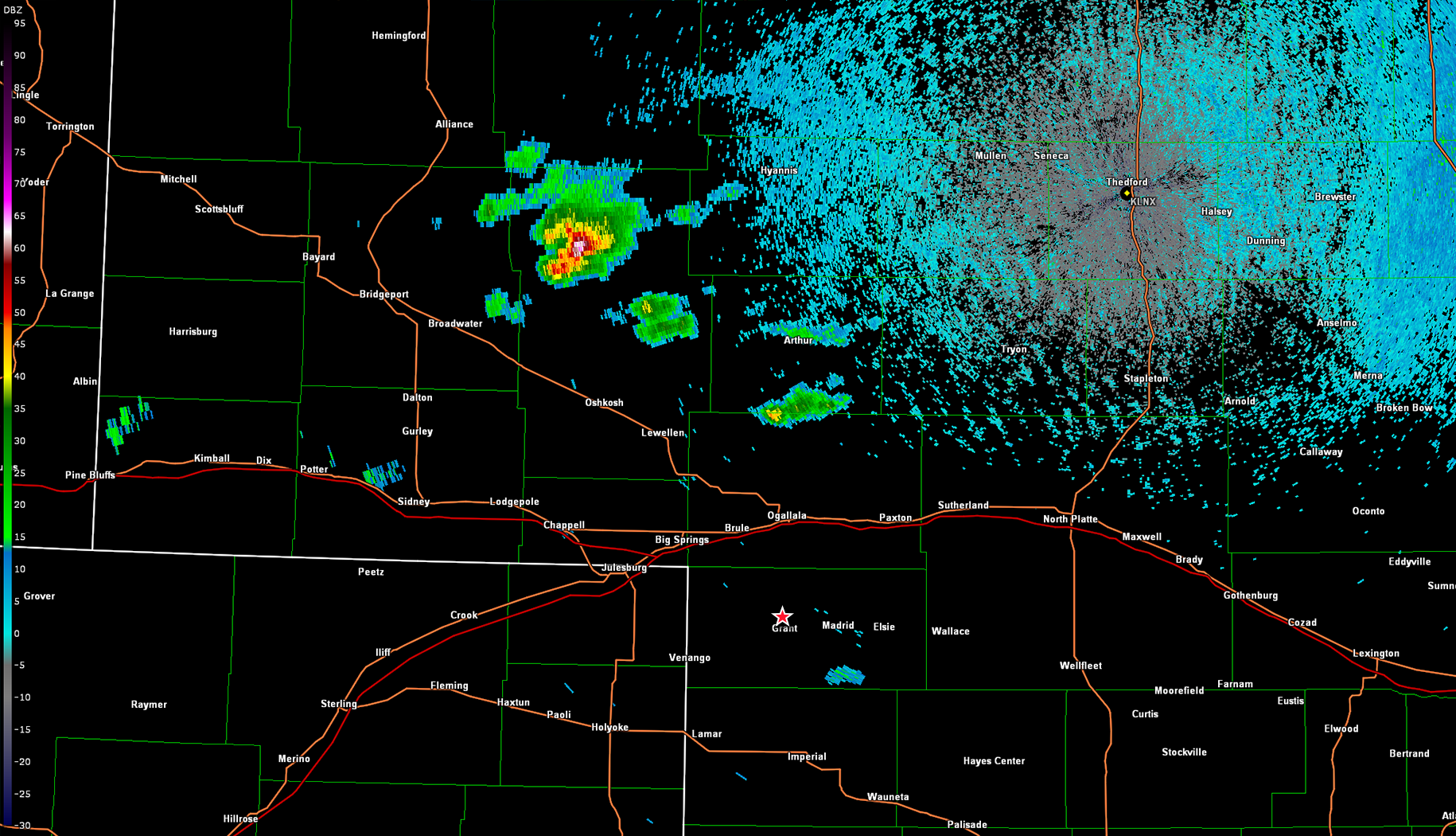
There were a few attempts west of Stratton that tried to get going but the updraft continued to get choked off before the storm could flourish. As the deadline rolled around it became apparent the northern field was going to go up quick so I started the trek north, it would take me about an hour to get up there.
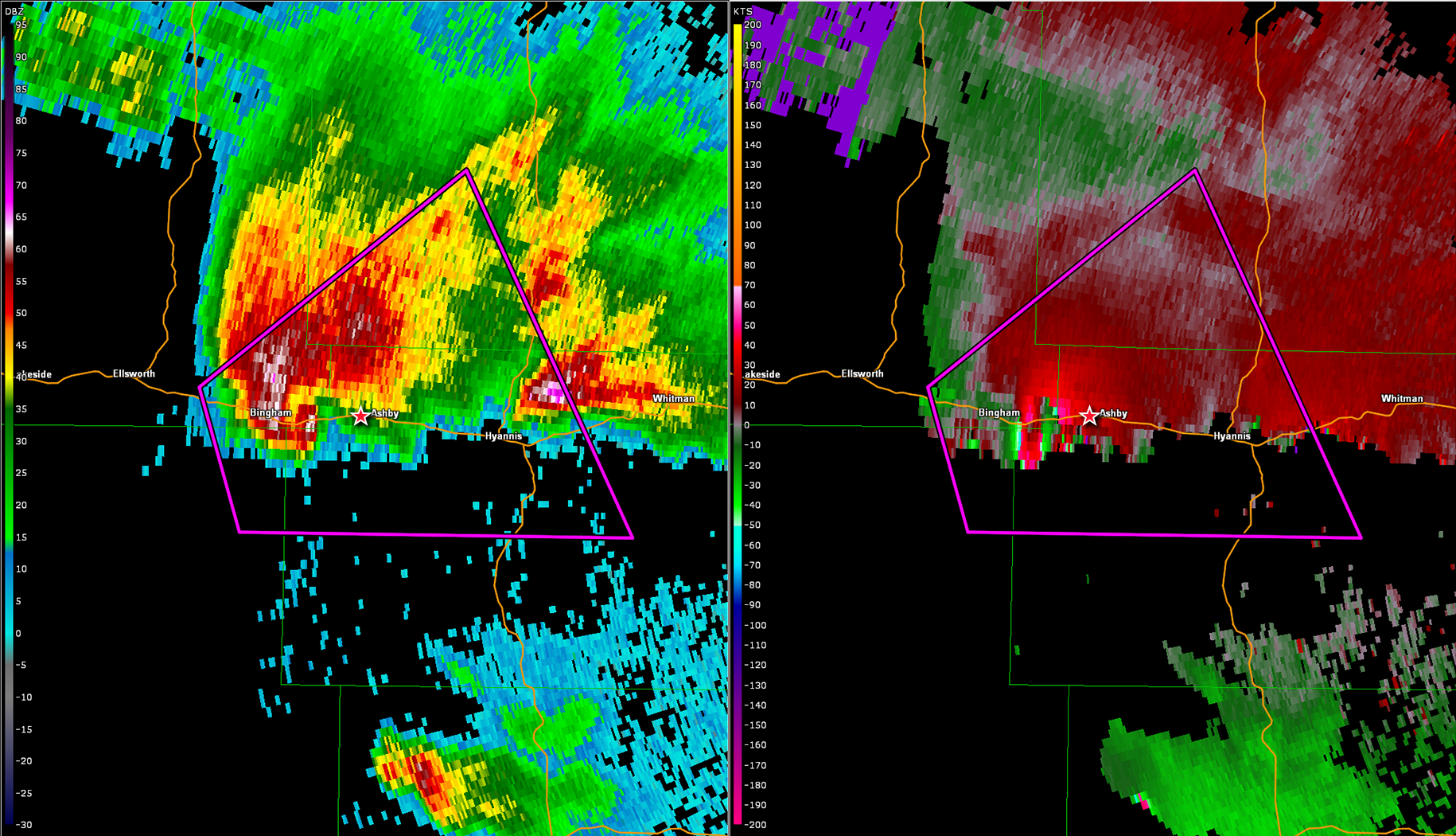
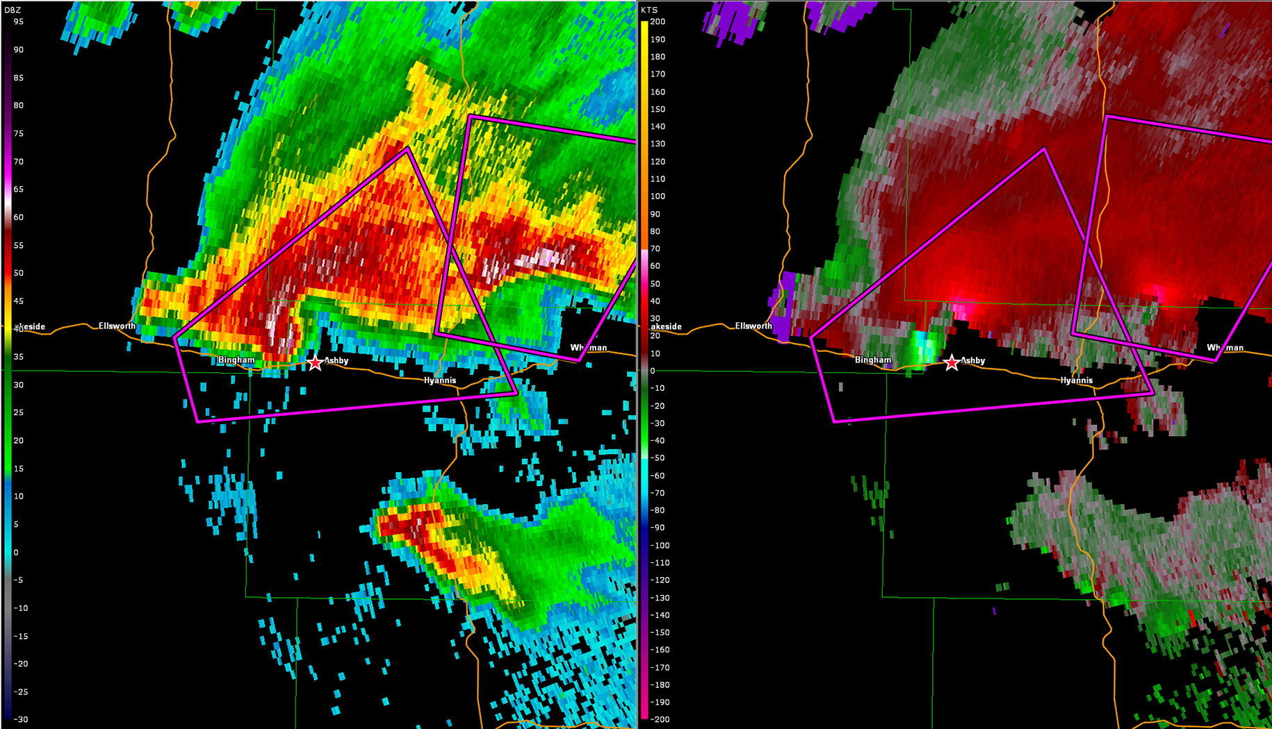
At this point the storm had initiated in the panhandle northeast of Sidney and at this point I was playing catch up. At 22z, the tornado watch was issued for the area and I was passing through Imperial on the way north. At 2230z the storm really ramped up, and I was closing in but still about 30 minutes out, so hopefully the storm would wait for me.
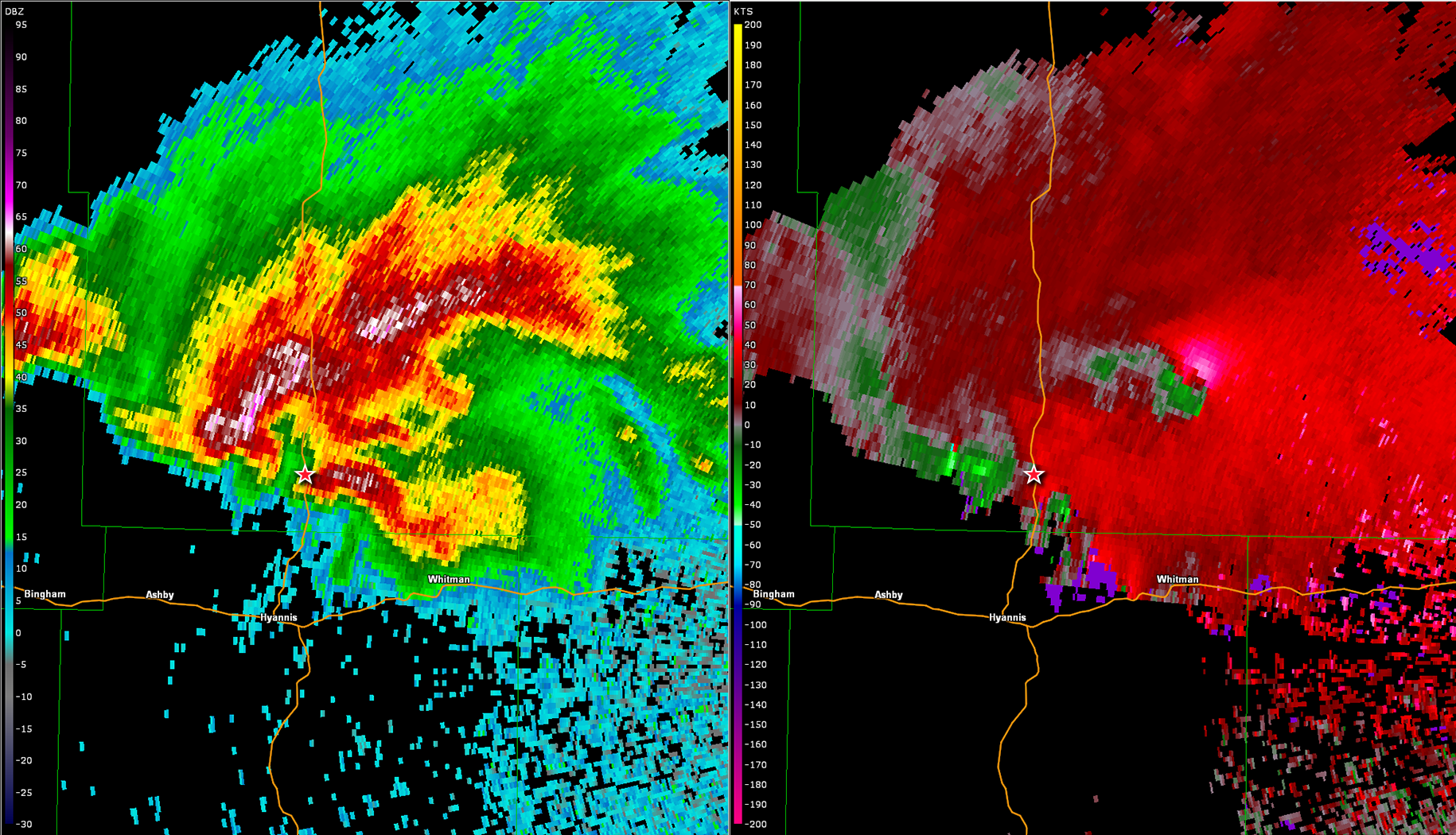
At 2247z the storm went tornado warned and I was just passing through Ogallala so I was well behind the storm. At this point you can’t do anything but just continue and hope you get there in time. While I was driving north on highway 61, the storm continued to organize ingesting cells that were developing along the flanks and the first tornado report came in around 2342z just as I was rolling up on it.
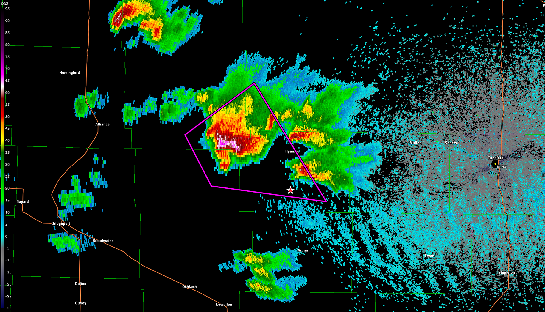
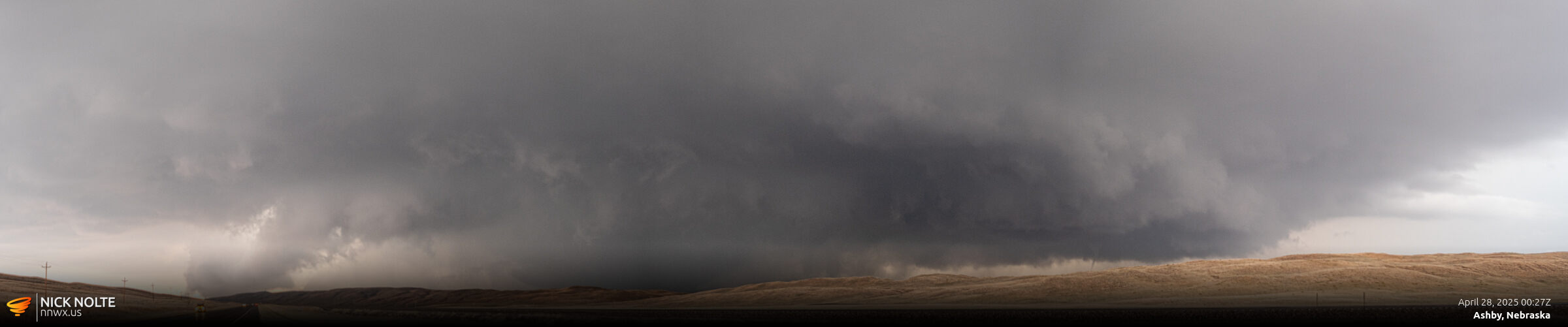
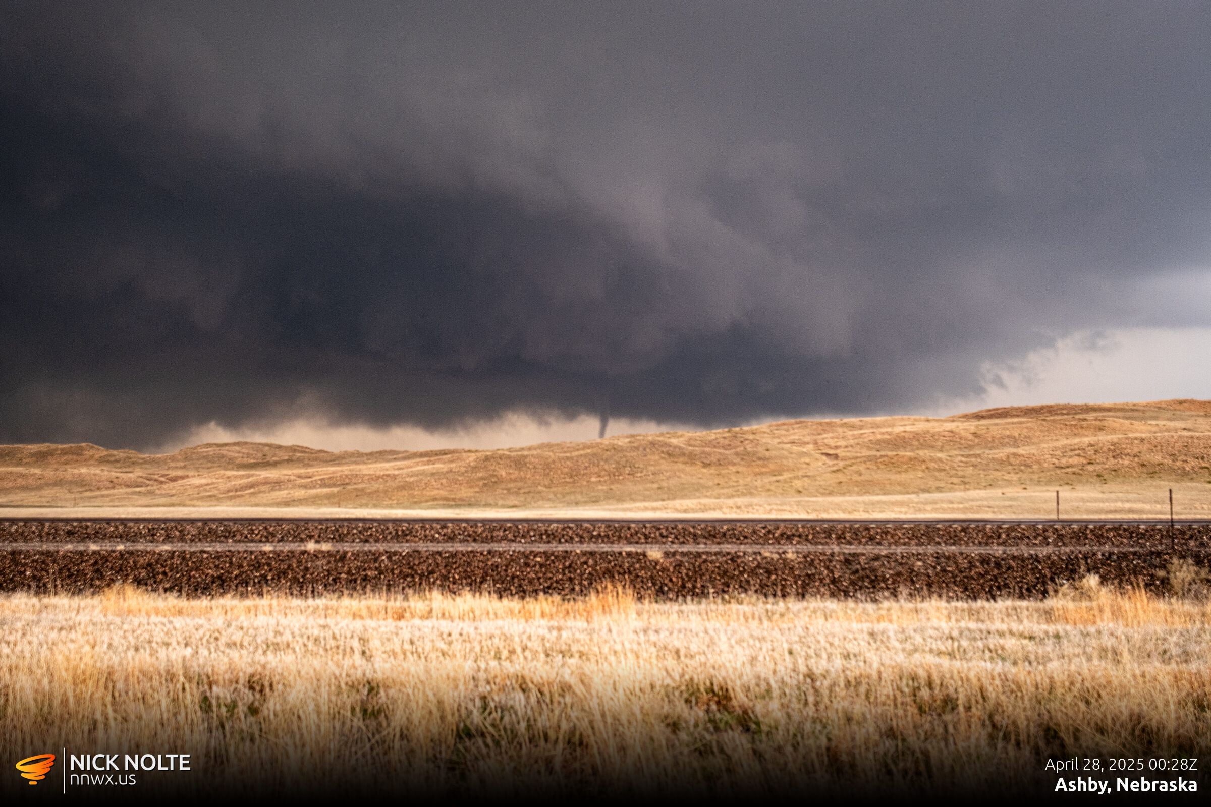
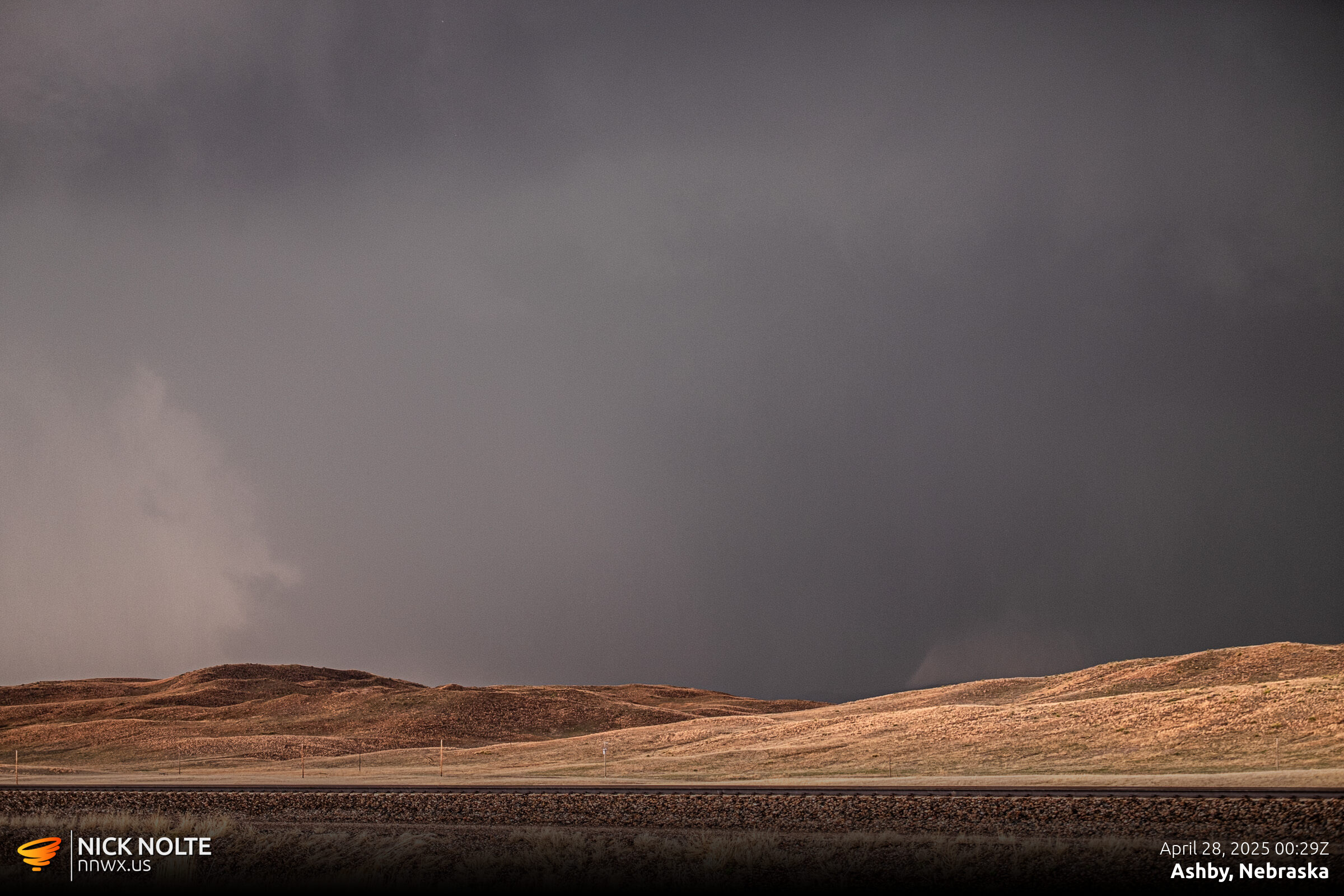
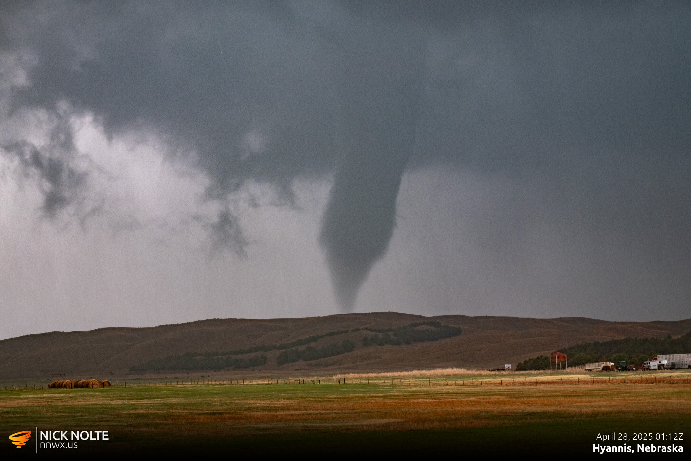
Eventually I was able to head west on highway 2 as the storm was over the highway and since it was moving relatively slowly I was able to get close and find a wedge in progress west of Ashby.
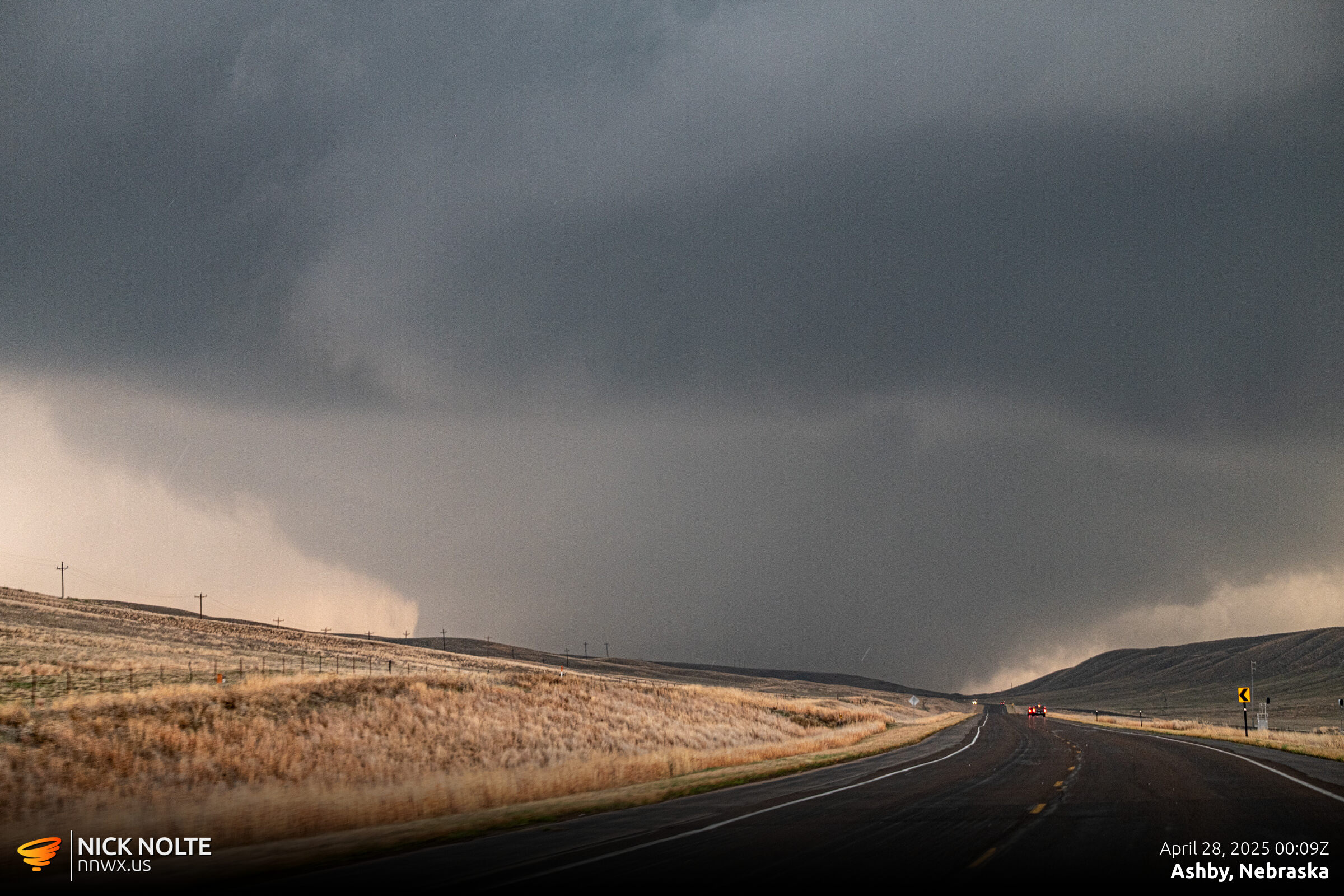
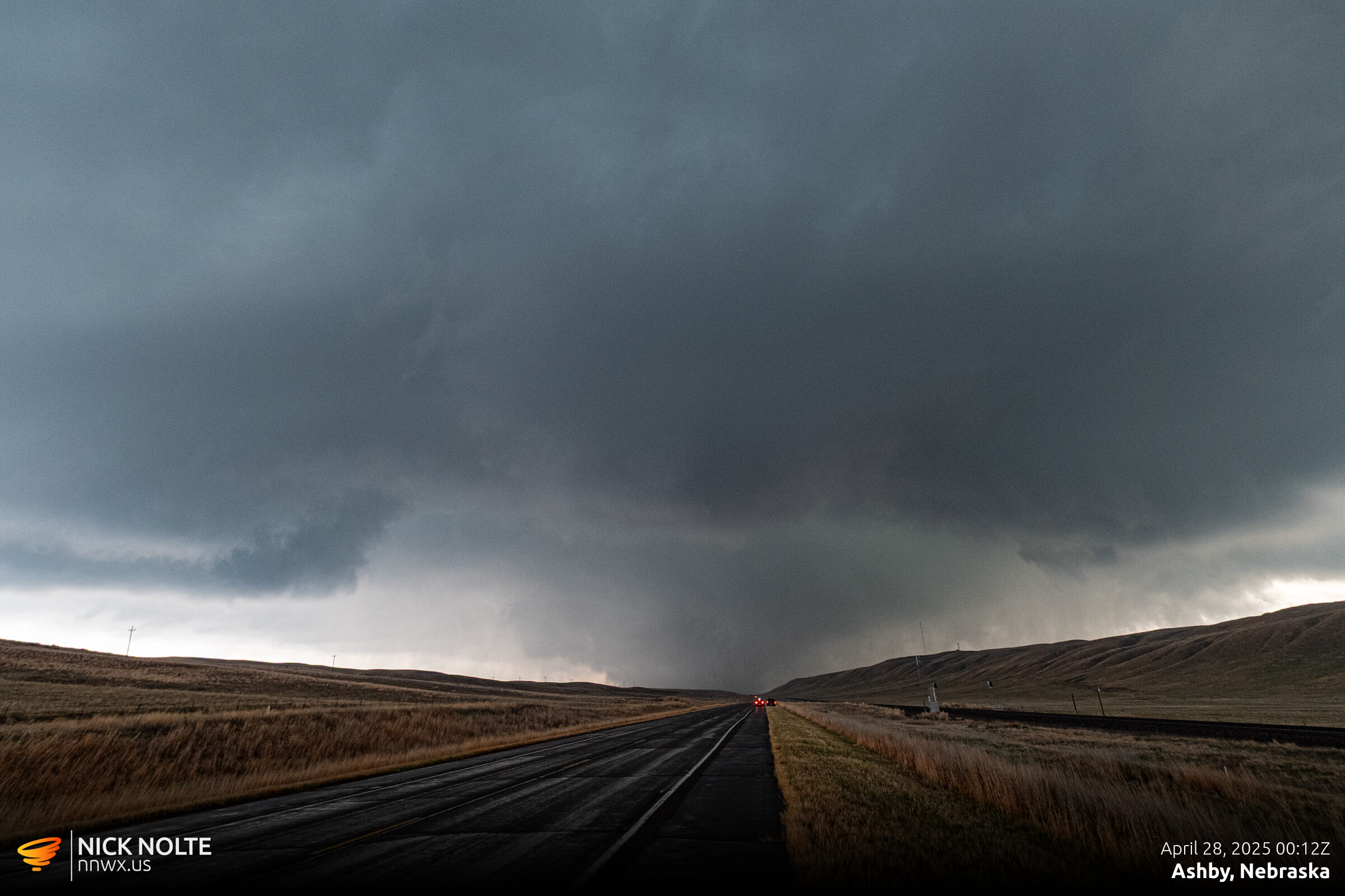
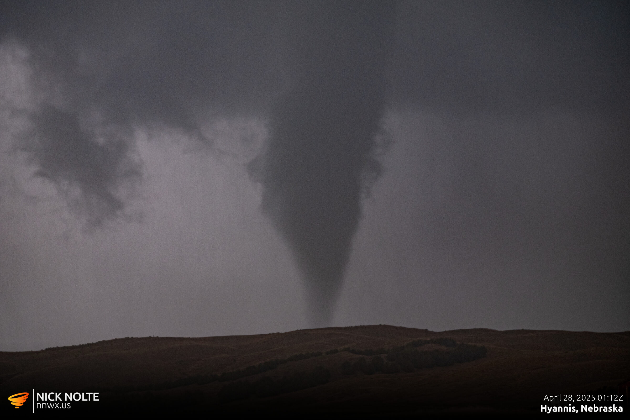
While the wedge was going on I happened to catch a satellite tornado on the forward flank of it just to the east of the main tornado. Apparently there were a couple reports of satellites, but this was the only one I caught.
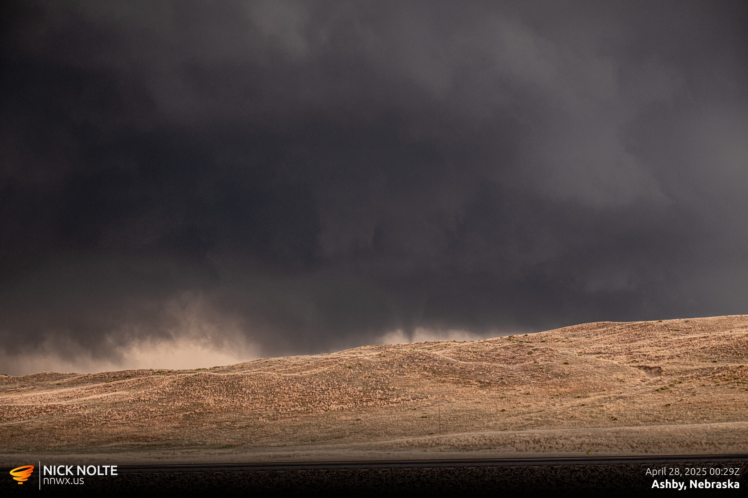
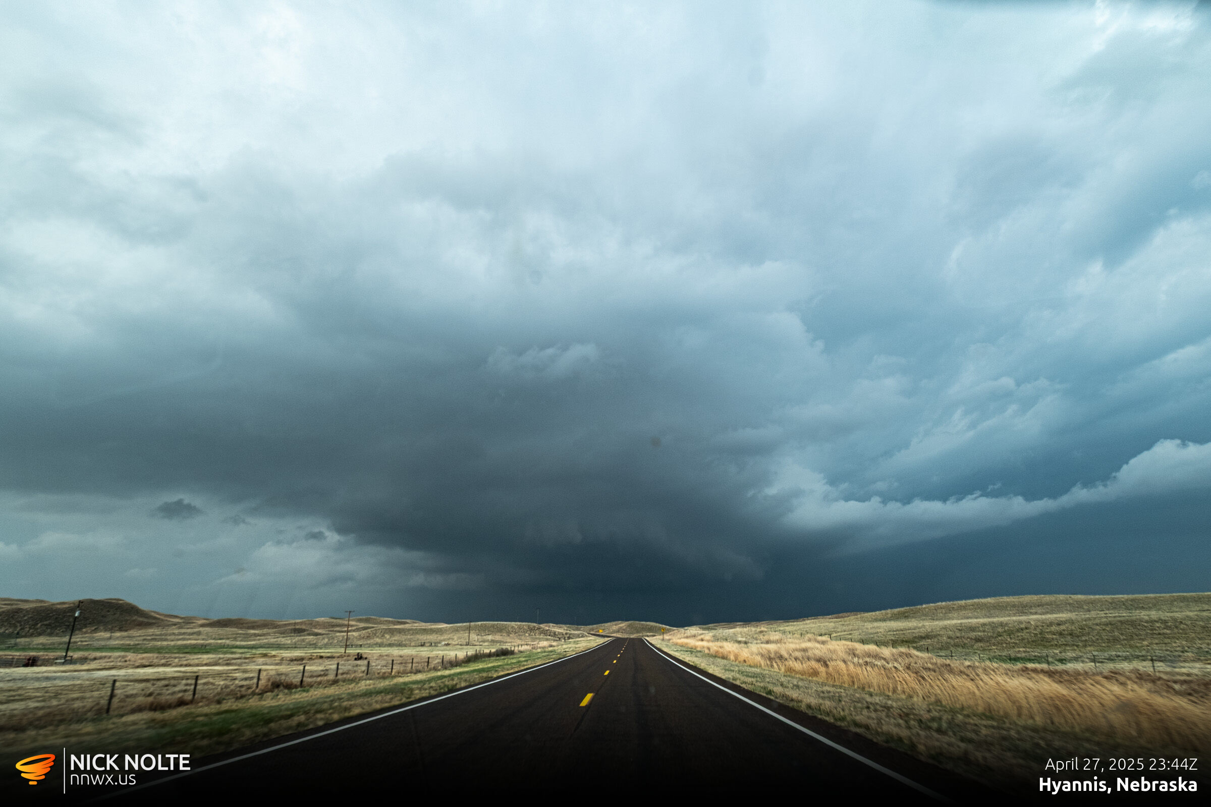
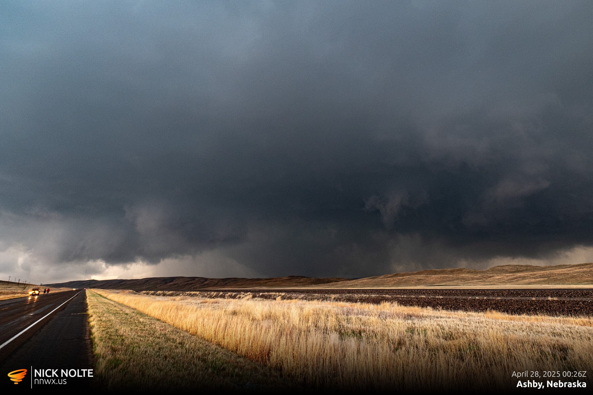
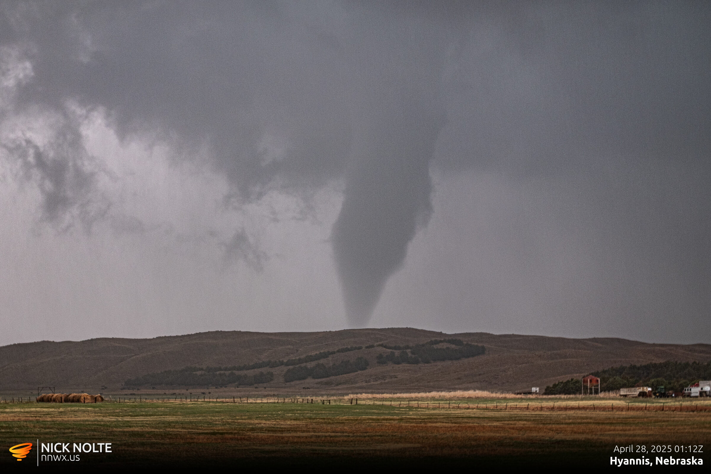
At this point I decided to head back to Ashby and poke north on the road out of town as roads are few and far between in the Sandhills. It looked like it was still churning but I didn’t want to go too far north and get caught by the RFD on the only road back to the highway. I bailed back south and head east to hit 61 north and eventually got in intercept path again and caught the rope-out stage of the tornado north of Hyannis. While two other cells to the east and northeast went tornado warned.
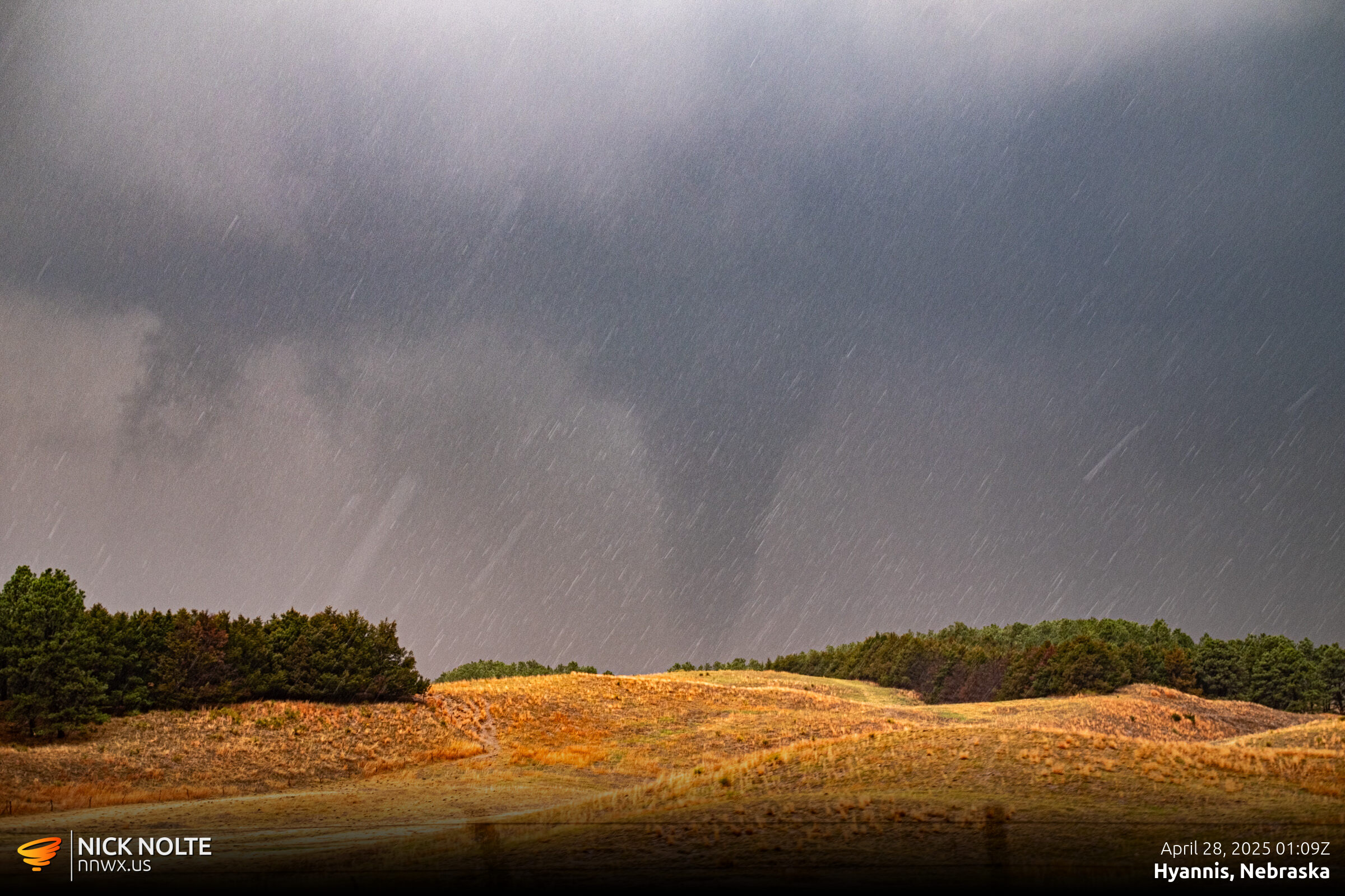
After watching the tornado rope out and dissipate the cell continued to the northeast producing additional tornadoes, I kept an eye on the storm as long as I could as I drove east on highway 2, but with the lack of roads, I decided to call the chase and begin the trek home.
Chase Video
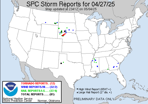
Storm Reports
Chase Recap
| START | END | DURATION |
|---|---|---|
| Grand Island, NE @ 27/1653Z | Grand Island, NE @ 28/0451Z | 11 hours, 58 minutes |
| INTERCEPTS | CHASER ENCOUNTERS |
|---|---|
| 28/0000Z @ 3 W Ashby, NE 28/0028Z @ 1 NW Ashby, NE | None |