| 0 | 1.00" | 60 | 573 |
|---|---|---|---|
| TORNADOES | HAIL | WIND | MILES |
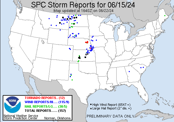
June 15th offered an opportunity for a relatively local chase. A remnant MCV from overnight convection was present in west-central Nebraska and a frontal boundary extended from a low in Canada south across Nebraska then southeast into the Ozarks. Daytime heating was forecast to promote strong instability along and north of the front.
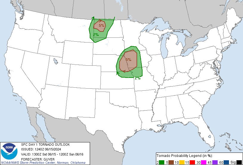
SPC had a 5% tornado outlook along the Missouri River Valley and it looked like the corridor between Yankton and Hebron would be a prime are for possible tornadic activity as surface flow throughout this area would be southeasterly most of the day. I took off from Grand Island around 17z and went east to Lincoln where I would decide whether I was going to play north or south.
I arrived in Lincoln shortly after 18z and looking at visible satellite there were two areas of interest worth going after. A robust cumulus field to the north around Norfolk and an area to the southwest along the Kansas border that looked like initiation would be pretty imminent. At 20z the SPC issued a mesoscale discussion for eastern Nebraska indicating a watch was probable. By this time I had decided to go south as a cell started to explode near Beloit, KS.
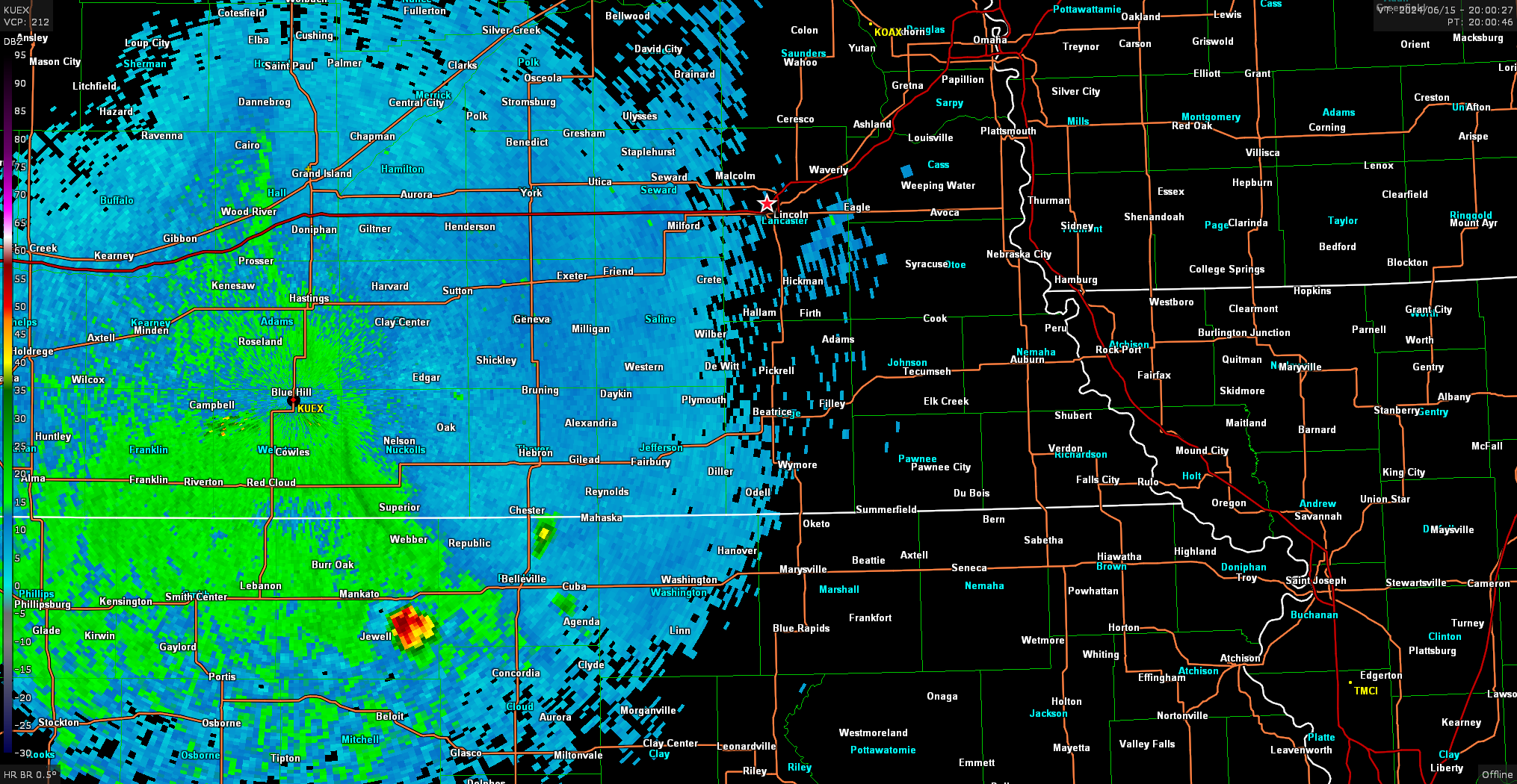
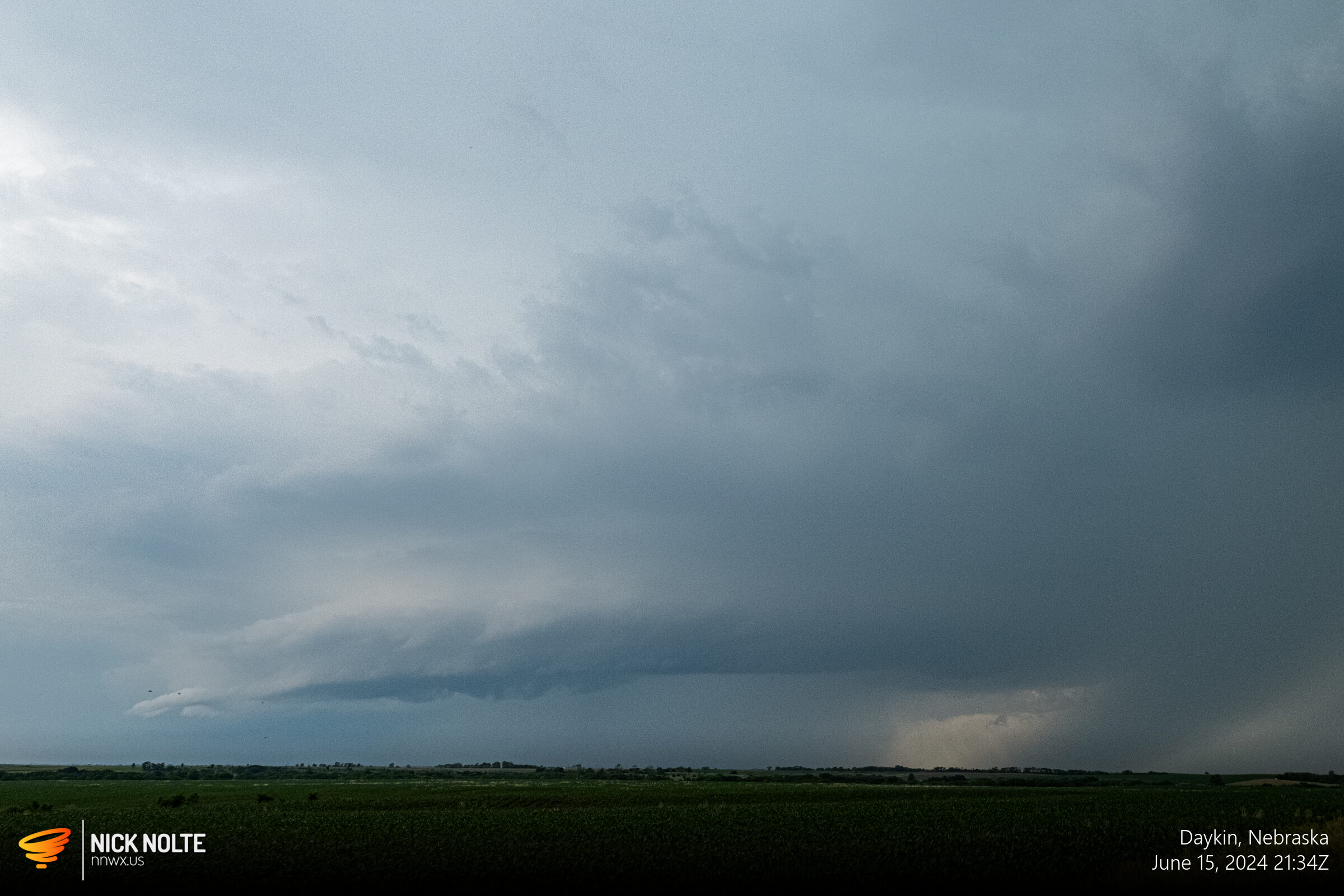
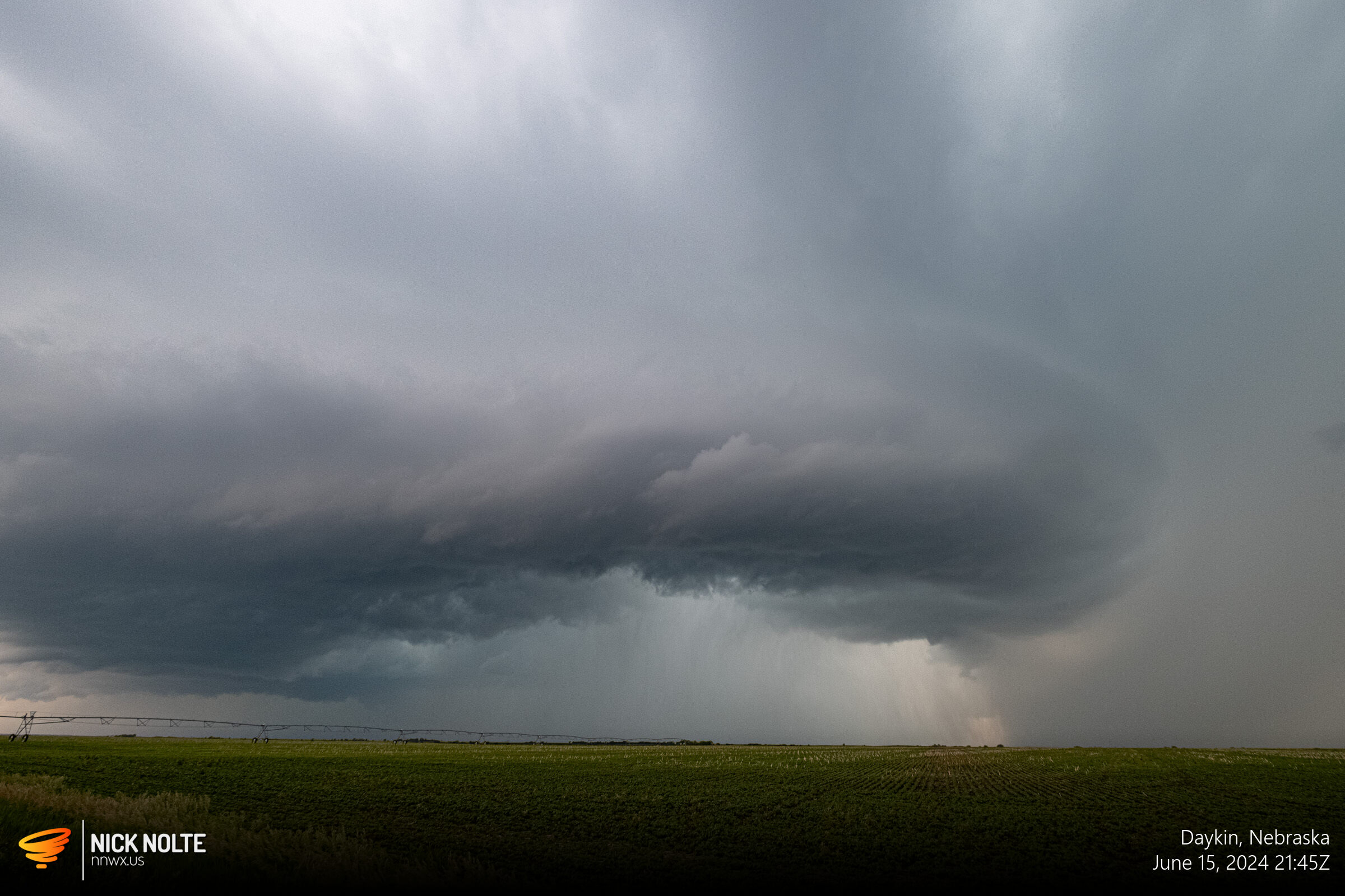
I arrived in Beatrice a bit before 21z and diverted west to intercept the cell passing by Hebron. I eventually got on the storm around 2130z. At the same time, the SPC issued the tornado warning for most of eastern Nebraska.
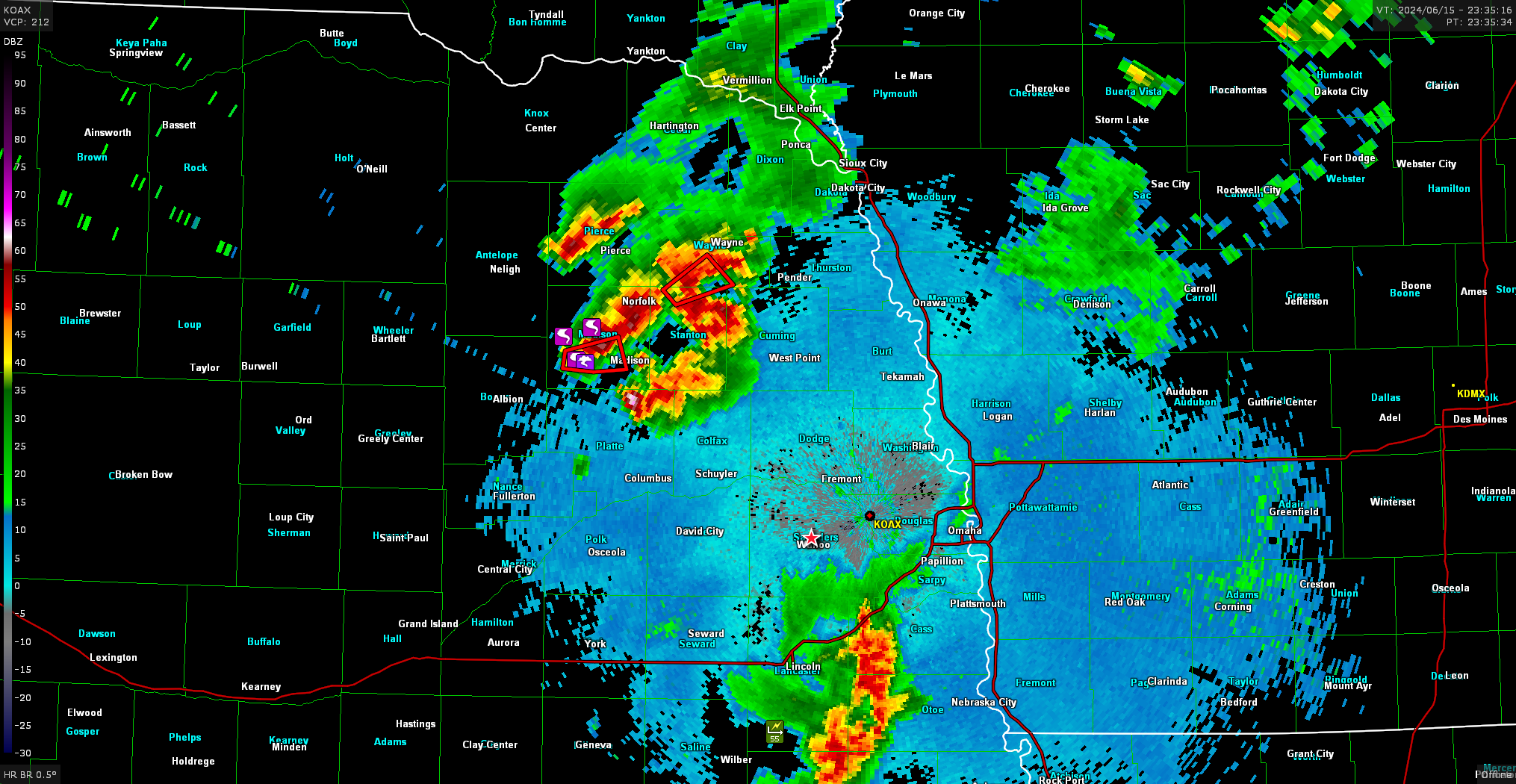
While this was going on, storms started to develop in the other target area up by Albion and Neligh. With the southern storms struggling I made the decision to blast north and try to catch one of those cells up there. Right after I made the decision, a bunch of tornado reports started coming in on the cell southwest of Norfolk. Around 2330z I was just passing around Wahoo and multiple cells near Norfolk were coming in with tornado reports.
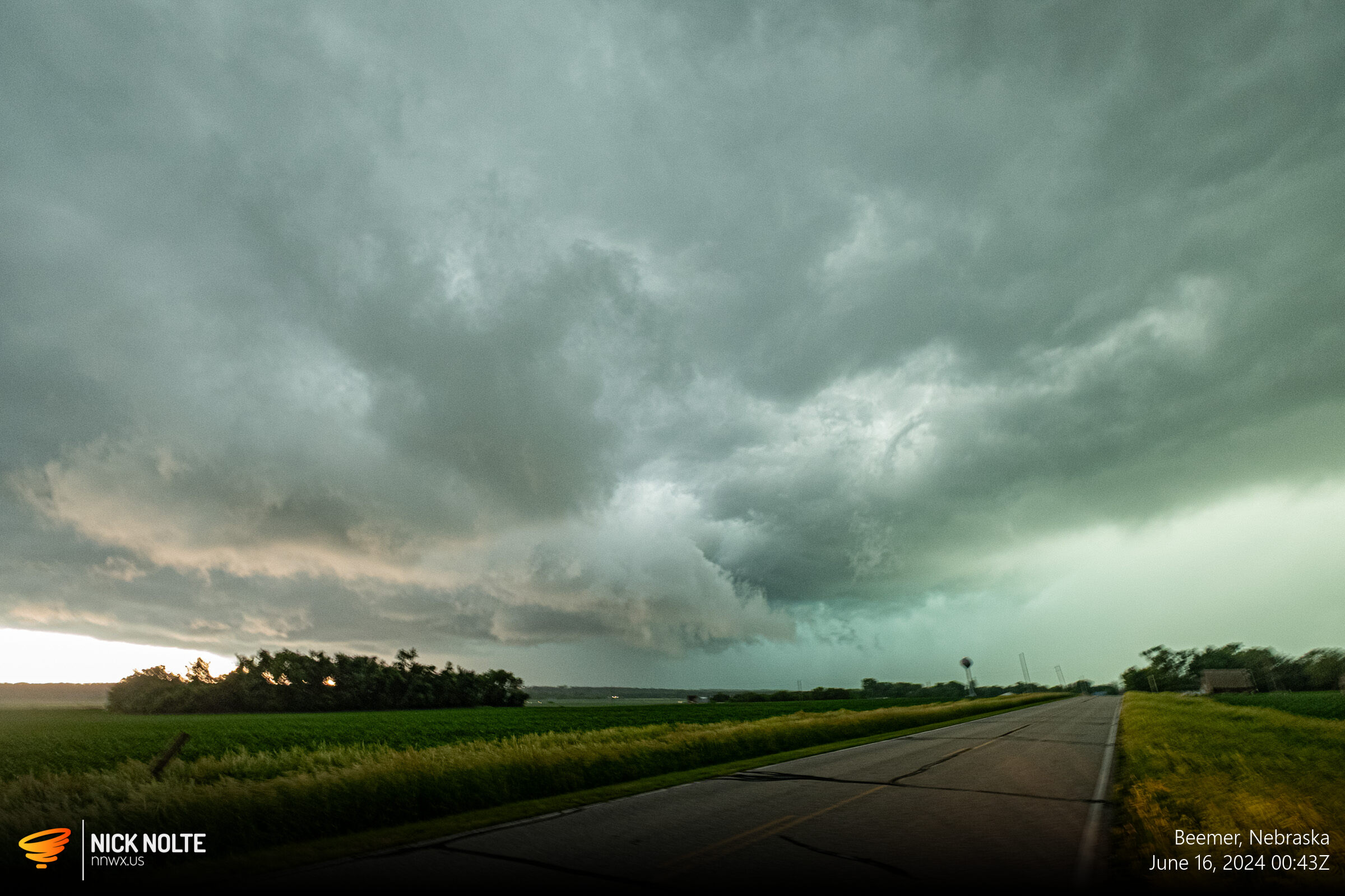
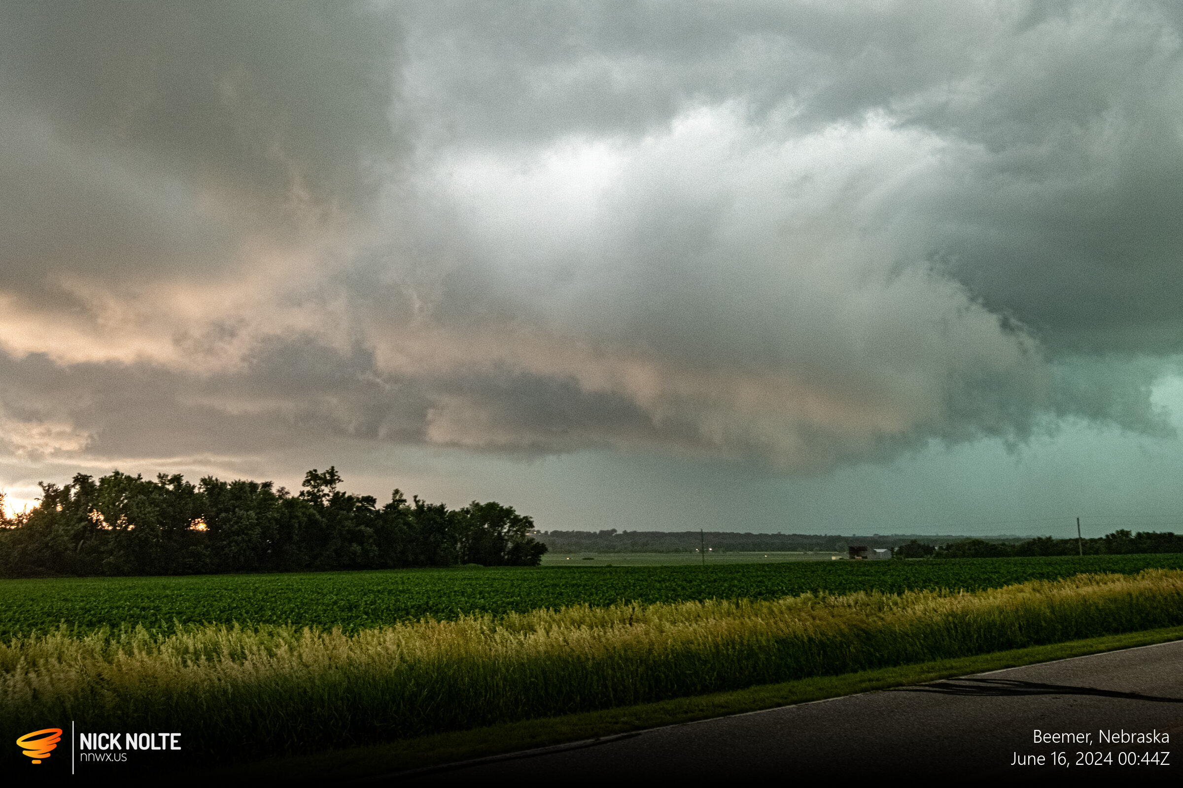
At this point I was on my way to West Point to intercept the southermost cell in the northern complex. Eventually that cell went tornado warned as well and I got on the cell at 16/0030z and was greeted with a low broad wall cloud.
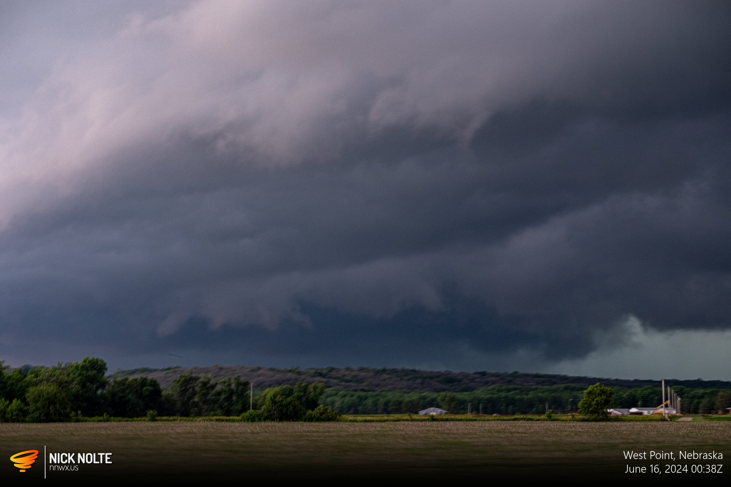
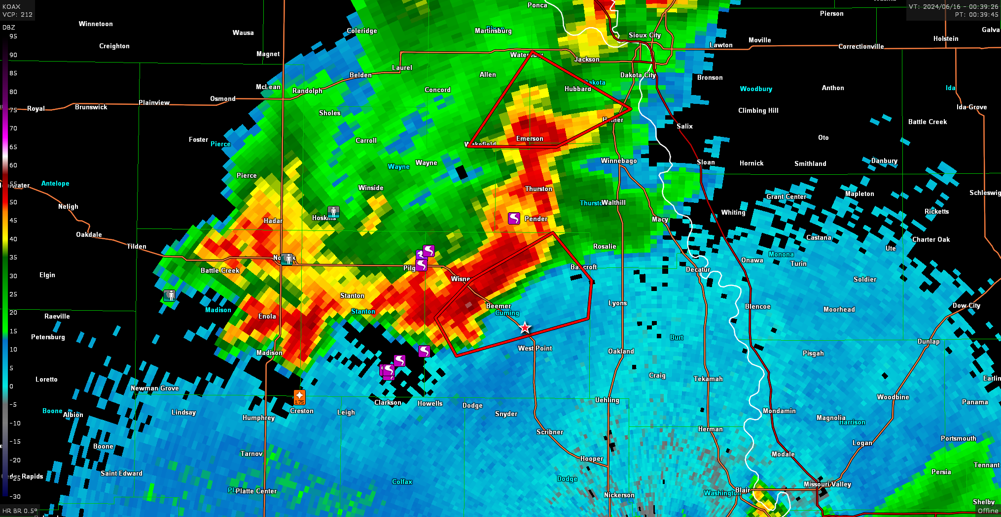
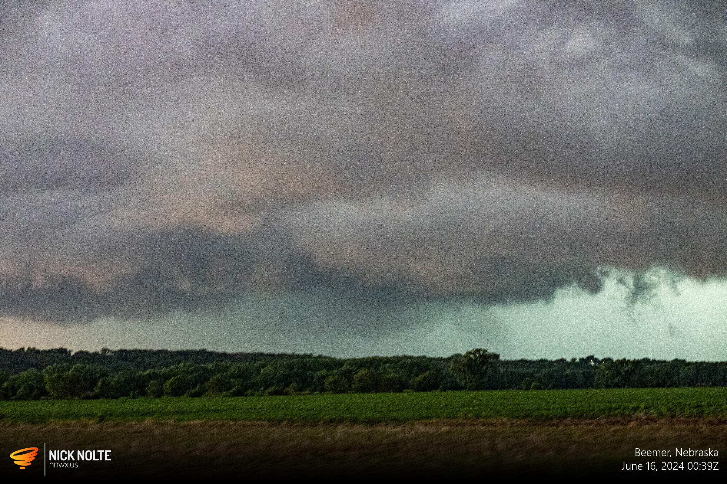
I pulled off near Beemer in line with the inflow notch to sit and watch as the storm approached. While there was quite a bit of cloud motion I didn’t see any significant rotation.
Eventually the storms started to congeal and line out and an outflow boundary became apparent on radar right around 01z ending the tornado threat.
Chase Recap
| START | END | DURATION |
|---|---|---|
| Grand Island, NE @ 15/1704Z | Grand Island, NE @ 16/0407Z | 11 hours, 3 minutes |
| INTERCEPTS | CHASER ENCOUNTERS |
|---|---|
| None | None |