| 4 | 1.00" | 70 | 464 |
|---|---|---|---|
| TORNADOES | HAIL | WIND | MILES |
Friday the 26th was one of those days that looked like it could be pretty significant. A surface low in Kansas with a trailing dryline and cold front was expected to track northeast towards Sioux Falls and eventually to Minneapolis overnight. How overnight and morning convection further south impeded the flow of moisture north would be one of the key factors in how the day would unfold.
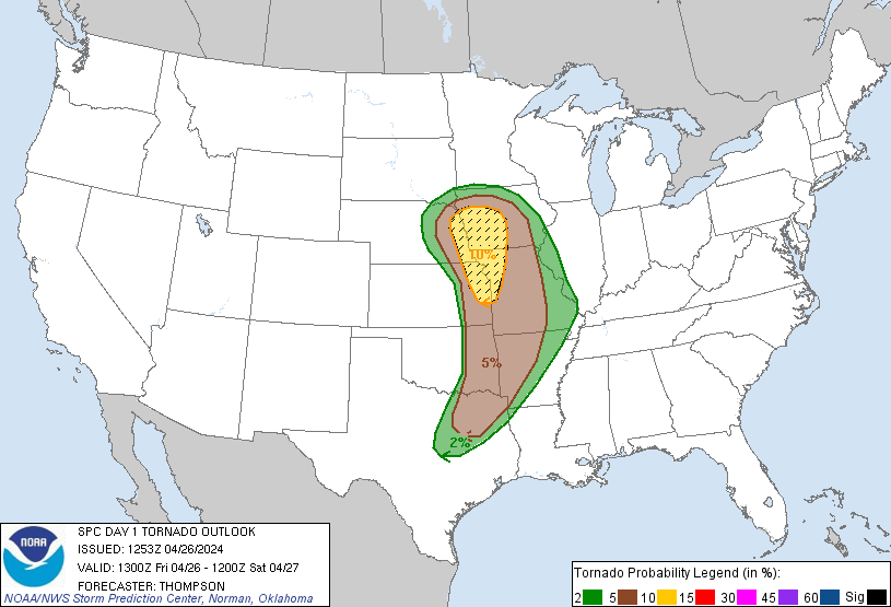
Despite these reservations, it was expected that airmass recovery would be pretty decent and we could expect MLCAPE values approaching 2,000 J/Kg as dewpoints lifted into the mid-60°Fs. Hodographs were expected to be curved in the low levels with upwards of 300 m²/s² effective SRH. As such, SPC had outlined the target area with an enhanced risk including a 10% hatched tornado risk.
I anticipated the warm sector to get further north than some of the models were forecasting so my original plan was to head to Columbus to setup for the day. I arrived in Columbus right around 17z and to my annoyance a storm was going up right under the low near Ravenna, literally 20 minutes from my house.
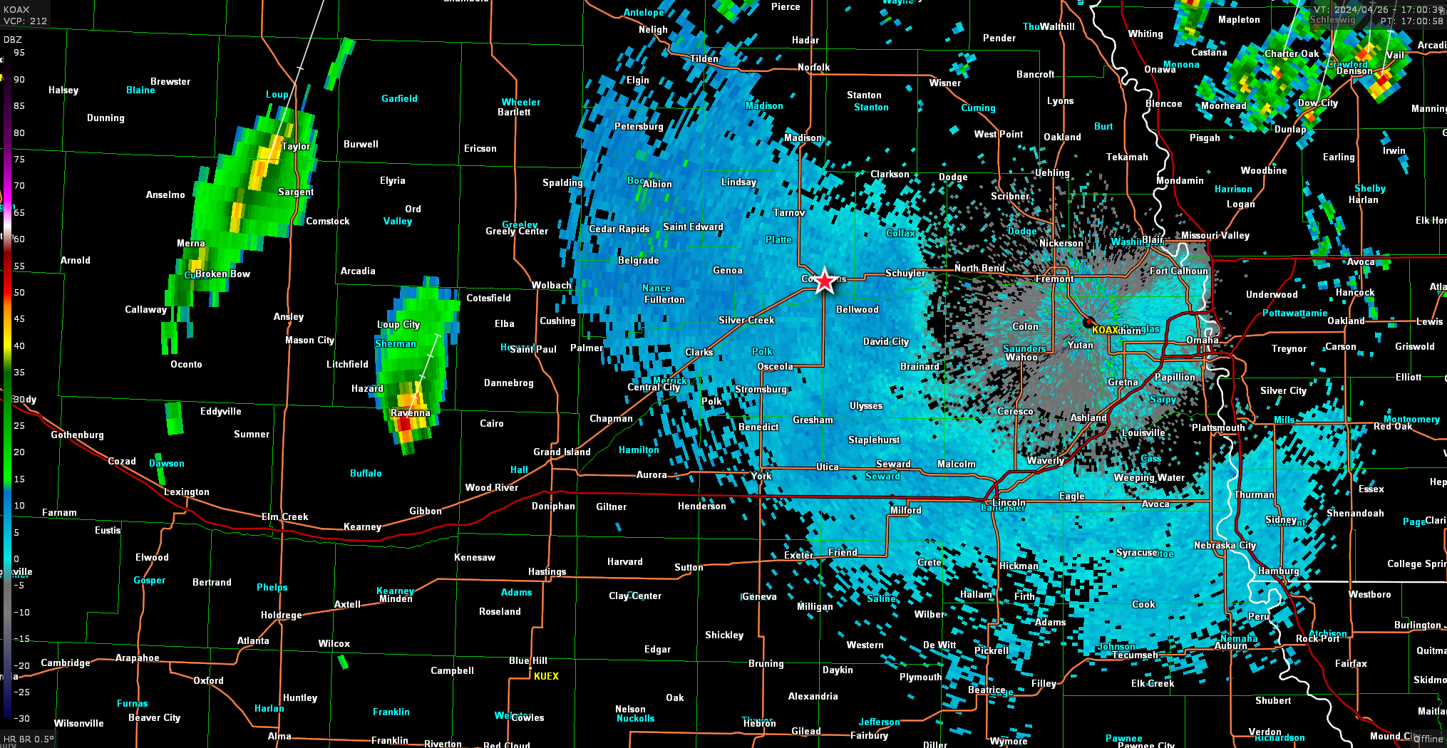
Surely that little spud won’t do anything. I’ll just stick it out here in Columbus and wait for the main show. Oh, what’s that? It’s tornado warned? Surely it’s just radar indicated. Oh it’s confirmed?
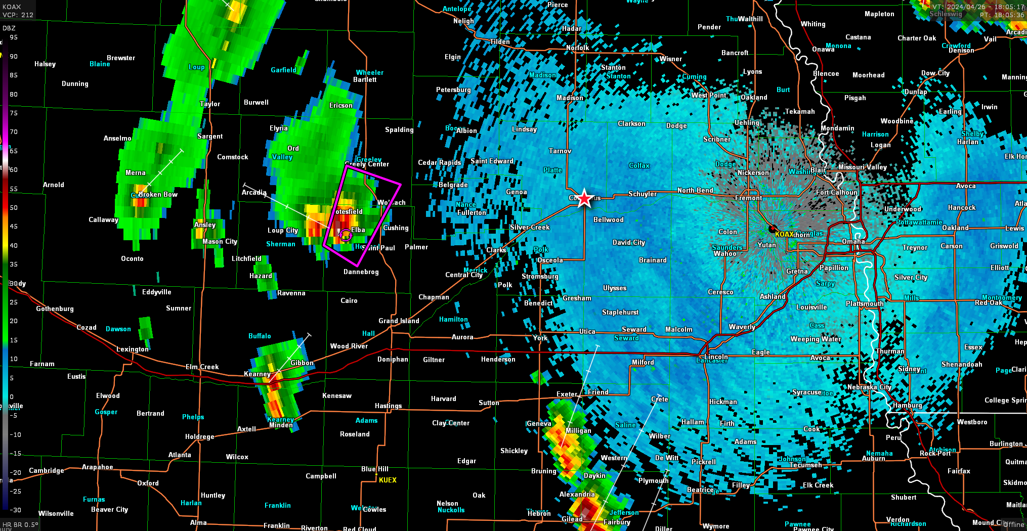
Oh, it’s actually a ground scraping wedge? Neat. Here’s a video from Jake Heitman with his intercept of this tornado
Anyway, always fun to see that happening while you’re waiting in your target area. At my location a cumulus field was beginning to develop to my south and I decided to head south to I-80 as it was clear I was too far north.
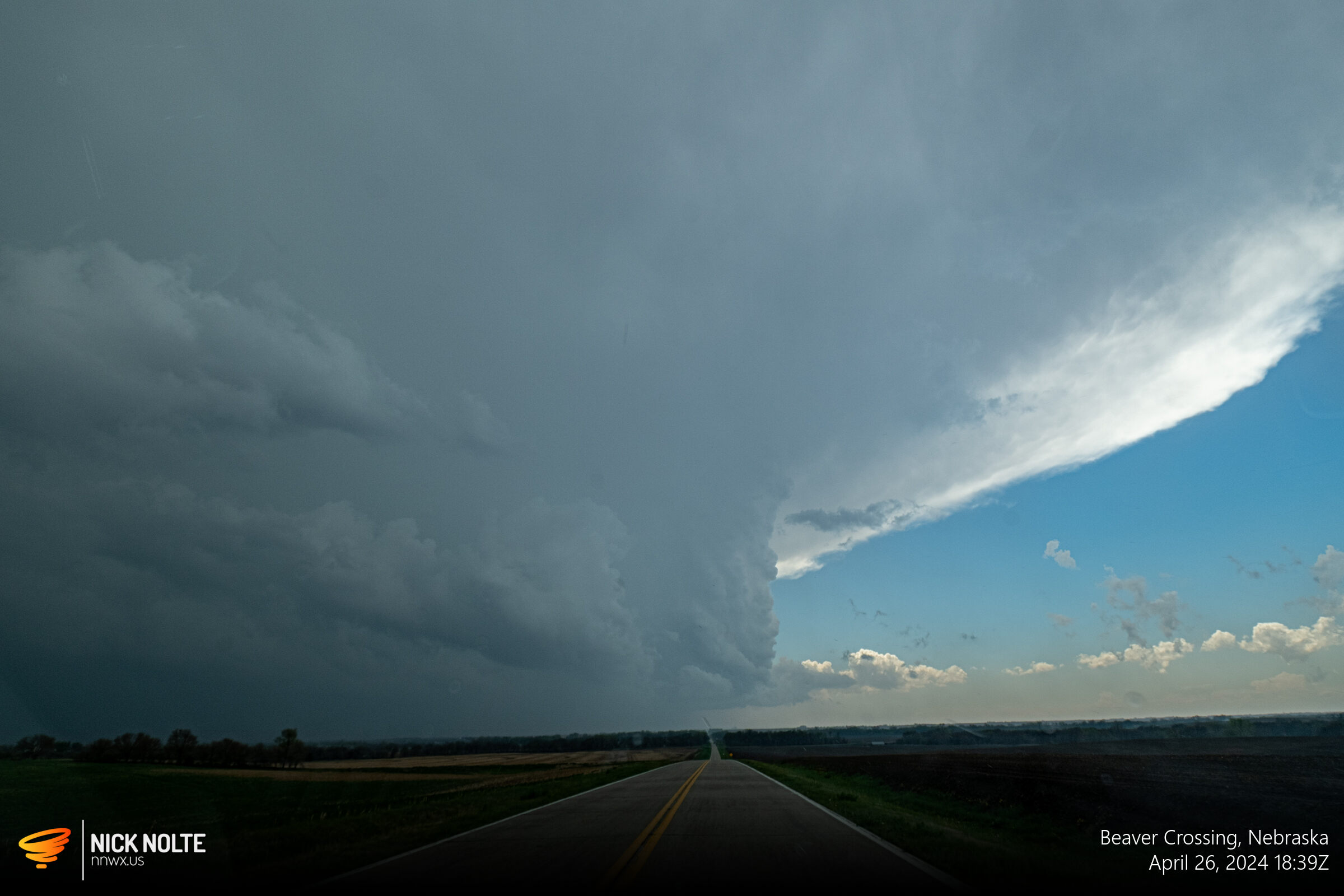
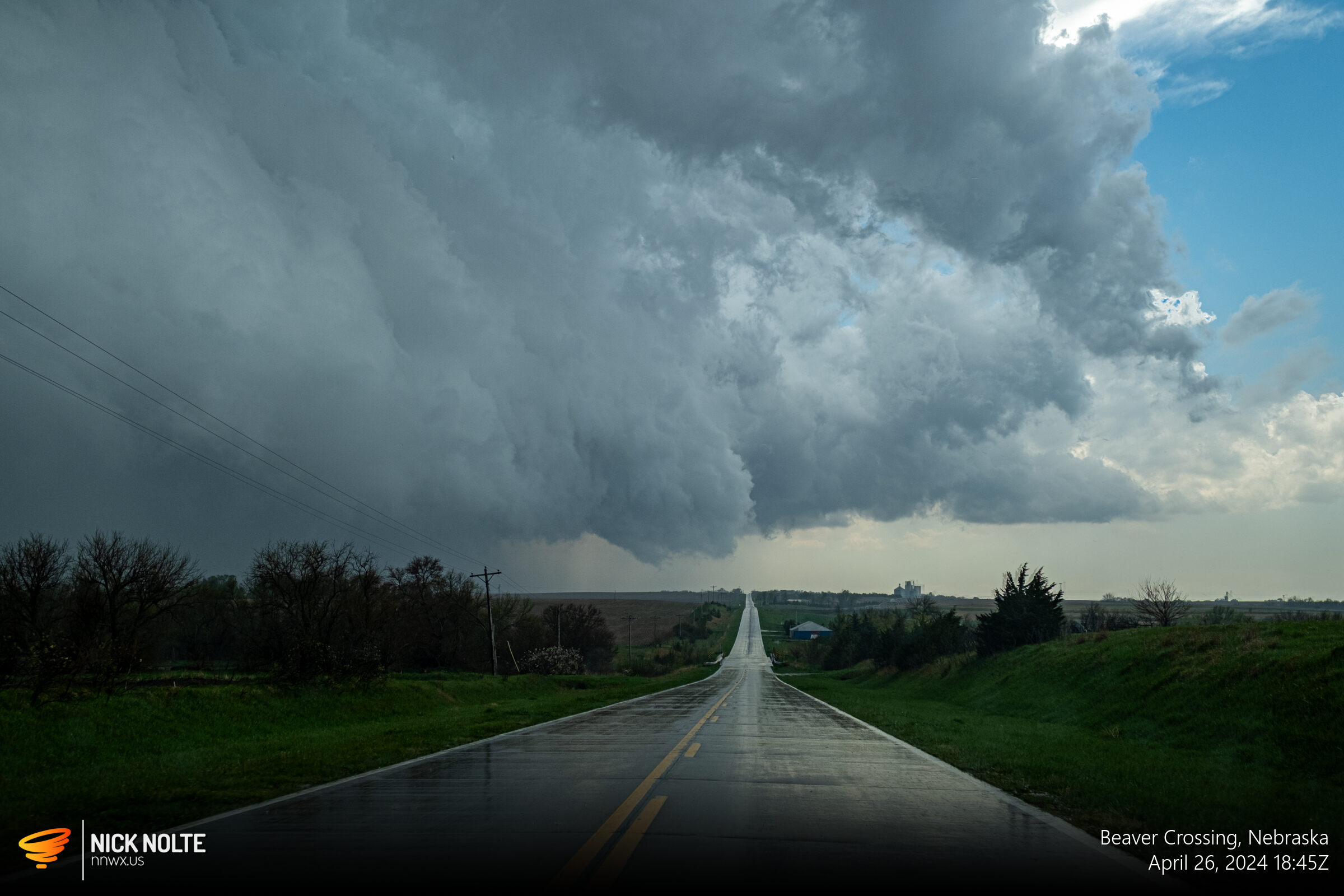
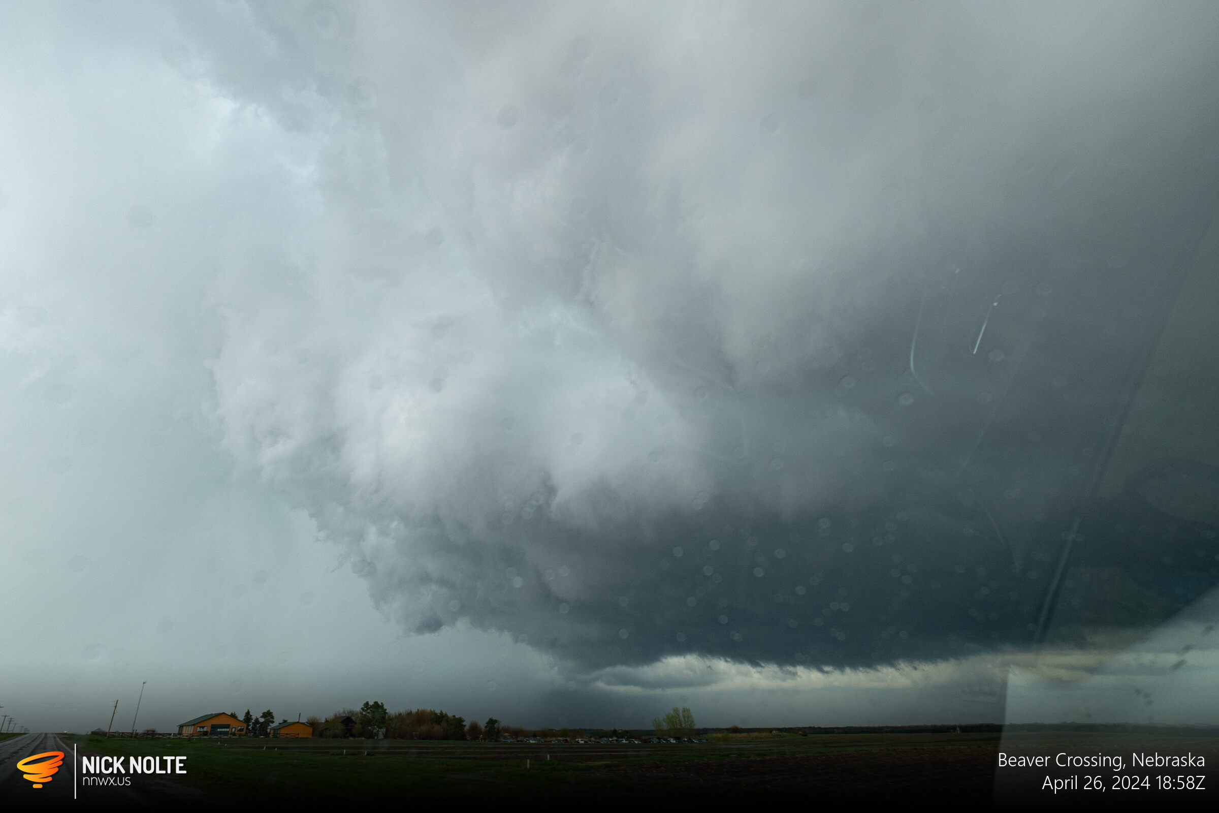
A couple of cells south of I-80 looked promising, one near Fairbury heading towards Lincoln and another near Friend heading towards Seward. I got visual on the updraft and base of the Friend storm at 1845z as I passed by Beaver Crossing.
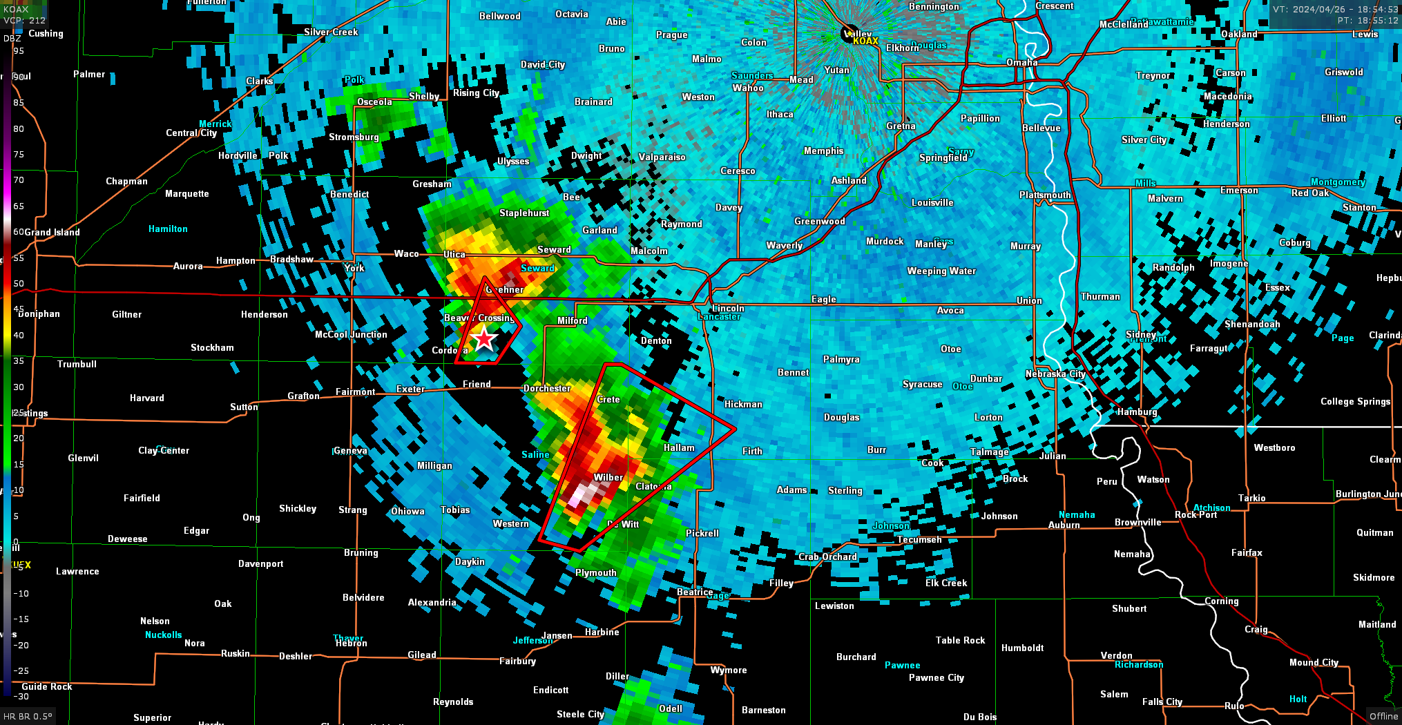
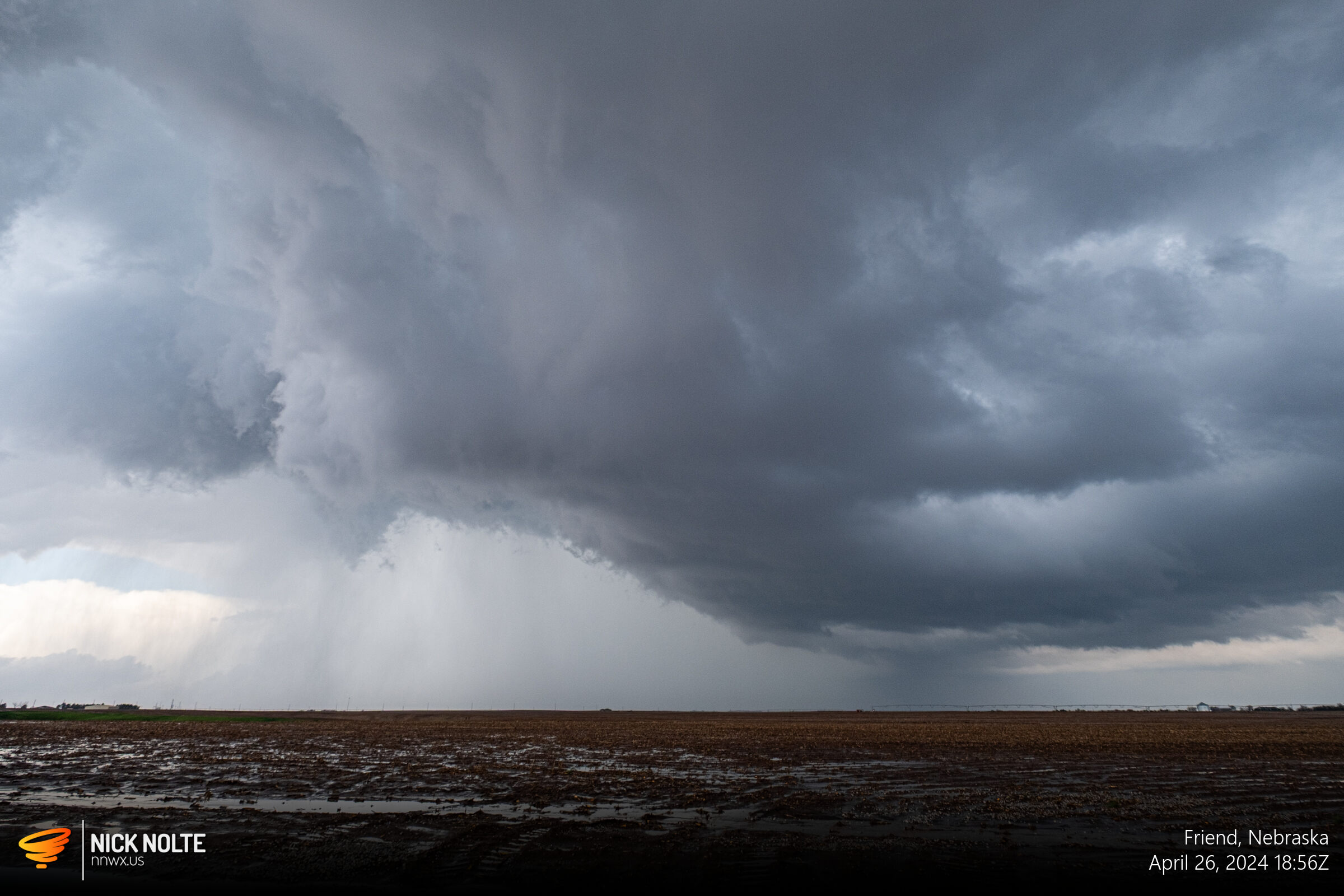
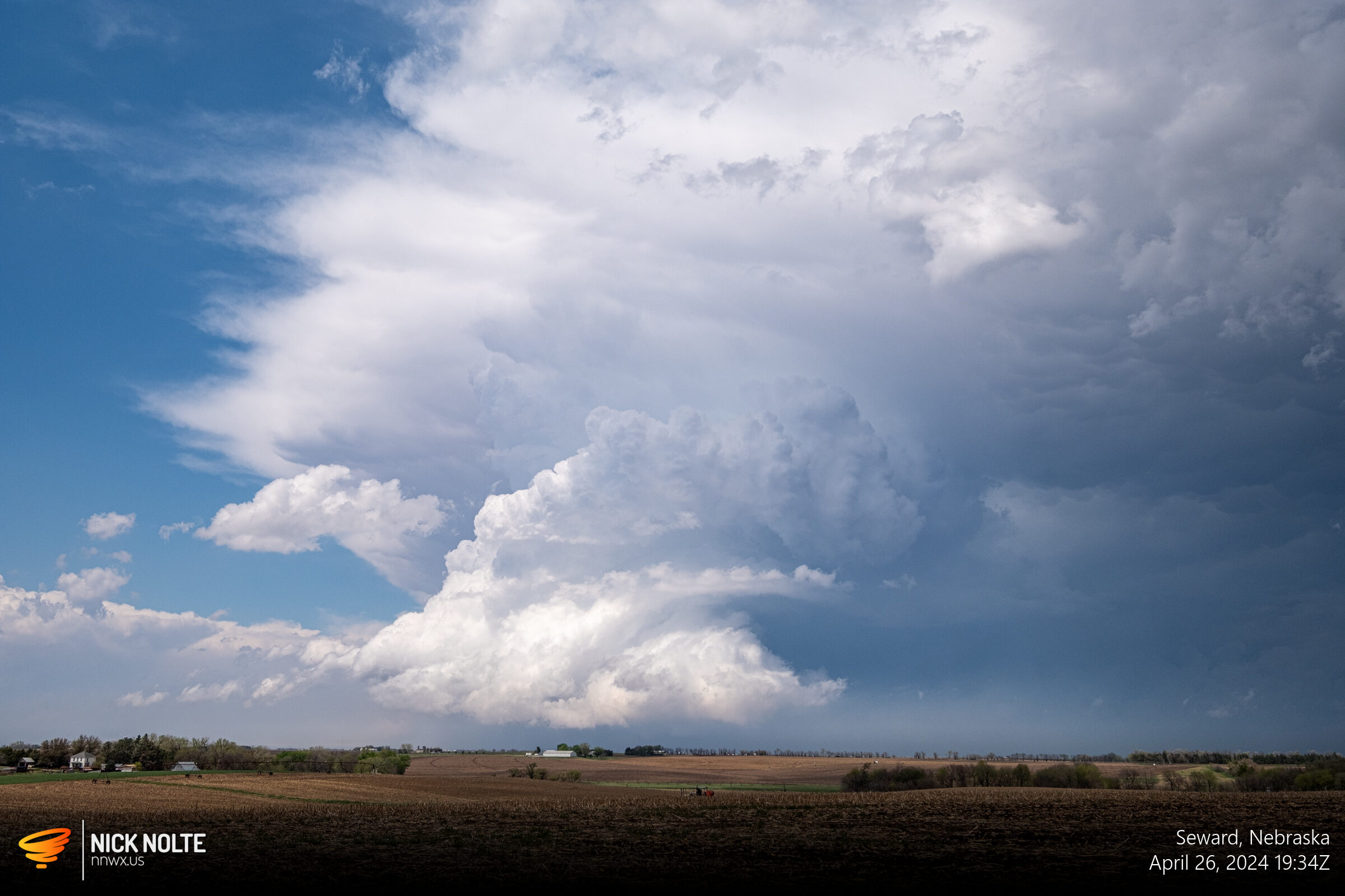
At this point, I decided to bail to the east storm as it was looking nicer on radar and the updraft on that tower had a nice corkscrew on it and it was tornado warned as well.
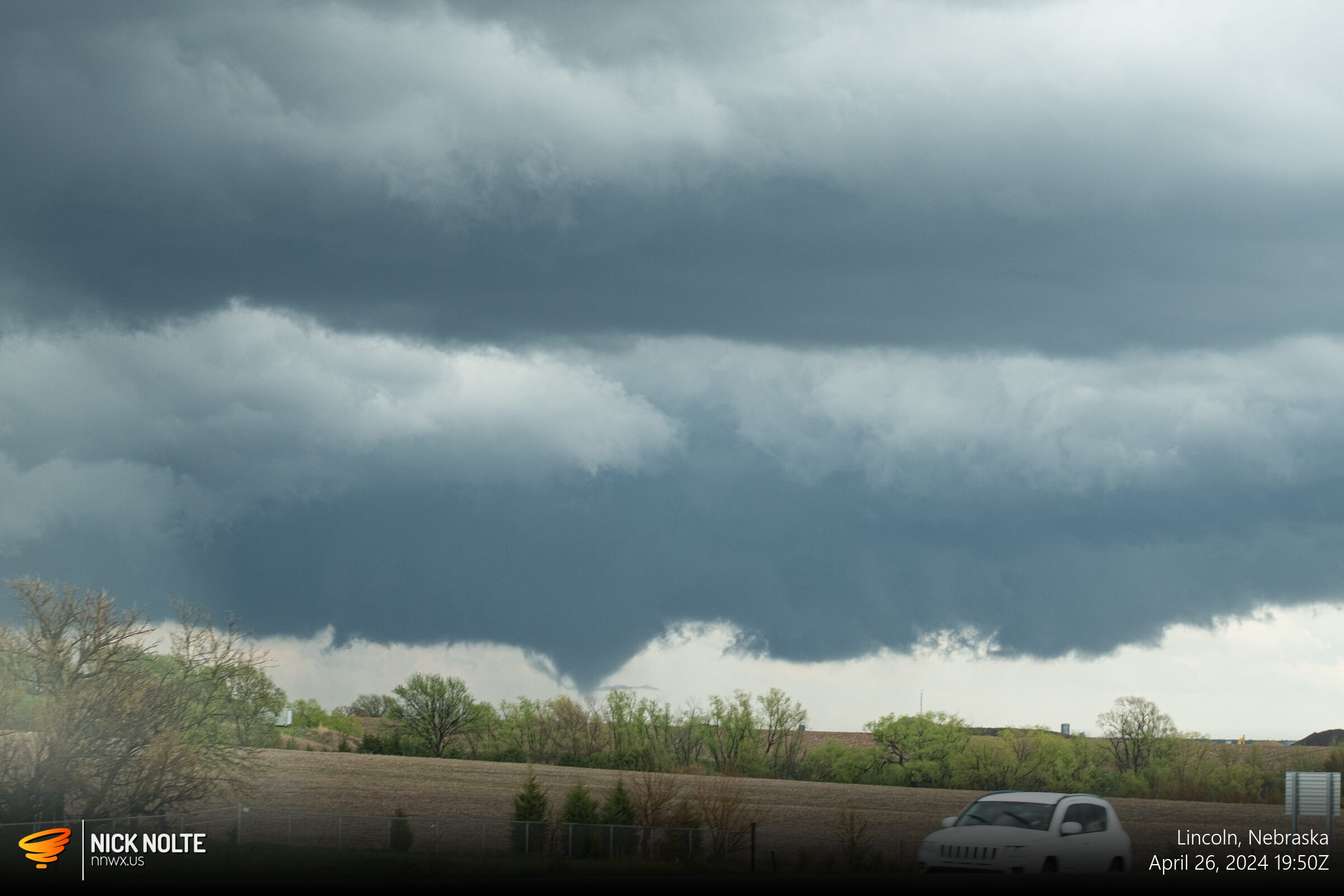
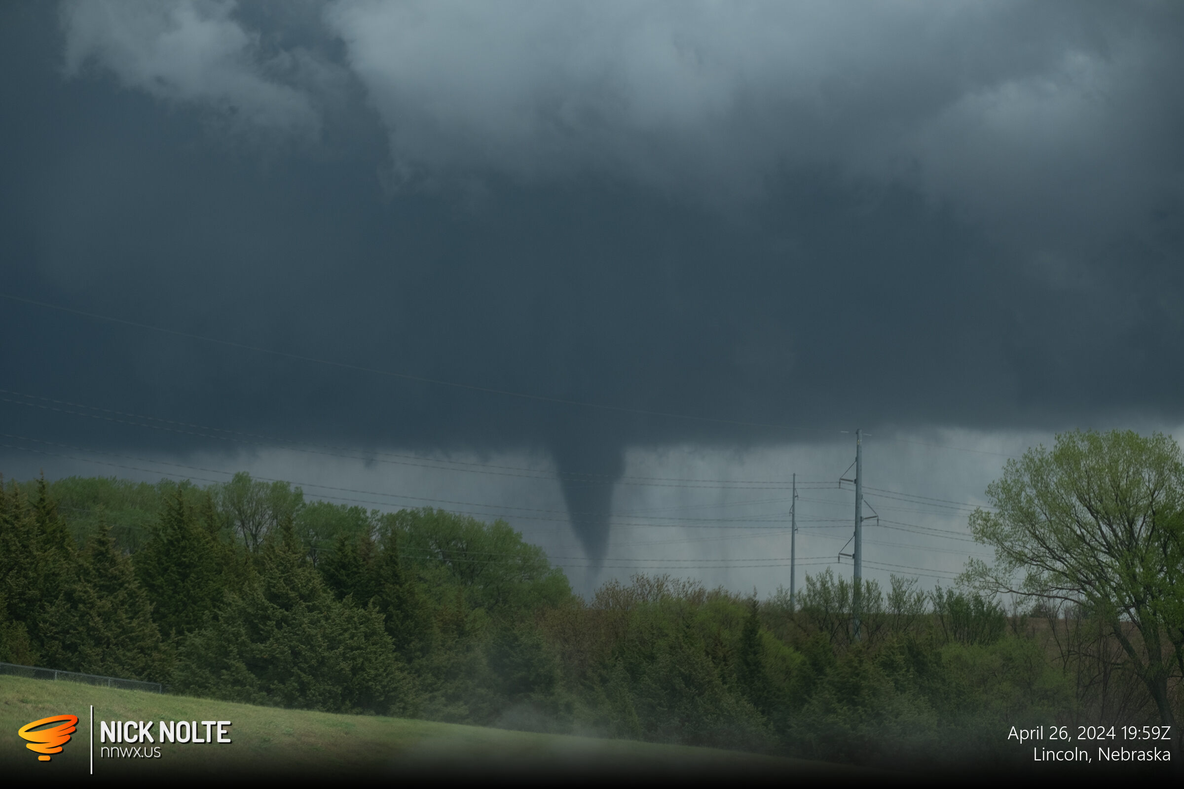
Eventually I hit up I-80 to bail east and intercept the Lincoln storm and caught up to it at 1950z and a tornado was just getting underway.
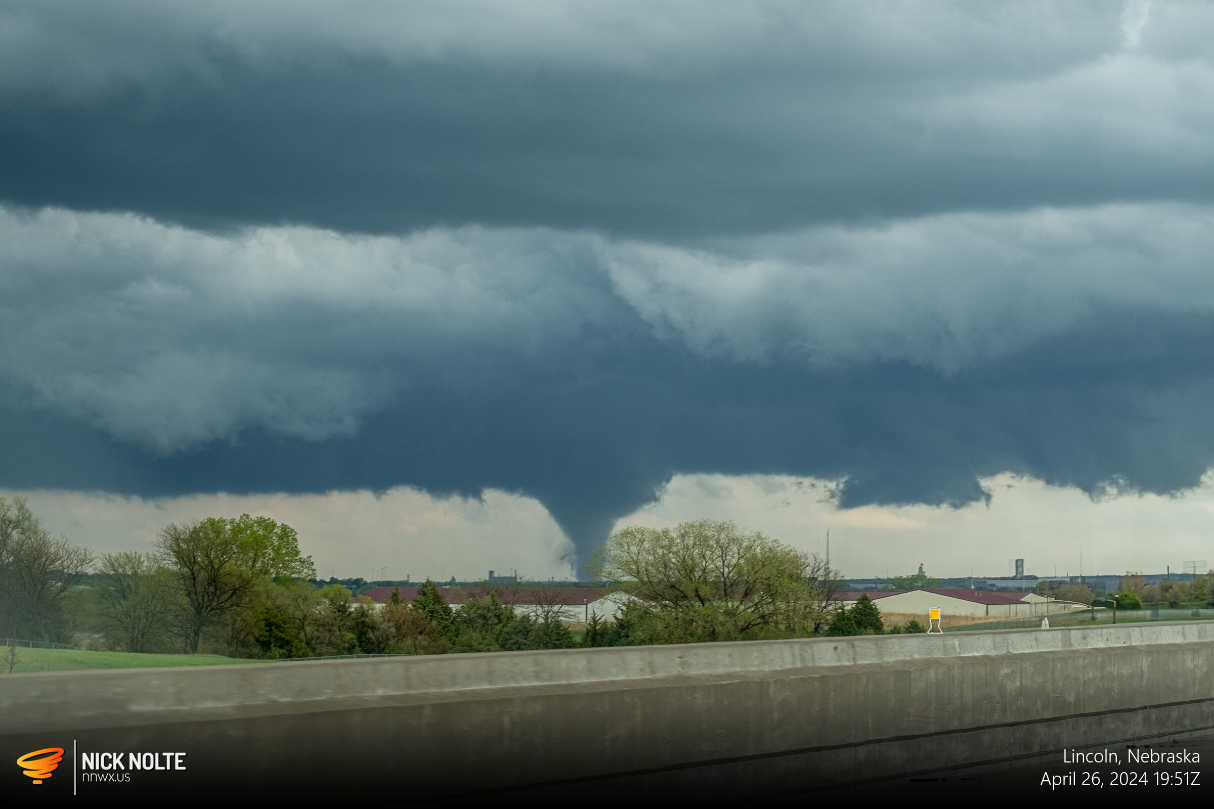
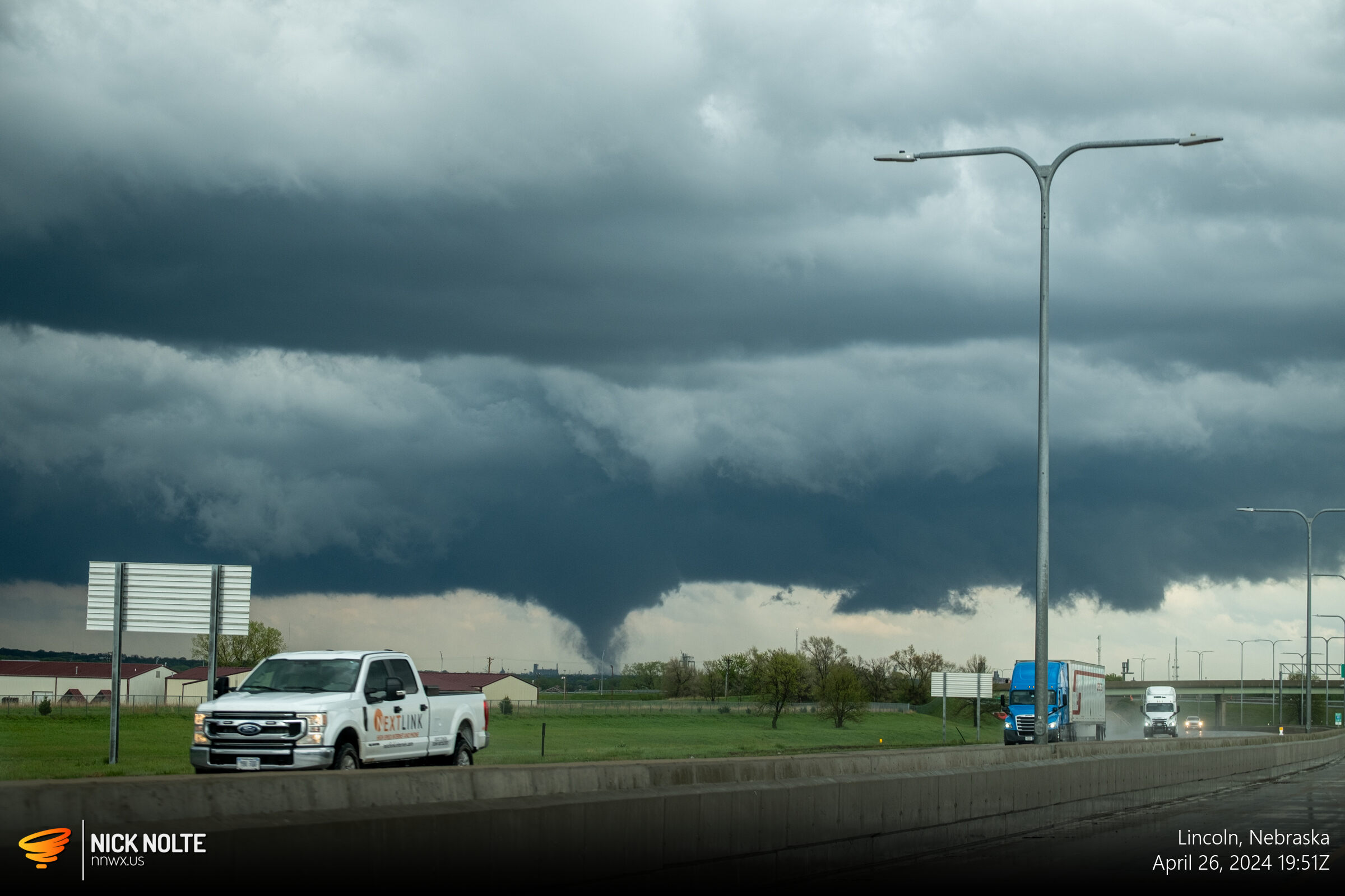
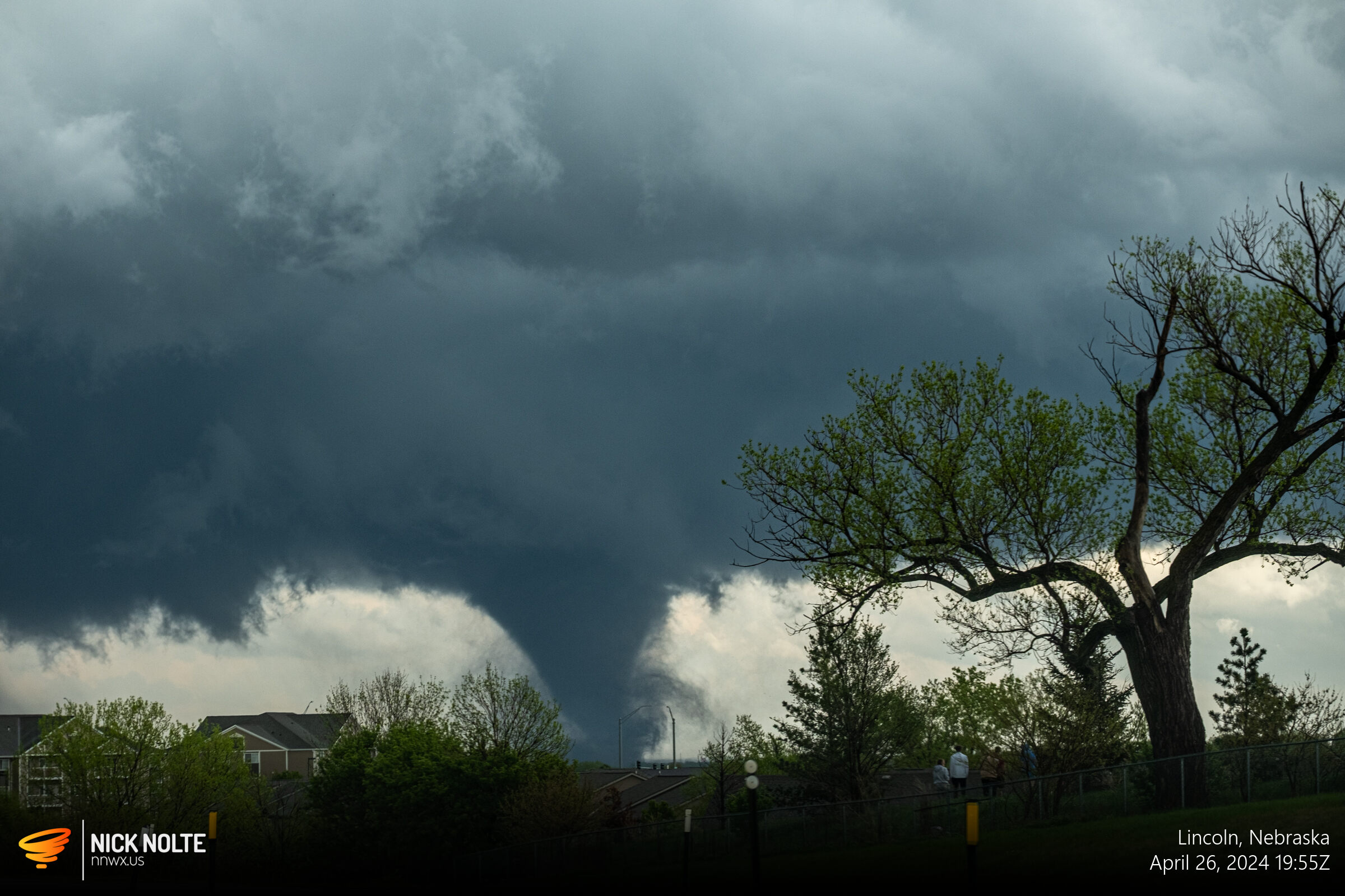
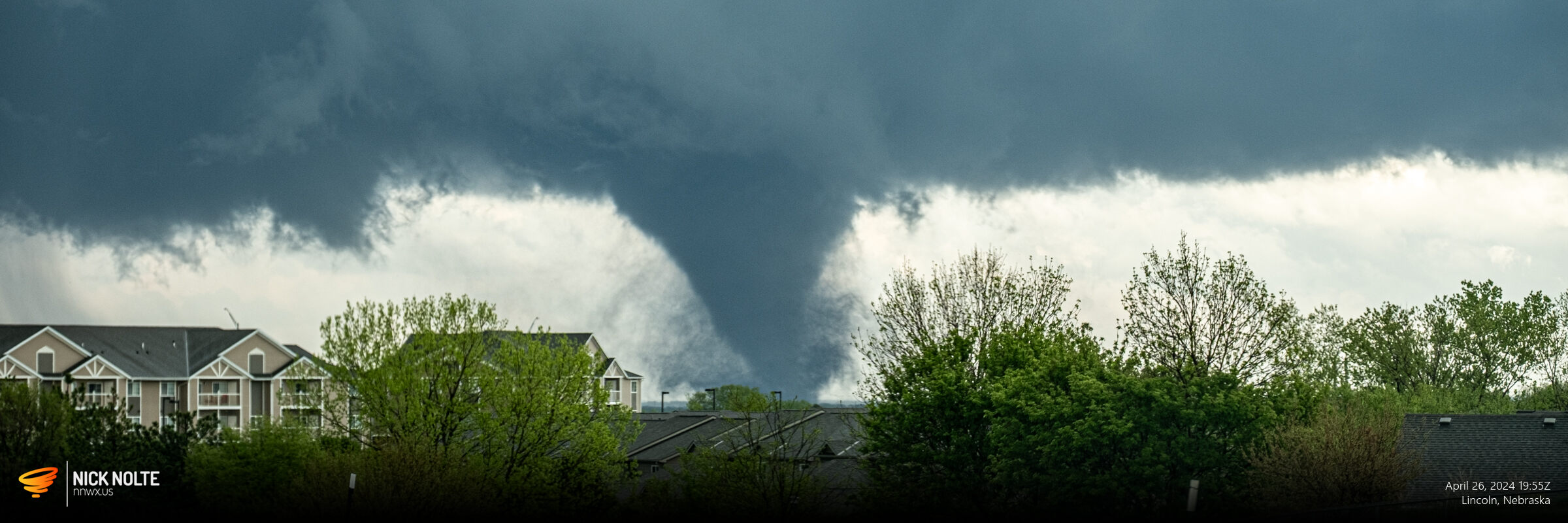
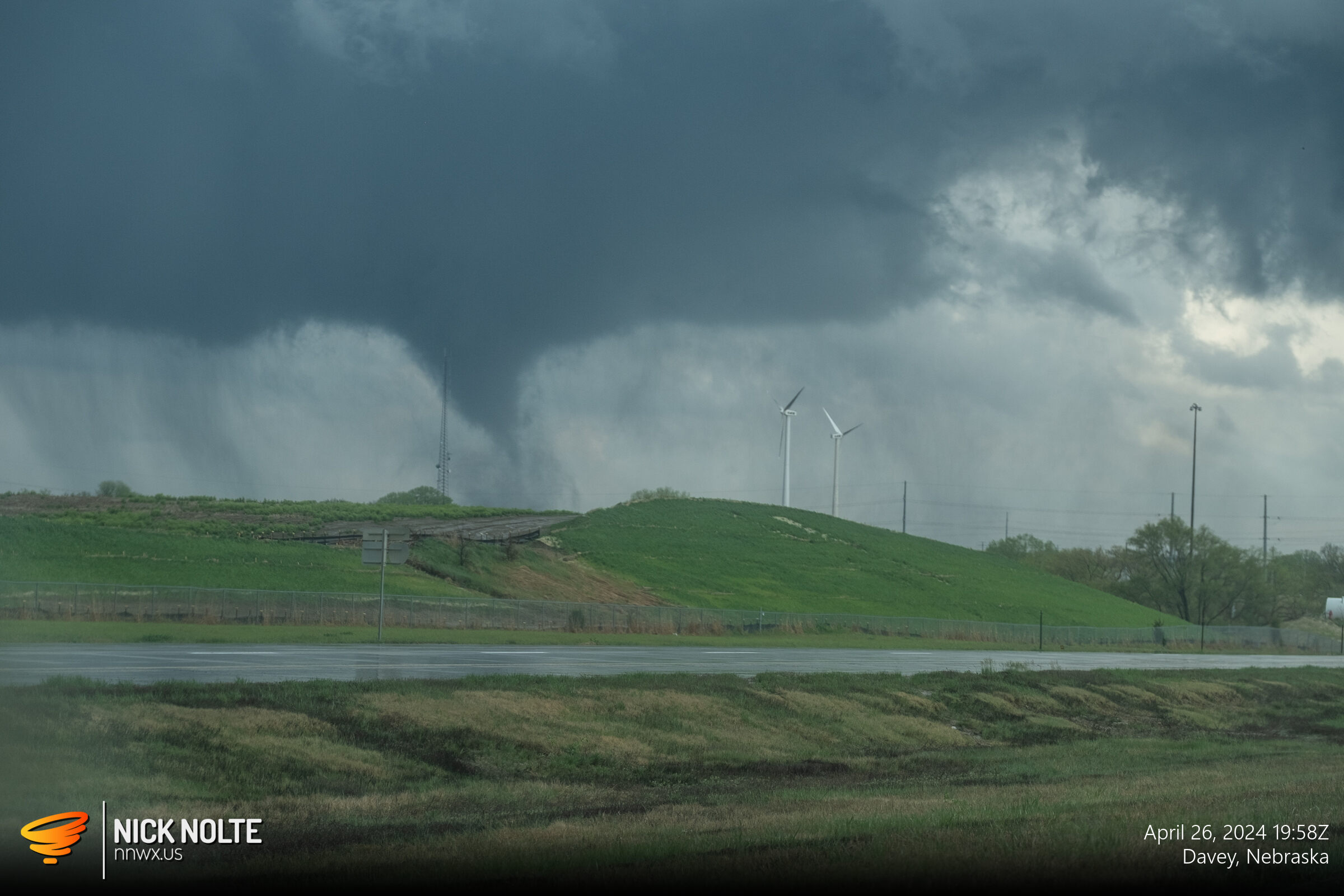
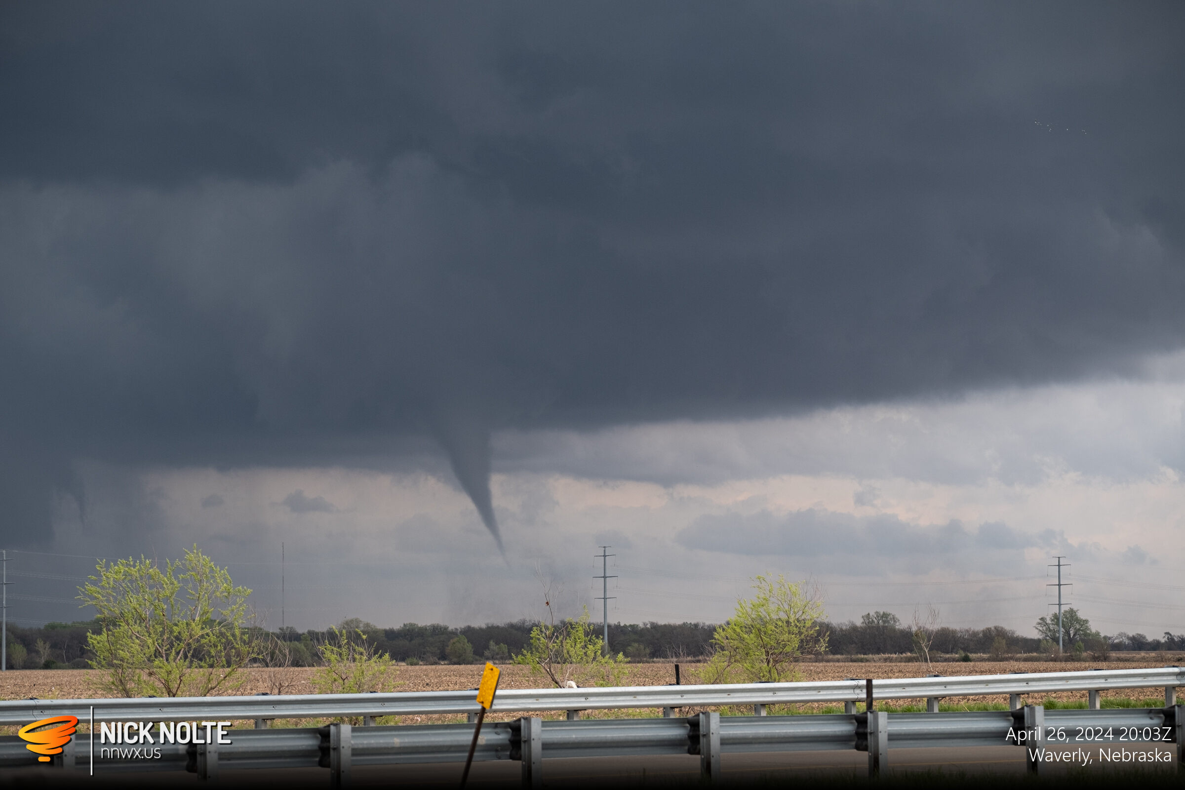
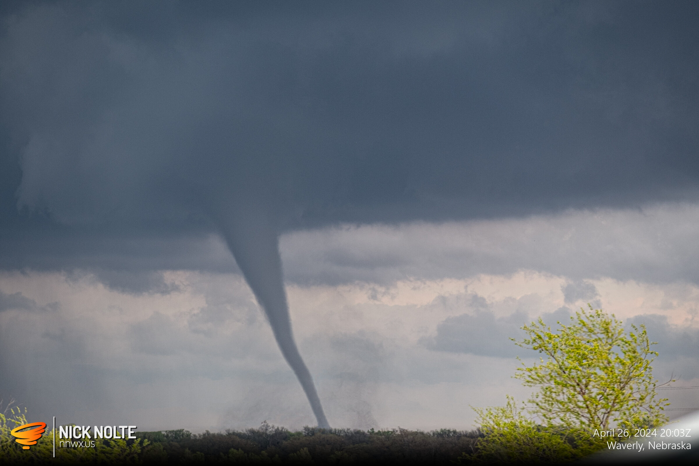
As the tornado crossed Interstate 80 it started to weaken a little bit and looked like it might rope out but eventually it reconstituted itself and this would end up moving on as the Waverly tornado.
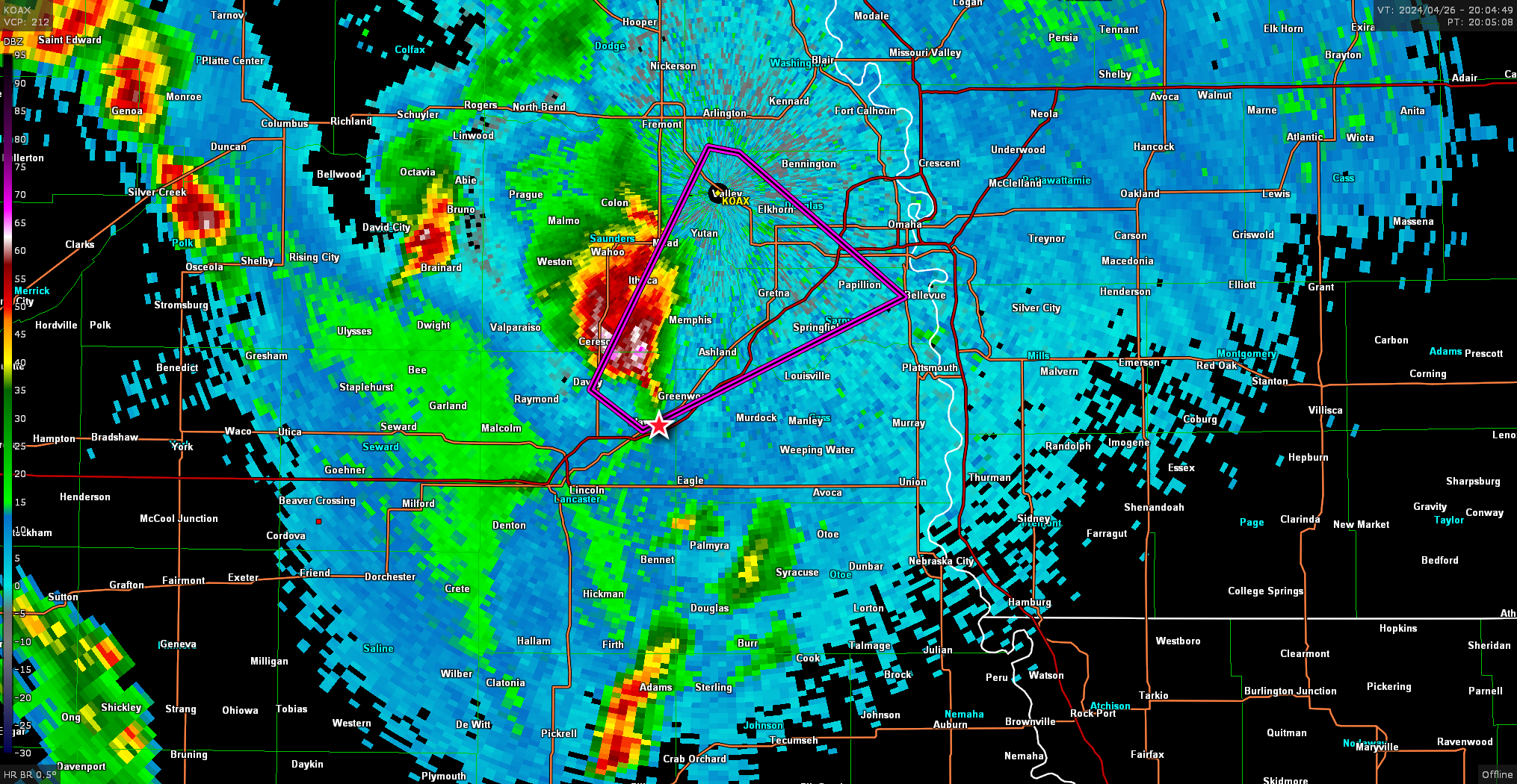
As the storm pulled away to the northeast, I was unable to keep up as Interstate 80 was partially blocked by an overturned semi. That cell ended up impacting the Elkhorn area. Once I got through I decided to continue east on the interstate to see if I could catch back up but and did manage to pull up on the backside of the storm near Blair.
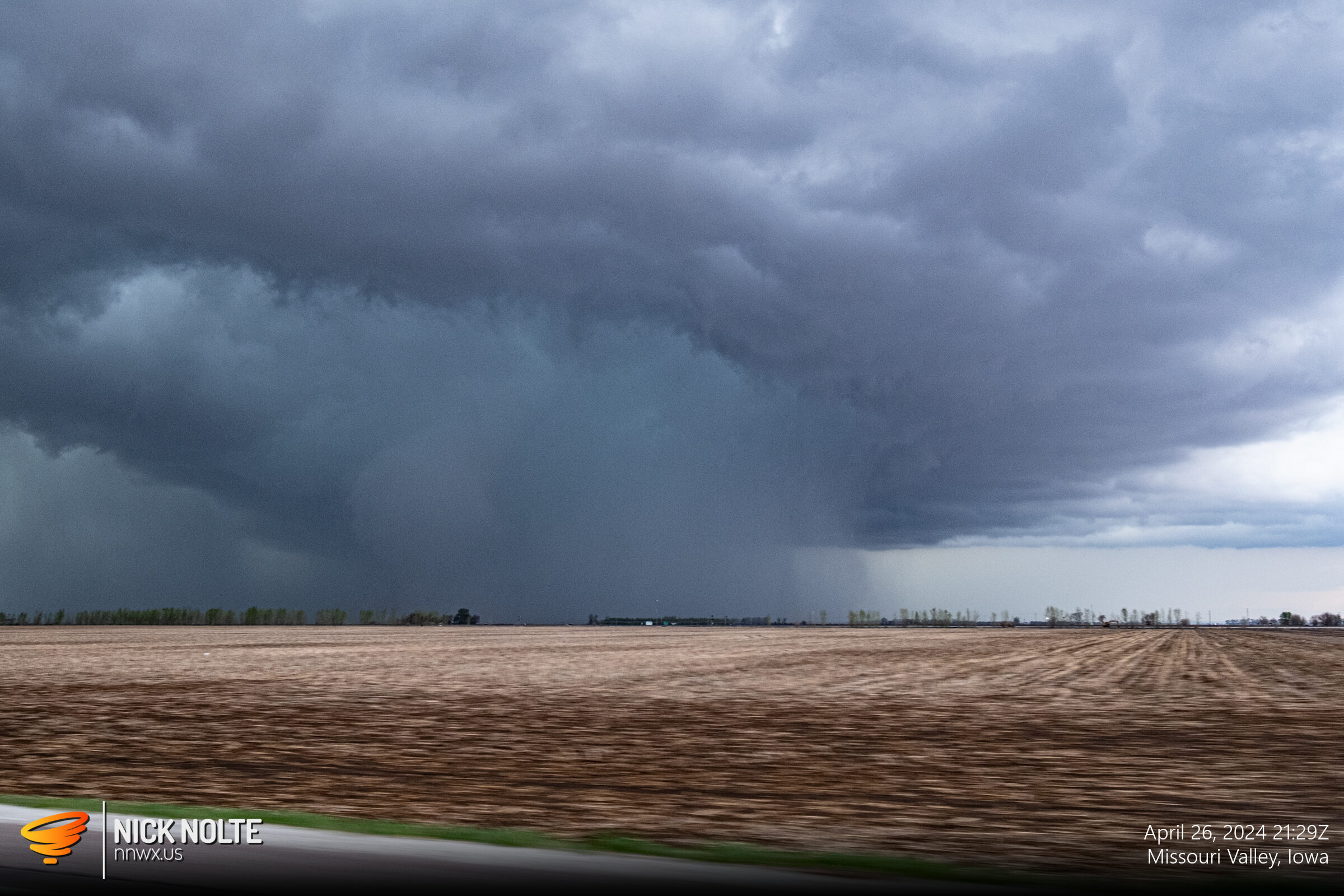
At this point I decided to drop off the storm and began targeting the storms coming up from the south as they were starting to become tornado warned as well. I figured it would be easier to setup for an intercept than continue trying to keep up with the Blair storm.
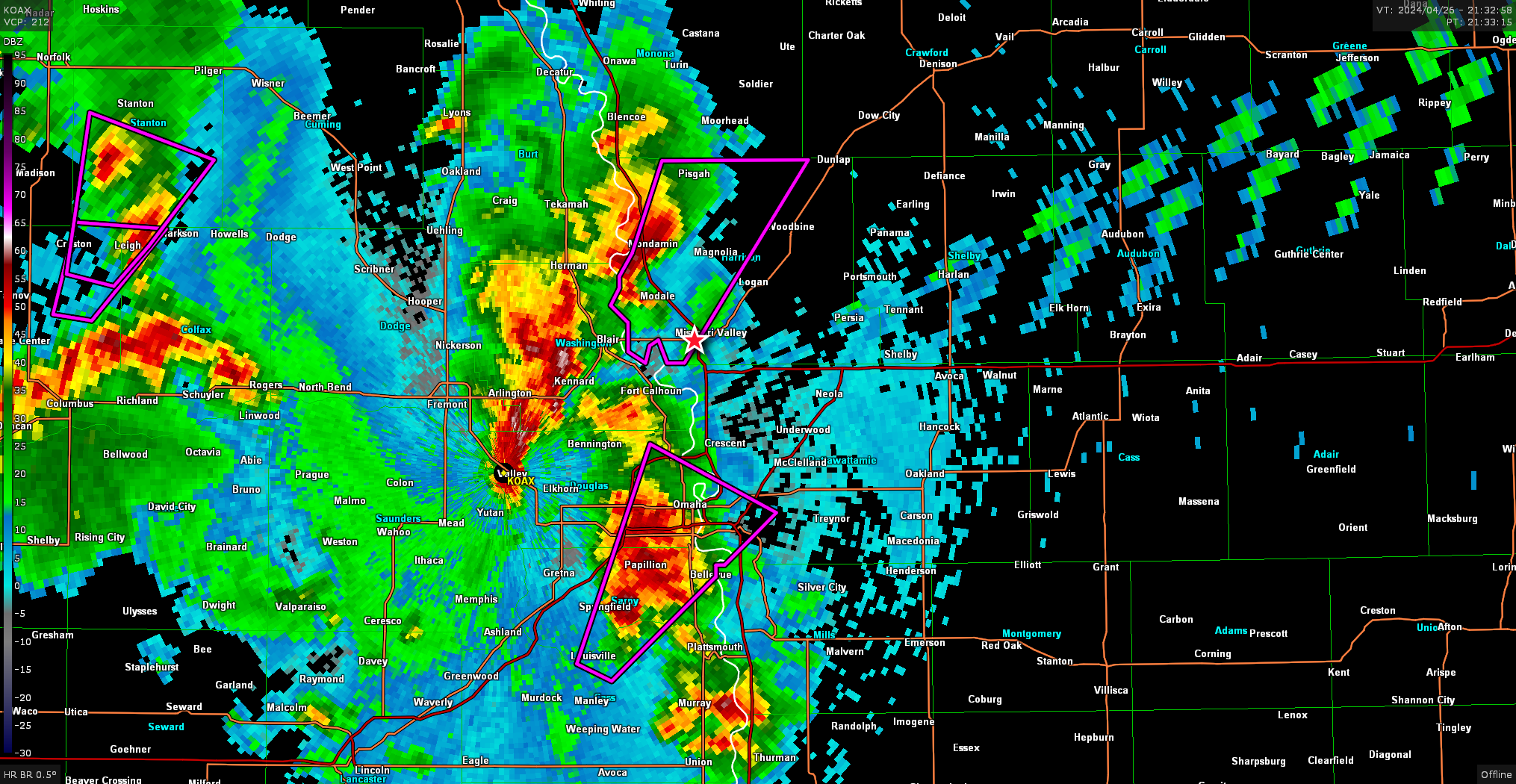
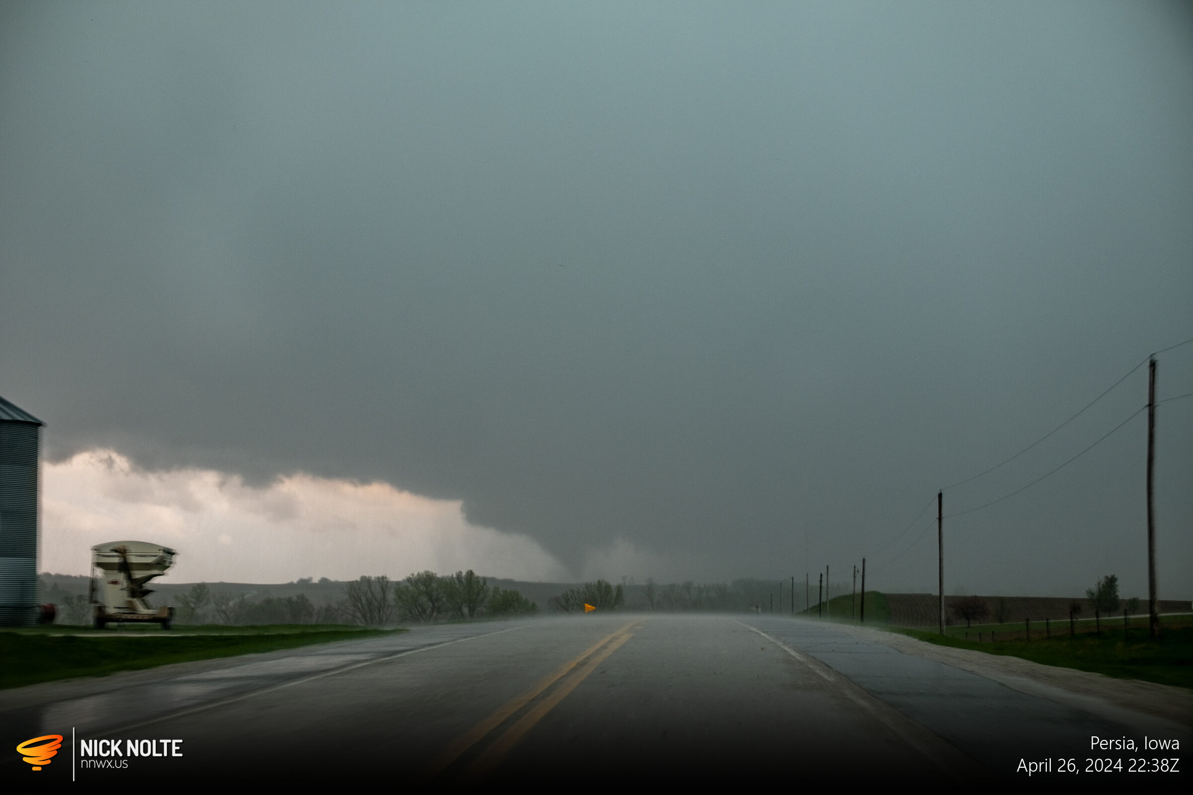
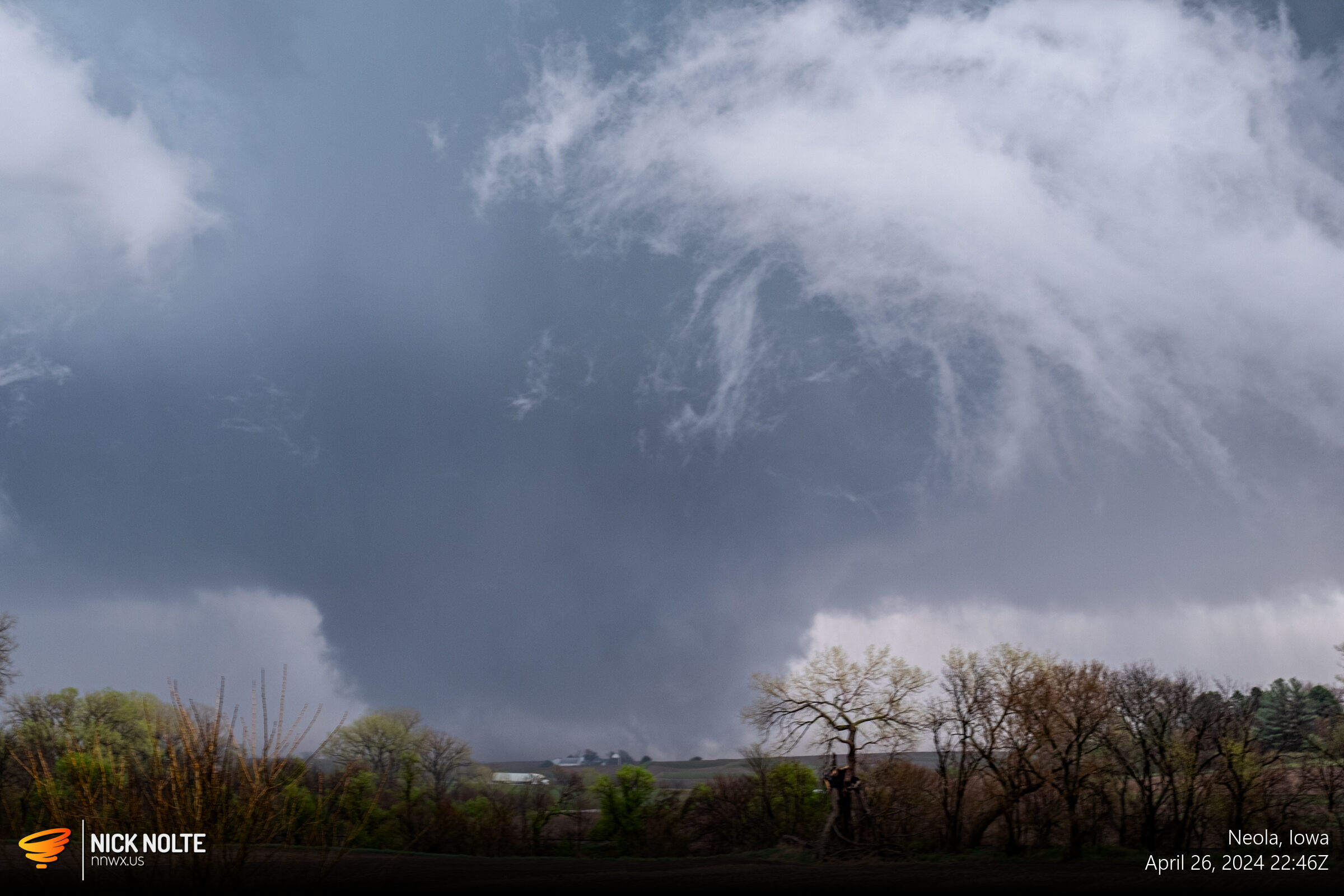
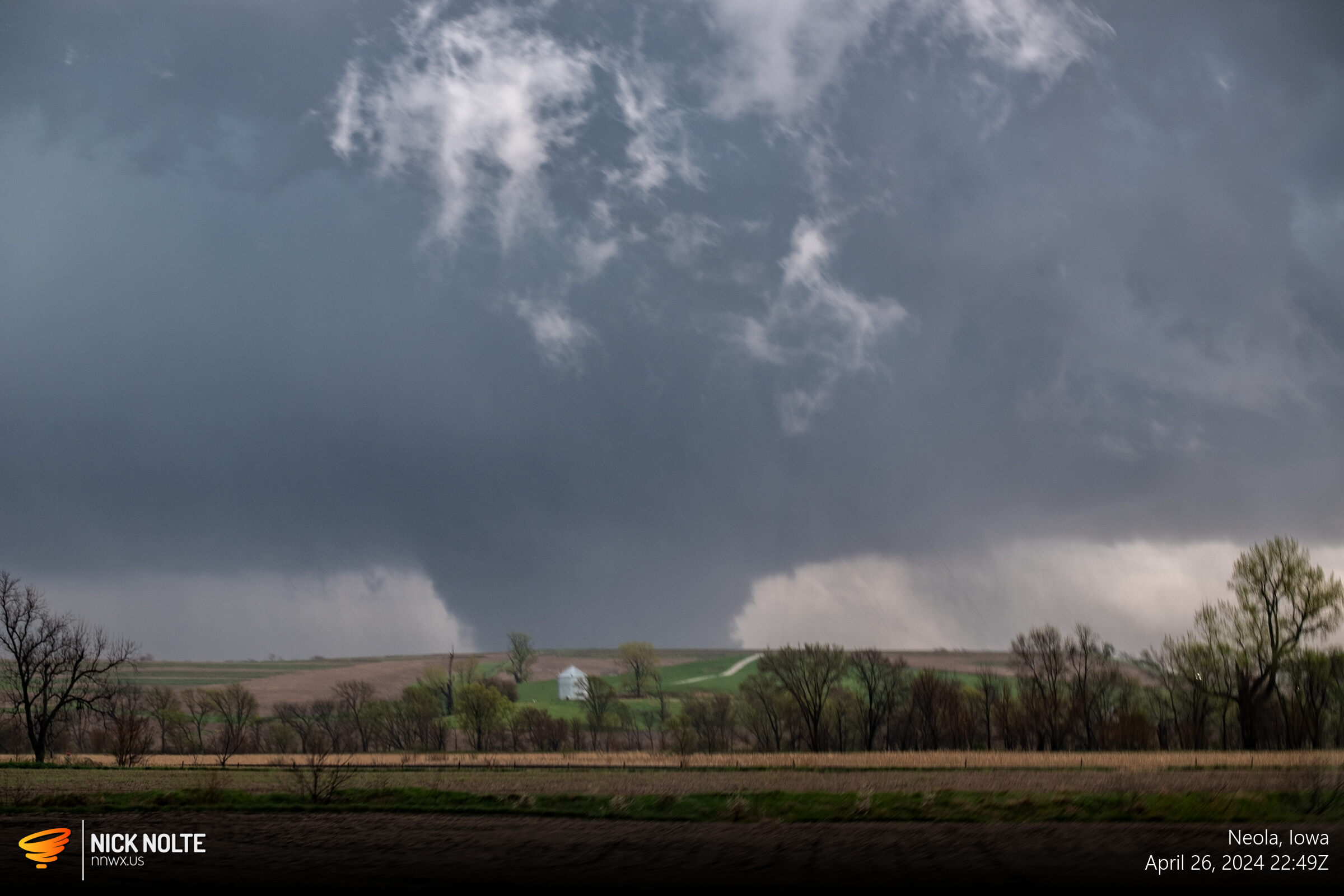
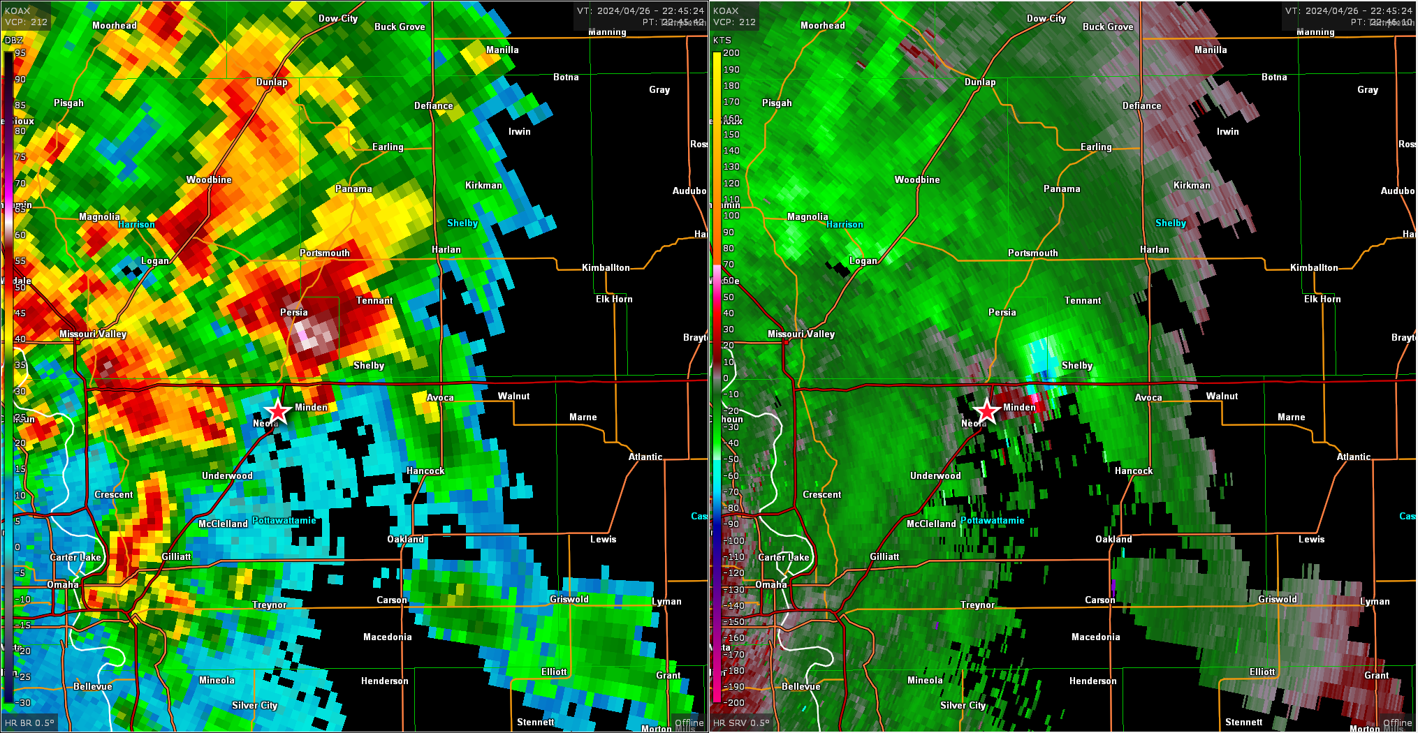
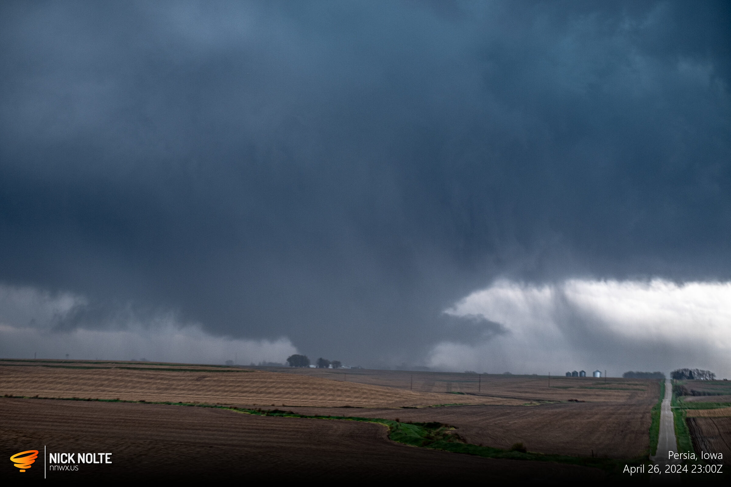
I dropped down on I-29 and then east on I-880 and setup near Persia to catch the next storm in line. As it approached a tornado was already in progress. I drove south a bit and setup near Neola to watch as the storm slid by to my east.
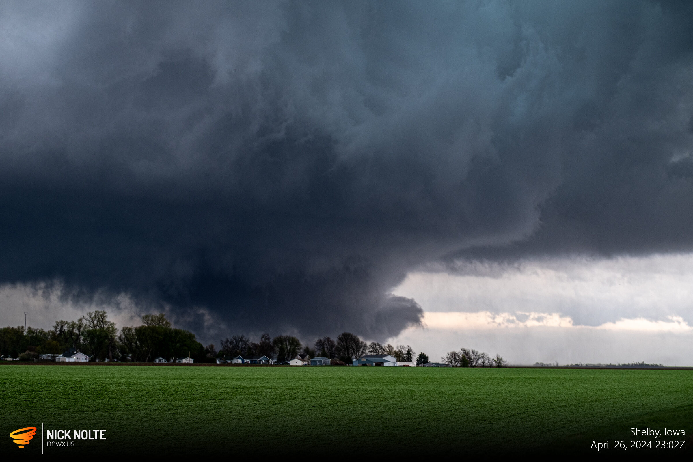
As the storm progressed, the tornado turned into a massive wedge as it tracked towards Minden.
I sat too long at this spot watching the wedge in the distance that I had to play catch up the rest of the chase, but visibility on the storm was excellent so trailing behind the storm was great for views.
Here’s my compilation video from the day’s chase:
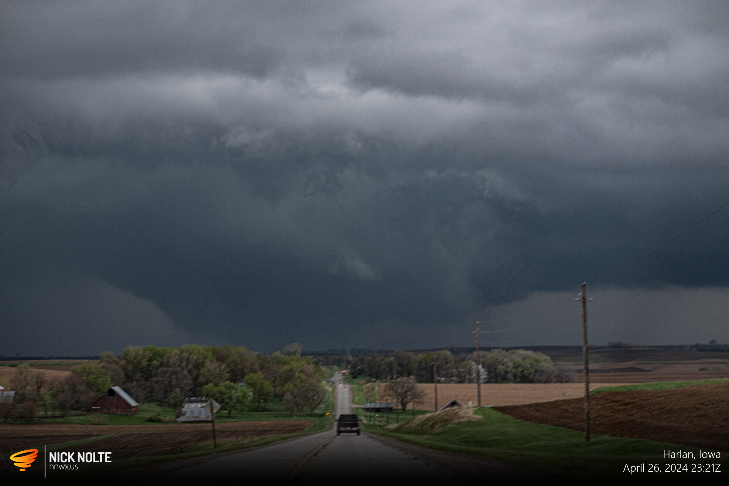
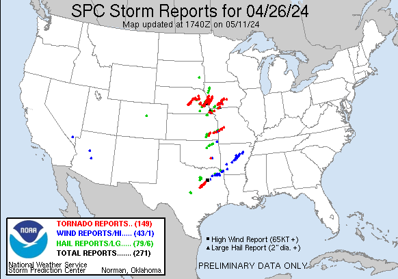
As it approached Harlan, I was too far behind to keep up and this marked the end of the chase. In all, a very good chase with top tier tornadoes on multiple storms as an outbreak verified with 149 tornado reports. The storm reports outlines around 9 clear long track tornadoes, 1 in Kansas and Texas each, the remainder in Nebraska and Iowa.
Chase Recap
| START | END | DURATION |
|---|---|---|
| Grand Island, NE @ 26/1543Z | Council Bluffs, IA @ 27/0155Z | 10 hours, 12 minutes |
| INTERCEPTS | CHASER ENCOUNTERS |
|---|---|
| 26/1950Z @ Lincoln, NE 26/2003Z @ 2 SW Waverly, NE 26/2237Z @ Neola, IA 26/2243Z @ 3 NE Neola, IA | None |