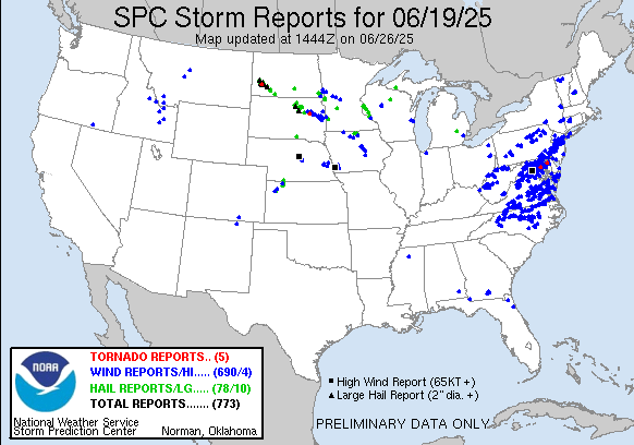
| 0 | 0.50" | 70 | 165 |
|---|---|---|---|
| TORNADOES | HAIL | WIND | MILES |
June 19th wasn’t a pre-planned chase day. SPC had a marginal extended from South Dakota into Kansas and Colorado along a surface trough. Although MLCAPE values were expected in the 2-3k range, it was a conditional threat on if something would fire.
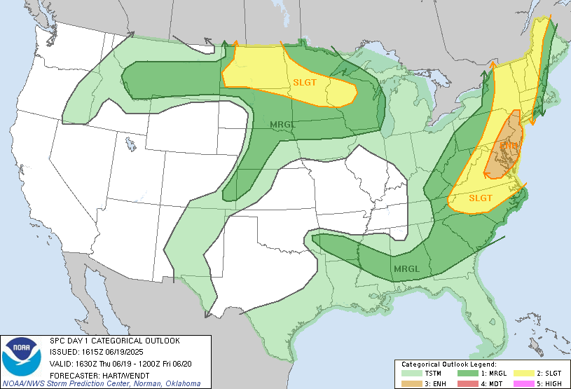
SPC issued a mesoscale discussion a bit after 6pm extending from O’Neill all the way to Southeastern Colorado. By this time a storm had already fired southeast of Basset. I was monitoring this from Grand Island and once I realized the storm was going to track down highway 11 I decided to head up there. I took off right at 0z and as I left the storm went tornado warned northwest of Burwell. Given the storm motion was around 10 knots I figured I could meet it as it passed through Burwell.
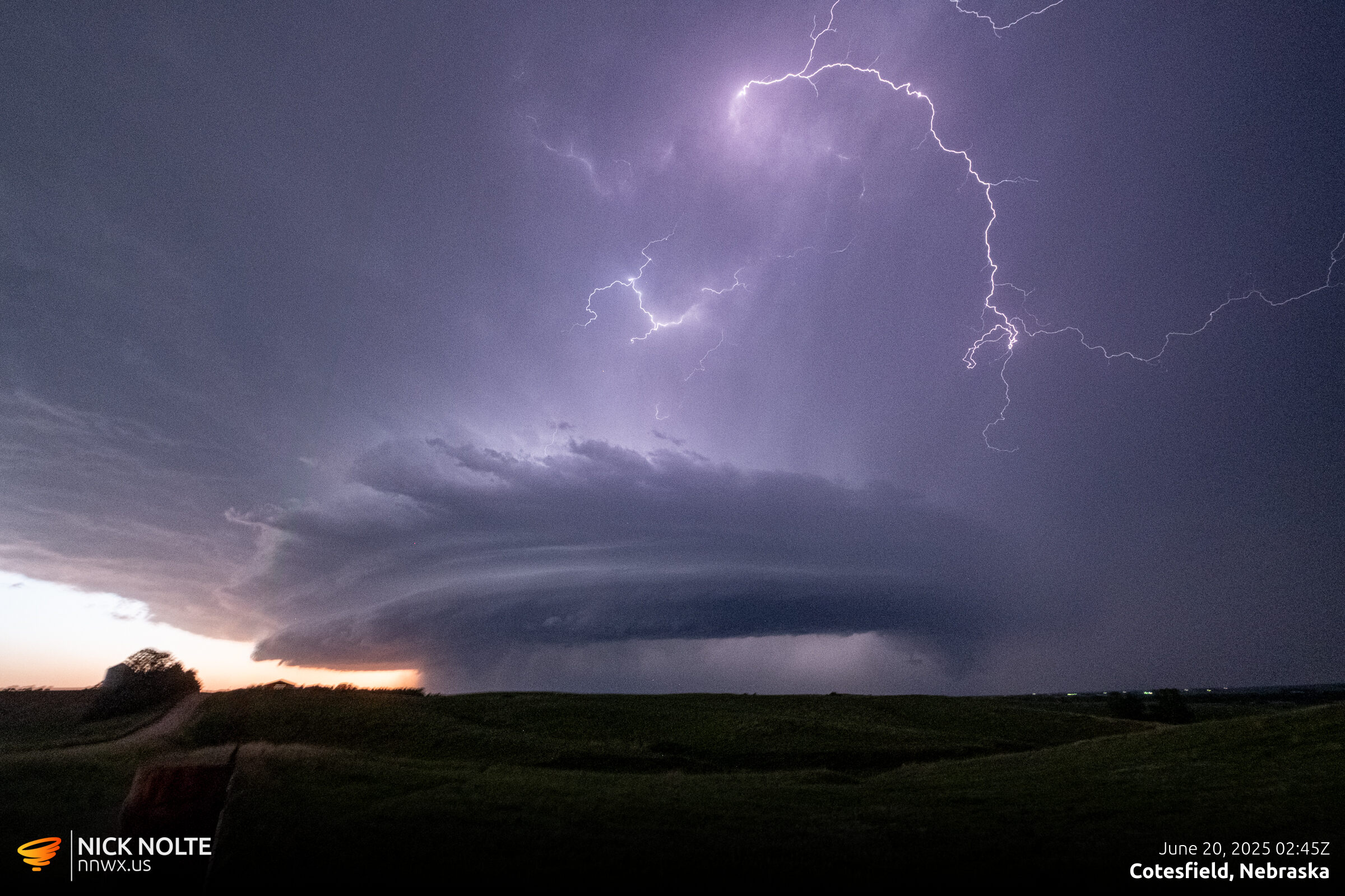
The cell sort of stayed stationary and backbuilt just north of Burwell and as I moved to the north side of town to poke into it I got a visual of a wall cloud and a gnarly inflow tail.
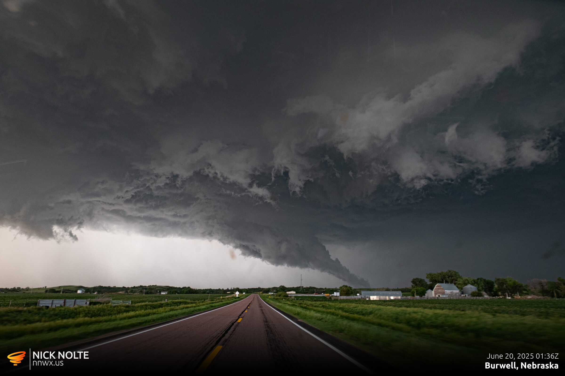
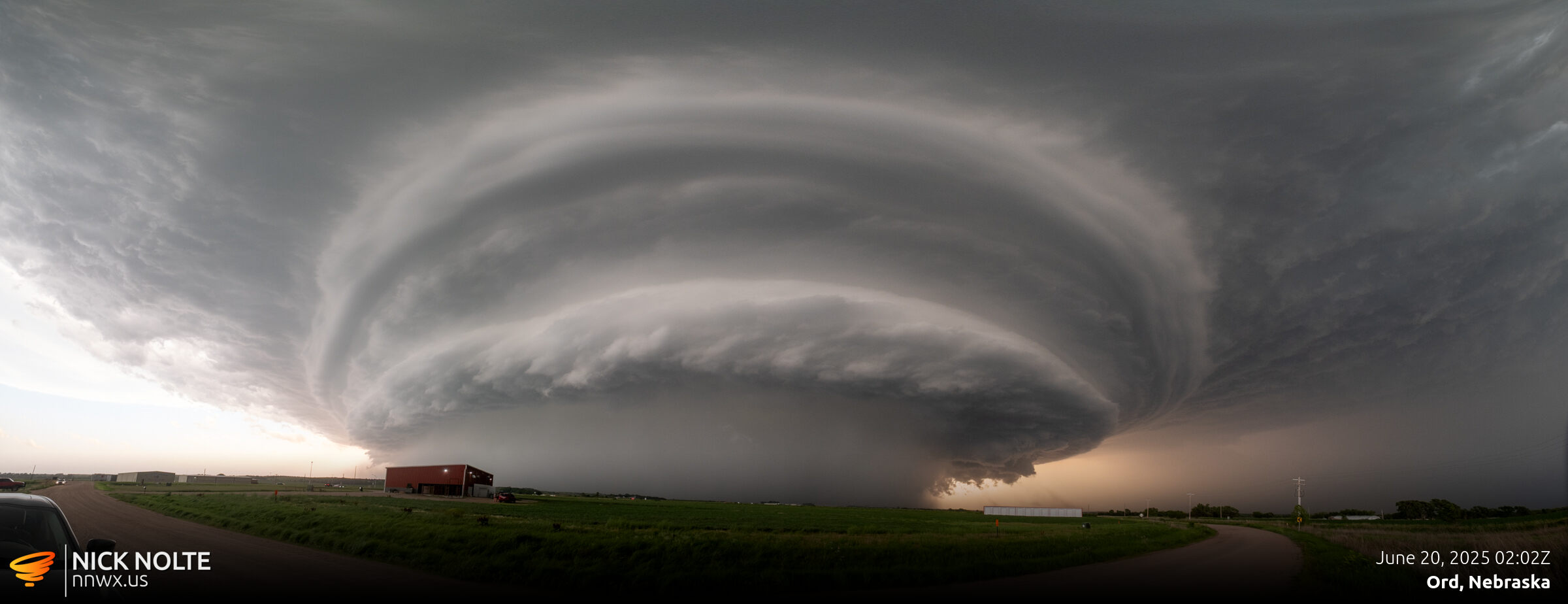
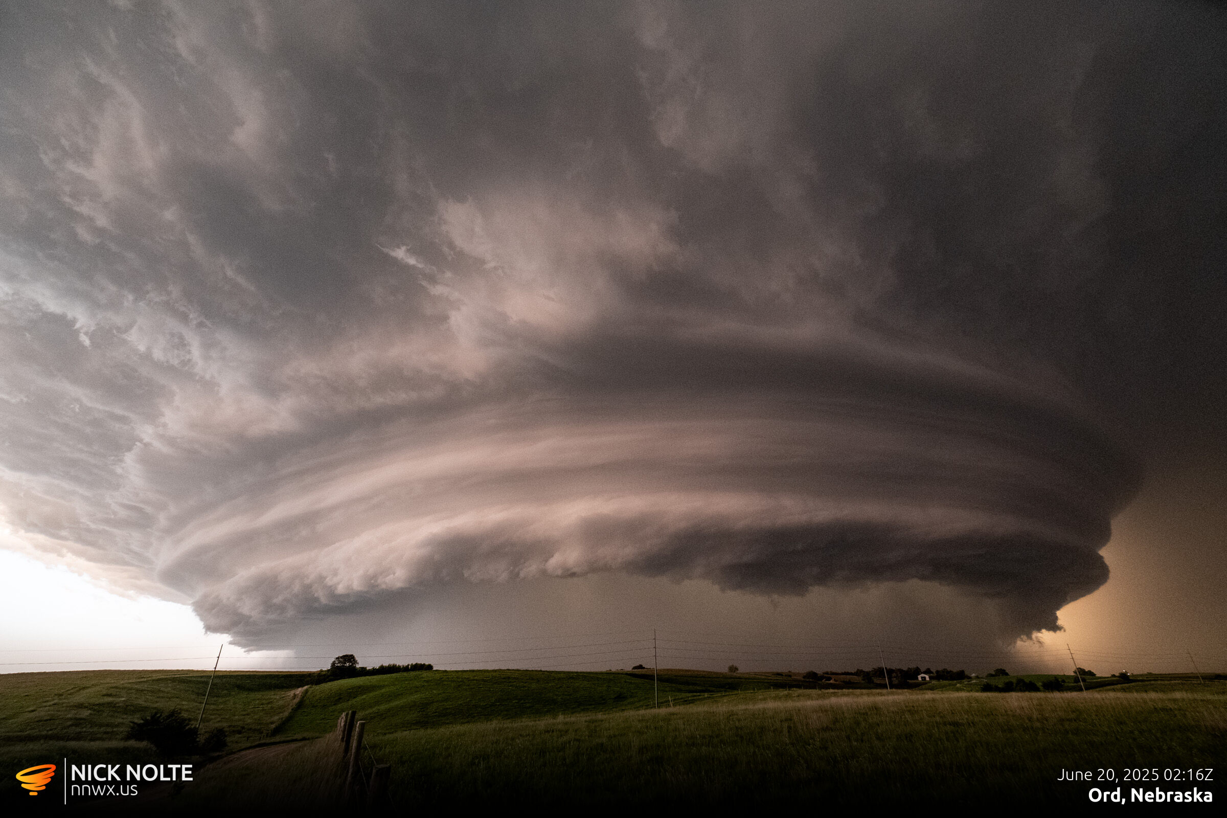
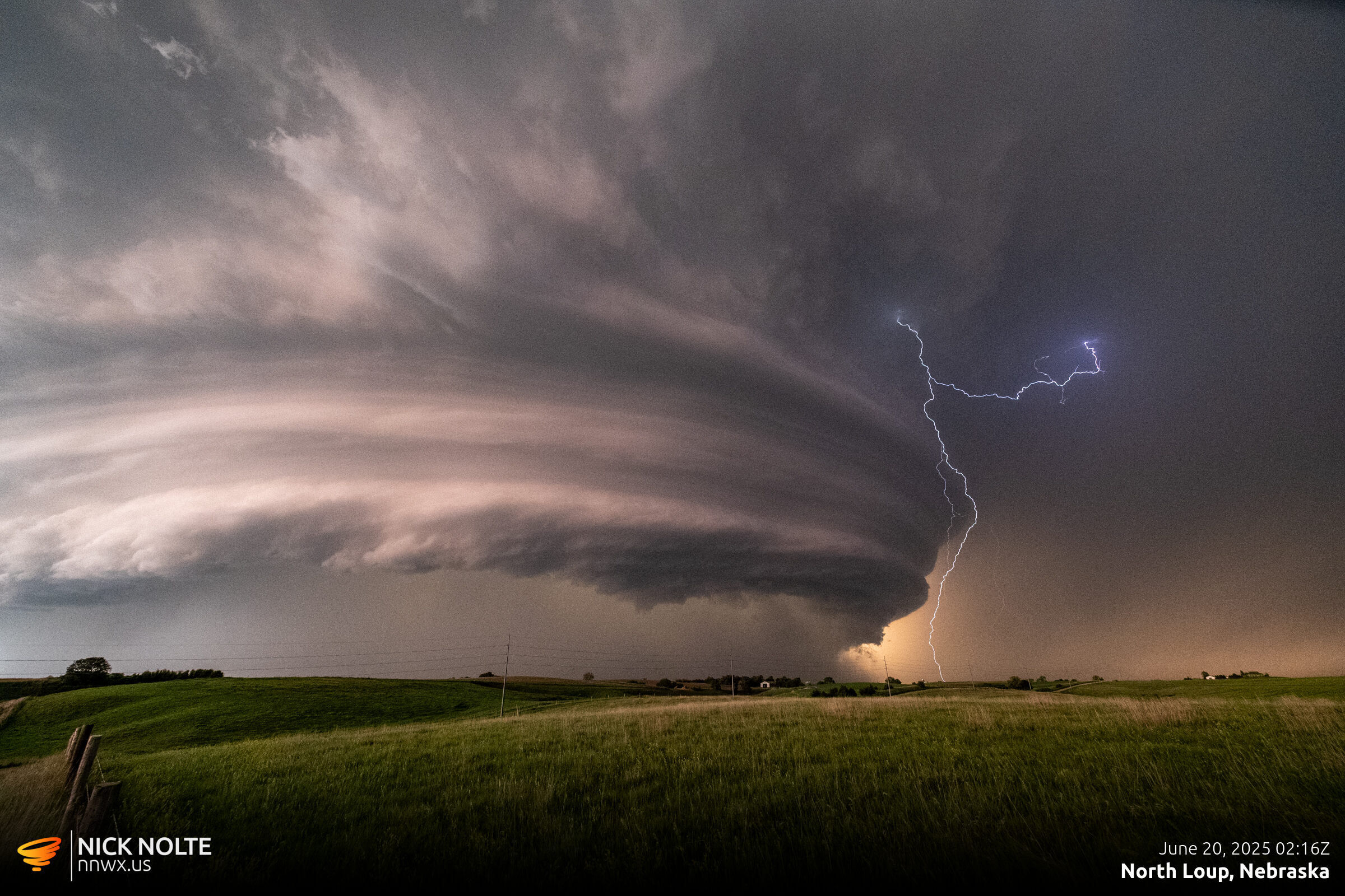
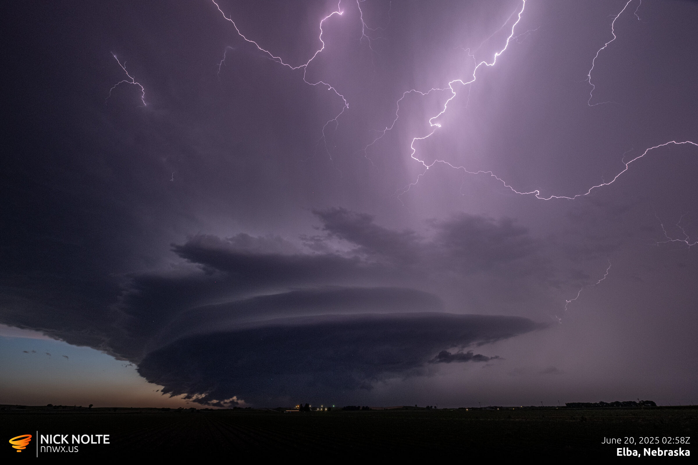
As this storm passed through Burwell, headed back southeast out of town as a few reports of 80mph winds came in that ended up causing significant damage to the grandstands at the rodeo grounds. I continued to track the storm as it ran down Highway 11 and it morphed into a quintessential mothership and I followed it all the way back to Saint Paul.
Chase Recap
| START | END | DURATION |
|---|---|---|
| Grand Island, NE @ 19/2359Z | Grand Island, NE @ 20/0334Z | 03 hours, 35 minutes |
| INTERCEPTS | CHASER ENCOUNTERS |
|---|---|
| None | None |