| 2 | 2.75" | 90 | 390 |
|---|---|---|---|
| TORNADOES | HAIL | WIND | MILES |
April 17th presented a pretty good setup for severe weather across eastern Nebraska into Iowa. A surface low in South Dakota with a cold front stretching into southwest Nebraska where it met with a dryline was forecast to drift east. While a relatively strong EML was present, the cap was expected to weaken from the low in Minnesota and maybe later in the afternoon near the triple point in Nebraska.
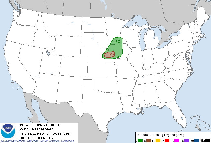
SPC had a pretty tight 5% area drawn basically over Omaha Metro and forecast models, especially the HRRR, was very consistent with one or two supercells tracking from the Columbus area to Omaha.
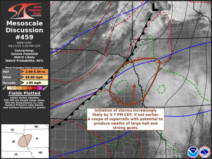
In my surface analysis before heading out, the triple point was evident near Kearney with a cold front between there and western Minnesota. Coupled that with the model output it looked to me like Columbus would be a safe starting point. I took off from GI around 1830z and began the trek up US 30. While on the way there a mesoscale discussion was issued along the front from Omaha to Sioux Falls for initiation between 5-7 PM CDT.
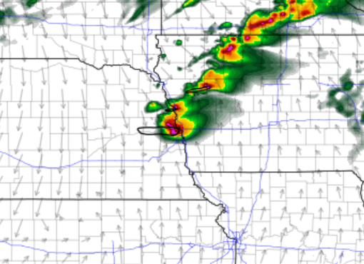
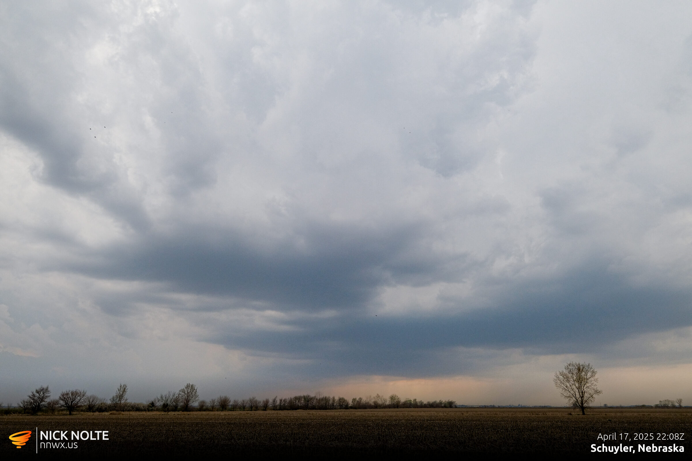
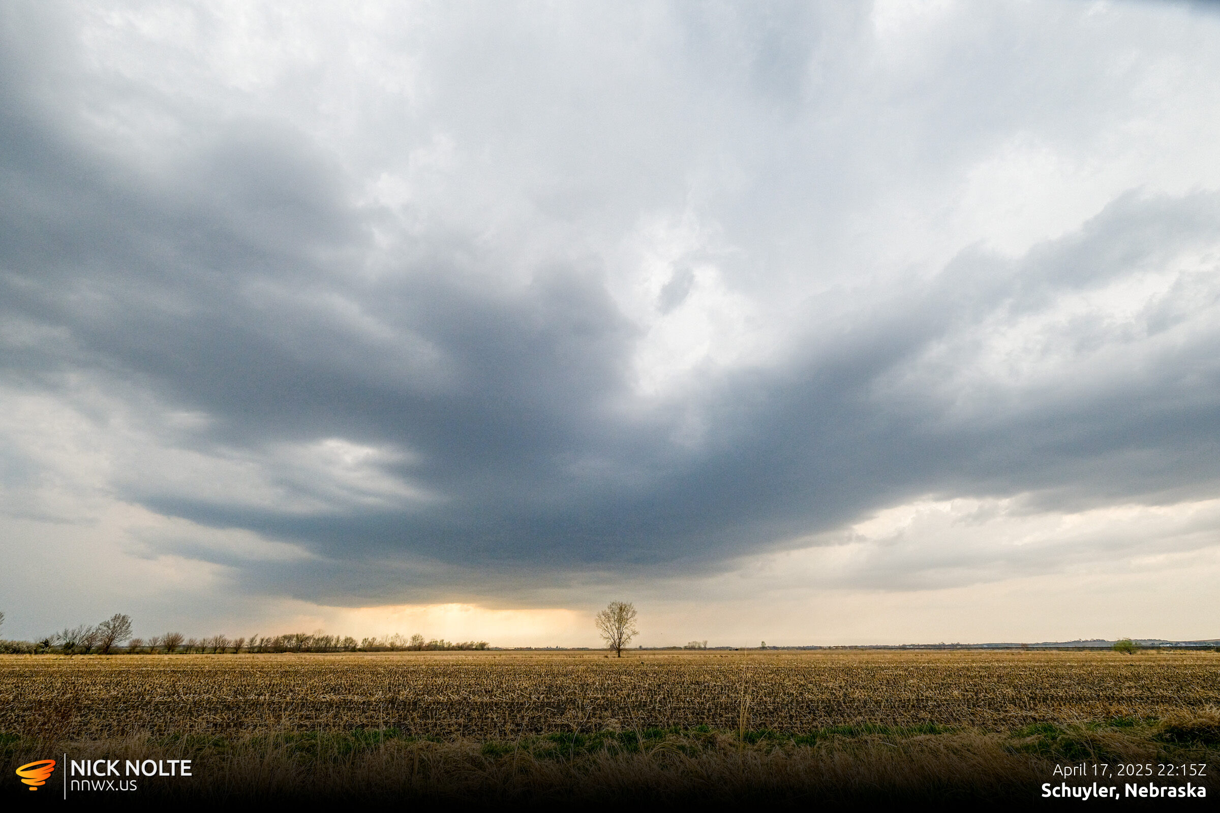
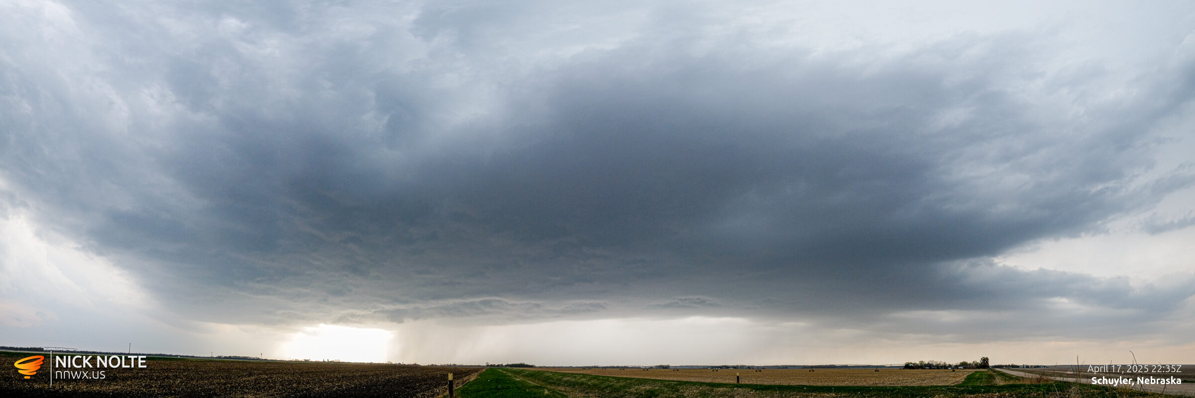
Right around 21z one of the most fun things that can happen when you’re away from home chasing…a cell pops up a couple miles from your house! I’m sitting in Schuyler as this cell develops right on the triple point over Wood River.
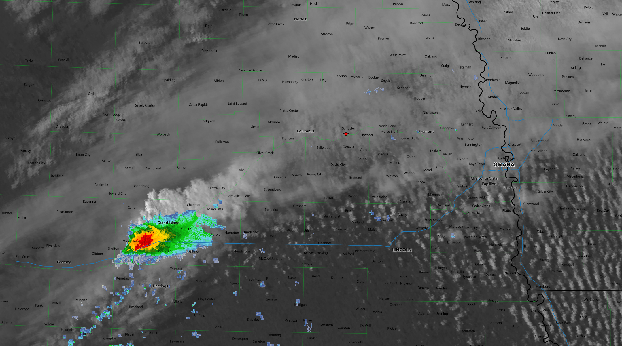
Luckily for me, a cell started to develop right over Columbus and I decided to stick with my original target and wait for the new cell to develop rather than drop south.
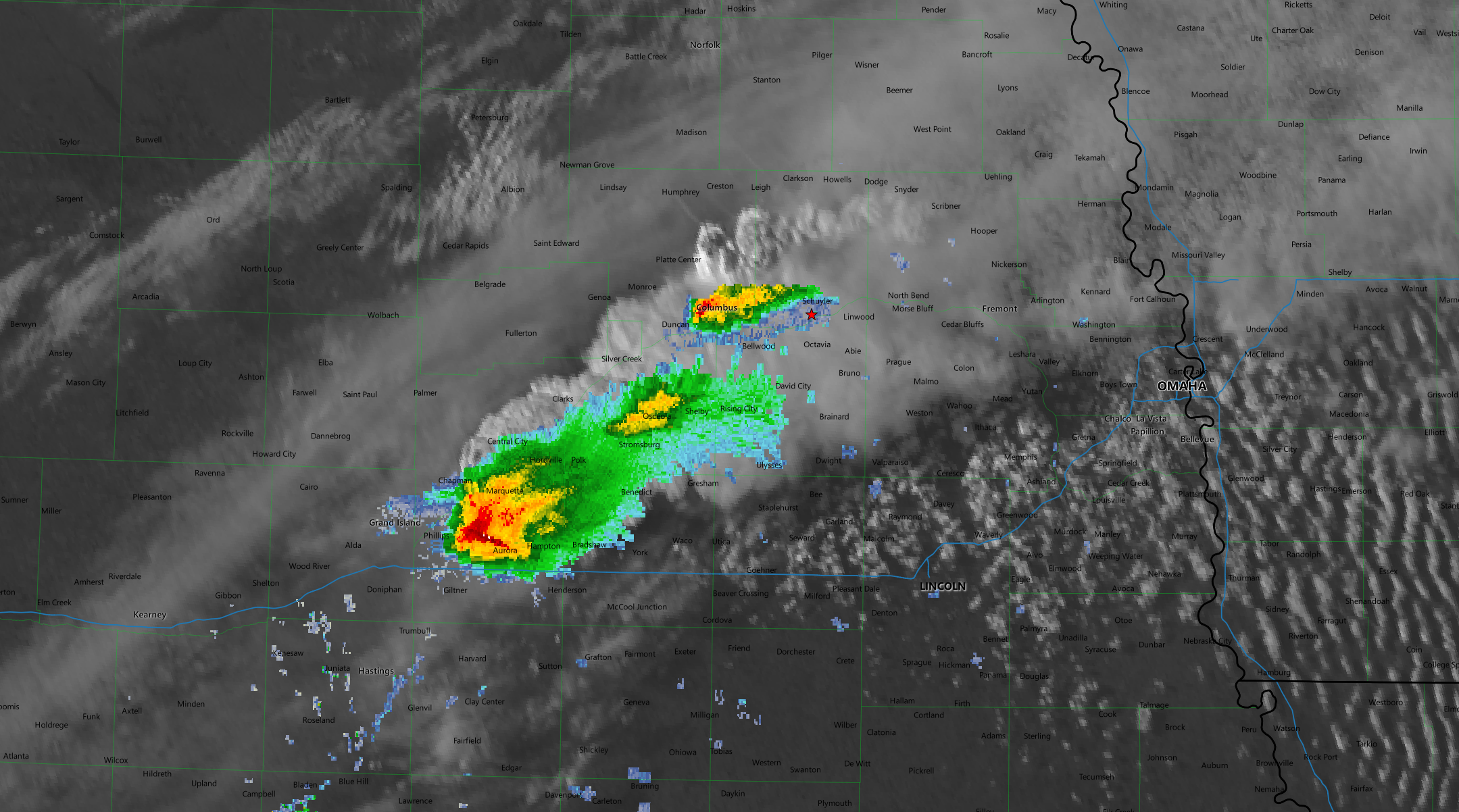
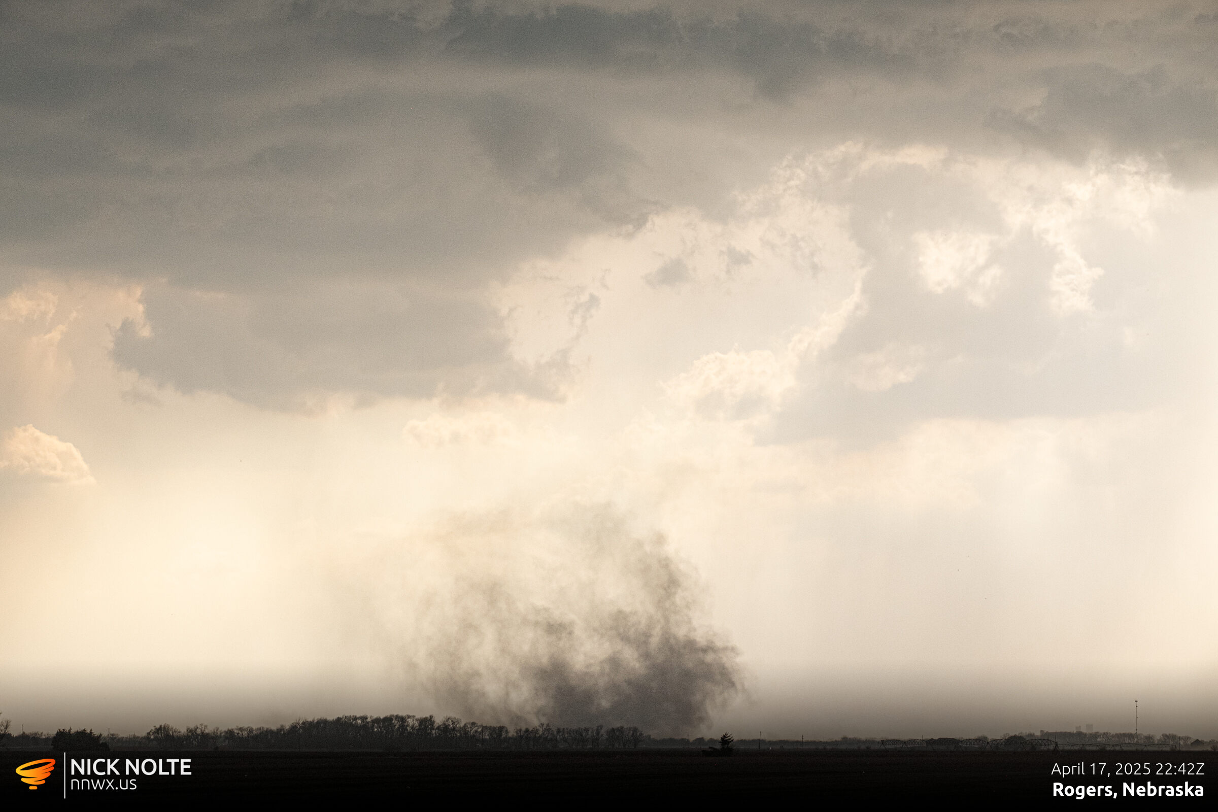
As I continued tracking the storm east, there was a dust swirl spinup. I’m not sure if this was a gustnado on the RFD front or an actual tornado but it was spinning with alacrity.
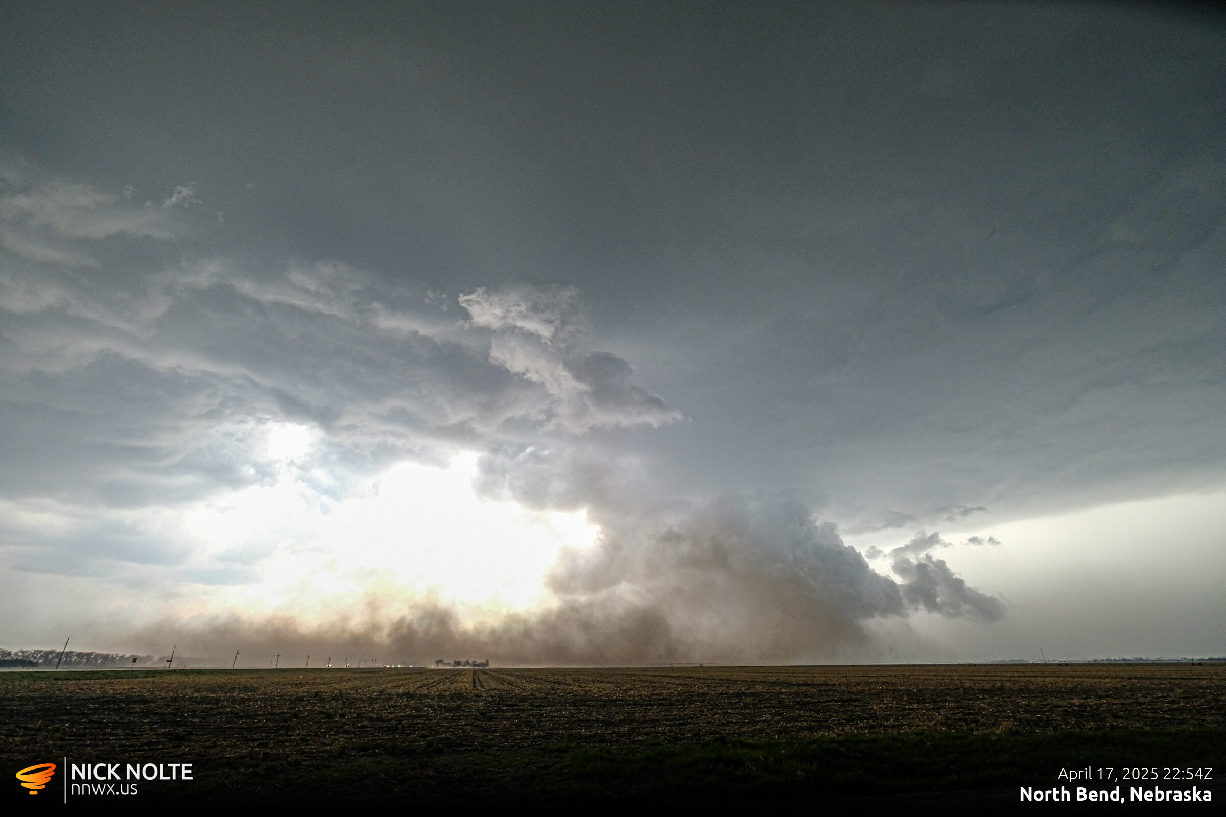
Shortly after this the storm started kicking up a huge wall of dirt along the RFD front obscuring the view into the notch. I made a decent effort to stay in front of the dust hoping it would eventually die down but after twenty minutes of non-stop dust I made the decision to let the RFD blow past me so I could see back into the storm.
As the storm approached Fremont my plan was to take the US-30 bypass around the north and east side and continue east on 30 from there. At this point the storms hail core really ramped up and as I transitioned from the freeway hail started to fall and I got caught in baseballs. I was surprised I didn’t lose any windows with how strong the wind was driving the hail.
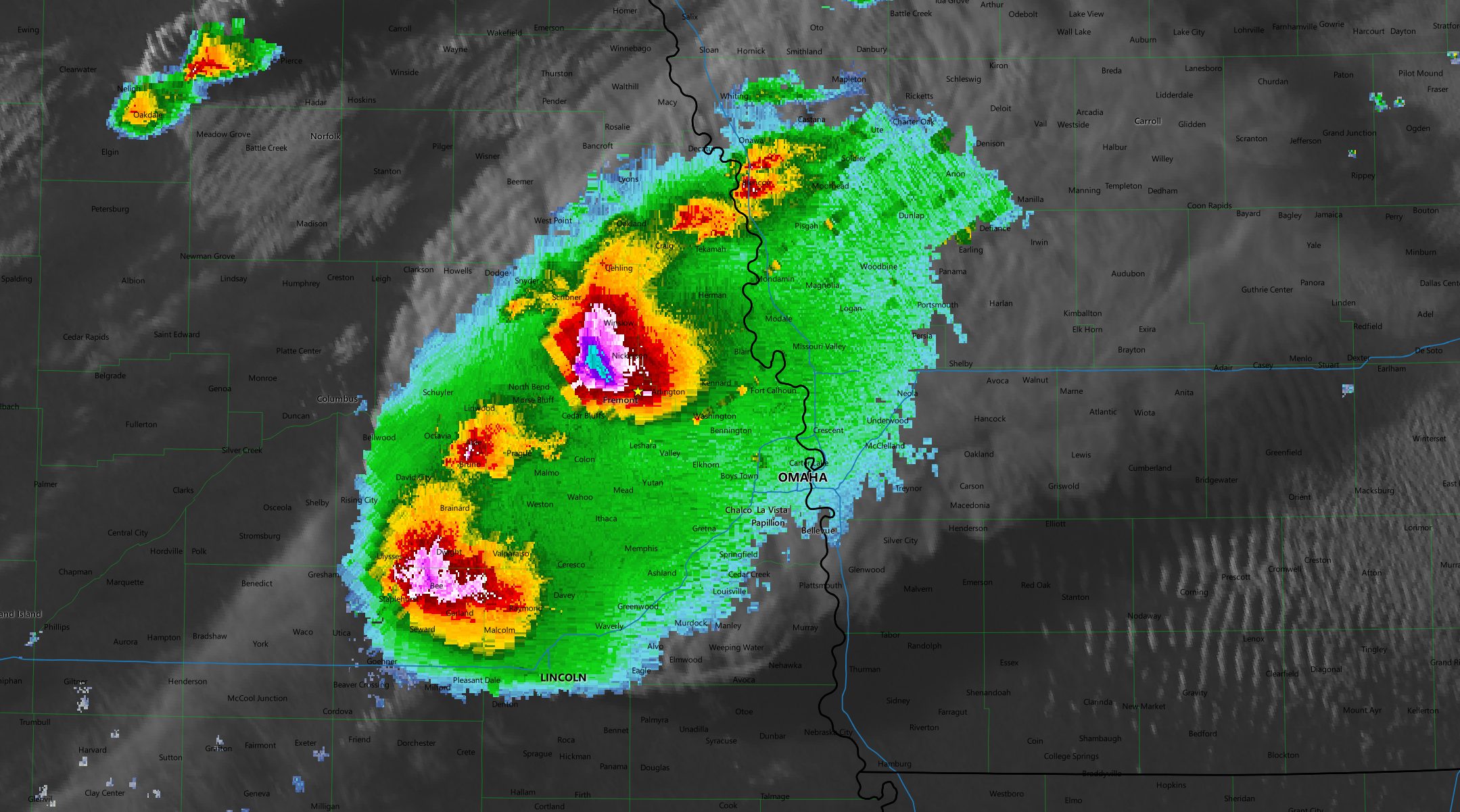
After passing Fremont I had to make a decision whether to take US-30 to Blair or drop down to highway 36 and cross at North Omaha. It looked like I wouldn’t be able to beat the FFD of the storm to Blair so I opted to drop down. After passing through Bennington and as I approached the I-680 bridge over the Missouri I spotted a tornado behind me.

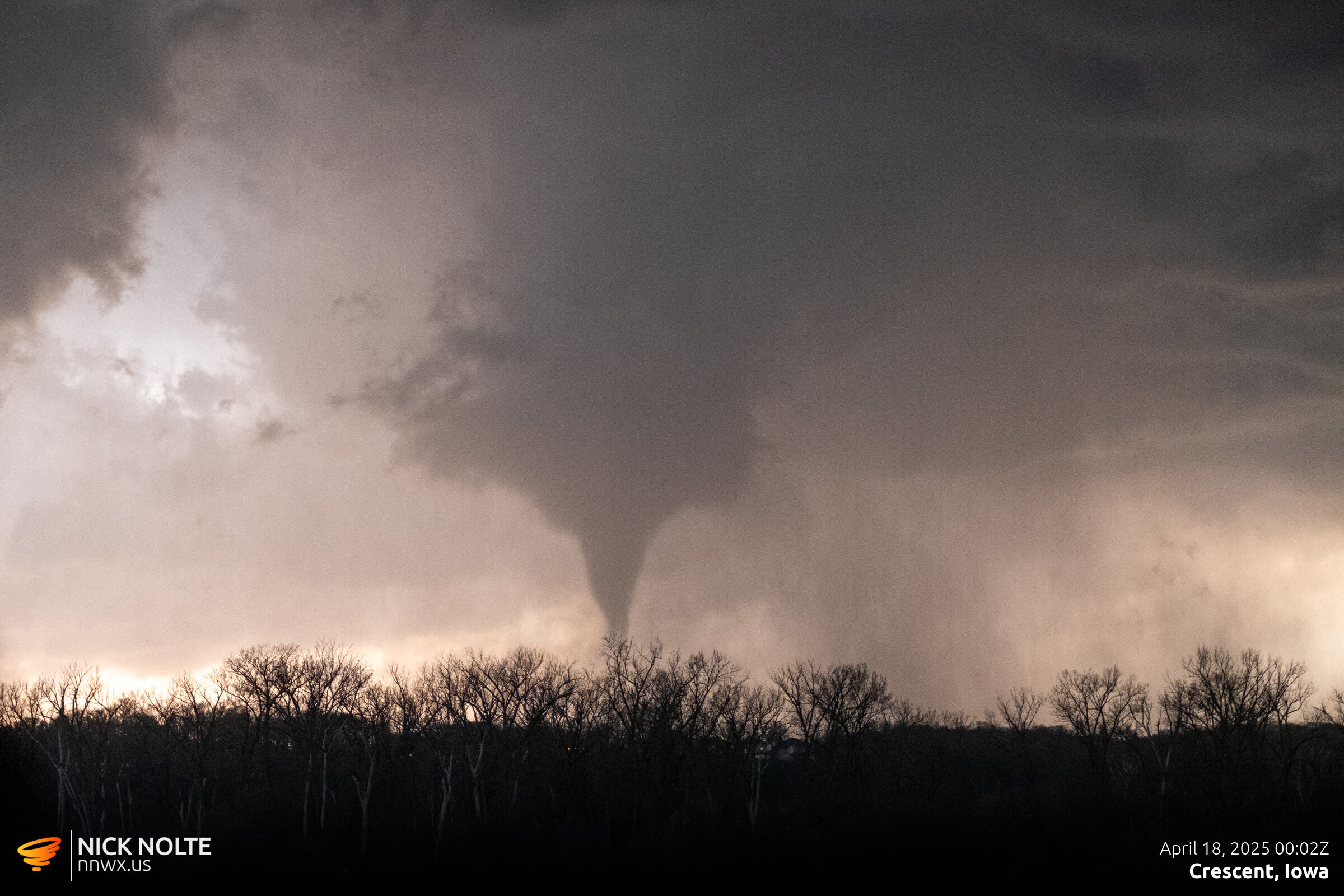
I sat on the shoulder of the highway while this tornado proceeded to track towards the river and watched it rope out before crossing into Iowa and seeing it reform or a new second tornado closer to Crescent.
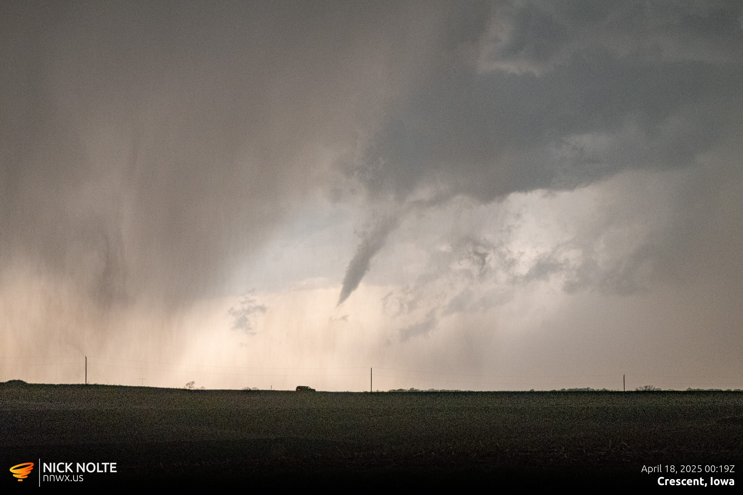
I tracked the storm to Underwood before deciding to drop south to attempt to intercept the southern storm as it was also dropping tornadoes near Randolph and Imogene. But after a bit I figured I wouldn’t get in front of the storm before it got dark so I called the chase at this point.
The National Weather Service surveyed the storm the following day and it ended up being rated EF-3 with wind speeds of 140 mph and a width of only 170 yards.
Chase Recap
| START | END | DURATION |
|---|---|---|
| Grand Island, NE @ 17/1818Z | Grand Island, NE @ 18/0331Z | 09 hours, 13 minutes |
| INTERCEPTS | CHASER ENCOUNTERS |
|---|---|
| 18/0002Z @ 5 W Crescent, IA 18/0019Z @ 1 E Crescent, IA | None |