| 1 | 1.50" | 70 | 290 |
|---|---|---|---|
| TORNADOES | HAIL | WIND | MILES |
A surface low with associated warm front was expected to stretch from the Southwest Nebraska and Colorado junction across the state line setting the stage for severe development as the front lifted north. This boundary would be coincident with a moisture axis and along with backed surface flow provide a prime environment for supercells with the potential for tornadoes.
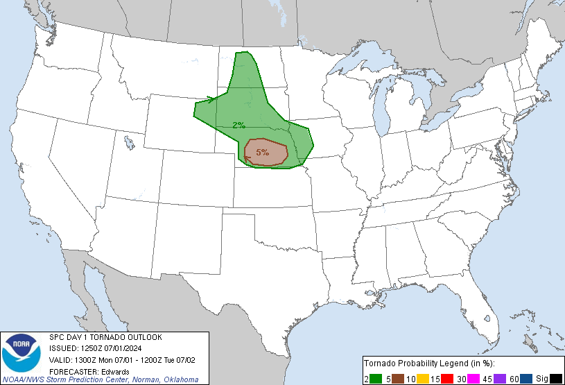
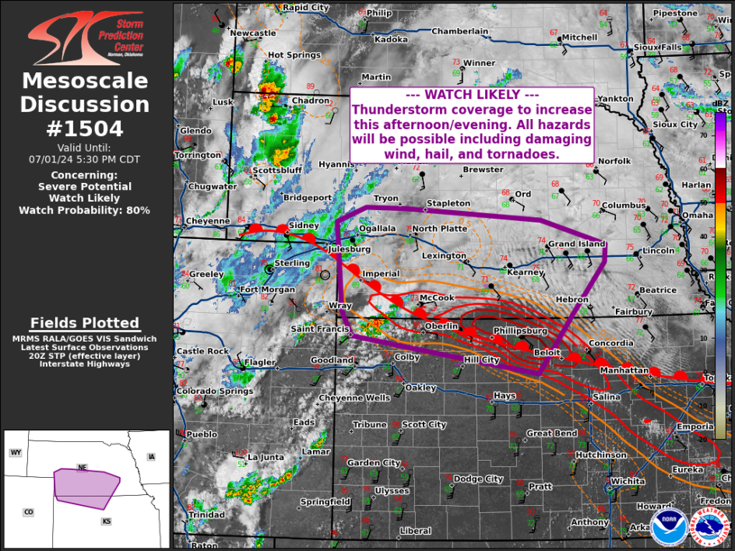
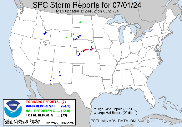
The SPC had a 5% tornado outlook across south central Nebraska encompassing the aforementioned prime environment as the best location for tornadic chances throughout the day. My target for the day would be somewhere between Arapahoe and McCook along the US-34 corridor. I took off from Grand Island around 20z, SPC issued a mesoscale discussion for southwest Nebraska as the front was starting to lift north. Storms had begun to develop along the triple point at the NE/KS border.
I arrived in Arapahoe around 2130z and there were a couple cells over by McCook so I continued west to intercept. Eventually I got on the cell northeast of Lebanon right before 22z.
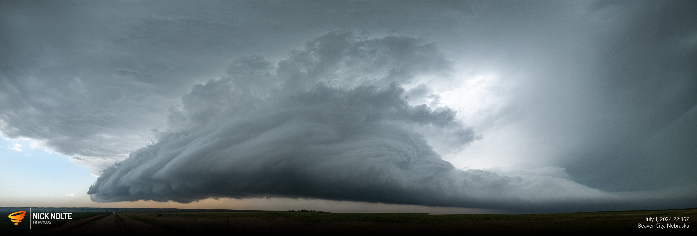
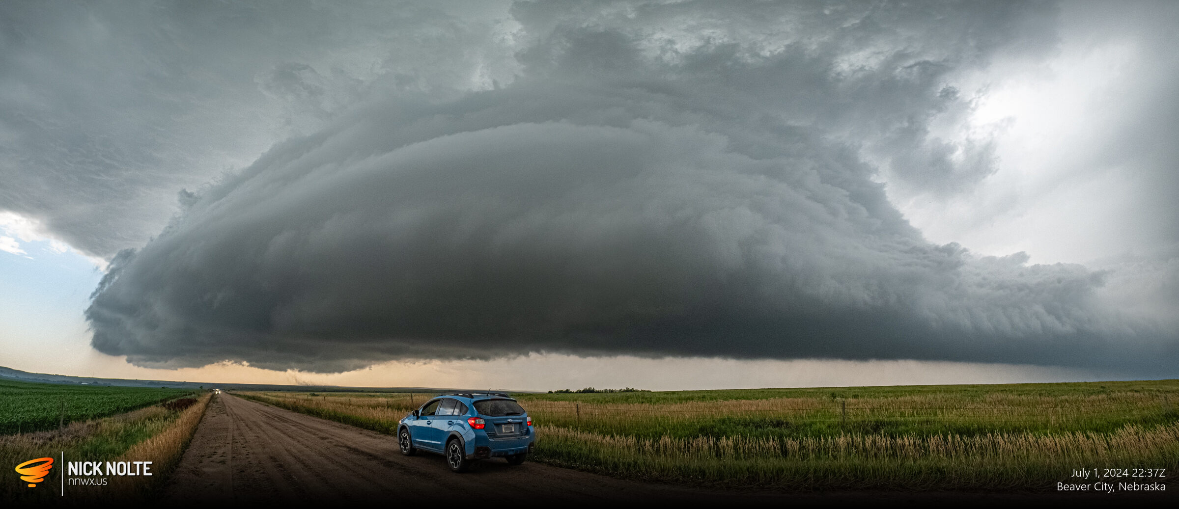
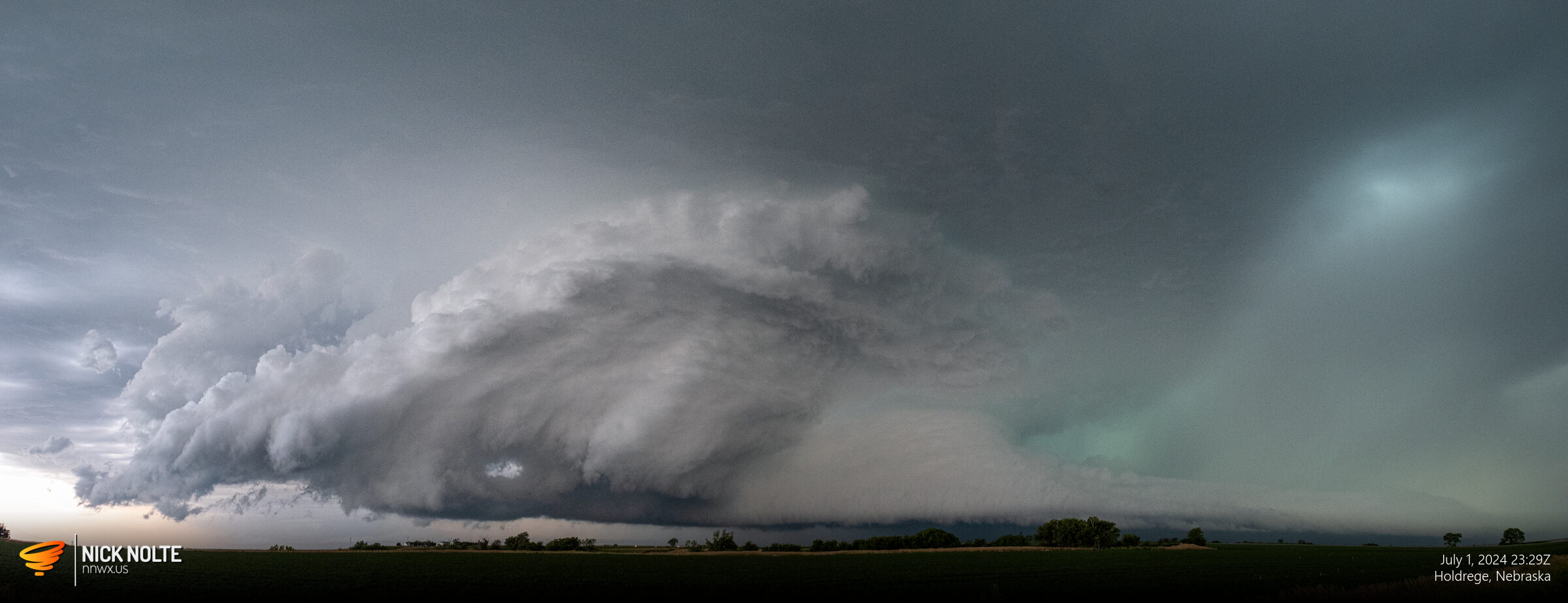
This storm exhibited some awesome structure and dust was getting kicked up in the distance on the RFD front.
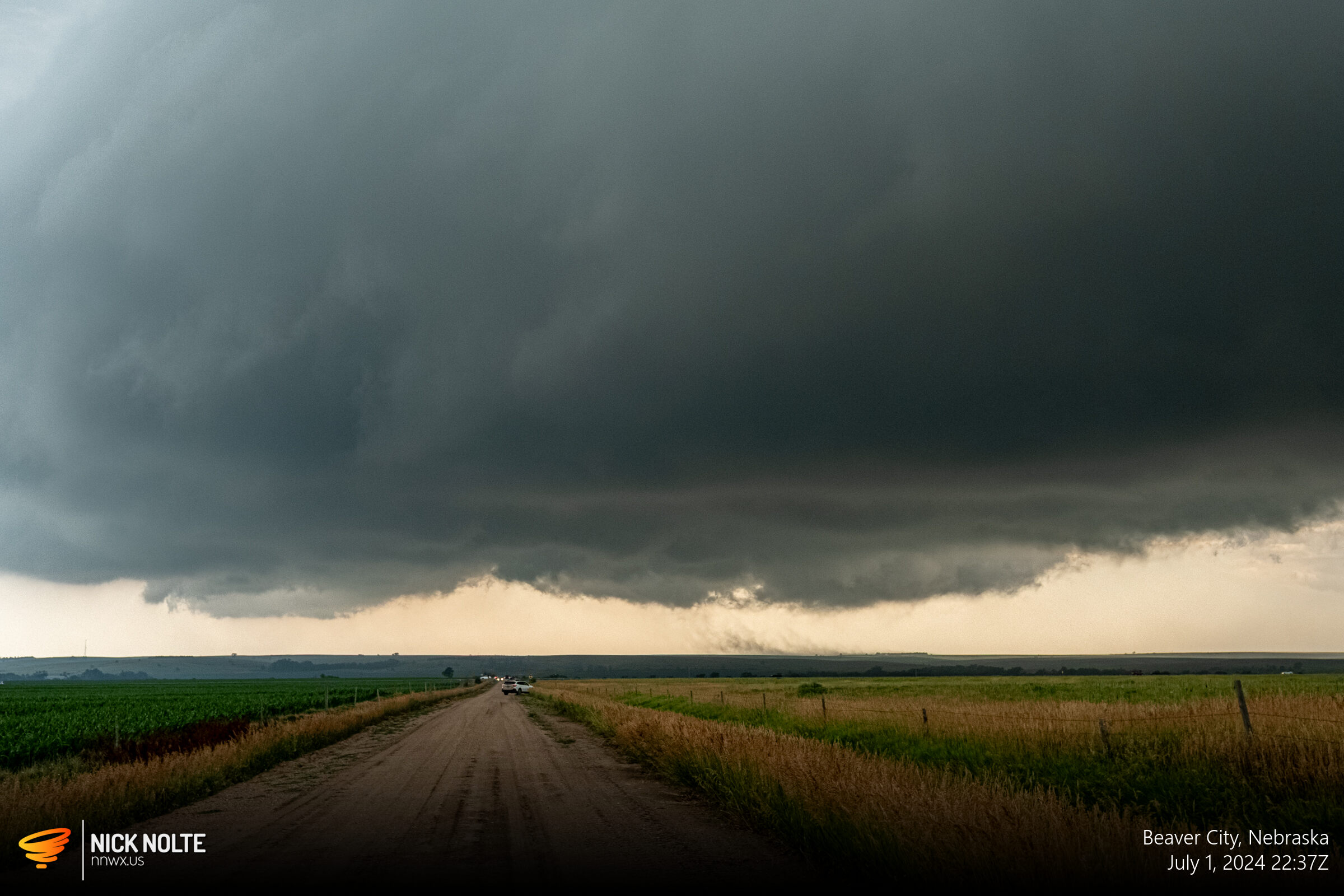
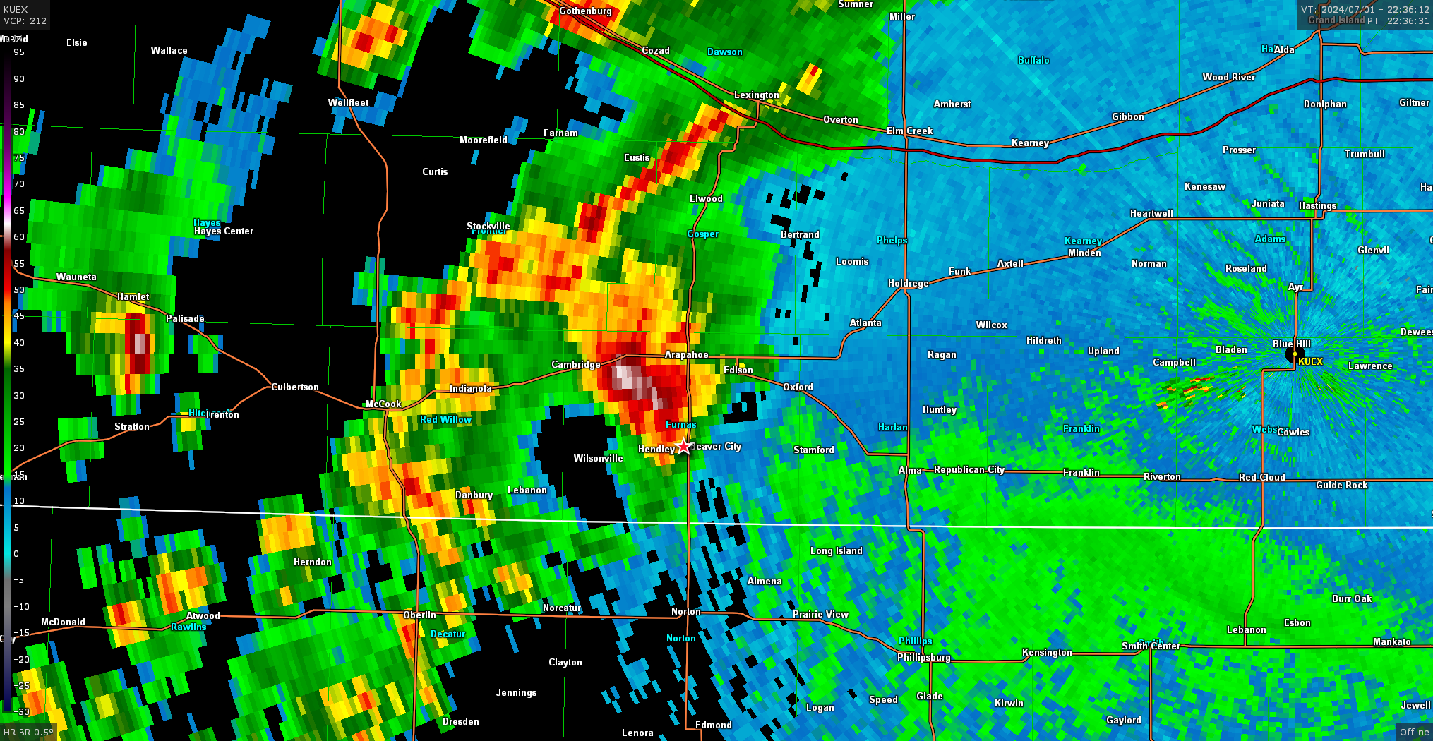
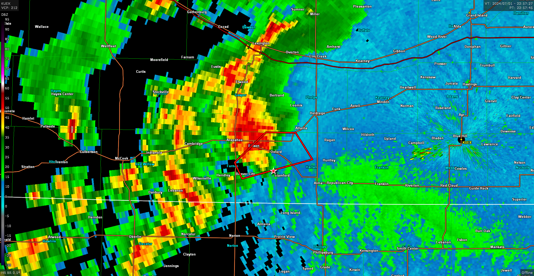
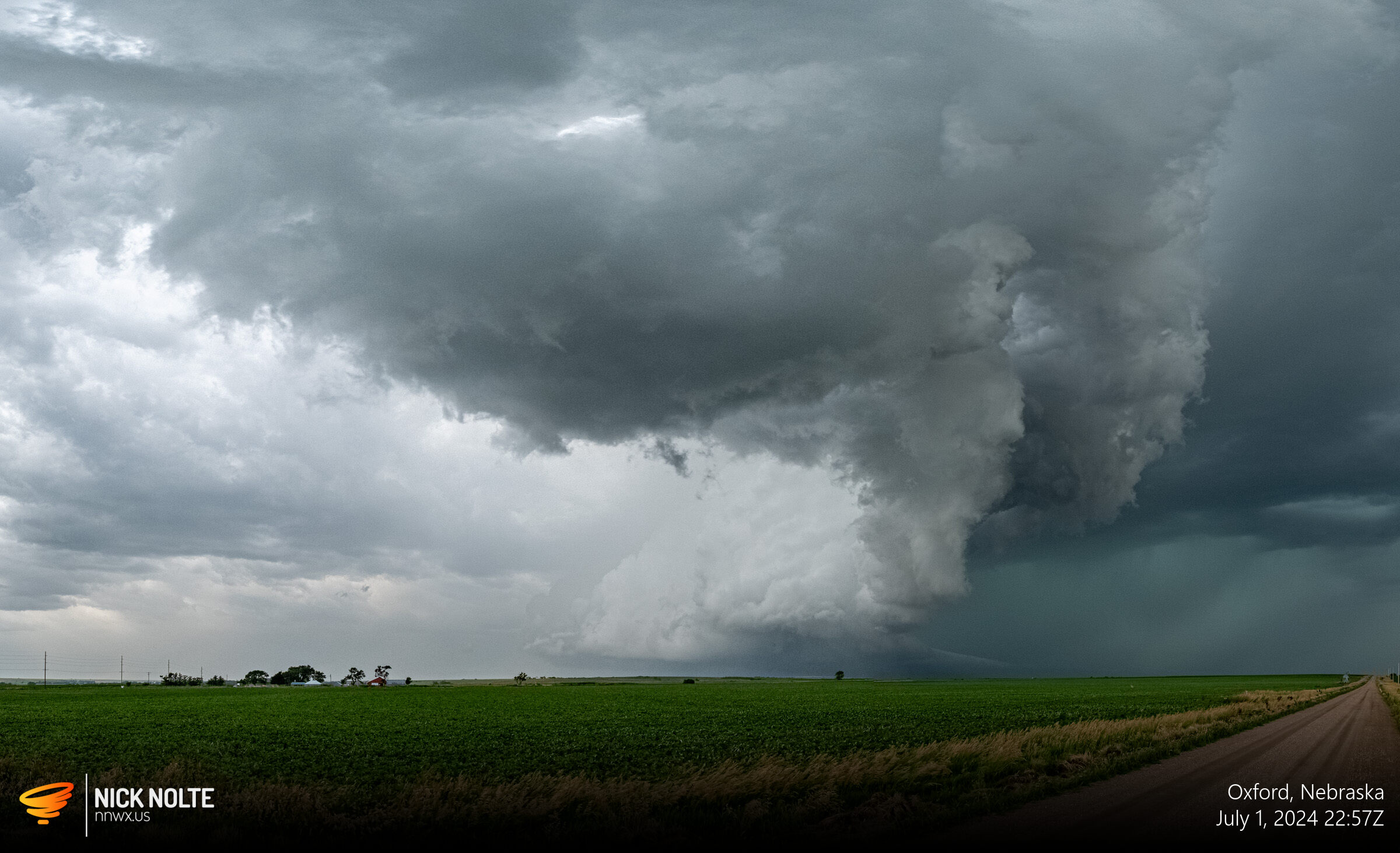
This storm went tornado warned as it approached Oxford just a few minutes before 23z and there was quite a clear RFD cut visible. I continued to track the storm as it moved east and the wall cloud became very beefy with a very large inflow band.
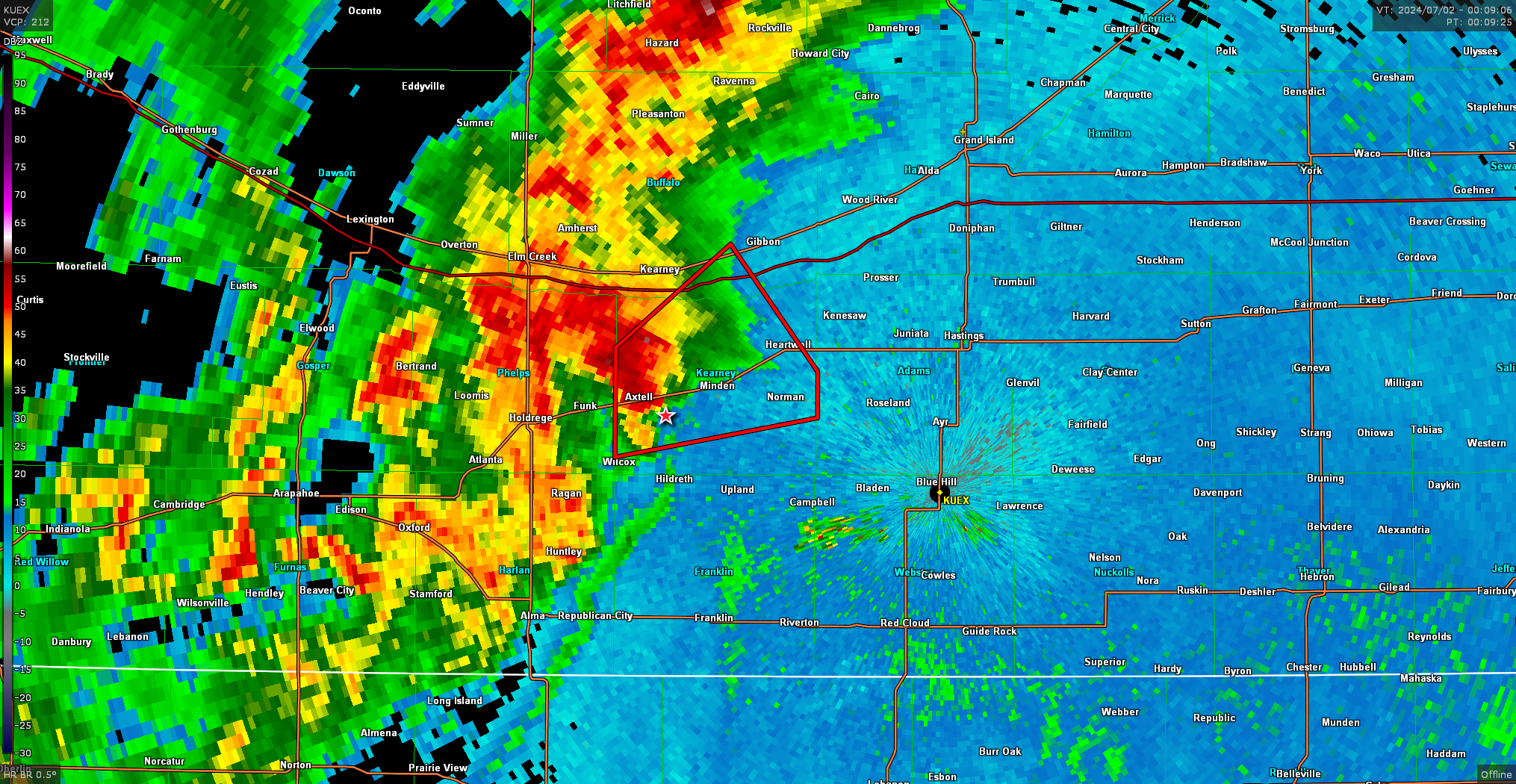
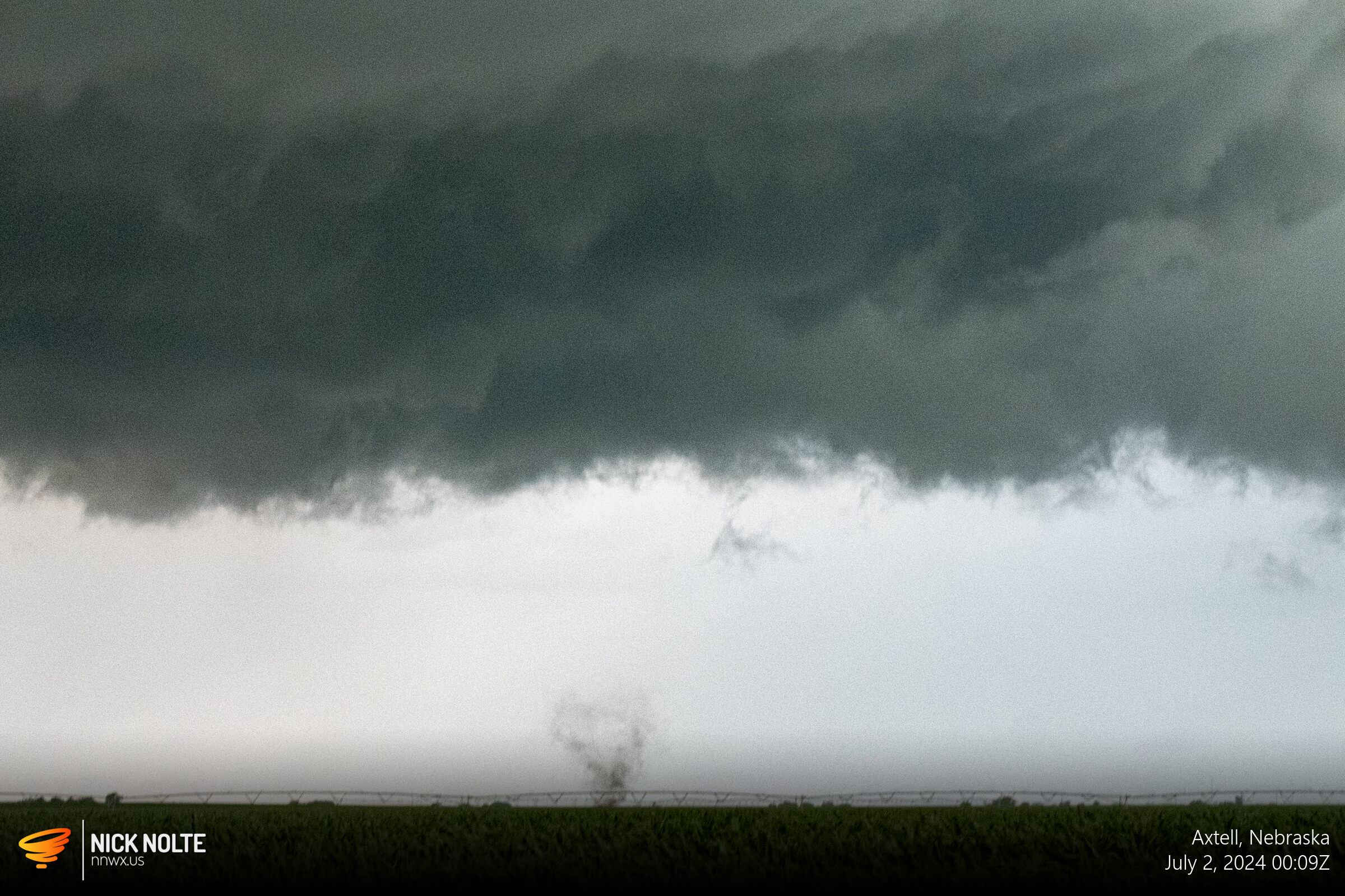
As the storm tracked near Axtell, a brief tornadic spin up occurred near Keene.
The rest of the trailing storms finally caught up to this cell after a bit and the cluster of storms went linear. As darkness approached I called the chase and began the drive home.
Chase Recap
| START | END | DURATION |
|---|---|---|
| Grand Island, NE @ 01/1952Z | Grand Island, NE @ 02/0130Z | 05 hours, 38 minutes |
| INTERCEPTS | CHASER ENCOUNTERS |
|---|---|
| 02/0008Z @ 3 SE Axtell, NE | None |