| 0 | 0.50" | 60 | 565 |
|---|---|---|---|
| TORNADOES | HAIL | WIND | MILES |
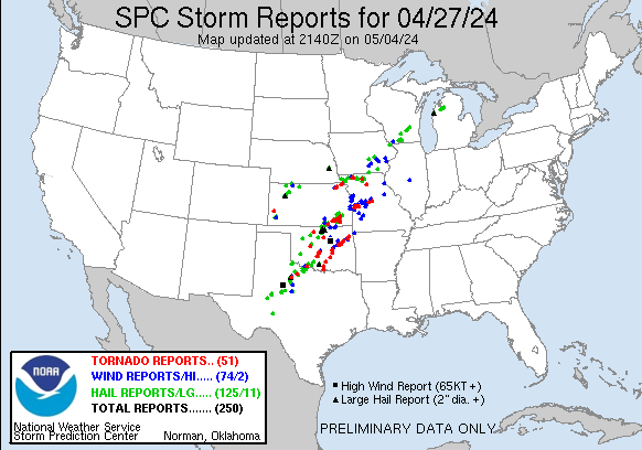
After a top notch chase day, I spent the night in Council Bluffs because I wasn’t sure if I was going to chase the 27th or not. A surface low was forecast to track from Southeast Colorado to Kansas City with a frontal boundary draped to the northeast into Central Iowa and a dryline stretching towards Midland, TX.
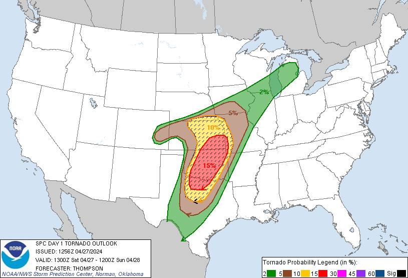
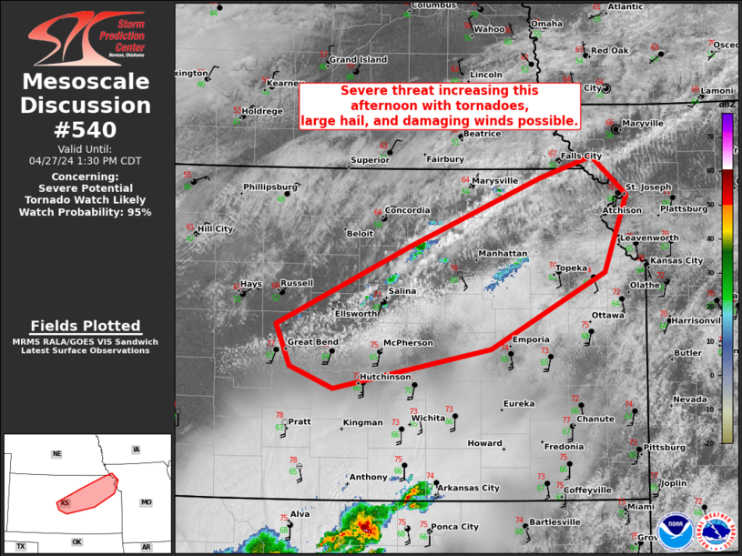
There were two target areas for the day, the dryline which SPC had outlined in a 15% hatched tornado risk and the frontal zone which was in a 10% risk. I have a tendency to prefer playing warm fronts and lows rather than drylines plus being closer to home I decided to play the northern target. SPC issued a mesoscale discussion for the frontal boundary from Great Bend to Kansas City shortly before 12pm
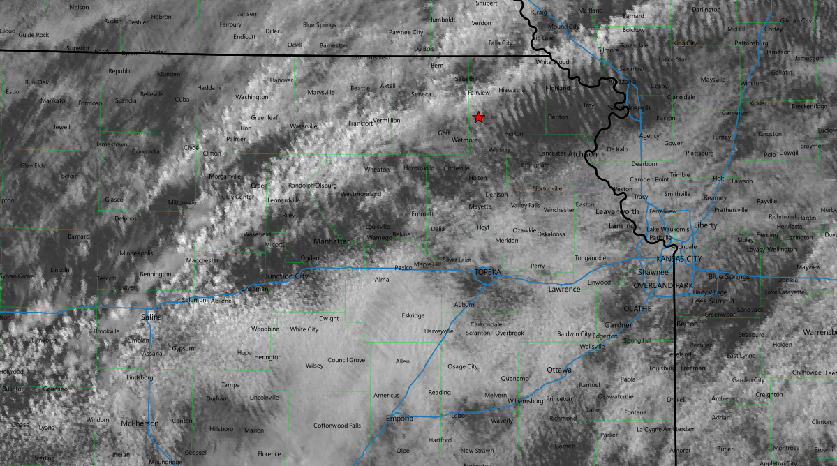
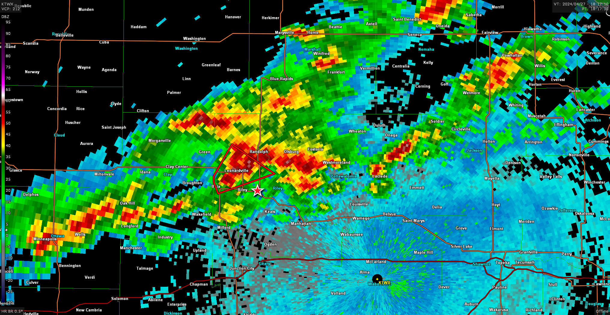
Cumulus was growing along the frontal boundary and I decided to head west towards the more agitated cumulus. I turned west on I-70 as I passed through Topeka shortly before 17z and arrived in Junction City around 1735z and took a few minutes to decide what to do. The cell to the north looked decent, but I wasn’t sure if that was the main target or not.
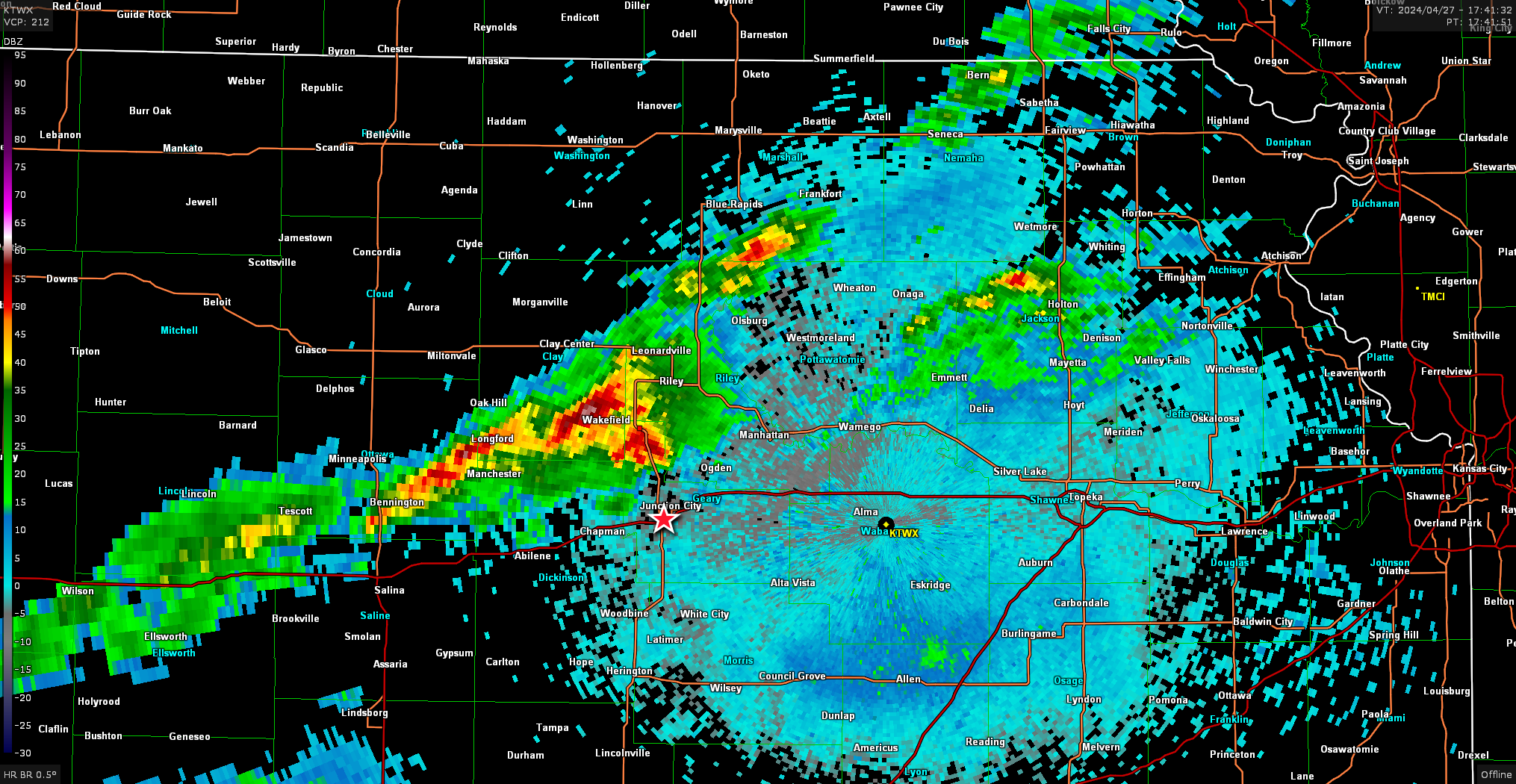
I decided to track the storm to the north and just keep an eye on additional development and reposition if necessary.
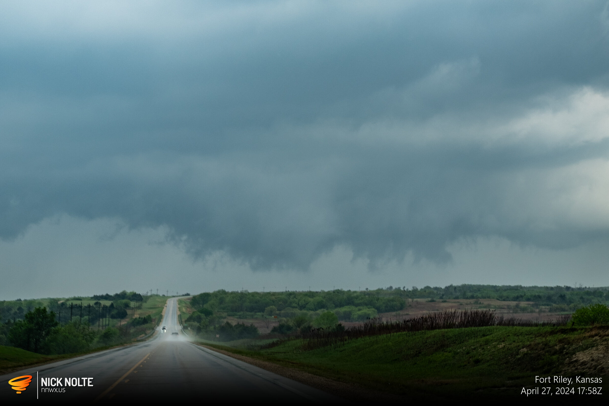
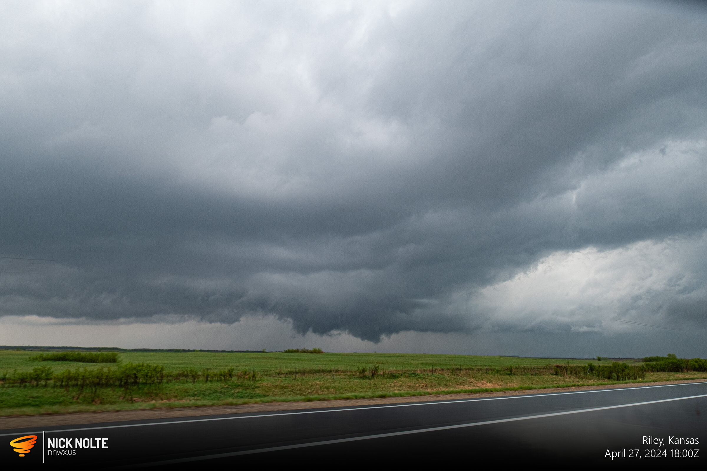
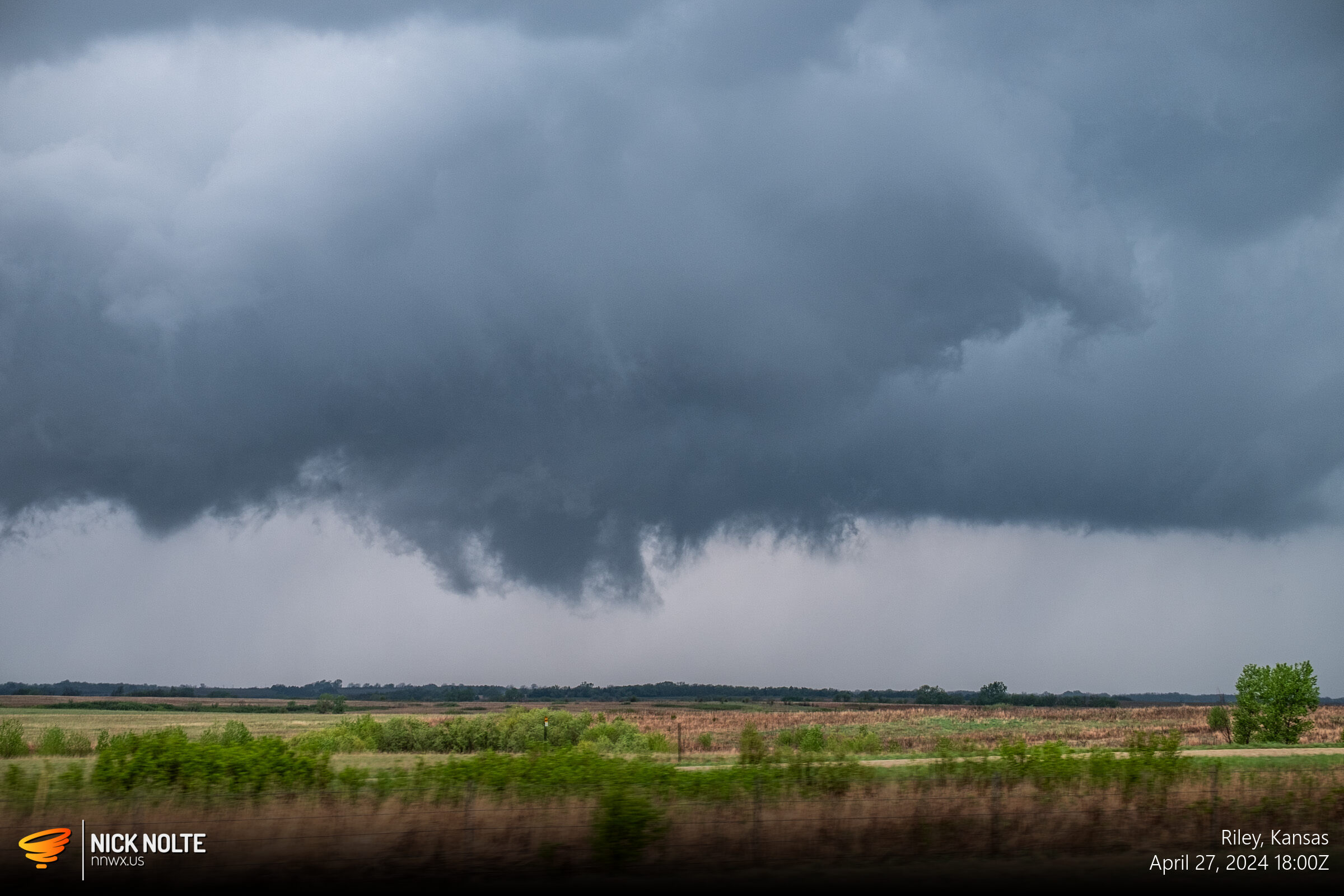
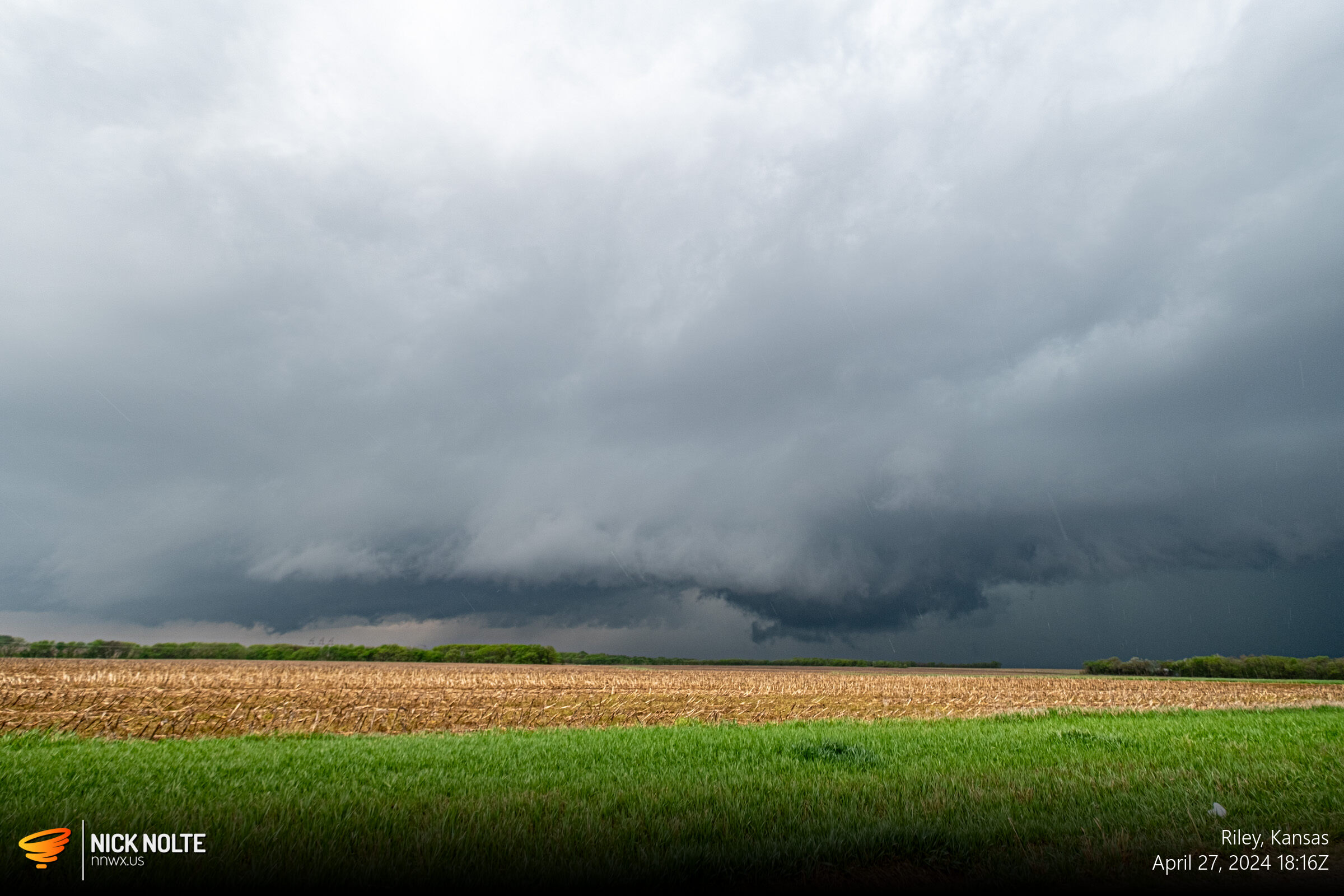
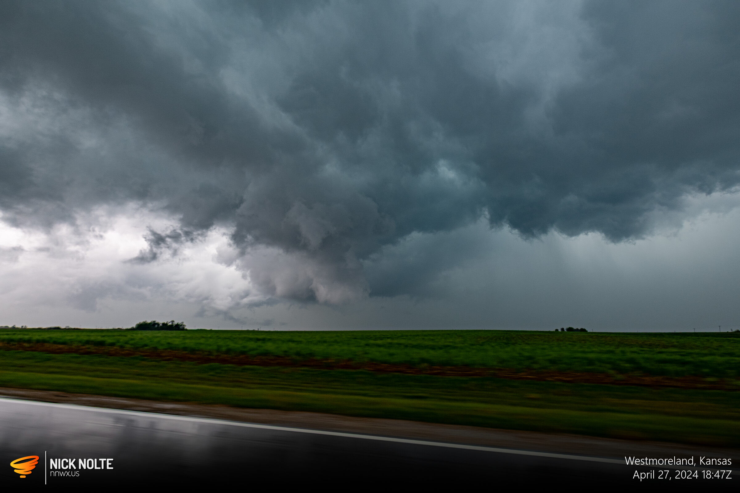
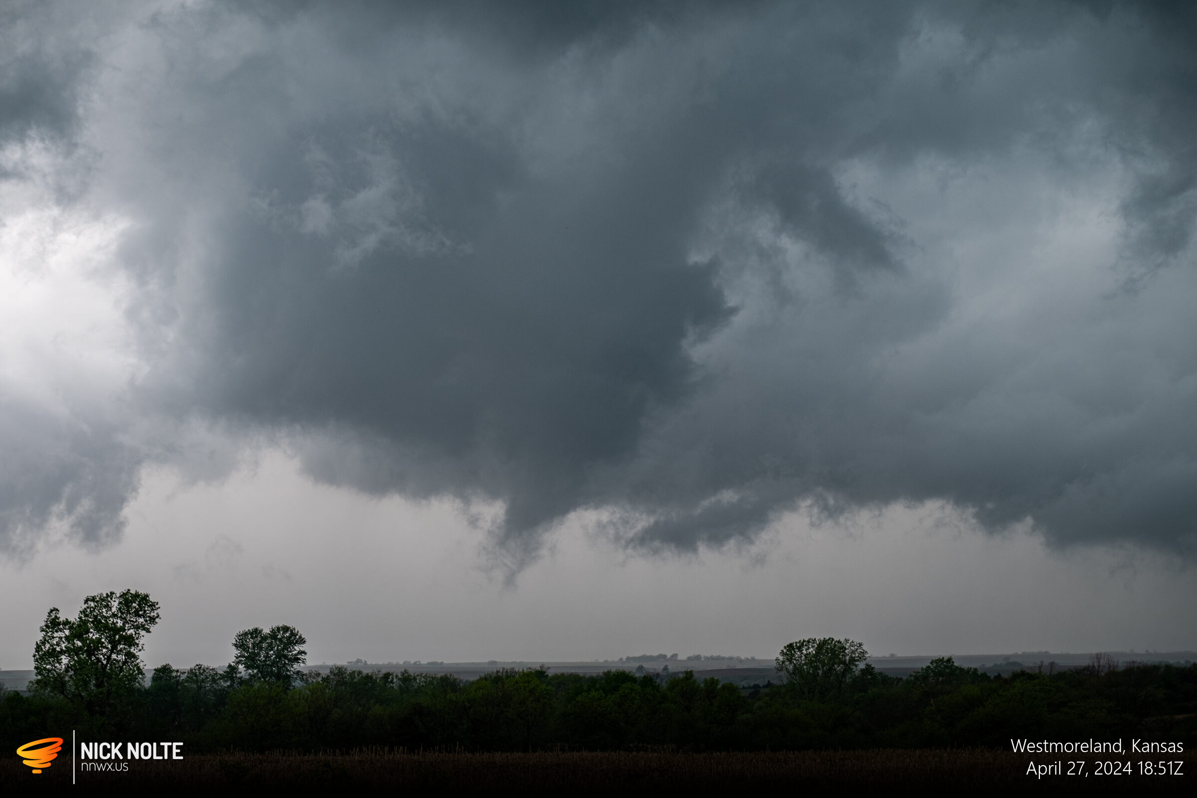
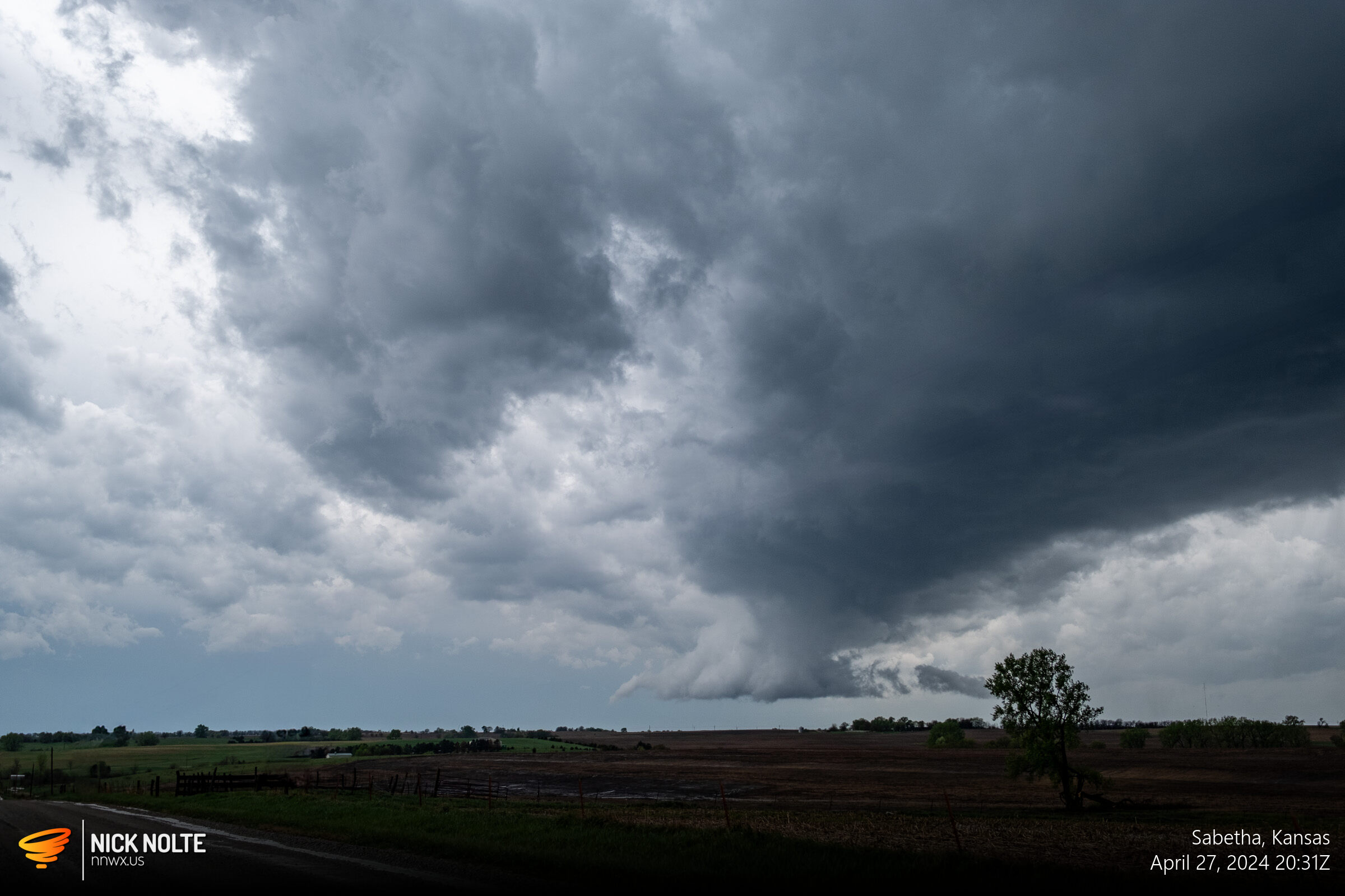
The storm was tornado warned during this time and there was some broad low level rotation and visually there were a couple of lowerings and bowls but I never saw any swirlies at the ground.
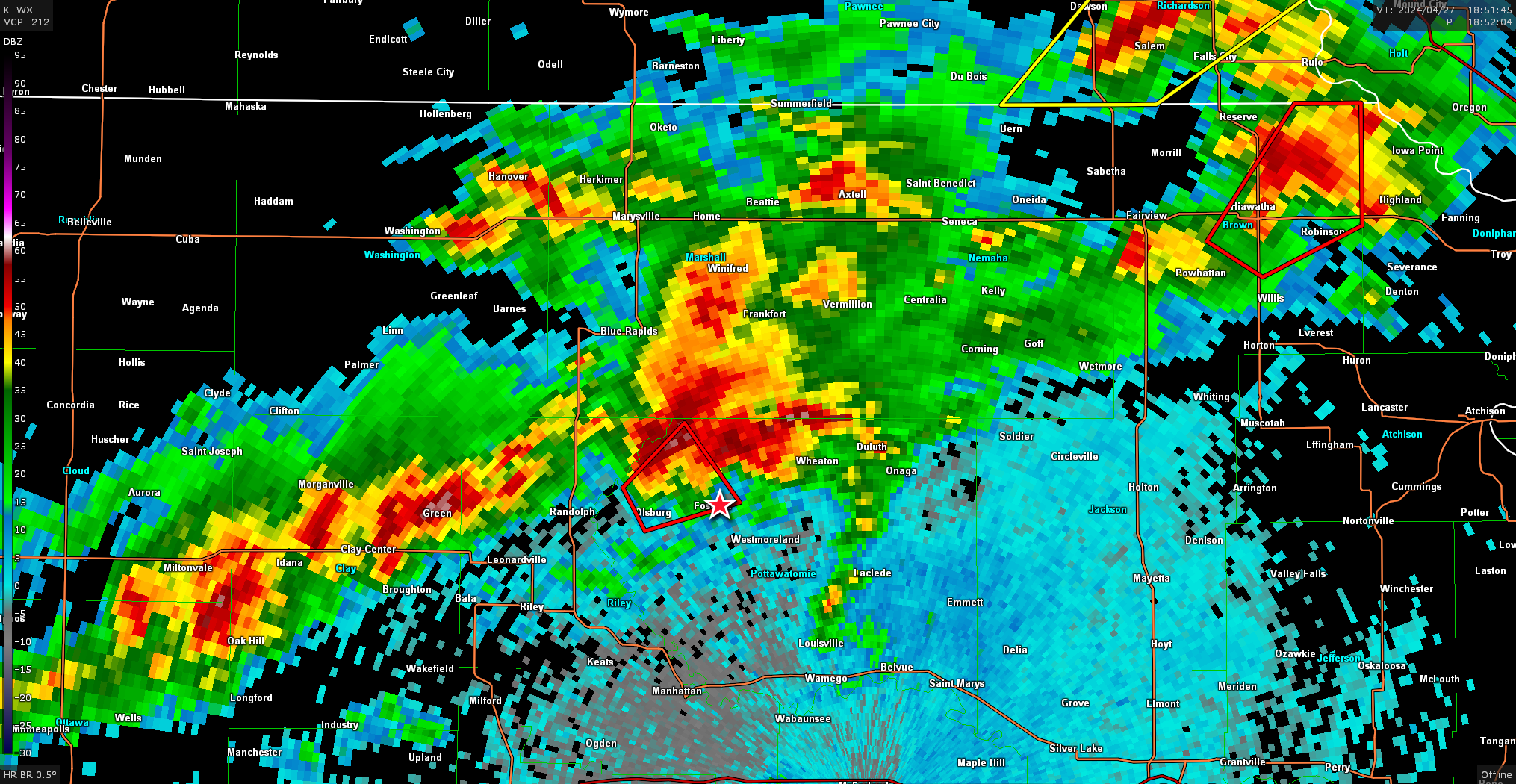
At this point the storm started pulling away and I had trouble keeping up. The storm continued to be tornado warned, but it looked even more disorganized as time went on.
At this point I called the chase and began the trek home.
Chase Recap
| START | END | DURATION |
|---|---|---|
| Council Bluffs, IA @ 27/1415Z | Grand Island, NE @ 27/2353Z | 09 hours, 38 minutes |
| INTERCEPTS | CHASER ENCOUNTERS |
|---|---|
| None | None |