| 0 | 1.00" | 70 | 628 |
|---|---|---|---|
| TORNADOES | HAIL | WIND | MILES |
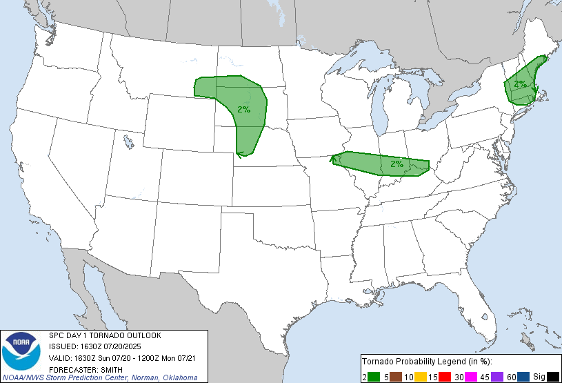
A surface trough was forecast to extend from Eastern Montana down through the Dakotas into Nebraska and Kansas. Strong heating along this boundary would contribute to large MLCAPE beneath modest mod-level flow. Isolated supercells were forecast from Southern South Dakota into Northern Nebraska.
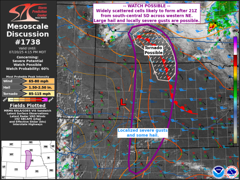
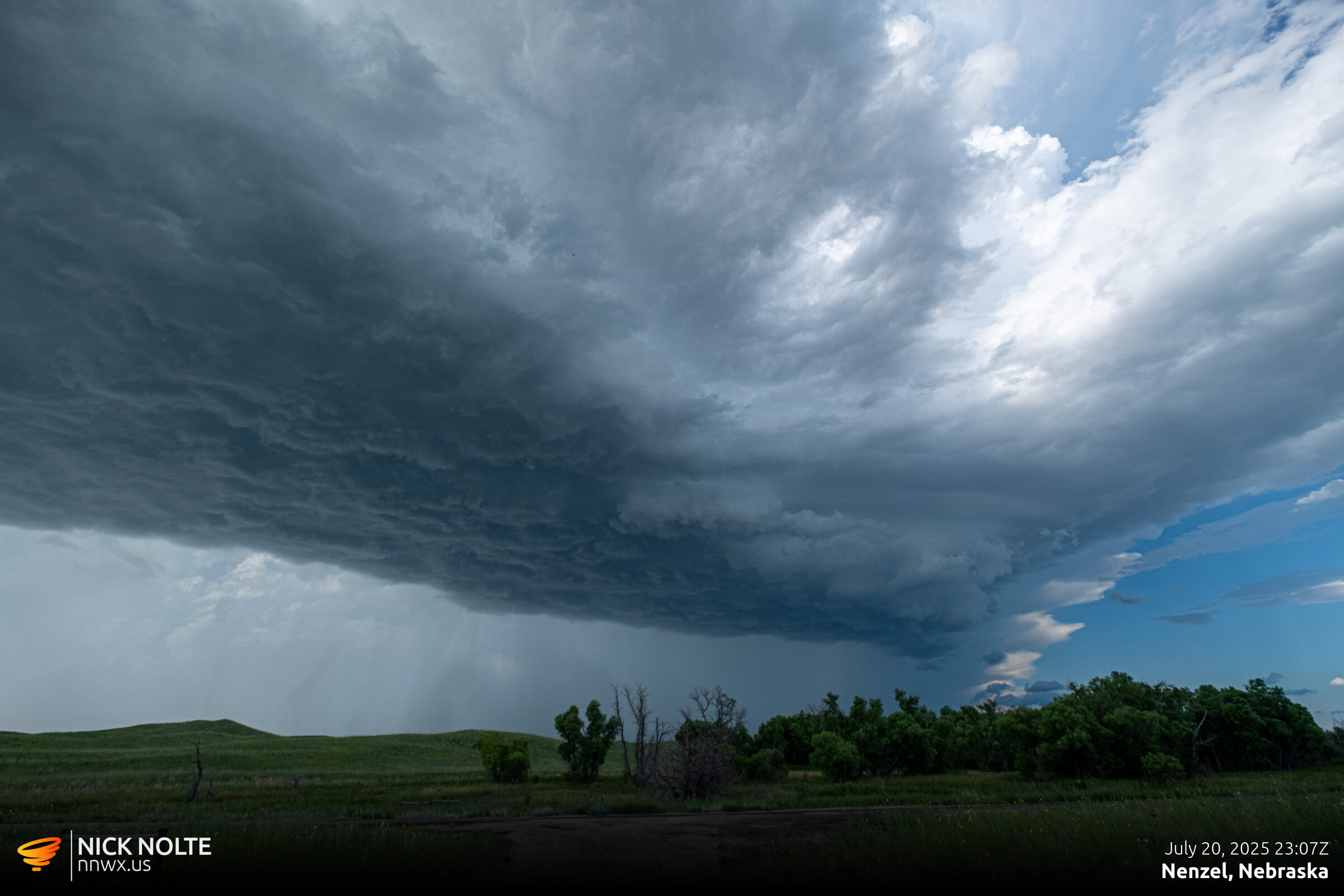
I had chased the day before driving to Thedford then down to Stapleton then back to Grand Island. Well, I pretty much planned to do it again this day as I was targeting the Valentine area. As I approached Thedford, SPC issued a mesoscale discussion which included an outlined area for tornadoes in Southern South Dakota, edging into Northern Nebraska.
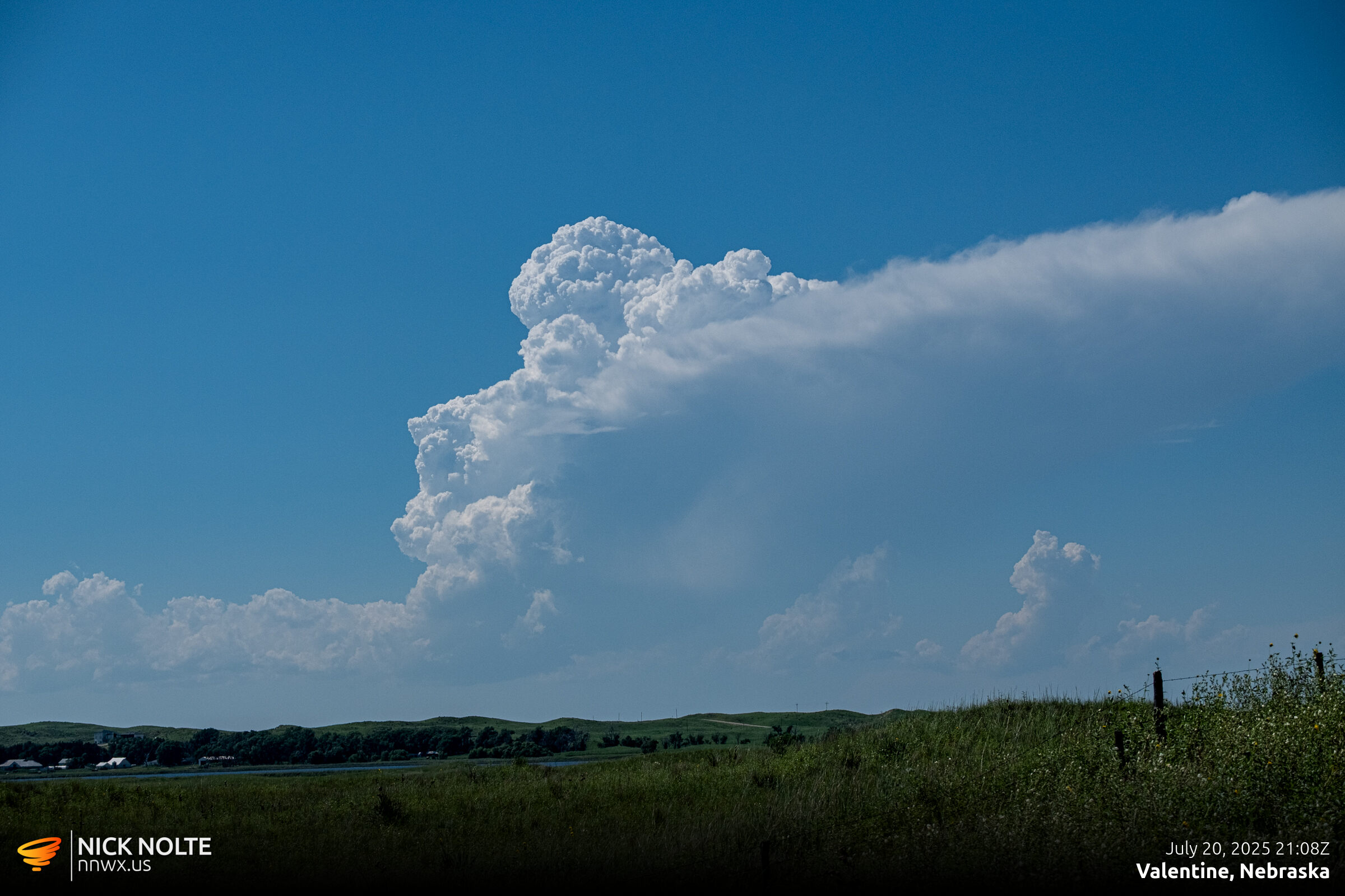
As I approached Valentine, a cell started to fire west of there near Cody. I drove west out of Valentine and found some back roads south of Kilgore to position myself on the storm hoping this one would get going.
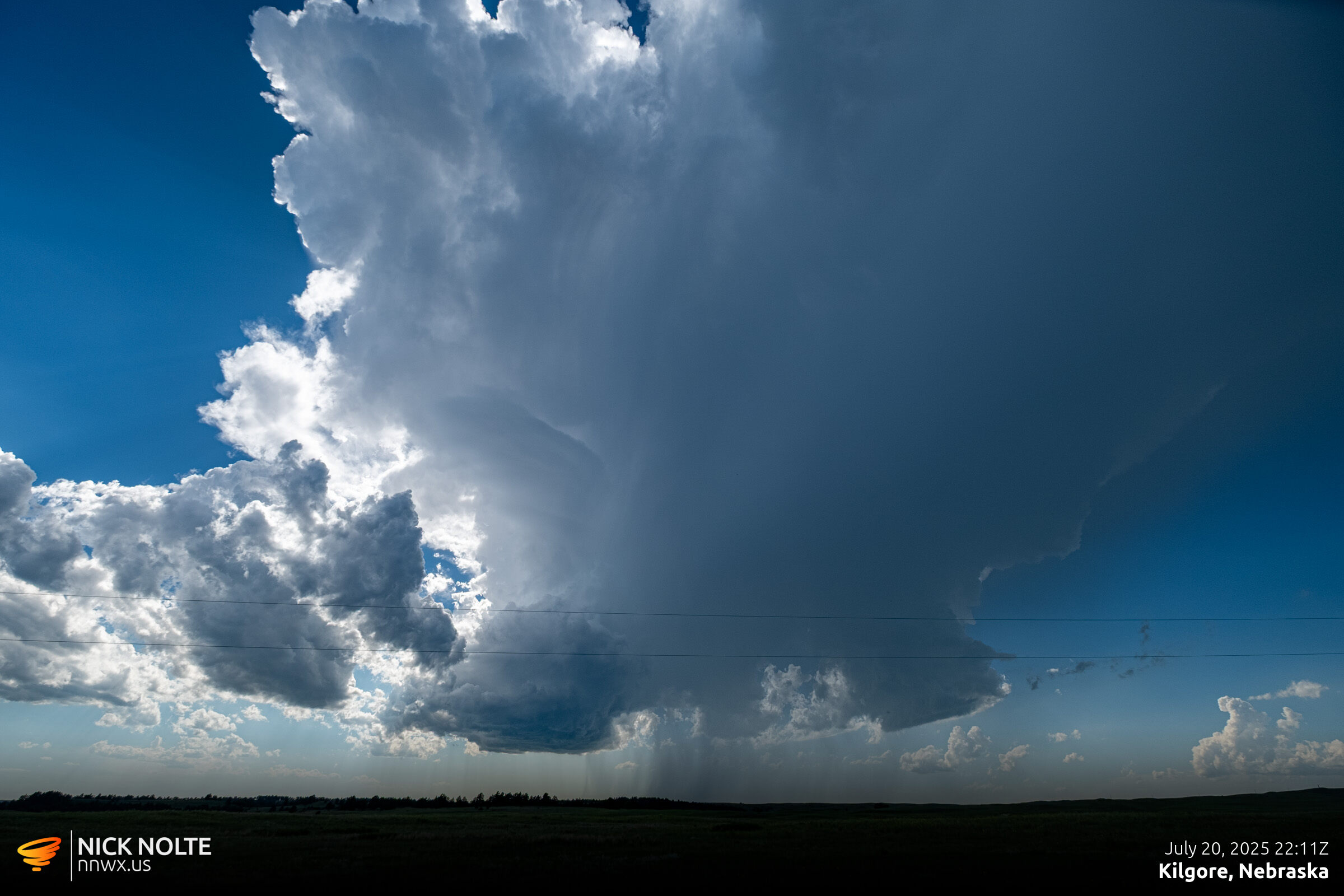


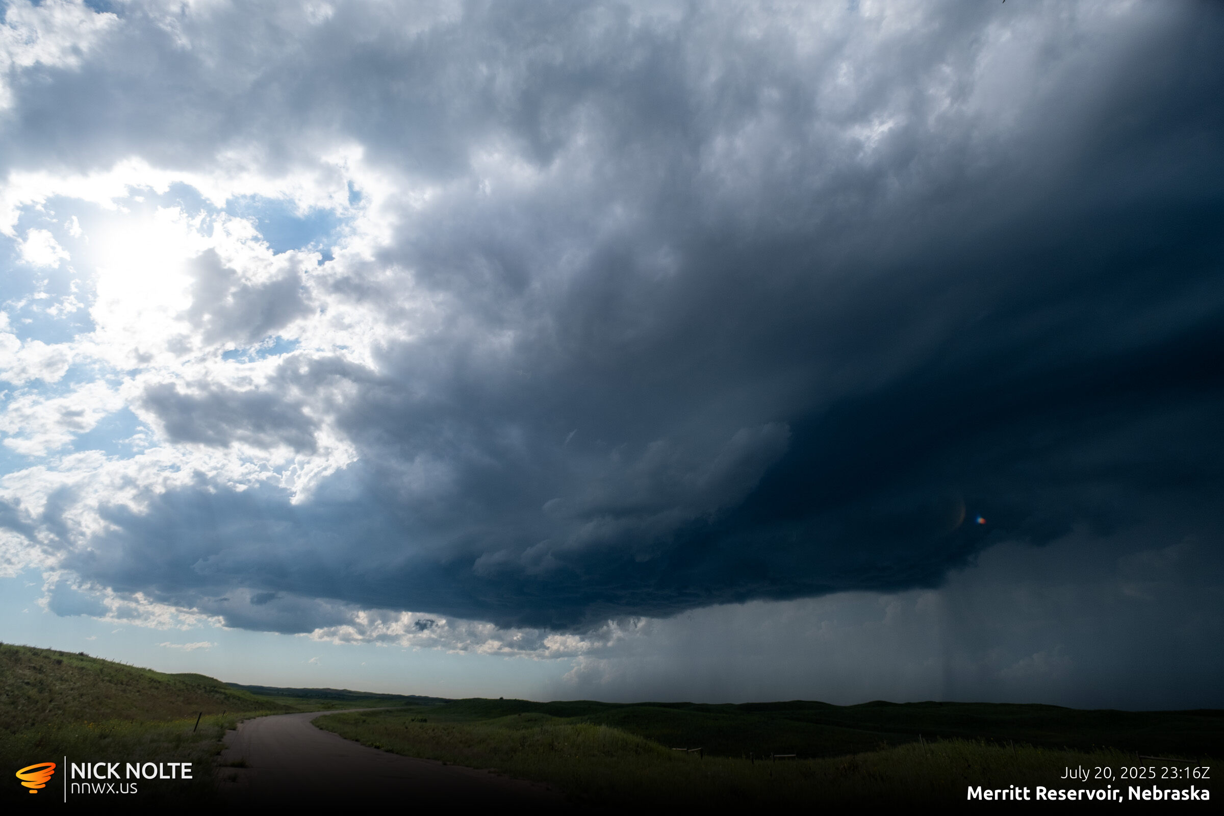
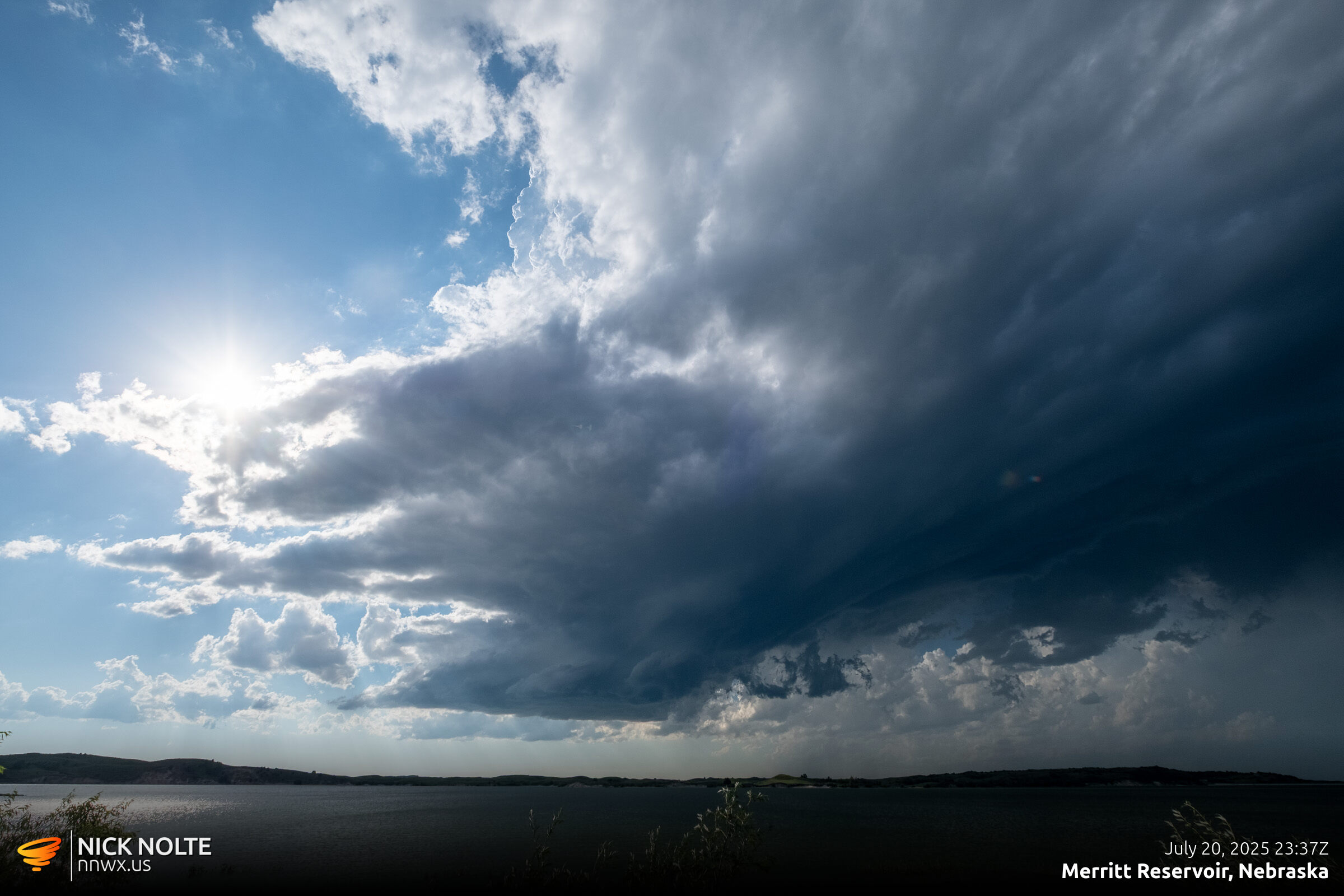
I hung around this storm hoping it would get organized and while that was happening a storm developed northwest of Mission, SD that went tornado warned. That was a good fifty miles away, but I decided this storm was fizzling out, might as well go for it. I eventually got on the storm as it approached the state line north of Kilgore.
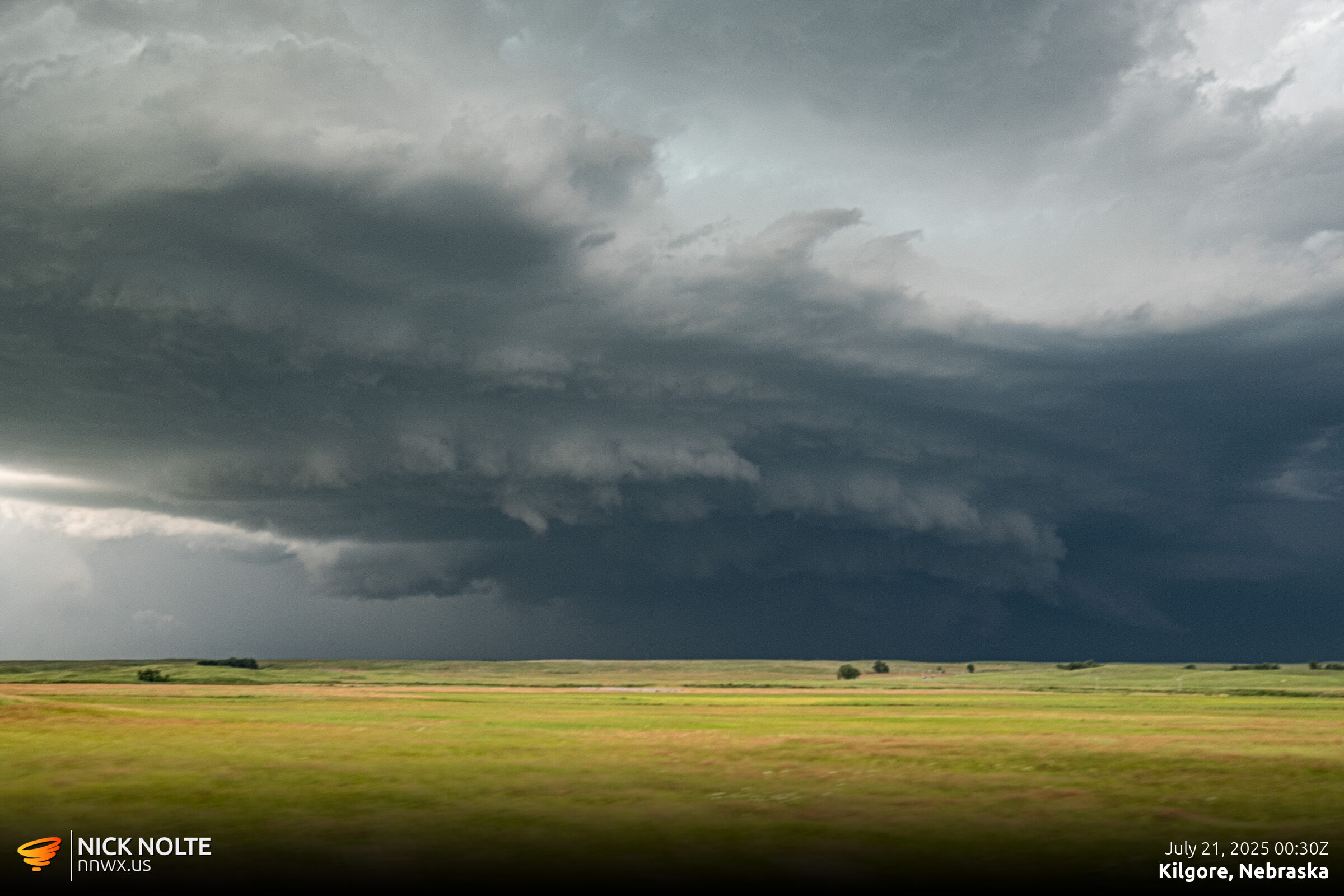
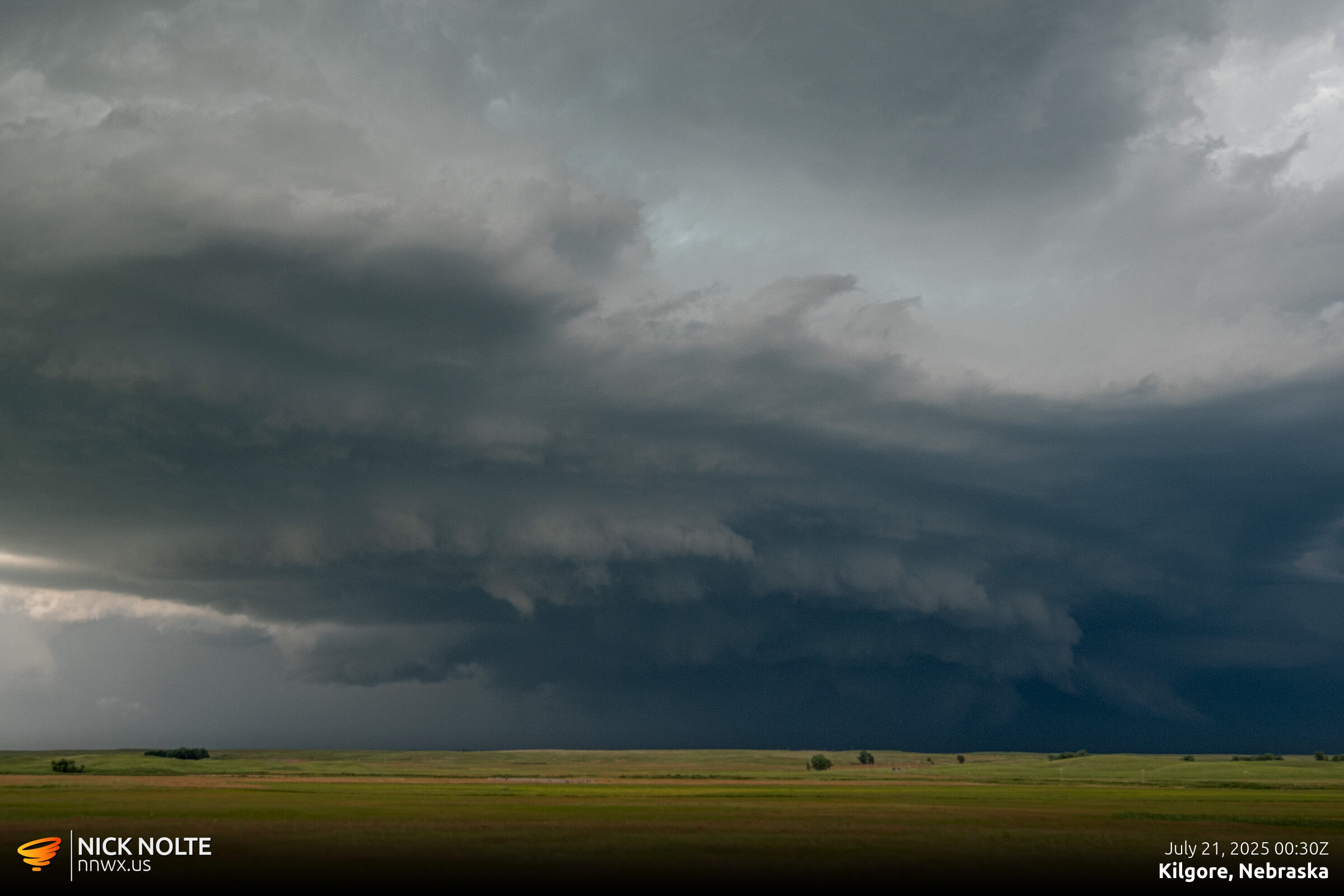
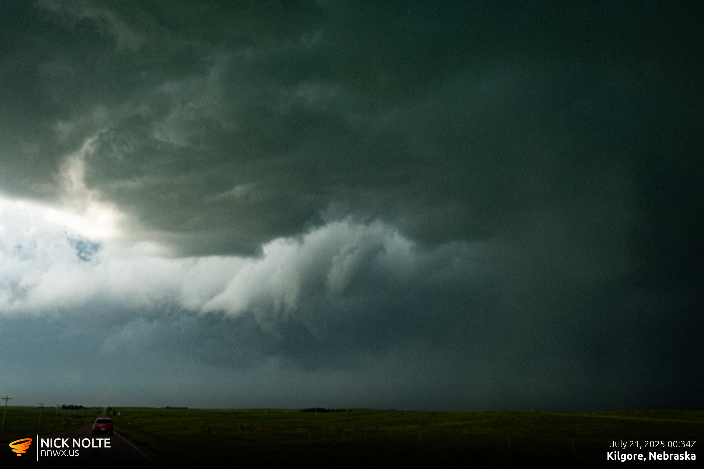
At this point, the storm was still tornado warned, but there were no tornado reports coming in and I never got a visual on anything tornadic despite the presence of a gnarly looking wall cloud. As the storm tracked through Valentine it went tornado warned again, but again, still couldn’t see anything.
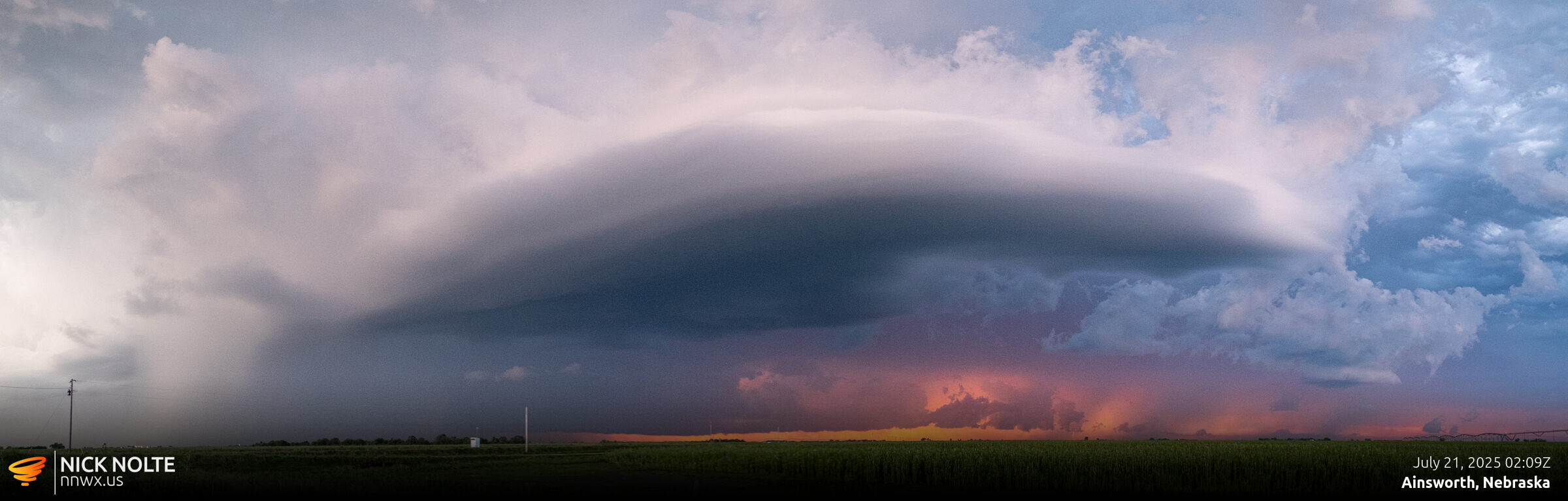
At this point I began the trek home as it was getting dark, but west of Ainsworth I gave the storm one more look as the sunset painted some crazy colors on the storm.
Chase Recap
| START | END | DURATION |
|---|---|---|
| Grand Island, NE @ 20/1722Z | Grand Island, NE @ 21/0456Z | 11 hours, 34 minutes |
| INTERCEPTS | CHASER ENCOUNTERS |
|---|---|
| None | None |