| 0 | 1.00" | 60 | 451 |
|---|---|---|---|
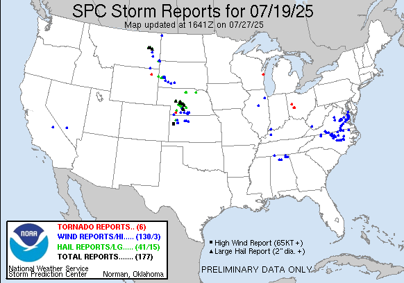
| TORNADOES | HAIL | WIND | MILES |
July 19th featured a surface trough that was expected to be in place from Montana into Eastern Colorado as a mid-level impulse ejected from the Northern Rockies. In Western Nebraska low to mid 60°F dewpoints were forecast to be present with higher values along a boundary present.
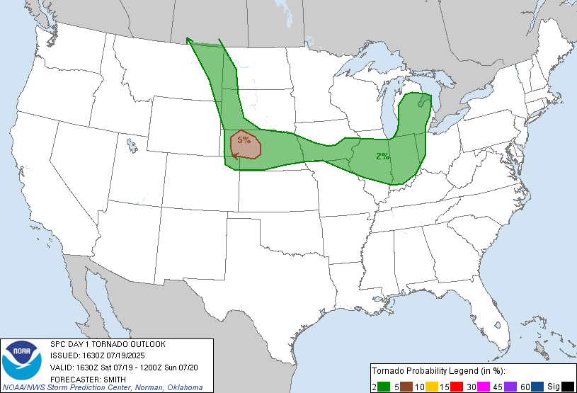
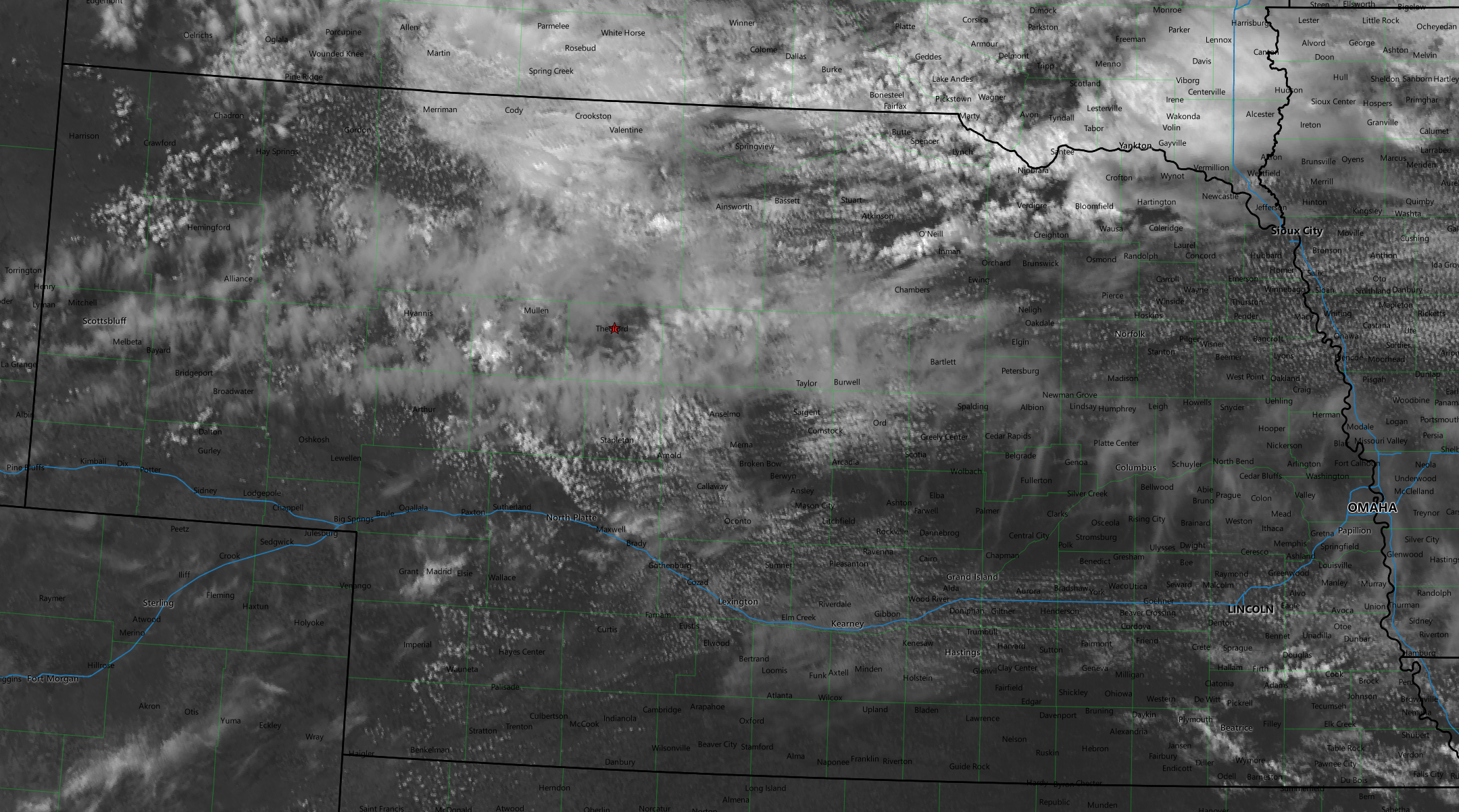
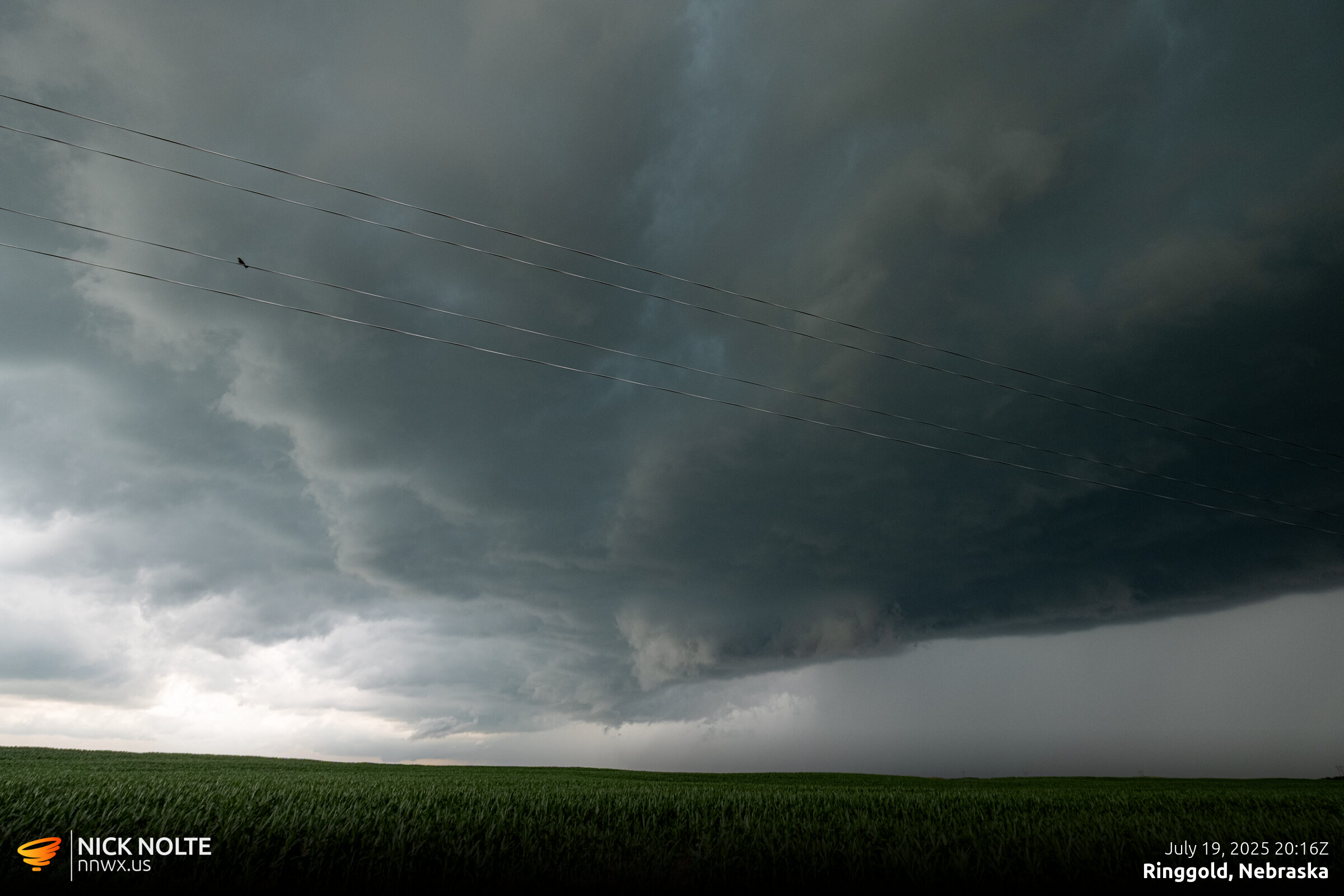
The original SPC outlook only had a wide 2% contour, but they upgraded the Nebraska Panhandle and Sandhills to 5% in later updates. My original target was Thedford. I had planned to head there to evaluate the situation and position as needed. I arrived in Thedford at 19z and visible satellite was showing the remnant boundary just off to the north with backed surface flow and low 70°F dewpoints to the south. A lot of stations along I-80 were reporting dewpoints up to 75°F.
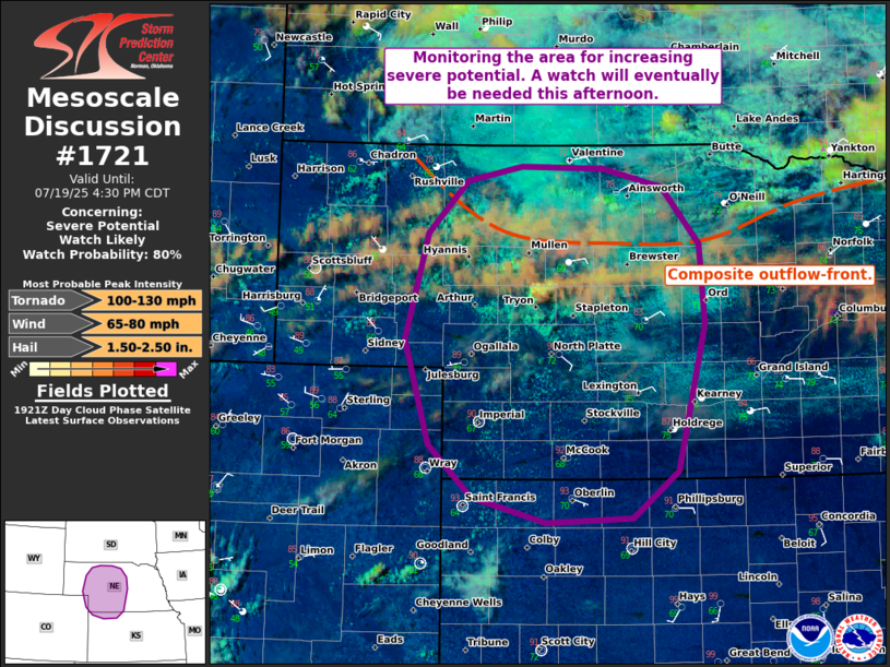
After evaluating the satellite in Thedford it appeared that an agitated cumulus field oriented from Tryon to North Platte would probably be the most likely area to initiate, so I began the trek down US 83 towards Stapleton. Shortly after, SPC issued a mesoscale discussion for the area.
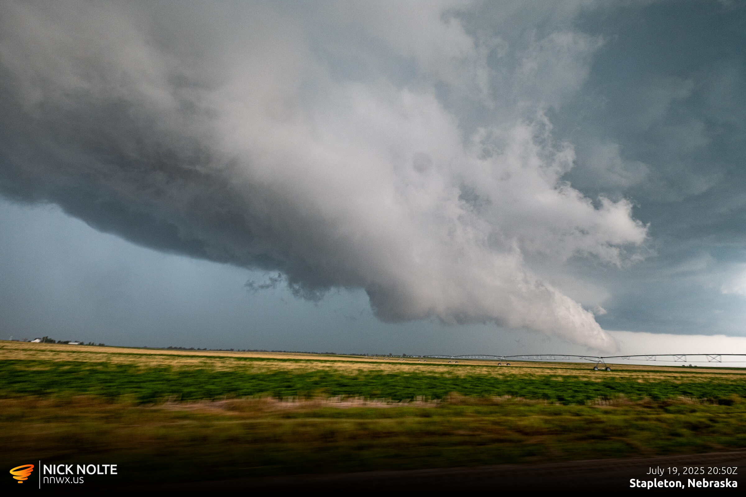
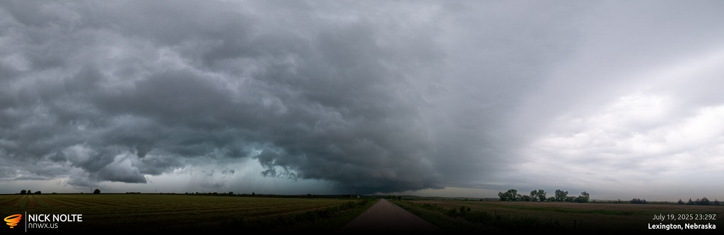
It didn’t take long for the first cell to initiate near Tryon. I eventually got on the cell west of Stapleton at 20z.
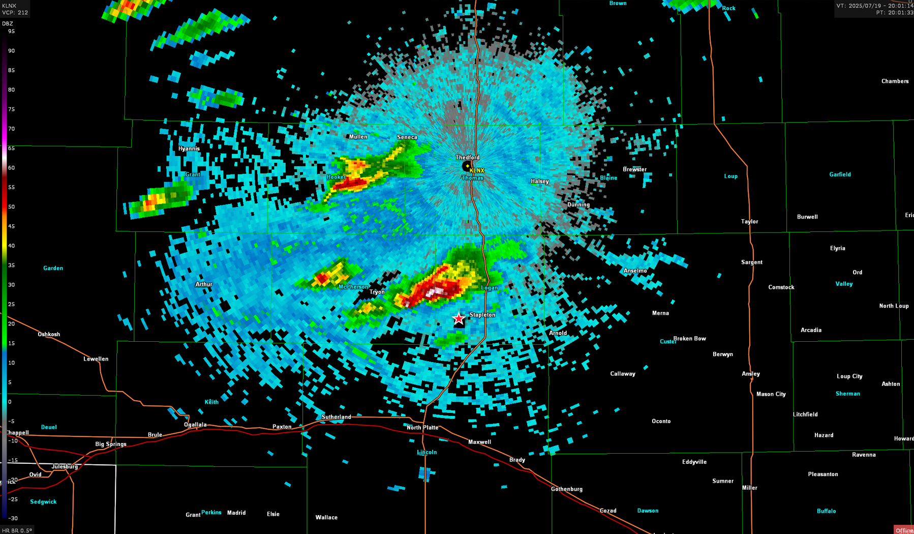
This storm ramped up fast and the hail core absolutely exploded. Right around this photo golf balls were dropping in the hail core. Then a couple minutes later some baseball reports came in.
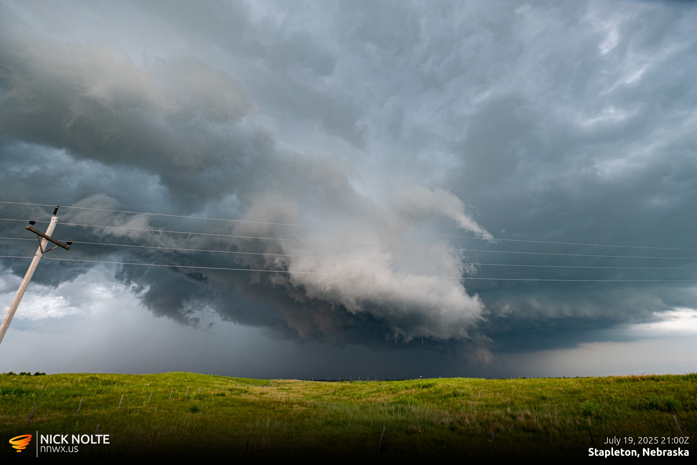
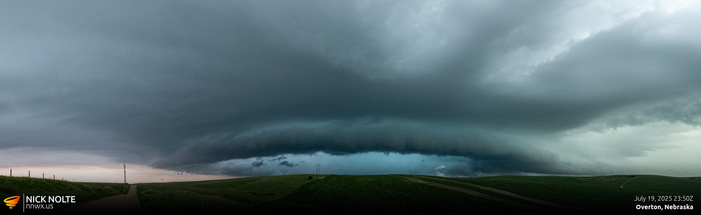
It was about this time a 4″ hail report came in at the intersection of US 83 and Highway 92 south of Stapleton. There was no way I was punching through the core of that to get in front of the storm so I had to detour to North Platte. While I was repositioning additional 3″ reports came in South of Arnold. I finally got back on the storm on highway 21 north of Lexington but by this time it had weakened.
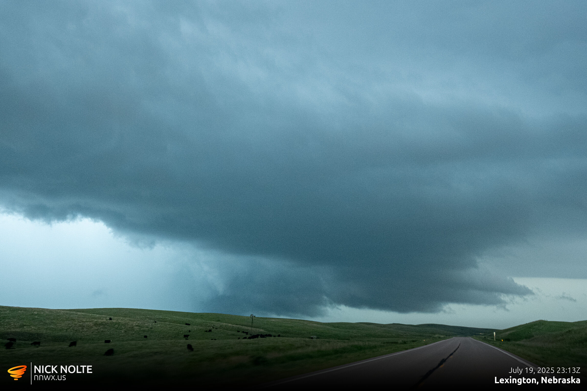
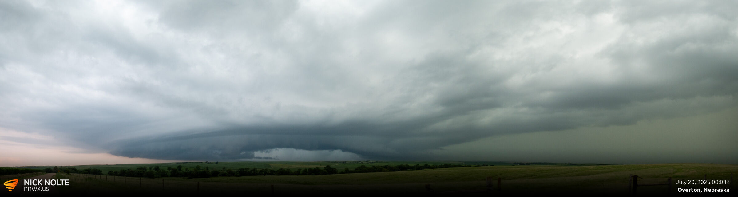
The storms started to congeal into a line of storms stretching from Pleasanton to Culbertson and the storm I was tracking had weakened considerably so I called the chase and headed home.
Chase Recap
| START | END | DURATION |
|---|---|---|
| Grand Island, NE @ 19/1636Z | Grand Island, NE @ 20/0124Z | 08 hours, 48 minutes |
| INTERCEPTS | CHASER ENCOUNTERS |
|---|---|
| None | None |