| 0 | 1.00" | 60 | 630 |
|---|---|---|---|
| TORNADOES | HAIL | WIND | MILES |
April 28th was supposed to be the event as the possibility of a regional outbreak loomed large. A deep low pressure was forecast to translate from central South Dakota towards Northern Wisconsin and drag a dryline/cold front extended southward through Nebraska, western Kansas and into West Texas. Meanwhile, a warm front extended east into central Minnesota. Dewpoints into the 60°Fs were expected throughout the warm sector creating a very volatile warm sector.
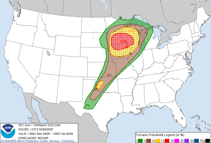
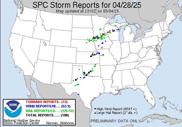
SPC had outlined a broad area of severe risk from the Upper Great Lakes all the way to West Texas with a moderate risk outlined in Southern Minnesota and Northern Iowa coincident with a 15% hatched tornado probability. They had noted that the ceiling for the event was high but that hinged on isolated or spatially separated development in the warm sector. Otherwise, development was expected along the front that would grow upscale quickly but have a chance for embedded QLCS tornadoes.
I had looked at forecast soundings in the morning and they were showing storm motions around 45 knots as an 80kt mid level jet was streaking through the area. To me that meant intercepts were mostly going to be one-and-done and if the chase was limited to what went up on the front there would be a lot of stair stepping to the next storm south.
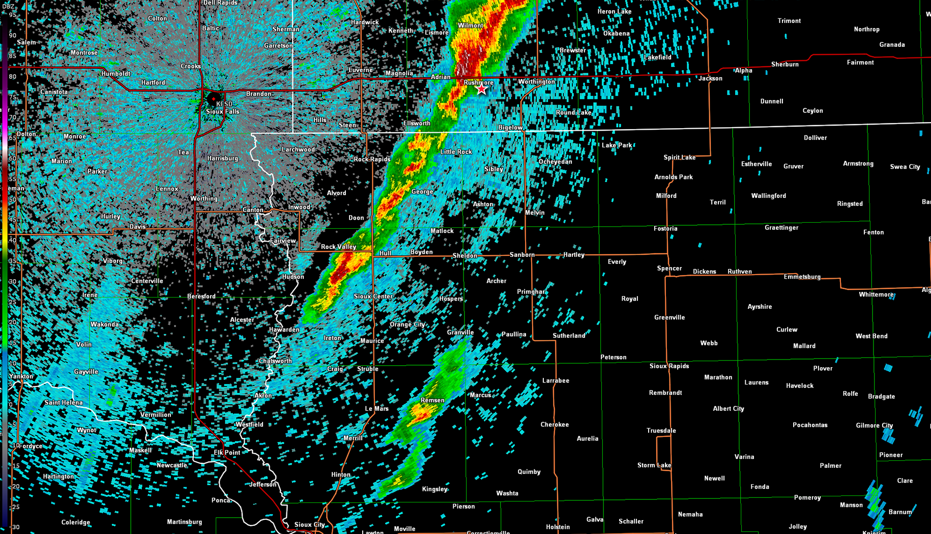
My plan was to basically head through Sioux City and position in Northwest Iowa to await initiation then hop from tail end charlie down as storms unzipped down the line. Models were forecasting two lines of storms developing, one where the tail would track right along the Iowa/Minnesota border then a second line that would follow and unzip into Iowa. With that knowledge I made the plan to get on the southern storm on the first line, but not get baited too far north making the second line my primary objective.
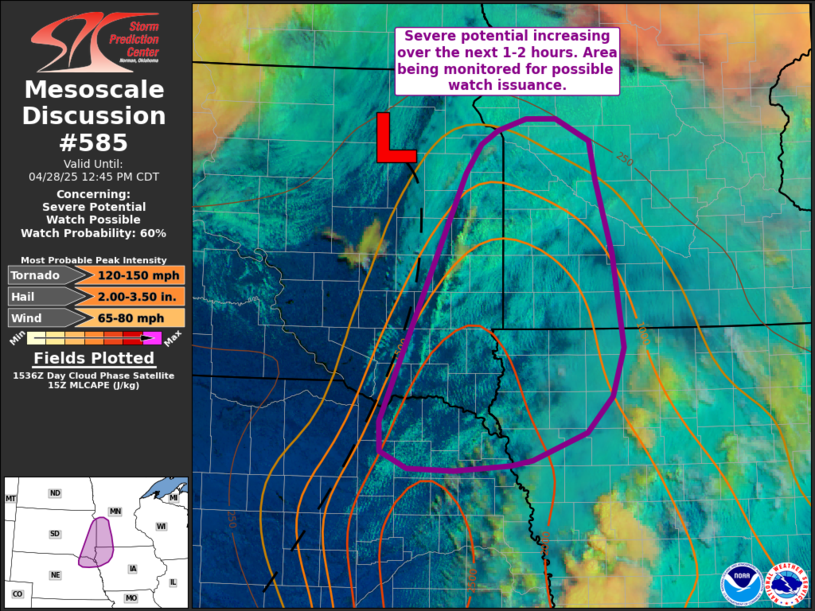
I took off from Grand Island just before 14z and made my way to Sioux City. As I turned north out of Fremont, SPC issued a mesoscale discussion for the target area mentioning the increasing potential for severe storms as the front was bubbling with cumulus from Fargo down to the Niobrara.
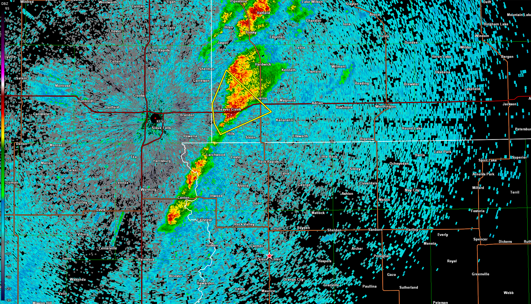
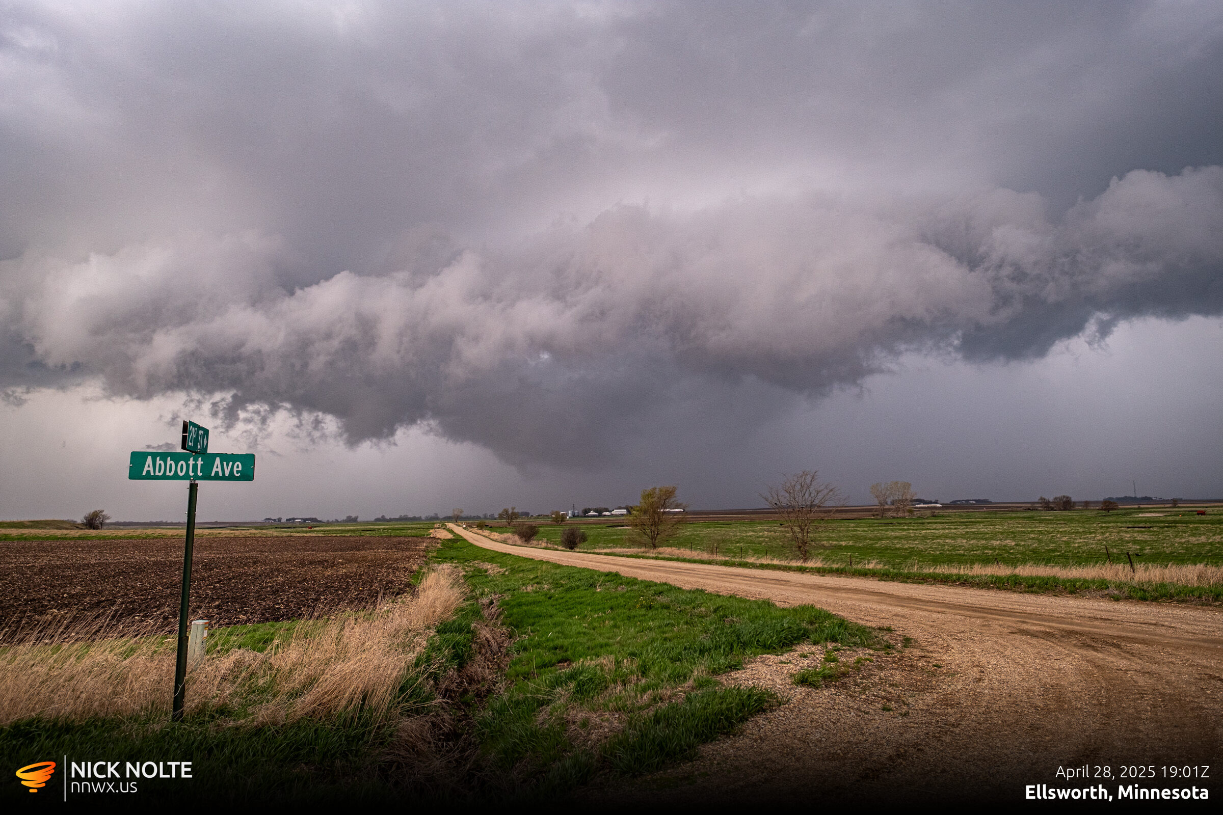
Storms started firing along the front right around 17z and as I passed through Le Mars shortly before 18z the first severe thunderstorm warning was issued for the cell just east of Sioux Falls heading towards Luverne. I was still 30 miles south so I just planned to continue north and intercept the next cell to develop on the flank.
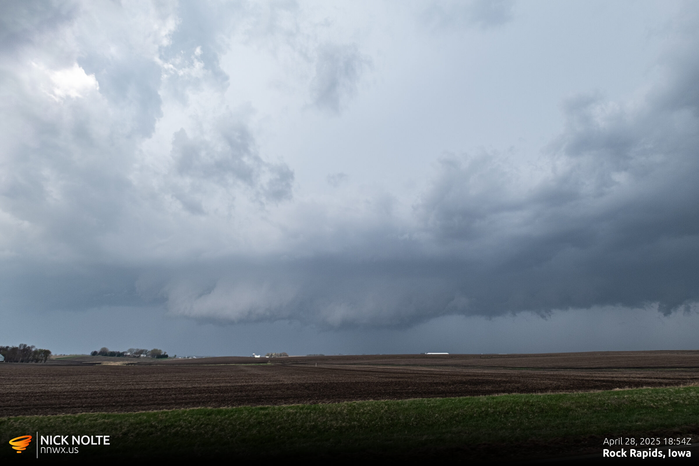
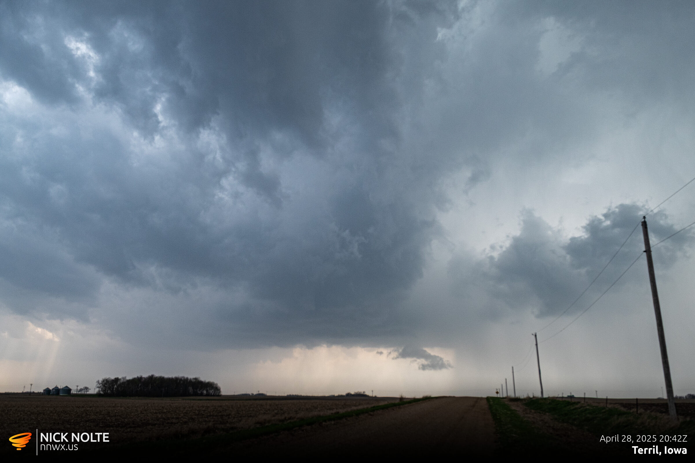
Eventually I got on the southern cell near Rock Rapids and it was exhibiting a nicely lowered wall cloud but I couldn’t make out any rotation, but these storms were pretty young so it was a good sign that they were developing walls that quickly. I tracked the cell for a bit as it crossed the state line into Minnesota near Ellsworth.
At this point I noticed a new cell starting to form out front of the tail end of the current line. This was my primary plan, as soon as that second line started to pop get south and get on it. Ironically, this started to pop at Le Mars where I was just ninety minutes earlier.
Given the storm motions my best bet was to head east-southeast towards the Spirit Lake/Spencer area to intercept and by the time it got to me hopefully it was doing something interesting. Eventually I intercepted the storm east of Lake Okoboji.
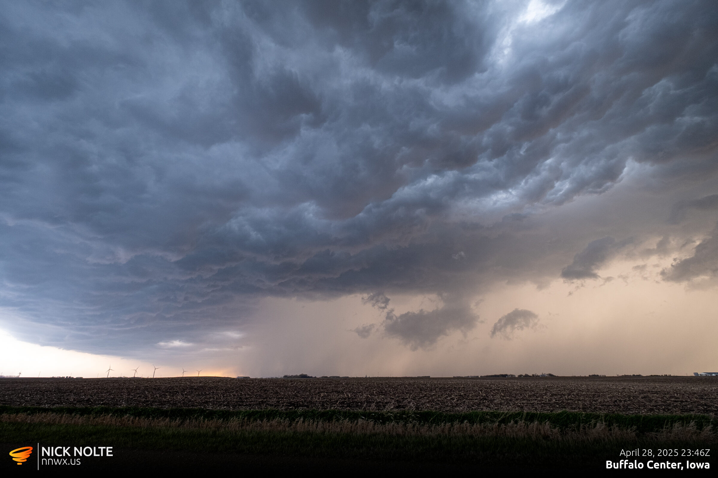
The storm didn’t look that impressive as it approached so I attempted to keep up with it as long as possible. After passing through Estherville, the storm started to organize and just before 2130z the storm went tornado warned.
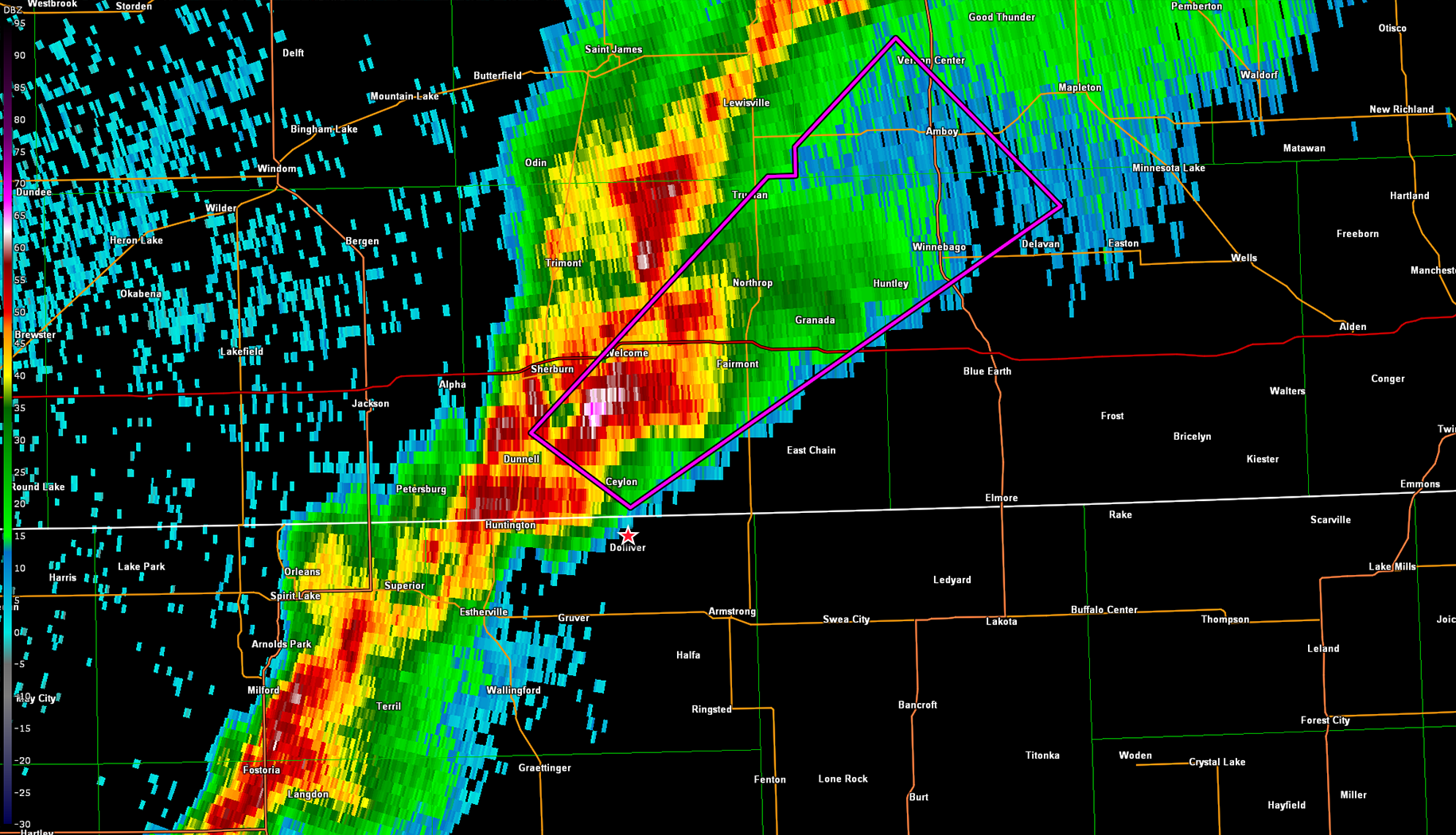
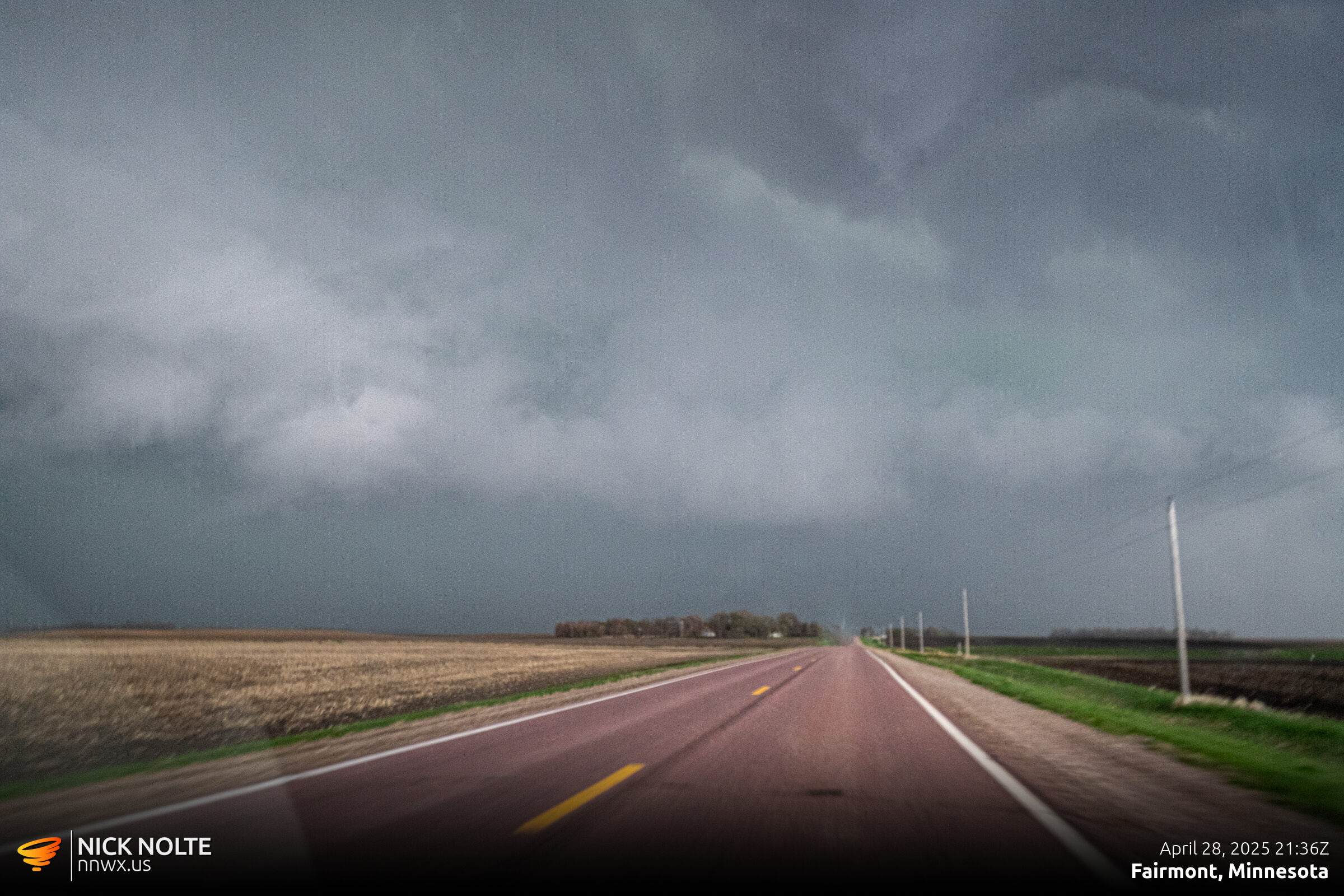
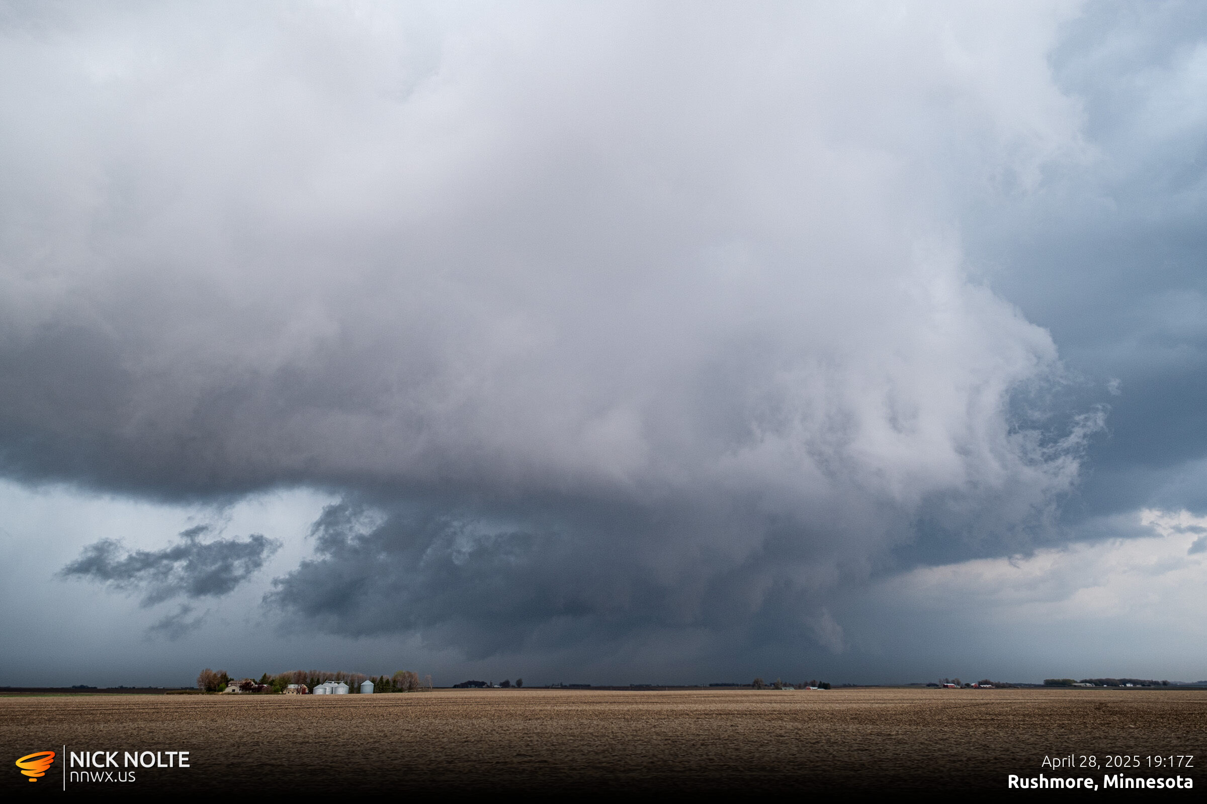
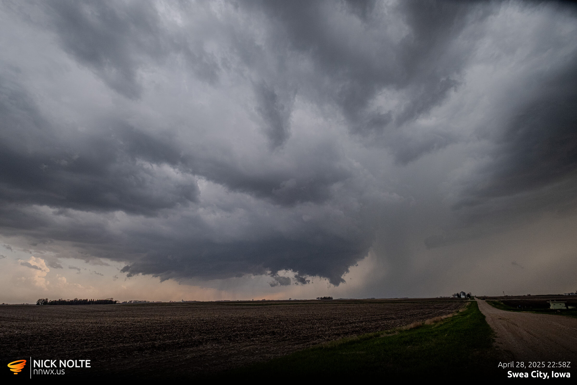
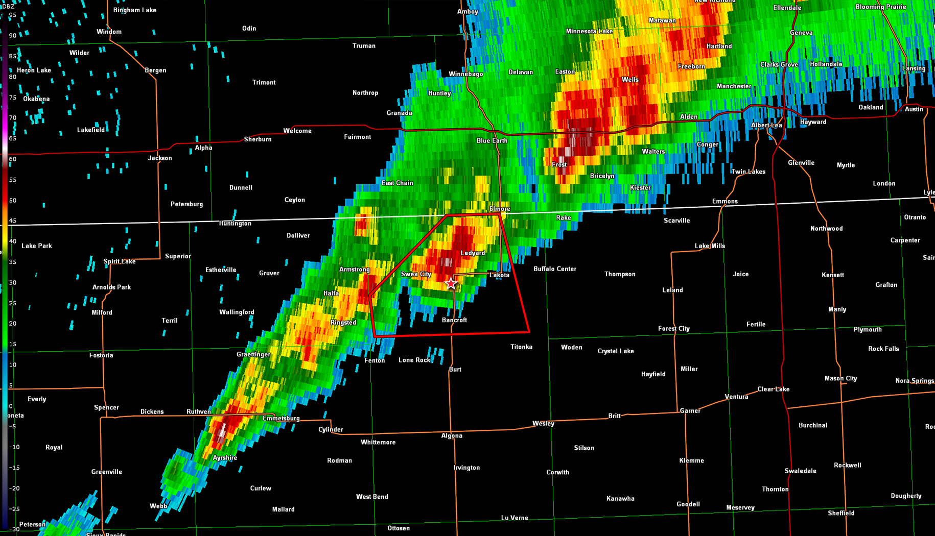
Storm motion was 60mph so keeping up with this was going to be damn near impossible, but the cells to the south weren’t looking any better so I kept up best I could for now. I tracked it to Fairmont, but it was leaving me in the dust so I started to bail south to the next cell in line. That cell ended up going tornado warned at 2244z and I got back on it a few minutes after near Swea City.
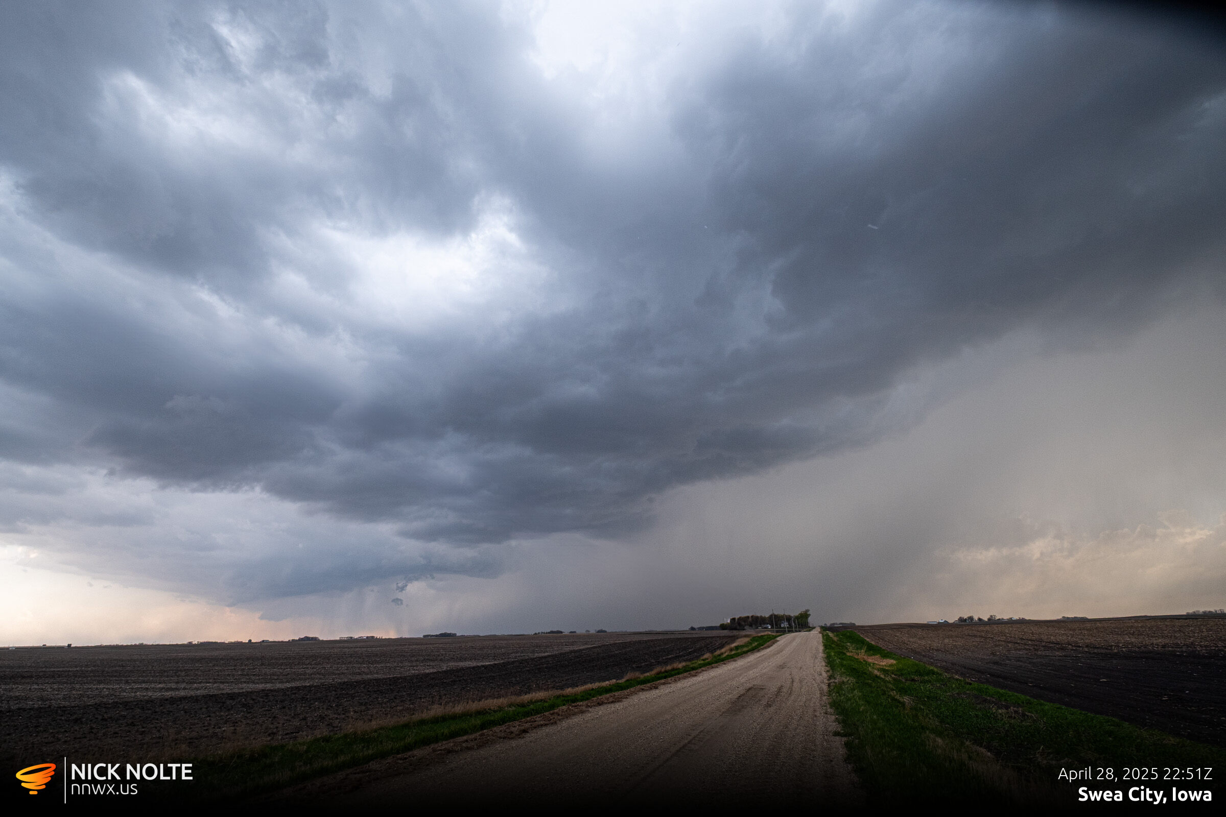
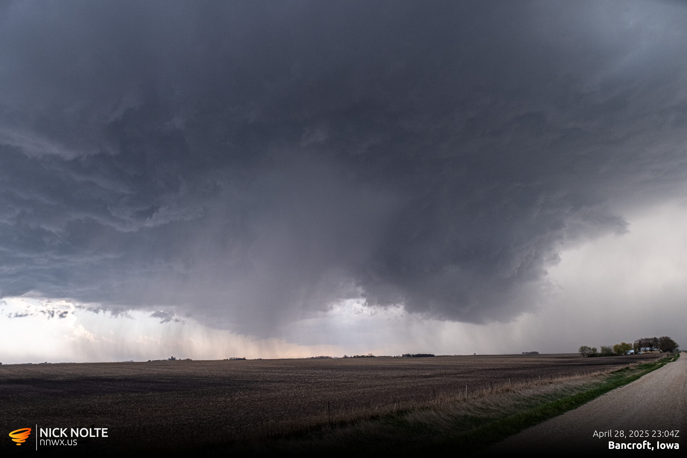
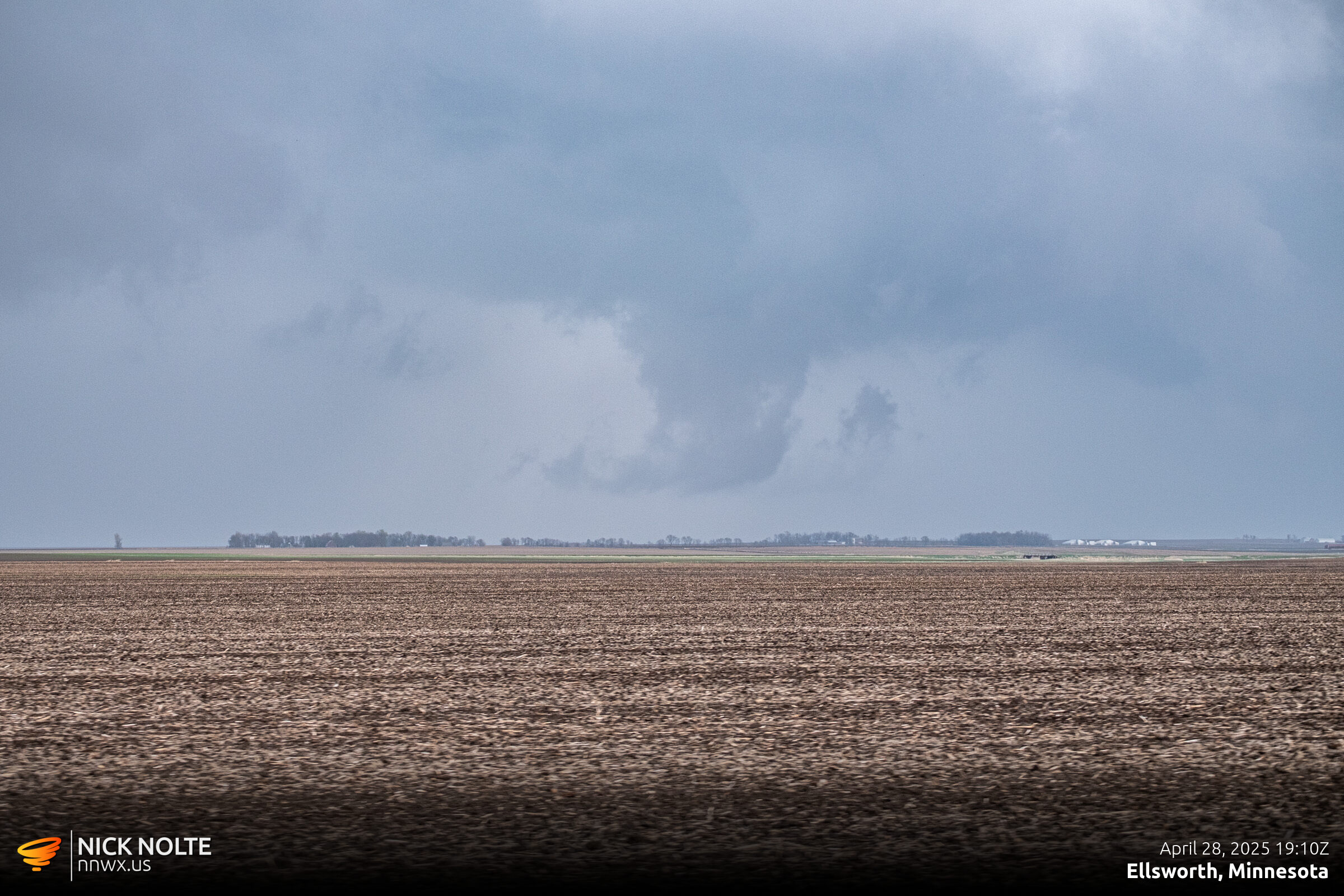
Even though the storm was tornado warned, I didn’t see anything going on underneath the storm. It seemed like I’d seen 13 different wall clouds throughout the day, but none of them seemed to be rotating.
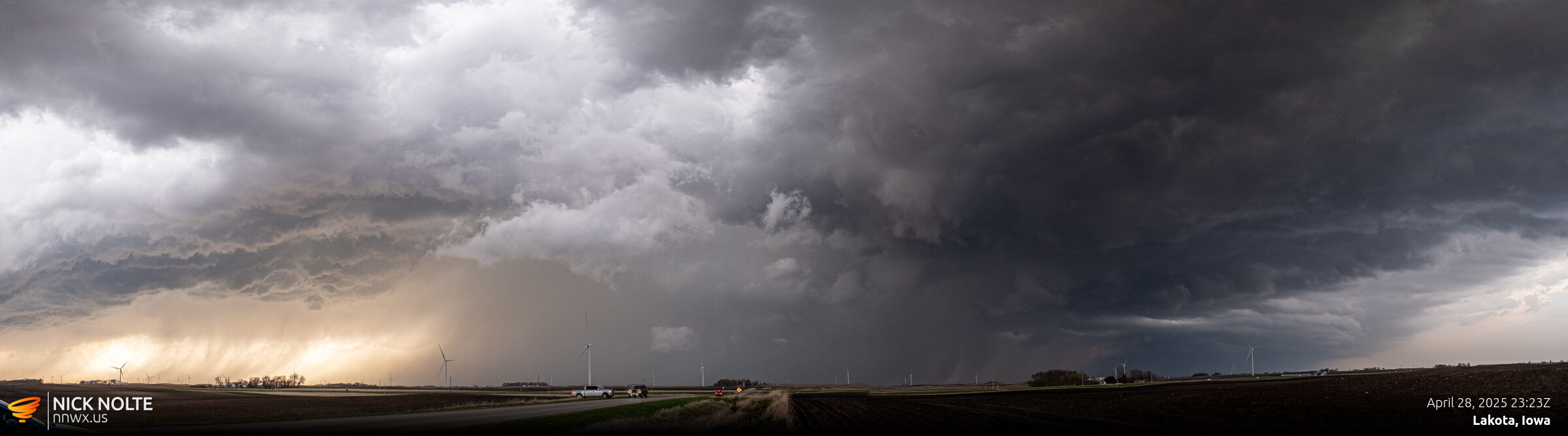
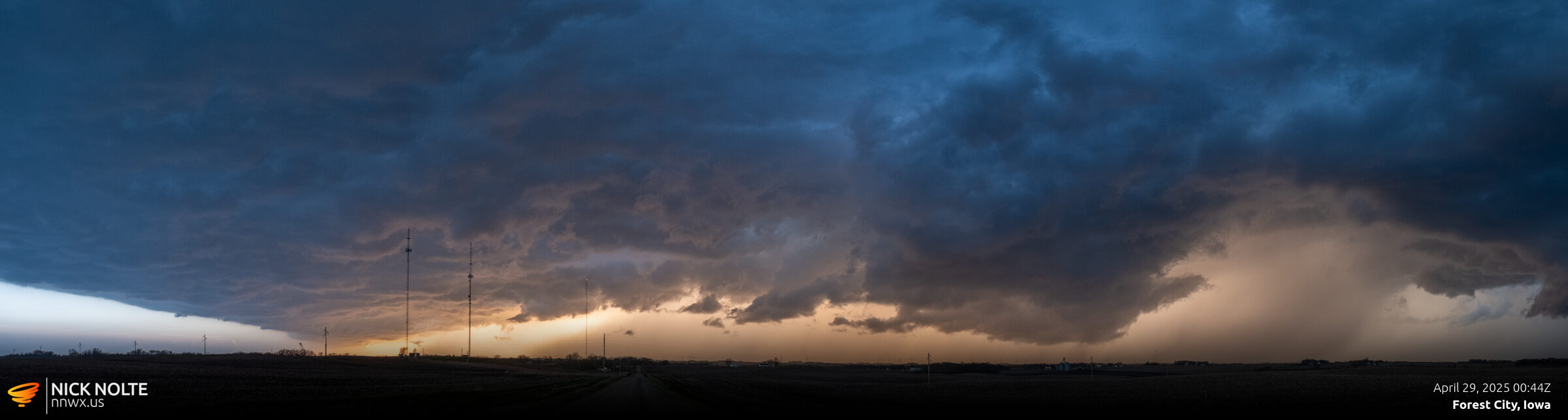
As the sunset, I dropped to Forest City for one last intercept and caught a nice panorama at dusk near town.
Chase Video
Storm Reports
Chase Recap
| START | END | DURATION |
|---|---|---|
| Grand Island, NE @ 28/1343Z | Des Moines, IA @ 29/0317Z | 13 hours, 34 minutes |
| INTERCEPTS | CHASER ENCOUNTERS |
|---|---|
| None | None |