| 0 | 1.75" | 70 | 370 |
|---|---|---|---|
| TORNADOES | HAIL | WIND | MILES |
June 7th was one of those days that ends up being a great chase even without tornadoes. Southerly surface winds were forecast to transport moisture north into Nebraska bringing dewpoints into the upper 50°s to near 60°F in the Sandhills. MLCAPE values were expected to reach 1500 J/Kg. Storms were expected to initiate in north-central Nebraska and migrate southeast eventually growing upscale overnight.
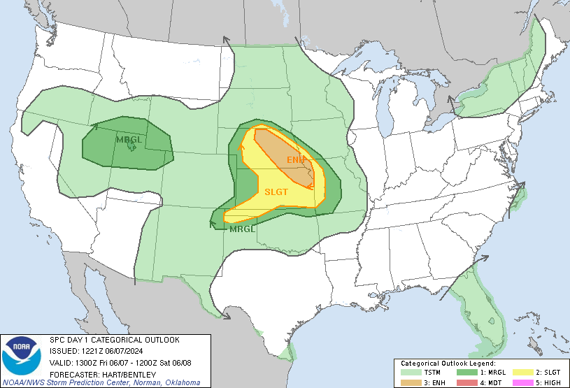
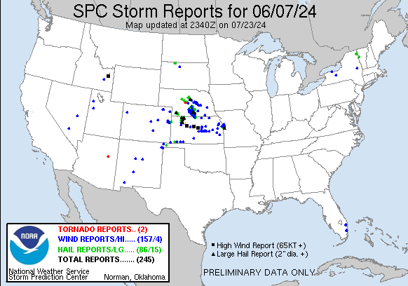
SPC had an elongated enhanced risk outlined from Valentine down to Kansas City. The primary threats along this corridor were large hail earlier in the day evolving to a wind event as storms grew upscale. There was a 5% tornado risk as well, but that seemed to be a secondary threat, but you never know!
A mesoscale discussion was issued at 18z for the Sandhills indicating a severe thunderstorm watch would be needed as mostly clear skies and continued insolation was increasing insstability as the initiating cumulus field appeared imminent in western Cherry County.
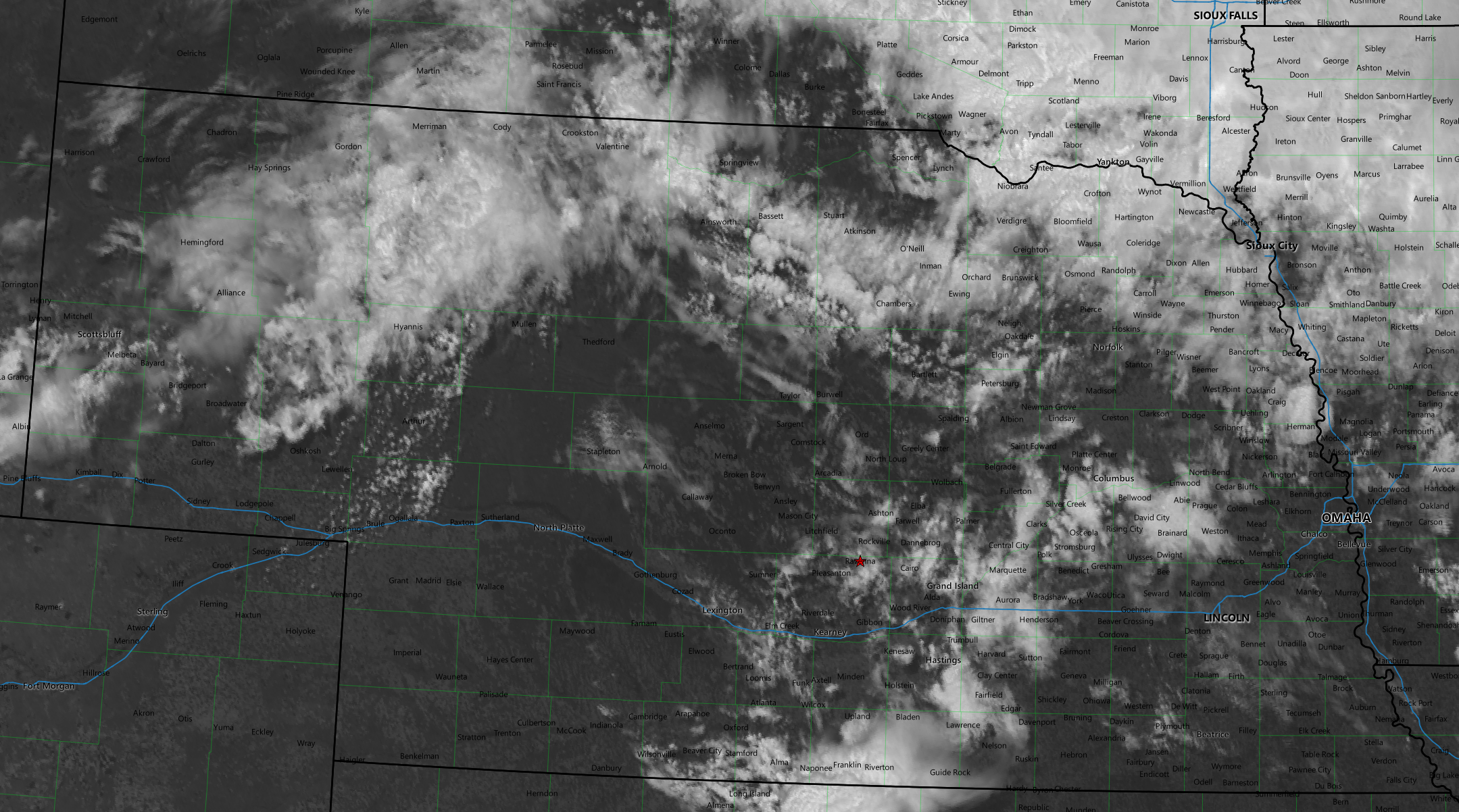
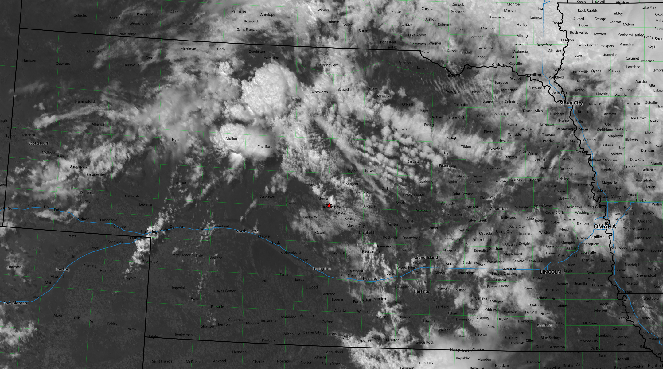
An hour or so later the storm that would be the initial target developed near Mullen. I had been hanging out in Broken Bow so began the trek towards Thedford.
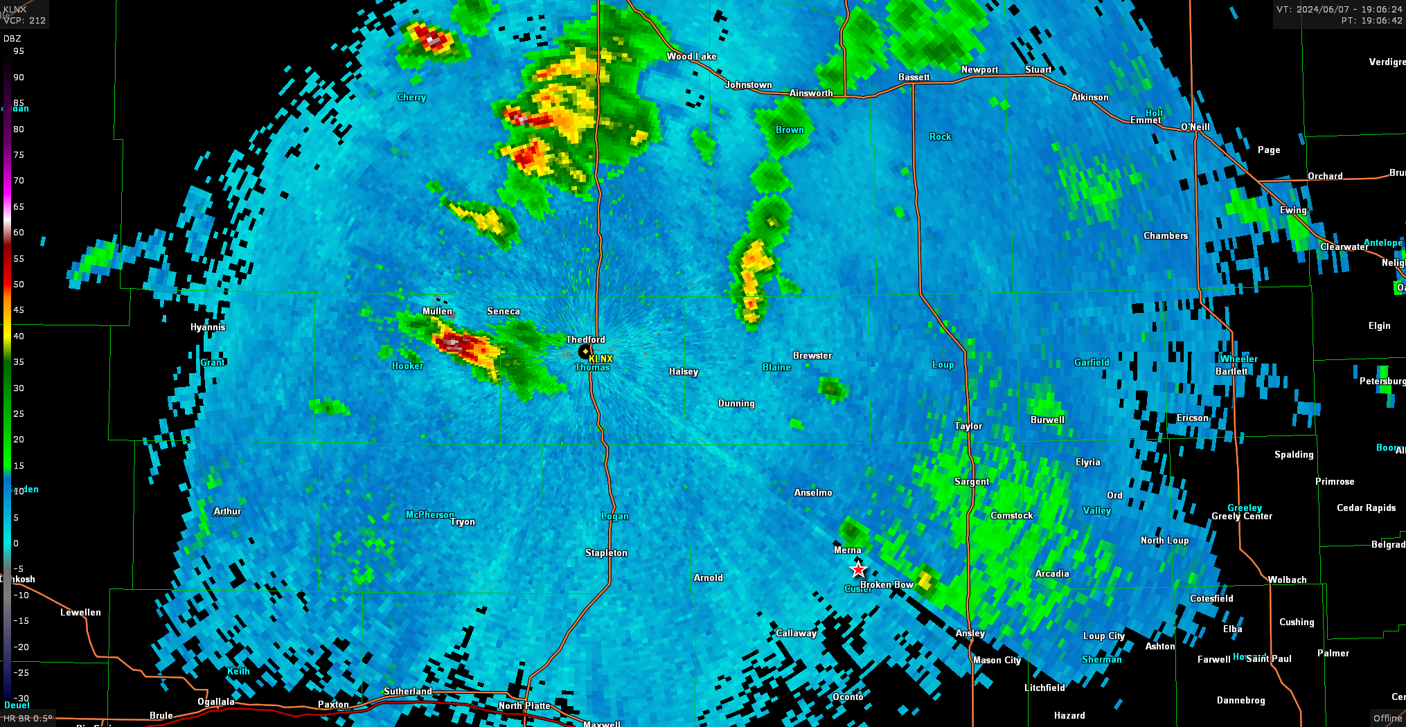
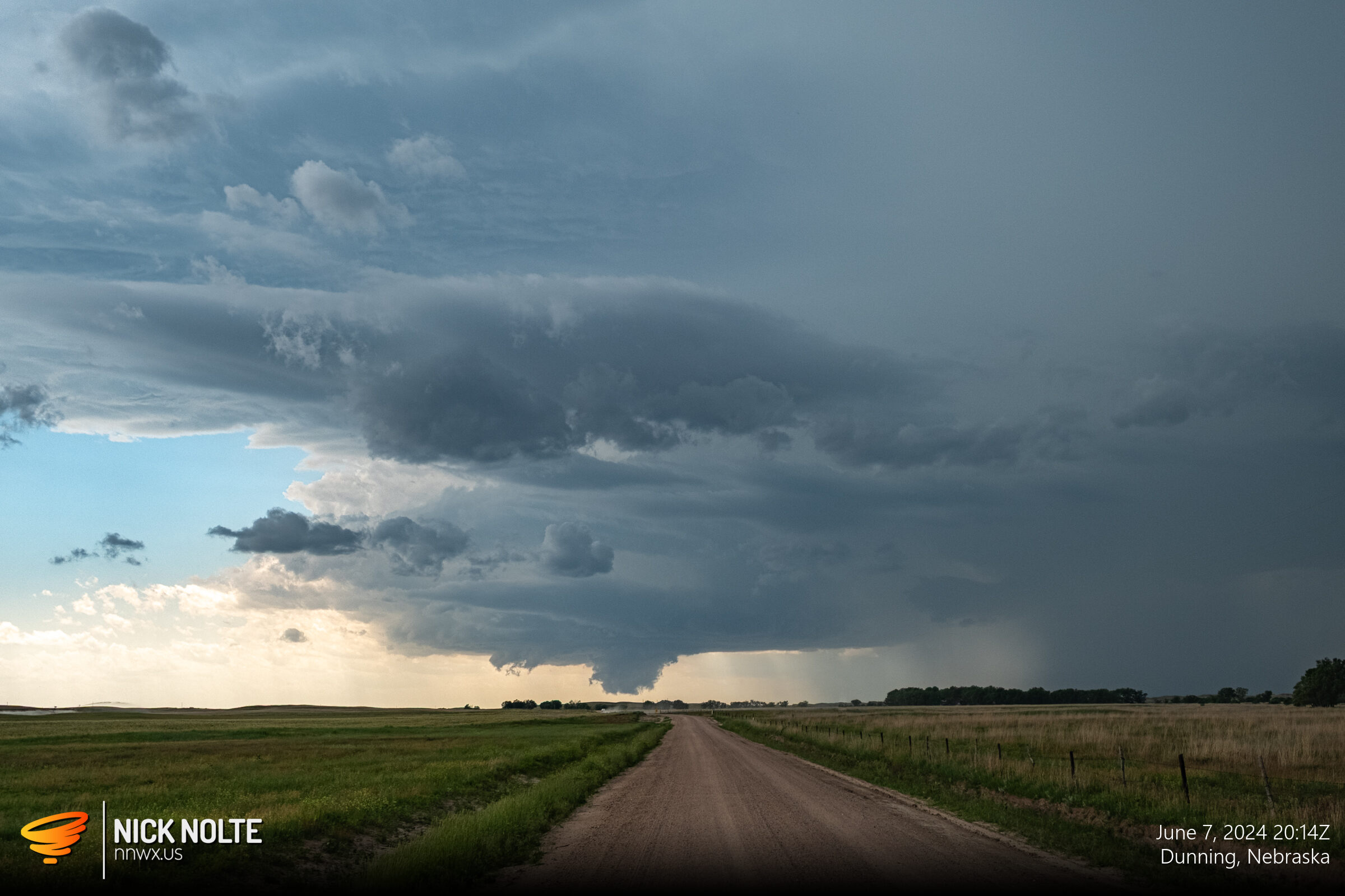
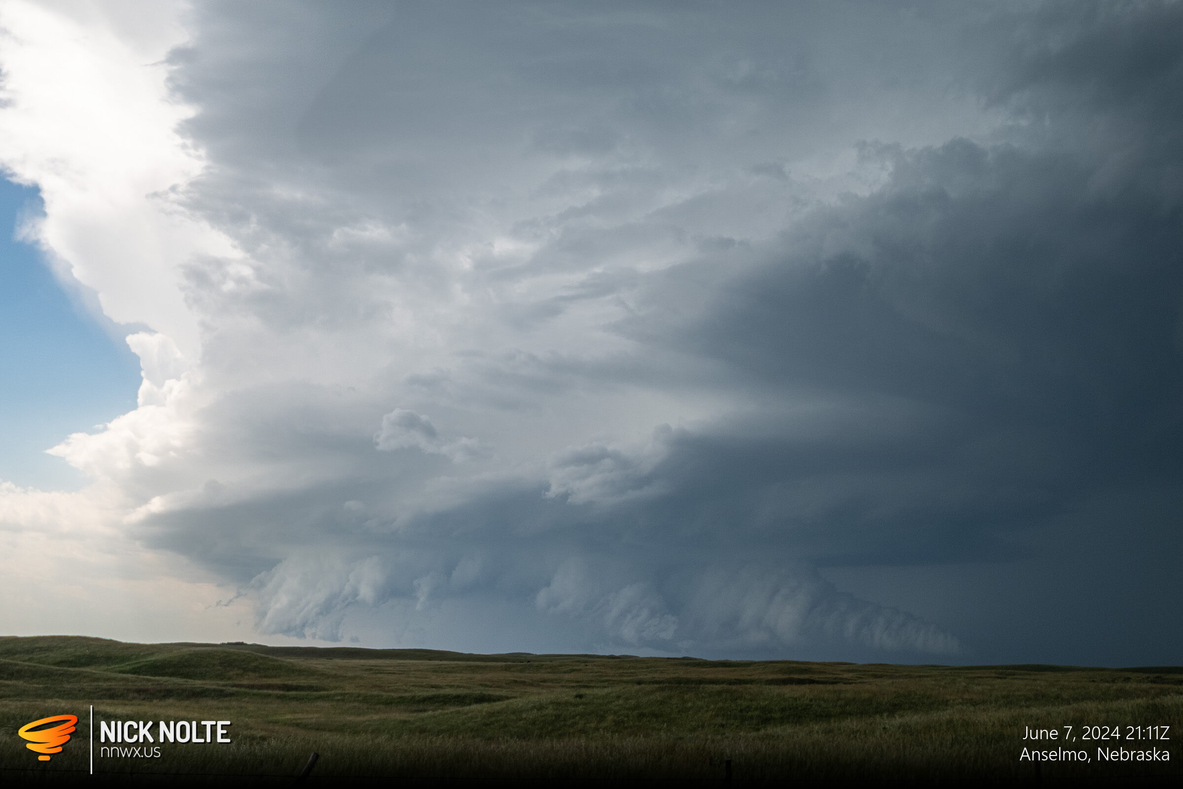
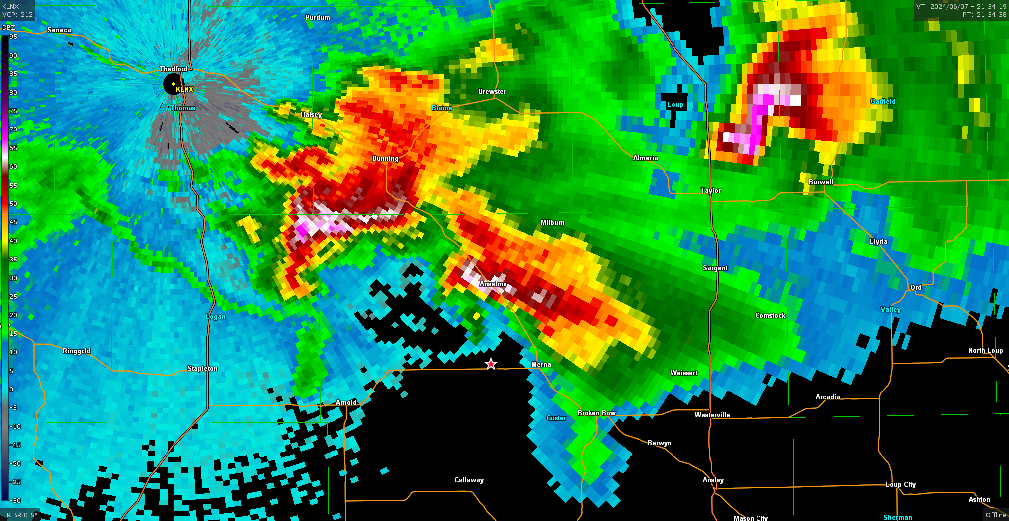
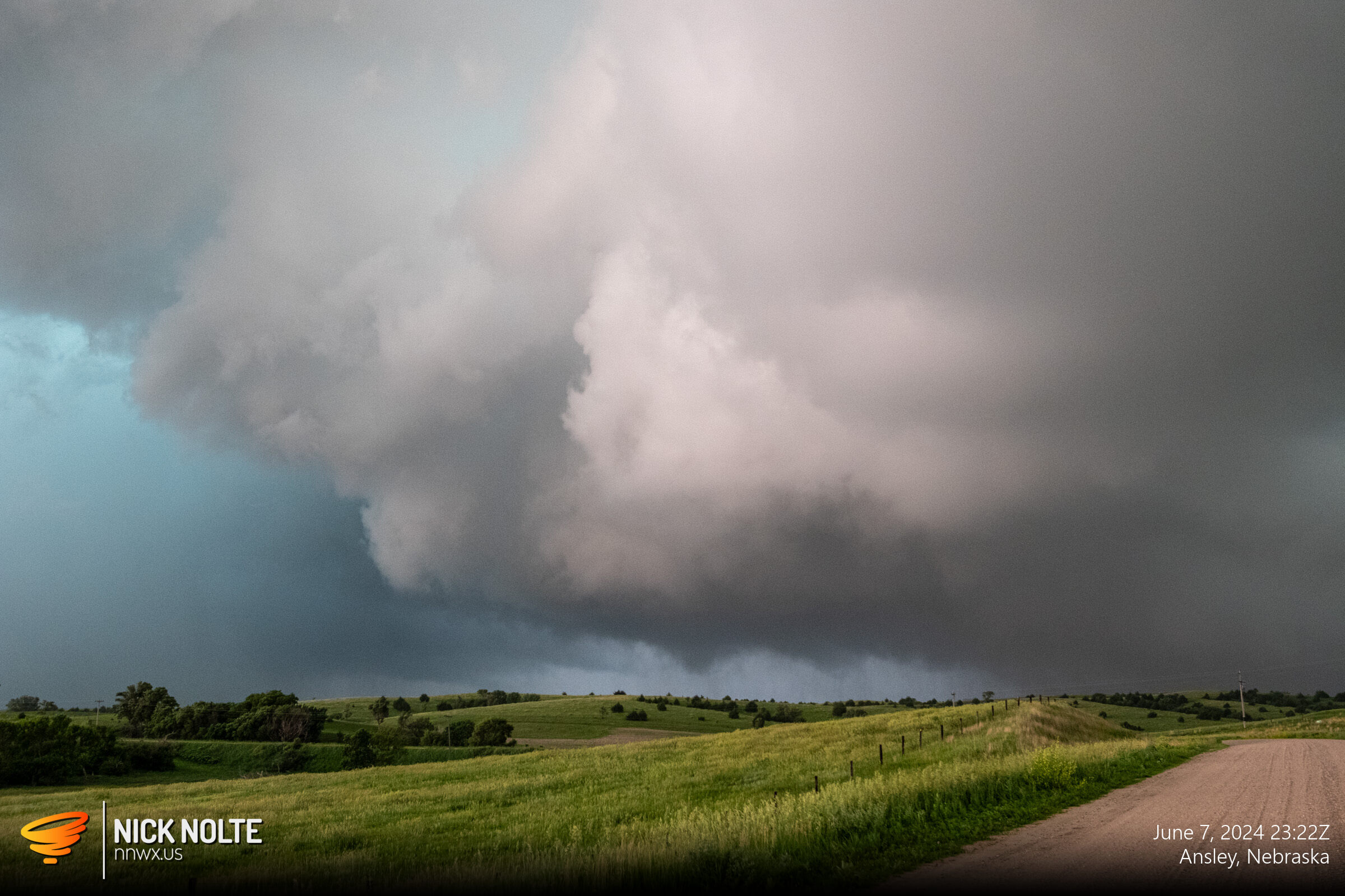
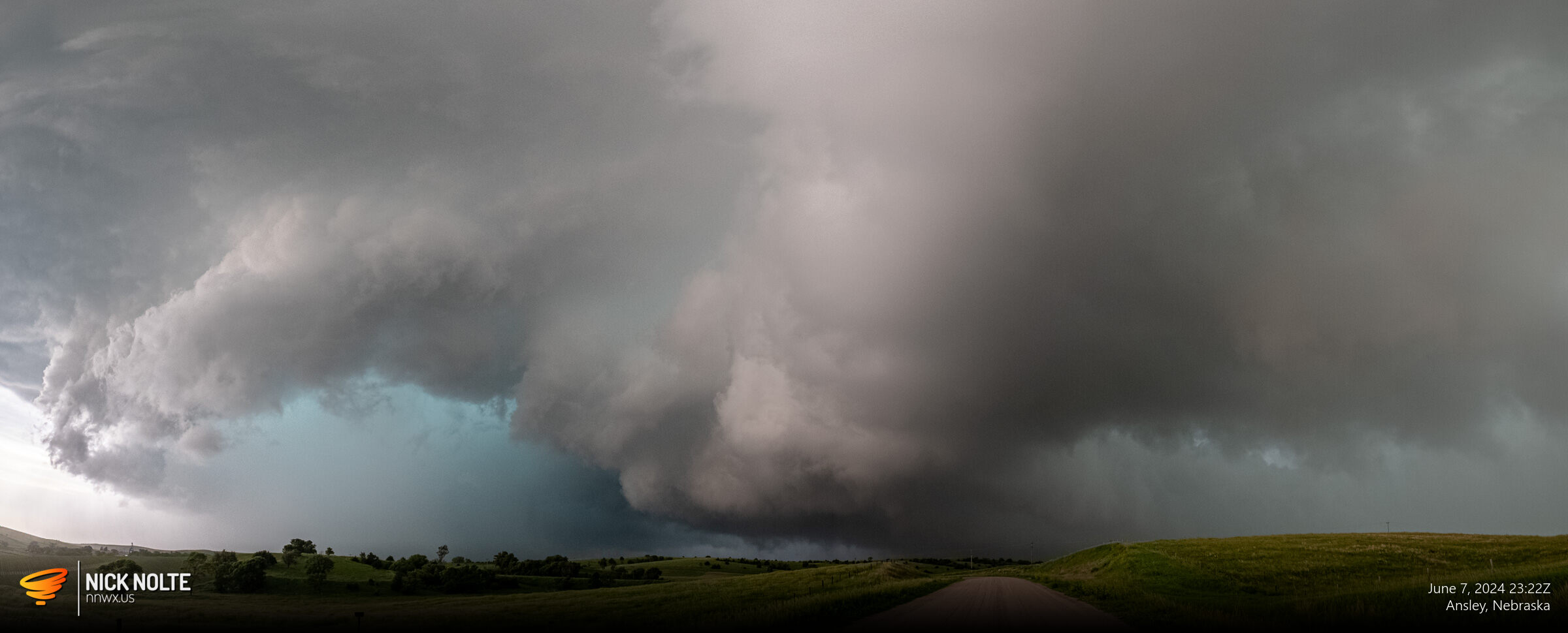
I eventually got on the storm shortly after 20z near Dunning and it was exhibiting a nicely lowered wall cloud and looking pretty good on radar.
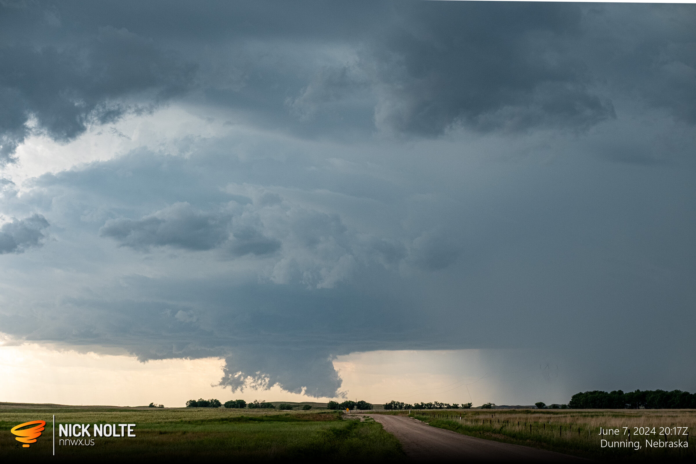
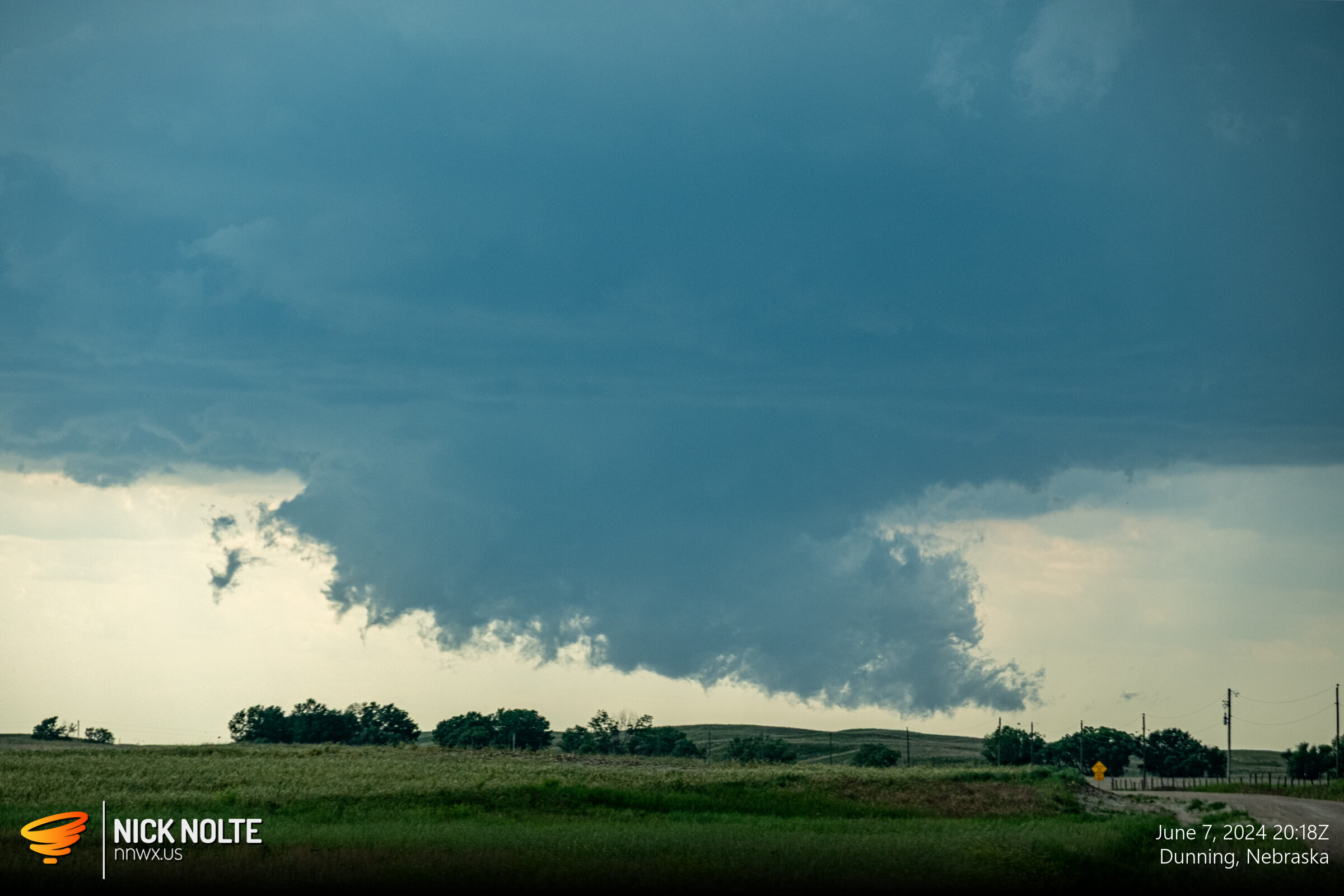
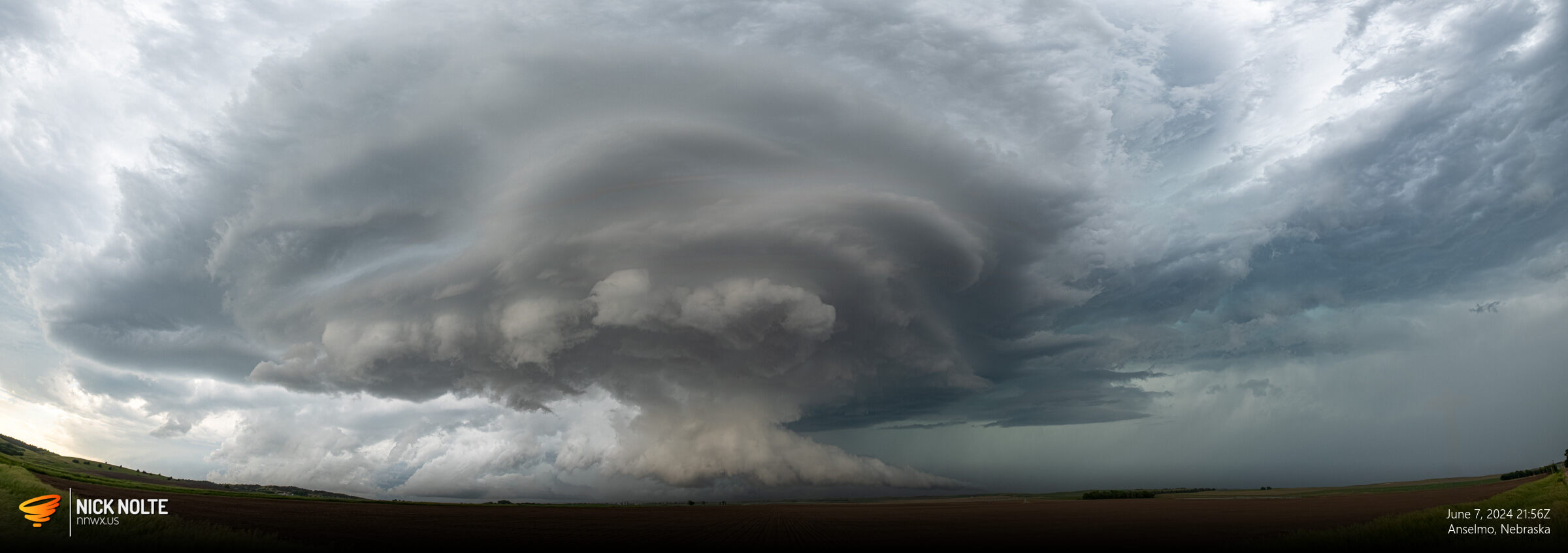
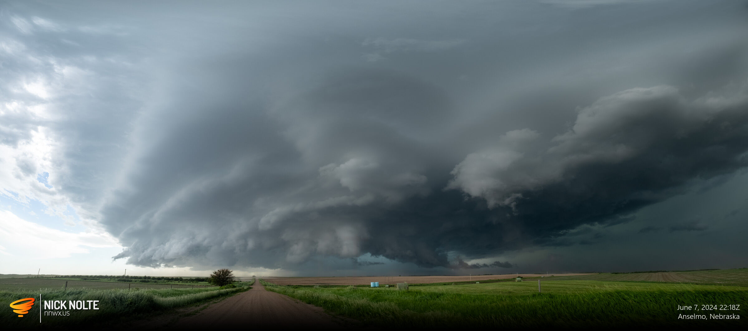
The storm continued to cycle and began to trek straight down highway 2 towards Broken Bow. As the storm approached Anselmo it really ramped up and the wall cloud beefed up.
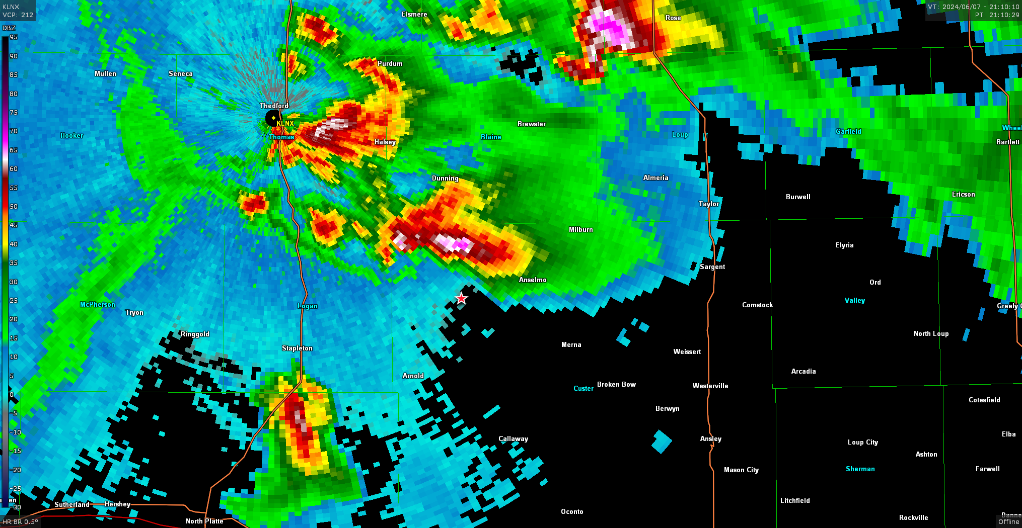
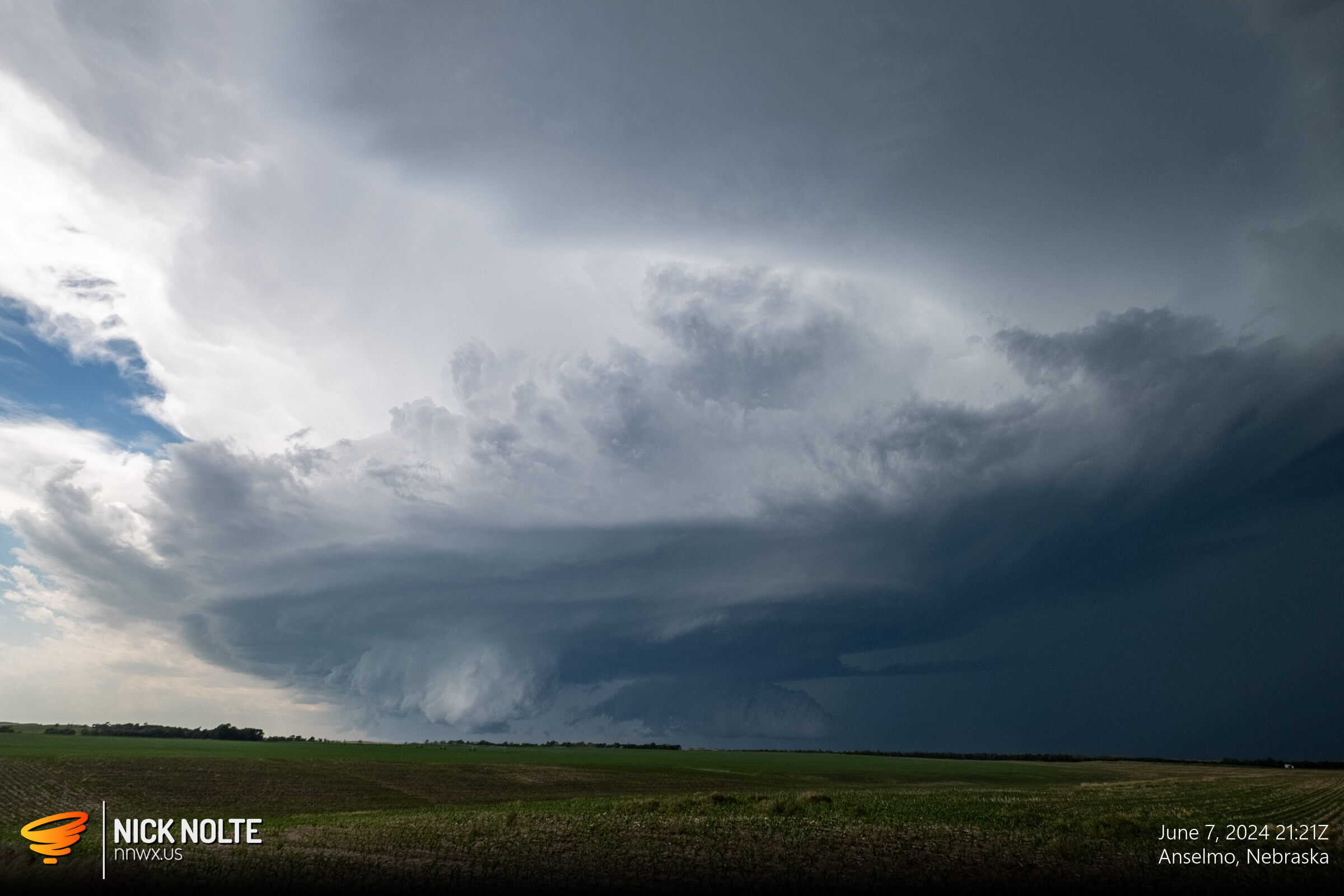
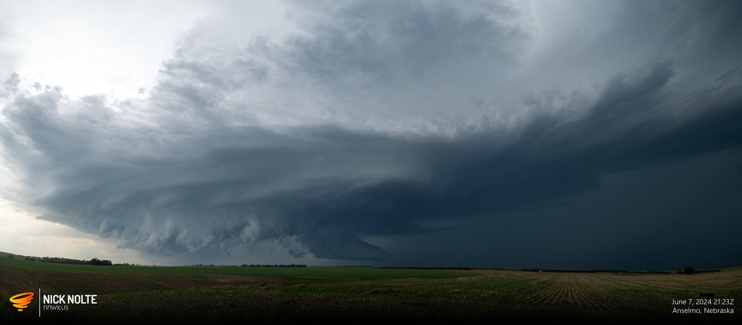
I was able to sit near Anselmo for a while watching the storm as it approached. A second storm formed behind it and eventually the storm I had been watching was consumed by the forward flank of the new storm and we had a new dominant supercell back to the west a bit and it would eventually become the highway 2 tracker.
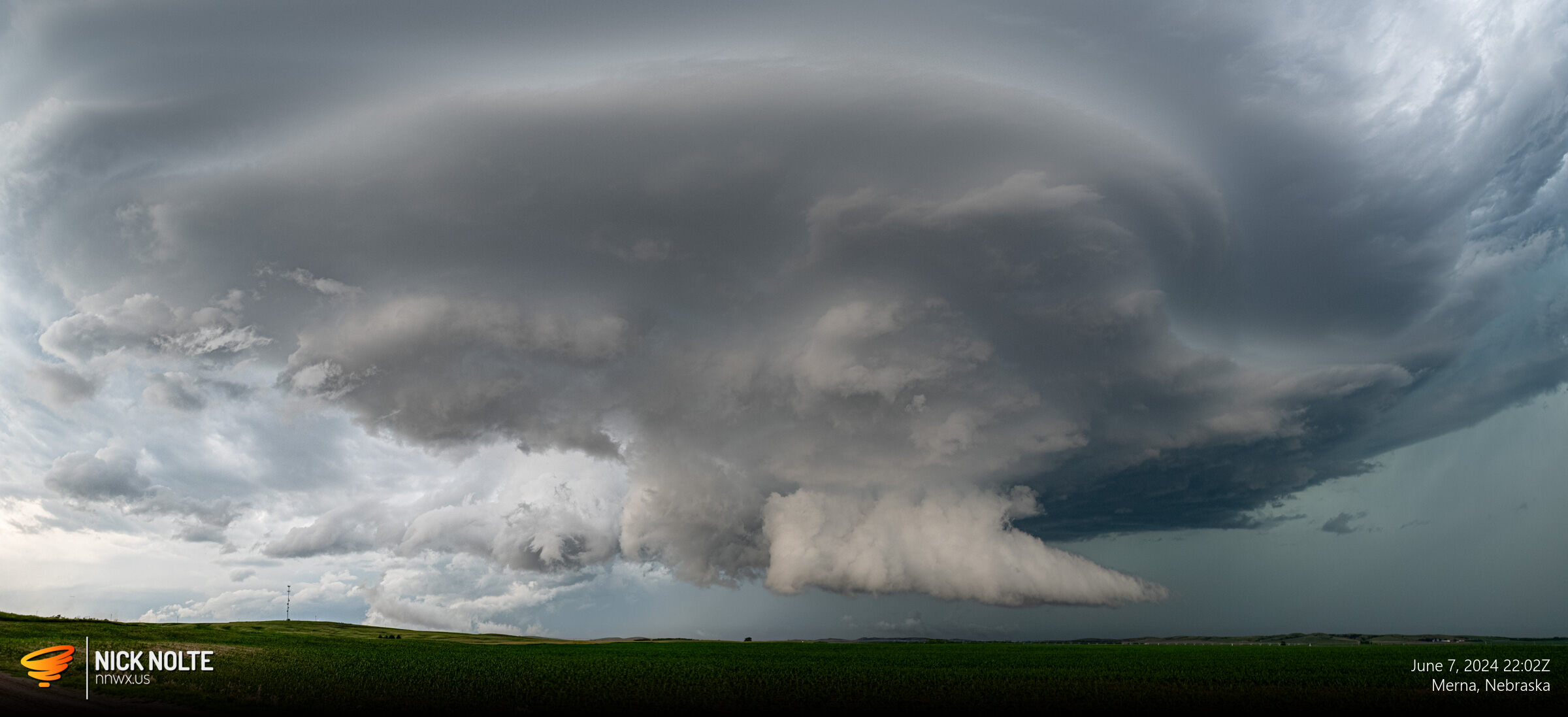
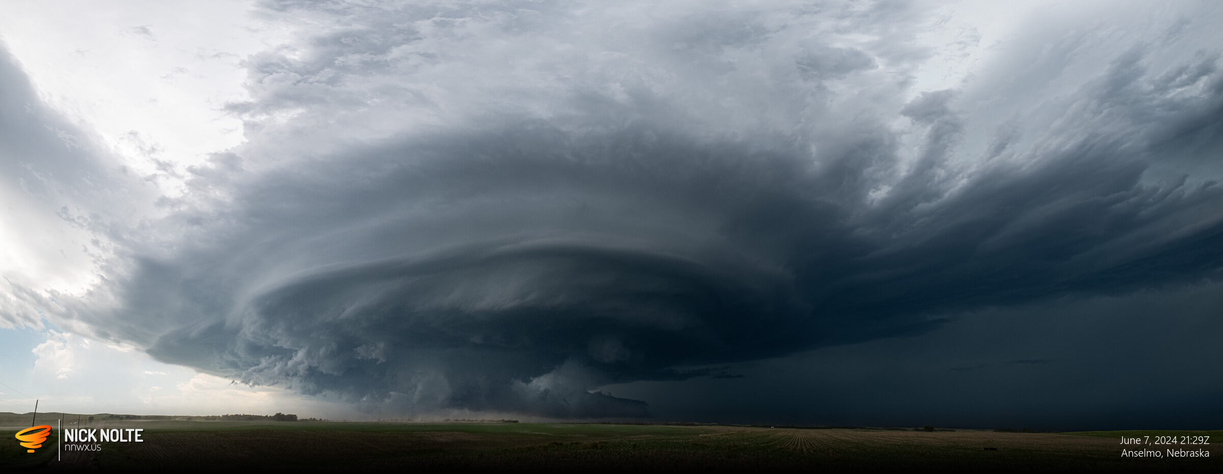
As the storm continued to track down highway 2 there were various reports of ping pong ball sized hail and a few wind gusts to 65mph. As the storm approached Ansley, the storm went tornado warned.
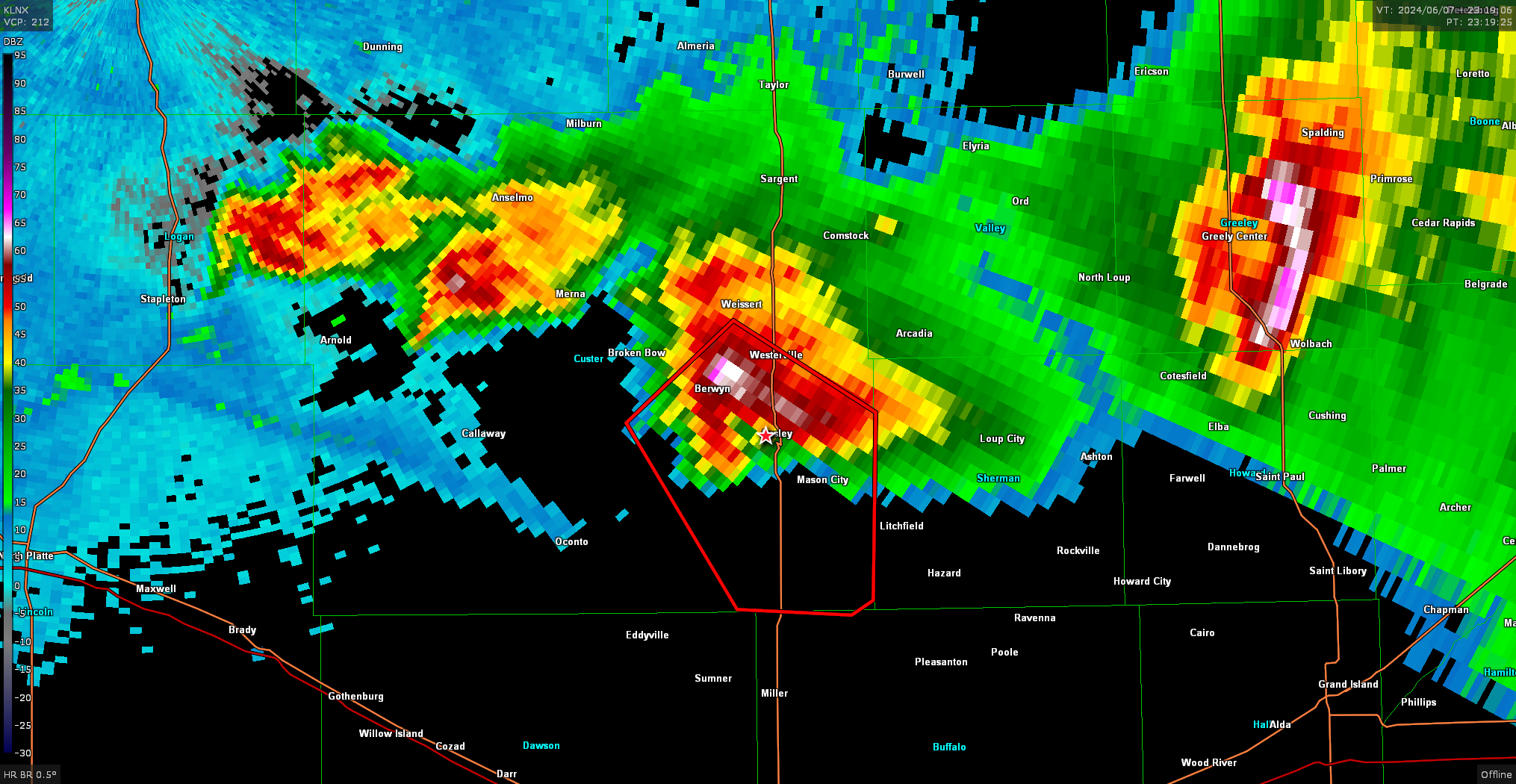
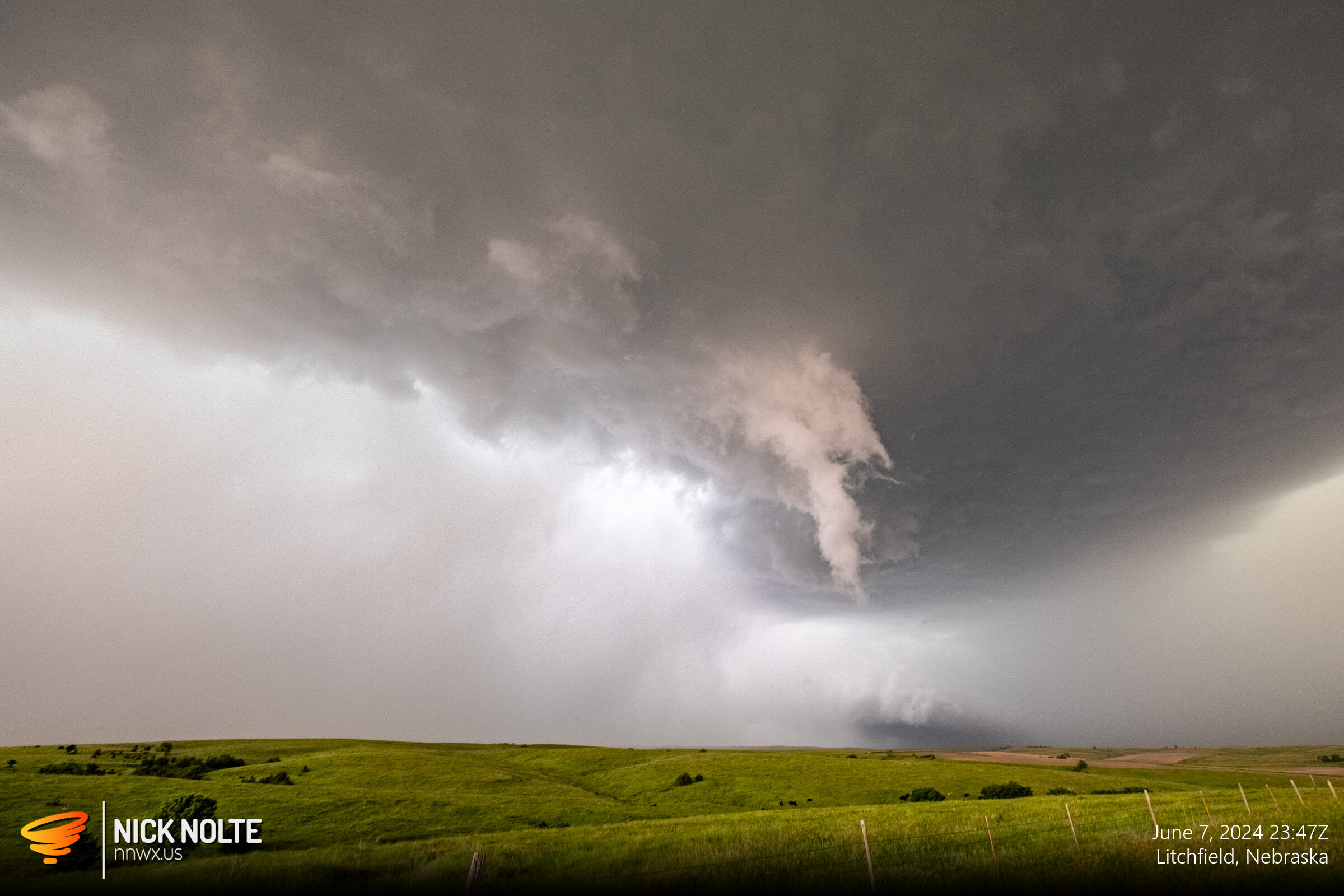
As the storm approached Litchfield it started dropping golf balls and continued on its way towards Wood River I called the chase as sunset approached. The storm continued to grow upscale and surged southeast into Kansas.
Chase Recap
| START | END | DURATION |
|---|---|---|
| Grand Island, NE @ 07/1727Z | Grand Island, NE @ 08/0155Z | 08 hours, 28 minutes |
| INTERCEPTS | CHASER ENCOUNTERS |
|---|---|
| None | None |