| 0 | 1.50" | 60 | 551 |
|---|---|---|---|
| TORNADOES | HAIL | WIND | MILES |
After driving back home the previous evening, I decided to trek back out for this event. Another low was forecast to develop in Colorado and Southwestern Nebraska with a dryline extending south to Texas. This was to trek east through Nebraska and bring a moderately buoyant environment with it as mixed layer cape values would exceed 2,000 J/Kg.
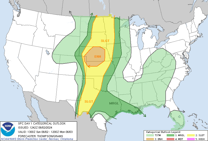
SPC had an enhanced risk through all of Central Nebraska most for overlap in large hail and severe wind coverages. Forecast models were predicting initial supercell modes with large hail morphing into a strong MCS as upscale growth took over and produced very strong winds. I took off from Grand Island around 18z and began the trip west along Interstate 80.
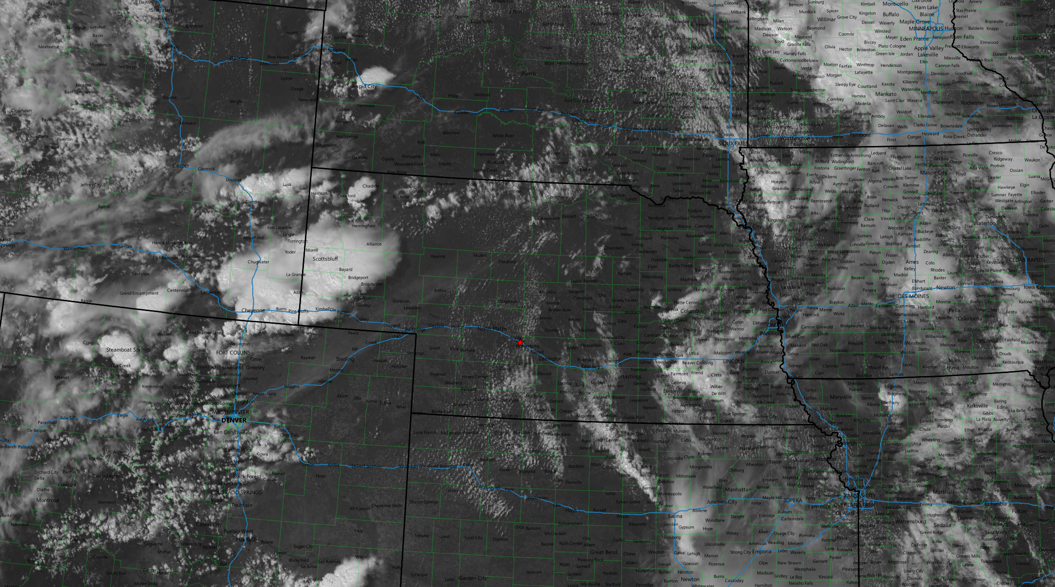
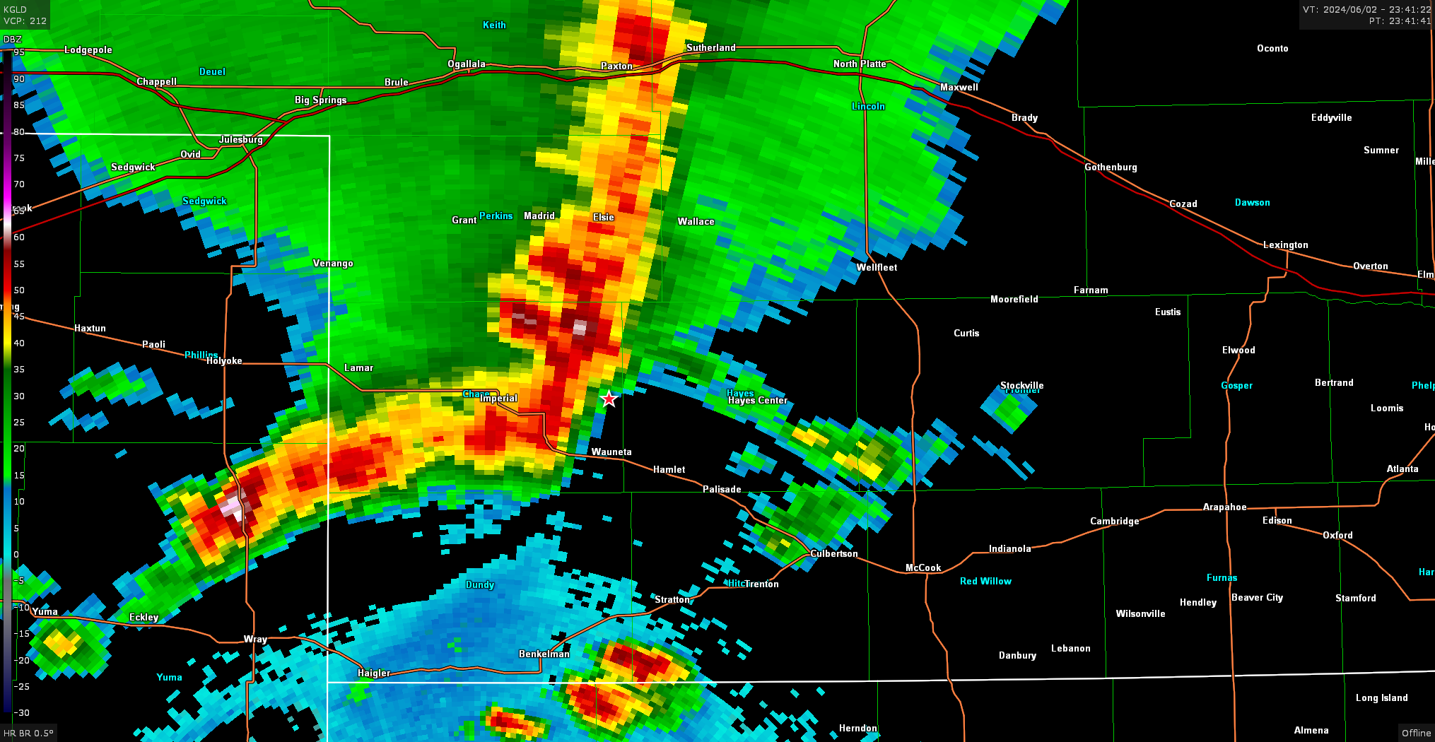
SPC issued a mesoscale discussion encompassing most of western Nebraska around 20z indicating a watch was probably needed soon. Storms had fired in southeast Wyoming and were migrating into the Nebraska Panhandle, so I continued west on 80 to intercept.
I intercepted the Sidney storm just east of there around 2130z
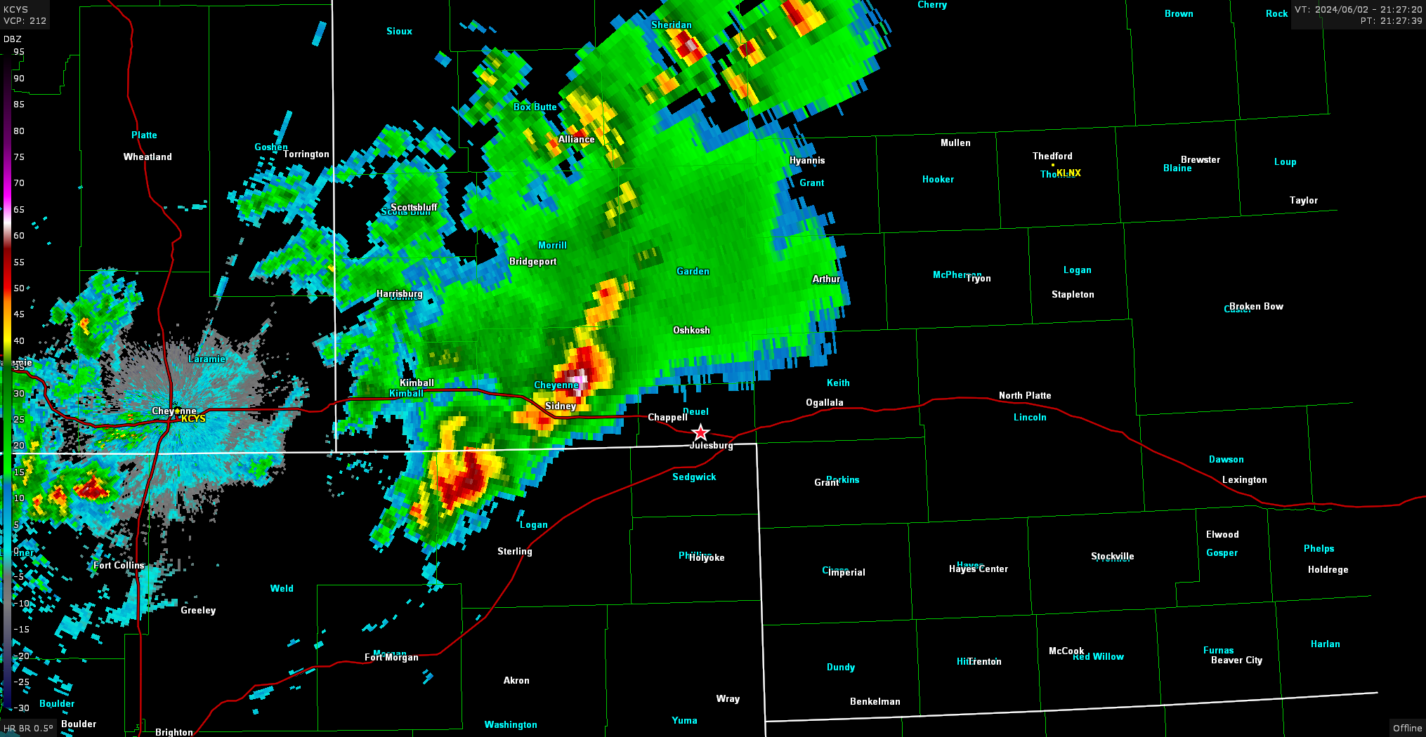
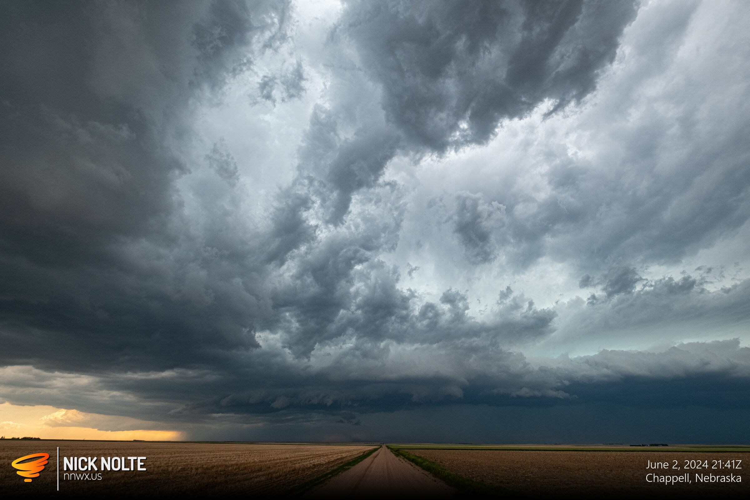
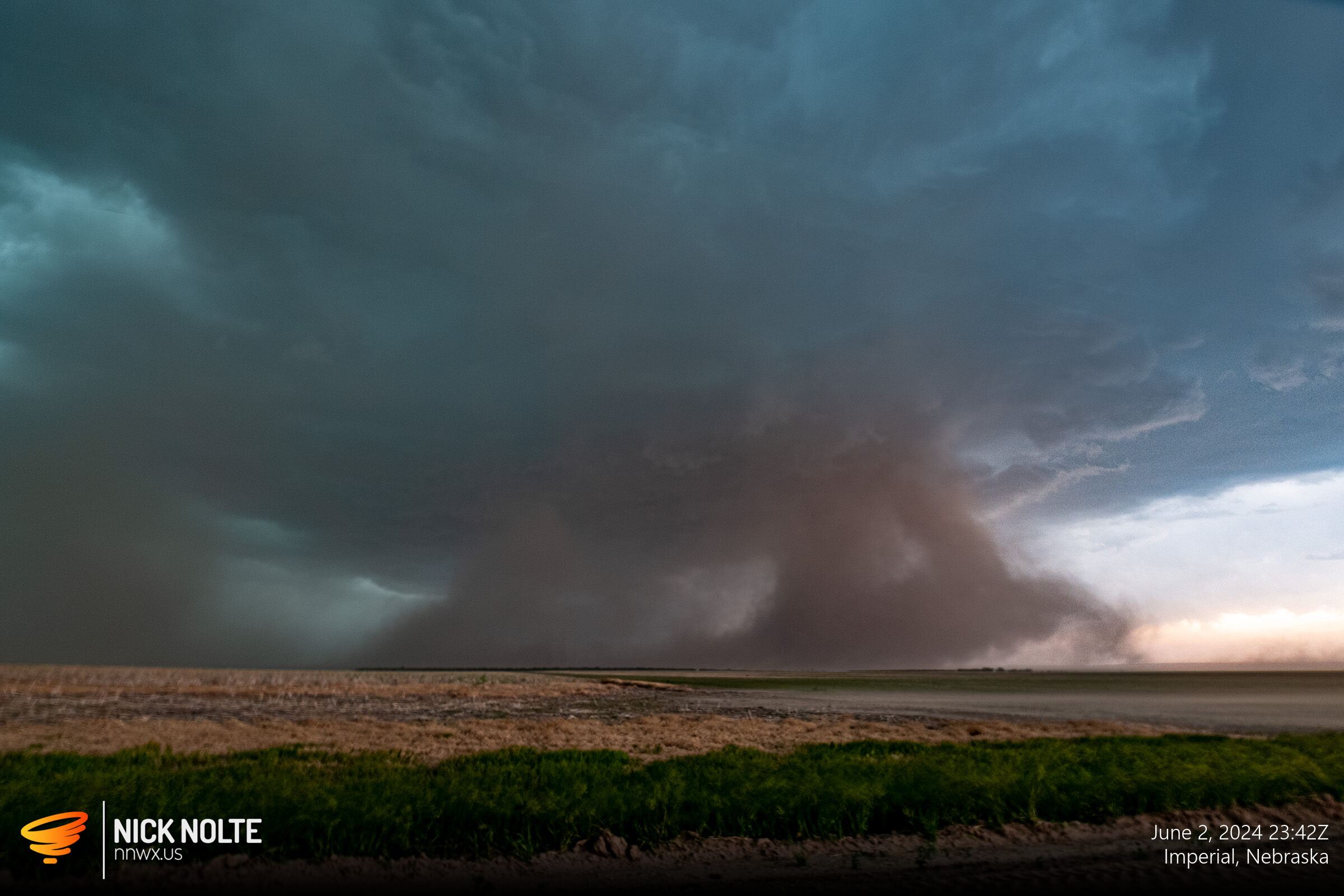
I tracked this storm for a bit as it drifted east southeast. It started to grow upscale and started to surge southeast. This change in characteristic marked the beginning of the storm really pushing out some wind. I dropped south from Ovid and started stairstepping with the storm as it headed towards Imperial to keep in front of it. Much of this time was spent running just to keep in front, but I was finally able to get far enough in front to take some more shots east of Imperial.
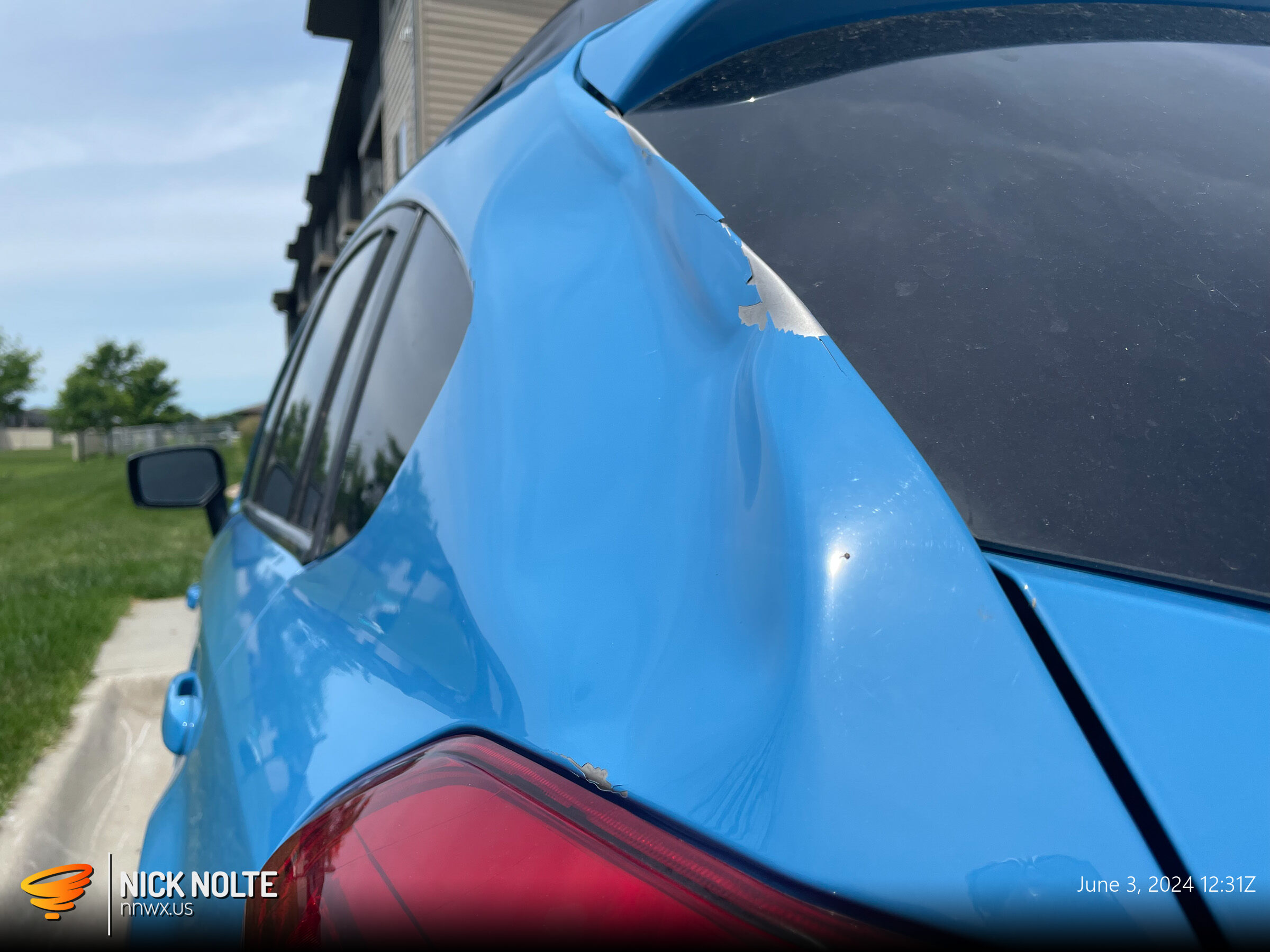
Between Culbertson and McCook the wind was pushing 80 or 90 mph and I witnessed large tree limbs snapped from trees along US 6. One of them actually hit my rear quarterpanel and caused a huge dent. I was actually lucky I didn’t lose any windows or taillights.
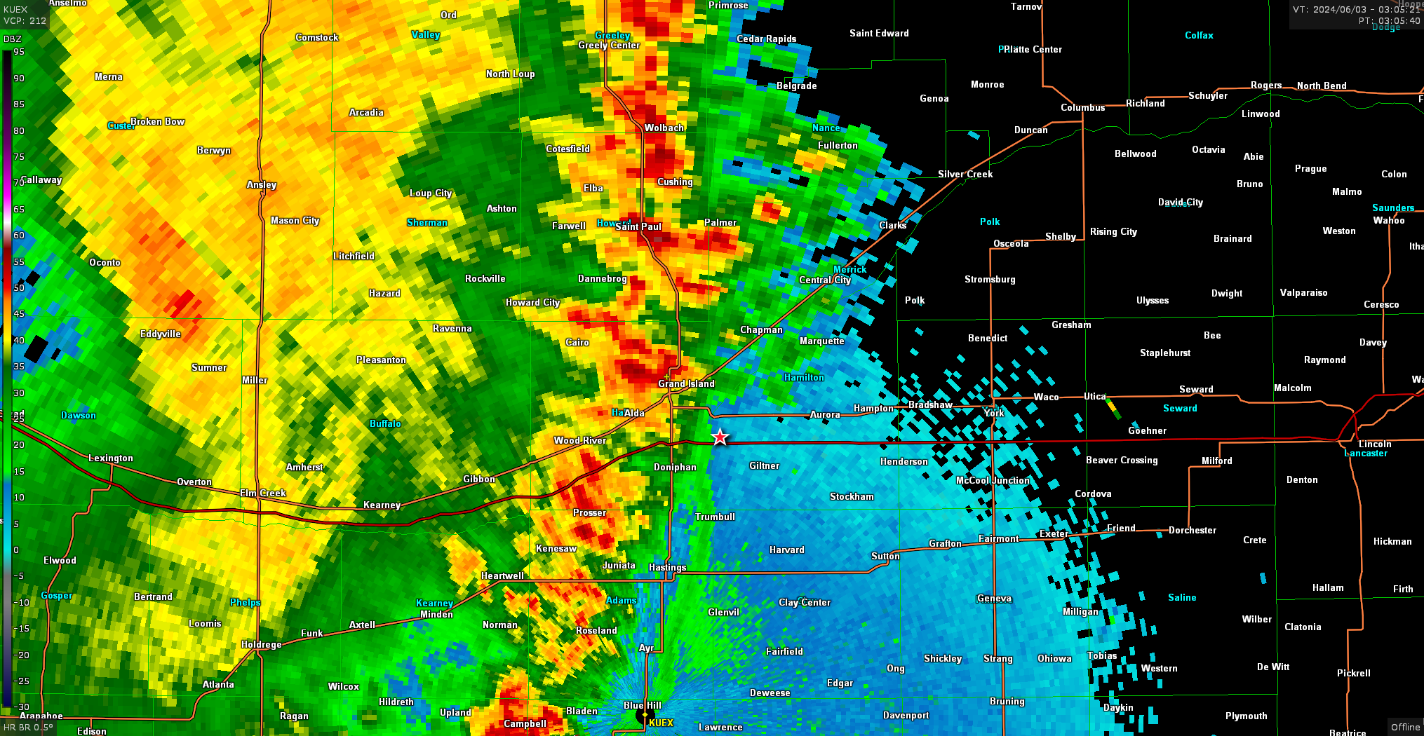
As I approached Holdredge, well after dark, the storm had a couple suspicious lowerings with some dust being kicked up, but I think this was just RFD and there were no tornado reports.
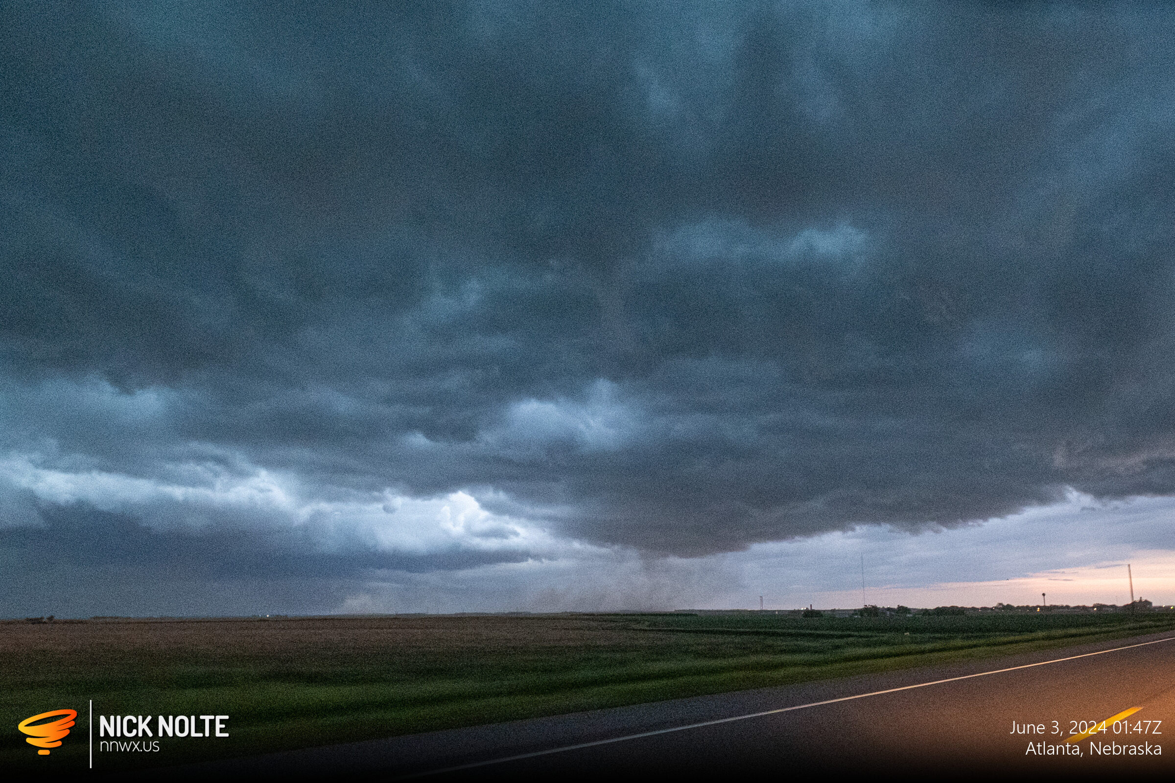
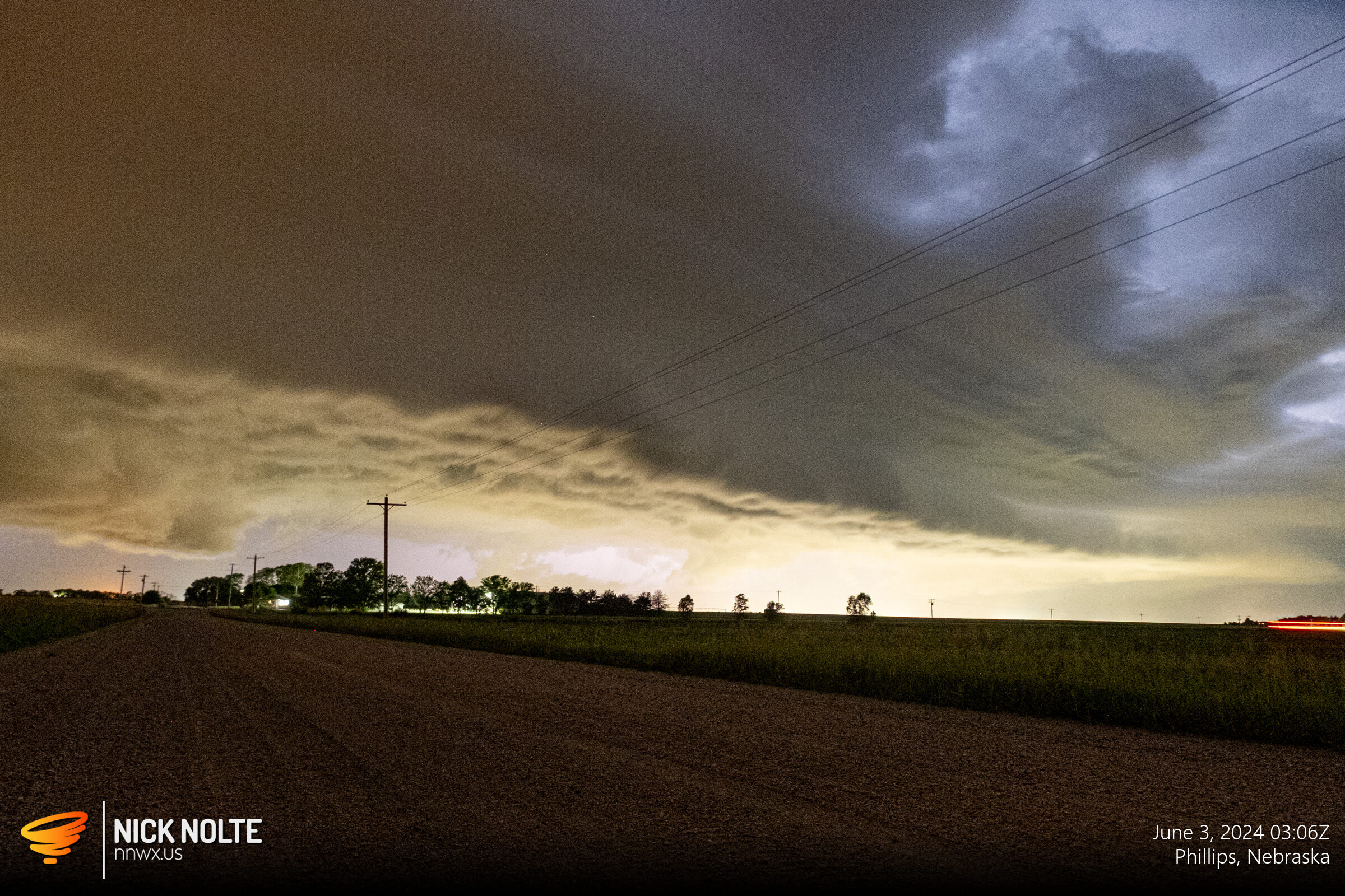
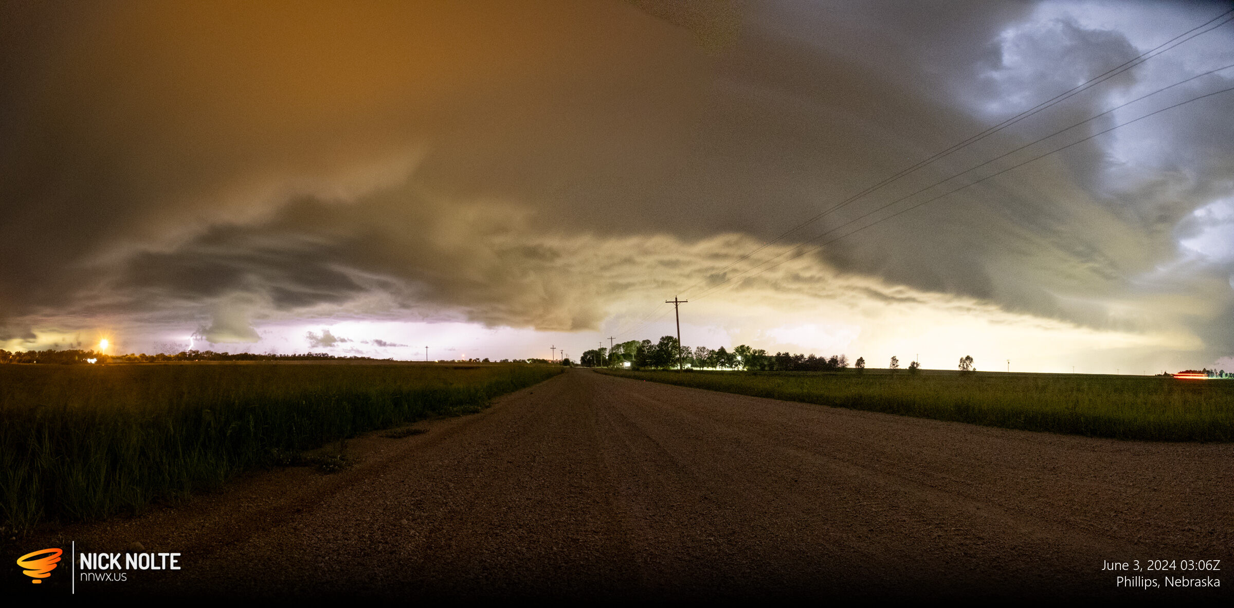
As I approached home, I actually went east of town to try and shoot a decent shot of the shelf cloud at dark.
Chase Recap
| START | END | DURATION |
|---|---|---|
| Grand Island, NE @ 02/1810Z | Grand Island, NE @ 03/0320Z | 09 hours, 10 minutes |
| INTERCEPTS | CHASER ENCOUNTERS |
|---|---|
| None | None |