| 0 | 1.00" | 70 | 289 |
|---|---|---|---|
| TORNADOES | HAIL | WIND | MILES |
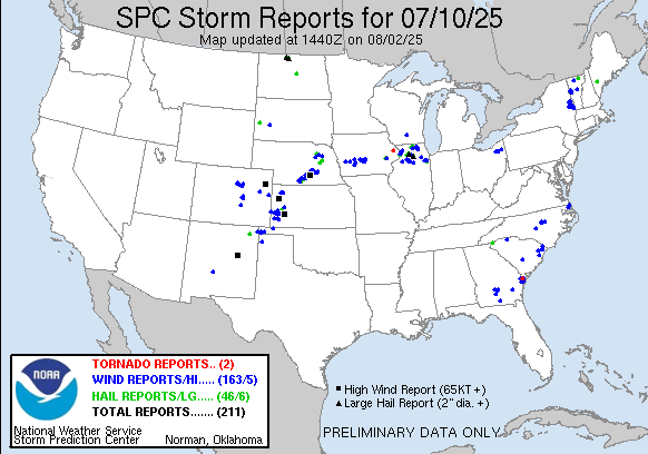
July 10th featured a modest belt of southwesterly low level flow atop a relatively moist low level atmosphere would prime the atmosphere for severe thunderstorms during the afternoon. With large CAPE values in Eastern Nebraska things would be primed for supercell development before upscale growth later in the evening.
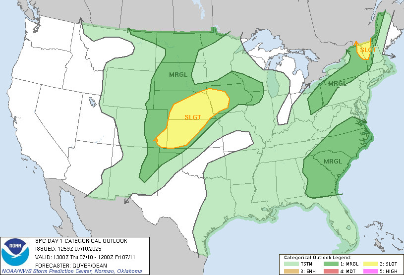
This was a regular work day for me, I hadn’t intended to chase but after watching satellite it looked like the O’Neill area might be a decent place to target. I left work early and headed up US 281 to O’Neill. A stationary front was forecast to stall across the eastern half of the state from Atkinson down to Rulo. I was eyeing the backed surface flow on the northeast side of the front. A bit after 19z SPC issued a mesoscale discussion for the area.
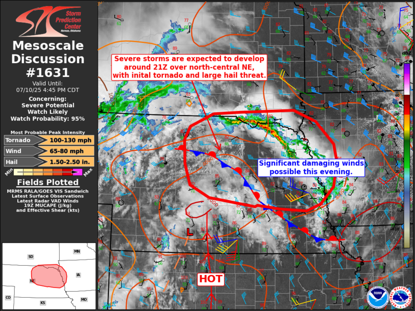
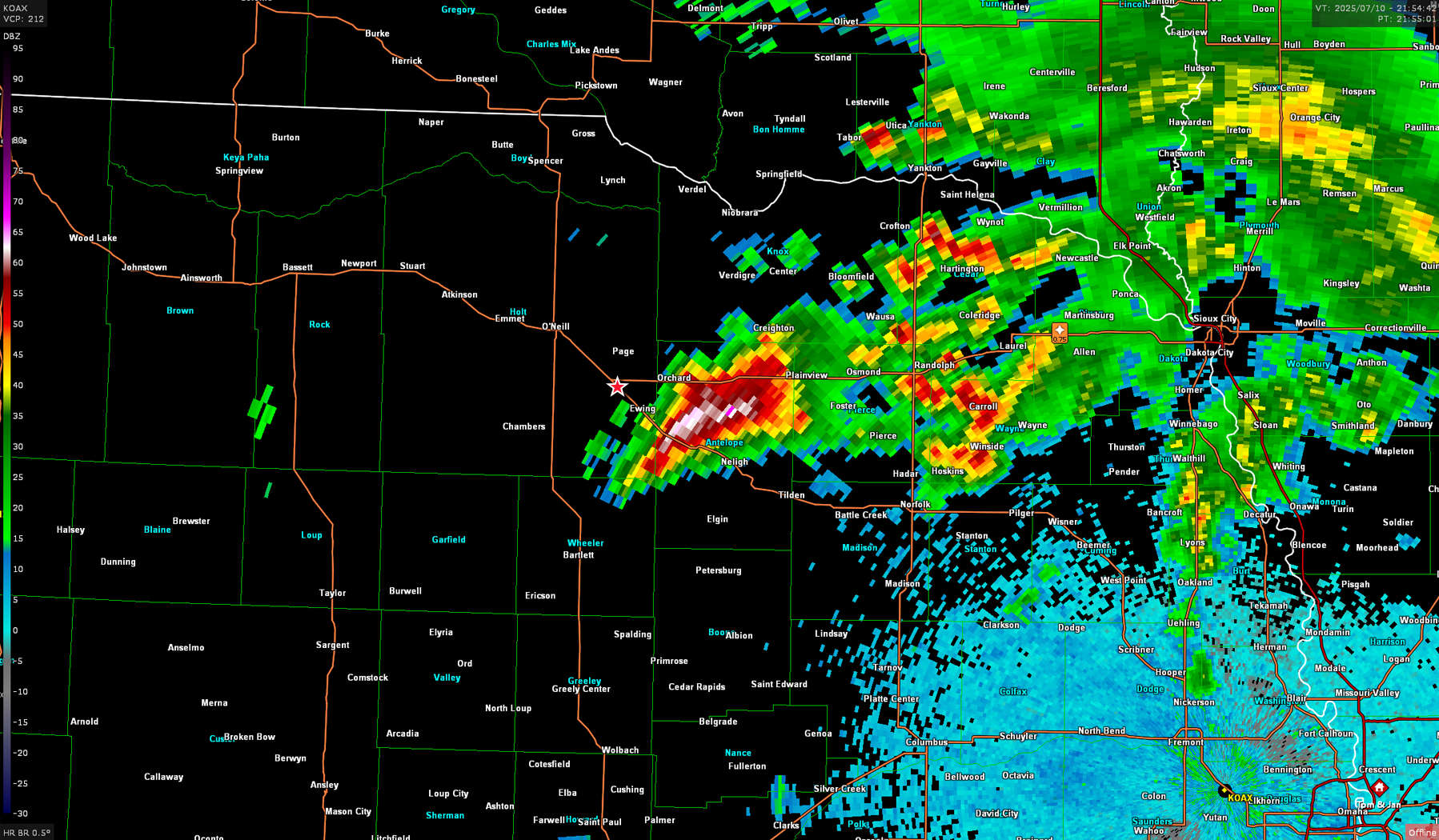
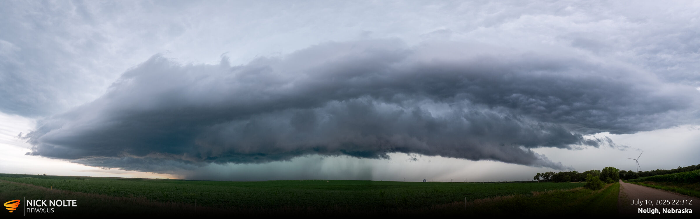
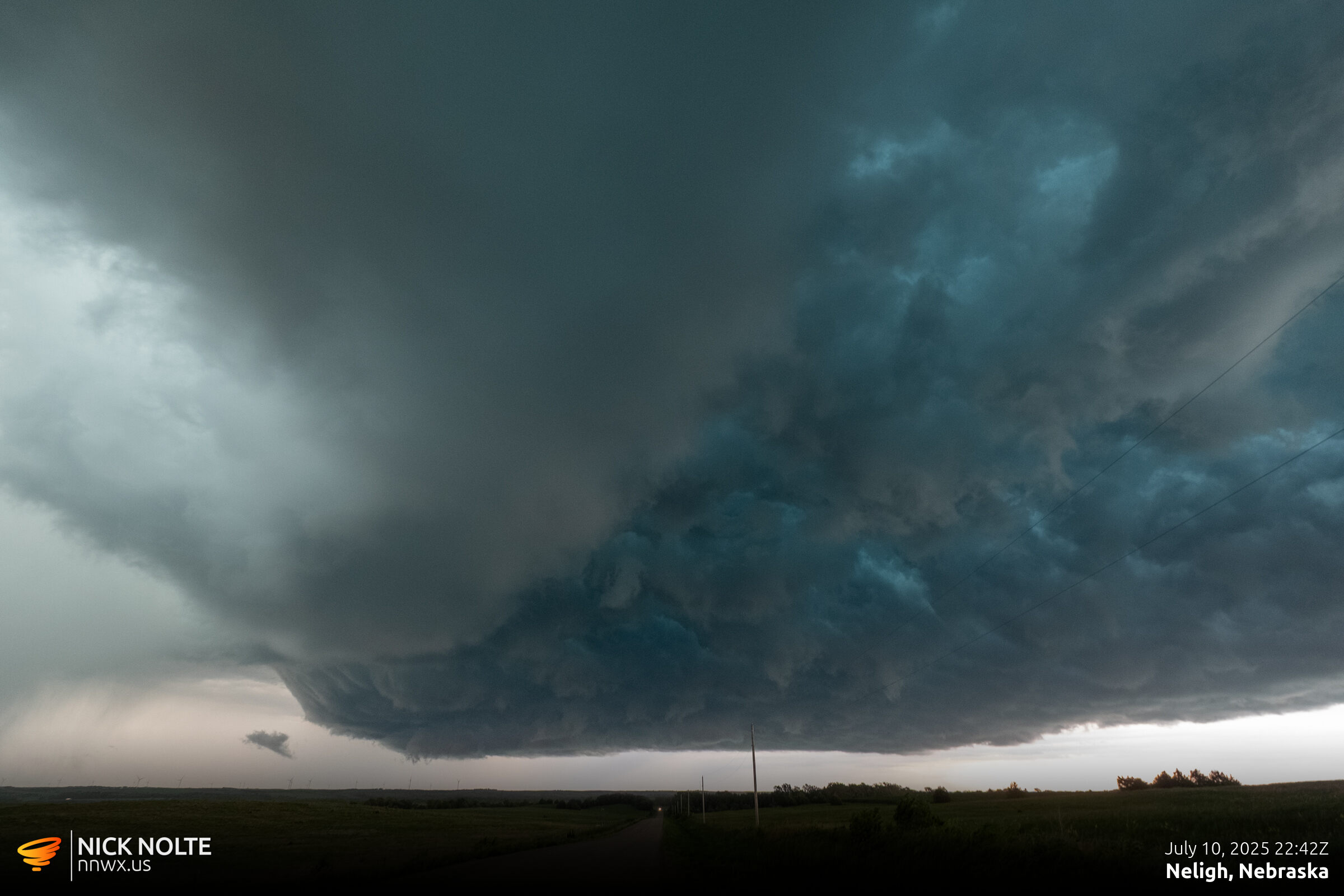
I arrived in O’Neill right at 21z as spotty storms were firing up along the US 20 corridor east of O’Neill. I hung around O’Neill and got to watch radar as a beefy cell went up just west of home. Felt like that was the third time that happened this year. At least it didn’t do anything. As 22z approached the cell northwest of Neligh ramped up very quickly so I went to intercept.
Not much else happened, many other cells popped up and congealed into a messy complex so I called the chase and headed home.
Chase Recap
| START | END | DURATION |
|---|---|---|
| Grand Island, NE @ 10/1923Z | Grand Island, NE @ 11/0035Z | 05 hours, 12 minutes |
| INTERCEPTS | CHASER ENCOUNTERS |
|---|---|
| None | None |