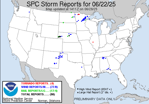
| 0 | 1.00" | 60 | 485 |
|---|---|---|---|
| TORNADOES | HAIL | WIND | MILES |
June 22nd featured a surface low in Northern South Dakota and Minnesota with a cold front trailing it across Nebraska into Colorado. This front was expected to stall across Nebraska as a stationary front where MLCAPE reaching 2,000 J/Kg was expected in the warm sector.
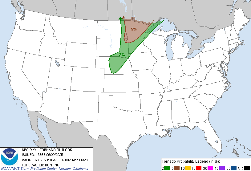
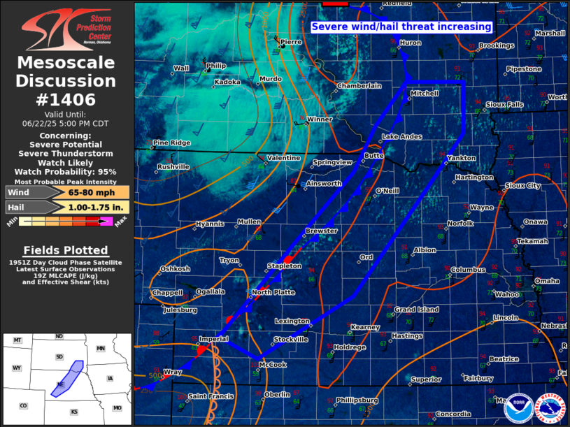
The theme of the year was “head to North Platte” so I took off from Grand Island around 17z and began the trek west to North Platte. The forecast looked like a triple point might setup near there as the front would stall and a dryline would intersect it southwest of North Platte. At 20z the SPC issued a mesoscale discussion for the frontal area across Nebraska as cumulus began to bubble along it.
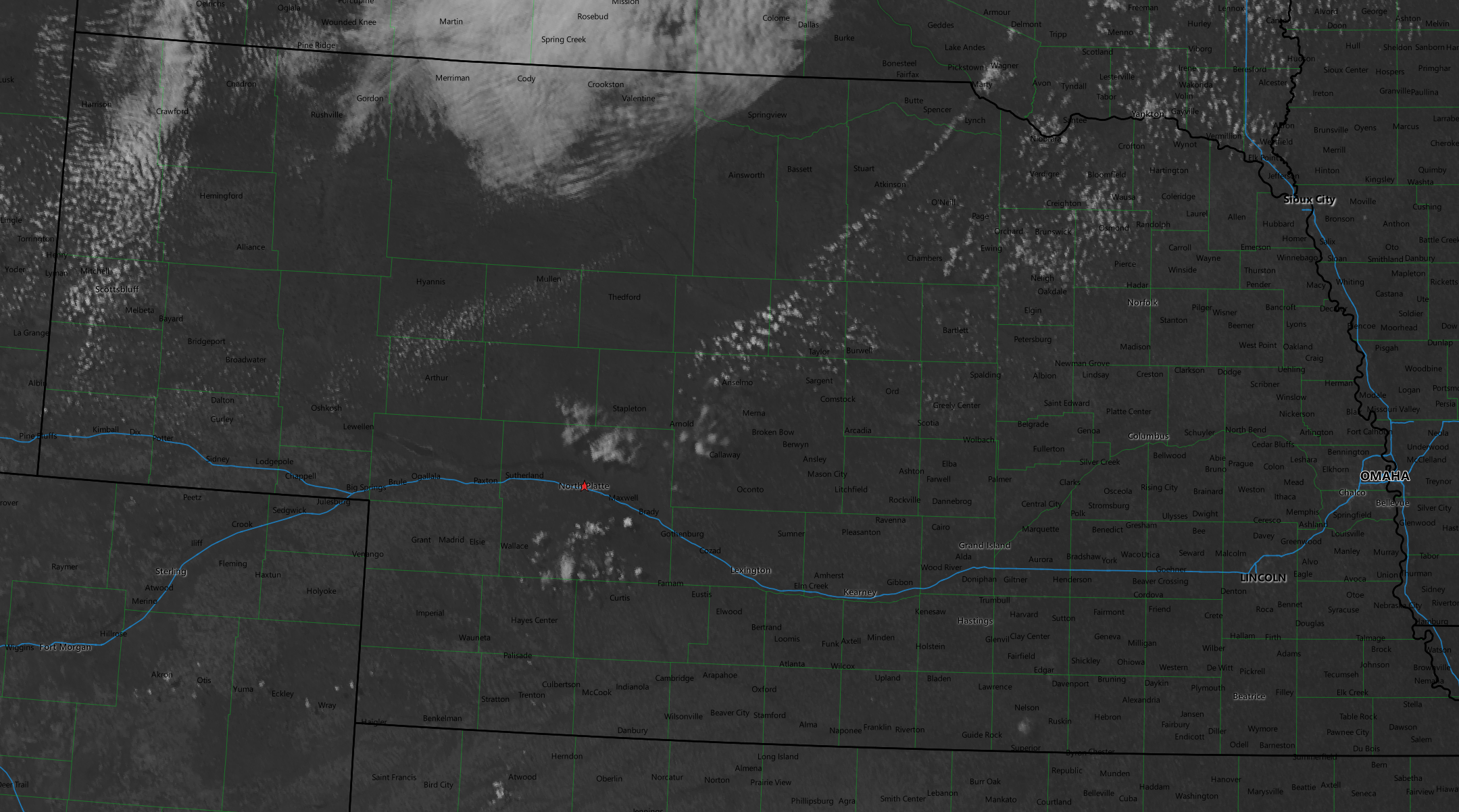
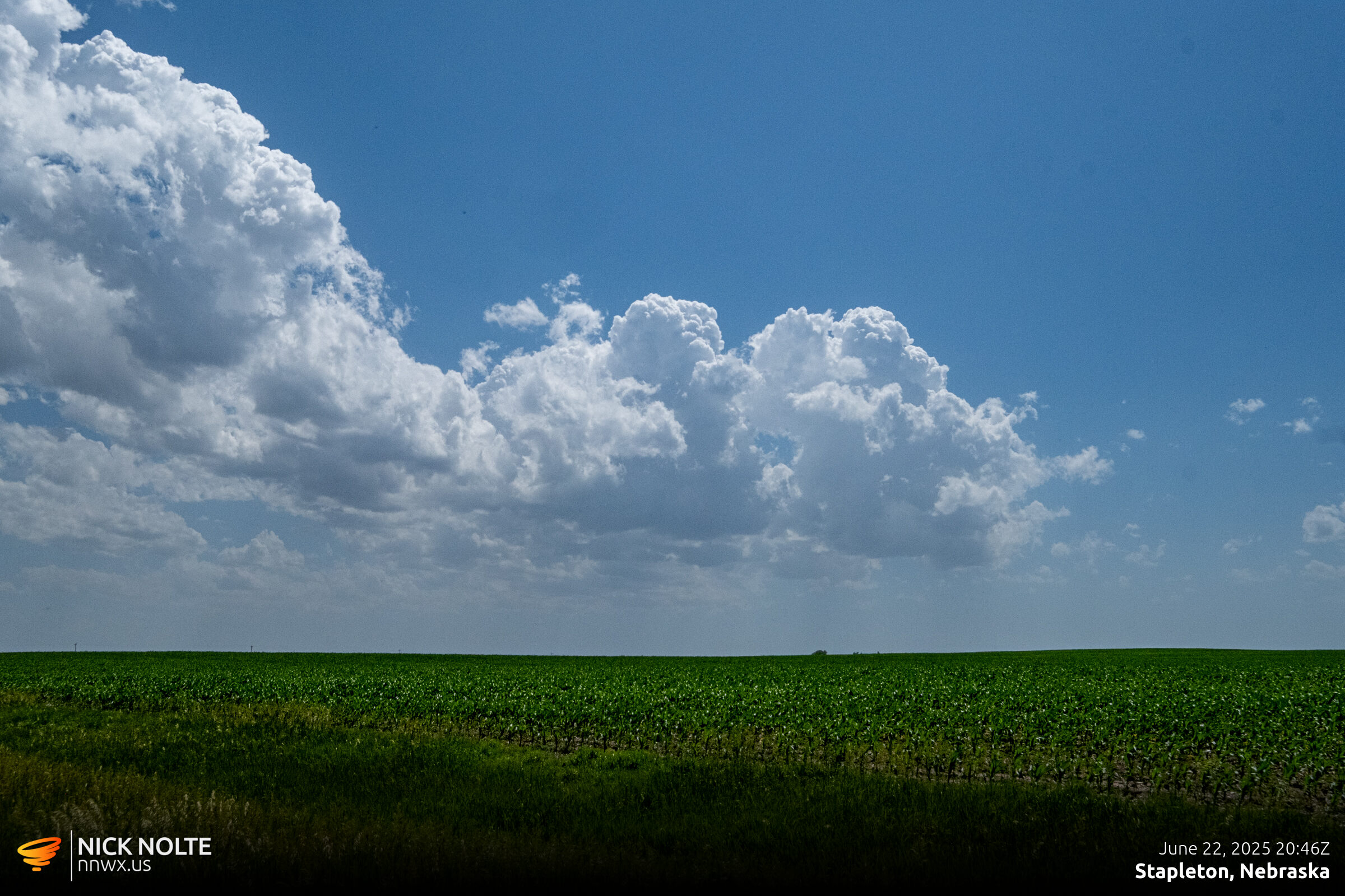
It looked like there were two potential initiation areas, the little cumulus field south of North Platte which was probably near the triple point and another area north near Stapleton along the front. I headed north out of town to intercept the first cells that went up near Stapleton.
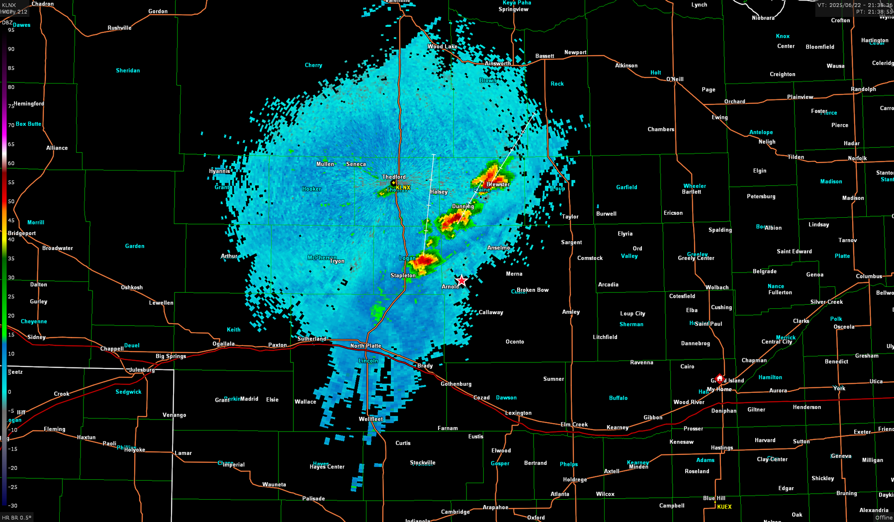
The storms were moving northeast and we were entering the sandhills so I had to maneuver to Merna then head back northwest along Highway 2 towards Dunning.
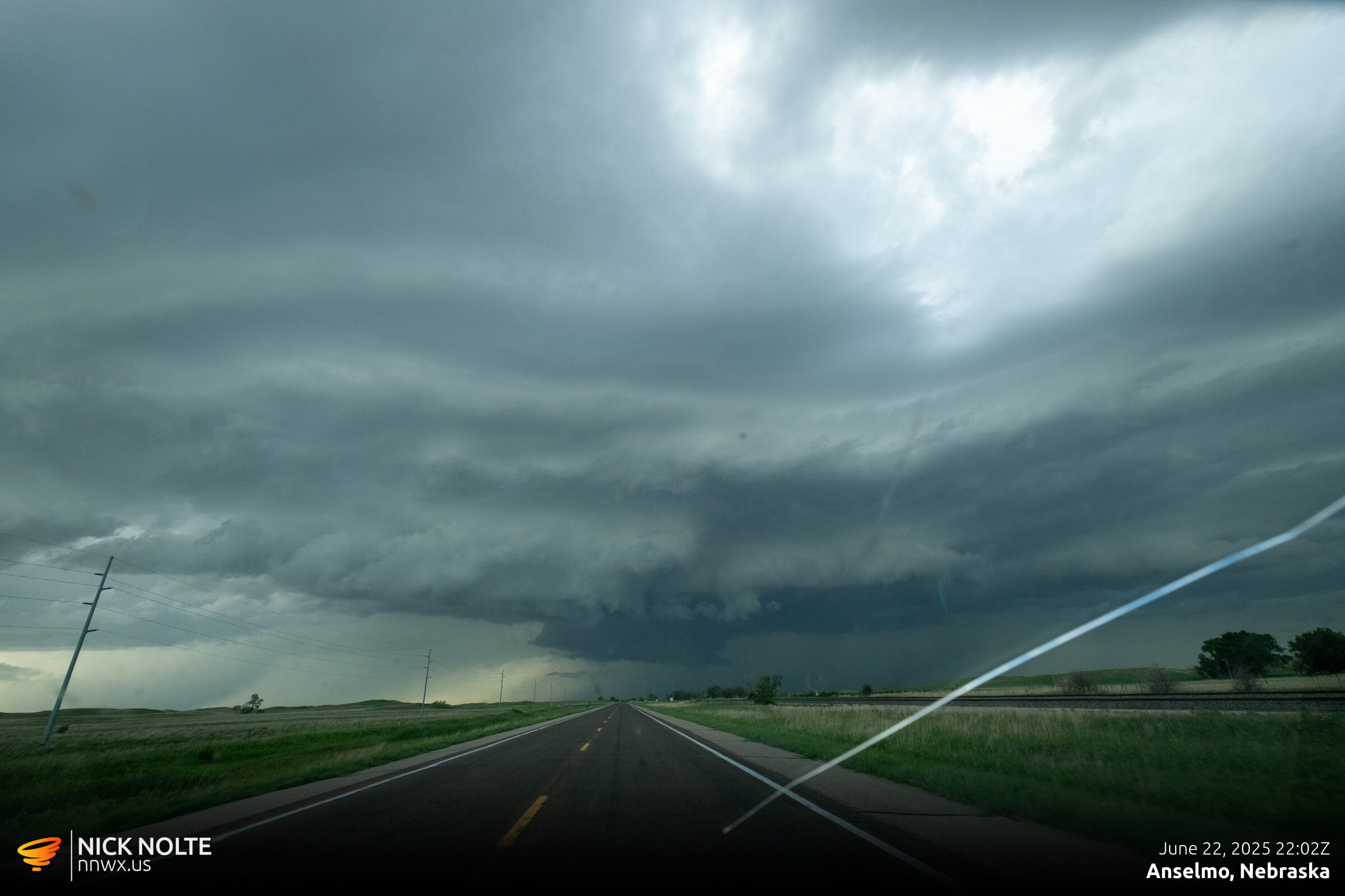
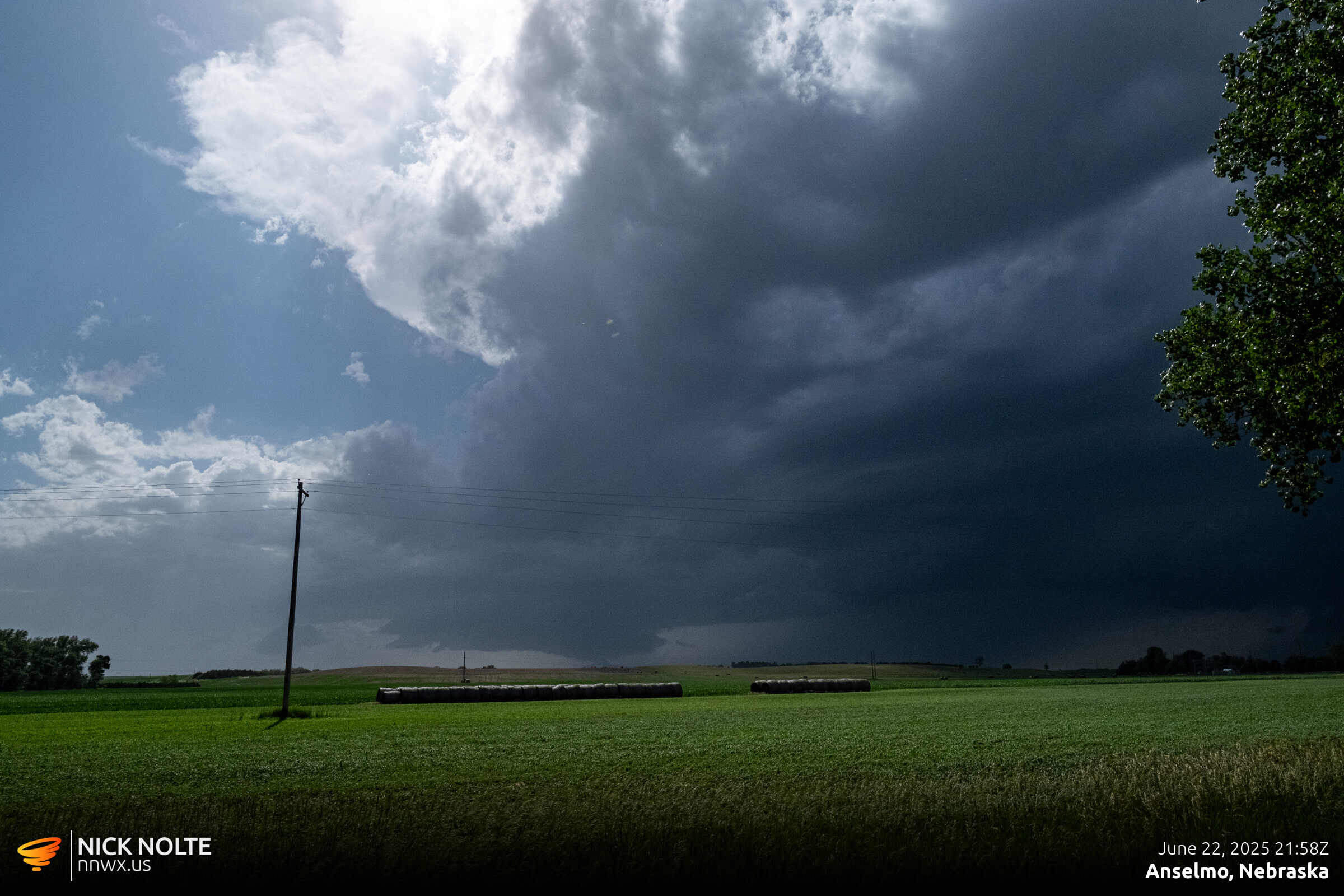
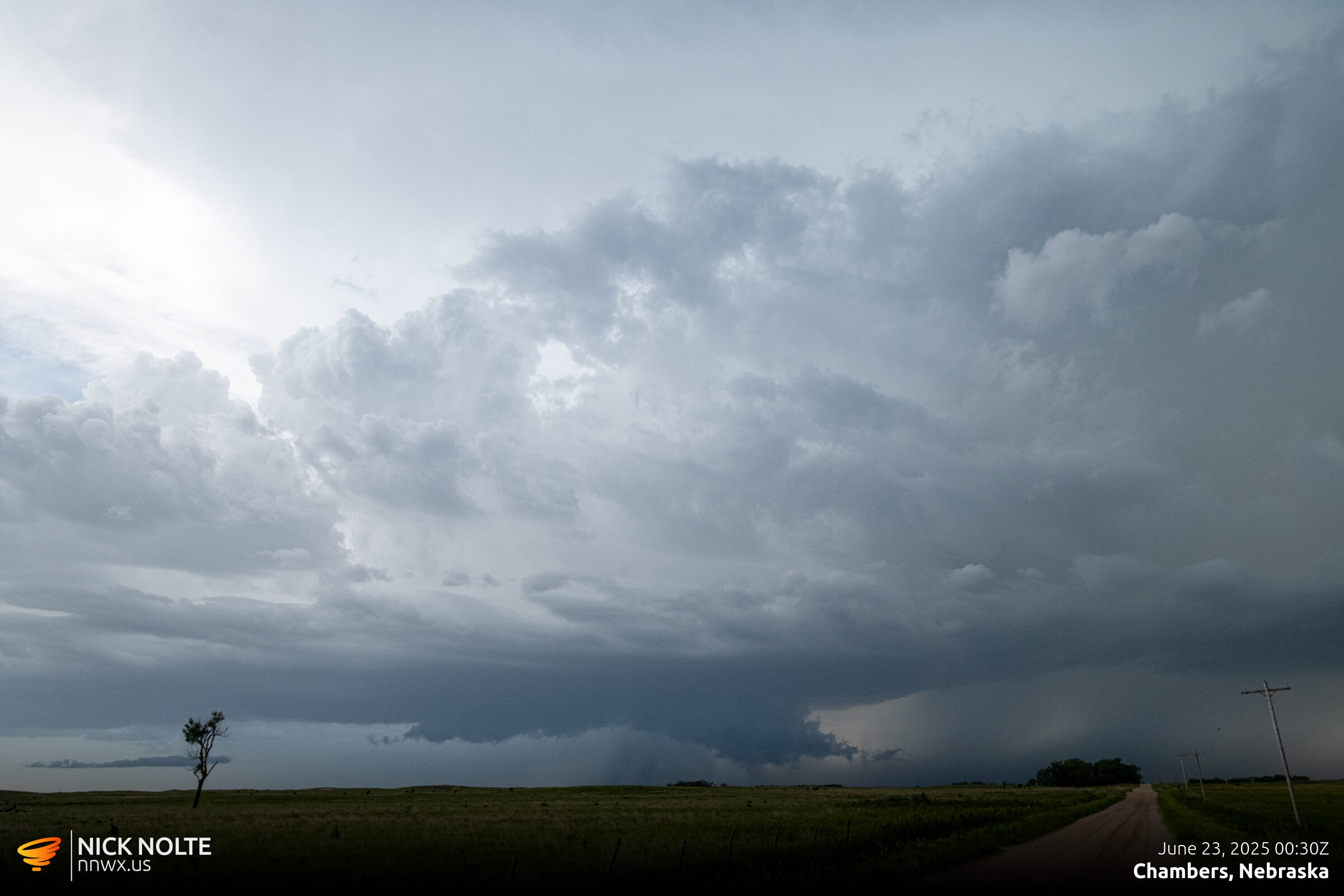
As the storm tracked northeast, an outflow boundary became apparent on radar. It appeared to wrap into the storm so I continued tracking it hoping it was still feeding on the warm inflow.
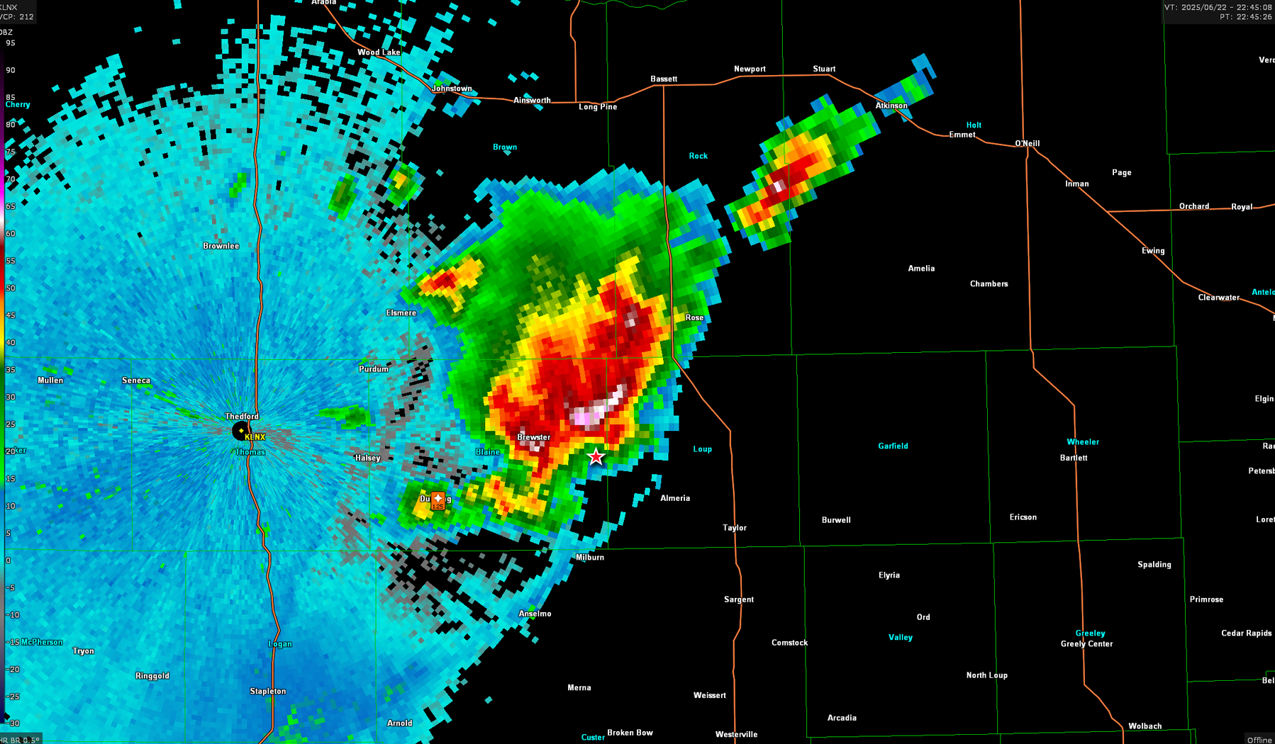
As the storm continued northeast, I tracked the storm all the way to Chambers before I decided to drop back to trailing storms in the now developing line.
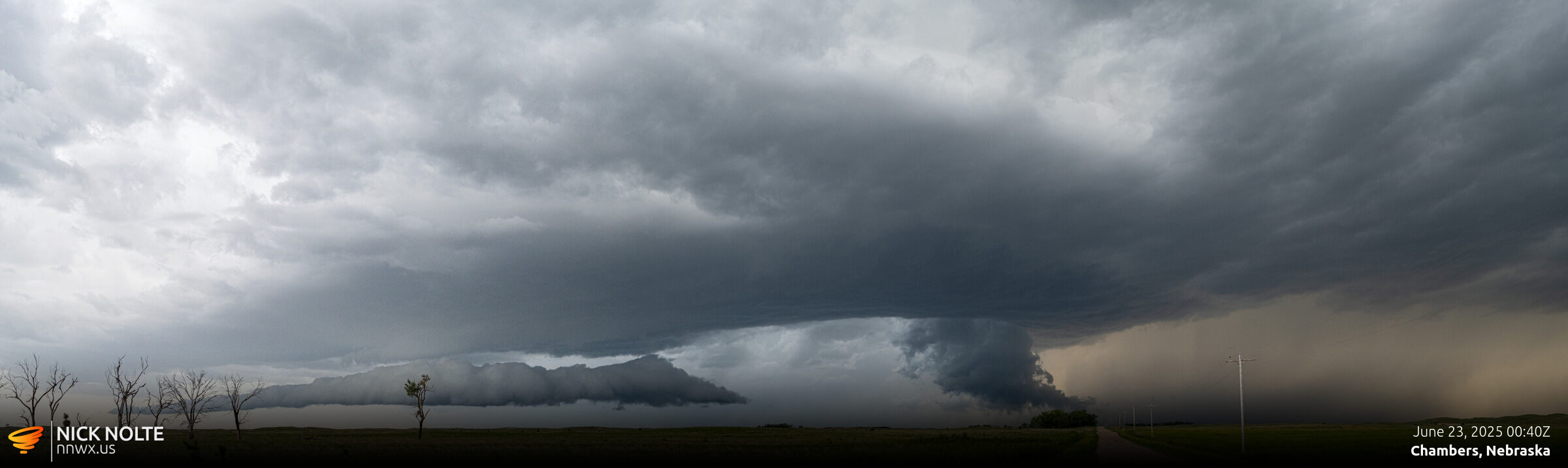
Eventually the storms grew upscale and started to line out so I called the chase and returned home.
Chase Recap
| START | END | DURATION |
|---|---|---|
| Grand Island, NE @ 22/1656Z | Grand Island, NE @ 23/0240Z | 09 hours, 44 minutes |
| INTERCEPTS | CHASER ENCOUNTERS |
|---|---|
| None | None |