| 0 | 1.75" | 80 | 77 |
|---|---|---|---|
| TORNADOES | HAIL | WIND | MILES |
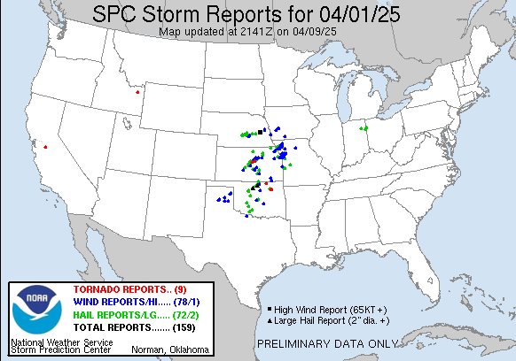
April 1 featured a deepening trough migrating out of the western United States with impulses moving into the South and Central Plains. A surface low was forecast to develop in eastern Colorado eventually developing into southwest Kansas then into Eastern Nebraska overnight. With a dryline extending south from the low through Kansas and Oklahoma the primary focus for severe weather would be along the dryline and along the warm front as it drifted north.
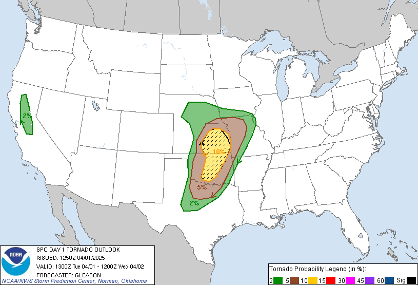
The SPC had a 10% hatched tornado area in the warm sector from the triple point down along the dryline. A marginal risk existed up closer to home in Nebraska. This day wasn’t really a chase day for me as I was working and wasn’t planning to make the trip into Kansas. If storms showed up near me in the late afternoon then I’d go check them out 🙂
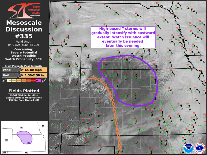
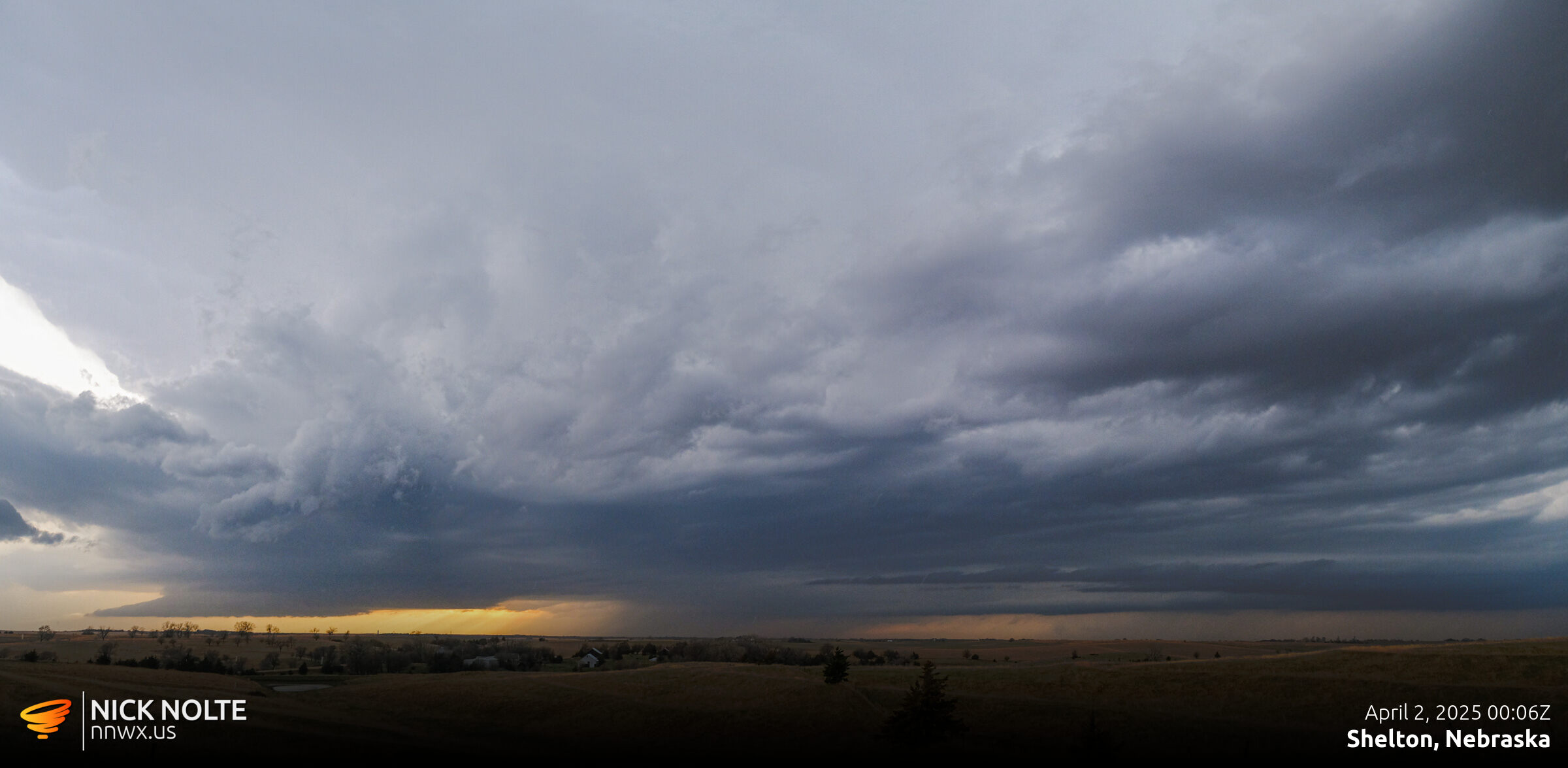
A mesoscale discussion was issued for north central Kansas and into southern Nebraska indicating the possibility of high-based thunderstorms in the evening. A few cells started to “fire” south of Kearney around 23z so I moseyed on out to check them out and got on them shortly before 0z as they matured.
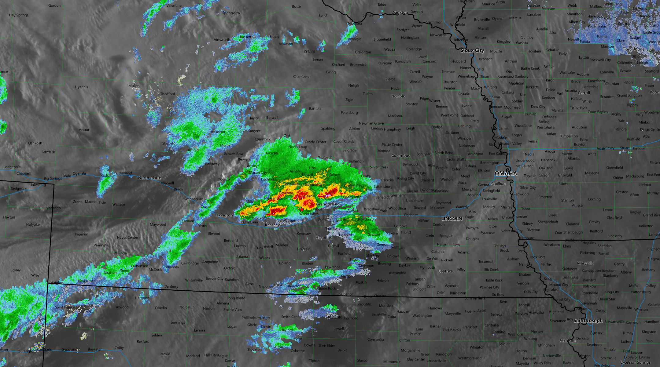
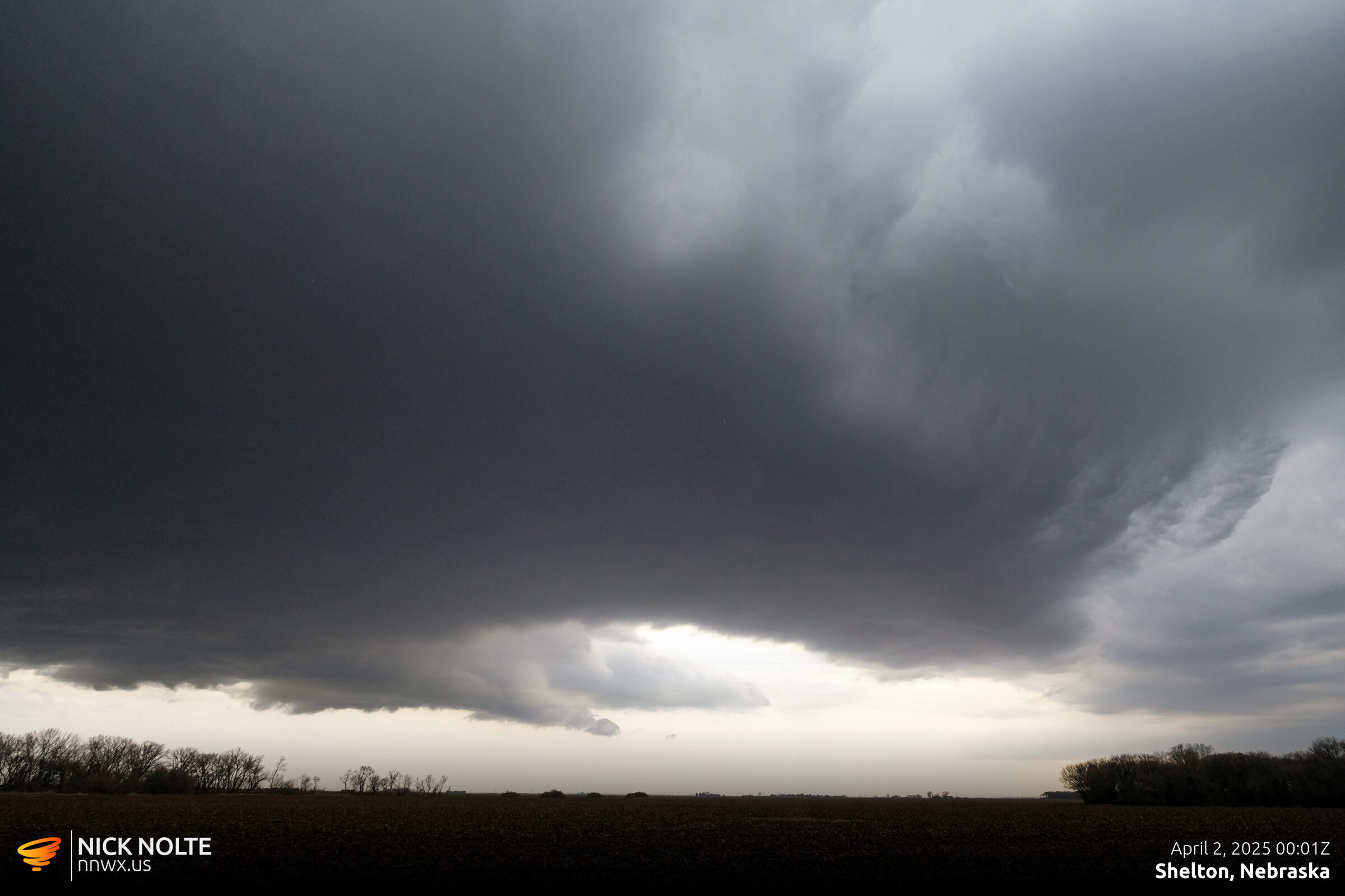
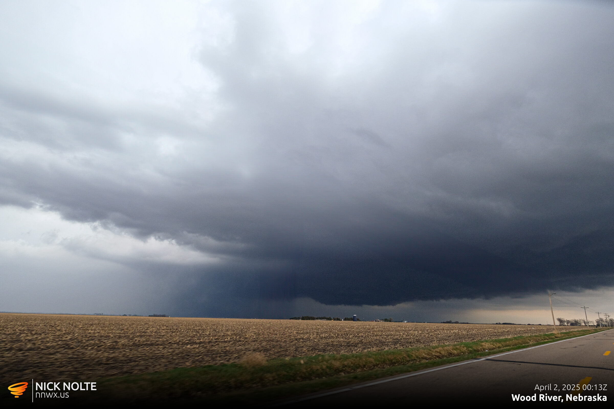
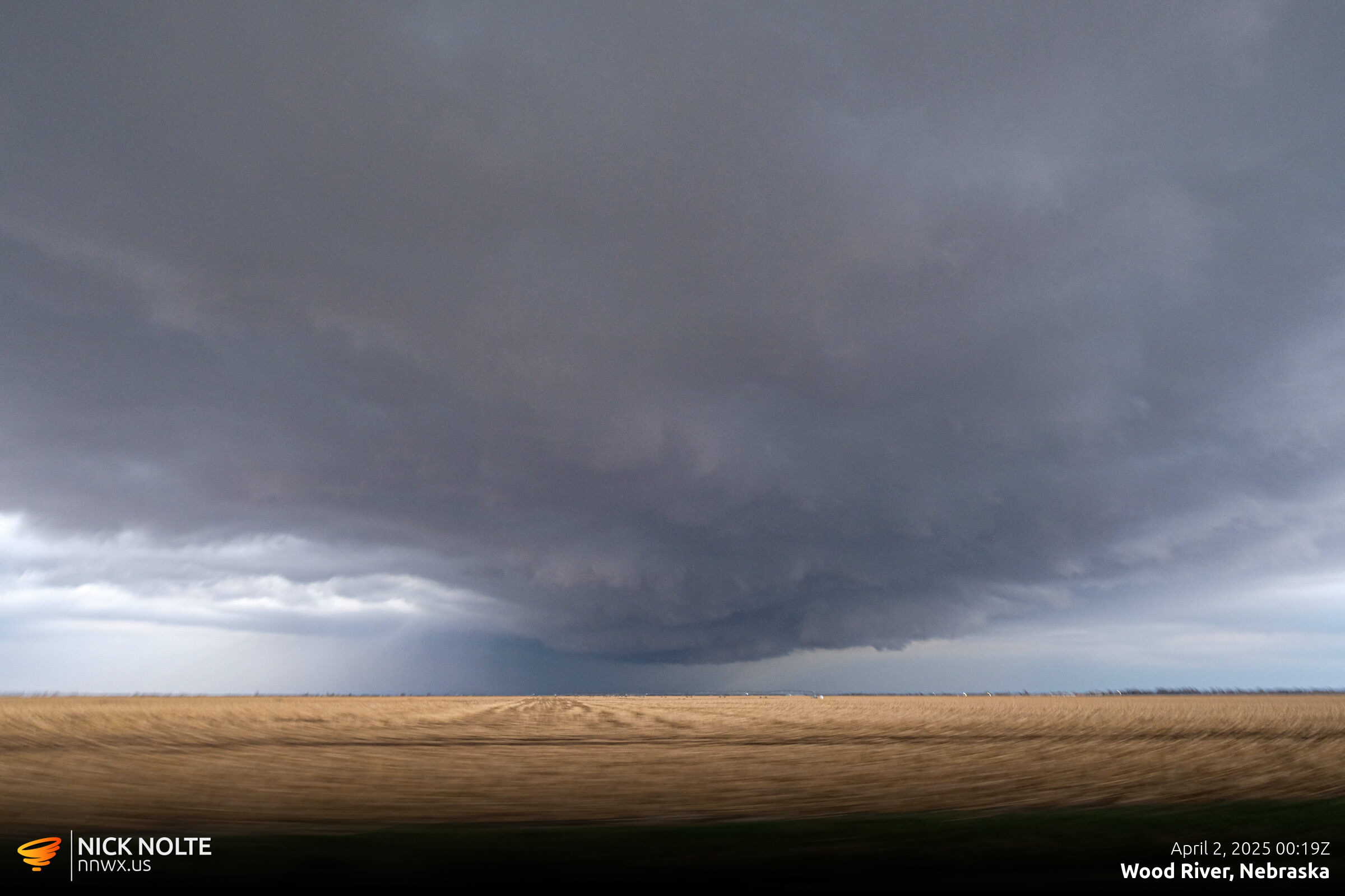
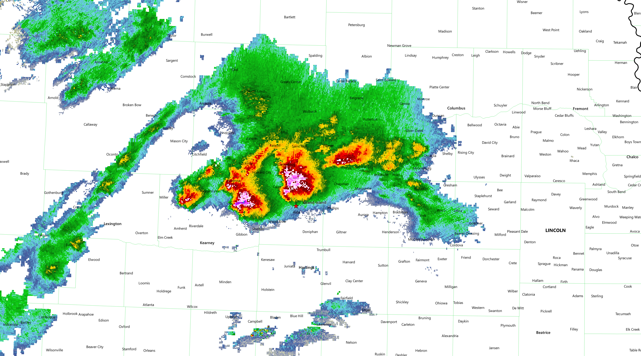
Eventually I decided to just punch the hail core and see what was in store and I found some golf balls north of Grand Island.
Chase Recap
| START | END | DURATION |
|---|---|---|
| Grand Island, NE @ 01/2325Z | Grand Island, NE @ 02/0116Z | 01 hours, 51 minutes |
| INTERCEPTS | CHASER ENCOUNTERS |
|---|---|
| None | None |