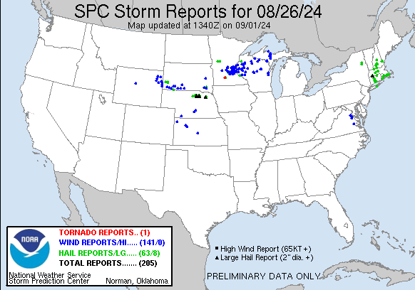
| 0 | 3.00" | 70 | 537 |
|---|---|---|---|
| TORNADOES | HAIL | WIND | MILES |
August 26th featured a surface low near Sioux Falls with a cold front stretching back across the Sandhills to another low over Wyoming. As the low moved east, the cold front would drop south into northwestern Iowa and Eastern Nebraska. Backed flow along the front to the triple point would provide obvious targets for the day.
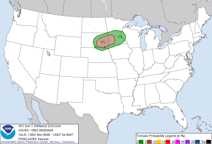
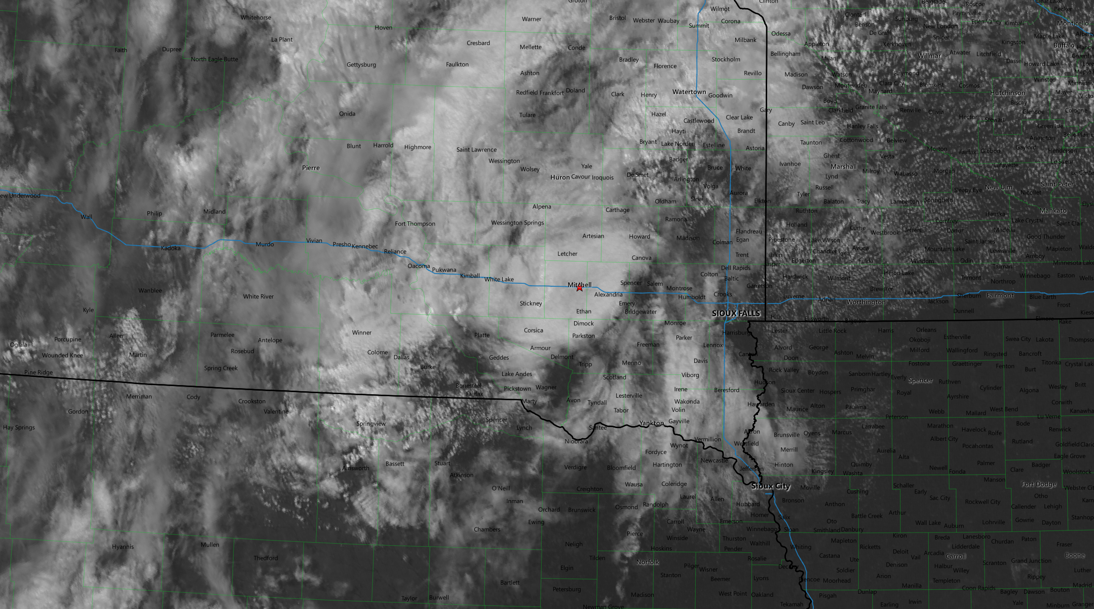
SPC had a 5% tornado risk from Pierre to Western Minnesota and it looked to me like playing the frontal boundary in South Dakota would probably be the play so my initial plan was to head to Mitchell and readjust from there. I arrived in Mitchell around 1830z and wished I had checked satellite earlier because a rather expansive stratus shield was still in place across South Dakota which I believed would shunt the action further south so I probably went further than needed.
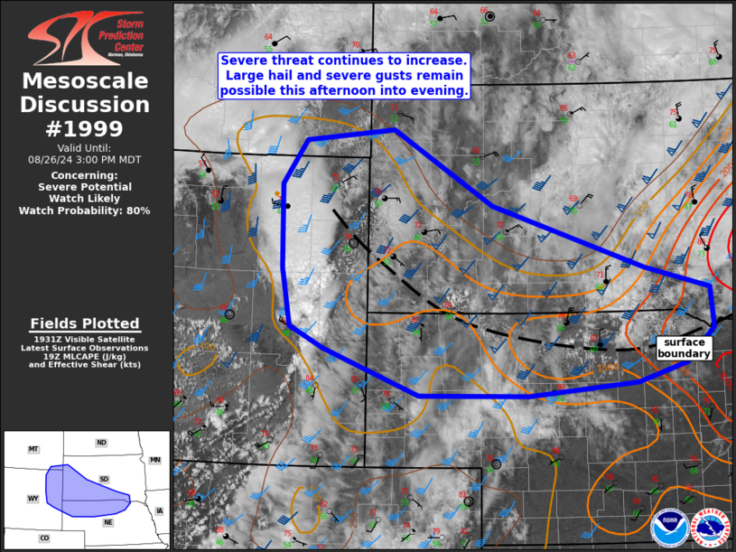
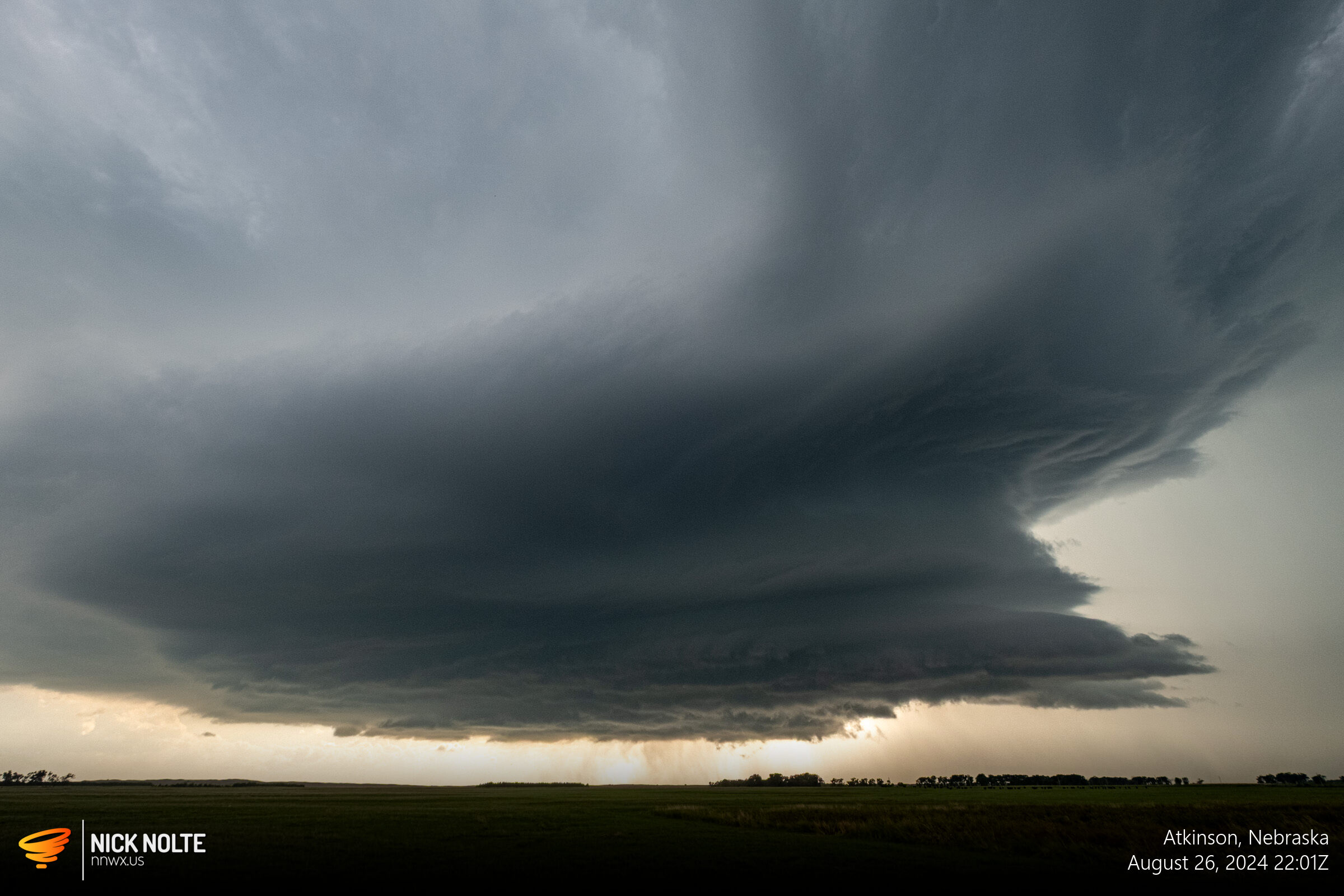
At this point it looked like development was imminent in an area along the US-20 corridor between Valentine and Atkinson as the surface boundary was apparent on satellite where the agitated cumulus was in Northern Nebraska. SPC issued a mesoscale discussion for the Black Hills stretching into northeast Nebraska as they also noted the deepening cumulus along the boundary.
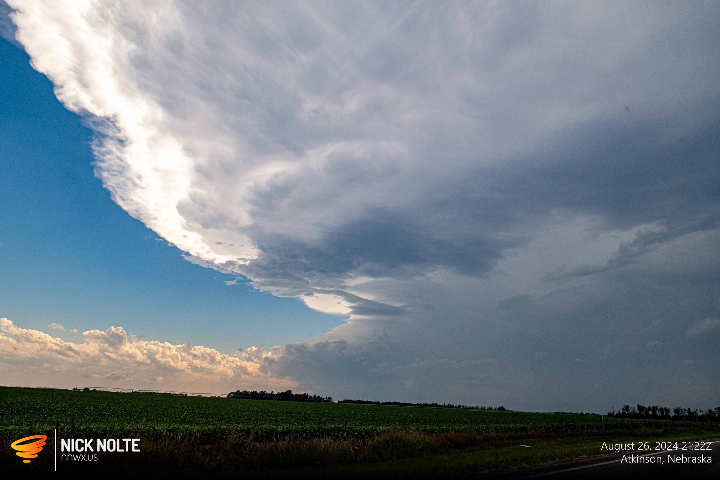
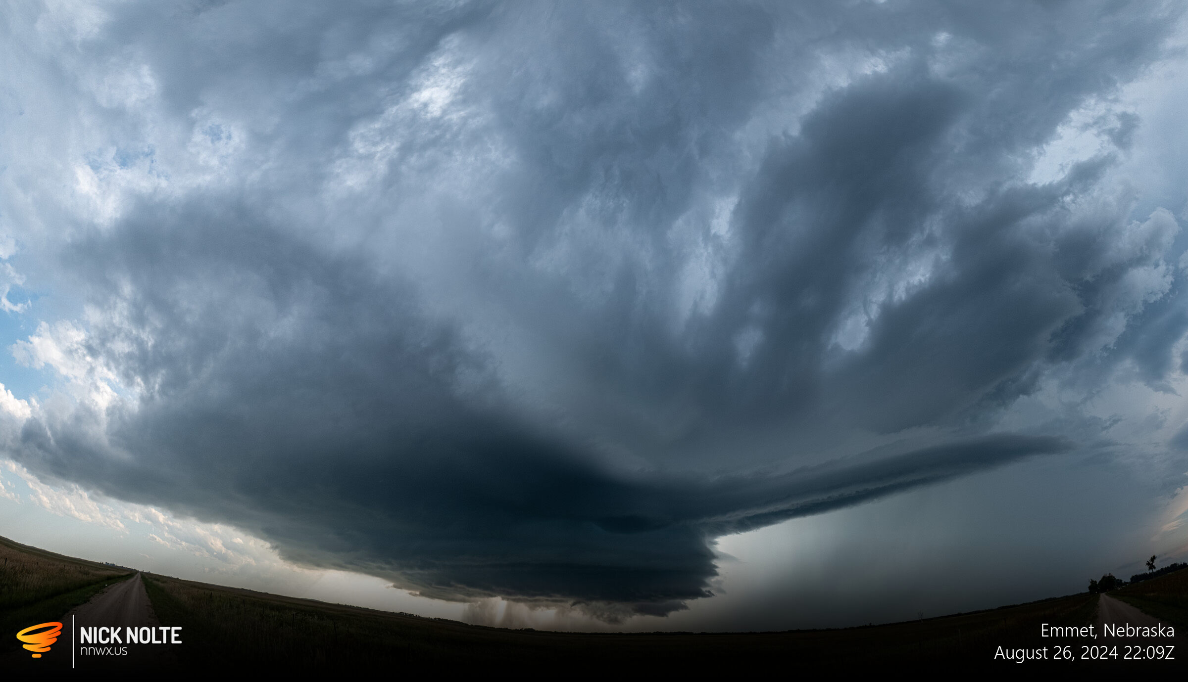
Disappointed in myself for driving all the way to Mitchell only to return the way I came to position for the development along the boundary. Around 20z a cell started to go up south of Ainsworth and around 2130z I got on the cell south of Atkinson.
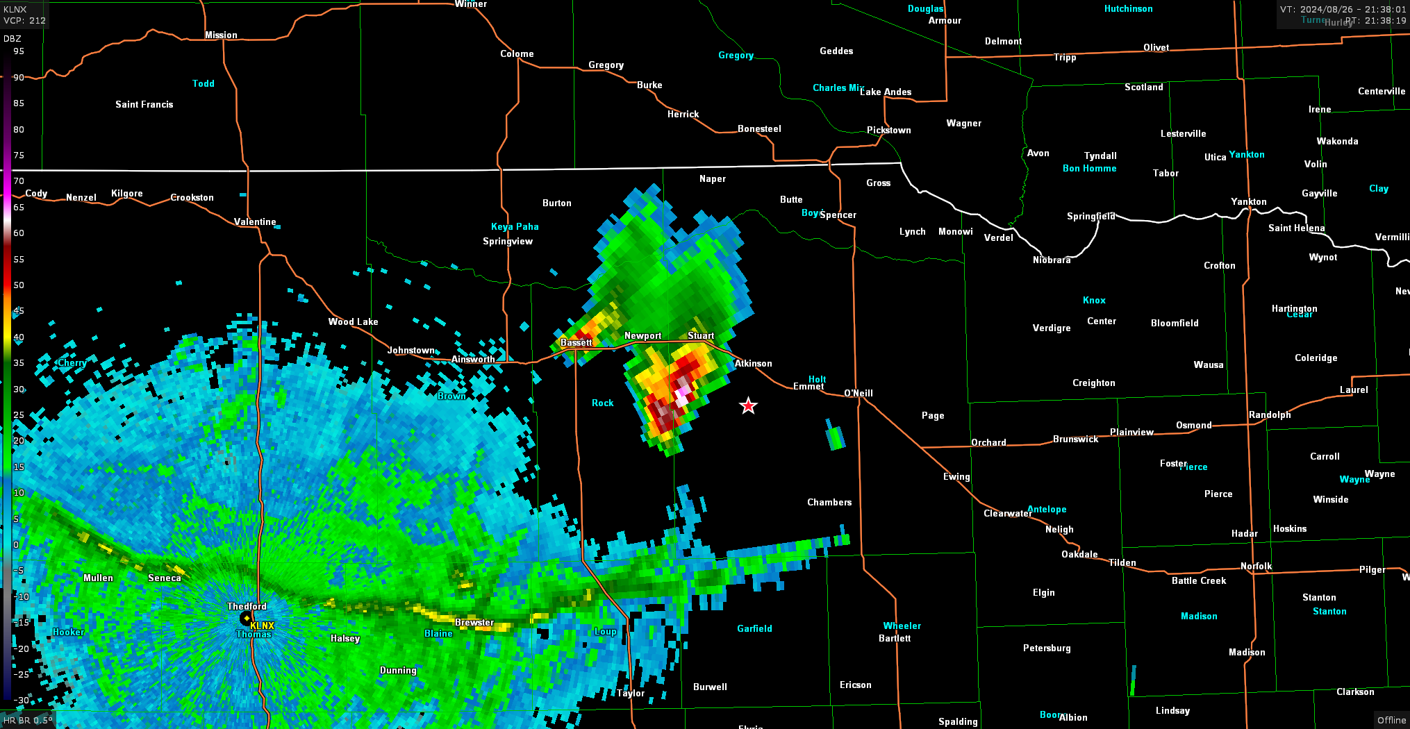
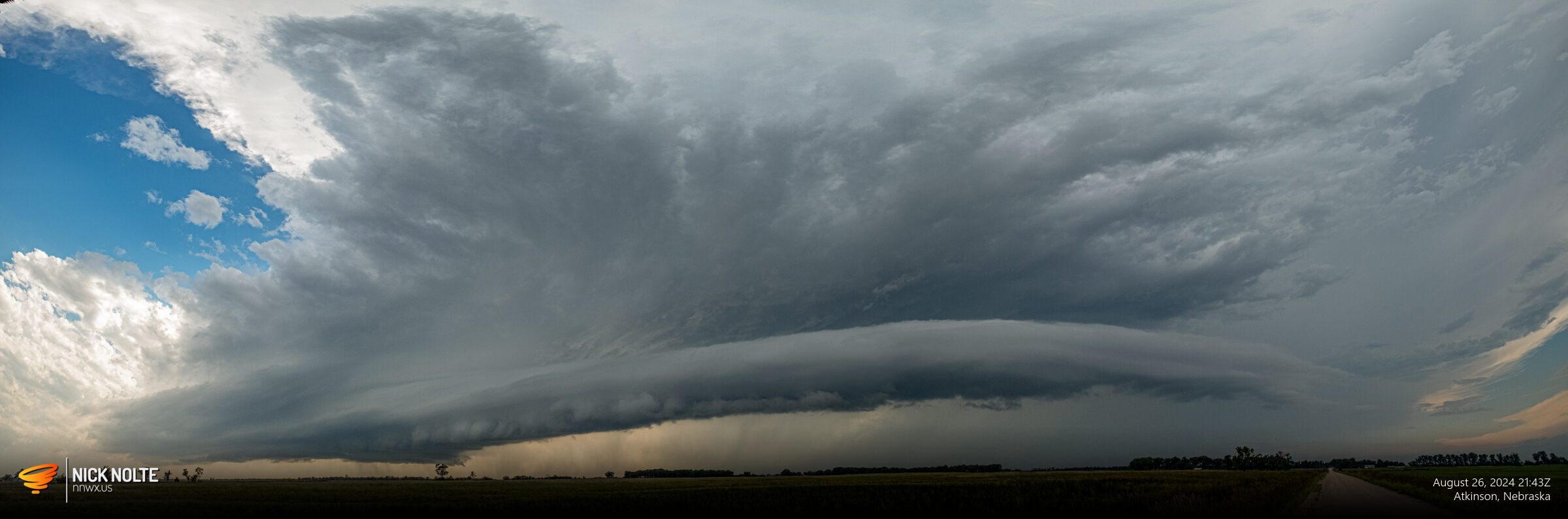
I continued tracking the storm as it headed for O’Neill as hail reports of baseballs started to come in
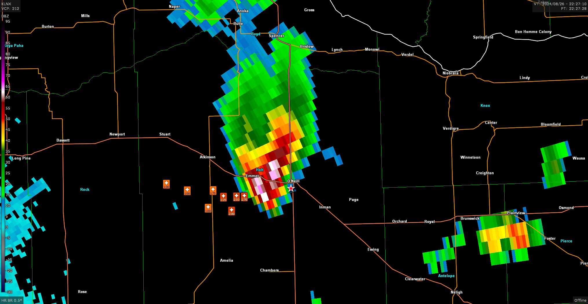
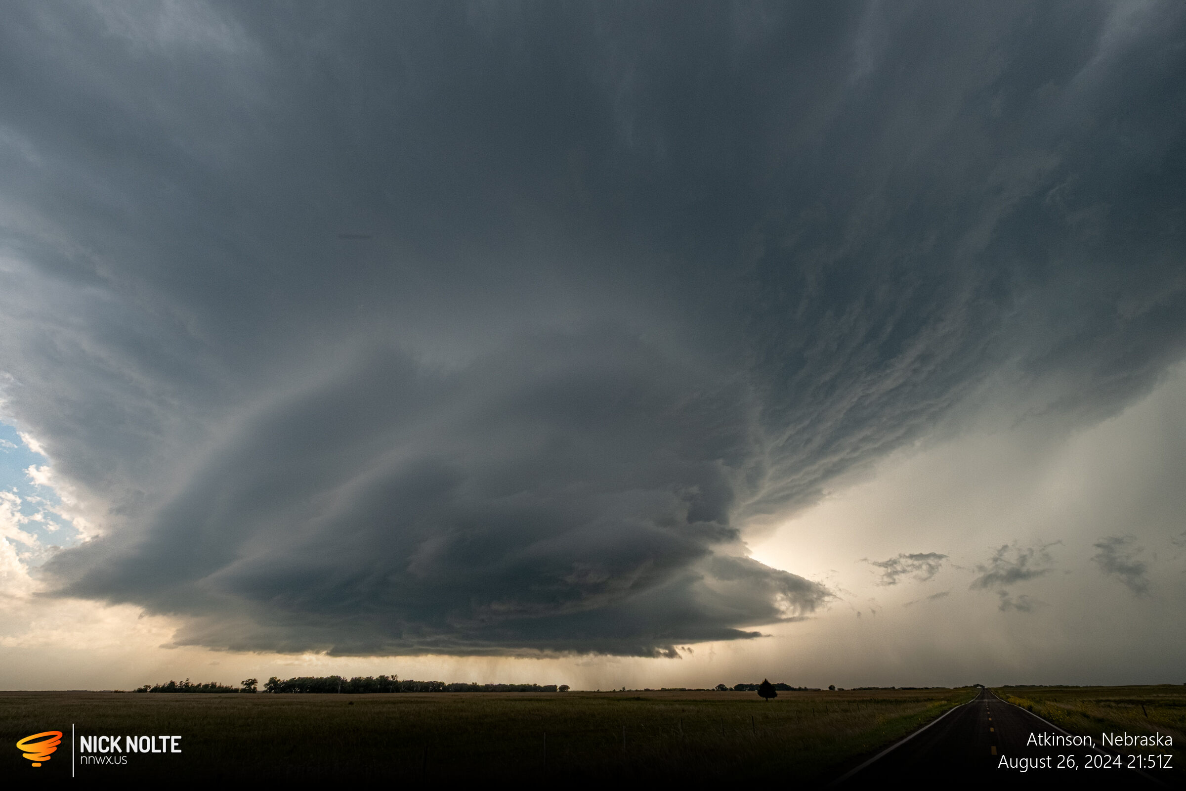
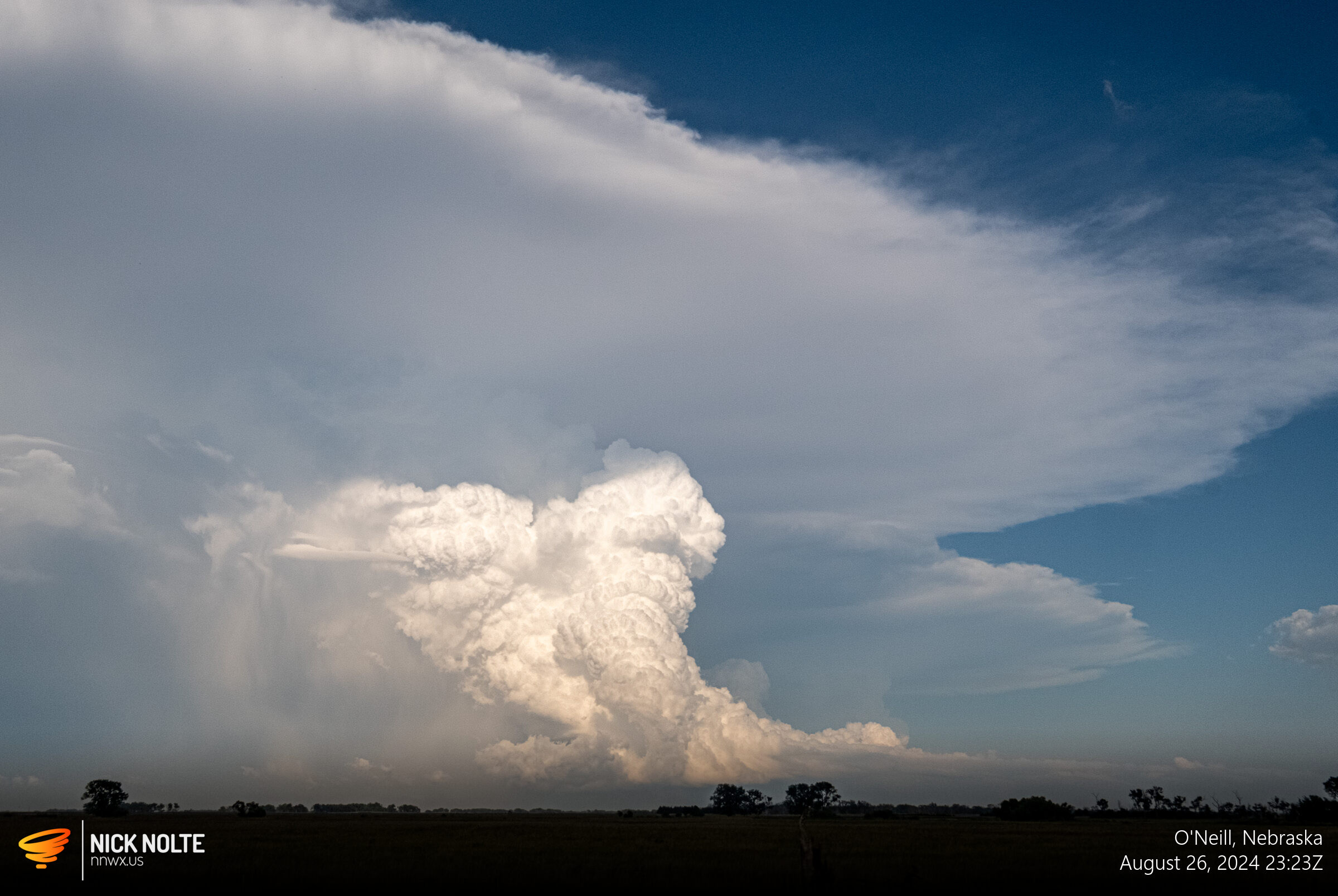
As the cell continued east, it started to weaken visibly and on radar so I decided to call the chase. I went back to O’Neill and was treated to a nice view of the backside of the supercell.
Chase Recap
| START | END | DURATION |
|---|---|---|
| Grand Island, NE @ 26/1501Z | Grand Island, NE @ 27/0055Z | 09 hours, 54 minutes |
| INTERCEPTS | CHASER ENCOUNTERS |
|---|---|
| None | None |