| 0 | 1.00" | 60 | 500 |
|---|---|---|---|
| TORNADOES | HAIL | WIND | MILES |
A surface low in northwestern South Dakota with an occluded front arcing across Nebraska and Colorado was forecast to move towards Sioux Falls throughout the day setting up a triple point over northern Iowa. The warm front from there extending eastward into Illinois.
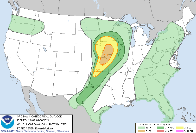
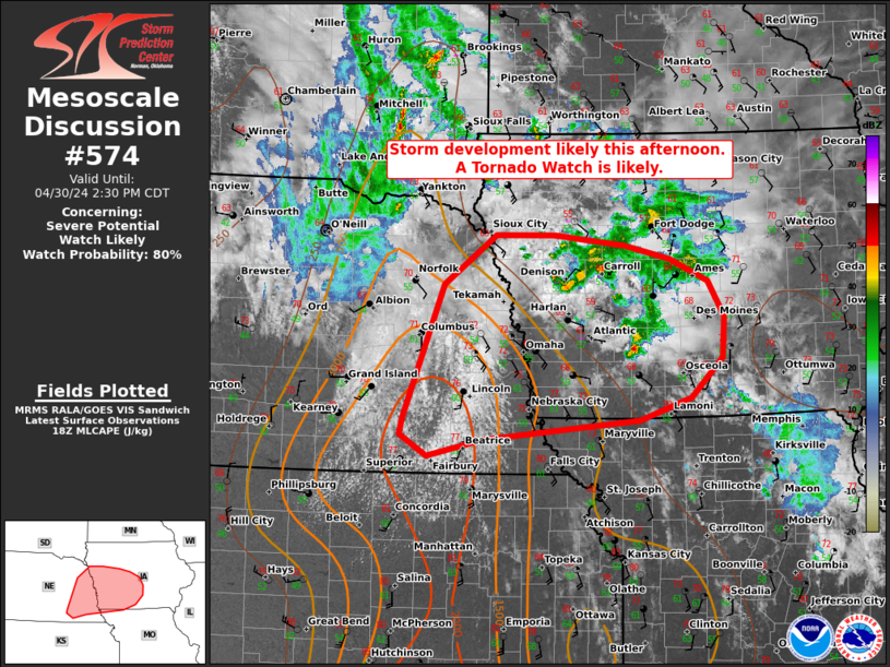
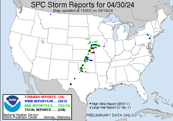
SPC had outlined an enhanced risk from the triple point southward through Topeka. My target for the day would be the triple point and warm front extending east from it. As such, I took off from Grand Island a bit before 18z and as i was headed east the SPC issued a mesoscale discussion for the target area indicating a tornado watch was likely.
The watch was issued about a half hour later and extended from Lincoln to roughly Iowa City and a few rows of counties on either side of Interstate 80. Around 19z storms started to fire along the cold front west of the US 75 corridor from Fremont down to Tecumseh.
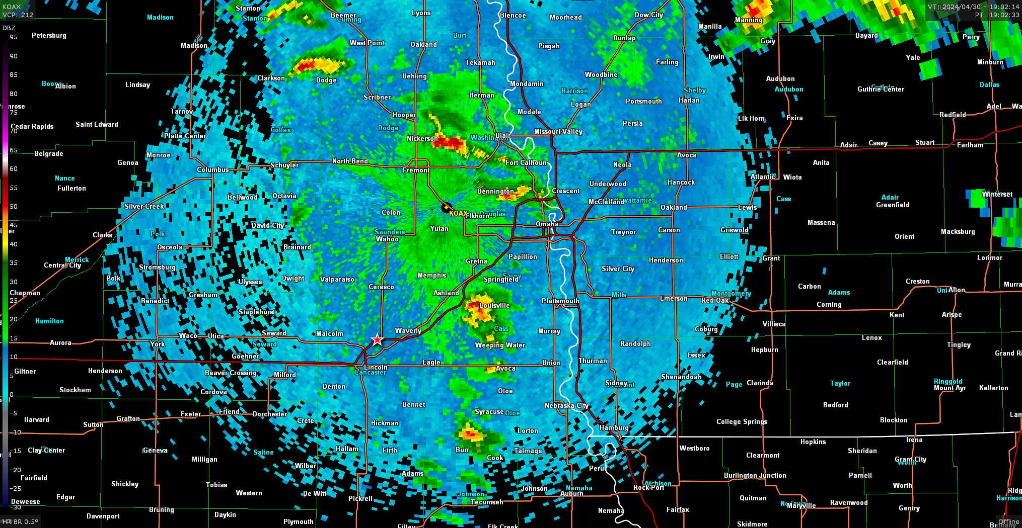
I was lagging behind the storms as I was just passing through Lincoln when they started firing. I decided to cross the river on US 34 south of Omaha and intercept one of the cells coming up from the north. Eventually I got on a storm near Emerson just as it went tornado warned.
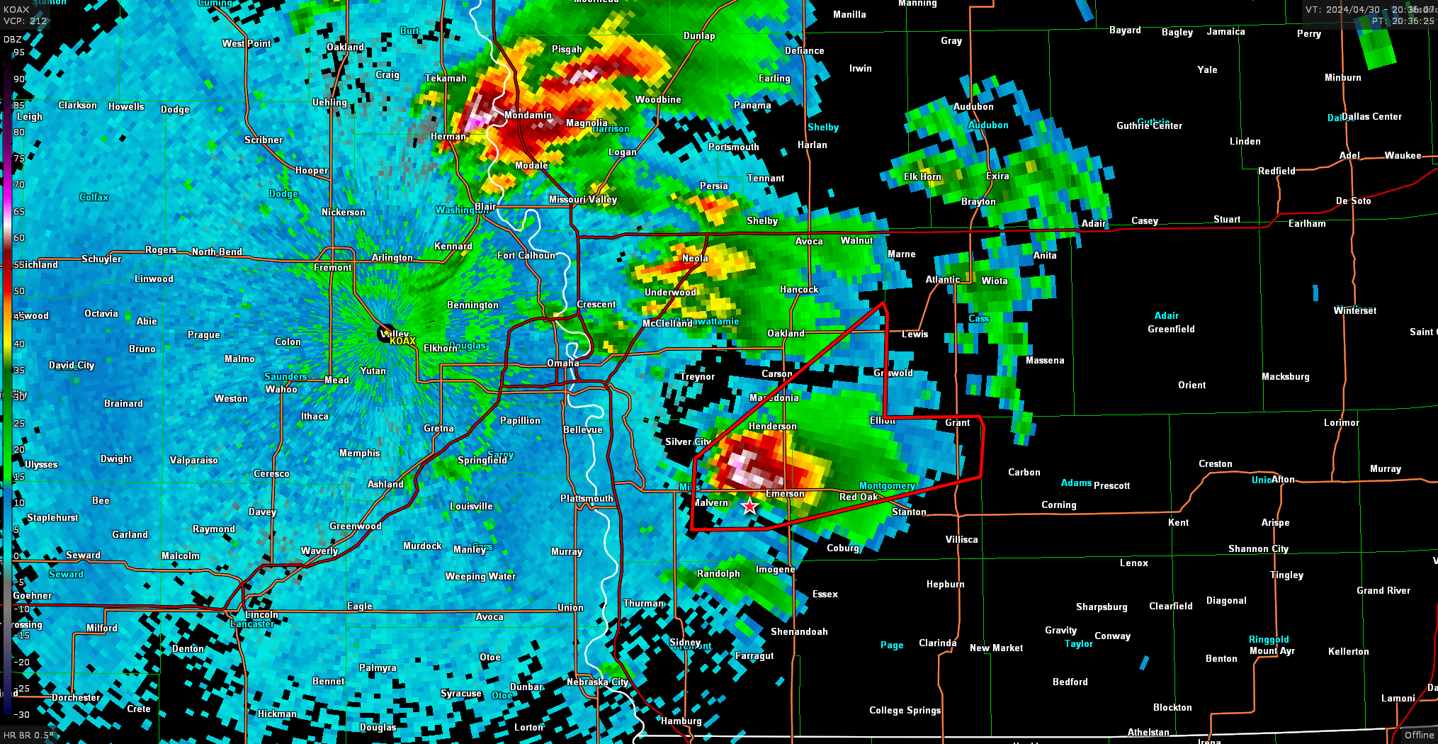
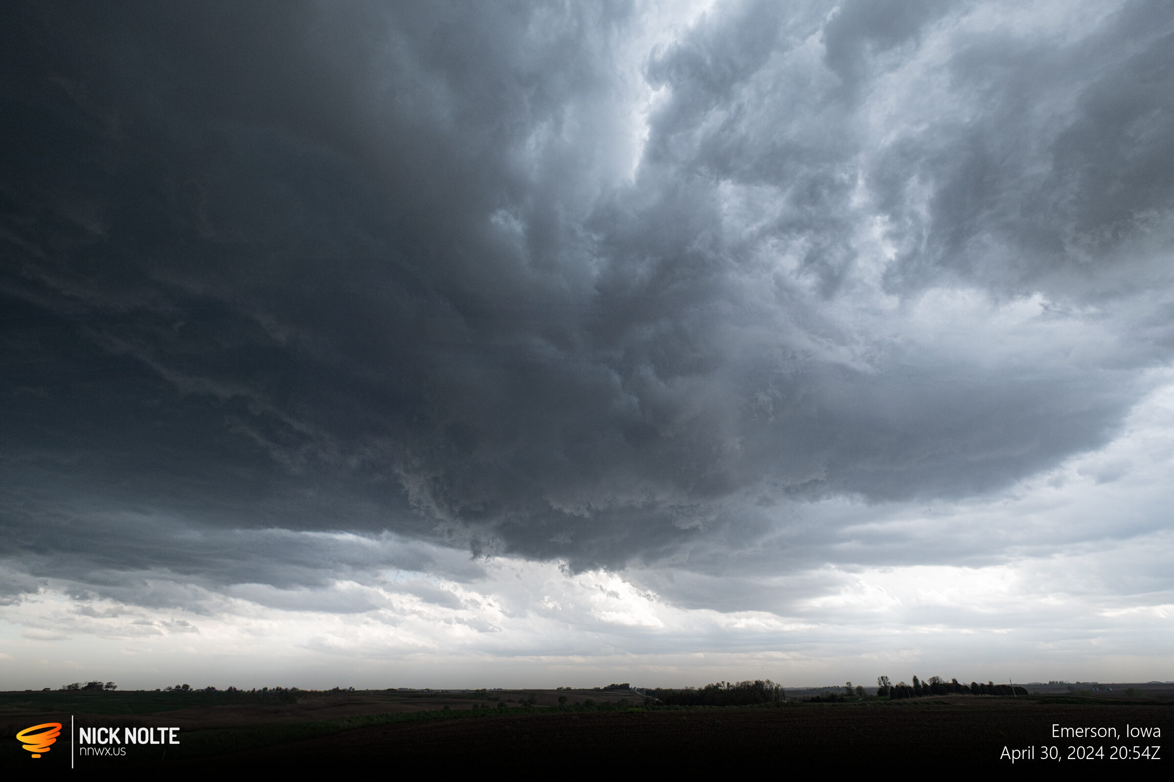
At this point, the storm was exhibiting some broad low level rotation, but nothing too serious and the wall cloud wasn’t very large or low. I continued to track this storm for a while, and after a while the organization ramped up quite a bit near Red Oak.
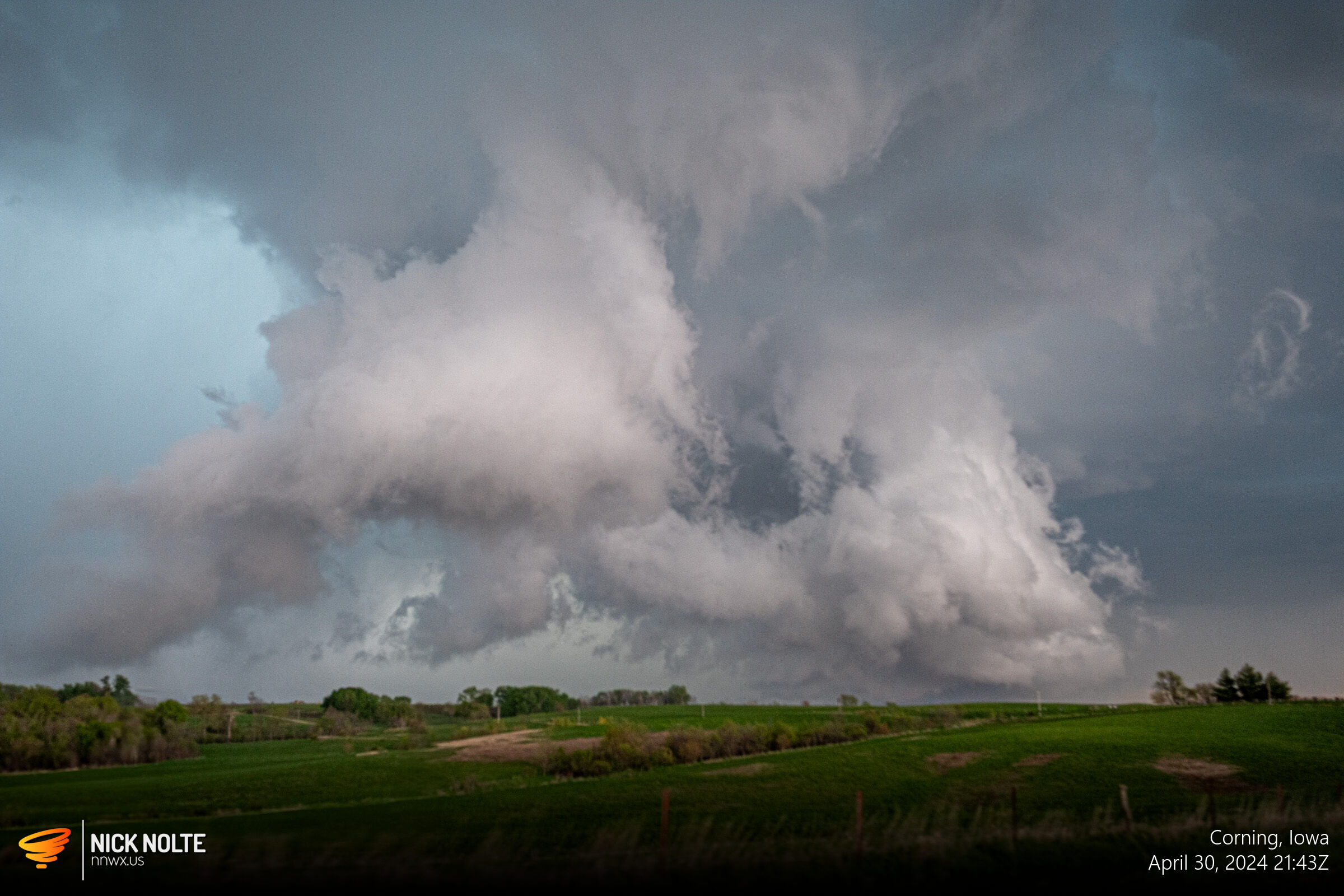
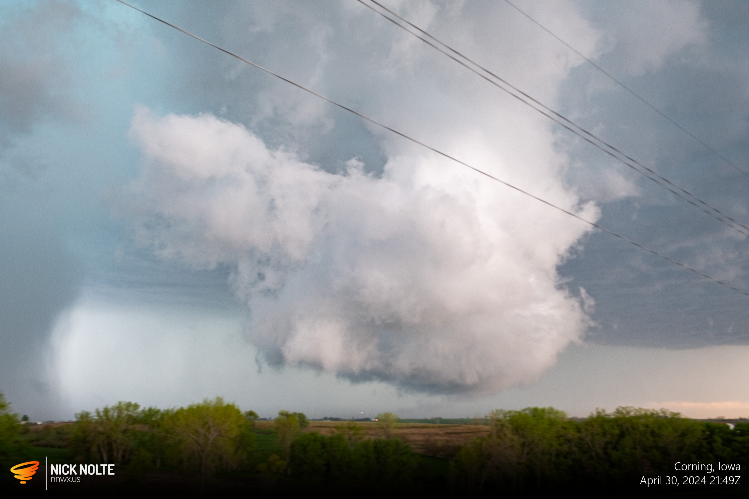
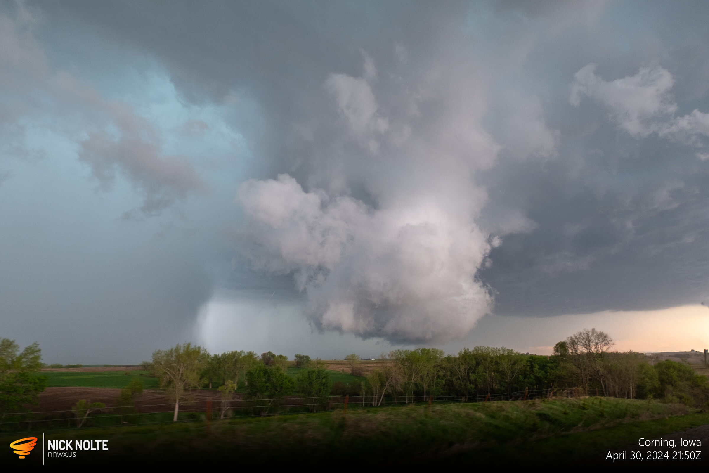
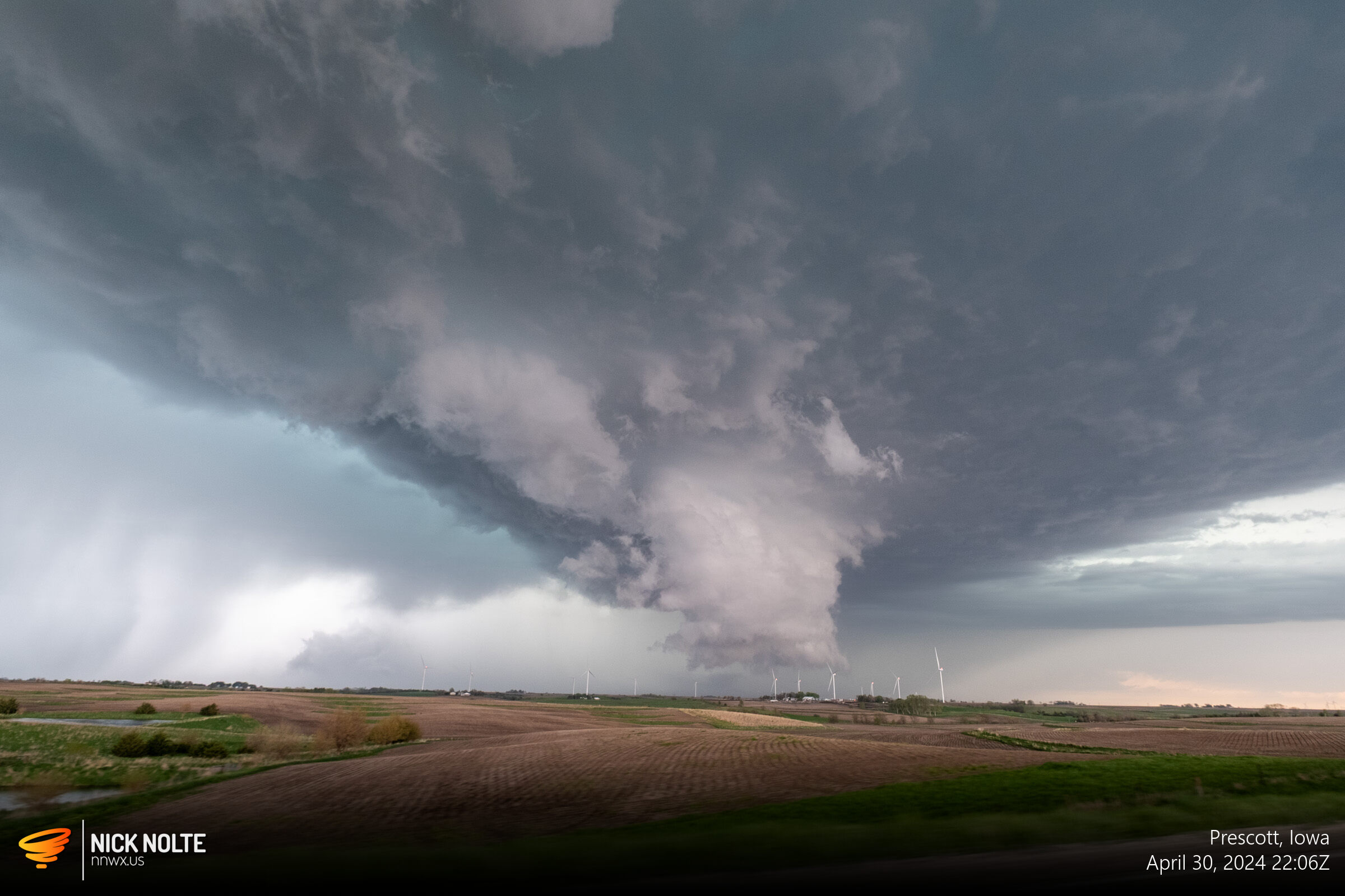
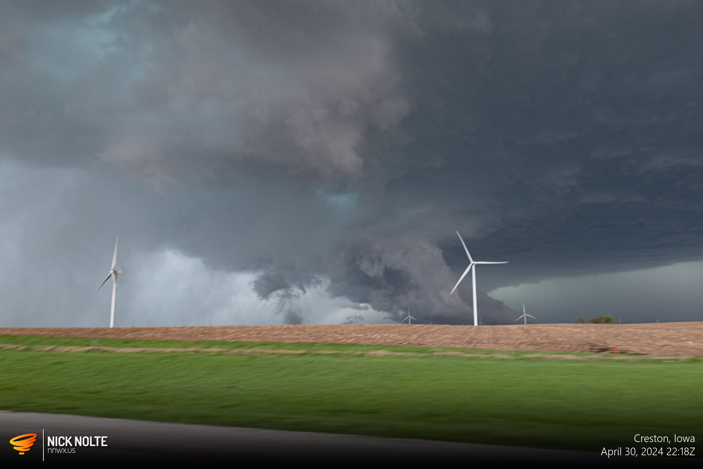
I tracked the storm all the way to Creston where it started to become outflow dominant and I decided to call the chase and head back home.
Chase Recap
| START | END | DURATION |
|---|---|---|
| Grand Island, NE @ 30/1738Z | Grand Island, NE @ 01/0239Z | 09 hours, 1 minutes |
| INTERCEPTS | CHASER ENCOUNTERS |
|---|---|
| None | None |