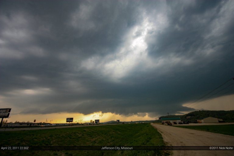
Month: April 2011

26 Apr

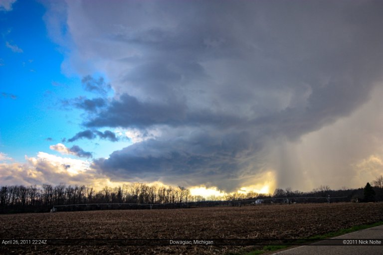
April 26, 2011 – Michigan

Hadn’t really paid attention to this day in Michigan. The big story was the impending tornado outbreak for the southeast that was to start this evening. Nevertheless, a little after 1pm a mesoscale discussion was issued regarding the potential for severe weather across Lower Michigan. A surface low near Green Bay had a trailing cold front back through lower Michigan into Illinois. This front was expected to trigger storms as the atmosphere destabilized. Strong boundary layer flow coupled with strong flow at the mid levels was conducive to supercellular development.

Read more
22 Apr

April 22, 2011 – St. Louis, Missouri

A surface low was expected to swing through Missouri with an attendant warm front draped across Missouri, Illinois and Indiana, as well as a trailing cold front extending back into Oklahoma.  The question was whether or not there would be a decent shot at tornadic storms.  The SPC had placed a large 5% tornado risk across southern Missouri, Illinois and Indiana.   I took off from home around 8am in the morning.  As I got closer and closer to Missouri, the visible satellite was showing a pronounced clearing across the bottom of the state along and south of I-70. It became clear that the greatest destabilization would occur in this area.

Read more
19 Apr

April 19, 2011 – Girard, IL EF-3 Tornado

For a day or three prior, April 19th was looking like a decent shot at severe weather along the warm front and near a surface low that was expected to be in Southwest Illinois.  The SPC had outlined the area in a moderate risk and had a 10% tornado outline for Southeast Missouri, Southern Illinois and Southern Indiana.  The Indiana portion would be for after sunset, so that wasn’t considered in the selection of a target.

Read more
09 Apr

April 9, 2011 – Mapleton, Iowa

Given the header to this post, you can imagine where this is going.  The day, however, began much more benign than it would end.  Being under the weather, I left Friday to get out to western Iowa so I wouldn’t have to get up early and make a marathon run.  This allowed me to get up at a leisurely time and be rested for the day.  I spent the night in Atlantic, Iowa. Saturday morning, I awoke and visited some relatives (I’m originally from there) and as the day wore on, it started to become clear that I was going to want to head west a bit, but stay on the Iowa side of the Missouri.  Eventually, I made the decision to head west towards Council Bluffs and see if anyone else was hanging out in the area.

Read more
09 Apr

Mesonet Data From Mapleton, Iowa Tornado – April 9, 2011

First, let me preface this with the following: my homemade instrumentation is by no means intended as a substitute for scientific grade research equipment. I certainly did not go out and spend thousands of dollars on research grade equipment, nor did I spend hours and money on scientific calibration techniques. What I did is collect a bunch of decent sensors which had decent specifications befitting of someone who wanted to collect data in the field and check it out later. Before taking it out in the field, I compared it with ASOS readings nearby and was usually within a degree on temperature, a percent or two on humidity and 1 hPa on pressure. I considered that good enough for my purposes. You can review the parts I’ve selected for my measurements in my mesonet build project posts earlier on this blog.

Read more